Friday – Sunday, August 27-29, 2021
This weekend it was time for me to head back down to the San Juan Mountains near Silverton so I could hike to the summit of a couple new peaks in the area. The San Juan Triangle, which is roughly defined as the area between Ouray, Silverton and Telluride, is one of my absolute favorite places in the state to explore the high country, and over the years I have been working to hike as many of the peaks in the area that I can. This time I was planning to hike Eureka Mountain and California Mountain on Saturday morning since they are both right by each other and pretty much surrounded by other peaks that I have already hiked. I had actually planned to do these hikes a couple of weeks ago, but that trip was cancelled when I was stopped by a mudslide on my way up to Red Mountain Pass, so I was happy to return this weekend.
Placer Gulch Peaks: Eureka Mountain & California Mountain
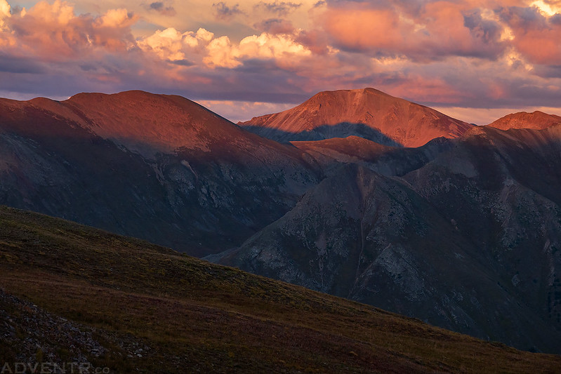
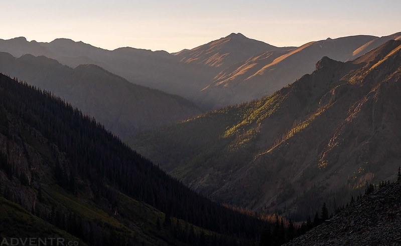
I left from work on Friday afternoon, grabbed a quick dinner and then made my way over Red Mountain Pass to Silverton and then Animas Forks. From Animas Forks I followed the road up Placer Gulch to the Gold Prince Mine and found a place to camp above Parson Lake. I arrived just in time to watch the sunset!
Sunset at Treasure Mountain
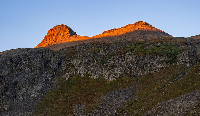
The light on Handies Peak was looking nice this evening.
Looking across to Jones Mountain, Niagara Peak and Crown Mountain.
Handies Peak Sunset
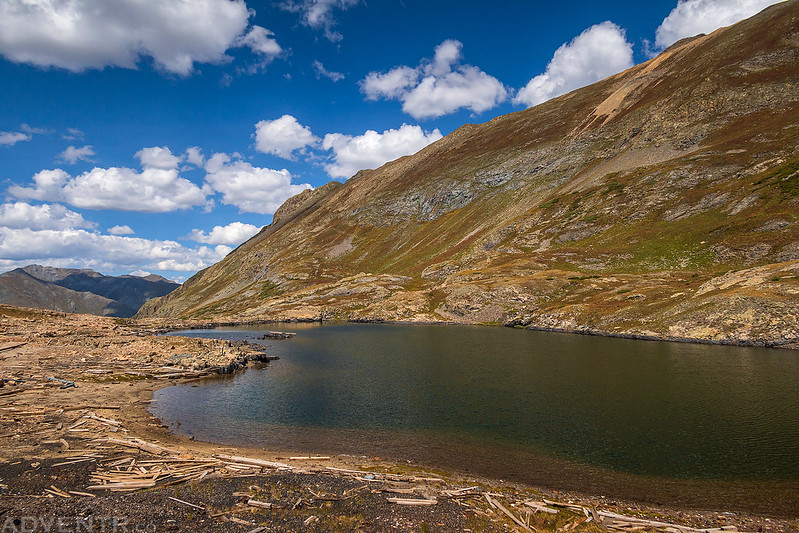
Parson Lake Evening

After a pretty good night of sleep I woke up just before sunrise on Saturday morning and started the day off with an easy hike above Parson Gulch to the summit of Eureka Mountain.
As the soft morning light lit up this unnamed and unranked 13,270 foot peak above Parson Lake, I thought it might be a good one to climb this morning if I had the time.

I also thought that ‘Parson Peak’ would be a good unofficial name for this peak, so that’s how I’m going to refer to it.

Sunrise on Emery Peak.

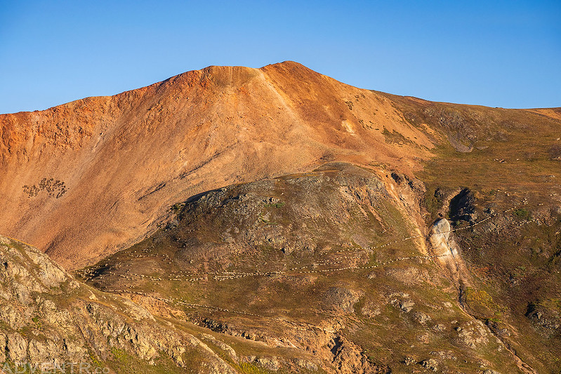
It was a pretty easy walk to the summit of Eureka Mountain (12,929).

During the entire early morning hike I was able to hear a noisy flock of sheep over on California Mountain. As I started hiking back to my Jeep I noticed they were moving across the face of the mountain to the side I had planned to hike up.
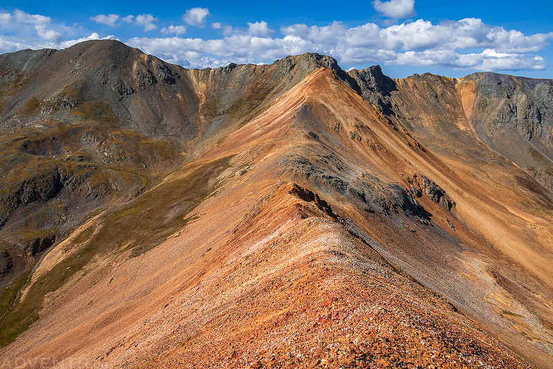
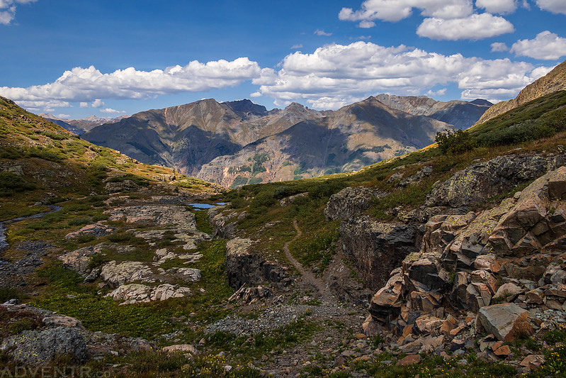
Before heading over to California Mountain I decided to hike up the ridge to ‘Parson Peak’ since it was right there and looked interesting.
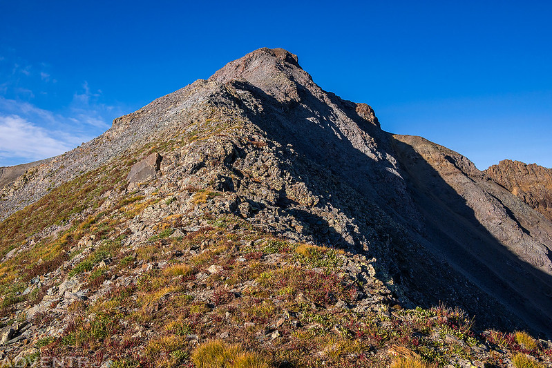
Following the rocky ridge to the summit.

I’m glad I decided to add this peak since the walk up the ridge was fun and the view was nice, too!

Looking down the southeast ridge into Eureka Gulch.

A view over to the summit of Eureka Mountain from the other side of Parson Gulch.

As I was hiking back down the ridge I noticed that most of the sheep had moved to the other side of California Mountain and cut off my planned hiking route to the summit.

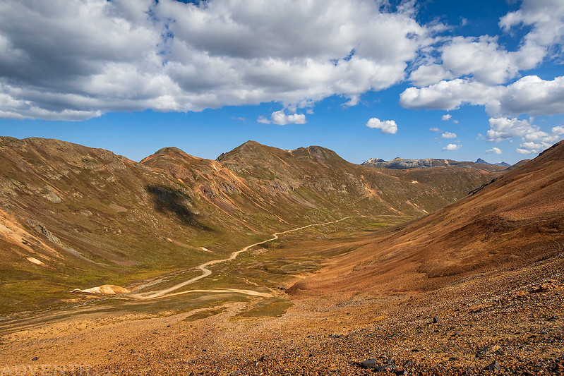
I really didn’t feel like walking through a large flock of sheep and getting harassed by the sheepdogs, so either I needed to skip that hike today or find a different route. I drove back down Placer Gulch and then up California Gulch to the other side of California Mountain to see if I could climb it from that side instead. The route looked steeper and rockier from the other side, but I decided to give it a try.
Looking back to my Jeep across the red rocky hillside I had to cross- California Pass is just out of the frame in the upper right. There was a very faint game trail that I was able to follow part of the way and the final climb to the saddle was steep and loose, but not terribly so.

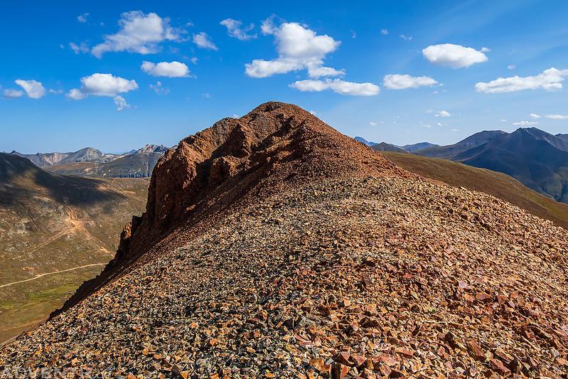
Once I reached the saddle it was a fun ridge-walk to the summit. There was one narrow section with drop-offs on both sides that almost stopped me, but I was able to get across.

California Mountain Summit (13,220)
Following the red ridge back down to the saddle. Hanson Peak is the mountain on the left.
The view down California Gulch as plunge-stepped into the loose rocks on my way back down from the saddle. The return hike was actually easier than I was expecting.
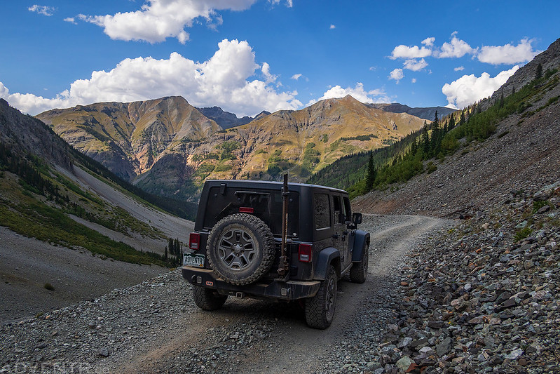
After returning to my Jeep I drove over California Pass and Hurricane Pass as I made my way back to Silverton. It was the perfect time to grab a burger for lunch from the Kendall Mountain Café before heading out on another hike this afternoon.
Arrastra Basin: Mayflower Mine to Silver Lake
The weather forecast was looking pretty good this afternoon, so I thought I’d try to get in another hike. I didn’t completely trust the weather enough to hike another peak, but I thought visiting a lake and the remains of a ghost town would be safe enough. I headed back out of Silverton and drove up Arrastra Gulch to the end of the road at the Mayflower Mine. The last mile or so of the road was steep and narrow, but not difficult.
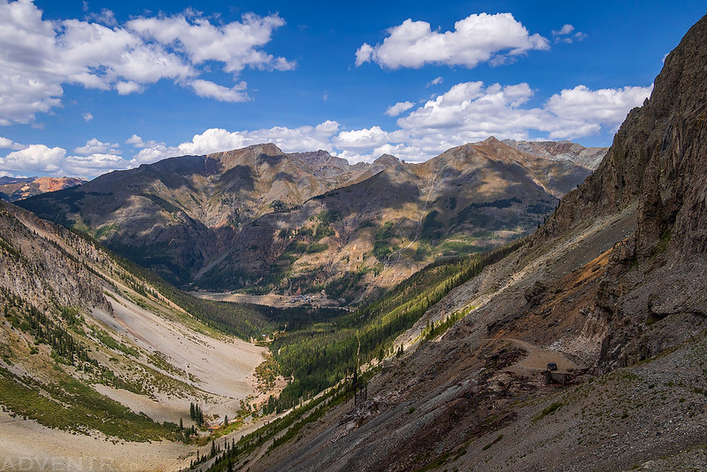
There were a lot of old rusty ruins at the Mayflower Mine. There was also a good view all the way down Arrastra Gulch to the Mayflower Mill, which offers self-guided tours just outside of Silverton.

An old ore cart pushed over the edge.

The views of the surrounding mountains were pretty nice, too.

From the Mayflower Mine, I started hiking up a steep, loose and narrow trail that continued further up into Arrastra Basin. You can see my Jeep parked below at the end of the road by the old mine.
Much of the trail to Silver Lake is pretty easy, but there is one section that is completely washed out and you must climb up a rock wall to continue. There is an old steel cable hanging down along the rock wall at this point that you can use to help with the climb. When I reached this section I was hesitant to continue by myself since I’m not much of a climber. Although I didn’t think I’d have problems climbing up, I was a little concerned that I would have trouble coming back down. After thinking about it for a few minutes, I decided to take my chances and started climbing- I would worry about the downclimb later. Without the aid of the steel cable, I don’t think there is any way I would have made the climb at all. I should have taken photos of this section, but I was too busy concentrating on what I was doing.
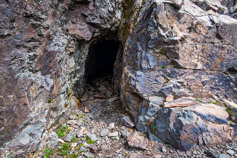
I passed this mineshaft along the trail in Arrastra Basin.
Looking back over the trail to Silver Lake.
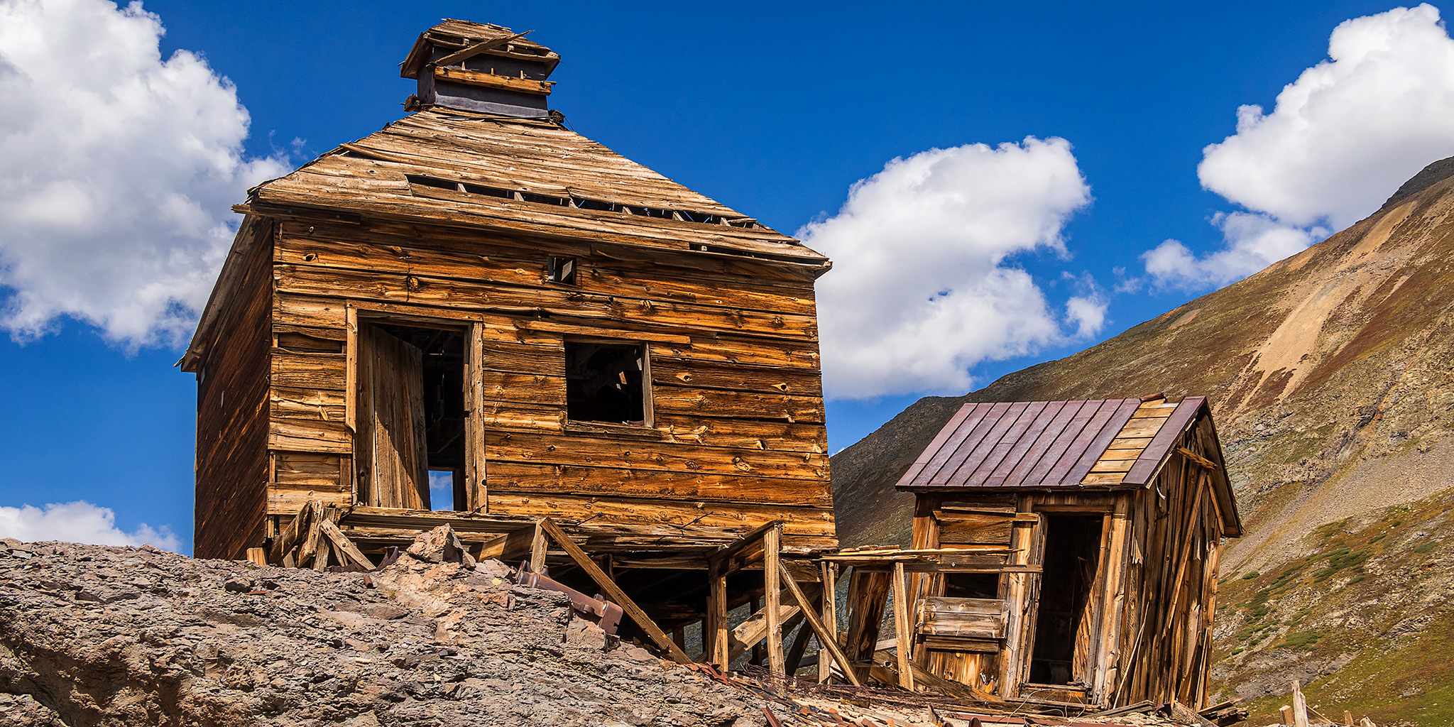
Soon I reached Silver Lake and the remains of the old ghost town. This is definitely an area that you need to watch where you step. There were boards with rusty nails sticking out of them everywhere!

This brick structure is unlike anything else I’ve seen in the area! I’m guessing it’s some kind of boiler? If you know for sure what it is, please leave a comment below.


There aren’t too many structures still standing here, but these two were preserved the best.

A very large spool of steel cable.

Half of this building is still standing.

This is the top part of a roof, but the rest of the building below it is now completely collapsed.

After exploring the area for a while it was time to leave Silver Lake and see if I could make it back down to my Jeep.
I definitely had a much harder time downclimbing the rock wall section of the trail, but with the help of the steel cable I was able to carefully make it. I’m not sure I would do this hike alone again because of this section, so maybe next time Diane will have to come with me.
Leaving the Mayflower Mine and driving back down Arrastra Gulch.
The Continental Divide: Minnie Gulch to Cuba
After leaving Arrastra Gulch I followed the Animas River for a couple of miles and then drove up Minnie Gulch to the end of the road at the Esmeralda Mine where I would spend the night. I spent the rest of the evening relaxing in camp and went to bed early.
Clouds over Minnie Gulch

Above camp I had this view of Cuba, which is where I planned to hike first thing on Sunday morning.
A smoky evening view from camp looking down Minnie Gulch.
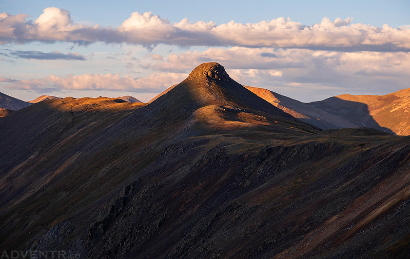
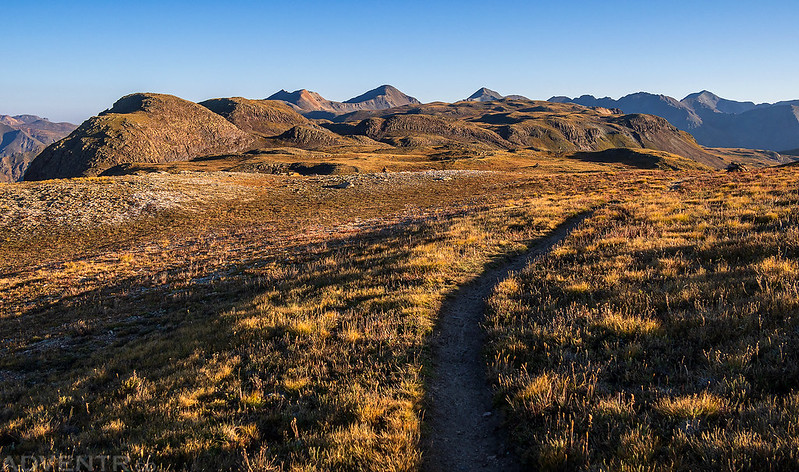
I was up again before sunrise on Sunday morning and was hiking up the Minnie Gulch Trail as it started to get lighter out. The trail was a gentle grade and very easy hiking for most of the way. As I neared the top of the gulch the trail disappeared, but it was still easy tundra walking with the occasional cairn until I crossed paths with the well-travelled Continental Divide Trail. I took a left on the Continental Divide Trail and followed it towards Cuba Gulch. I’ve now hiked sections of the Continental Divide Trail in three different states this year including New Mexico and Wyoming. There’s nothing quite like starting the day with a high ridge-walk along the Continental Divide!
PT 13069 catching the first light of the day.
Hiking up Minnie Gulch in the early morning.

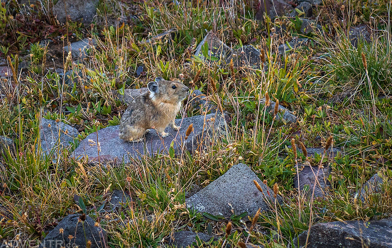
This little pika stopped on this rock long enough for me to get a photo.
There were a number of large cairns along the Continental Divide Trail. I liked the way the light was striking this one with the background still in the shadows.

Just before the Continental Divide Trail started to descend into Cuba Gulch, I left it and followed a lesser trail towards Cuba. This was turning out to be an easy and enjoyable hike in the high country!
I passed this small tarn on my way to Cuba, which is the highpoint just left of middle.
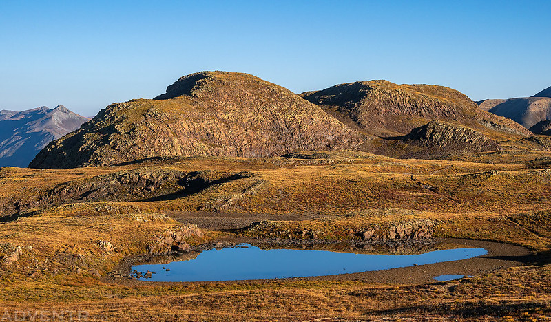
It was an easy walk to the summit.

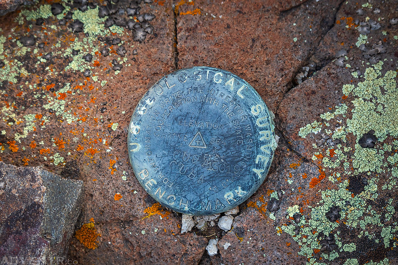
Cuba Benchmark (13,019)
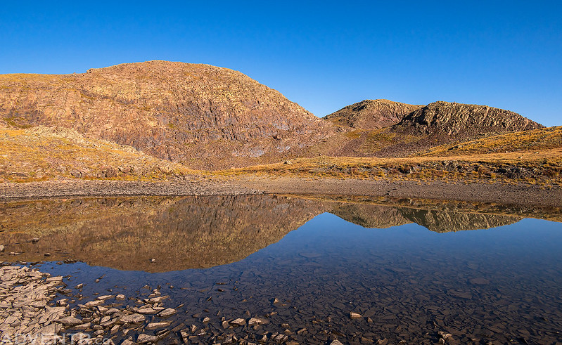
A reflection of Cuba in another small tarn just below it.
Hiking back down Minnie Gulch to my Jeep. It had been yet another nice weekend exploring the San Juan Triangle!
