Tuesday – Thursday, May 18-20, 2021
After spending two nice days in Arizona exploring Petrified Forest National Park, it was time to move on to New Mexico so we could spend a couple of days along the Continental Divide at the southeast margin of the Colorado Plateau in El Malpais National Monument and the El Malpais National Conservation Area. Last winter we spent a short day in this area but were unable to do much because the roads were snow-covered and muddy from a recent winter storm, so we had vowed to come back as soon as we could in warmer weather. We had hoped to do a little caving on our next visit, but because the caves are all currently closed due to COVID-19, we had to stay above ground this trip. Of course, there were plenty of other hiking opportunities to keep us busy and that just means we now have another excuse to come back when the caves are open again!
We slept in a little later on Tuesday morning and then took our time getting ready to get the day started. I was feeling much better today and ready to get out hiking again. The weather forecast for the day was calling for cooler temperatures and overcast skies with strong winds and a chance of thunderstorms in the afternoon, so I figured it would be a good day to search for some rock art. First, we drove over to the Joe Skeen Campground and found a campsite that we would use as our basecamp for the next three days. It was a nice little campground and there were even a couple of open sites when we arrived in the morning. Once our tent was set up and staked down well to survive the strong winds later in the day, we headed over to the Cebolla Wilderness to search for some petroglyphs. One thing Diane and I quickly noticed as we drove to the wilderness area was how many Continental Divide Trail backpackers there were walking along the roads in the area. We would continue to see a lot of them throughout the next couple of days, so I guess we timed this trip when a large bulk of them are on their way north to Colorado. Unfortunately, we also saw a lot water jugs for the CDT hikers stashed everywhere along the roads, which made the area seem kind of trashy.
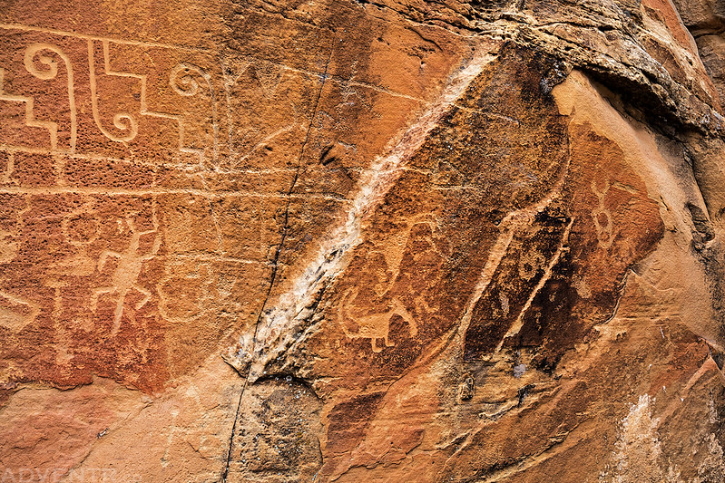
We had no problems finding the first large petroglyph panel we were looking for.

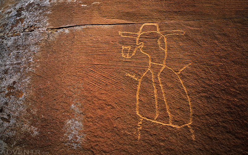
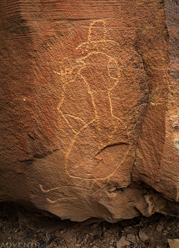
We then spent some time exploring other canyons in the area to see if we could find any other petroglyphs. We did find a couple smaller panels.
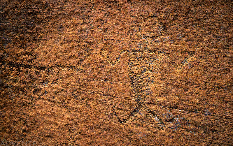

The following two petroglyphs seem to be a little newer…
Next we drove around to the other side of the Cebolla Wilderness so we could visit the Dittert Site.

The Dittert Site is a possible Chacoan Outlier that includes a Great Kiva.
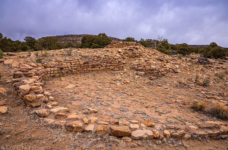
Remains of the Dittert Site Great House

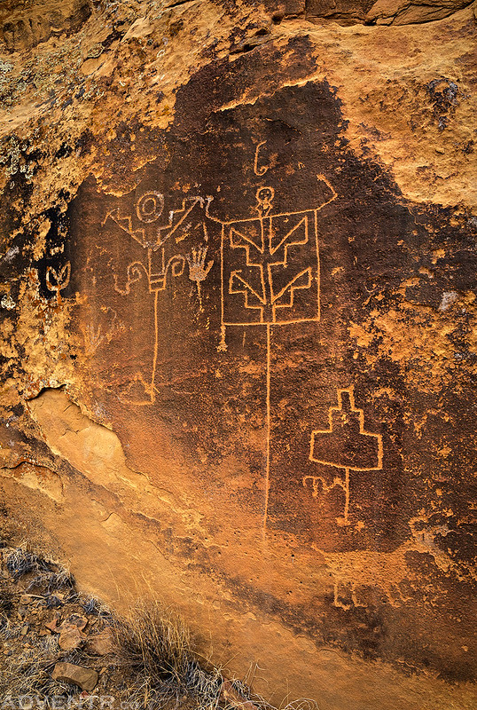
We still had plenty of time for another hike, so we set out in search of the Alldridge Point Petroglyphs. Aside from possibly knowing which canyon they might be found in, I really didn’t have any other information about their location and hoped for the best as we set out in search of them. Lucky us, after about two miles of hiking we found the panel pretty easily, and it was pretty amazing!
This big wall is just covered with petroglyphs!

A closer look at the right side of the wall.
Here are some petroglyphs found on the left side.

This bird eating a lizard is pretty cool!

Wall of Petroglyphs

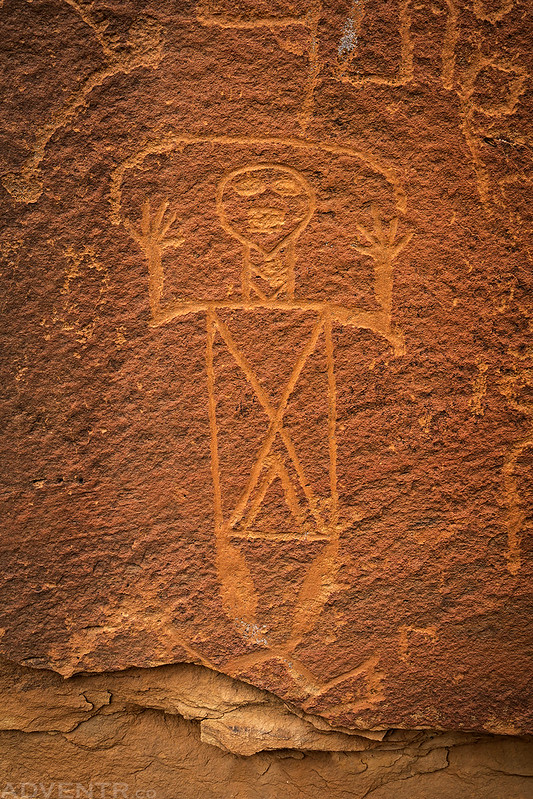
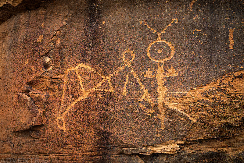
There were a couple smaller panels found nearby, too.

Hand Panel

Flying Bird Panel

Petroglyphs in the Corner

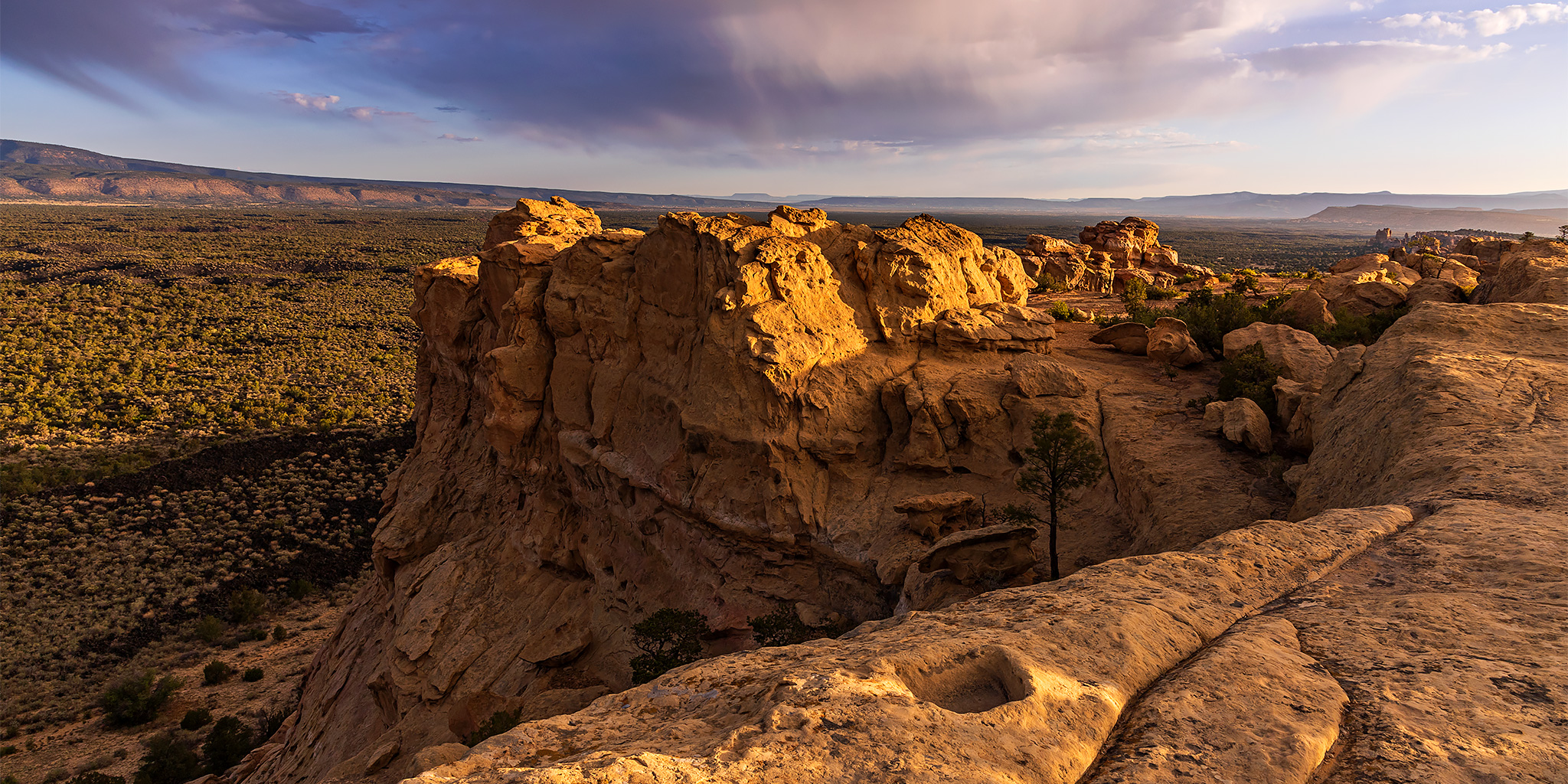
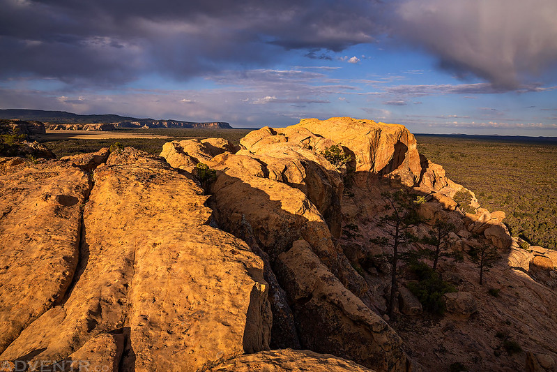
Before heading back to camp we visited the Sandstone Bluffs Overlook, which was really close to the campground. We ate our dinner there and hoped there might be a nice sunset…

There was a touch of color on the horizon over the Zuni Mountains, but that’s about it.
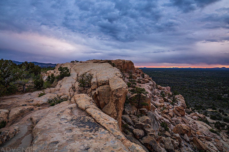
Zuni Mountains On Fire

We returned to camp when it was dark out and found that our tent had survived the wind and was still standing. It had been a long day and we were tired, so we went right to bed. Overnight it started to rain on and off and continued doing so into the morning.
We woke up to some amazing conditions on Wednesday morning which included a rainbow.

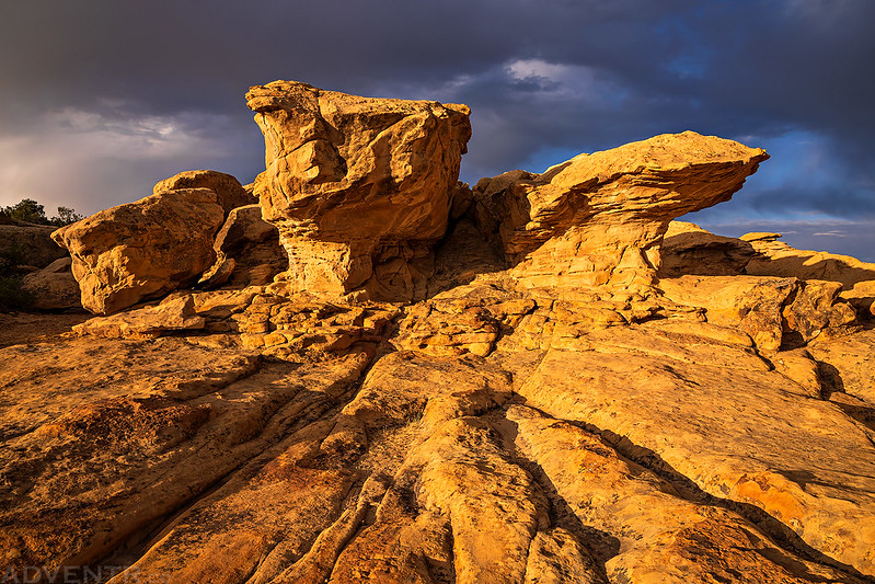
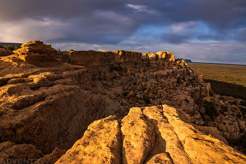
Since the clouds and light were looking nice, we returned to the Sandstone Bluffs to enjoy the views and take a few photos.

The Malpais

El Malpais Views

Sandstone Sunrise
At The Edge
Sandstone Bluffs Morning

Rock Point
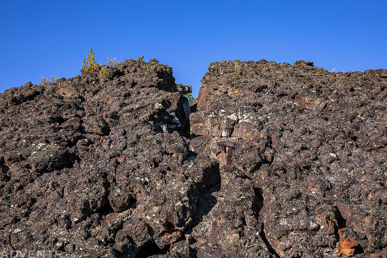
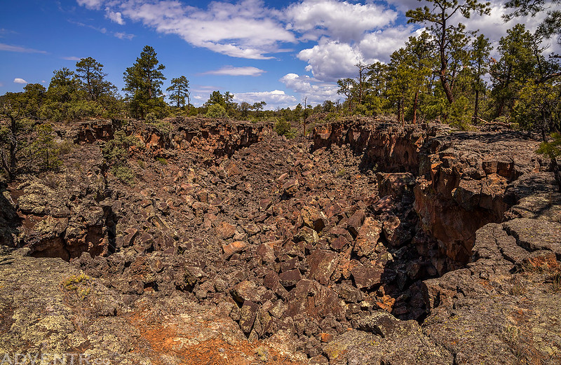
Now that we had found some rock art and ruins and experienced a beautiful sunrise, it was finally time to start exploring the lava of The Malpais. We started with a short hike in the Lava Falls Area. I found it strange to photograph the dark lava fields, as I had to underexpose my photos to make them look right, which is the opposite of photographing in the snow where you have to overexpose.
A big crack in the lava.
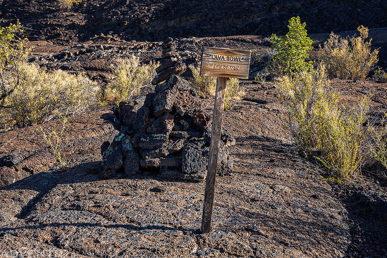
Into The Lava Bowl

Lava Bowl, End of Trail
Cracks in the Lava

Next we continued on to the Chain of Craters Backcountry Byway which roughly follows the Continental Divide along the western edge of The Malpais and passes by a number of cinder cones along the way.

Chain of Craters Backcountry Byway & Cinder Cones

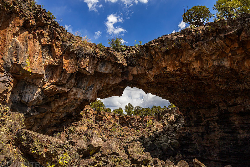
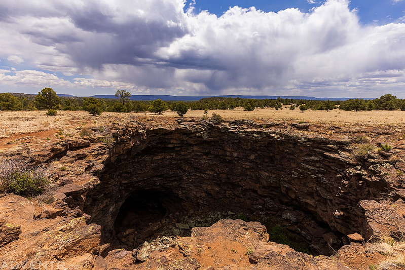
Our next hike was a loop through the Big Tubes Area where we stopped to see this Lava Bridge near Big Skylight Cave.
Most of the trail followed the rim of these lava trenches and passed other caves and collapsed lava tubes along the way.

Although we could not climb down into Four Window Cave this time, at least we could see the spots of light from the four windows in the darkness of the cave.

Long Lava Trench

Following the trench back to the trailhead.
When we returned to the trailhead we had lunch at a picnic table in the shade and then finished the rest of the drive back to the highway. Next we stopped at the El Calderon Area so I could hike to the rim of a cinder cone. At this point Diane’s foot was bothering her, so she decided to wait for me while I hiked the 3.5 mile loop on my own.
Following the El Calderon Trail.

One of the Double Sinks the trail passes by.
A view of another lava trench as I started climbing up the cinder cone.

This is a look inside the El Calderon Cinder Cone.

I followed the trail to the rim so I could loop all the way around the cinder cone.

There were a lot of trees along the rim, so views of the cinder cone were not so great, but there were a couple nice views of the surrounding area.

We completed our driving loop around El Malpais National Monument and returned to Grants for some supplies. Since it was still early enough for one more hike, we headed back to the Cebolla Wilderness for a little more exploring.
Returning to the El Malpais National Conservation Area.

Cebolla Canyon was looking nice this evening.

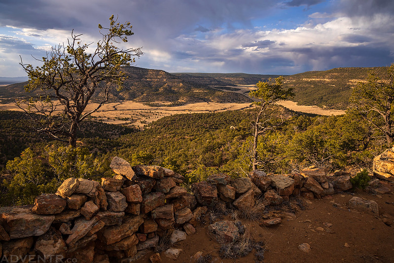
After a steep and loose climb to the top of a ridge, I spotted some ruins.

I climbed to the other side of the narrow ridge for a different view.

The walls were built along the edges on both side of the narrow ridge for a long way. It was a pretty large site!
After another day of exploring The Malpais, it was time to get back to camp and get some rest.

We were supposed to be on our way to Bandelier National Monument on Thursday, but the weather forecast for the weekend was looking like there was going to be a lot of rain so we decided to skip driving that far out of our way and instead planned spend one more morning in El Malpais before heading north on our way back home. This way we could get home a little bit early to relax and avoid the extra driving.
On Thursday morning we slept in, packed up camp and then headed over to the Narrows Picnic Area.

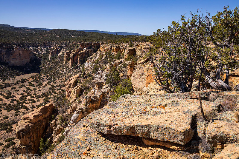
We followed the Narrows Rim Trail along the edge of Cebollita Mesa above The Narrows.
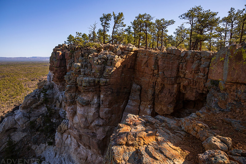
The trail ends at an overlook across from La Ventana Natural Arch.
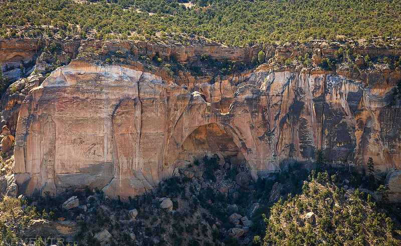
A view along the edge of the mesa from the end of the trail.
When we returned to the trailhead we had lunch in the picnic area and then started our drive north to Colorado. We planned to spend the night in Durango so we could visit Chimney Rock National Monument in the morning, rain or shine…
Randy, you have such an eye for the best ways to present geological formations, sunrises and sunsets, panoramic scenes, etc. However, your tour de forces is your rock art scenes. NO body does it better. I look at rock art daily either on line or in the myriad of books I peruse about American rock art sites. I can pick out any of your photos if they are included in a feed or whatever. You have a great eye for what the creators of the art must have hoped. You include context when needed for size and situation. You photograph in a way that the viewer gets a wonderful glimpse into the spectacular things you witness as you hike along in remote, beautiful settings. You have an artistic eye and your photographs reflect it.
Thank you again and again.
Thanks for the kind words, Dianne