Saturday & Sunday, July 14-15, 2018
So far, this seems to be the summer of hiking to places that have been on my to-do list for a very long time (Highland Mary Lakes & The Devils Causeway), so I figured it was finally time to check out Oh-Be-Joyful Creek in the Raggeds Wilderness near Crested Butte. While part of this hike is commonly done as a day trip, we decided to go for a quick and easy overnight backpacking trip up the valley so we could camp near Blue Lake, which is located in the Ruby Range on a ledge nestled below Scarp Ridge and Afley Peak. I was also hoping to climb a nearby peak in the evening or morning, depending on the weather, and maybe catch a nice sunset, too. I had viewed Blue Lake from above a few years ago when I hiked to the high point of Scarp Ridge and have wanted to get a closer look ever since.
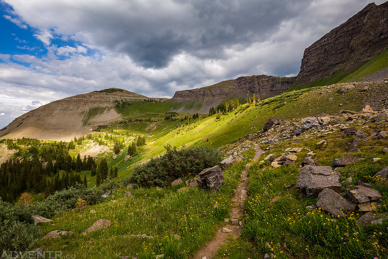
Since we didn’t have too long of a hike ahead of us on Saturday, we woke up a little later than usual, had some breakfast and took our time leaving home. Our driving route to the trailhead took us through Delta and Somerset before taking the gravel road over Kebler Pass into Crested Butte. From there we followed the Slate River to the Oh-Be-Joyful Recreation Area where we found the very last parking spot on the other side of the river crossing. We finished getting our gear together, shouldered our packs and started hiking late in the morning. Unfortunately, since we started hiking later in the day and much of the west has been experiencing high temperatures lately, the hike was pretty warm for us since the trail only starts out at around 9,000 feet. As if the heat wasn’t bad enough, the humidity was also very high and there were a lot of annoying bugs flying around and bothering us throughout the hike. As we got higher the temperature dropped a bit and the bugs thinned out, but the lower portion of the hike wasn’t the funnest. This hike is usually a popular spot to see a lot of wildflowers in the early summer, but because of the the lack of snow over the winter and high temperatures, most of the wildflowers in the valley were wilting and in pretty bad shape at this time. We would a pass a lot of day-hikers coming back down the trail throughout the day, but only saw two other campsites up higher in the valley this evening.
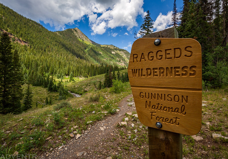
Welcome to the Raggeds Wilderness.
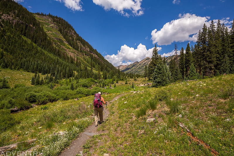
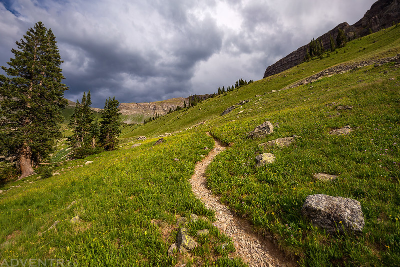
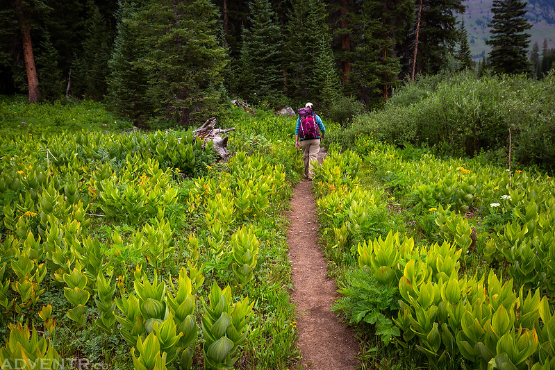
Diane hikes ahead of me through the Oh-Be-Joyful Valley.
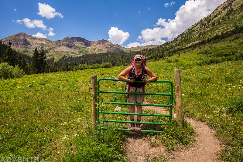
This gate was right in the middle of the trail, but there is no longer a fence connected to it, so it wasn’t doing much good there…
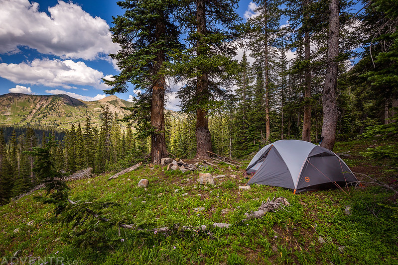
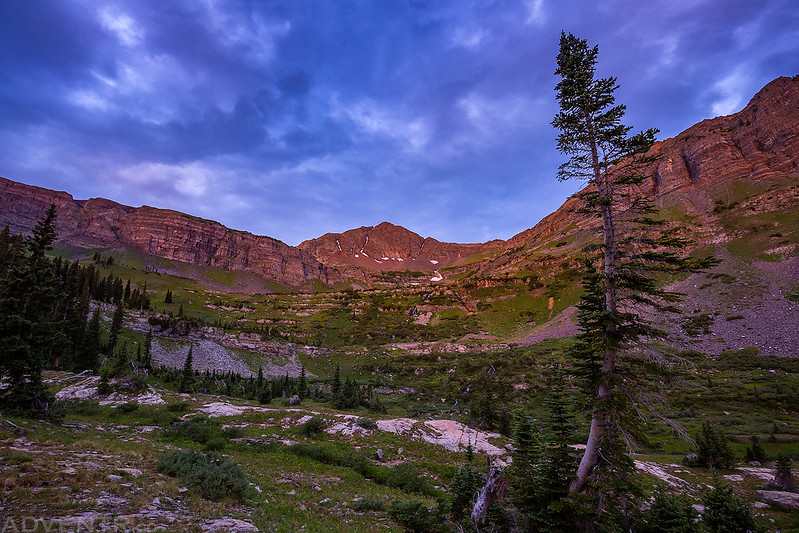
About a half mile and 500 feet of elevation before reaching Blue Lake we found a nice secluded campsite near the edge of a small cliff that offered great views towards Democrat Basin but was still protected in the trees in case there was a storm. After setting up camp Diane took a nap while I rested around camp for a little bit and enjoyed the views. We had some dinner later in the evening and then left camp right afterwards so we could visit Blue Lake after all the day-hikers had left. As we were hiking up to the lake Diane spotted a mountain goat high above on a band of cliffs below Scarp Ridge, but it was much too far away for me to get a photo of.
Shortly before reaching Blue Lake we found a nice secluded campsite with a great view of the surrounding area and set up our tent near the edge.
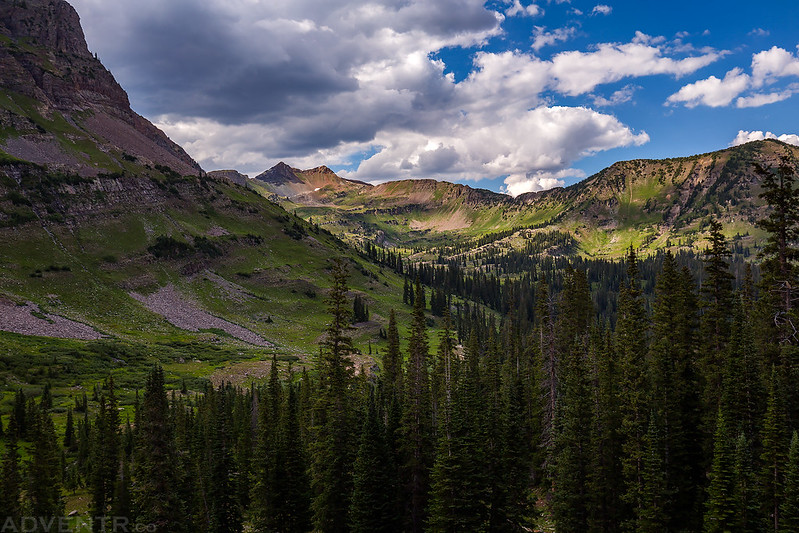
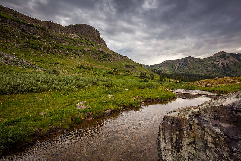
Here’s a view from our campsite to Richmond Mountain (12,501), Democrat Basin and Daisy Pass.
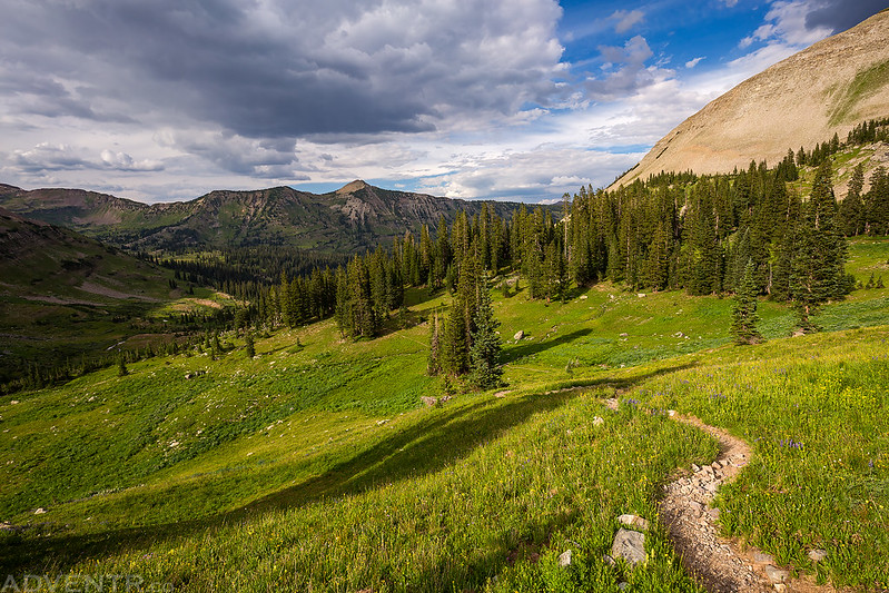
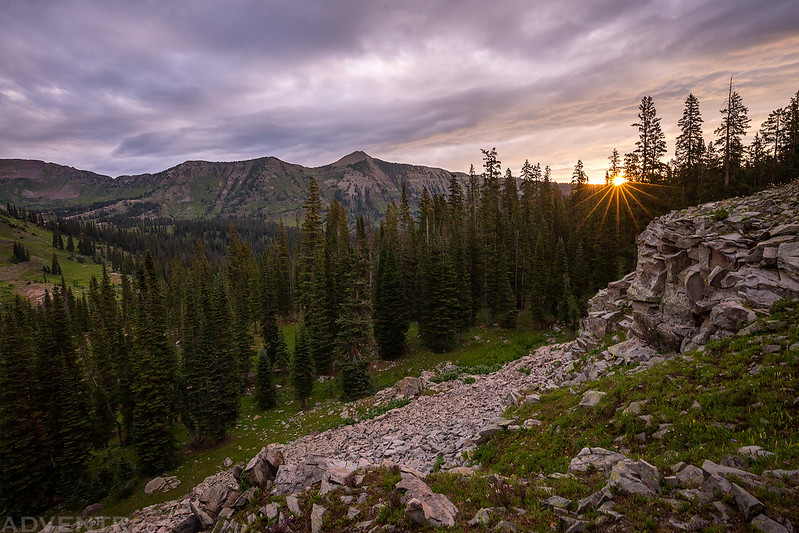
Following the trail to Blue Lake after dinner with Schuylkill Mountain (12,146) in the background.
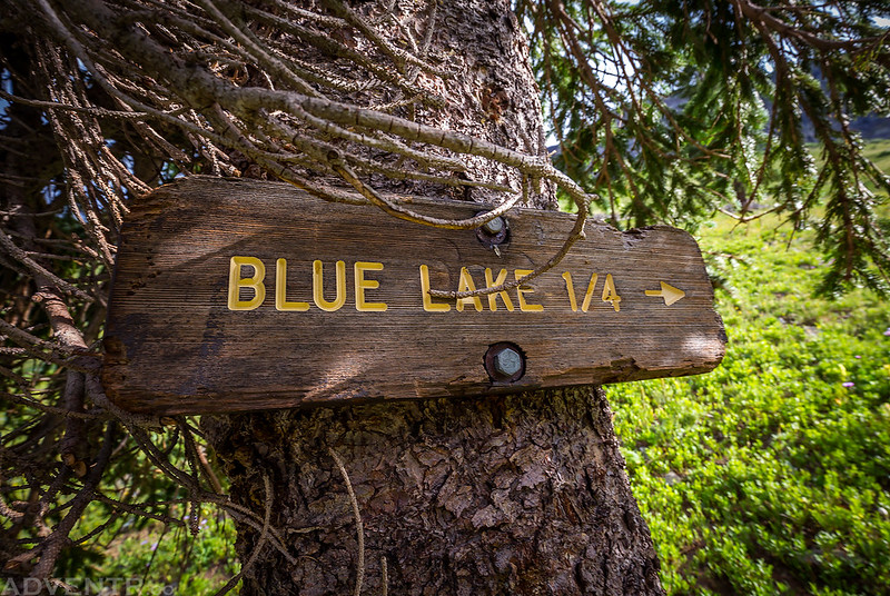
Diane spotted this sign just off the trail and hidden in a tree.
Climbing the last couple hundred feet to the lake.
A little spotlight below Star Pass and Garfield Peak (12,100).
As we were hiking up to the lake we heard a helicopter and then realized that it was down below us lower in the valley. We saw it circle and come back two more times and assumed it was a search and rescue operation, but when we got home and searched to find out what had happened we learned there was actually a small wildfire down in the Oh-Be-Joyful Valley below us and they were putting it out and containing it. Thankfully they were on top of the situation, because if that fire had grown it could have been really bad for us!
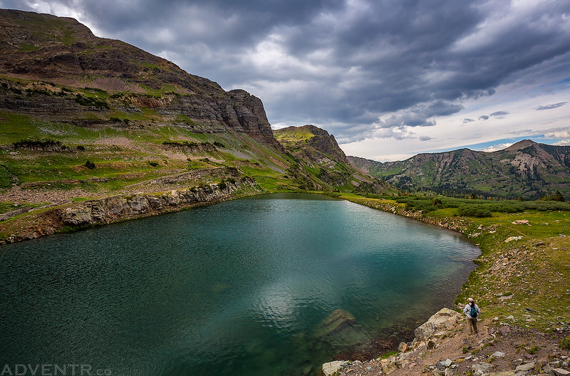
Diane stands near the shore of Blue Lake below me and takes in the beautiful scenery.
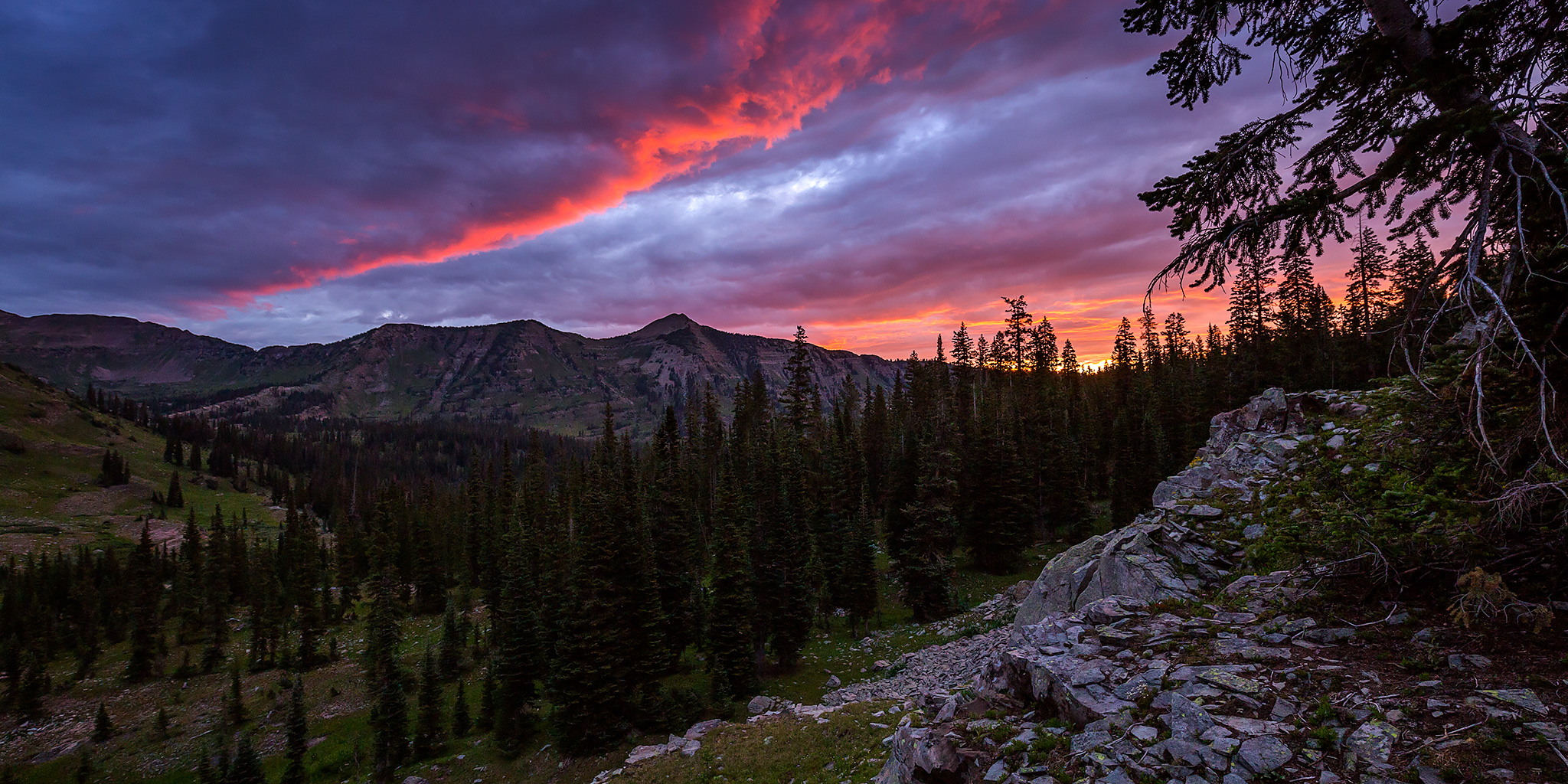
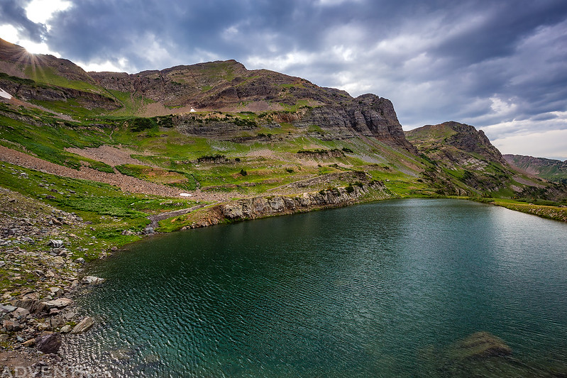
A cloudy evening at Blue Lake as the sun dips below the ridge.
After visiting the lake fo a while, Diane and I went our separate ways as she headed back down to camp for the night while I continued climbing up to Star Pass so I could visit the summit of Garfield Peak. While there were a lot of clouds in the sky, we had not had any storms or rain all afternoon and based on my experience it didn’t look like dangerous weather was nearby, so I was hoping I’d be able to get to the top without any issues, although I was ready to turn around if the weather did get bad.
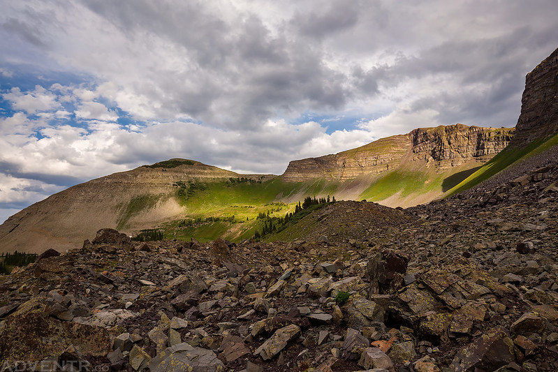
After leaving Blue Lake, I hiked through this rocky section on my way to Star Pass and Garfield Peak.
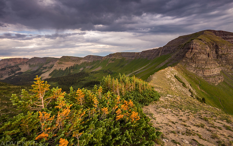
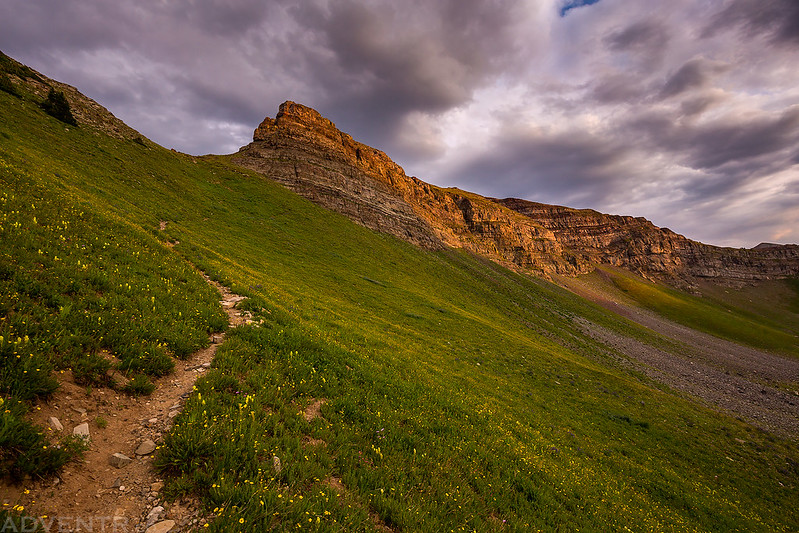
After hiking across the rolling tundra I had a pretty good view of Garfield Peak as I climbed the steep trail to the pass.
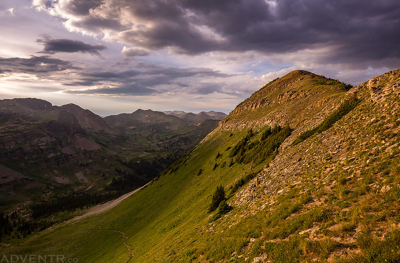
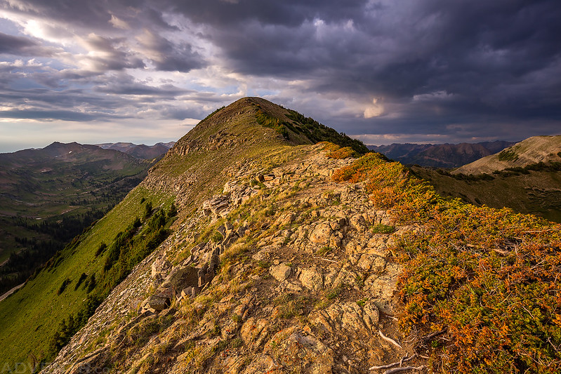
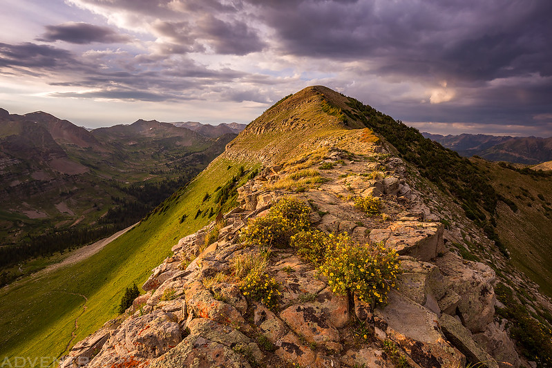
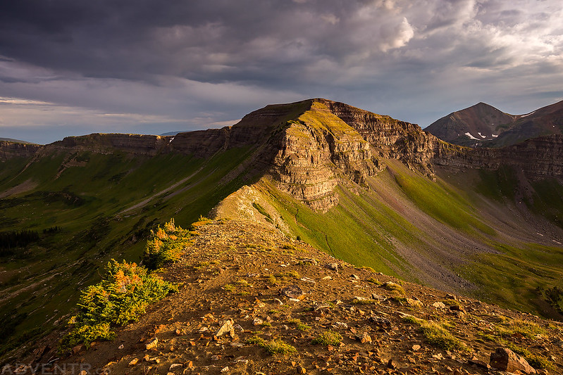
Following the summit ridge to the top of Garfield Peak.
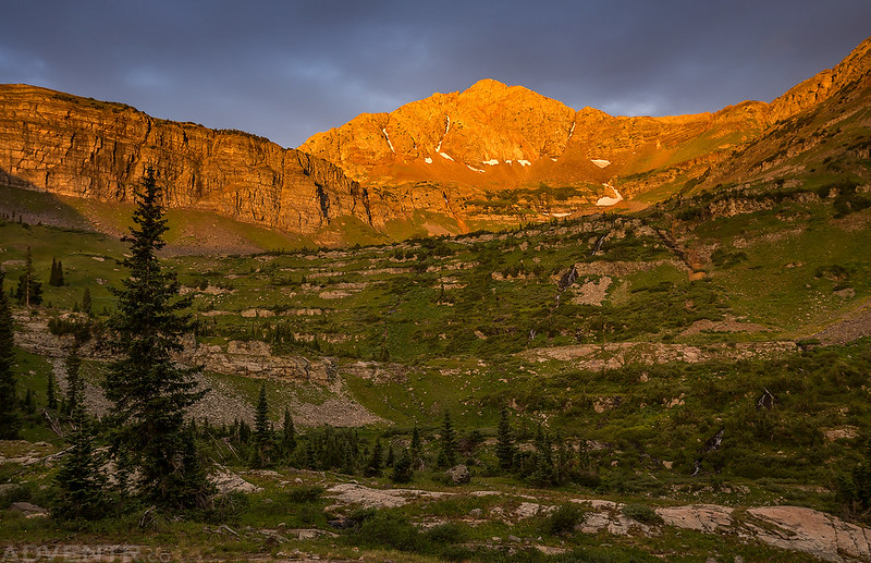
When the sun wasn’t hidden behind the clouds the warm evening light was spectacular!
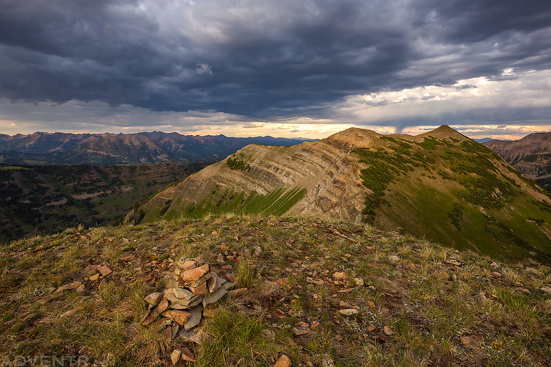
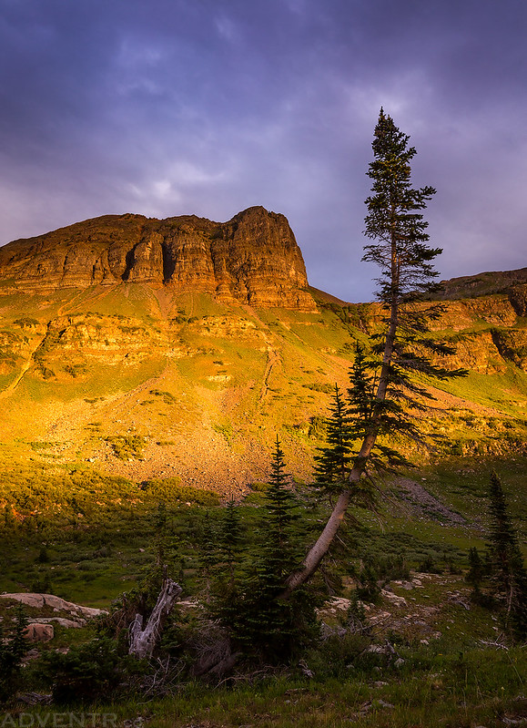
Looking back over the pass to Scarp Ridge.
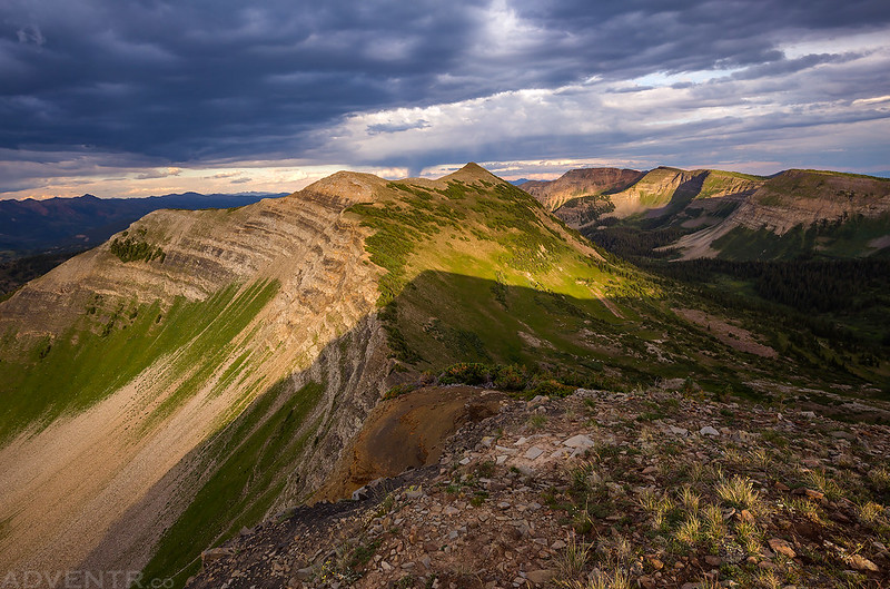
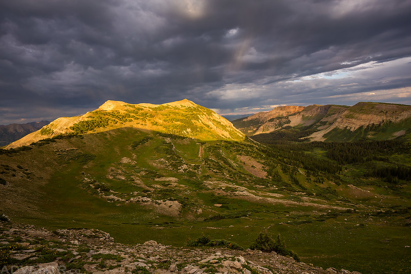
On the summit of Garfield Peak overlooking Peeler Peak (12,227).
While I was on the summit the sun broke free of the clouds for a little bit and the shadow of Garfield Peak was cast onto Peeler Peak.
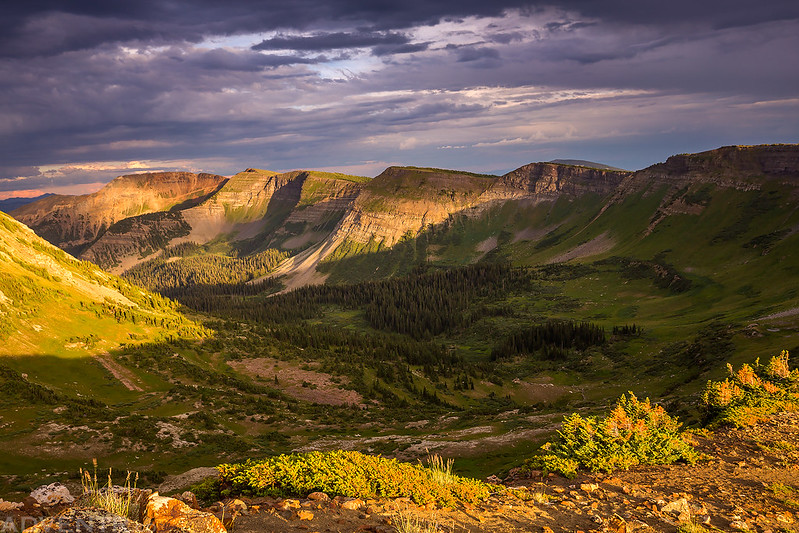
From the summit of Garfield Peak, I had a pretty grand view of the surrounding Elk Mountains including Snowmass Mountain (14,092), Mount Baldy (12,805), Maroon Peak (14,156), Pyramid Peak (14,018), and Gothic Mountain.
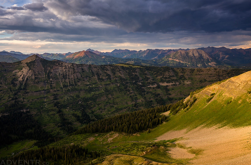
The warm light over Peeler Basin on Mount Emmons (12,392) was very nice as I started hiking back down to the pass.
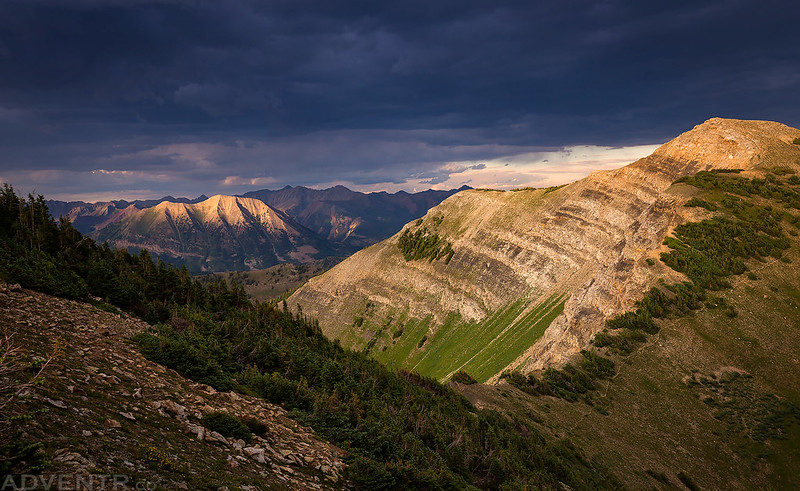
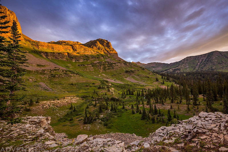
The light was looking pretty good on Scarp Ridge (12,212) on the other side of the pass, too.
As I was hiking down from the summit I noticed that Gothic Mountain (12,625) was lit up nicely for a few minutes.
One last look at Peeler Peak before hiking back down from the pass.
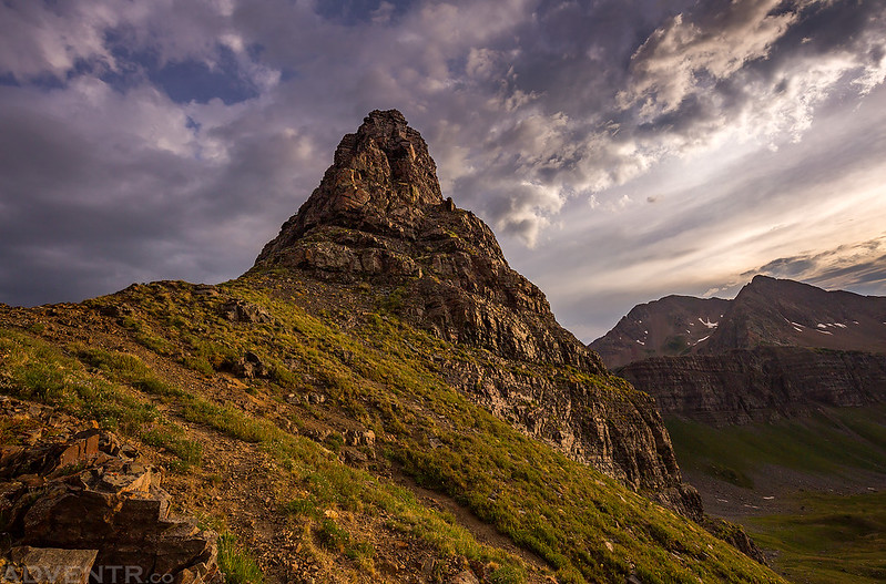
The edge of the rocky cliff towered above Star Pass.
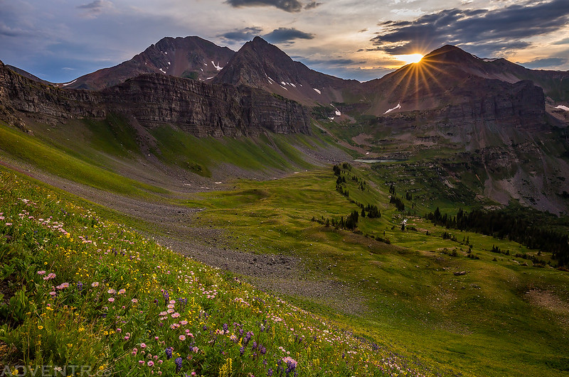
As I was hiking back down from the summit I had to stop and photograph this steep slope covered with wildflowers while the sun was setting behind Afley Peak (12,646). To the left are Mount Owen (13,058) and Purple Peak (12,820) with Blue Lake in the basin below.
The last light on the cliffs of Scarp Ridge above as I continued descending the trail back to camp. There were a few sprinkles of rain during the remiander of the hike, but nothing that even got me wet.
As soon as I reached camp I got right into my sleeping bag and tried to go to sleep. It had been a long and tiring day and I was pretty exhausted. Shortly after getting dark out the wind really picked up outside for a while, but it eventually died down. I was awakened a few times during the night by the sound of rain on our tent, but there was never any lightning or thunder. I never stayed up for long, but Diane told me in the morning that it sounded like it was raining pretty good for a while. I had set my alarm so I could get up and photograph sunrise, so when it went off I peeked my head out of the tent to check out the conditions. I saw a lot of clouds in the sky, but it looked like there was a small gap on the eastern horizon. Instead of going back to sleep for a while, I decided to take my chances and grabbed my camera to get up for the day. It was a good decision!
It looked like there was a small gap on the horizon that would let some light through this morning, and I was right!
Purple Peak illumined by a subtle touch of alpenglow.
Intense morning light on Purple Peak for a few short minutes.
We had a pretty nice view from camp this morning. Just left of center is Oh-Be-Joyful Peak (12,420).
I liked the look of the curved tree near camp.
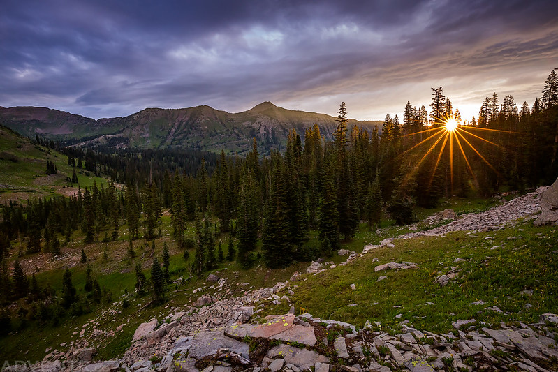
I caught this sunstar next to Schuylkill Mountain as I hiked back up the ridge to our tent.
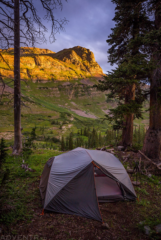
An early morning view of our wet tent below Oh-Be-Joyful Peak.
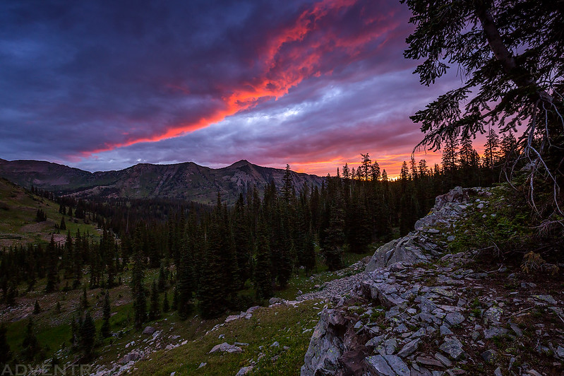
This would be the last time we would see the sun for the rest of the day…
Based on the weather forecast I saw from the previous day, thunderstorms were supposed to start early today, so after the sun disappeared behind the clouds we packed up camp and started hiking back down the trail to try and avoid them. The hike back down was much easier and the temperature out was cooler, although it was still pretty humid out.
After packing up camp we stopped by upper Oh-Be-Joyful Creek to filter a little water for our hike down to the trailhead.
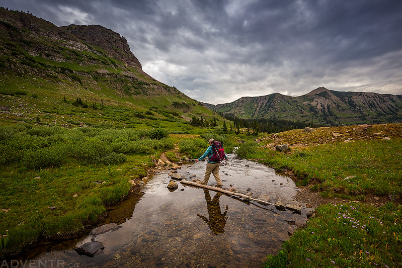
Diane crosses the creek as we continued down the trail.
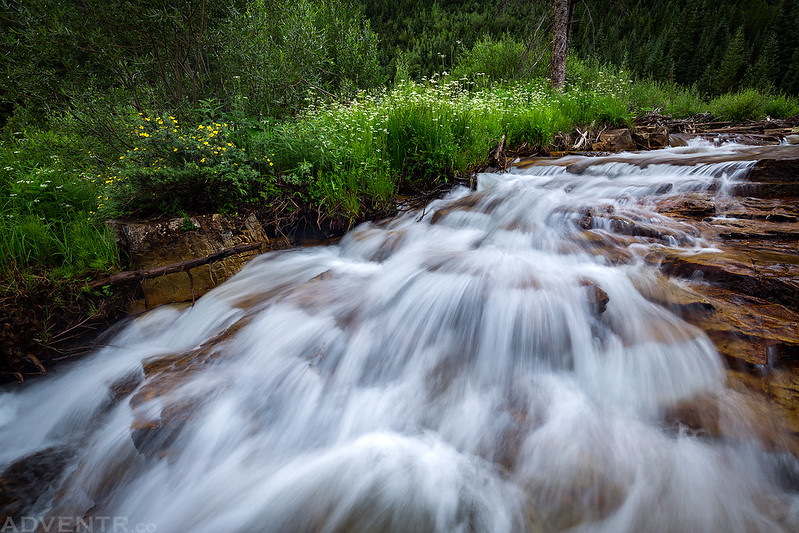
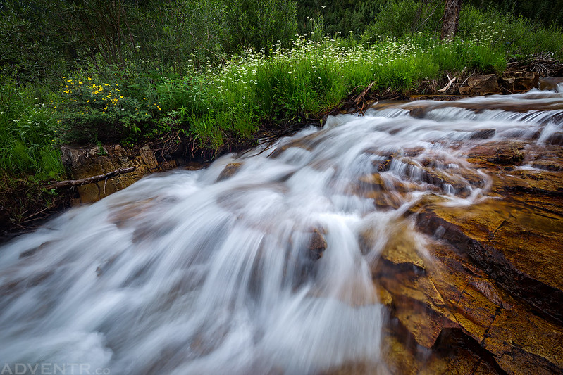
Since it was overcast out, I stopped by a nice looking cascade in the creek to take a couple of photos.
Diane hiking ahead of me as we followed the trail back down to my Jeep. It had been a very good weekend!
>> Oh-Be-Joyful Creek to Blue Lake Photo Gallery
Thanks for this post Randy. I hiked Scarp Ridge last summer and saw Blue Lake From above….so good to see your beautiful photos of the area! Tom McC, McQueeney, Texas
Gorgeous pictures!
Wow, those evening pics are even more dramatic than your usual. Beautiful pics. Amazing scenery too!