Saturday, September 24, 2016
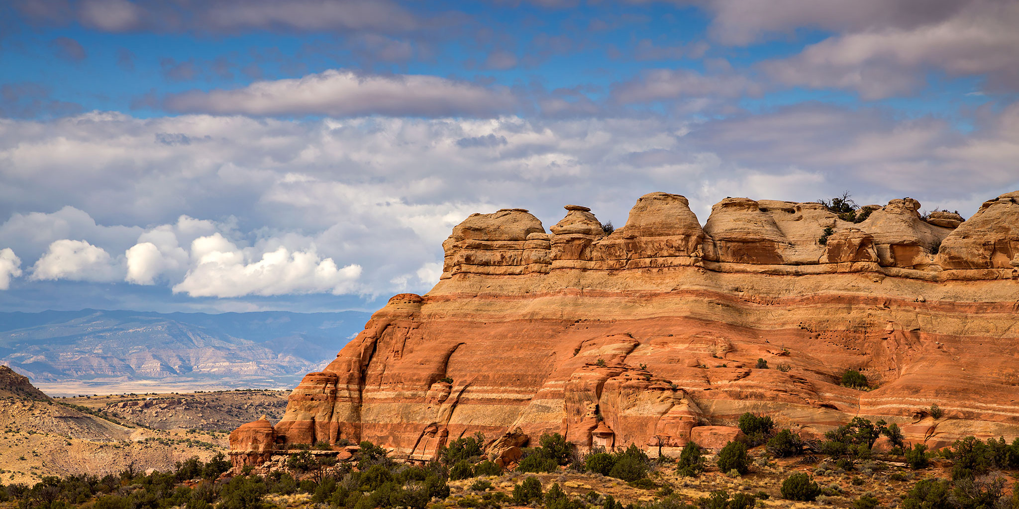
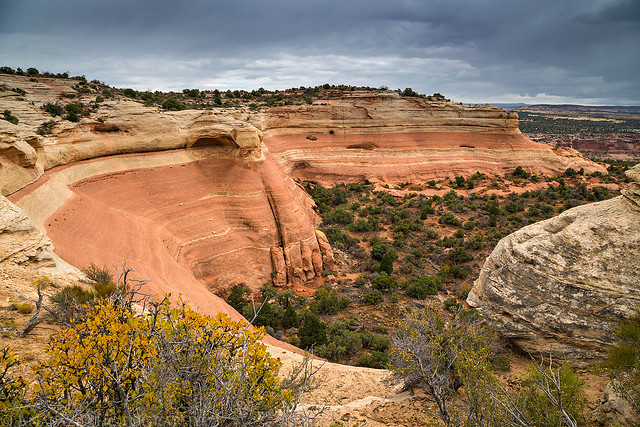
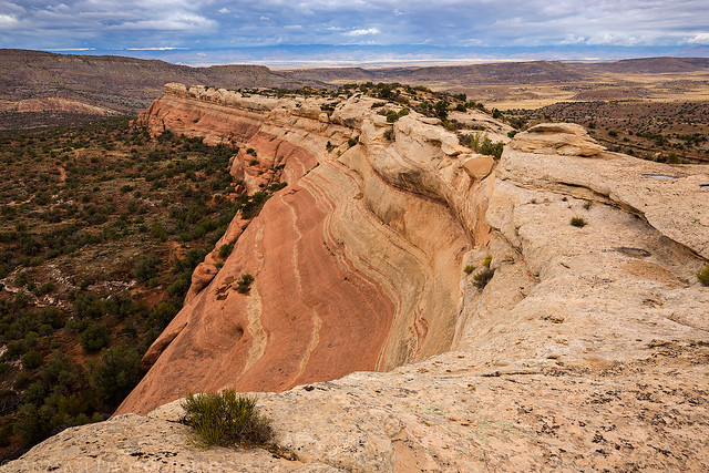
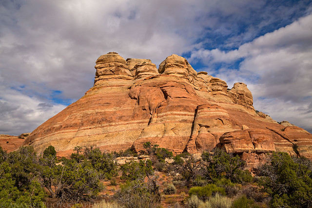
Part of the sandstone ridge that makes up PT 5239 in Rabbit Valley.
I was originally planning this hike for Thursday after work, but the weather made me change my plans that day. Since we ended up staying close to home this weekend because of the weather, I decided to head back out to Rabbit Valley after the rain stopped late in the morning and hiked up to the summit of PT 5239. I’ve been trying to explore more of Rabbit Valley lately and this short summit away from the more popular trails looked like a good place to check out.
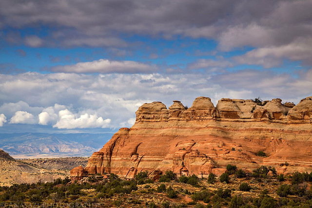
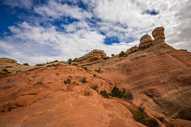
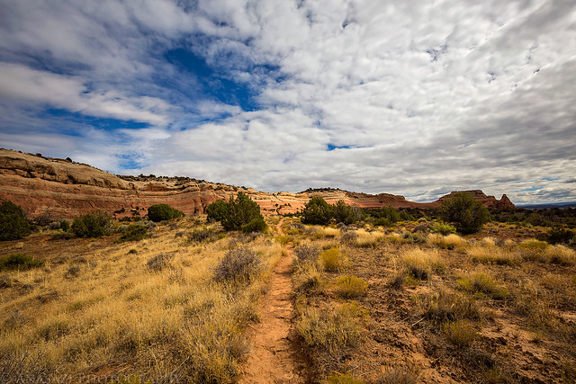
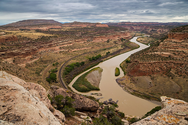
After the morning rain had stopped the weather was pretty nice for the rest of the afternoon and evening with only a few additional sprinkles that didn’t even get me wet. It wasn’t hot out and there was a nice breeze, but the sky was mostly cloudy the entire afternoon and it was also quite humid out. This turned out to be a great off-trail hike and it offered some nice views the entire way. I started the hike on the Jouflas Horse Trail but soon left the trail and climbed to the top of a long sandstone ridge. The sandstone was very colorful and fun to explore as I made my way over to the high point. There was even a nice narrow section with steep dropoffs on both sides. At the summit there was a good view up Ruby Canyon and the Colorado River.
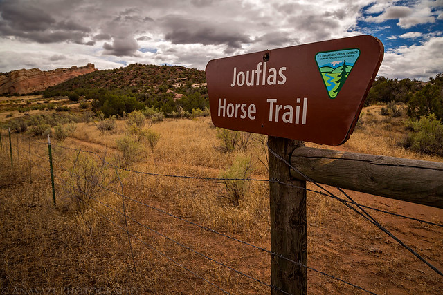
A sign near the beginning of the Jouflas Horse Trail.
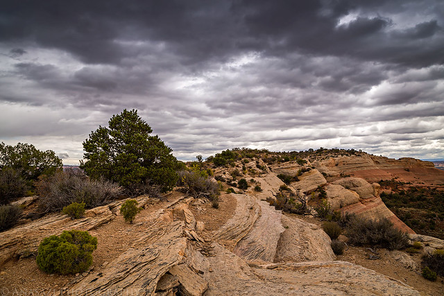
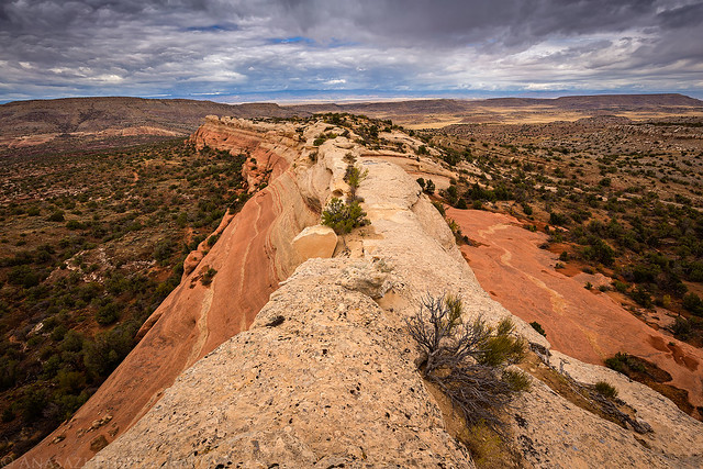
Following the top of the long sandstone ridge with dark clouds above.
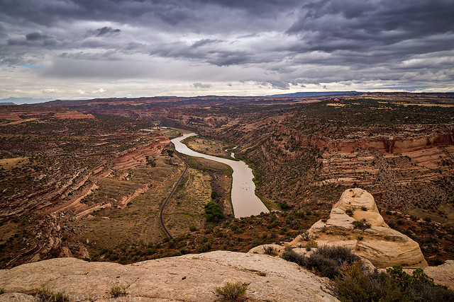
This is a view from near the summit overlooking Ruby Canyon and the Colorado River. If you look closely you can see quite a few boats floating down the river.
After reaching the summit I did a little more exploring on top of the ridge since I was up there.
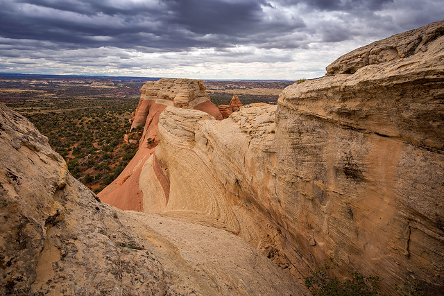
This part of the ridge juts out to the west, but I couldn’t find a way beyond this point.
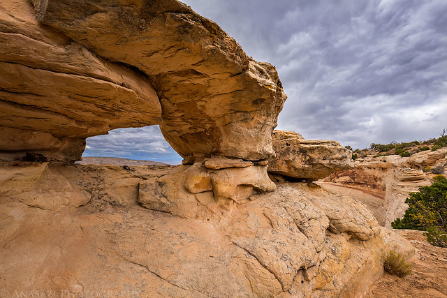
There was a small arch nearby, though.
Hiking back along the ridge to the other end, since I didn’t see any other ways down on this side.
The ridge got a bit narrow for a short section with steep dropoffs on each side.
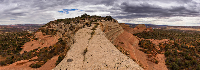
A panorama of the narrow section looking the other direction towards PT 5239.
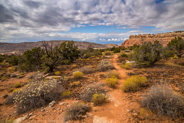
Following the easy sandstone ramp back off the ridge.
After returning the way I had come, I joined back up with the Jouflas Horse Trail again and decided to take it back out to the edge of Ruby Canyon for a view over Black Rocks. I would have loved to have completed the entire Jouflas Horse Trail loop, but I didn’t have enough time this afternoon since I had a concert to attend in the evening. I will have to return and finish the loop from the other end another time.
The sun came out for a little bit when I rejoined the Jouflas Horse Trail and started following it back to the rim of Ruby Canyon.
There was a pretty nice view over Ruby Canyon with Rabbit’s Ear Mesa in the upper left.
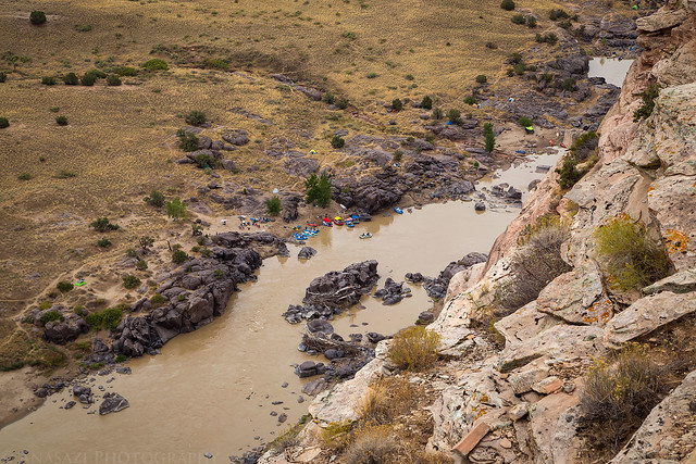
Looking down on a crowded campsite from the Black Rocks Overlook. It was a lot less crowded when we were there last month.
Of course, the sky started to finally clear up as I hiked back down the Jouflas Trail to my Jeep.
The end of the sandstone ridge in the sunlight near the end of the hike.
Below is a map and GPS track from my hike starting at the Jouflas Horse Trail to the summit of PT 5239 in case you are interested in checking it out for yourself. I highly recommend this short hike!