Grand View Point Trails: Murphy Trail Loop, Murphy Point & Gooseberry Trail
Saturday & Sunday, November 2-3, 2019
After finishing up hiking all of the official trails in the Needles District of Canyonlands National Park last year I figured that it was time for me to get started working on my remaining trails on the Island in the Sky. While I have already hiked most of the official trails on the top of the mesa, I had not hiked any that descend down to the White Rim, so I wanted to change that this weekend. I figured a good starting point would be to hike a couple of the shorter trails that start from Grand View Point, including the Murphy Trail, Murphy Point Trail and Gooseberry Trail. It’s kind of funny, although the Island in the Sky is the closest district of Canyonlands to me, it’s also the one that I’ve spent the least amount of time in. I think I’m going to make it my goal to finish hiking my remaining trails in this district of Canyonlands within the next year. Let’s see how many I can squeeze in over the winter!
I left home late on Saturday morning after sleeping in and having a good breakfast. Although I usually like to get an early start and be the first one on the trail when I go hiking, this time I thought the light along the Murphy Trail Loop would be nicer in the afternoon, so I went for a later hike. I arrived at the trailhead shortly before noon and the temperature out was very nice, especially since it was just starting to warm up after a strong cold front had moved through the area earlier in the week.
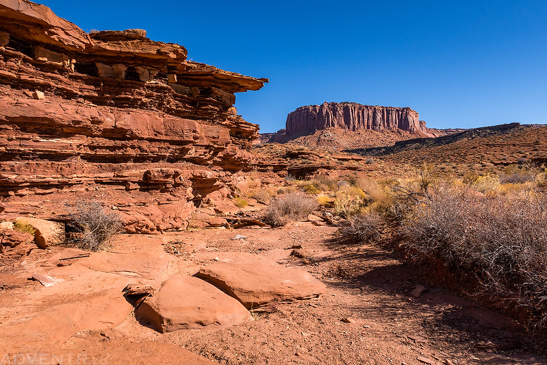
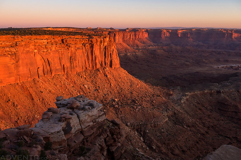
Starting my first hike from the Murphy Trailhead.
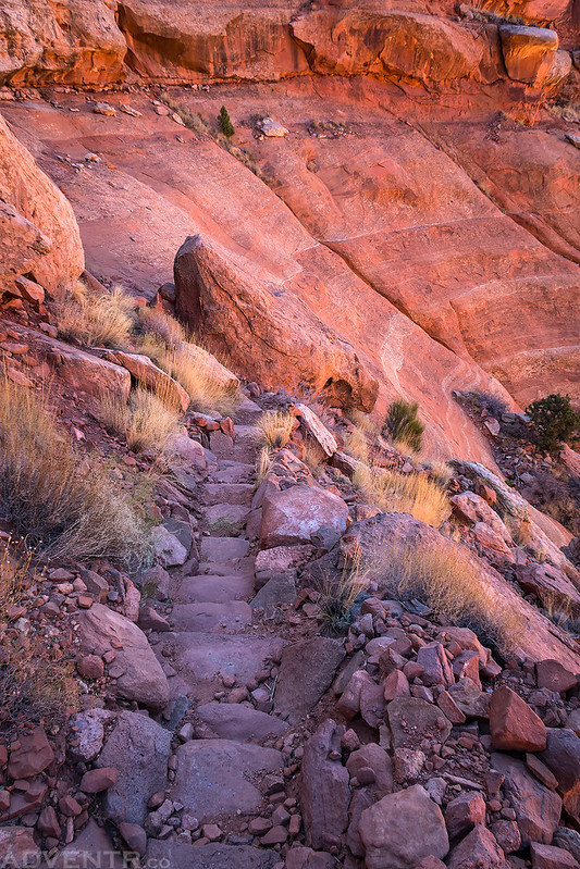
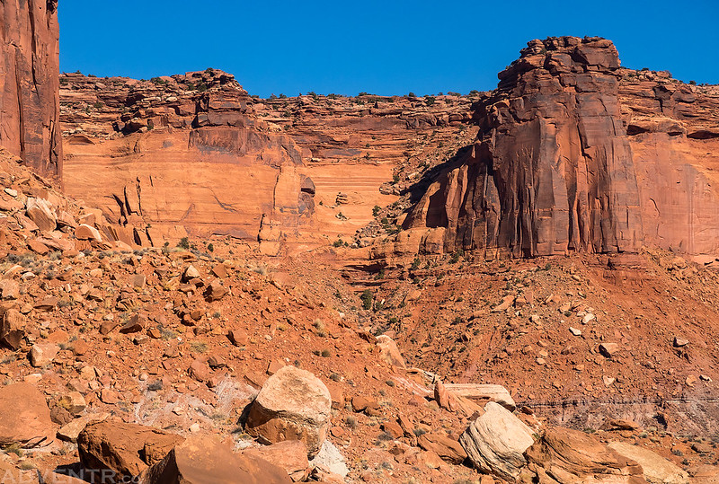
Descending a section of rock stairs along the Murphy Trail.
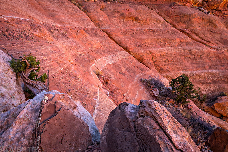
I liked the color and lines of the sandstone here.
The Murphy Trail Bridge was originally made from logs and rough-cut planking and built around 1917 by Jean Idiart and Darwin Allies. The bridge was reconstructed in 1998 and no longer retains any historic integrity, but that’s probably a good thing for hikers who use it today!

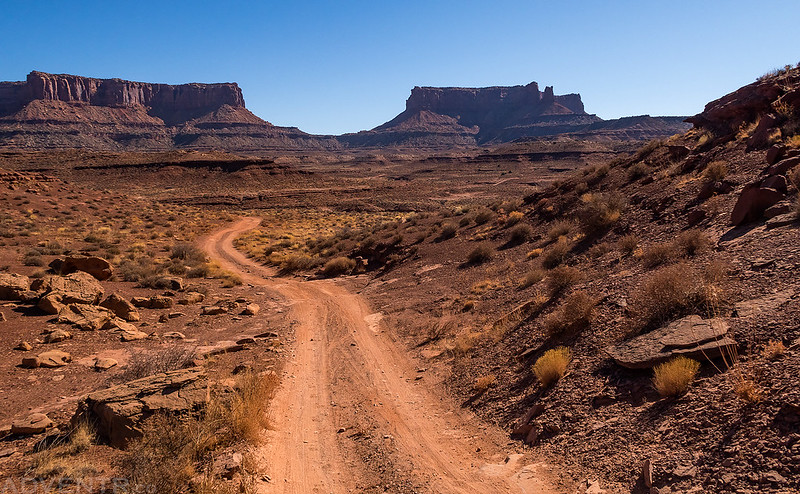
Junction Butte comes into view as I hiked down Murphy Wash.
White stripes along the wash.

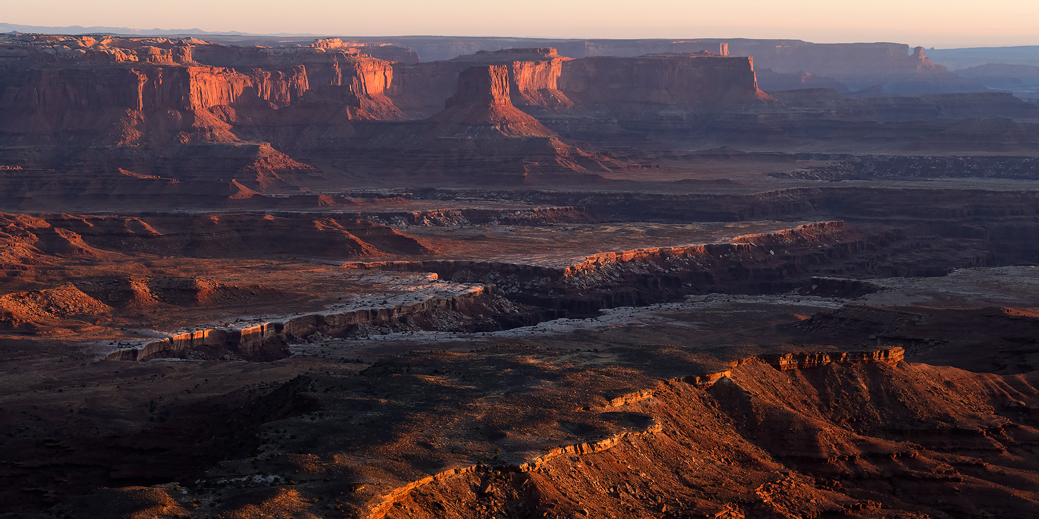
When I reached the White Rim Road I turned right and headed toward Murphy Hogback. This is the view looking back to Grand View Point and Junction Butte from the road.
Hiking up the dugway to the top of Murphy Hogback. My favorite campsite along the White Rim Road is located right at the top.
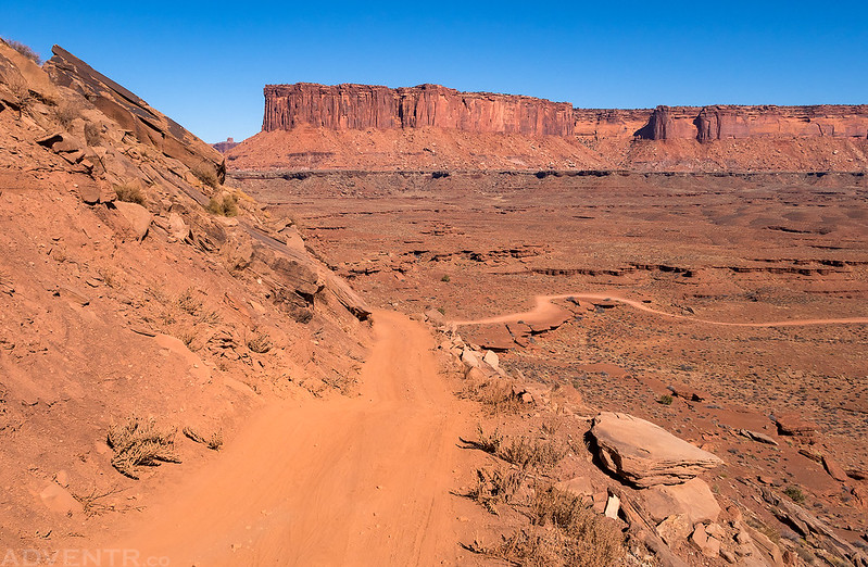
Following the Murphy Hogback Trail back towards Murphy Point.
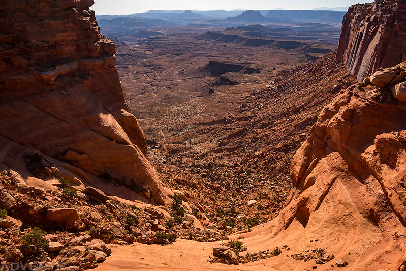
A look at the chute that the Murphy Trail uses to descend from top.
During my hike back up I noticed these inscriptions near the Murphy Bridge from both Jean Idiart and Darwin Allies. There were actually quite a few different inscriptions left by Jean throughout the 1940s.

Looking down the chute of the Murphy Trail as I neared the top again.
Following the trail along the rim.

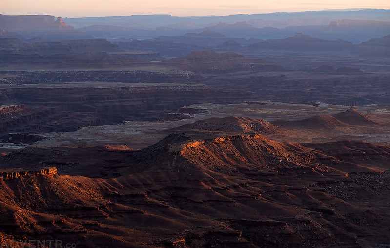
Instead of heading back to my Jeep at the trailhead, I followed the Murphy Point Trail out to the end so I could catch the sunset since I had never hiked this short trail before either. The sky seemed quite a bit hazy and smoky this afternoon, which I’m guessing is smoke from the wildfires California has been dealing with lately.
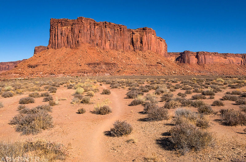
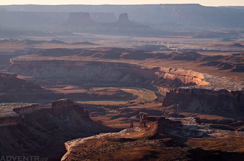
Here’s a hazy view over Murphy Hogback from the end of Murphy Point. You can see the Murphy Hogback Trail below which obviously follows an old mining track. Look closely through the haze and you can see Lizard Rock, The Chocolate Drops, Elaterite Butte and Ekker Butte in The Maze.

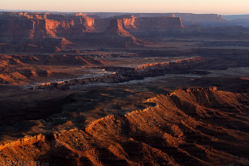
A nice evening view of Junction Butte from Murphy Point. Cathedral Butte is the high point on the horizon between the end of Grand View Point and Junction Butte.

I think the haze made for an interesting view over to Turks Head in Stillwater Canyon.

Here’s a slightly different view that includes the entire bend of the Green River with the Buttes of the Cross in the background.
Candlestick Tower in the distance over Soda Springs Basin.

Hiking back to my Jeep at dusk.
I returned to my Jeep at the trailhead and then left the park in search of a campsite for the night. I ended up finding a good spot to spend the night near Whitbeck Rock and had some dinner while listening to a podcast. While I was finishing my dinner I saw a bright green meteor streak across the sky in front of me. It was pretty cool and actually the second bright meteor that I have seen this year! I read for a little bit and then went to bed early.
The extra hour of sleep on Sunday morning was welcomed even though I had gone to bed early. I woke up about an hour before sunrise and headed back over to Grand View Point where I stopped at the White Rim Overlook. I caught the sunrise from the top of the Gooseberry Trail and then started my descent to the White Rim Road once the sun was up. It was actually a really great hike to take just after sunrise as the views were amazing!
The Earth’s shadow over the rim of the Island in the Sky.

I just love it when that golden light illuminates the cliffs!
It was a bit hazy out again this morning, but I think that helped make for a nice layered view.
I love the light on the rims below with Airport Tower in the distance.
The view from the top of the Gooseberry Trail towards the La Sal Mountains at sunrise.

Beginning my descent of the Gooseberry Trail. I know it doesn’t look like there would be a trail here, but I can assure you that the trail descends the chute below.

Hazy Morning View

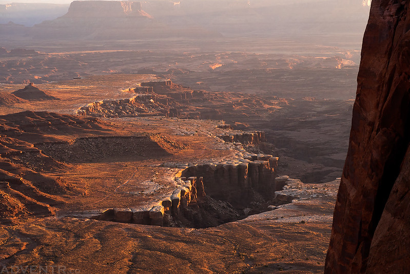
The rim of Gooseberry Canyon below is my destination this morning. Only about 1500 feet below the start of the trail.
Looking back up at the chute that the Gooseberry Trail uses to get down the cliff.

Once the trail reached the bottom of the cliffs, it then followed the wash to the White Rim Road.

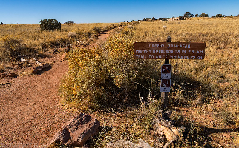
The sign where the trail meets the road.

I walked along the rim of Gooseberry Canyon for a better view.
Gooseberry Canyon


Following the White Rim Road back to the Gooseberry Trail so I could hike back up it.

After hiking back up the wash I started climbing up the steeper section of the trail when I heard people up above and then heard a rock falling down the steep chute above. At first I thought they were hiking down and accidentally kicked a rock loose, but then I spotted someone on the rim pick up a large rock and throw it over the edge, right over the trail and above me! Thankfully I hadn’t climbed high enough that it was close to me, but I yelled up for them to stop throwing rocks over the trail. The person disappeared after that and I heard no other rocks thrown over the edge, but I did keep an eye out for places to seek shelter the rest of the way up, just in case…
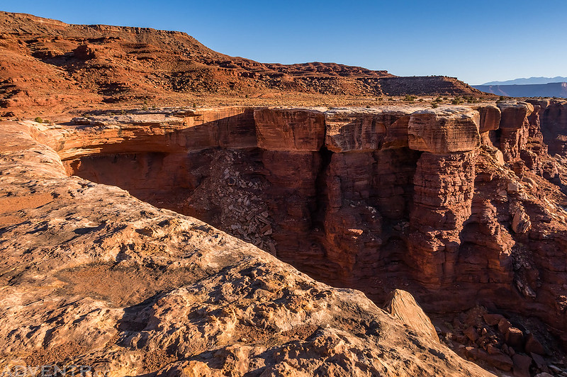
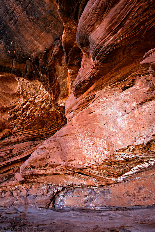
I stopped at a colorful alcove near the top and found this little arch.
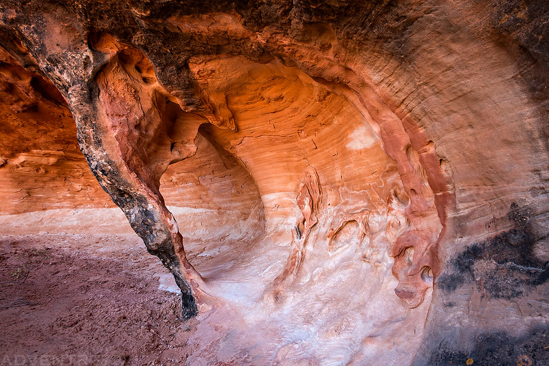
Colorful erosion in the alcove.
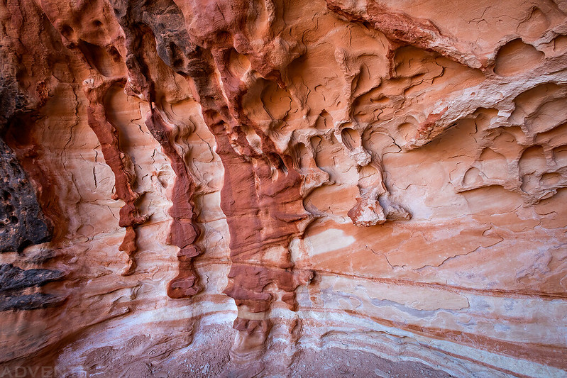
Sandstone Cove
When I returned to my Jeep at the trailhead it was just before 10:00am and I had finished the round trip hike in just under 3 hours, and that included a lot of stops for photos along the way. The Gooseberry Trail was a very pleasant hike that I enjoyed a lot.
Since it was still a little early, I decided to make a quick stop on my way back home to climb The Knoll (6,316), which is one of the highest points on the Island in the Sky, but it’s not within the boundaries of the National Park. It’s actually right near the Dead Horse Point Road intersection.
Here’s a view of The Knoll as I was on my way to climb to the top. It’s a pretty easy and short hike.

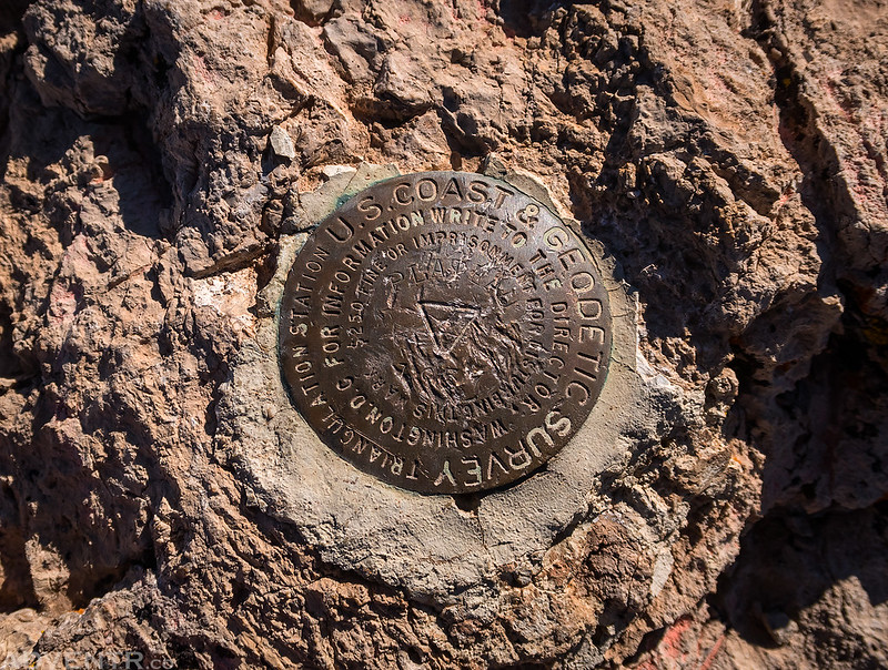
The Plateau Benchmark was on the summit.
Here’s a view from the top looking over to Monitor and Merrimac buttes.

It felt great getting back to the Island in the Sky and I’m looking forward to more trips here over the next couple of months. As a matter of fact, I already have a couple of campsites reserved over the winter!