Tour of the Deserts | Honeymoon Adventure
Tuesday – Friday, March 7-10, 2017

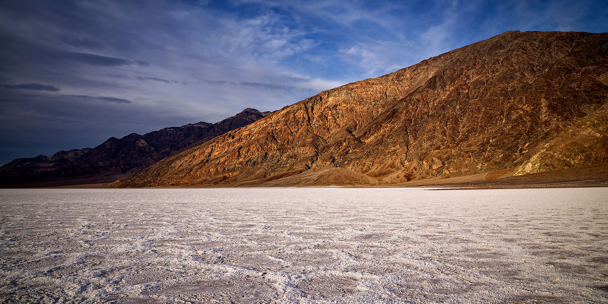
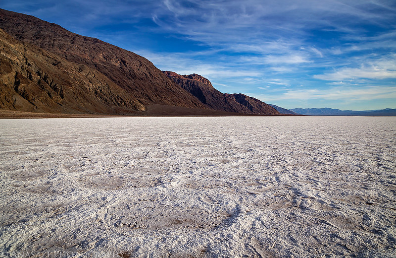
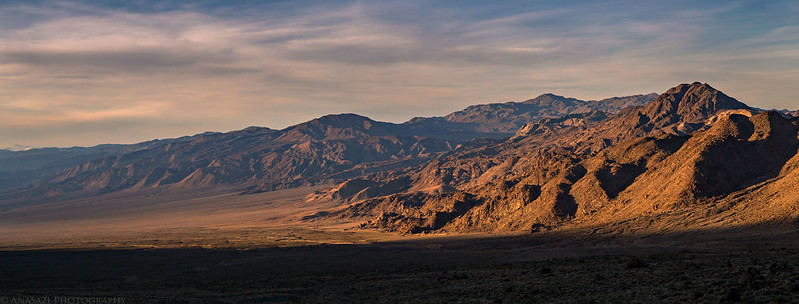
The salt flats of Badwater Basin in Death Valley National Park, the lowest area in North America.
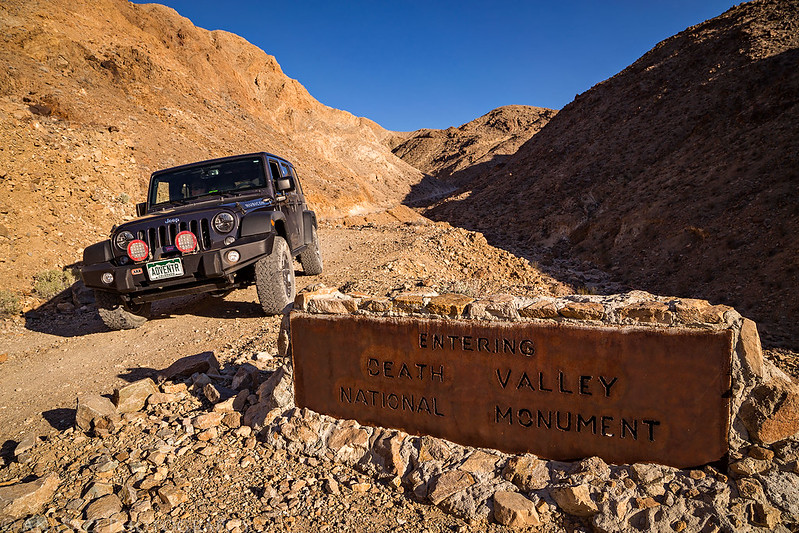
After getting married in Red Rock Canyon National Conservation Area just outside of Las Vegas, Diane and I left for our honeymoon on a tour of the deserts of the southwestern United States. We started off our journey by spending a couple of days in Death Valley National Park. While I have been to Death Valley a few times before, this was Diane’s first visit, so we made sure to stop at a few of the popular locations so she could get a nice overview of the park.
Unfortunately, the Death Valley portion of our trip would not go quite as planned. While we were in Las Vegas I had come down with a pretty bad cold that would get worse during our first two days in the park. Plus, there were also a few road closures from recent heavy rains that prevented us from going to a few places we wanted to go. I guess we’ll just have to go back again in the near future!
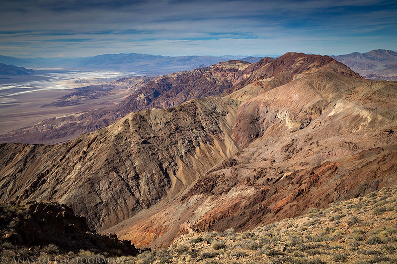
We started our adventure with a stop at Dante’s View so Diane could get a nice overview of Death Valley from this expansive overlook.

Even though I was not feeling well, we still hiked over to the nearby Dante Benchmark (5,704).

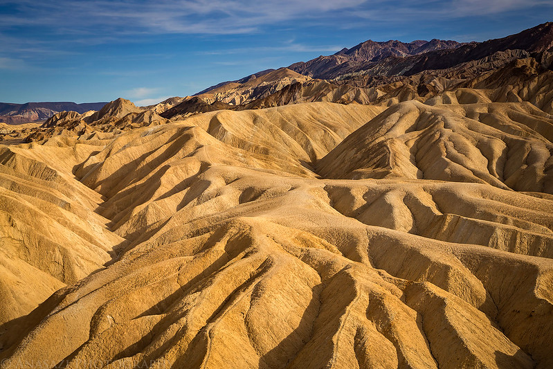
After driving back down from the overlook we stopped at Zabriskie Point since it’s one of the more popular areas in the park.
We made a brief stop at the Furnace Creek Visitor Center so Diane could pick up a magnet from the gift shop and then we drove back to Badwater Basin to check out the salt flats. Thanks to my cold and sinuses, I was unable to pop my ears when travelling over the mountains into the lower basins, so my hearing was heavily muffled while we were down in Death Valley and I couldn’t hear much. It really wasn’t much fun…
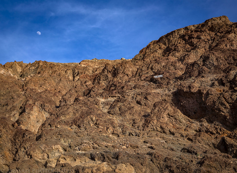
That marker above shows where sea level is.
The salt flats were still wet, muddy and slippery in a lot of places, so we didn’t venture out too far from the road.
Since I wasn’t feeling well we didn’t stick around for sunset like I had planned, and decided to forgo camping this night. We left Badwater and drove to Beatty, Nevada where we got a room for the night and went to bed early.
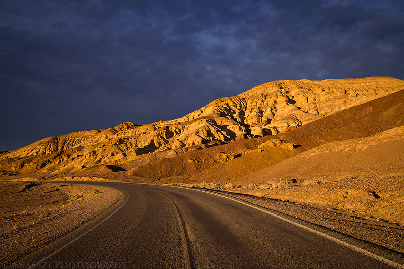
Nice warm light as we drove through Death Valley.
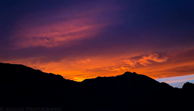
We did catch a colorful sunset as we drove over Daylight Pass on our way to Beatty.

We slept in late on Wednesday morning in hopes that the extra rest would help me start feeling better. It didn’t. We grabbed some breakfast and then picked up some cold medicine in town before driving over to Rhyolite to check out the old ghost town. From there I had hoped to take Titus Canyon Road back into the park, but we found that it was still closed. Instead we headed back over Daylight Pass and made our way over to the Ubehebe Crater.
We walked a short distance around the rim of the crater, but I wasn’t feeling well enough to complete the loop or go down into it.

From the crater, we took the Big Pine Road to Crankshaft Junction and through the Last Chance Mountains to Eureka Valley. I had a great time camping at the Eureka Dunes a few years ago and was looking forward to doing the same on this trip. After we setup camp near the base of the dunes I took a nap for a while. Shortly before sunset we hiked into the dunes, but as soon as we reached the top of the first sand dune we came to, I was exhausted and couldn’t do much else. This cold had taken away all my energy. We sat down at the top and watched the sunset. I had hoped to explore some more remote sections of the dunes for photos, but that just was not happening today.
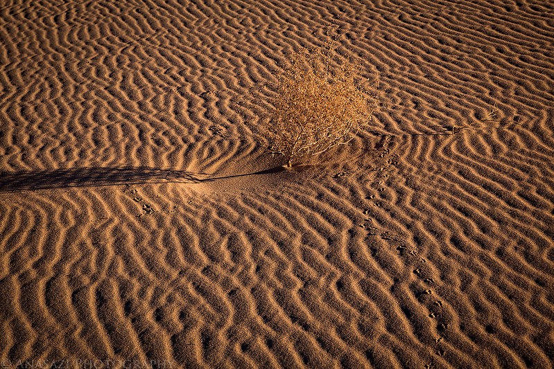
Tiny tracks in the sand.
A view of the Eureka Dunes as we climbed the one closest to our camp.

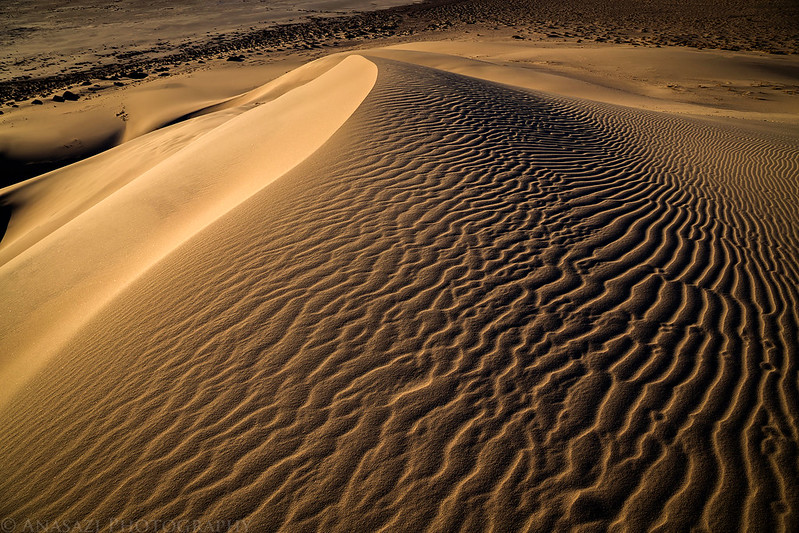
I just love the ripples and shadows you find in sand dunes.
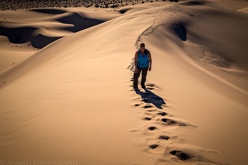
Diane following me to the top.
Sand dunes at sunset.

The road through Eureka Valley.
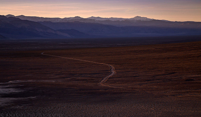
Last Chance Range Sunset

When the sun dipped below the Saline Range we hiked back down from the top of the dune and went right to bed again. I needed all the rest I could get to get over this cold.
On Thursday morning we slept in later again (no sunrise photos for me so far), packed up our camp into the Jeep and then started the drive over Steel Pass Road into the Saline Valley. Thankfully, I was finally starting to feel better today since the rest of the day was going to be mostly new territory for me and I was looking forward to hiking to some petroglyphs later in the morning.
Leaving the Eureka Dunes behind as we drove out of Eureka Valley.
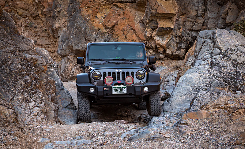
From the descriptions of the Steel Pass Road that I had read ahead of time I wasn’t sure what to expect but I was fairly confident that I would have no issues with it in my Jeep. It actually turned out to be a much easier road than I expected. The deep sand past the dunes was not deep at all and the rocky section through Dedeckera Canyon was narrow with a few small ledges, but it was more fun than difficult. The only tricky section was on the other side of Steel Pass where the narrow road dropped down into a wash. Part of the road had been washed out and it was narrow and off-camber. It also looked worse than it was and gave us no trouble. Before we left camp this morning I had told Diane that this would probably be the roughest road we would drive the entire trip…that turned out to be wrong!
Driving through Dedeckera Canyon on the way to Steel Pass was fun and scenic.
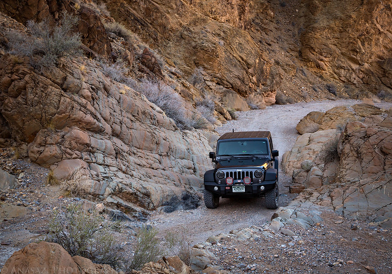
Diane took this photo of me coming up one of the ledges.

The narrowest section I had to squeeze the Jeep through.
Once on the other side of Steel Pass, we headed toward Saline Valley and the Inyo Mountains.

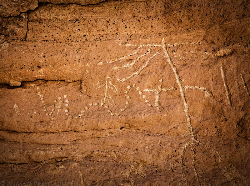
Later in the morning we took a break from driving so we could finally hike to the first petroglyphs of the trip. I had been really looking forward to seeing the petroglyphs at the White Cliffs and they would not disappoint!
The California Condor petroglyphs were nothing short of amazing!

There were plenty of other petroglyphs scattered along the walls of the canyon here, too.

Such unusual designs…


Diane hiking back down the wash that cuts through the white cliffs.

When we reached Warm Springs in Saline Valley we had contemplated stopping for a dip, but we were short on time and they were a little busier than we would have liked, so we just checked them out and then continued on our way. We headed south through Saline Valley past the sand dunes and Salt Lake. The road in the valley was pretty wash-boarded and seemed a lot bumpier than the one we had just taken over Steel Pass.
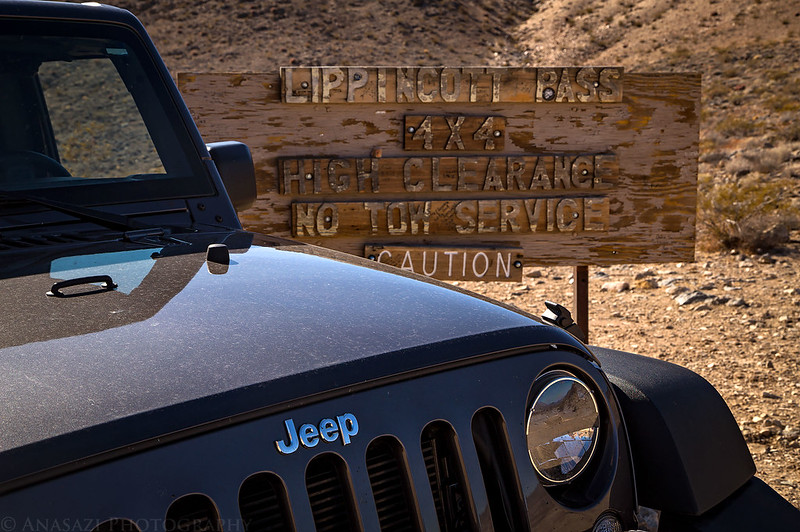
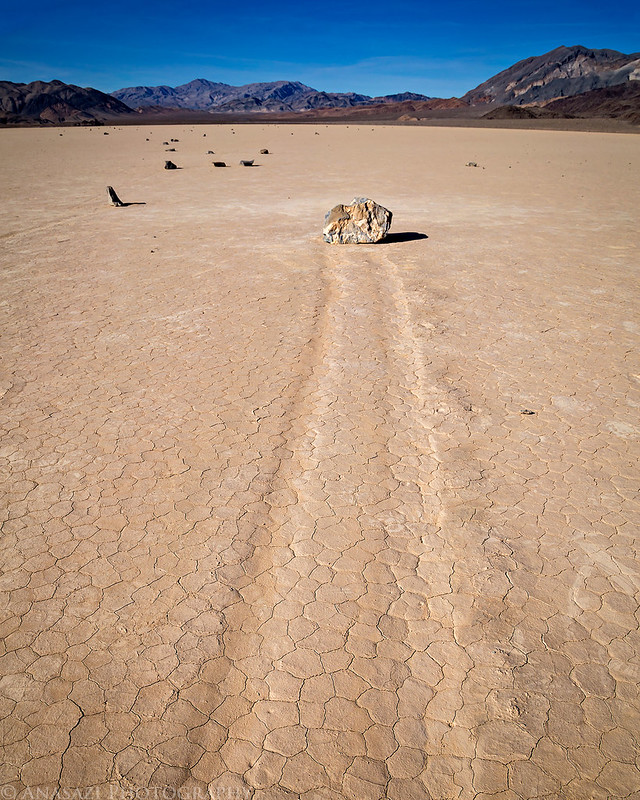
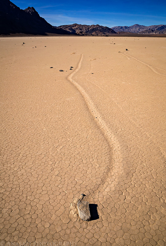
Since Diane wanted to see the Sailing Stones at The Racetrack, we took the shorter (but steeper and rougher) Lippincott Pass Road up to see them. I had never been up this road before and found it much steeper than I thought it was going to be. It was also narrow and rougher than I expected, but still a fun way to get up into the Racetrack Valley.
At the top of the Lippincott Mine Road.
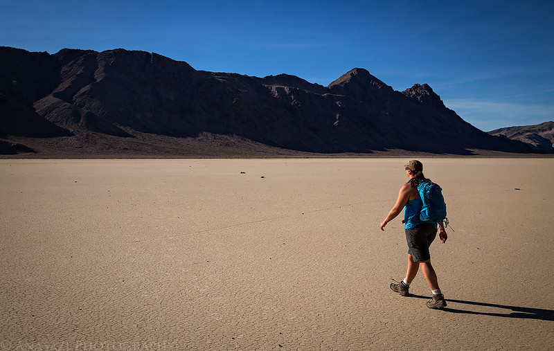
We hiked out across the playa to see the Sailing Stones.

Diane hikes back toward my Jeep across The Racetrack playa.
Our drive back down the Lippincott Road was a little bit nicer since it was getting later in the afternoon and the light was warmer.

A cool old sign along the road that predates the National Park.
A late afternoon view across to the Inyo Mountains.

Remember how I mentioned that the road through Saline Valley was wash-boarded and rough? Well it finally caught up with us as we were driving south through the valley again after returning from the Lippincott Road. Somewhere between that intersection and the climb up into Grapevine Canyon, the knob that holds my hi-lift jack on the tailgate rattled loose and was lost. We slowly drove back a short distance looking for it after I noticed it was gone, but we had no luck finding it. The jack didn’t fall off because the base of the jack was also bolted to the mount, but it was flopping around. We had to stop and repack the Jeep so that we could fit the jack inside now, which took some extra time with sunset quickly approaching.
An evening view across Saline Valley as we started the drive through Grapevine Canyon up to South Pass.
The light was pretty nice when we finally reached South Pass and had this amazing view down Mill Canyon, across Panamint Valley to the Panamint Range. If you look down in the valley you can even see the Panamint Dunes.

We were running very late this evening. It was dark out by the time we reached the highway, we hadn’t had any dinner, we’d been driving all day, and the Jeep was almost out of gas. The only thing to do at this point was to head over to the Panamint Springs Resort for burgers and a tank of gas. When we were done having dinner and fueling up the Jeep, we found a campsite along the Nadeau Trail in Panamint Valley which was not too far away and spent the night there.
I woke up on Friday morning feeling even better than the previous day. I think I was finally getting rid of this cold. Today would be our last day in Death Valley National Park and even though I didn’t get to do everything I had planned, I wanted to make sure that we visited Striped Butte before leaving. Originally, I had planned to visit Butte Valley by way of Warm Spring Canyon, but since the West Side Road was still closed that was not an option. Looking at a map it looked like we could still reach the valley by taking Goler Canyon Road over Mengel Pass, so we decided to give that a try. I had not researched this particular road, so I had no idea what to expect. All the map said was “Road conditions require experienced four-wheel drivers”. As an ‘experienced four-wheel driver’ we took our chances!
After crossing the dry lake bed and driving through the ghost town of Ballarat, we followed the edge of the not-so-dry lake in Panamint Valley and caught this reflection of the Slate Range.

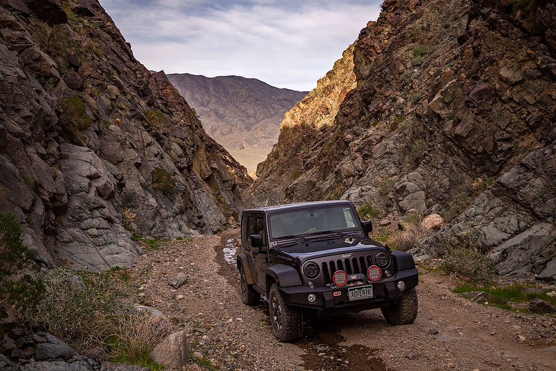
The road up Goler Canyon turned out to be a very scenic drive and I’m glad that we came this way. While not as nice as the more popular Titus Canyon Road, it was definitely a nice consolation prize.
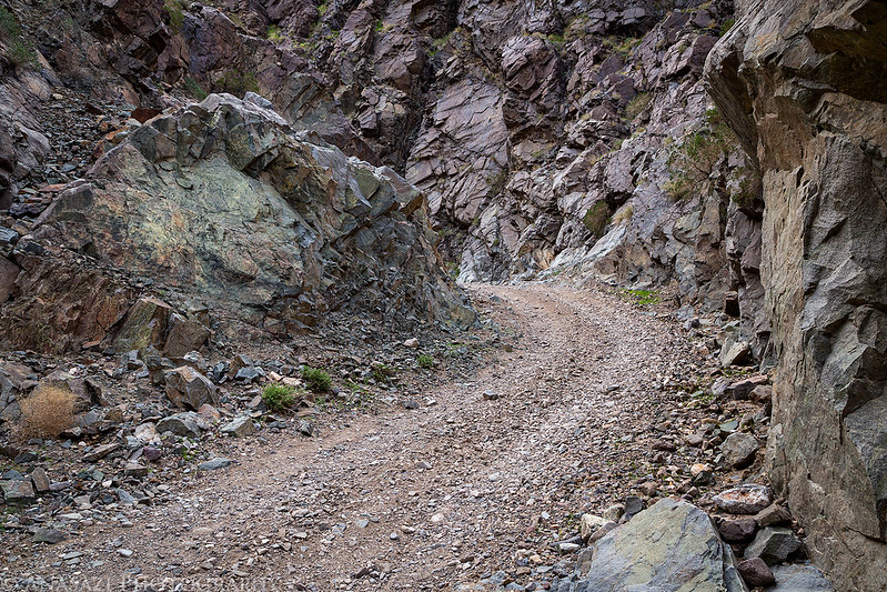
The lower portion of Golder Canyon was nice and narrow.

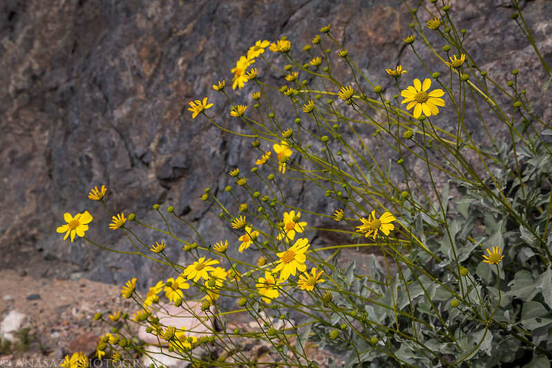
Some of the only wildflowers we saw while we were in Death Valley National Park.
Like I said before, it was a nice scenic drive…


There were plenty of old mines and structures in the upper section of the canyon.

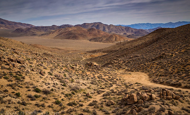
The road was actually pretty easy until we started getting closer to Mengel Pass. For a few miles on either side of the pass was the roughest section of road we would drive the entire trip. There were a lot of boulders scattered throughout the road that made it crucial to select a good line though. This slowed us down a bit, but we made it through without incident.
This is a view into Butte Valley from the top of Mengel Pass.
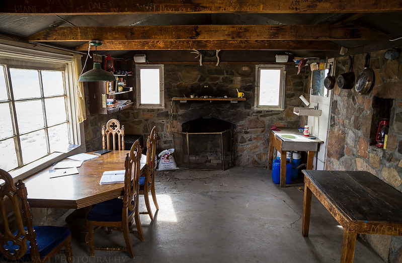
We stopped to check out the Geologist’s Cabin while we were in the valley.

Inside the stone cabin.
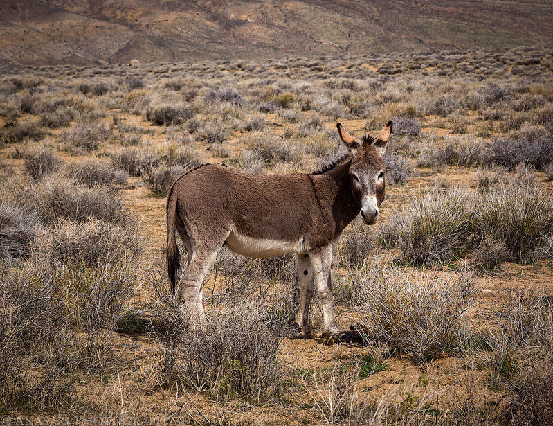
We spotted a wild burro near one of the springs.
This is the best photo of Striped Butte I was able to get on this trip. I had hoped to camp in the valley so I could catch a sunset and sunrise here, but that will have to wait for another time. It’s still a pretty cool sight!

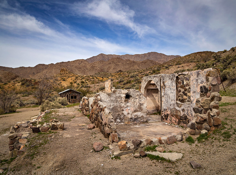
On our way back down from Mengel Pass we made a short detour to visit the Barker Ranch since we were in the area. For those not familiar, this ranch was made infamous when Charles Manson was arrested here in 1969.

We finished the drive back down into Panamint Valley and then headed south through Trona and Ridgecrest on our way to the next destination of our trip- The Mojave National Preserve.
Beautiful shots, as always! Great stuff and thanks for sharing! I had a bad cold that same week… it packed a wallop.
Thanks John! The cold certainly slowed me down during this portion of the trip.
Great trip as always. Congrats on getting married.
Thank you Doug!
Am in awe of your travels and so appreciate seeing your photos of the scenery and pictographs. I’ve an armchair interest in archeology and rock art and will never get to see the likes of these, so prolific! The places you go would demand my wearing Depends! I sketched a few In Montana with easy access, and saw a few in Sinagua ruins near Sedona. The country you drove through has inspired me back to Google Earth. Even tho there are no street views, one can still worm their way over montains and into canyons for a virtual journey, but sometimes I get knocked in the face by the side of a mountain if I don’t watch where I’m going at low altitudes. Thanks for sharing your adventures and amazing glyphs! Keep sharing! Glad you’re over the cold.
Congratulations on your marriage. This looks like it was an awesome honeymoon. Great to see your style of beautiful photos of all these different places. Especially interesting to see your take on the places nearer to me, like Death Valley and Mojave National Preserve. I normally live vicariously through your photos of Eastern Utah and Western Colorado to recall my trips through the area, since it’s quite a drive for me and I haven’t been out there in about 6 years.
Thanks David!