Press "Enter" to skip to content

Tag: clouds

Medicine Bow Peak in the Snowy Range

Wednesday, August 31, 2022

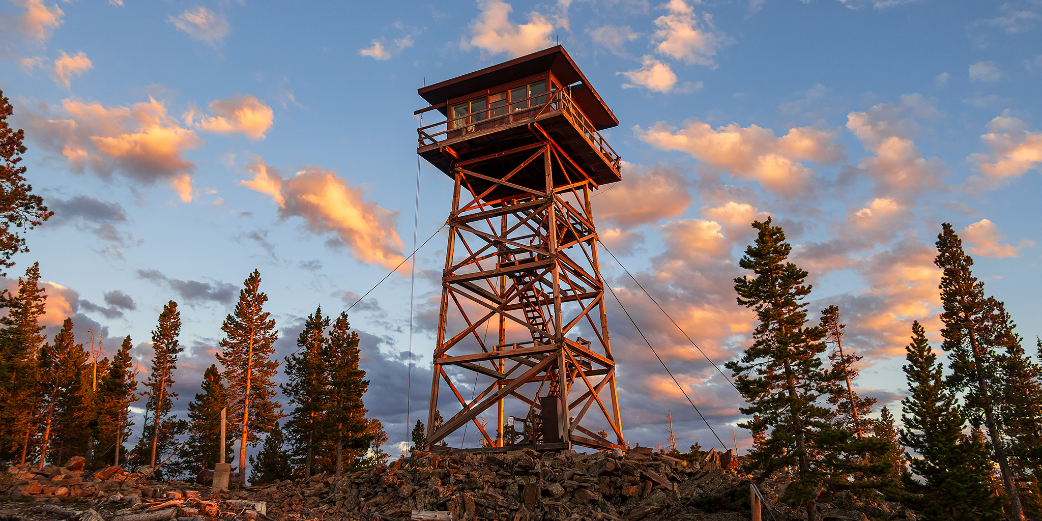
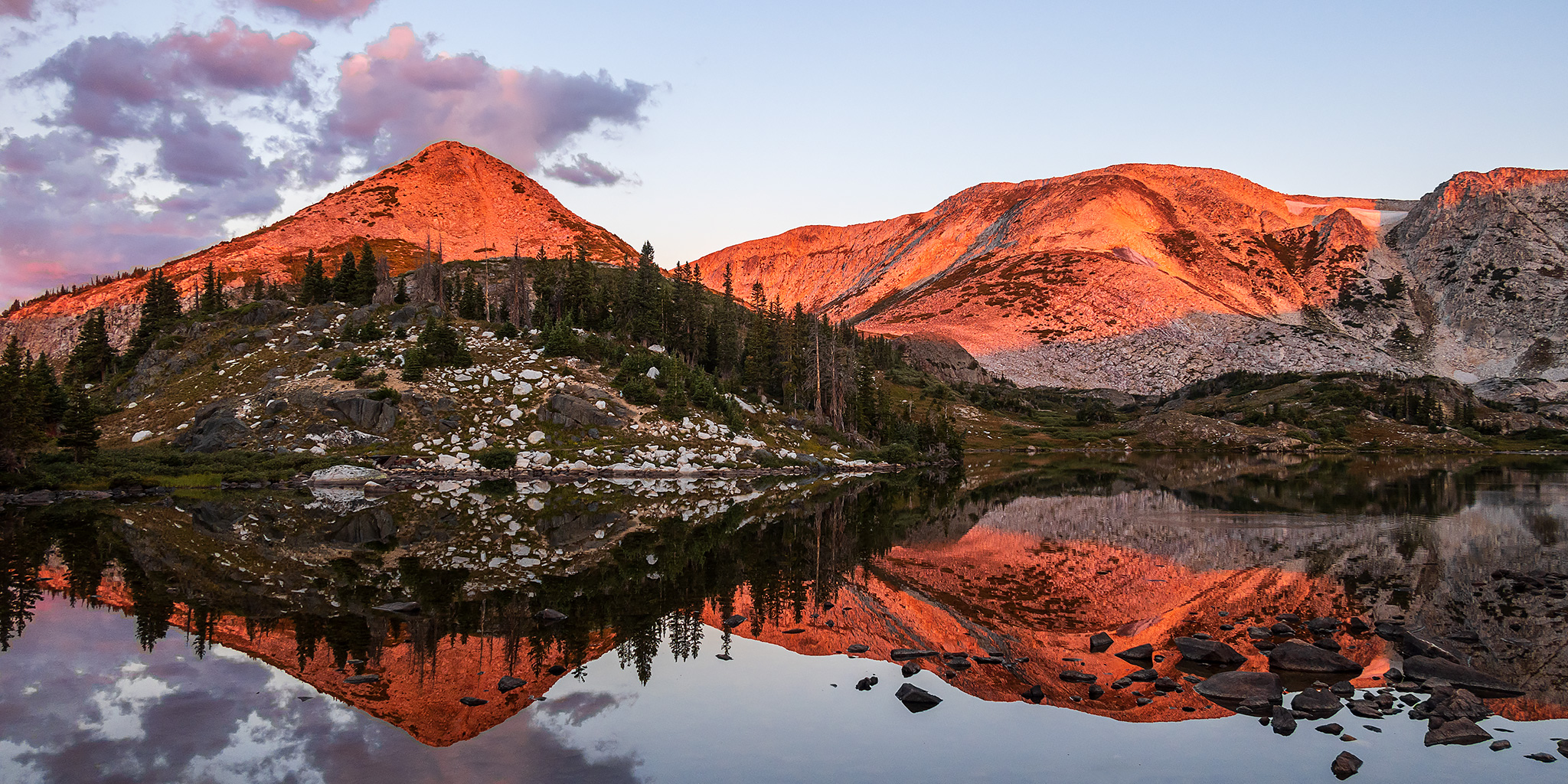
After spending my first night at the Spruce Mountain Fire Lookout Tower I got up extra early on Wednesday morning so I could drive to the nearby Snowy Range and hike to the summit of Medicine Bow Peak, which at 12,013 feet is the highest peak in this small but spectacular subrange of the Medicine Bow Mountains. After leaving the Fire Tower, I dropped down into the Centennial Valley and then followed the Snowy Range Highway, which is also known as the Great Skyroad, up to the Lewis Lake Trailhead near Libby Flats. As I passed through the small town of Albany, I swear I saw a Ringtail Cat cross the road in front of my Jeep, but it was too dark out for me to be 100% certain. I arrived at Lewis Lake just in time to catch the pre-dawn alpenglow and then a beautiful sunrise, but as I was making my way to the shore of the lake I had to give wide berth to a couple of moose that were grazing right near the trailhead.

1 Comment

Spruce Mountain Fire Lookout Tower

Fire Lookouts Extravaganza | Tuesday – Thursday, August 30 – September 1, 2022

After hiking to the Shadow Mountain Fire Lookout in the morning, it was time for me to head further north through North Park and into the Medicine Bow Mountains of Wyoming so I could spend the next two nights at the Spruce Mountain Fire Lookout Tower while exploring the surrounding area. Over the past couple of years I’ve been trying to visit more Fire Lookouts and Towers in the Rocky Mountains and have already spent a night in the Jersey Jim and Mestaa’ėhehe Mountain Lookout, so it should come as no surprise that I have been trying to reserve a night at the Spruce Mountain Fire Lookout Tower, which sits atop the 10,003 foot summit of Spruce Mountain near Laramie, Wyoming and was renovated and opened to the public for overnight rentals in 1997. Of course, getting a reservation proved to be a bit challenging, but I finally managed to grab two nights (the minimum length of stay allowed) and then began planning this Fire Lookouts Extravaganza!

3 Comments

The Summertime Blues: Hiking the Abajo Mountains

Three Directions in the Blue Mountains | Friday – Sunday, August 5-7, 2022

This past week I had been struggling to decide where I wanted to go this weekend as I continually watched the weather forecasts for the mountains since all of them were calling for a large monsoonal surge to enter Colorado which was supposed to create a lot of rain and thunderstorms throughout the high country of the state. On Thursday I decided to look outside of Colorado to the Abajo Mountains, locally known as the Blue Mountains, which had a much milder weather outlook for the weekend, so that’s where I decided to go. As luck would have it, on Friday all the weather forecasters changed their tune about the stormy weather in Colorado for the weekend, but by then I had already set my mind on heading up into the Abajos, plus it has been a while since I did any hiking in this small laccolithic range, so now I was looking forward to getting back!

2 Comments

Hagerman Pass and the Colorado Midland Railway

Wednesday – Saturday, July 27-30, 2022

This Thursday and Friday I was going to be attending the GIS Colorado Summer Meetup which was being held at Turquoise Lake near Leadville and then I planned to spend the rest of the weekend exploring the surrounding area. I was hoping to get plenty of hiking in during the evenings and over the weekend, but that didn’t end up happening and I spent most of the time meeting new people and relaxing around camp, which was a nice change of pace. Although the weather forecast had been calling for a wet and stormy couple of days at the end of the week, we didn’t see much rain at the campground, but it was still overcast and cloudy much of the time. These are some photos I took over the days I was in the area.

3 Comments

A Morning in the Northern Snake Range

Saturday & Sunday, July 16-17, 2022

After hiking Telescope Peak and leaving Death Valley National Park earlier in the day, I stopped for a quick dinner in Tonopah and then continued driving east across the Great Basin of Nevada as I made my way back home. I made another quick stop for fuel and food in Ely and then continued on into the northern portion of Snake Range to find a place to spend the night at a higher elevation where it would be cooler out. After leaving the paved highway and driving across the bottom of Spring Valley, I followed the steep switchbacks of a narrow dirt road into the Humboldt National Forest in the dark and then stopped at the first decent campsite I found along the way. It was about 9:30pm when I finally stopped for the night and I was pretty tired since it had been a long day, so I quickly got into my sleeping bag and went to bed.

Leave a Comment