Friday – Sunday, November 19-21, 2021
I was originally planning to spend this weekend on Cedar Mesa by myself, but after my issue while hiking last Friday I was a bit uncertain about hiking alone this weekend. I decided it would probably be a better idea to take it easy and stay a little closer to home. I didn’t want to do anything too strenuous alone yet, so I figured I could go back to my roots by doing some exploring and short walks from my Jeep. There are a bunch of Jeep roads north of Moab in the Labyrinth Rims area that I have never driven before, so I thought that would be a good place to go. Since I didn’t plan this trip out like I usually do, I basically just hopped in my Jeep with a map and an idea of a couple areas I wanted to explore along the way and went. I thought I would start the trip at the rim of Taylor Canyon on Horsethief Point and then make my way north along the eastern points of Labyrinth Canyon.
I left from work on Friday afternoon and then headed west into Utah. I grabbed a quick dinner in town and topped off my fuel tank in Thompson Springs before making my way out to the rim of Taylor Canyon on Horsethief Point. I had hoped to make it to the rim by sunset, but I got caught behind some slow vehicles on Highway 313 and didn’t arrive until dusk. It’s harder to get anywhere by sunset after work at this time of the year…
Driving past Beehive Butte at sunset.
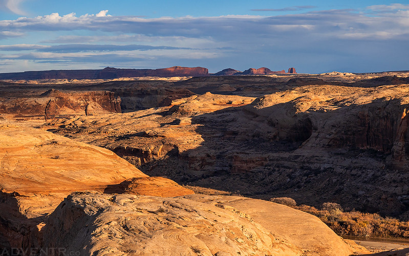
I arrived at the rim of Taylor Canyon just in time to catch the last of the glow on the sandstone.
It was pretty cloudy on Saturday morning as I went for a walk along the rim of Taylor Canyon across from Zeus and Moses.

Assuming the weather cooperates, I will hopefully finally be spending a night down in Taylor Canyon in a couple of weeks.
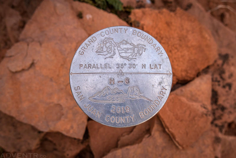
I’m usually more interested in the older benchmarks, but I thought this one was kind of cool.
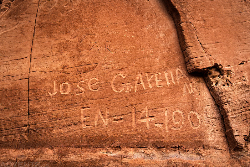
One of the short hikes I wanted to do today was to walk around the base of Beehive Butte to see if I could find any rock art or historic inscriptions.

I found a couple of faint inscriptions from the 1930’s that appeared to be from sheepherders, but then I came across this one from Jose in 1906.
I wasn’t expecting to actually find any rock art here, so I was pleasantly surprised when I came across this lone petroglyph. This would be the only petroglyph I would see all weekend.

Then I found this inscription from January 1st, 1895 from Joe F. Sullivan and C. Wheeler or C.W. Heler. I’m not sure which?

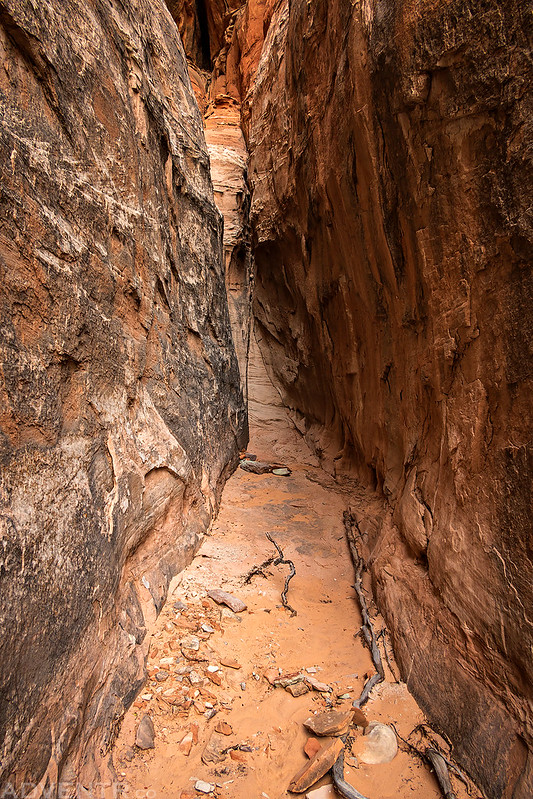
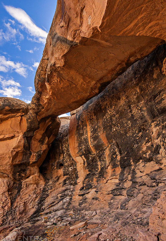
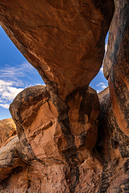
A short slot in Beehive Butte.
Looking Up

Beehive Butte View

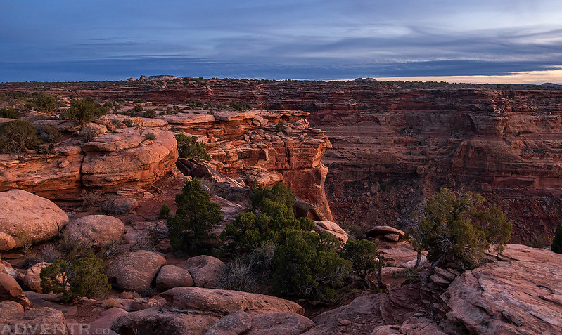
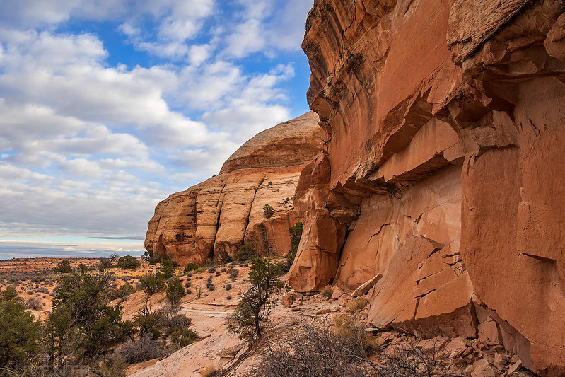
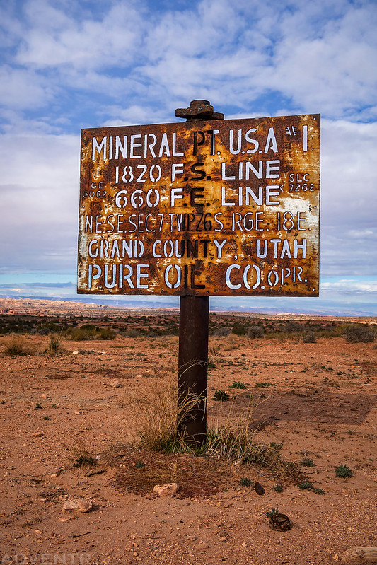
After leaving Beehive Butte I followed part of the Hellroaring Rim Jeep Trail out to the end of Mineral Point.

From the end of the road there was a good view over Labyrinth Canyon near the mouth of Hell Roaring Canyon.

Mineral Point USA #1
Towers along the trail.

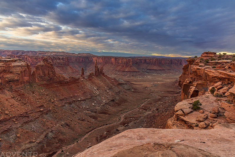
Next up I followed a road out to Deadman Point and visited three different overlooks near the end of the point.
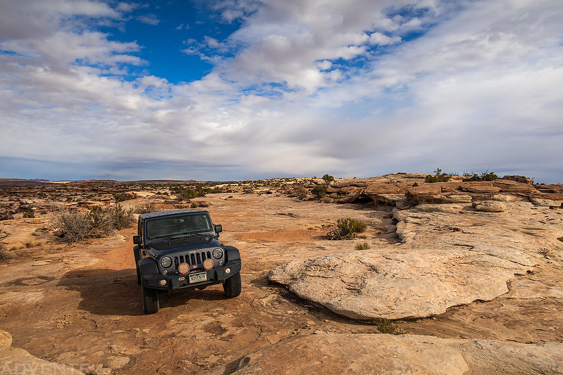
Deadman Point Rim

Although it’s really hard to tell from this photo, I visited an overlook right across from the Bowknot Bend Saddle Overlook that I had visited a few weeks ago.

It would stay mostly cloudy and overcast for much of the day.

Stopped by a long pothole on Deadman Point.

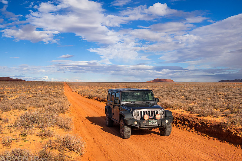
I skipped Spring Canyon Point this time since I spent a little time there last November. The sun finally started to come out again as I followed the road out onto Tenmile Point.
I stopped for a short walk to Natural Arch Rocks.
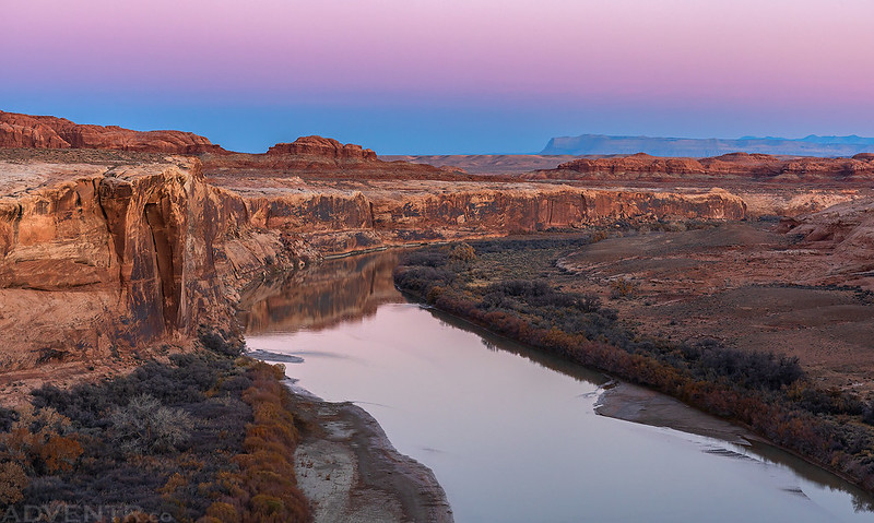
Finally, I drove to Trin-Alcove Bend and found a place to camp on the narrow peninsula of the bend. It was a spectacular area!
Our camp is in a great bend of the canyon. The curve is to the west and we are on the east side of the river. Just opposite, a little stream comes down through a narrow side canyon. We cross and go up to explore it. At its mouth another lateral canyon enters, in the angle between the former and the main canyon above. Still another enters in the angle between the canyon below and the side canyon first mentioned; so that three side canyons enter at the same point. These canyons are very tortuous, almost closed in from view, and, seen from the opposite side of the river, they appear like three alcoves. We name this Trin-Alcove Bend.
After exploring these alcoves, we recross the river and climb the rounded rocks on the point of the bend. In every direction, as far as we are able to see, naked rocks appear. Buttes are scattered on the landscape, here rounded into cones, there buttressed, columned, and carved in quaint shapes, with deep alcoves and sunken recesses. All about us are basins, excavated in the soft sandstone; and these have been filled by the late rains. Over the rounded rocks and water pockets we look off on a fine Stretch of river, and beyond are naked rocks and beautiful buttes leading the eye to the Azure Cliffs, and beyond these and above them the Brown Cliffs, and still beyond, mountain peaks; and clouds piled over all.
Major John Wesley Powell,
July 15, 1869
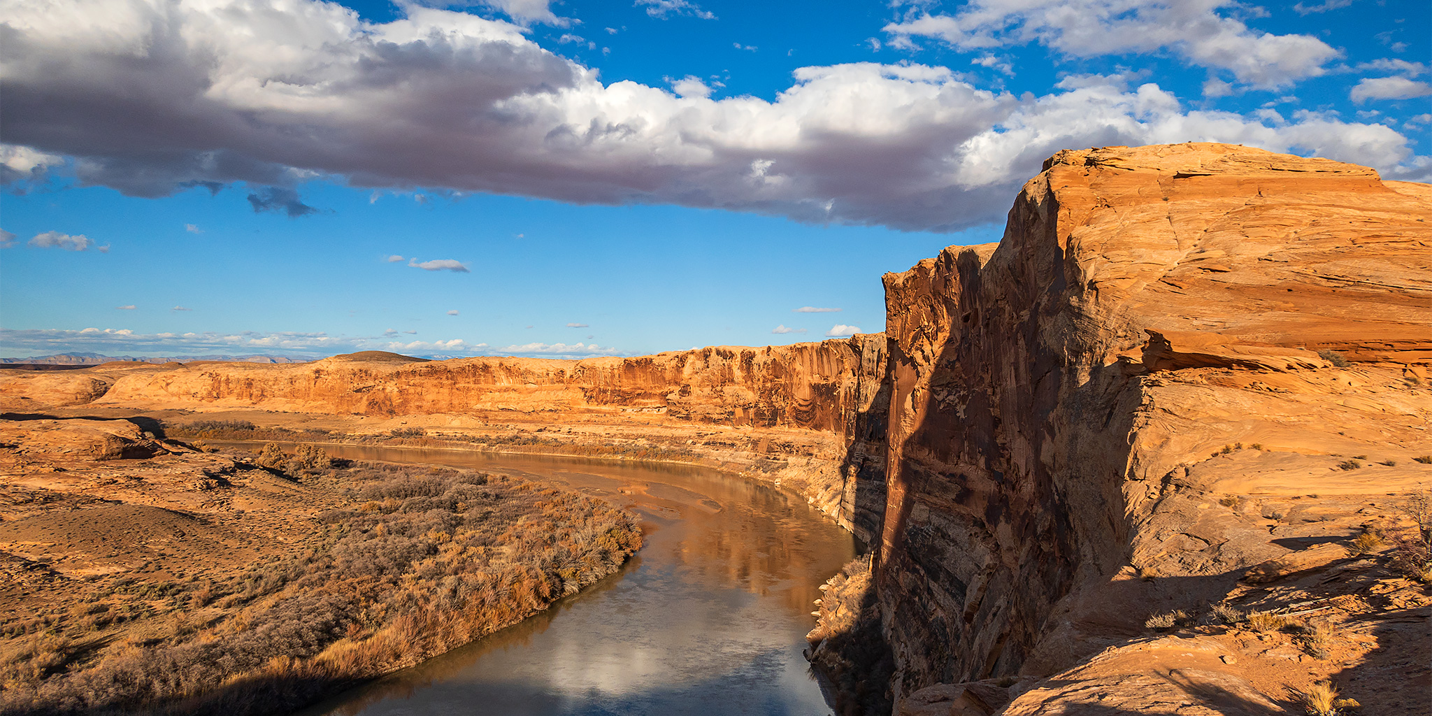
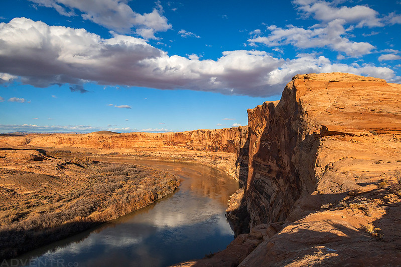
The rim of Labyrinth Canyon as the Green River enters Trin-Alcove Bend.
It was just a short walk across the narrow sandstone peninsula to see the river on the other side of the bend.

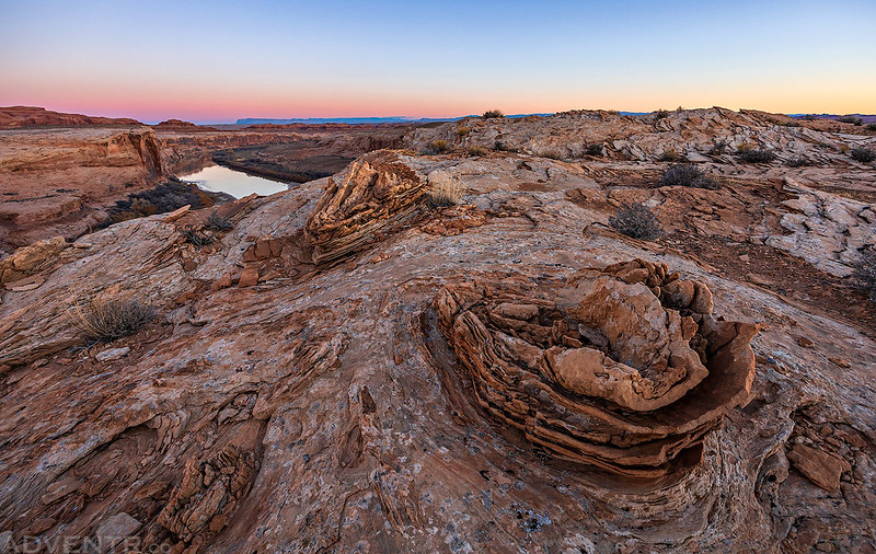
I went on my longest hike of the day shortly before sunset as I walked down to the low point of the Trin-Alcove Bend Saddle and then climbed up to the highpoint on the other side.

Labyrinth Canyon Rim
Trin-Alcove Bend Saddle

A view from near the highpoint of Trin-Alcove Bend. I’m glad the sun came out and the clouds were looking nice this evening.

The Needles and Tombstone Rock were visible on the horizon.
Naked Rocks

After sunset I ate dinner, listened to some podcasts and then went to bed early. The wind really picked up after sunset and was pretty gusty for a least a couple of hours, but when I woke up before sunrise on Sunday morning it was very calm out. I took a few photos from the rim at dawn and sunrise and then got back in my Jeep to head back home early so I could start preparing for our upcoming Thanksgiving trip to New Mexico. Even though I didn’t do very much hiking this weekend, it felt good to just drive some dusty backroads in my Jeep again, which is something I haven’t done much of in the past few years.
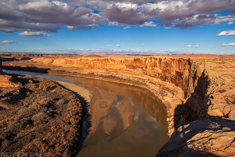
Labyrinth Canyon Morning

Trin-Alcove Bend at Dawn

Green River Morning
Cracked Eggs
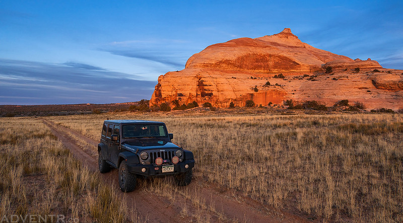
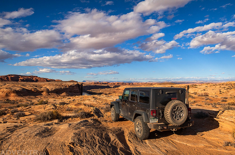
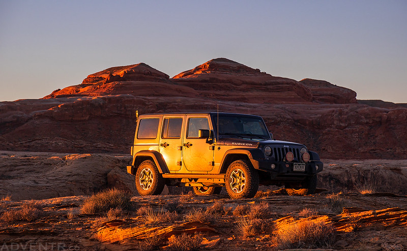
The first light of the day strikes my Jeep.
Good Morning

Thanks for sharing these beautiful images Randy. Hope you get to the bottom of your recent health issue…I know that can be disconcerting. Hope you and all you love have a pleasant Thanksgiving! Tom McC
Thanks Tom!
Thank you so much for sharing!! I’m Lifting you in prayer for a complete recovery! As always I enjoy your blog very much!
Donnette