Moab Meanderings in the Fog | Saturday & Sunday, January 3-4, 2026
For the first weekend in 2026 I returned to Moab so I could spend a little time hiking and exploring around Kane Springs Canyon. Of course, similarly to last weekend I was stuck with overcast conditions again, except this time I was mostly in or under a layer of low clouds and fog. After leaving home early on Saturday morning it was a slower than usual drive to Moab since I had to drive through a thick layer of fog pretty much the entire way with the temperatures hovering around freezing. It was still foggy out when I reached the mouth of Kane Spring Canyon, so instead of going on my first hike right away I decided to continue up the canyon to Hurrah Pass to see if I could get above the fog for some photos at sunrise. This turned out to be a really good choice since I was able to get out of the fog for a little bit, until it finally enveloped the pass. Then I returned to the Amasa Back Trailhead and started hiking with hopes that the fog would burn off soon.
After driving up Kane Spring Canyon a few miles I eventually got out of the fog, which was a good sign!

Following the road up to Hurrah Pass.

The first light on Hatch Point.

The low clouds must have been following closely behind me because it wasn’t very long until they caught up.

Driving up Hurrah Pass Road in the clouds.

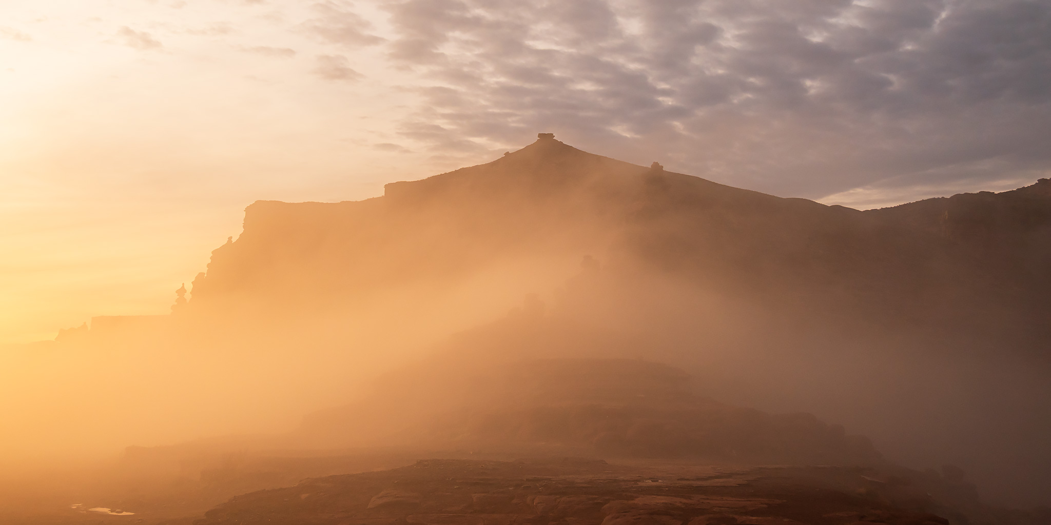
Sunlight through the fog.

Fog & Stone

The light was briefly spectacular at Hurrah Pass!

Looking the other direction from Hurrah Pass towards the Colorado River.

Hurrah Pass Layers

Driving on top of the clouds after I turned around and started heading back down.

There’s not much better than watching the low clouds dancing in the canyons in early morning light.


I didn’t see anyone up at the Anticline Overlook. There might have been some nice views from up there?

4Runner in the Fog

Arch & Spire

After driving back down under the clouds to the trailhead I started hiking up the Amasa Back Trail with hopes that the fog would burn off soon.

My hopes were raised that the fog would start clearing out soon when I started to see the sun, but then it disappeared again.

I spent a little time trying to find the way out of this unnamed canyon in the fins.

Looking back down the canyon I had just come up.

It was at this point I decided to turn around and head back down. The sandstone was covered with lichen and very slippery with a big dropoff below and I wasn’t comfortable trying to get across. Besides, it was now clear that the fog wasn’t going anywhere anytime soon, so I wouldn’t even be able to see the views from the top anyways. I’ll have to come back another time when it’s dry out.

Before returning to the trailhead I decided to follow a spur off the Cliffhanger Trail to an overlook of the Colorado River, even though I knew I probably wouldn’t be able to see much today.

Nearing the edge of the overlook…

Although I couldn’t see anything from the overlook today, I could hear vehicles on the road far below.

Following along the edge on my way to another nearby overlook where I wouldn’t be able to see anything either.

After returning to the trailhead I spent the rest of the afternoon visiting a few nearby rock art sites that I hadn’t been back to in many years and then returned to town for dinner. As usual for this time of the year, I spent the night at my regular campsite in the Sand Flats Recreation Area and found out that the camping fee must have gone up in the new year because just last weekend it was $15 and now it was $20.
When I woke up early on Sunday morning I figured the fog was going to be gone since I had seen the moonlight from the full moon at least a few times overnight, but when I looked outside I found that not only was it still there but it was much thicker than it had been the day before. I could barely see much further than the front of my hood as I descended into the Moab Valley, but I did eventually drop below the clouds as I neared town. Still, I decided to carry on with my original plans and drove back into Kane Springs Canyon so I could hike up Hunter Canyon. While I had hiked this trail once before with Diane over a decade ago, I didn’t really remember much about it and wanted to check it out again. Before starting the hike I thought it might be a good idea to drive up to Hurrah Pass again and see about watching the sunrise above the clouds. When I first arrived near the pass at early dawn things were looking pretty good since I could see the Wolf Moon above with some fog below, but the clouds quickly overtook the area before sunrise and left me without any views.
After giving up on catching another nice sunrise, I drove back down to start hiking.

Fog & Towers

I thought I might get lucky with the fog clearing out when I started to see some blue sky along the rim of the canyon, but it quickly disappeared.

Hiking up the Hunter Canyon Trail under the low clouds.

Hunter Canyon

There were many little waterfalls and pools along the way.

The upper canyon walls were hidden in the clouds.

Hunter Canyon Fork

This was my turnaround point for the hike where I should have been able to see Curious Arch, but it was obscured by the clouds this morning.

I climbed up for a better view of Hunter Arch on my way back to the trailhead.

I was originally planning to start heading back home right after this early morning hike, but I thought it might be interesting to drive up to the Island in the Sky first to see if I could get above the clouds- and I am glad that I did!
Petroglyphs of Kane Springs Canyon
Moab Area Rock Art XLIX
Here are a few photos of just some of the petroglyphs I saw this weekend while knocking around Kane Springs Canyon. I haven’t been back to many of these sites in almost fifteen years, so it was nice to revisit them while the canyon was hidden in the clouds.
Long Map Panel

Legless Sheep

Birthing Rock

Sandals

Faded Petroglyphs

Barbell Sheep Panel

Nice Sheep Petroglyph

Big Men Panel

Button Panel

Alone

Family Panel

Lone Anthropomorph

Kane Creek Sheep

Tracks Panel

Moonflower Panel

Low Moonflower Petroglyphs


It’s so interesting to see placed I’ve visited under different conditions. Thanks for reviving memories!