Friday – Sunday, November 1-3, 2024
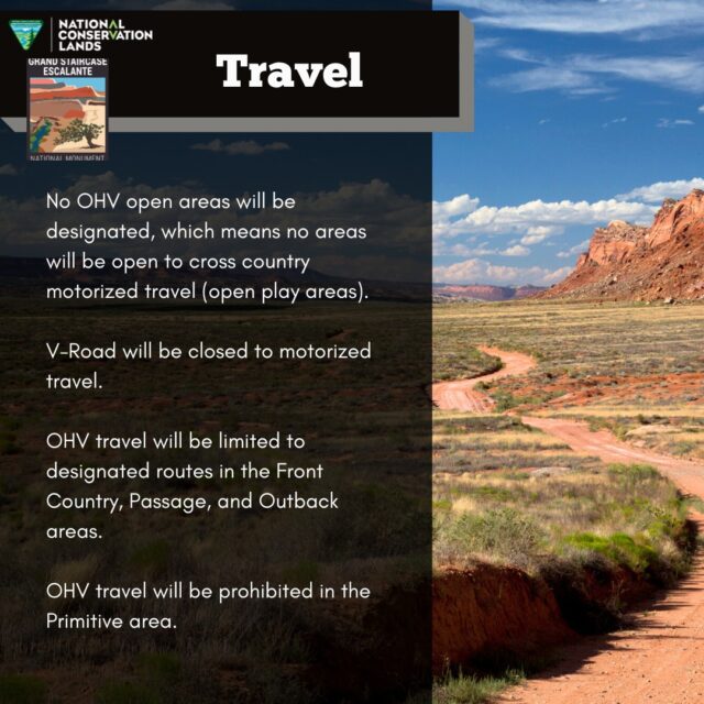
I started this weekend trip off with two main goals in mind as I headed west into Utah on Friday. The first one was to drive The V Road in the Grand Staircase – Escalante National Monument before it’s closed to motorized vehicles in December, and the second one was to finally take a ride on the Charles Hall Ferry across Lake Powell while it’s open and there is still enough water for it to be in operation. Although these two goals might seem like they can’t possibly be connected in any way, there is a historic route which was known as the Halls Wagon Road, Hall Road or Halls Trail, that went from Escalante to Halls Crossing and does kind of tie these two areas together. So even though I never followed any part of the actual Halls Wagon Road on this particular trip, I did roughly parallel the route on modern day roads the entire way. Plus, I have already hiked a couple sections of the historic route including Silver Falls Creek, Muley Twist Canyon and Halls Creek, and I hope to do more sections in the future. I had all of this information on my mind as I left from work on Friday and made my way over to the Escalante River Country near Harris Wash.
Charles Hall (1823-1904) was a scout on the Hole-in-the-Rock Expedition. After the expedition he, and others, realized that the original route through the “Hole” was much too difficult and one that couldn’t be used by small parties because of the difficulties in lowering wagons down steep cliffs. In 1881 another and easier way was found from Escalante to Bluff that bypassed the Hole-in-the-Rock. This route went from Escalante Town, down Harris Wash, across the Escalante River, up Silver Falls Creek, across the Circle Cliffs Basin, and into Muley Twist Canyon, which was followed into Halls Creek. The route then went down Halls Creek to what quickly became known as Halls Crossing. It joined the Hole-in-the-Rock Road near Lake Canyon.
Steve Allen, Utah’s Canyon Country Place Names (2013)
Canyons of the Escalante: First & Final Drive on The V Road
The last time I was out in the area around Harris Wash was about ten years ago and at that time the road onto The V was closed, and as far as I knew it was closed indefinitely. That’s why I was surprised to learn a couple years ago that The V Road had actually been officially reopened again in the 2020 Management Plan, so I made sure to put it on the list in the back of my mind to get out there to drive it the next time I was in the area. Well, the priority to drive it got bumped up to the top of my list about two months ago when the Grand Staircase – Escalante National Monument announced that this road would be getting closed again in their new Management Plan, so I figured that I better get out there to drive it as soon as I could and then hike out to the Escalante River from there since the hike will be much longer after the closure.
After topping off my gas tank in Boulder I continued on to Harris Wash and then drove out to the end of The V Road so I could see what kind of shape it was in since Jared hoped to take his Jeep out there with me the following morning. Aside from some deep sand and a rocky section near the end, it was in better shape than I was expecting.
Parked at the end of The V Road.
Following The V Road back toward the Red Breaks.
I found place to park and started hiking over to the Escalante Volcano since it was nearby and I still had some daylight left. Calling it the ‘Cosmic Ashtray’ just feels so disrespectful to me for such an interesting natural feature of the landscape…
It was nice to just wander the expanse of red sandstone in the late afternoon light.
Sandstone Volcano
The light wasn’t great for photos, but I did manage to catch a sunstar.
After a quick visit with The Volcano, I continued wandering around the area to see what else I could find before sunset.
I stumbled upon this nice little hoodoo…
…and I enjoyed the expansive views of the surrounding terrain.
Eventually I ended up above The Volcano again.
Inside The Volcano
There were some interesting patterns in the sandstone up there.
One final view from the top before I started hiking back down to my Jeep.
I liked the light and shadows across the landscape here.
Since Jared was going to be joining up with me later this night, I drove back out past the Harris Wash Trailhead and found a campsite that I had signal at so I could let him know where I was. Then I read for a while and fell asleep before Jared arrived. I believe I briefly woke up when I heard him pull into camp, but I must have fallen right back asleep. On Saturday morning we both got up before sunrise and started driving back out onto The V as it was getting light out.
Good Morning!
The colors in the sky were pretty great this morning as we followed The V Road.
Caution Deep Sand
Jared was a little worried about the sandy sections of the road since the 4WD in his Jeep wasn’t currently working. Unfortunately, he forgot to turn off his Traction Control before trying to get across the deep sand and quickly got bogged down to a stop. I reversed course and hooked up a strap to his Jeep and then dragged him the rest of the way through the sand. I guess it’s payback for when he dragged me off of the White Rim Trail a couple years ago.
After we were past the sand it was a mostly easy drive to the old drillhole at the end of the road.
Once we reached the end of the road we shouldered our packs and set out across The V to the edge of the Escalante River Canyon.
Although it was supposed to be mostly cloudy and overcast today, we got lucky with a little sunlight on the sandstone this morning.
After a couple of miles we reached the rim of the Escalante River Canyon and made our way to the top of the Lower Sand Slide.
We were hoping to hike down the sand slide into the canyon to visit a large rock art panel, but there was just too much of a gap between then top of the cliff and the sand dune. Jared considered trying to get down, but eventually gave up on that idea. I knew there was no way I would be able to climb back up this section, so I quickly abandoned all thoughts of trying.
The cottonwood trees along the Escalante River were just beginning to change colors.
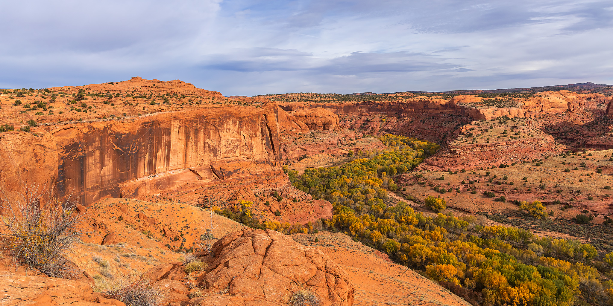
Even though we weren’t able to hike down into the canyon from here, the views from the rim were pretty spectacular.
Lower Sand Slide
We were even able to see the rock art from the rim of the canyon, It’s just too bad that I didn’t bring my long lens with me on this hike…
After hiking back to the Jeeps at the drillhole we drove back out from The V Road and Harris Wash and then headed into Escalante to get some lunch.
Jared remembered to turn off his Traction Control on the way back and was able to get across the ‘Sandy Sea’ on his own with a bit of momentum.
Glen Canyon: Pedestal Alley and the Charles Hall Ferry
We were hoping to get a burger from Nemo’s in Escalante for lunch, but when we got there we found that they were closed, so instead we headed over to Boulder and grabbed lunch at the Burr Trail Grill. After lunch Jared headed back home since he hadn’t been feeling too well and I started following the Burr Trail east through the Circle Cliffs and Waterpocket Fold on my way to Bullfrog.
Only 72 miles to the Lake Powell Ferry.
The cottonwoods in The Gulch were looking nice as I passed through.
Descending the switchbacks of the Burr Trail in Capitol Reef National Park.
Before making it all the way to Bullfrog I stopped to hike the Pedestal Alley Trail, which is similar to Little Egypt or a much smaller version of Goblin Valley. I was hoping to be here during a nice sunset, but it was just too cloudy and overcast this afternoon for that to happen.
Pedestal Alley Canyon
Tilted Caprock
Big Chimney
Pedestal Alley
After returning from the hike I continued on to Ticaboo for gas and that’s when I decided to significantly alter my plans. I was originally going to take the Charles Hall Ferry from Bullfrog to Halls Crossing in the morning, but the first ferry wouldn’t leave until 11:00am from this side and then I’d still have about a five hour drive home after that. However, if I spent the next two hours driving around to Halls Crossing this evening instead of hanging out at camp, I could get on the first ferry at 10:00am and then only have a three and a half hour drive back home, so I decided to go the long way around and do that instead. Plus, since we were gaining an hour overnight from the end of Daylight Saving Time I would still be able to get plenty of sleep tonight. So after spending the next two hours following Trachyte Creek, North Wash, White Canyon and the base of the Red House Cliffs, I finally made it to near Halls Crossing and stopped to camp by the Cal Black Memorial Airport.
I woke up when it started to get light out on Sunday morning and went for a hike along the rim of Moqui Canyon. It was still overcast and cloudy out and had rained on and off a few times overnight.
The Turtle
After the hike I finished the drive to Halls Crossing and was first in line waiting for the ferry to arrive. As you can see, the sun actually had started to come out a little bit by now, too.
Lake Powell
I was starting to get a little worried that the ferry might not be running today when I was the only one in line and there weren’t any other people around, but then I felt better when I saw the Charles Hall Ferry on the way.
It turns out that I was going to be the only passenger on the ferry this morning.
Charles Hall Life Preserver Ring
Here’s a view from the ferry with Mount Ellsworth in the distance.
Sandstone Island
It took less than a half hour to reach Bullfrog.
Here’s one last shot of my Jeep alone on the ferry before I disembarked.
Once I was on solid ground again, I started the drive back home through on and off rain showers with only a quick stop at Stan’s in Hanksville for lunch and gas.


