Southern Utah Wanderings
Saturday, October 11, 2014
On Saturday morning we woke up before the sun came up and were able to watch the sunrise as we drove down the Old Sheffield Road to it’s end near the Red Breaks. Today we would be hiking to the unusual sandstone formation known as the Escalante Volcano. This interesting landform is known by many names including the Red Breaks Crater, Cosmic Ashtray, Cosmic Navel and Islomania Dome, but I’m just going to stick to simply calling it The Volcano.
Watching the sunrise from along the Old Sheffield Road.
Sunrise Drive by IntrepidXJ, on Flickr
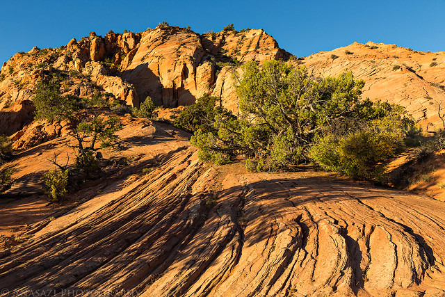
Morning light on a sandstone dome near the road.
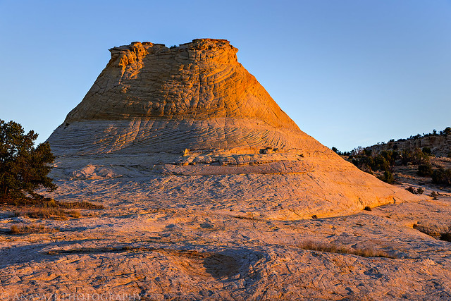
Dome Light by IntrepidXJ, on Flickr
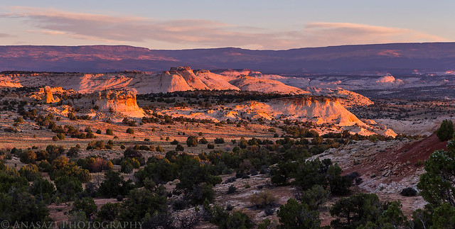
Sunrise view towards the Henry Mountains.
Spencer View by IntrepidXJ, on Flickr
I parked at the end of the road to start hiking the rest of the way. I ended up stopping where it looked like the road turned into a hiking trail, but there weren’t any signs or anything stating that the road was closed beyond this point.
Trailhead Parking by IntrepidXJ, on Flickr
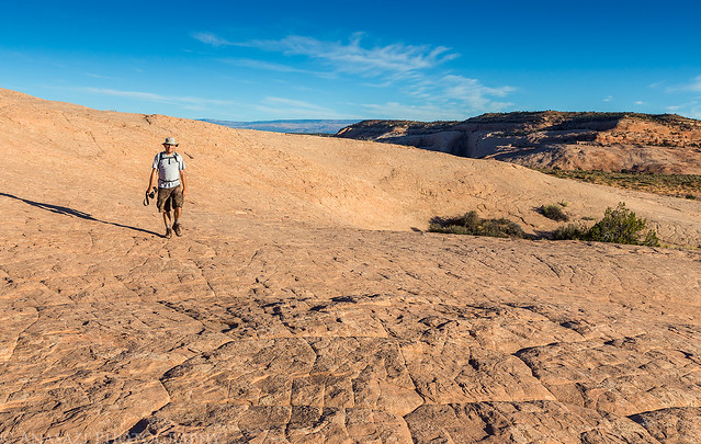
After hiking along the sandy trail for a short distance, we eventually reached the large expanse of slickrock that we would need to cross to reach the Volcano. It was much nicer than hiking in the sand.
Sandstone Hiking by IntrepidXJ, on Flickr
Jared crossing the white sandstone.
Sandstone Wandering by IntrepidXJ, on Flickr
The colorful sandstone in this area reminded me of exploring the Coyote Buttes area in northern Arizona.
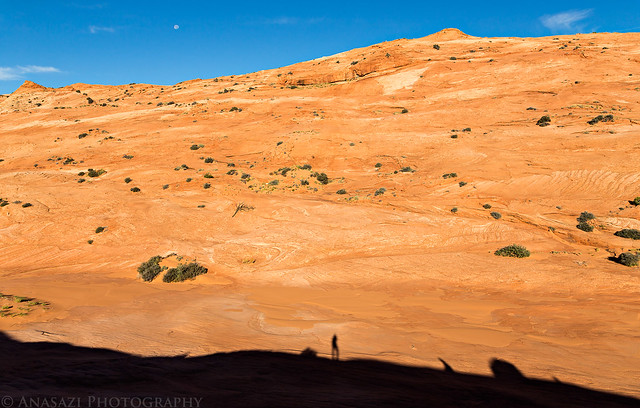
Stone Shadows by IntrepidXJ, on Flickr
We ended up taking a more direct approach to the Volcano which made for some steep climbing and descents, but it also meant that we initially approached the Volcano from above and got a nice look down into it.
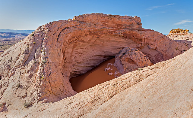
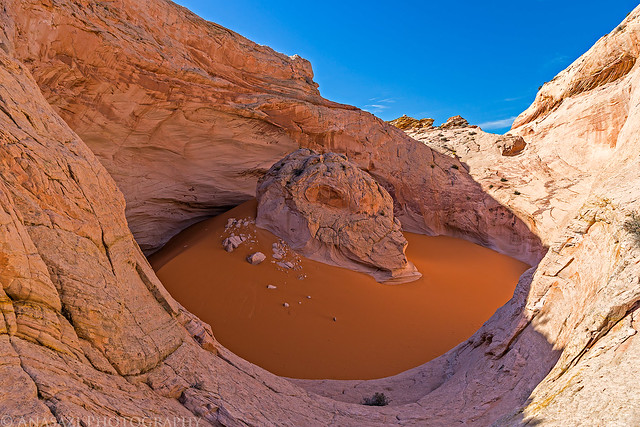
Escalante Volcano by IntrepidXJ, on Flickr
Jared taking photos inside the crater for a little scale.
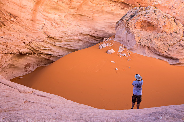
Inside by IntrepidXJ, on Flickr
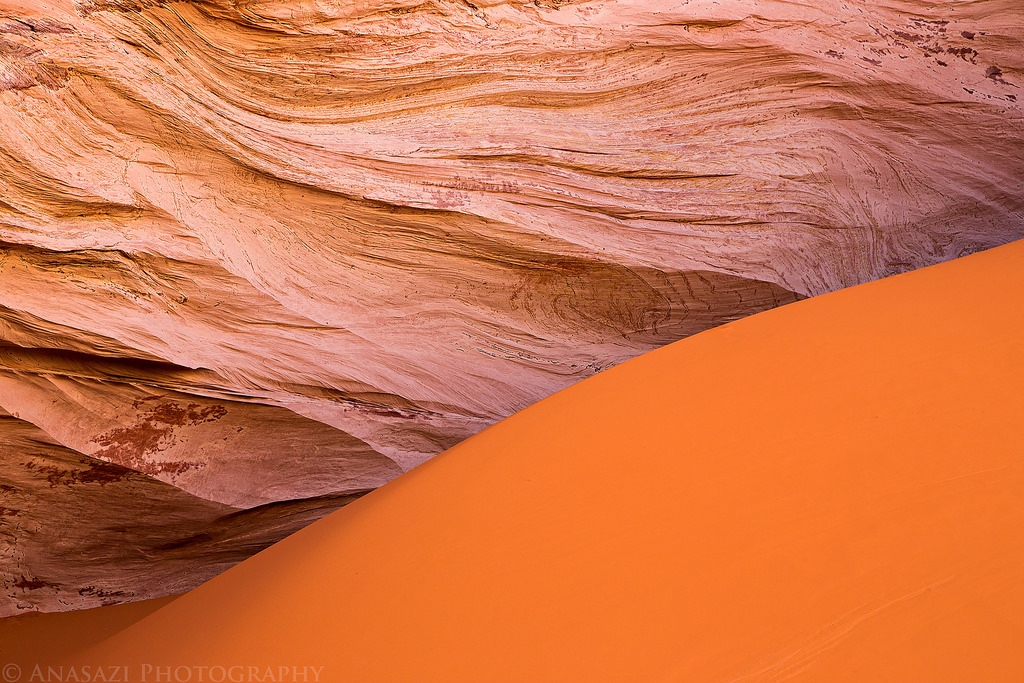
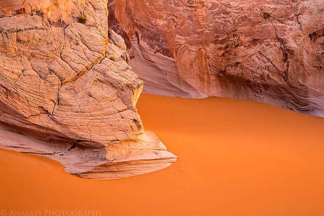
The light at this time of the day wasn’t ideal to photograph the entire crater, so I focused on some of the details inside.
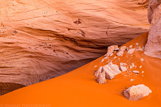
Erosion by IntrepidXJ, on Flickr

Sand & Stone by IntrepidXJ, on Flickr
Island by IntrepidXJ, on Flickr
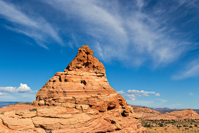
Another overview shot of the Volcano with my wide-angle lens.
Overview by IntrepidXJ, on Flickr
Parts of this area also reminded me of the White Pocket.

White Pocketish by IntrepidXJ, on Flickr
A teepee-shaped rock we passed on our hike back to the Jeep.
Teepee by IntrepidXJ, on Flickr
There was plenty of colorful sandstone to explore in this area.
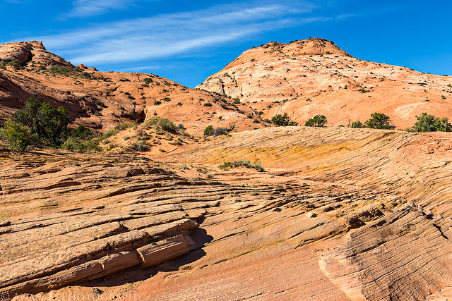
Colorful Hike by IntrepidXJ, on Flickr
After returning back to my Jeep at the end of the road, I decided to call it a trip and head home a day early. It had been a good week and I wanted to get back home so I could spend some time with Diane and relax before going back to work on Monday. We drove back to camp and I loaded up my gear before parting ways with Jared and driving back home.
On my drive back home I made a quick stop on Boulder Mountain to take a photo of the fall colors that were still hanging on up here.
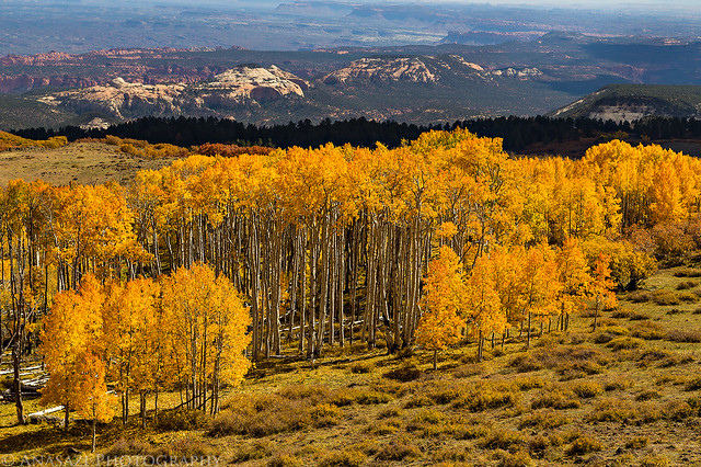
Boulder Mountain Fall Color by IntrepidXJ, on Flickr
Terrific! I really enjoy your trip reports. I’m going to have to go to this place. I’ve been down Old Sheffield Road a couple of times before, but only to access Big Horn Canyon.
You made it seem like this was a day hike;the only route I’ve previously known was via red breaks slot. How far down Hole in the Rock Rd did you happen to park?! I’m planning a seven day trip exclusively for Hole in the Rock Rd to get a true feel of GSENM for may ’16 and this was on the list last year but 13 days wasn’t enough to enjoy all southern Utah had to offer. Thanks
Hi Anthony, this was a day hike. I started the hike from the end of the Old Sheffield Road, not the Hole in the Rock Road.
That’s Spencer Flat Rd as well right? About how far would you say the hike was from the end of the road…miles/hours?! This has been on my list for the last 3 years and making it a must do this time around.
Yes, that’s the same road. I don’t recall the exact mileage, but I don’t believe it was more than about 8 miles round trip.
Sorry for the questions, but from the parking spot you stopped at is the general direction S.E.? I’m a pretty advantageous hiker…ie. AZT in 29 days, but love to spend time and acknowledge marvels such as this. How long did your roundtrip hike take?! Again, I appreciate the knowledge as I thought before only reachable via red breaks!
Yes, S.E. is the direction we hiked. If I remember correctly the hike was around 5-6 hours and we took our time to explore the area a bit.