
The Plateau Provence: Peaks & Plateaus of the Colorado Plateau, Part IV
Friday – Sunday, August 30 – September 1, 2024
After spending Friday morning visiting a number of rock art sites along the Old Trappers’ Trail in the Book Cliffs, I left the canyon shortly before noon and continued on to Ray’s in Green River where I stopped and had a burger for lunch. Afterwards, I topped off my gas tank and headed west across the San Rafael Swell into the High Plateaus of Utah for the rest of the weekend. After my recent Northern Trek into the the High Plateaus earlier this summer, I’ve been looking forward to getting back out and going on a loop through the southern plateaus including the Table Cliff, Paunsaugunt, and Markagunt, plus making a return to the Sevier Plateau so I could visit a new peak along the way. Now after this weekend I have visited the highpoint of all the major plateaus on the Colorado Plateau in Utah except for the Kaiparowits Plateau, which is next on my list!
Grass Valley: From the Fish Lake Plateau to the Sevier Plateau
After driving across the San Rafael Swell, I got off the Interstate and drove across the Fish Lake Plateau on a couple of backroads that brought me around the northern side of Hilgard Mountain. I had considered stopping to hike to the summit of Hilgard Mountain along the way, but I wasn’t feeling up to the hike this afternoon and decided I’d come back another time in the future.
Hilgard Mountain from Sheep Valley

After passing by Fish Lake and stopping for gas and ice cream in Koosharem, I continued on through Grass Valley below the edge of the Awapa Plateau and then started driving up onto the Sevier Plateau when I reached Antimony.

The late afternoon light was looking very nice as I followed the Mount Dutton Road toward the top of the plateau.

Looking across Johns Valley to Griffin Top and the Escalante Mountains.

The light was spectacular this evening as I drove across the Sevier Plateau, and it confirmed that I had made the right decision to skip the hike up Hilgard Mountain!

Mount Dutton and the Sevier Plateau.

I had considered staying here to photograph the remainder of the sunset, but then I decided to keep on going hoping for even better views near the edge.

I could tell it was another good decision when Mount Pierson came into view.

Over the Edge

Cliffs of the Sevier Plateau

Sevier Plateau at Sunset

It wasn’t far to the summit of Mount Dutton from this point, so I kept driving as the clouds turned a lovely shade of magenta.


I made it to the top of Mount Dutton at dusk and then drove down the road just a short way to find a campsite for the night.

Mount Dutton of the Sevier Plateau
I slept very well overnight and woke up shortly before sunrise on Saturday morning so I could return to the summit of Mount Dutton (11,041) and watch the sunrise. It turned out to be a great one!
Watching the sun come up over the Aquarius Plateau.

Jeep & Sky

First Light on the Sevier Plateau

Great light on Adams Head and beyond!

A colorful view across Johns Valley to Powell Point.

Sevier Plateau Sunrise

This rocky knob is the highpoint of Mount Dutton.

Mt Dutton 1966

My Jeep and the Mount Dutton Summit

Jeep at Sunrise

It truly was a beautiful morning up on the Sevier Plateau!

High Plateaus

When the colorful light of sunrise had dissipated, it was time to start driving down the other half of the loop road.

Blind Spring Mountain

This part of the loop road brought me closer to Adams Head.

Descending the Cottonwood Road down into Johns Valley.

Highpoints of the Escalante Mountains: Griffin Top & Barney Top
Once I reached the highway that runs through Johns Valley, I followed it south for a short distance to Widtsoe and then headed up the Old Escalante Road along Sweetwater Creek up into the Escalante Mountains. When I reached the main junction at the pass I headed north onto Griffin Top to visit the highpoint.
Following an easy two-track across Griffin Top.

Before going to the highpoint of Griffin Top, I first followed the edge out to Mud Springs Point which offered great views along the way.

MUD 1959

Mud Springs Point

Then I hiked a loop through the trees which brought me to the highpoint.

I completed the short loop by following the two-track back to my Jeep.

I returned to the main junction at the pass and then headed south on a much rougher and narrower road to the top of Barney Top.

Barney Top View

The road was much better on the south side of Barney Top as it descended to the Table Cliff Plateau.

Barney Top Cliffs


Highpoint of the Table Cliff Plateau & Powell Point
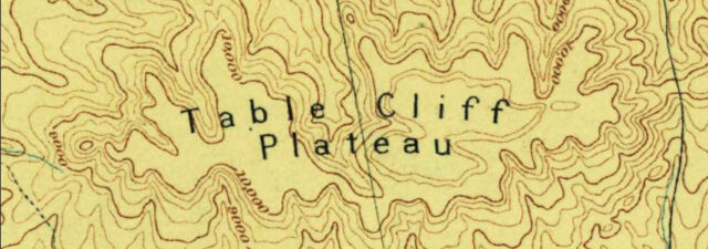
The southwestern cape of the Aquarius ends at a high pass separating the Escalante drainage from that of the Panquitch Hayfield. This pass is thus in the main divide between the drainage system of the Colorado and of the Great Basin. At this cape the lava-cap of the Aquarius terminates, but beneath it the Tertiary thrusts out a long peninsula to the southward. The altitude of these beds is very nearly 11,000 feet above the sea, and the peninsula which they form is Table Cliff. Upon its summit is an outlying remnant of lava a few hundred feet thick, which was once, no doubt, continuous with the lava-cap of the Aquarius. The table is practically a large butte left by the denudation of the surrounding country.
C.E. Dutton, 1880
After reaching the top of the Table Cliff Plateau I started following the narrower road out to Powell Point. The road was rough in a few places and there were a number of water-filled mud holes along the way, but it wasn’t too difficult. From the end of the road it was just a short hike to the overlook at the point.
Powell Point Trail

Powell Point

Looking back toward Mount Dutton and the Sevier Plateau from Powell Point. A reverse of the view I had at sunrise…

Table Cliff 1929

Table Cliff Plateau

Looking across Henderson Canyon and the Tropic Valley to Bryce Canyon and the Paunsaugunt Plateau.

Edge of the Table Cliff Plateau

Highpoints of the Paunsaugunt Plateau
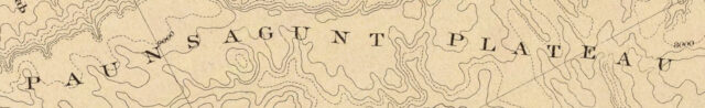
The Paunságunt Plateau is a flat-topped mass, projecting southward in the continuation of the long axis of the Sevier Plateau, bounded on three sides by lofty battlements of marvelous sculpture and glowing color. Its terminus looks over line after line of cliffs to the southward and down to the forlorn wastes of that strange desert which constitutes the district of the Kaibabs and the drainage system of the Grand Cañon of the Colorado River.
C.E. Dutton, 1880
After returning from the short hike to Powell Point, I drove back out the narrow trail and then headed down Pine Canyon into Johns Valley. Then I made my way over to Tropic for gas and lunch before heading up the East Fork of the Sevier River so I could visit the two highpoints of the Paunsaugunt Plateau. Yes, there are two highpoints that are the same elevation and less than a mile-and-a-half away from each other. This actually turned out to be my least favorite of the plateaus I would visit this weekend since the area was very busy with vehicles and UTV’s on the dusty road along the East Fork, plus the two highpoints were in the trees and offered absolutely no views. I didn’t stick around very long and I didn’t take many photos…
I passed by the Tropic Reservoir on my way to hike to the two highpoints of the plateau.

This is the view from the western highpoint of the Paunsaugunt Plateau. I hiked along an old logging road to the top which was very overgrown and hard to follow.

Here’s another view of the Tropic Reservoir as I drove back down to the highway.

Before leaving the area, I made a short detour up to the mouth of Casto Canyon so I could enjoy the colorful cliffs on this side of the Paunsaugunt Plateau.


The Highest Peak in Kane County: Andy Nelson Peak
Kane County Highpoint & Gooseberry Point
Once I was back on the pavement I headed south to Long Valley Junction and then climbed up onto the Markagunt Plateau via Highway 14. It was starting to get late, but I hoped I still had enough time to visit the highpoint of Kane County and find a place to camp before dark.
I made a quick stop at the Navajo Lake Overlook.

I drove most of the way up to the Kane County Highpoint (10,100), even when the road got narrow and was scratching up both sides of my Jeep, and then walked a short distance to find it. The highpoint was marked by this stack of rocks and was located in the trees where there wasn’t any kind of view to be had.

Sunset was getting close, so I drove over to Gooseberry Point hoping for a nice view from there. There wasn’t one…

I followed the edge as best I could until I found this view towards Brian Head.

At least the clouds were looking nice as I drove down from Gooseberry Point to find a campsite.

I was up early on Sunday morning so I could hike to the summit of Andy Nelson Peak, which is the highest ‘peak’ in Kane County, as opposed to the highest ‘point’ that I had visited the previous evening.
Just like the previous evening, views were limited from the hike up Andy Nelson Peak, but I did catch this sunrise shot of Navajo Lake from the trail. There seemed to be a lot of smoke or haze in the air this morning which added to the warmth of the scene.

Once I reached the ridge between Navajo Peak and Andy Nelson Peak, I was able to find an opening in the trees where I could see Zion in the distance.

Although the summit of Andy Nelson Peak (10,027) was open, it was ringed with trees that continued to limit the views.

A Hazy Markagunt View

Looking across the valley to Gooseberry Point.

Here’s a parting shot of Andy Nelson Peak over Navajo Lake as I left to visit the highpoint of the Markagunt Plateau. As you can see, it was starting to get busy around the lake…

Highpoint of the Markagunt Plateau: Brian Head
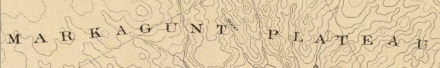
The Markágunt Plateau lies southwest of the Tushar. From the southern salient of Midget’s Crest a considerable portion of its expanse may be seen, though the view is not a very good one. In truth there is nowhere to be obtained a good panoramic overlook of the Markágunt, for there is no stand-point sufficiently lofty. The observer on this summit, standing more than a mile above the neighboring lowlands, will find it difficult to realize that the most distant verge visible along the southwestern horizon has an altitude about equal to his own.
C.E. Dutton, 1880
After returning to my Jeep from the hike up Andy Nelson Peak it was time to finally visit Brian Head, the highpoint of the Markagunt Plateau. I’m not sure why Jared and I didn’t visit this highpoint back in 2021 when we were hiking around Cedar Breaks, but we didn’t? There’s a well-maintained gravel road all the way to the top, so this would be a quick and easy one…
Brian Head Peak

A hazy view from along the road to the top.

Brian Head Peak Overlook

This structure located on top of Brian Head (11,307) was built by the CCC in 1935 and apparently was severely damaged by wind in 2022.


Brian 2, 1957


Walking along the edge of Brian Head.

I wasn’t planning on sticking around for Labor Day, so I headed down into Cedar City, grabbed an early lunch in town and then finished a large driving loop by returning home via I-15 and I-70. It had been a nice weekend in the High Plateaus, although I think I prefer the more isolated ones that are further away from St. George and Cedar City. The Markagunt and Paunsaugunt are very busy places!
The Snake Whisperer
Although these small but amazing Barrier Canyon Style pictographs are not located on one of the High Plateaus I visited this weekend, they are located near the base of one of them, and I was able to stop and find them during the trip.


