Around the Red Table: Crooked Creek Pass & Cottonwood Pass
Friday – Sunday, September 15-17, 2023
This weekend I headed out to the very northern end of the Sawatch Range so I could drive around and explore Red Table Mountain, which is located just west of the Holy Cross Wilderness between Gypsum, Eagle and Thomasville. I left from work on Friday afternoon, stopped in Rifle for gas and a bite to eat, and then continued on through the Roaring Fork Valley to Basalt where I turned off and followed the Fryingpan River to Lime Creek. Although I had driven through a couple heavy rain storms along the way, I found the beginning of the Crooked Creek Pass Road to be in good condition when wet, but that quickly changed as I drove higher and found some very slick conditions. After sliding off the road into the ditch twice, and thankfully not off the other side of the road, I found a small level spot to pull over and spend the night at. I had had enough of the slick and slippery road and felt it was too sketchy to continue driving up to the pass or turning around and heading down, so I was hoping that the road would dry out a bit overnight.
After getting a pretty good night of sleep, I woke up well before sunrise on Saturday morning and found that the road was slightly stickier, but not by much. I still didn’t feel comfortable driving the rest of the way up to the pass in these conditions, but the road was good enough for me to drive back down. Of course, that meant I wouldn’t be getting up to the trailhead for Mount Thomas near Crooked Creek Pass which is where I was hoping to hike this morning, so I had to come up with alternate plans. After making it back down to the Fryingpan River I looked over the map and thought I might hike up to the Fryingpan Lakes instead, so I drove over to that trailhead at the end of the road.
Driving above the Fryingpan River early on Saturday morning with a little fresh snow on the highest peaks along the Continental Divide.
When I reached the trailhead for the Fryingpan Lakes I changed my mind again because I didn’t really want to spend one of my last weekends in the mountains this year hiking in the trees. I wanted to be up above treeline with expansive views! There were no storms in the forecast at all this weekend, so I figured I would try driving around to the other side of Crooked Creek Pass and hopefully be able to make it to the trailhead for Mount Thomas from that side so I could carry on with my originally planned hike in the afternoon.
As I drove past the Ruedi Reservoir there was steam fog rising off the surface. It was actually moving pretty swiftly.

On my way back through Glenwood Springs I stopped and grabbed a quick breakfast and then carried on driving through Glenwood Canyon to Eagle. From Eagle I followed the Brush Creek Road up through Sylvan Lake State Park and continued up to Crooked Creek Pass and found the road on this side in much better condition, and had no troubles reaching the Mount Thomas Trailhead.
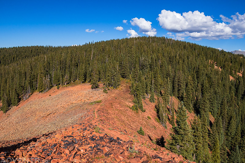
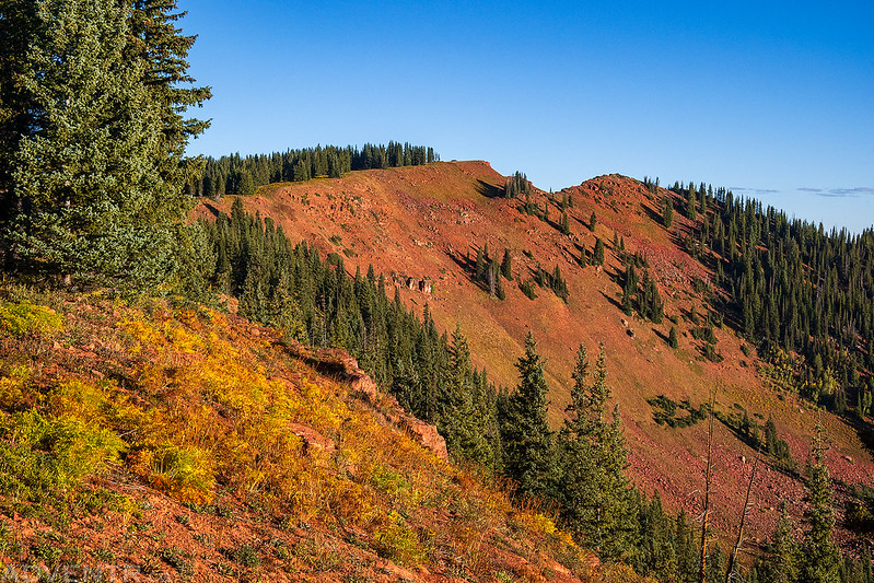
After reaching the trailhead above Crooked Creek Pass I followed the Mount Thomas Trail onto Red Table Mountain and walked through the burn area from the 2021 Sylvan Fire.

Mount Thomas Trail
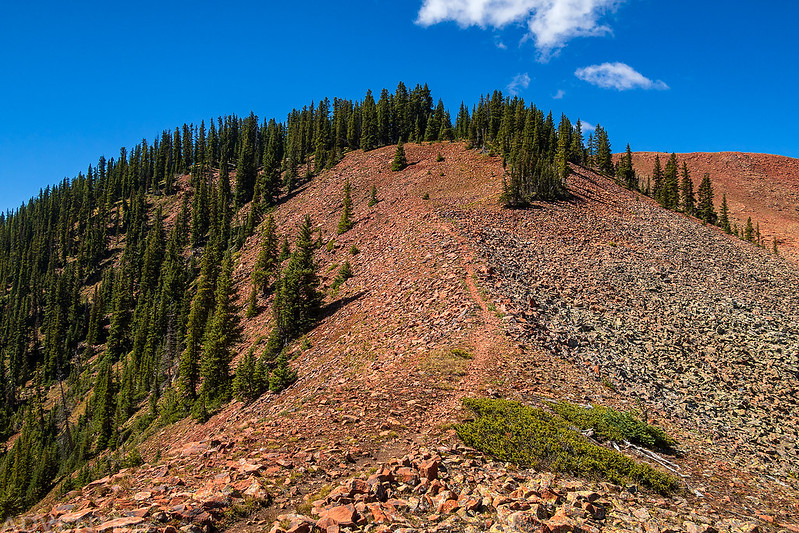
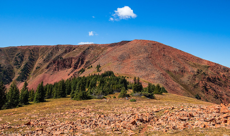
After a couple miles I finally had my first view of Mount Thomas from the trail.

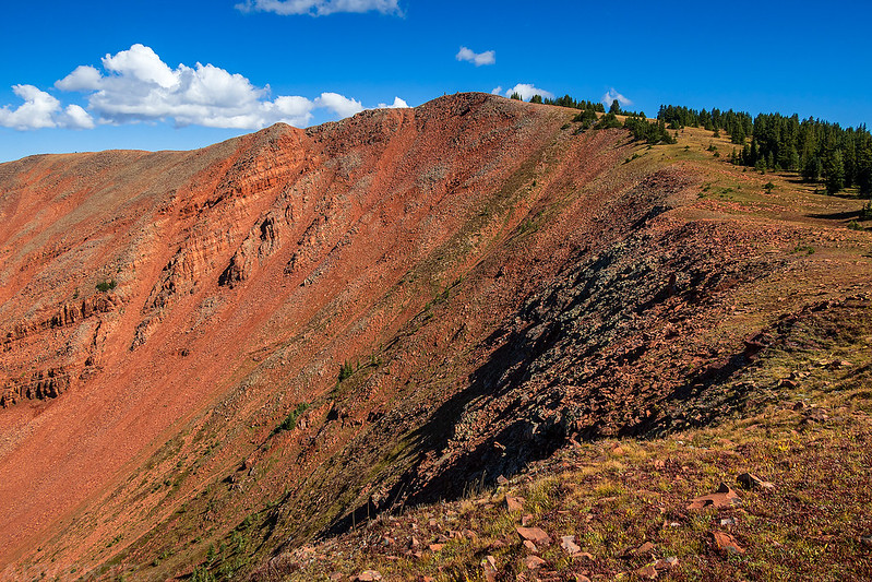
It was a lovely hike among the bright red rocks.

After about 4.5 miles I reached the summit of Mount Thomas where there were two large cairns.
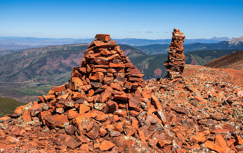
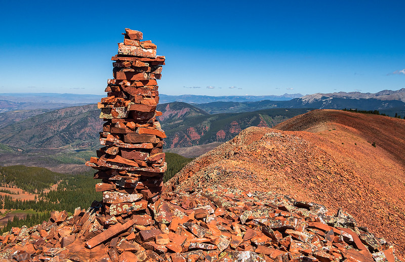
Tall Narrow Cairn
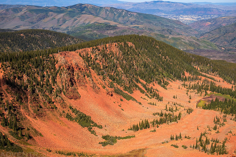
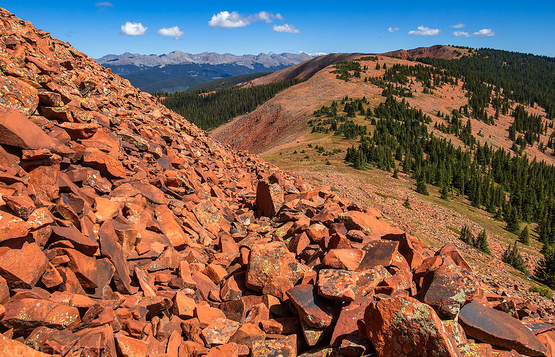
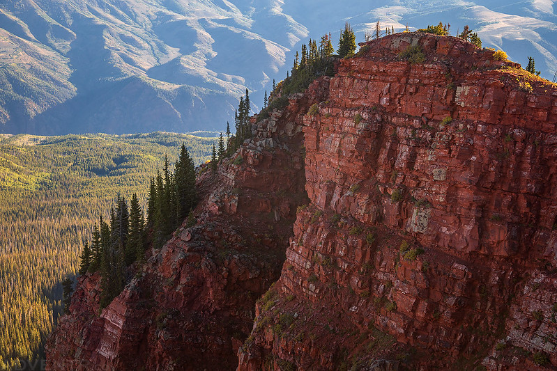
Looking down the red rocky ridge from the summit.

When I first started hiking I wasn’t sure if I was also going to attempt to hike to the highpoint of the Red Table Mountain, which was another two miles beyond Mount Thomas, but I was feeling pretty good and decided to give it a go.
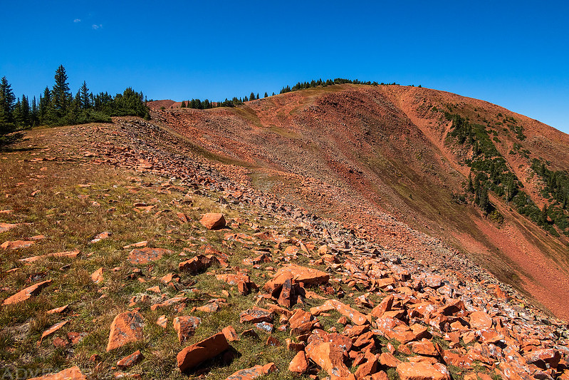
Approaching the final climb to the summit of Red Table Mountain.
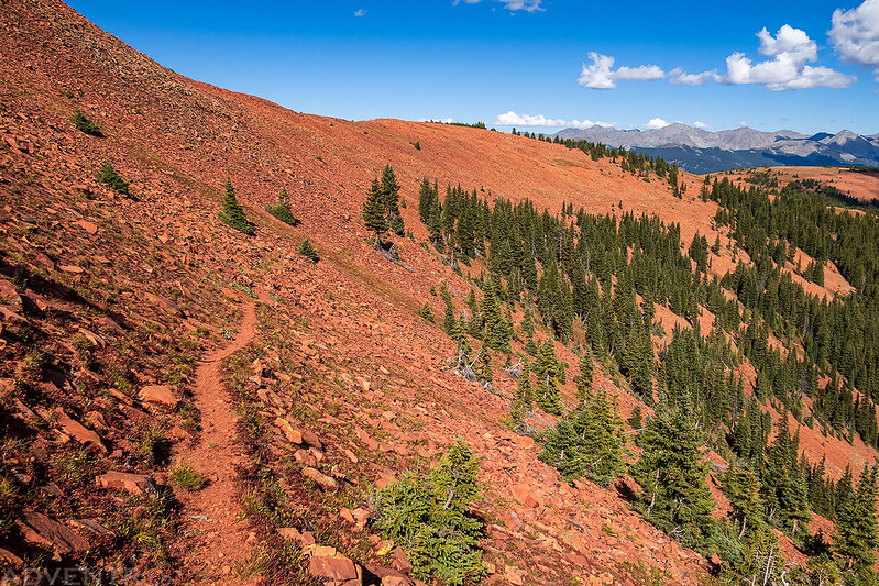
Surprisingly, there was a nice and easy trail through the steep red rocks to the top.
After walking about a half-mile across the flat-topped mountain, I made it to the highest point.

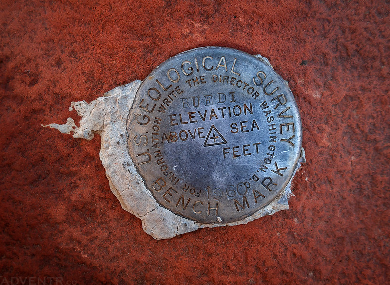
Rudei, 1960
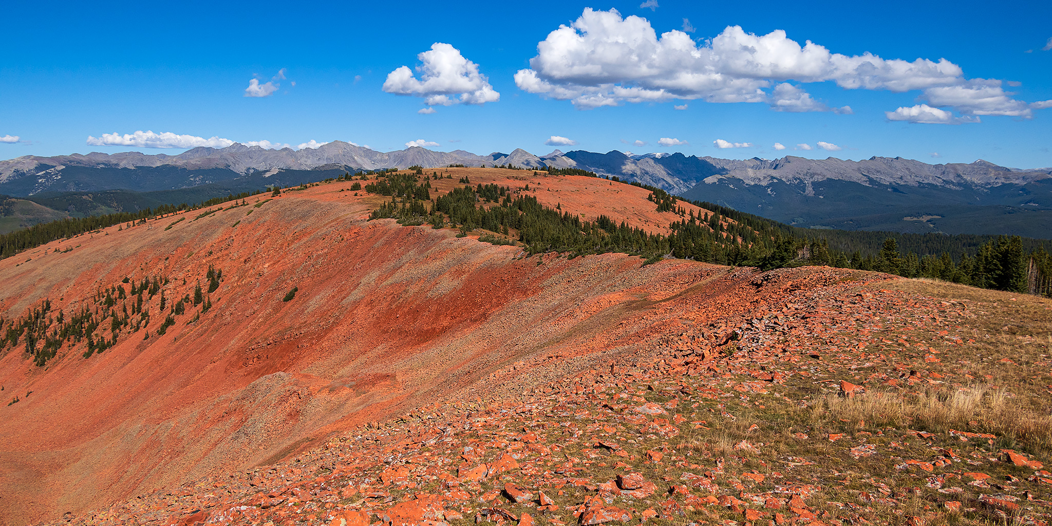
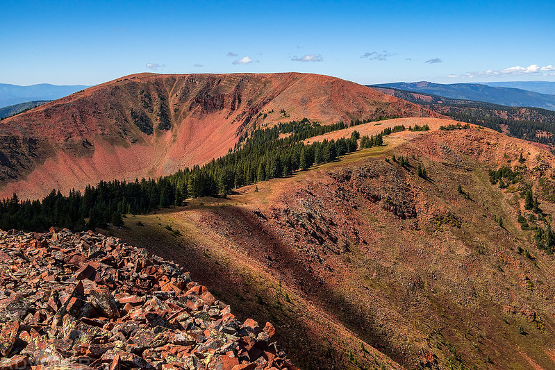
Overlooking my return route along the red ridge below with the peaks of the Holy Cross Wilderness on the horizon.

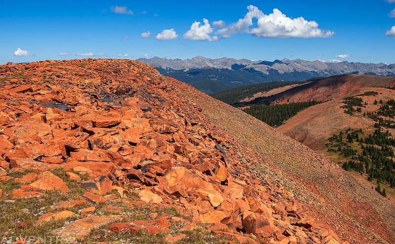
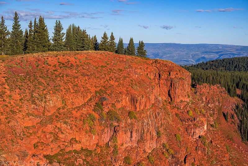
Edge of the Red Table
There were plenty more ups and downs on the way back to Mount Thomas and the trailhead…


Following the Mount Thomas Trail back into the trees.
I liked the way the light was catching the tops of the trees on this mountainside.

Crooked Creek Park

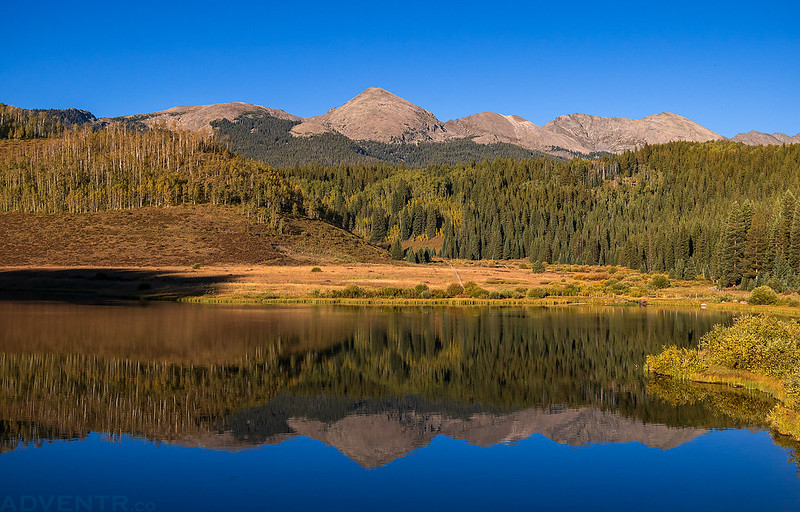
After returning to my Jeep I drove down from Crooked Creek Pass to the spot I had spent the previous night at, since the road had mostly dried out, and then I stopped to eat dinner in Lime Park with a great view of the surrounding peaks.

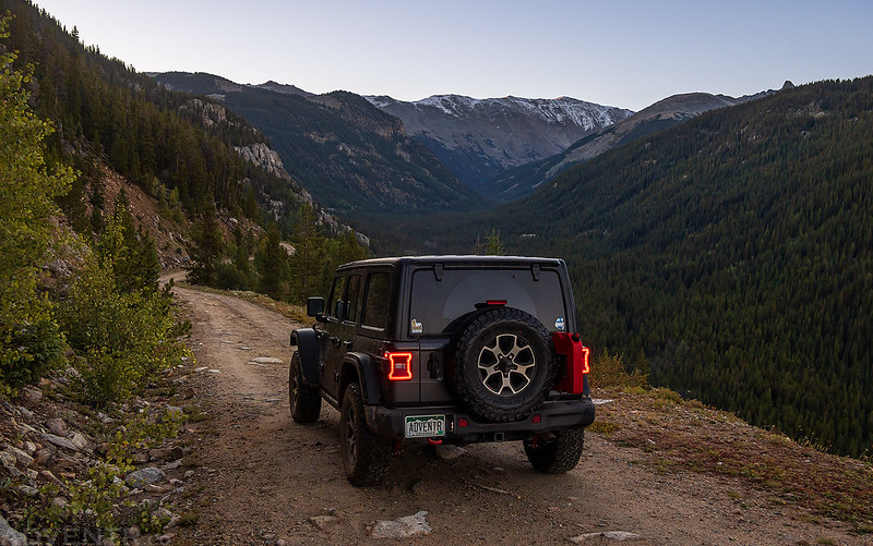
After dinner I drove past Crooked Creek Reservoir as I made my way back over Crooked Creek Pass to Eagle and then Gypsum.
Even though it was getting late at this point, I wanted to get to the other side of the Red Table Mountain to find a place to spend the night, so from Gypsum I headed up the road to Cottonwood Pass and then followed a rutted and bumpy road up onto the east end of the Red Table Mountain. By this time it was getting dark out and and a lot of the campsites along the way were already occupied by hunters, but I managed to find a decent spot to spend the night just below the Hoosier Benchmark near the highest ridge of the mountain. It was well after dark by the time I found the campsite, so I got in my sleeping bag and went to sleep shortly after arriving.
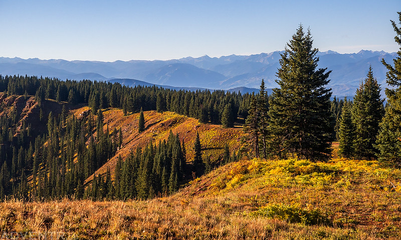
I was up early on Sunday morning and drove to the end of the road to watch the sunrise with expansive views of the Elk Mountains and Mount Sopris to the south.

At the end of the road I went for a short walk over to PT 11775.

After watching the sunrise I returned to my campsite so I could hike up to the Hoosier Benchmark.
It was a short and easy walk along the edge of the Red Table Mountain.

Here’s a view from near the Hoosier Benchmark, which wasn’t actually located near the highest point.

Hoosier, 1953

I liked the look of this red peak that was just below the highpoint.
Hoosier Point View
Following the ridge back down to my Jeep.
When I returned to my Jeep I drove down off of the Red Table Mountain and then followed the Cottonwood Pass Road into Carbondale. I decided to take the longer scenic route home and followed the Crystal River up to McClure Pass so I could grab a burger for lunch in Hotchkiss along the way. Although I had to changeup my plans a bit because of the muddy roads, I still had a nice time exploring the red rocky slopes of the Red Table Mountain as the mountain season is coming to and end for me this year.
Nice job on this! Looking at this this weekend. Hopefully, the road between Eagle and Crooked Creek Pass doesn’t get too soggy.