Floating from Mineral Bottom to The Confluence | Average CFS: 2,590
Friday – Wednesday, September 16-21, 2022
We continue our journey. In many places the walls, which rise from the water’s edge, are overhanging on either side. The stream is still quiet, and we glide along through a strange, weird, grand region. The landscape everywhere, away from the river, is of rock—cliffs of rock, tables of rock, plateaus of rock, terraces of rock, crags of rock—ten thousand strangely carved forms; rocks everywhere, and no vegetation, no soil, no sand. In long, gentle curves the river winds about these rocks.
Major John Wesley Powell,
July 17, 1869
The time had finally come! It was time for me to float the Green River through Stillwater Canyon in Canyonlands National Park and I couldn’t have been more excited! I’ve wanted to float this stretch of the river for many years now but have always put it off for other trips because I was a little concerned about making it to The Confluence in time for the Jetboat shuttle. Our float down Meander Canyon was actually kind of a test to see how easy it would be for us to make that kind of distance in our inflatable kayaks at this time of the year, and we ended up coming up short by about eleven miles on that trip. Still, I made it one of my goals to finally get into Stillwater Canyon this year and booked the Jetboat shuttle back in February. This time I added an extra day to the trip just to make sure we would have enough time to make it to The Confluence. As usual, my friends Jackson and Chris were supposed to join me on this trip, but unfortunately Chris had to back out the week before, so this time it would just be me and Jackson.
A couple days before our launch the remnants of a tropical storm passed over the area and dropped a lot of rain, raising the level of the Green River due to flash flooding upstream. I thought this would be good for us, helping make the miles easier with the higher water level, but what it actually did was drown many of the sandbars we like to camp on at this time of the year and left them underwater or muddy. The mud left behind from the dropping water levels also made accessing many of the side canyons difficult, and we ended up skipping a few that I had hoped to get into. I guess that just means I will have to return for another float in the future!
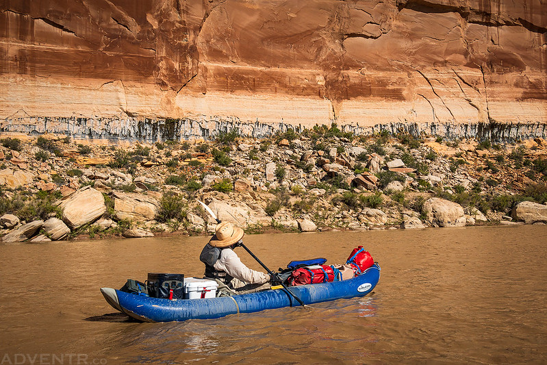
After leaving from work on Friday afternoon I stopped by Jackson’s house to load all his gear into my Jeep and then we both drove over to the Potash Boat Ramp along the Colorado River and left his vehicle there. From there we took my Jeep down to Mineral Bottom as the sun was setting and found a spot to camp nearby. As we set up camp in the dark there was a lot of lightning off to the west, but it didn’t look like the storms were headed our way. Just to be on the safe side, we put the rainflys on our tents which ended up proving to be a good decision as the lightning and thunder started to get closer and it began to rain a little while later. The wind picked up and so did the rain for a little while, but the storm didn’t last long and it was calm again for the rest of the night after that. We both got up shortly before dawn on Saturday morning, packed up camp and headed over to the Mineral Bottom Boat Ramp so we could rig our boats and get on the water early.
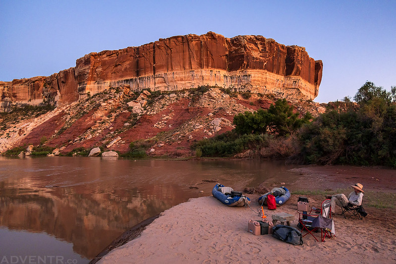
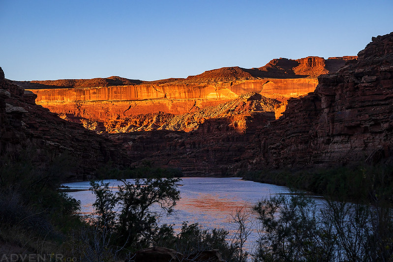
While rigging up our boats at the ramp we were treated to a beautiful sunrise over the calm waters of the Green River in Labyrinth Canyon.


Labyrinth Canyon Sunrise
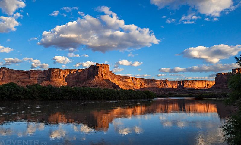
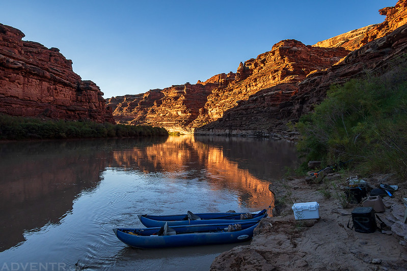
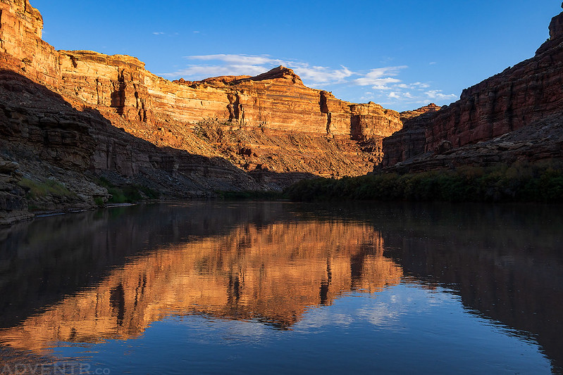
Mineral Bottom Reflections

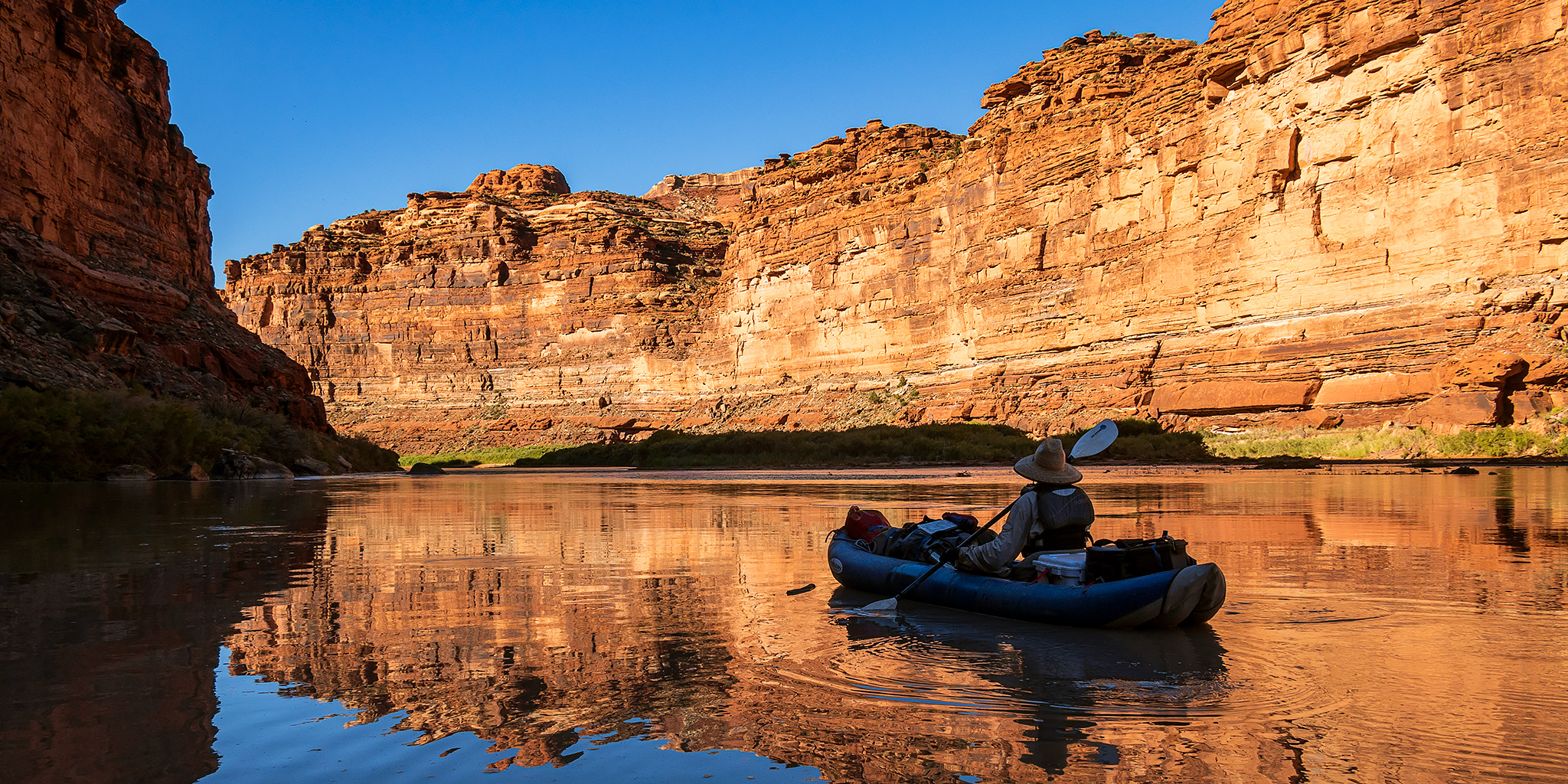
Once our boats were ready we set off onto the reflective waters of the Green River.

In order to actually reach Stillwater Canyon we would first have to float down about 20 miles of lower Labyrinth Canyon. The weather forecast wasn’t looking the best over the next couple of days, so we wanted to get in as many miles as we could on this first day, while the weather was good!


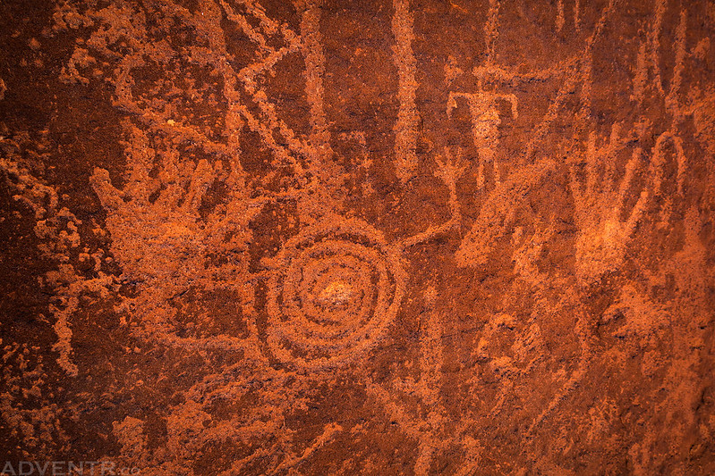
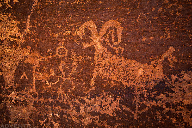
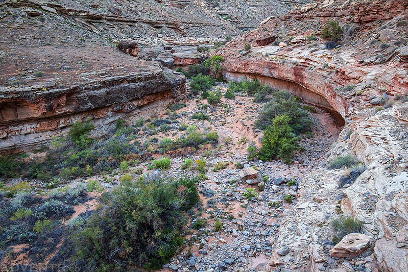
Since the White Rim Road follows along the east side of the river for much of this part of Labyrinth Canyon, I have already done all the exploring I’ve wanted to do on that side of the river, so there weren’t many stops I wanted to make this time around. Our first stop of the day was at Horsethief Canyon to find a small panel of petroglyphs. The mouth of this canyon was very slick and muddy which made it difficult to access the canyon- a problem that we would encounter a number of times on this trip caused by the recent rise and drop in the water level of the river.
Looking up Horsethief Canyon after I was finally able to break through the thick brush.

Horsethief Canyon Petroglyphs

After leaving Horsethief Canyon we floated around Fort Bottom but didn’t bother to stop since I have hiked there from the White Rim Road a couple times before.


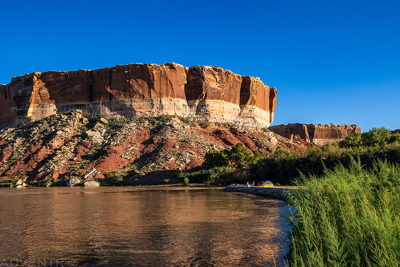
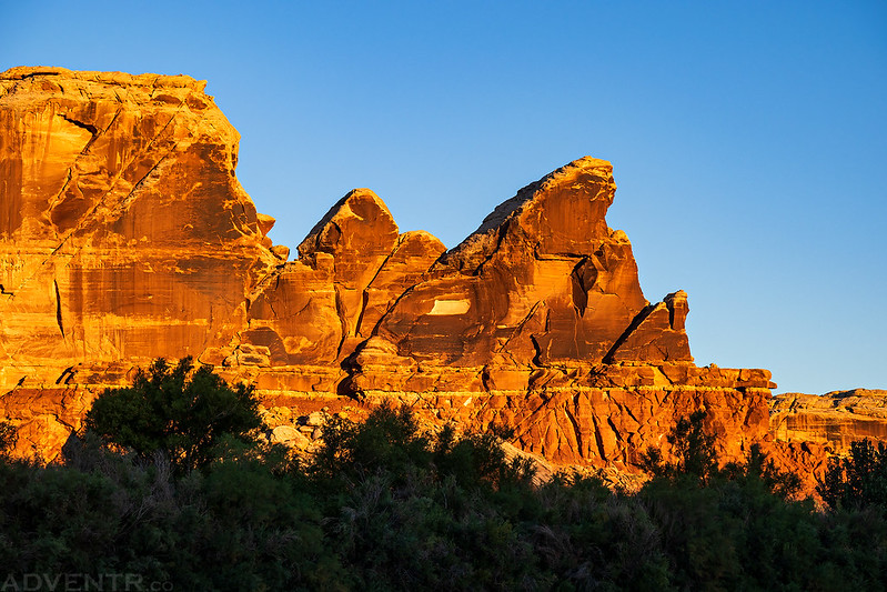
As soon as we passed Potato Bottom the White Rim Sandstone emerged and would continue to rise higher and higher above the river for the remainder of the trip.

Here’s a view back to Steer Mesa as we floated by Beaver Bottom.

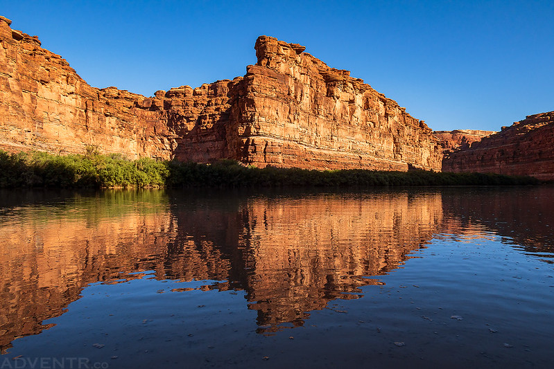
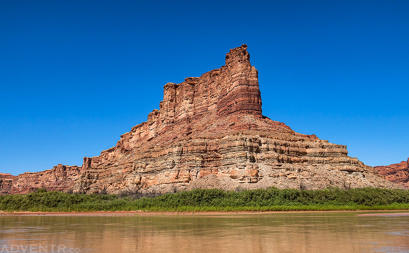
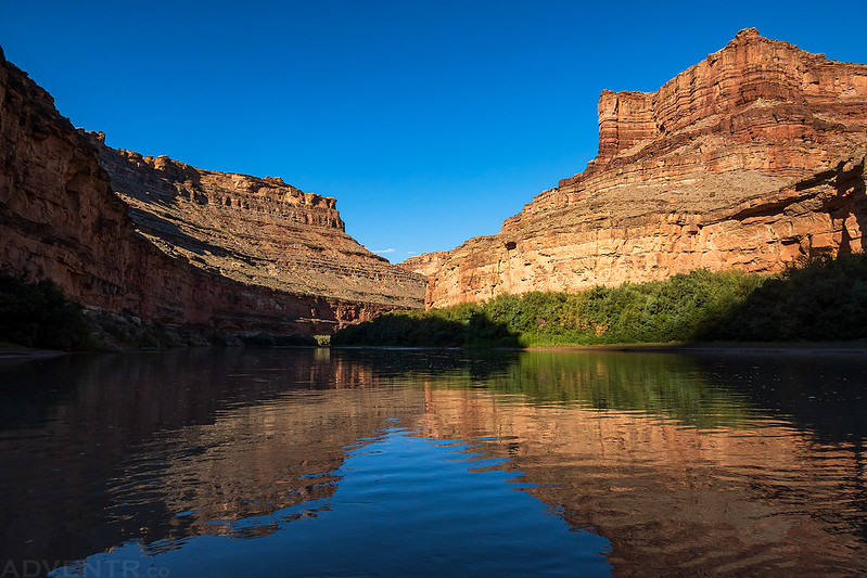
After navigating the little riffle at the mouth of Millard Canyon and rounding the bend next to Queen Anne Bottom, Candlestick Tower came into view and we were now officially in Stillwater Canyon.

The line which separates Labyrinth Canyon from the one below is but a line, and at once, this morning, we enter another canyon. The water fills the entire channel, so that nowhere is there room to land. The walls are low, but vertical, and as we proceed they gradually increase in altitude. Running a couple of miles, the river changes its course many degrees toward the east. Just here a little stream comes in on the right and the wall is broken down; so we land and go out to take a view of the surrounding country. We are now down among the buttes, and in a region the surface of which is naked, solid rock—a beautiful red sandstone, forming a smooth, undulating pavement.
Major John Wesley Powell,
July 17, 1869

By now we had paddled over 20 miles and it was starting to get late, so we were on the lookout for a campsite.
The canyon curves as we enter Bonita Bend.

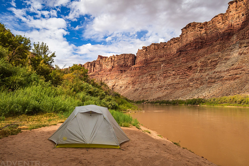
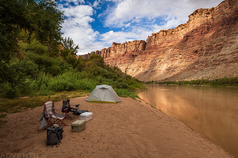
We found a nice sandbar at the outer edge of Bonita Bend just past Anderson Bottom and set up camp for the night.
We pass a place where two bends of the river come together, an intervening rock having been worn away and a new channel formed across. The old channel ran in a great circle around to the right, by what was once a circular peninsula, then an island; then the water left the old channel entirely and passed through the cut, and the old bed of the river is dry. So the great circular rock stands by itself, with precipitous walls all about it, and we find but one place where it can be scaled. Looking from its summit, a long stretch of river is seen, sweeping close to the overhanging cliffs on the right, but having a little meadow between it and the wall on the left. The curve is very gentle and regular. We name this Bonita Bend.
Major John Wesley Powell,
July 17, 1869
This was a pretty nice sandbar campsite, which are my favorite kind this time of the year, but unfortunately we would have trouble finding nice sandbars the next two nights since many of them were either still underwater or very muddy from the recent rise and fall of the river level.
After getting to bed early, I slept very well overnight and then we were back up at dawn on Sunday morning so we could get on the river early again. The last forecast we saw said there was going to be strong winds in the early afternoon and we wanted to get some miles in before then.
Early morning light on the point of The Frog in Anderson Bottom.
After breakfast and loading up our boats, we were on the water by 8:00am.

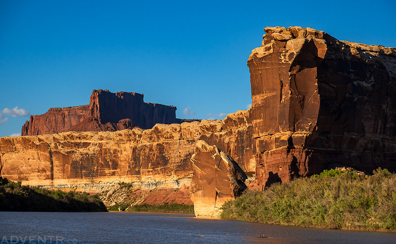
Shortly after leaving camp I turned around for a view of both buttes of the Buttes of the Cross.

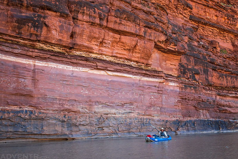
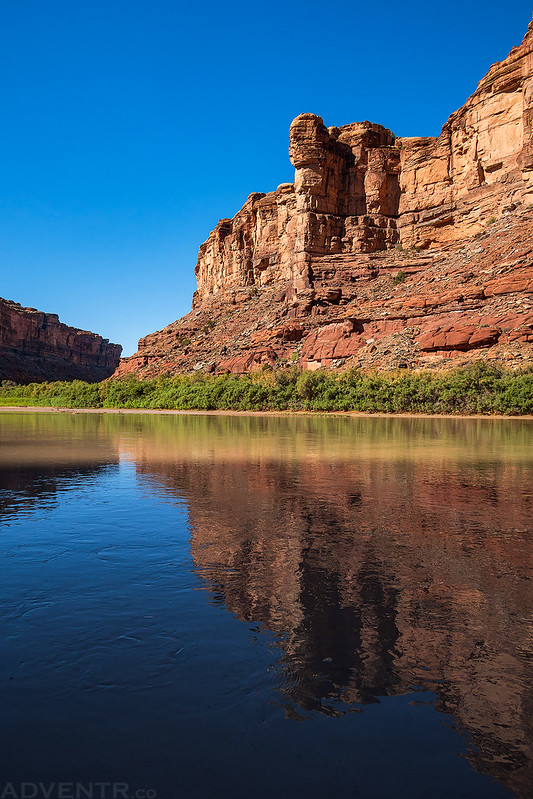
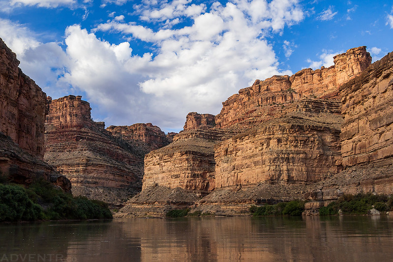
Below the White Rim in Stillwater Canyon.

We spotted a couple inaccessible ruins across from Valentine Bottom. I had hoped to stop at Valentine Bottom next, but we could not find an access point through the brush that wasn’t super thick and muddy.

After floating to the very end of Tuxedo Bottom we stopped to go on a short hike and had a nice view of Turks Head from our landing spot.

Our short hike brought us up to Newspaper Rock, which is a large boulder with petroglyphs pecked into three sides of it.


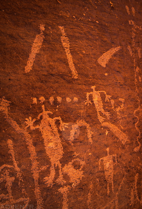


After checking out the petroglyphs in the area we were soon back on the river and ready to float around Turks Head.

Once we made it to the other side of Turks Head we went on a short hike in search of a couple granaries.

Turks Head Granary I
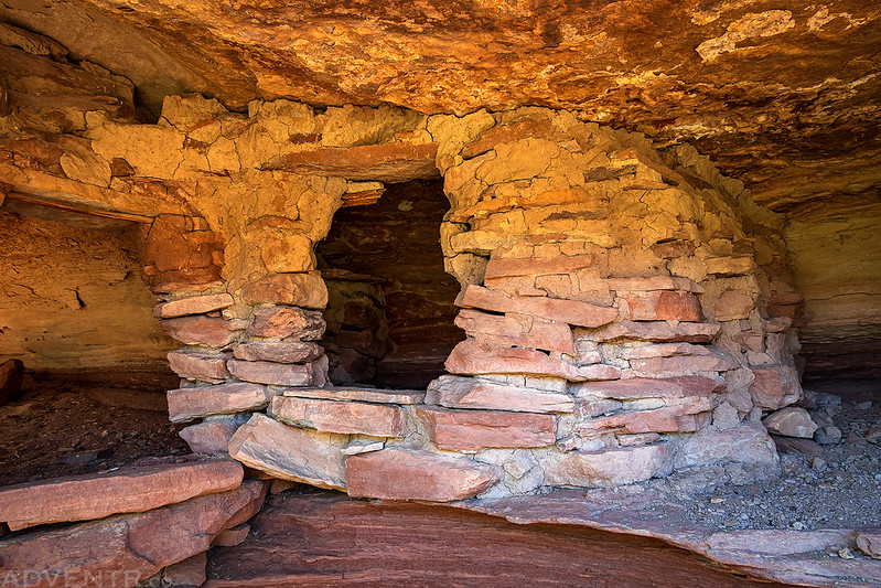
Turks Head Granary II
Turks Head Granary III
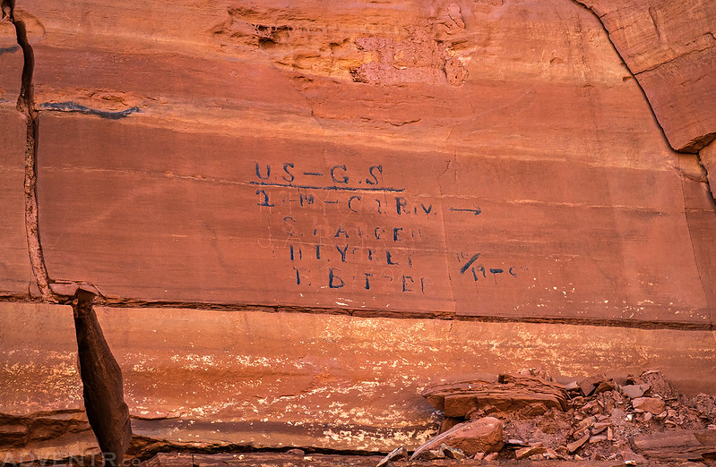
On the way back to our boats Jackson spotted a couple old inscriptions on the wall, including this one from H.T. Yokey from 1904. I know I’ve seen at least one other inscription from him in the San Rafael Desert.

There was also an inscription from J.A. Ross and Ella Ross.

A short distance further down the river and on the other bank was another inscription from H.T. Yokey when he was here with the USGS in 1909.
Now we were back on the river again in search of a campsite for the night.

We didn’t come across any good sandbar camps this afternoon and ended up staying at the Pre-Horse Camp after floating over 14 miles today. It is a highwater camp that required us to carry all our gear up a steep sandy slope with a big rocky step in the middle. It wasn’t a lot of fun.
Pre-Horse Camp

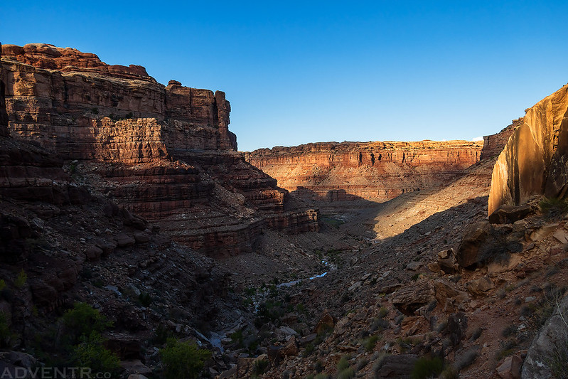
Shortly before sunset I went exploring up a nearby canyon that went up to the ledge above our camp.
Our sunset view from camp.
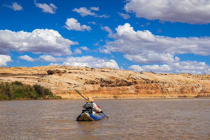
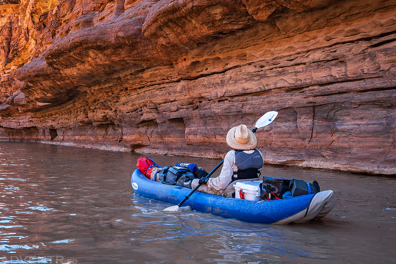
I had trouble falling asleep at first because this campsite really seemed to hold the heat and it didn’t really cool down much overnight, but eventually I fell asleep. Just like the previous two morning, we were up at dawn and on the river by 8:30am for another early morning float. I really enjoy being on the river at this time of the day.
Loading our boats on Monday morning after carrying our gear back down the steep slope.

There were some lovely reflections this morning.

After a couple miles we passed by the mouth of Horse Canyon, which drains much of The Maze and Land of Standing Rocks. There was a small riffle here, too.
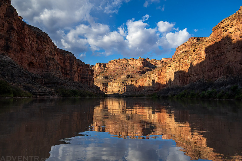
Stillwater Canyon Morning


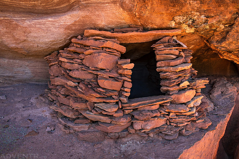
We made a brief stop at the mouth of Jasper Canyon to hike up to a ruin.

Jasper Canyon Ruin

Then we floated around a couple more bends of the river and decided to call it an early day near the mouth of Water Canyon.

We stopped at the Water Ledges Camp which is another highwater camp found just before the mouth of Water Canyon and had to carry our gear up another steep trail. This time we had a little nicer view and early shade, though.

Water Ledges Camp

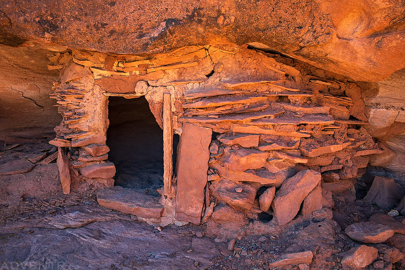
Later in the evening after dinner I hiked up into Water Canyon and passed by this ruin along the route. I have a feeling that it is historic based on the opening, but I really have no idea?

I hiked up the steep trail in Water Canyon until I had a nice overlook of the canyon behind me. Then I headed back down.

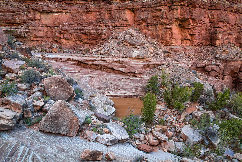
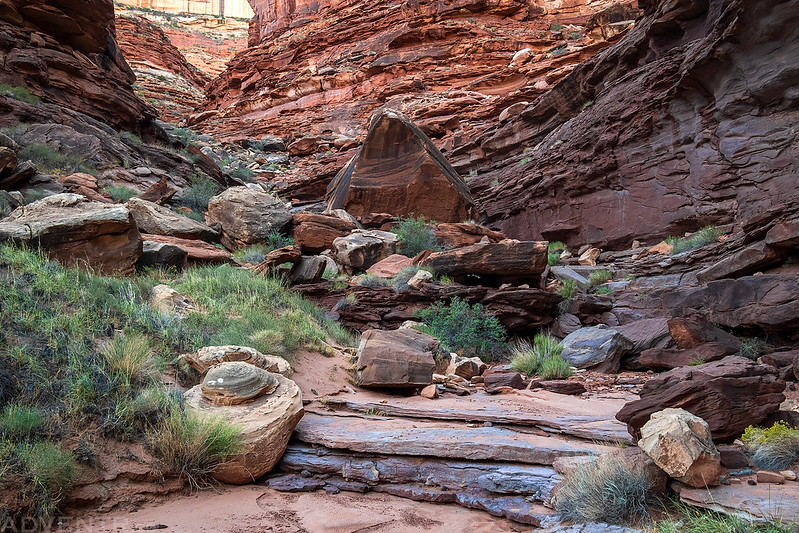
There was an interesting short water-carved slot near the mouth of the canyon that I wandered around for a bit.

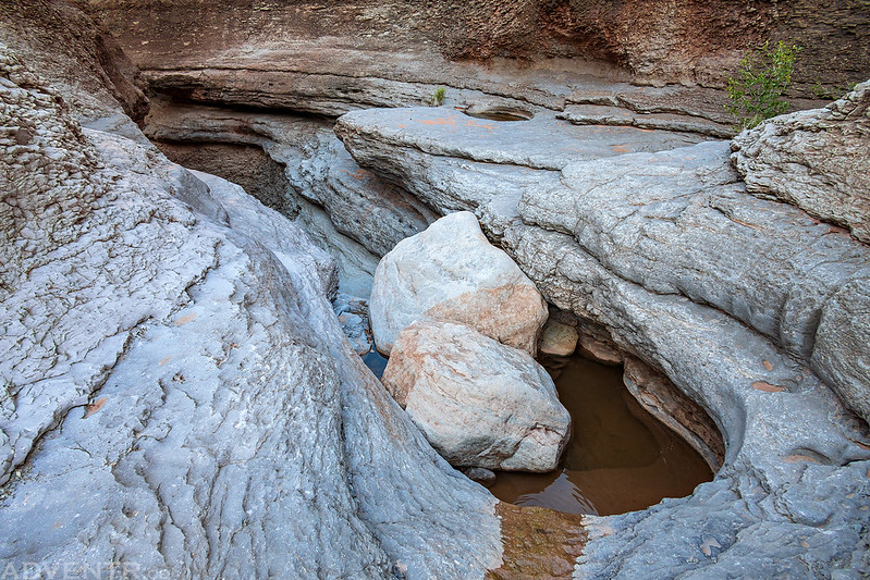

Lower Jump of Water Canyon

Following the ledge back to camp just before sunset…
There were a couple clouds in the sky at dusk this evening.
Before we went to bed this evening we made sure to put on our rainflys again since the last forecast we had seen was calling for rain in the morning. At around 4:00am I was awakened by thunder, lightning and a little rain, but it didn’t last long. When we got up shortly before dawn there were still some distant flashes of lightning visible on the horizon, but no audible rumbles of thunder.
The sunrise was pretty nice this morning!

We loaded up our boats and were on the water shortly after 8:00am.
We only had about 4.5 miles to go to reach The Confluence, so we took our time and enjoyed a relaxing morning float though the last few miles of Stillwater Canyon.
Before going around the final bend of the Green River and reaching The Confluence, we had a good look up Powell Canyon.
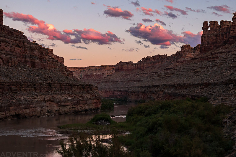
Late in the afternoon the water becomes swift and our boats make great speed.. An hour of this rapid running brings us to the junction of the Grand and Green, the foot of Stillwater Canyon, as we have named it. These streams-unite in solemn depths, more than 1,200 feet below the general surface of the country. The walls of the lower end of Stillwater Canyon are very beautifully curved, as the river sweeps in its meandering course. The lower end of the canyon through which the Grand comes down is also regular, but much more direct, and we look up this stream and out into the country beyond and obtain glimpses of snow-clad peaks, the summits of a group of mountains known as the Sierra La Sal. Down the Colorado the canyon walls are much broken.
Major John Wesley Powell,
July 17, 1869
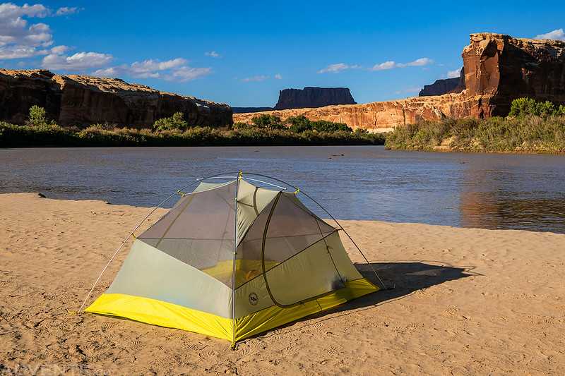
Of course, as soon as we rounded the bend and entered The Confluence, the sky was now completely overcast and it looked like it was going to start raining at any time. Just past The Confluence was a very large sandbar that looked like a good place to camp and wait for the Jetboat, which happened to be arriving just as we showed up. While we were waiting for them to pick up the current passengers they told us they would prefer if we camped at a site further down the canyon since they had trouble getting the boat to shore today, so we left and headed downstream a short distance to the small sandy camp they had suggested. We quickly got our tents set up before it started to rain, which it would do on and off for much of the afternoon.
The sun did come out a couple of times between the light rain showers. We had a nice big tree to sit under that helped keep us dry while staying out of our tents.

Looking back towards The Confluence from our campsite, which is just out of view around the bend.

Below-The-Confluence Camp
This is where we spent the rest of the day.
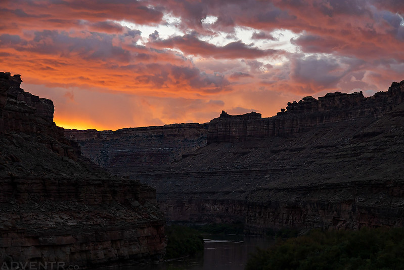
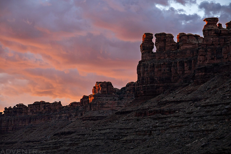
The sky started to clear in the late afternoon, so I had hopes for a nice sunset.

I liked the look of the clouds behind this little point on the cliffs above camp.

One Boat at Sunset
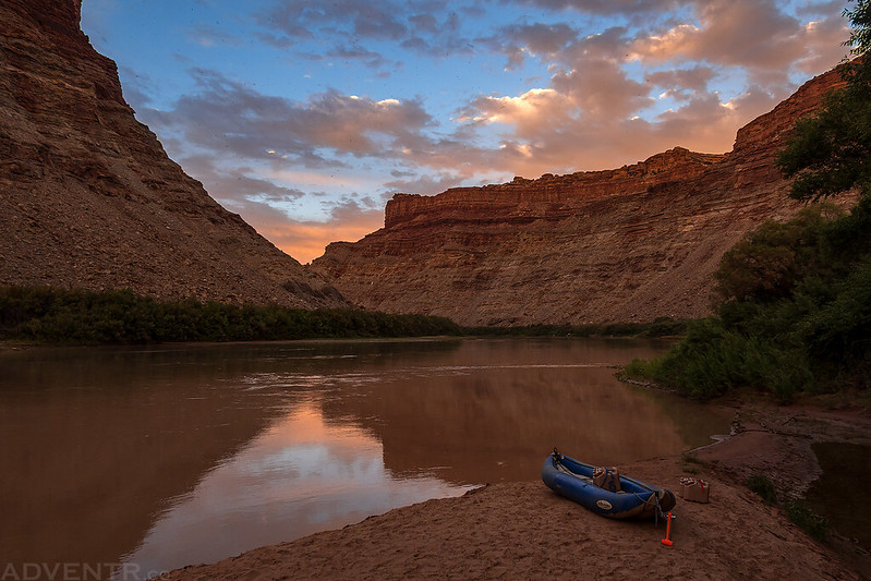
This turned out to be the most colorful sunset of the trip!


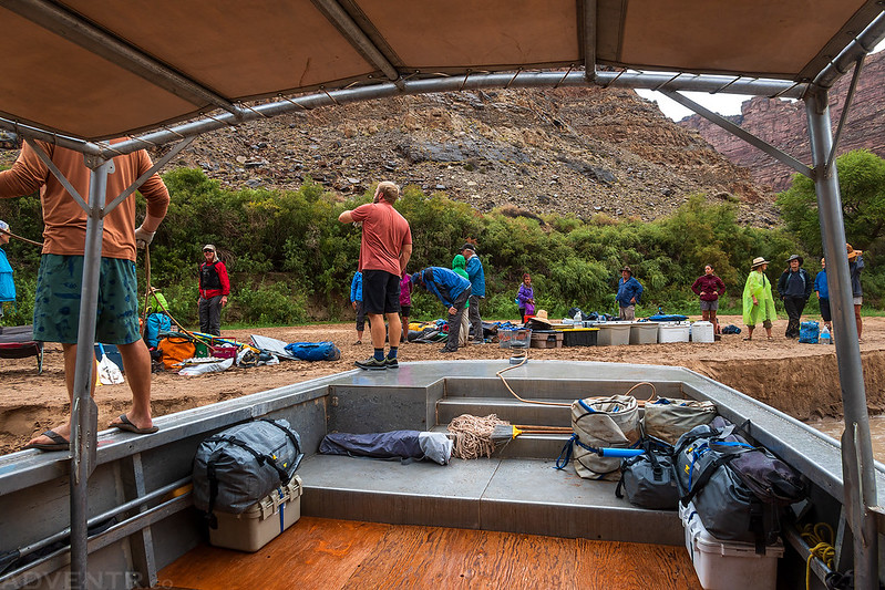
We were expecting more rain overnight and to be packing up our wet gear up in the morning, but there were only a few sprinkles at around 5:00am that didn’t even get our tents wet. When we woke up shortly before sunrise on Wednesday morning the sky was overcast and it looked like it might rain soon, so we packed up our gear while everything was still dry and then waited for the Jetboat to arrive around 10:00am. While we waited it did start to rain for a while, so we sat under the large tree in camp which helped keep us dry. The Jetboat showed up a little early to pick us up and we were the first ones on this morning. Then it returned to the large sandbar at The Confluence to pick up everybody else.
Getting ready to load up the rest of the gear and people at The Confluence.
Once everyone was on the Jetboat it was about a two-hour ride back up to Potash with some on and off rain that pelted us in the face at 30mph, but I still enjoyed the views and was happy to finally see the lower end of Meander Canyon that I had missed on our last trip!
Here’s a short video clip (sped up a little) as the Jetboat left The Confluence and started the ride up Meander Canyon.
Great pix. Have paddled both sections, but did not know about the granaries and other ancient sites.
There’s a lot more I wasn’t able to get to this time, too!
This was a great report, I really enjoyed the style, where you narrated us through your days as opposed to some of the reports where you have a wonderful prologue and then a photo gallery. Of course, I understand the style of those as well – both from a time-to-author and “what are you really going to say about another beautiful bend in the hike” perspective. I struggle with my own in that regard as well, sometimes.
I don’t know if I’ll ever have a mode of water travel – it’d be a lot of work to drive all the way down for a paddle, but this sure did make me yearn for such an adventure. Kudos and keep it up.
Thanks! A lot of the reports where I don’t narrate and just include a gallery of photos after the introduction is usually because those contain sensitive locations (rock art and ruins).
Yeah, as I alluded to, I totally get it. I mean, I wish you shared the locations so I could drive a thousand miles to follow in your footsteps, but I get it . As you know, I’m not shy about asking when I’m planning to be in the area, and I keep plenty of the spots I visit “unnamed” or “name redacted” as well!
Keep it up. No matter the style, they are always fun to get lost in!
BTW- The place we got our Jetboat shuttle from (Tex’s)- they also rent canoes and all the other gear you need if you don’t want to buy your own but would still like to go on a river trip.
Great photos and report Randy. Now I have another trip to add to my list of things I want to copy from you!
Thanks for the continued inspiration!
Did you prefer meander or Stillwater canyon? Thanks!
I liked them both. It would be really hard for me to choose one over the other. You can’t go wrong on either of them!
Signed up for Stillwater in May. Figure we’ll experience meander on the way out. A bit worried about camping space and the crowds at high water, but analyzing the map it seems to be plenty of camping available with a little effort. Thank you!!
Yeah, that’s definitely a good way to go so you can experience them both. Although a different experience, I do enjoy the jetboat ride.
Hi there-love your pictures! We are taking our family down Stillwater/Labyrinth in early June. Could you please give some details about the boat you used (Brand/Length)? Thanks!!
Thanks Casey. I used a Tributary Tomcat Tandem inflatable kayak.