Lost In The Maze II | Wednesday – Sunday, April 6-10, 2022
This is the most inaccessible part of the United States. Scaling a thousand-foot cliffs, our eyes swept the ‘Land of Standing Rocks,’ dome-shaped and pinnacled, weird and fascinating in shape and color. Here were limitless leagues of silence. In all directions extended uninhabited, waterless wastes, with a jumble of mesas, buttes peaks and mountains that shoulder above this plateau of naked rocks. The sight awed and inspired me.
Amos Burg, 1938
I can hardly believe it’s been just over four years since my last visit to the Land of Standing Rocks in Canyonlands National Park. It feels like it was just yesterday when Diane and I were heading out to The Maze over the long Memorial Day weekend each spring, and I’ve recently had a strong desire to return. After completing all the trails in The Needles and the Island in the Sky in 2018 and 2019 respectively, The Maze is the only remaining district of Canyonlands where I have not hiked every official trail on the map, so I figured it was time to head back and continue working on completing that personal goal. That’s part of the reason I hiked down the North Trail late last year. So back in early November I got on Rec.gov and booked couple campsites in the Land of Standing Rocks, two nights at Chimney Rock and two nights at The Wall, which seemed like a good place to basecamp for the trails that I wanted to hike this time. My friend Jerry, Jared and Dave were going to be joining me on this trip, but unfortunately Jerry got sick just before the trip started and was unable to make it this time.
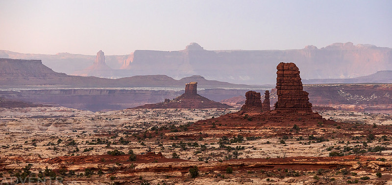
Into the Land of Standing Rocks
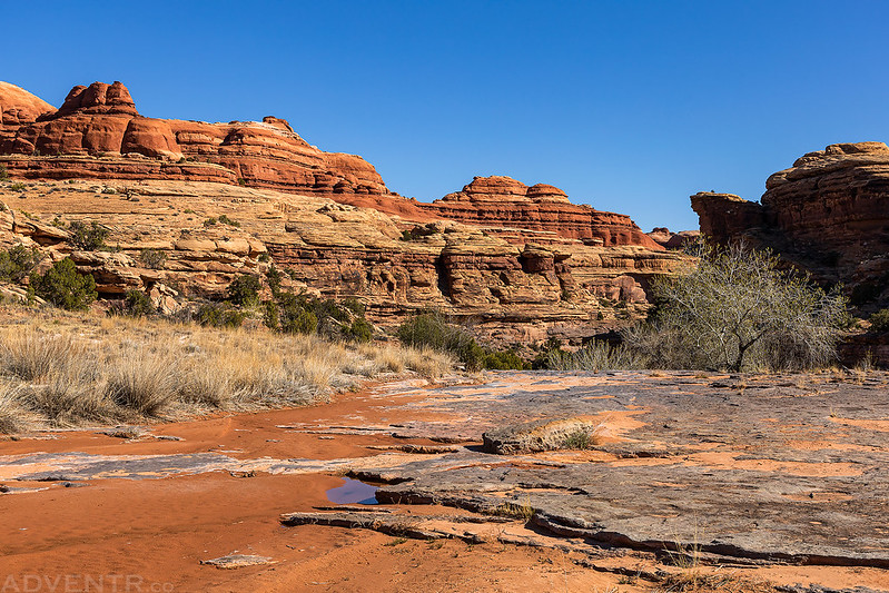
I planned to meet Dave and Jared at the Hans Flat Ranger Station when they opened at 8:00am on Wednesday morning, but this time I decided not to spend the first night nearby, so I woke up at 3:00am, grabbed a quick breakfast and headed into Utah from home. After topping off my gas tank in Green River I finished the drive to the Ranger Station and arrived shortly after 7:00am. Dave and Jared had camped nearby and showed up shortly after me. Once the Ranger Station opened up we obtained our permit and started the drive down the Flint Trail into the Land of Standing Rocks. The road was quite a bit rougher than I remember it being the last time I was out this way, but we had no problems making it to our campsite for the next two nights at Chimney Rock. Once we got camp set up we went on a couple short hikes in the general area to get warmed up for the next few days.
A nice view of The Pinnacles and Henry Mountains as I drove across Coyote Flat just after sunrise.

No camping allowed in this smoke-stained alcove near an old closed road.

My original plan was to hike the Water Canyon and Shot Canyon loop on Thursday, so shortly before sunset we hiked over to the rim of Water Canyon to see if we could find the way down. Since we had no success finding the obscure route into the canyon I decided to change plans and start the trip with a hike into Ernies Country on Thursday instead. We all went to bed early this evening and I was extra tired from getting up very early, so I fell asleep quickly and slept well.
An evening stroll along the rim of Water Canyon.

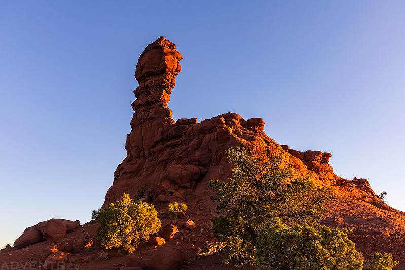
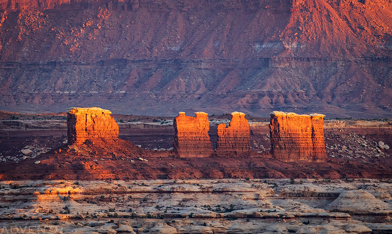
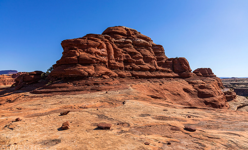
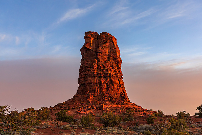
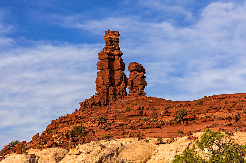
Chimney Rock Camp

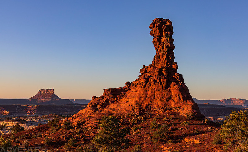
Chimney Rock and Ekker Butte
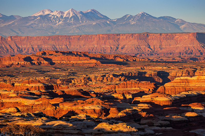
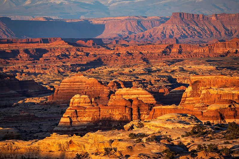
Hatch Point and the La Sal Mountains

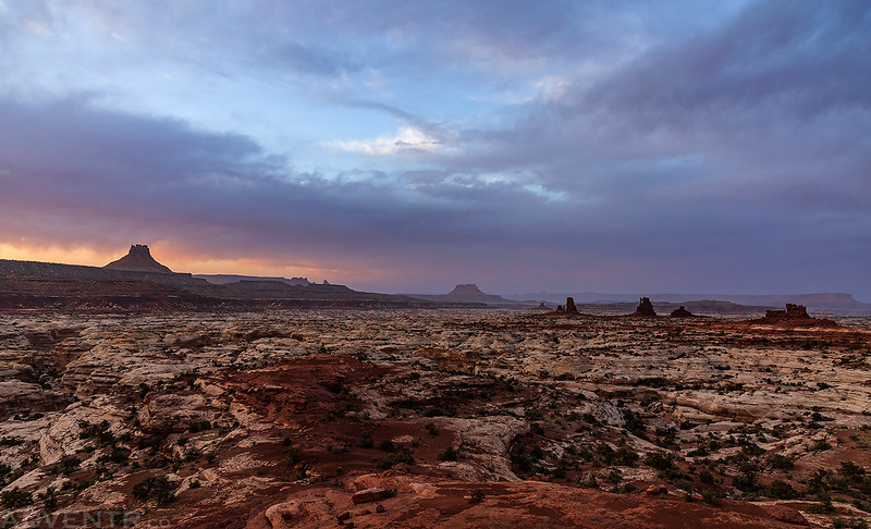
Sunset over The Needles with Cathedral Butte and the Abajo Mountains on the horizon.
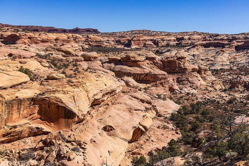
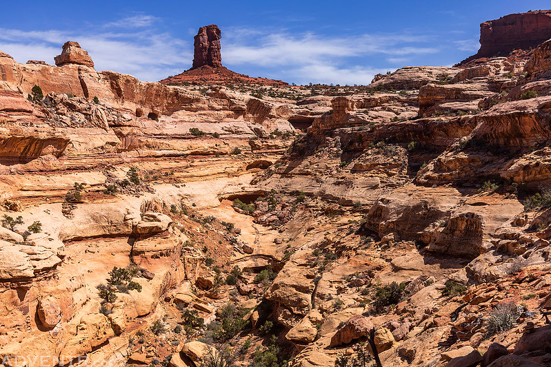
Ernies Country Trail
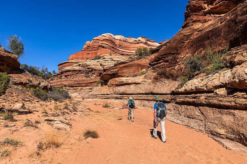
We were up before sunrise on Thursday morning so we could run the shuttle for our hike through Ernies Country. We dropped my Jeep off at the trailhead near Doll House 3 and then took Dave’s Jeep back to the trailhead near The Mother and Child to begin our descent into Range Canyon. Dave had to do some creative organizing of his gear to make room for Jared in the back. The temperature was cool out when we started hiking, but it would warm up pretty good later in the day. I thought I knew what to expect from this trail since I have hiked in a little ways from both ends before, but there turned out to be a lot more ups and downs along the way than I was expecting. By the time we reached my Jeep at Doll House 3 on the other end, we had hiked about 13 miles including all side trips.
Early morning light on Elaterite Butte.

Above the canyons in Ernies Country.
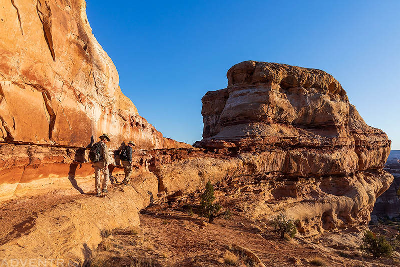
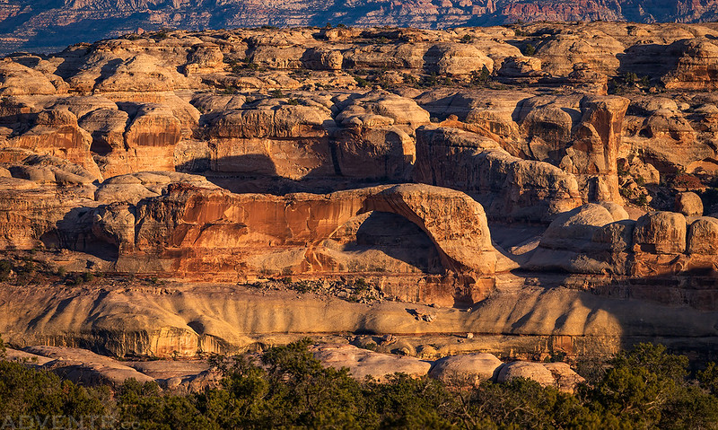
We made a short detour and climbed up to Whitmore Arch.

Whitmore Arch Sunstar

Underneath Whitmore Arch
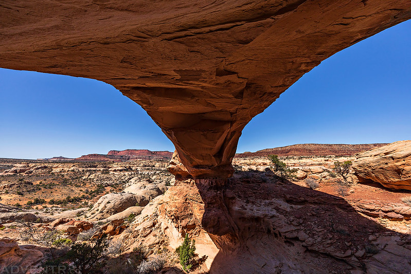
The view from the arch.

We also stopped to check out Clell’s Spring, which was completely dry.
Canyon Stripes

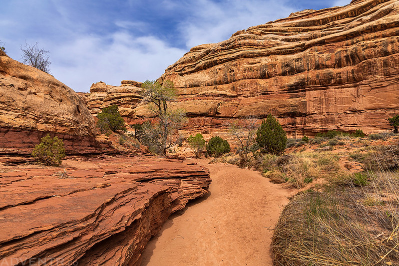
Sweet Alice Canyon
The hike through Main Flat and Wide Valley was a long uphill sand-slog and not particularly fun, but the views of The Fins were nice! In hindsight it probably would have been better to hike this route the other direction.

After arriving at the trailhead we picked up Dave’s Jeep and returned to camp for dinner and to relax. Unfortunately, the no-see-ums were out and annoying at camp, so I guess the wind had kept them away the previous evening. After enjoying another Canyonlands sunset we all went to bed early again.
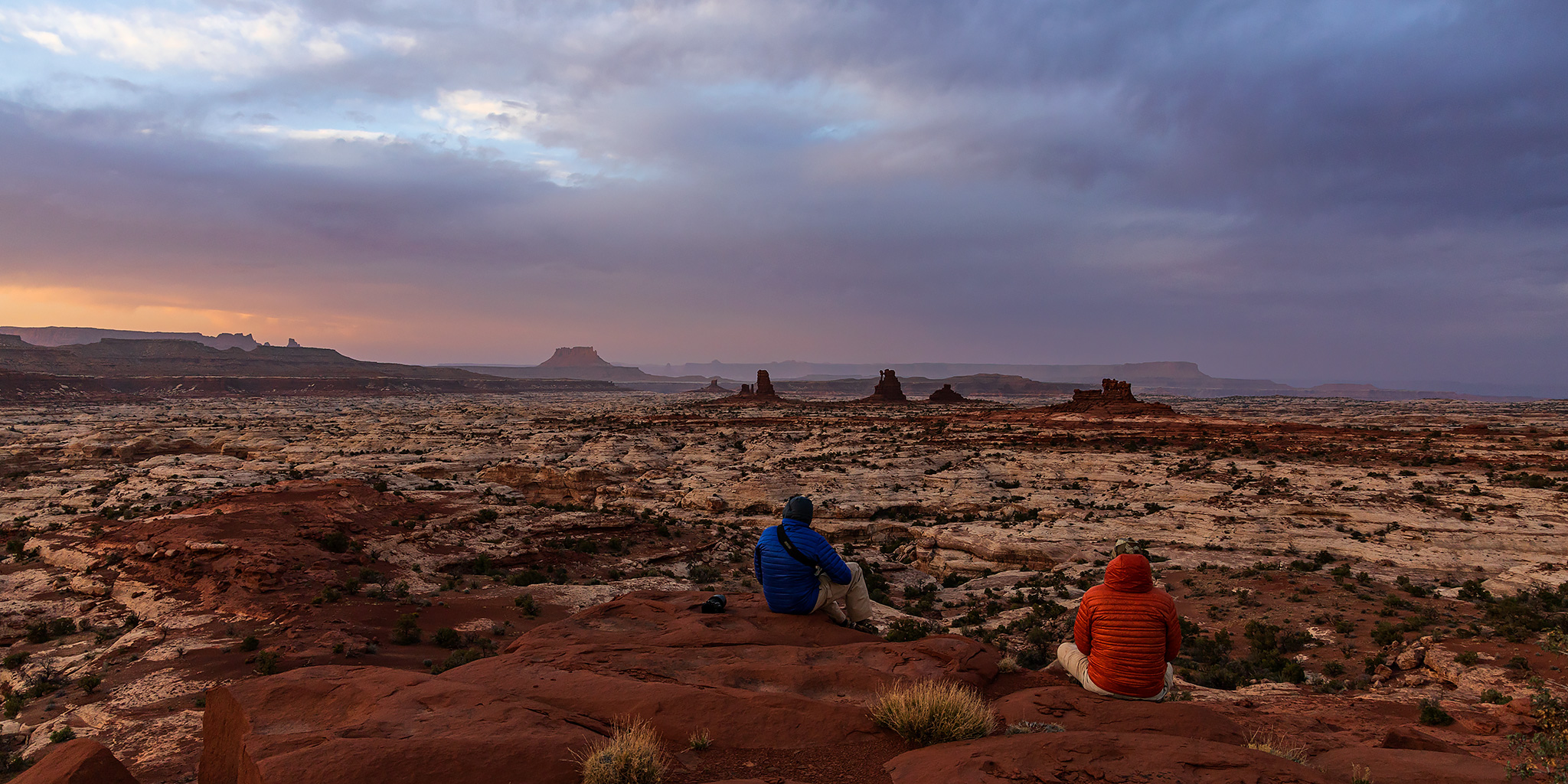
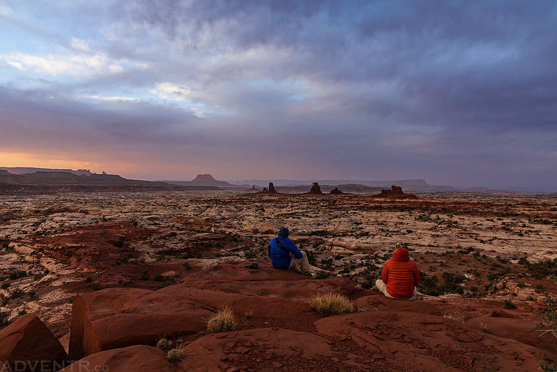
Back at camp we watched another sunset over Canyonlands from Chimney Rock.
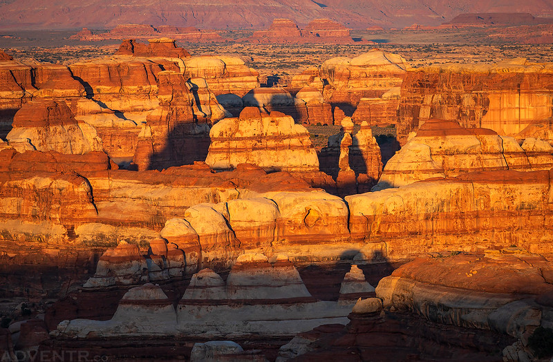
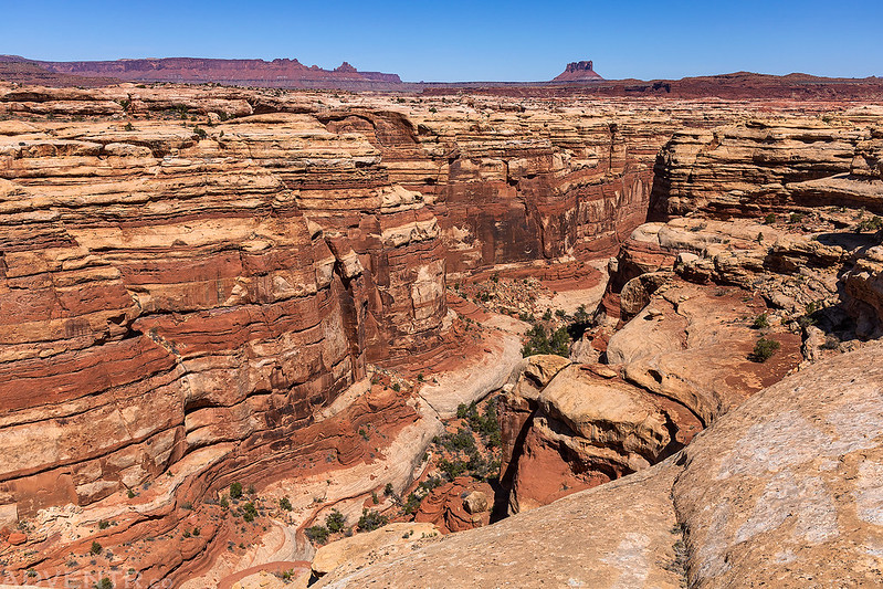
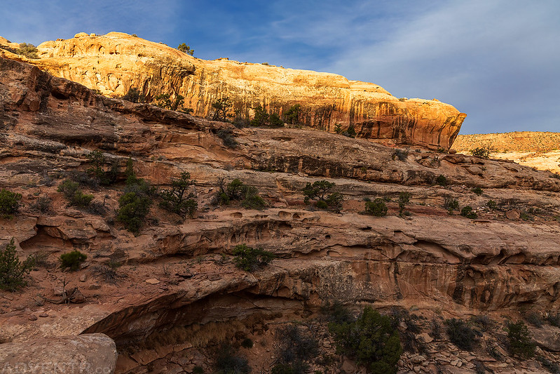
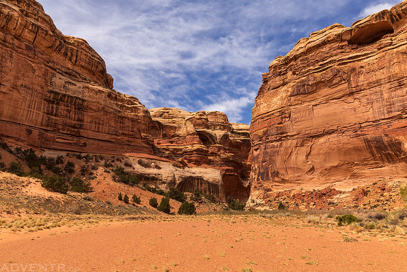
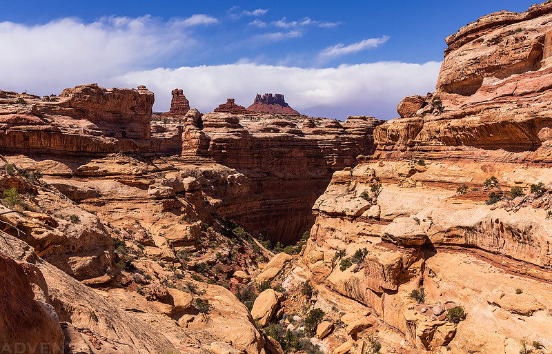
Wilderness of Stone
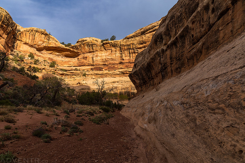
Water Canyon & Shot Canyon Loop
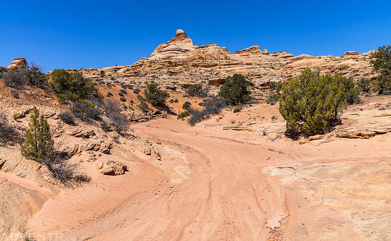
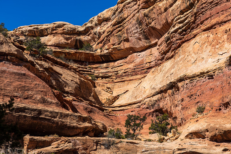
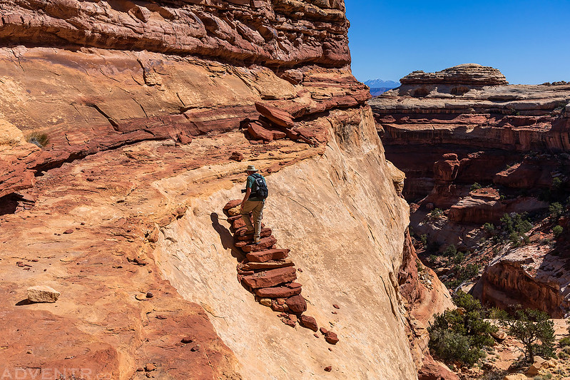
On Friday we were looking for a shorter and easier hike to do since our planned hike for Saturday was going to be a pretty long one. Even though we had forgone our plans to hike into Water Canyon the previous day, we decided to give it another shot this morning and hoped we would be able to find the way in. Since we would be spending the next two nights at The Wall Camp, we packed up our camp at Chimney Rock first thing and then moved our Jeeps over to the trailhead before starting the hike. This time we did find the correct route that was marked by cairns and started the descent into Water Canyon. There was a section of ledge-crawling and some very steep slickrock friction-pitches along the way, but the worst part was a steep climbing ledge near the bottom. At first I thought I was not going to be able to climb down this part and would have to return the way I came, but in the end I managed to make it down this tricky section. From that point on it was an easy walk down the canyon, over the divide into Shot Canyon and then back up to the trailhead by lunchtime.
Elaterite Butte Morning #2
Chocolate Bars
This would be our last morning near Chimney Rock.

Following the ledge as we started our descent into Water Canyon.
Canyon Stripes

Dave following the Water Canyon Route.

Jared at the bottom of the trickiest section of the descent.

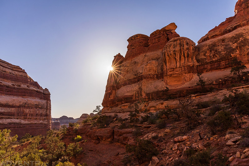
Water Canyon Sunstar
An arch in Water Canyon that Jared spotted.

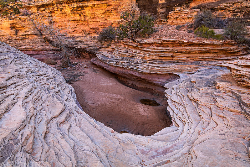
A little pour-over along the way.
Water Canyon Reflection

Lower Jump of Water Canyon
Hiking through the chute on the way to Shot Canyon.

On top of the divide between Water Canyon and Shot Canyon.
Thieves Cache Arch

Starting our hike back up Shot Canyon.
Shot Canyon Sunstar

Shot Canyon Stripes

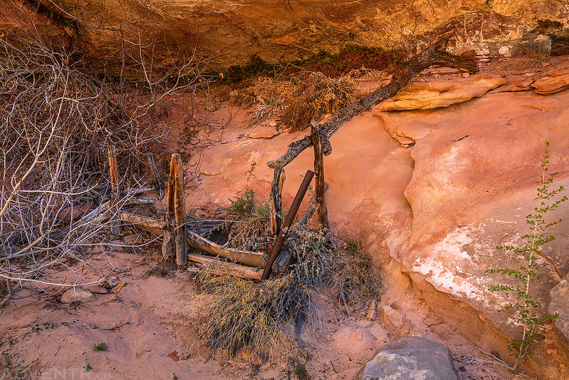
The remains of the constructed trail out of Shot Canyon.
Jared walking up the stone steps.
On our way back to Chimney Rock we walked near the edge of upper Jasper Canyon.
After returning to Chimney Rock we drove over to our next campsite at The Wall, had some lunch and then just rested around camp the remainder of the day. Well, except for Jared, he went wandering around the rim of the South Fork of Horse Canyon for a while. We stayed out of the sun by sitting in the shade of my Jeep and thankfully there was just enough of a breeze to keep the no-see-ums away. After dinner the breeze died down a bit and the gnats became annoying again. I went for a walk around camp at sunset and climbed up to a highpoint for a better view, even though it was pretty hazy out this evening. We all went to bed early again since we had a long hike ahead of us on Saturday, which was also going to be the warmest day of the trip!
The Wall Camp

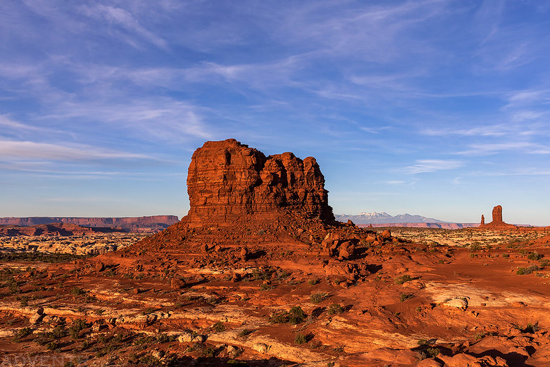
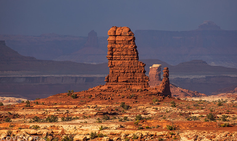
Standing Rocks Evening
From the top of the highpoint I had a view of Tibbett Arch to the south.
A distant view of Chimney Rock and the La Sal Mountains.

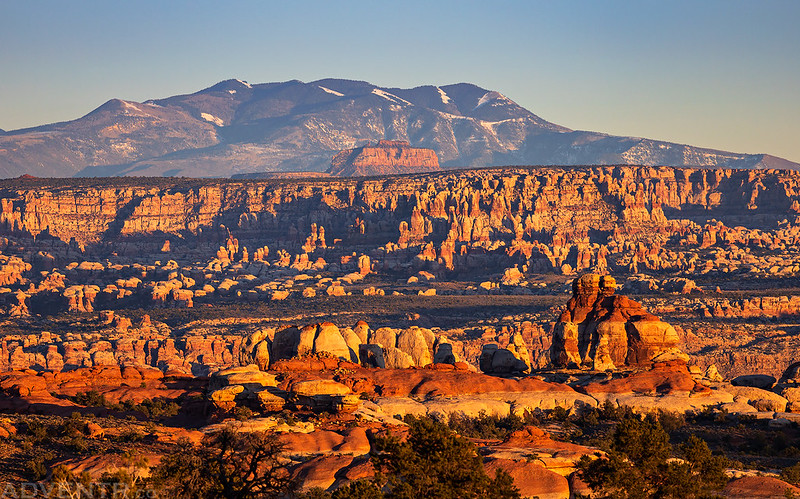
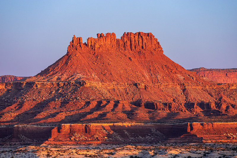
Butte & Spires

Another beautiful evening in Canyonlands!


South Fork of Horse Canyon to The Plug
This was the first night of the trip that I did not sleep well at all, mostly because the wind started to pick up overnight and was pretty loud. There was a nice sunrise this morning as Dave and I ran the shuttle for our long loop hike combining the South Fork of Horse Canyon, Pictograph Fork and The Plug Route. We dropped my Jeep off at the trailhead near The Plug and then drove back and started our hike at the head of the South Fork. There was a little nice light on the canyon rim as we started our descent into the canyon, but soon after reaching the floor of the canyon the sky became mostly overcast until we neared Pictograph Fork.
Dave coming to pick me up from The Plug Trailhead.

The Plug
Just another morning view of Elaterite Butte over The Maze.

The view as we started our hike to the South Fork of Horse Canyon.

Following the route down into the South Fork.

Rim Light
The upper South Fork was a nice looking canyon.

Once we made it to the canyon bottom it was easy hiking the rest of the way to Pictograph Fork.


Single Flush Arch


Down below Brimhall Point and the Maze Overlook Trail.

The light was harsh when we reached the Harvest Scene, and since I’ve already been here a few times in better light I didn’t bother taking any photos this time. From this point on the hiking was a bit of a sand-slog up Pictograph Fork to The Plug Route, but the clouds were finally clearing which made for some great scenes in this beautiful section of the canyon. With the sun back out it also warmed up quite a bit and the wind really picked up again and was blowing sand around at times.


Following the steep route out of the canyon between Lizard Rock and The Plug.
When we reached my Jeep at the trailhead my GPS recorded the hike at about 18 miles. We picked up Dave’s Jeep and then returned to our campsite for the rest of the evening. The Wall Camp is located up on a ridge and is completely exposed with no protection from the wind, so the gusts were very strong!
A windy afternoon view from back at camp.

My Jeep made a decent wind-block to help keep us out of the wind.

Here’s a little sample of the wind at camp. Dave’s tent did survive the night, although we weren’t sure if it was going to make it at times…
Canyonlands Light & Layers
Shortly before sunset the wind shifted directions and filled the air with smoke from somewhere. We are still not sure where it came from, but you could certainly smell it!
We enjoyed a final sunset from a highpoint near camp in the Land of Standing Rocks!
Leaving The Maze
Although the wind did calm down a bit overnight, it still stayed pretty strong and I’m not sure how Dave was able to sleep through it? I’m glad I had earplugs with me and used them! I was hoping to photograph one last sunrise before we left, but there were too many clouds to the east and it never happened. Sunday was just our day to drive back home, so we didn’t make any extra stops along the way and I didn’t take many photos. Since the Flint Trail was pretty rough and bumpy on our way in, we both decided it would be more comfortable to drive out via Hite this time, and it was.
Leaving the Land of Standing Rocks
The Mother and Child
Driving around the head of Teapot Canyon.
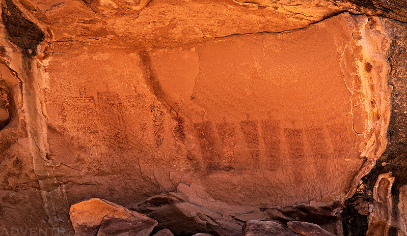
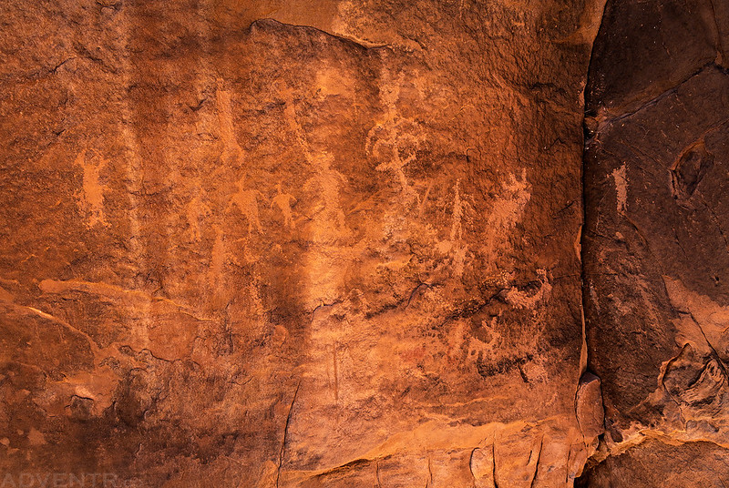
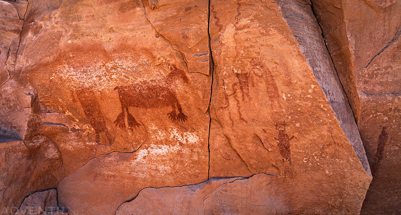
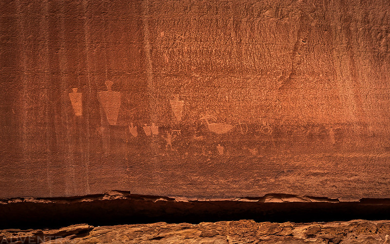
Rock Art of The Maze
During our hikes in The Maze we revisited a couple of rock art sites and found a couple of new ones, too. Here are some photos of the pictographs and petroglyphs we saw along the way.


Canyonlands National Park Favorite Jeep Roads & Hiking Trails
There is one final personal note I’d like to add to this Trip Report about the guidebook Canyonlands National Park Favorite Jeep Roads & Hiking Trails written by David Day, which has been one of my favorites over the years. While I have quite a few hiking guidebooks in my library that I use all the time and have hiked many trails from, I don’t believe that I have ever completed every trail in any of them …until now! After this trip I have now hiked every single trail in this guidebook to Canyonlands National Park, and while there are still many, many places in Canyonlands that I want to explore, this is an accomplishment that I’m pretty proud of!


As always, nice report and beautiful pictures. We are thing about going to The Maze in October this year.
Hello,
My name is Brad Peterson. I’m a professional photographer and utah outdoor enthusiast. I love your blog btw. You have done a fantastic job! WOW!! If you’d ever like to hook up on the trails, I’d be more than happy and willing! I’m somewhere in Utah deserts every other week for about a week at a time. I drive a 2017 Toyota Tacoma, and I’m working on documenting for a future publication book of Rock art in Utah, and more specifically in the Range Creek area. I hope to be soon working with Ed hemlick, Price native, and author of two publications on San Rafael Swell and 9 mile canyon. I’m always up for adventure. I hope to here from you If not, perhaps our paths will cross some time!
Best
Brad Peterson
Awesome photos, and congrats on completing all the hikes in Day’s book! (that’s a lot more than I’ve done, and Canyonlands is my favorite and most-visited national park!) How hard was the Plug exit for you, compared to other exits in the Maze? I’ve done several of the others (Shot Canyon, SE Fork Picto Canyon, Pete’s Mesa Route, Sweet Alice to Standing Rock, etc) and am considering doing a route next Spring with my son (his first trip to the Maze), but am concerned that the Plug exit might be too difficult for him; I have this vague impression that it is harder than many of the others.
I didn’t find The Plug exit any more difficult than any other routes in the Maze. It seemed pretty standard for the area and I didn’t find it difficult at all, other than me being tired at the end of a long hike that day.
Thanks!