From the Muddy Mountains to the Red Mountains
Friday – Monday, January 17-20, 2020
Back a few months ago when I started thinking about where I wanted to go during this extended weekend, I figured I would probably head over to The Needles or Cedar Mesa, like I usually do. However, as the holiday weekend got closer I realized there was probably going to be too much snow on the ground for any hiking I would like to do there, plus we had been stuck under an inversion in Grand Junction with cold temperatures and gray skies for a while, so I thought it would be nice to head down to the Mojave Desert between St. George and Las Vegas so I could warm up and get my annual Mojave fix instead. Late last year I had invited my friend Jerry to join me this weekend and when I informed him about the last minute change of plans it seemed that he was looking forward to getting into some warmer weather for a few days, too.
I left right after work on Friday evening and headed straight down to St. George where I met up with Jerry. We grabbed a late dinner and then finished driving to the Muddy Mountains in Nevada, not far from Las Vegas. We found a place to camp near the Buffington Pockets and quickly went to bed since it had been a long drive and was getting pretty late when we arrived.
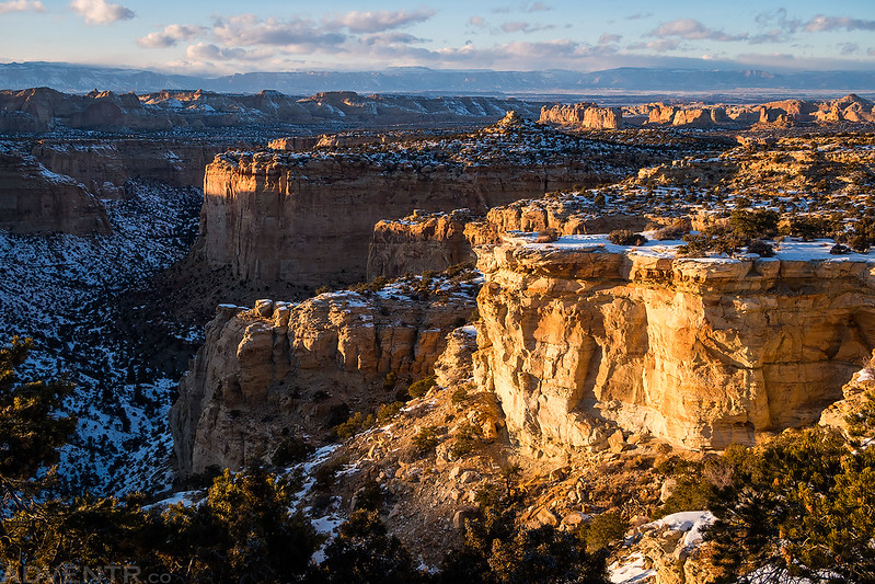
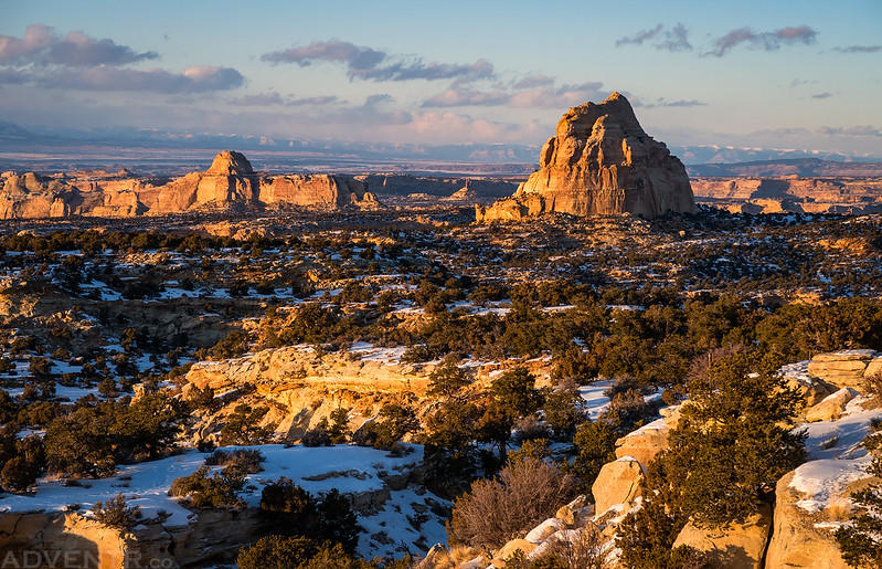
Since I was driving over the top of the San Rafael Swell just before sunset on Friday, I stopped for a couple quick photos from the edge of the South Fork of Coal Wash.
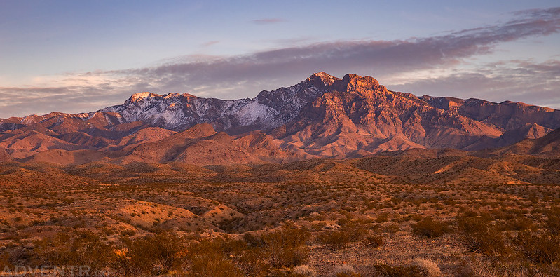
Even though I didn’t get much sleep, I still woke up to watch the sunrise from camp on Saturday morning. The temperature overnight never dropped below 40 degrees which was a welcome change from home. The thin clouds in the sky turned magenta and we were able to see all the way to Mount Charleston on the distant horizon, which is located northwest of Las Vegas. We went on a short loop hike around camp and then packed up and headed out on our adventures for the day.
Our first view from camp at the foot of the Muddy Mountains in the soft morning light.

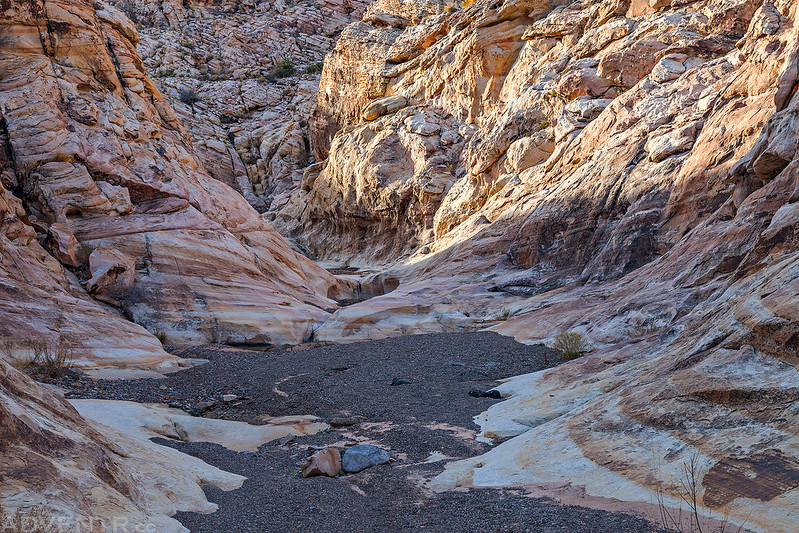
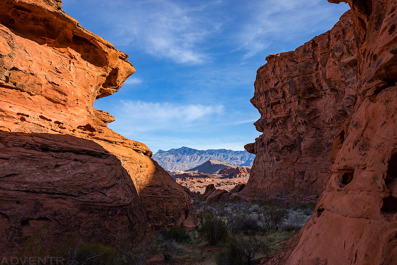
We wandered around the shallow sandstone canyons of the Buffington Pockets for a little while.


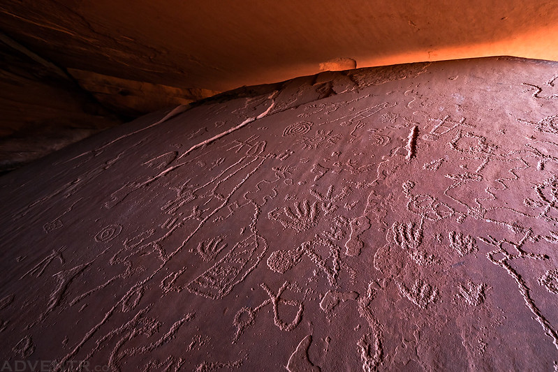
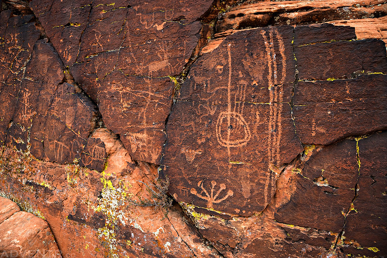
We stumbled upon this nice panel of petroglyphs.
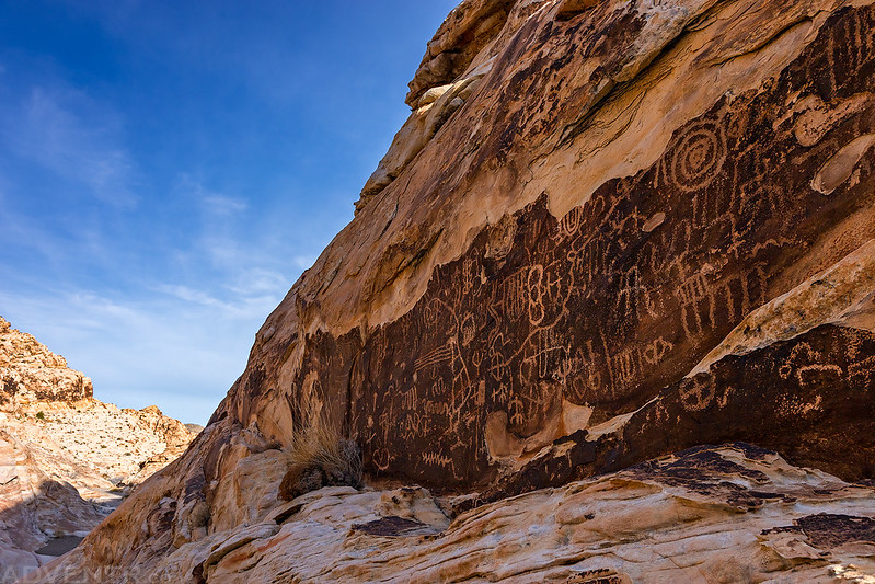

There were a few other smaller and faded panels nearby.

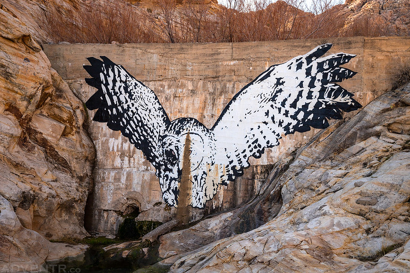
Dam Owl
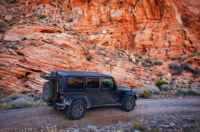
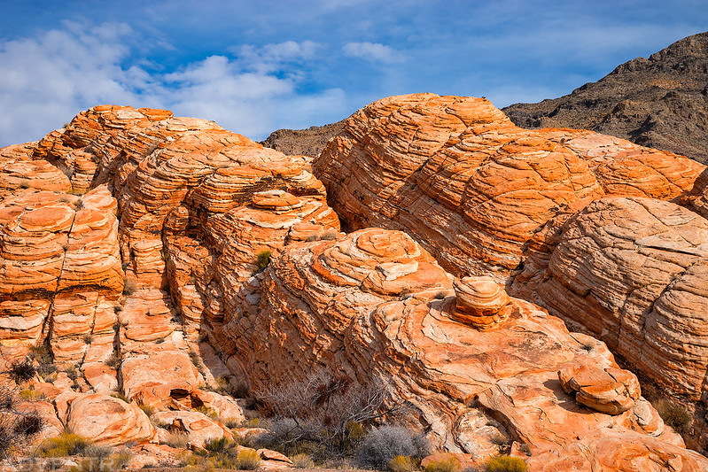
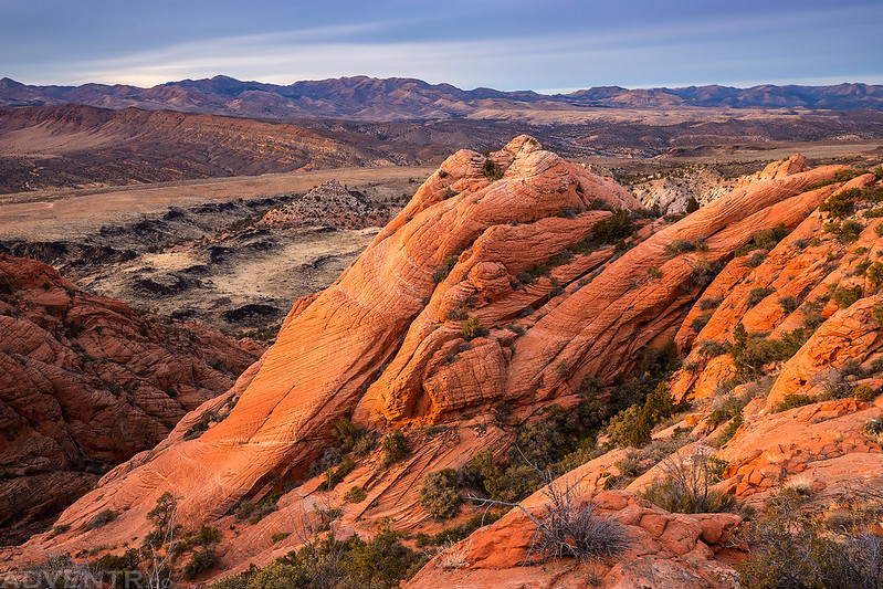
We passed some very colorful sandstone as we drove the Bitter Springs Backcountry Byway through the Muddy Mountains.
Someone put a lot of effort into creating this metal sign at the trailhead.

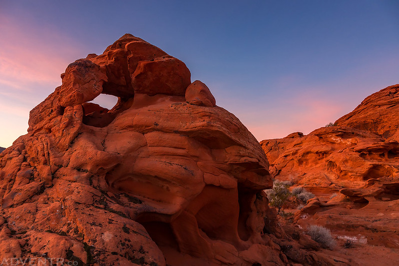
Hidden Valley Arch

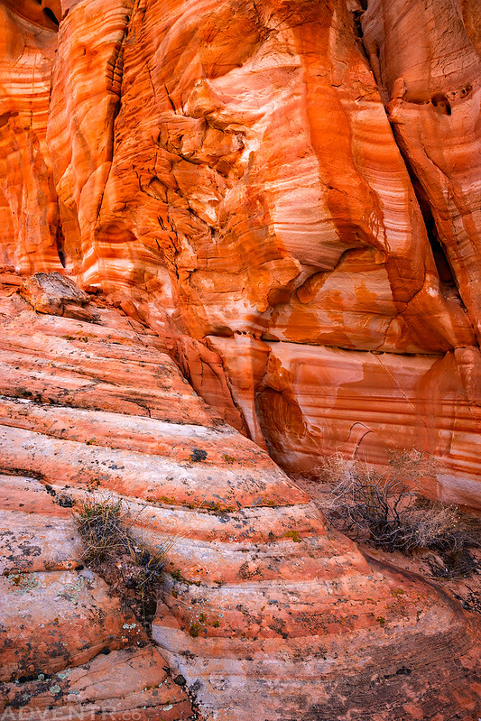
This pocket of colorful sandstone in Hidden Valley caught our attention, so we made sure to hike right through it.

Little Alcove Rock


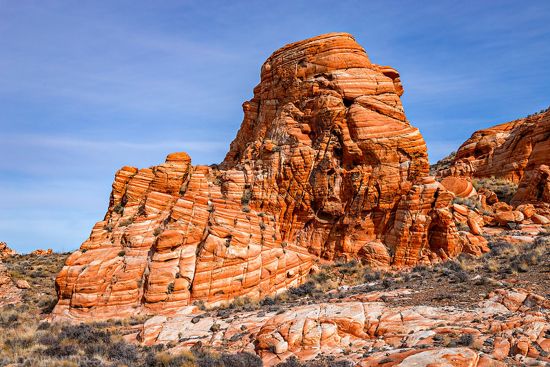
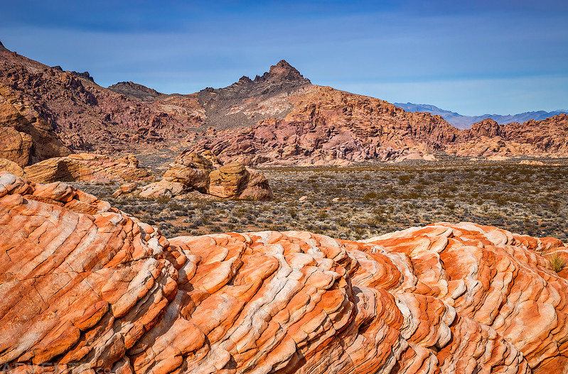
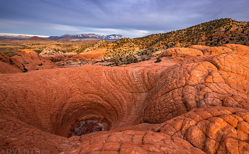
Next, we came to another large sandstone pocket that reminded me of a smaller and more colorful version of the Escalante Volcano.
I followed the colorful sandstone to the top of the outcrop.

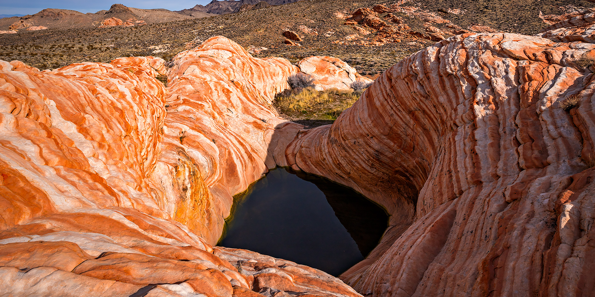
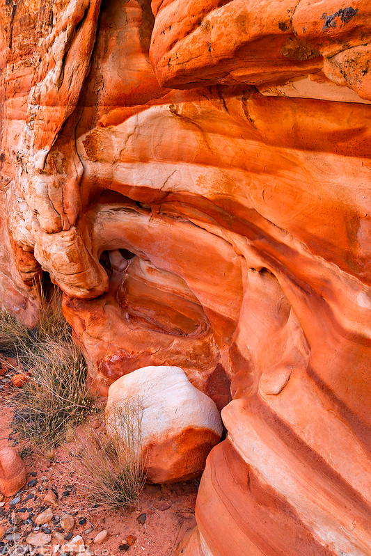
That’s where I found this hidden tinaja in the colorful striped sandstone.

The colors were amazing! It sort of reminded me of The Wave.
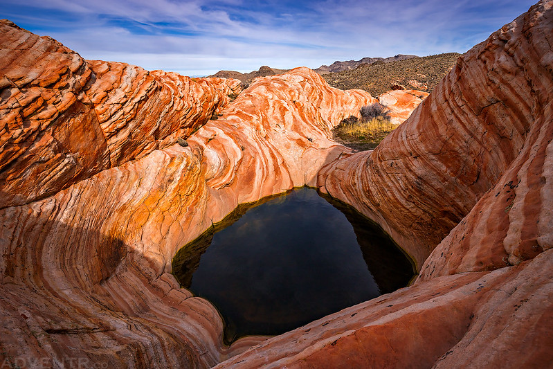
Sandstone Tinaja

Hidden Valley View
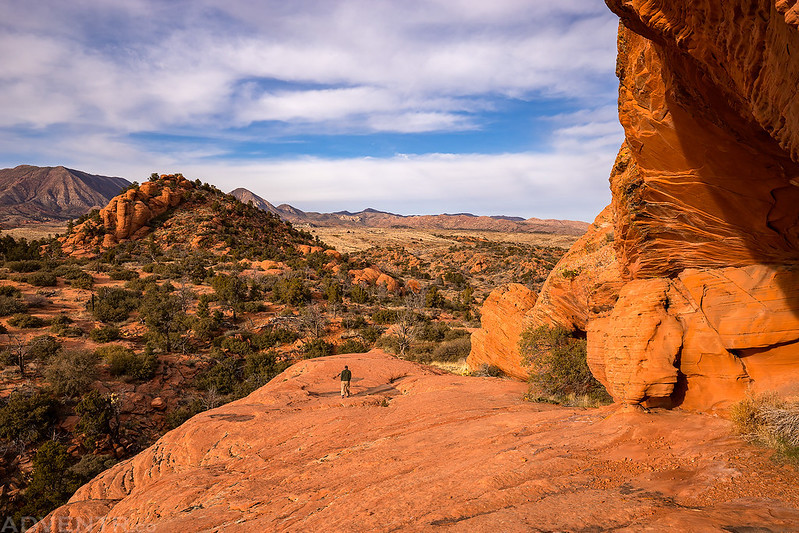
After a beautiful afternoon exploring Hidden Valley in temperatures that were in the upper 50’s, it was time to head back out to the highway and make our way back towards Mesquite.

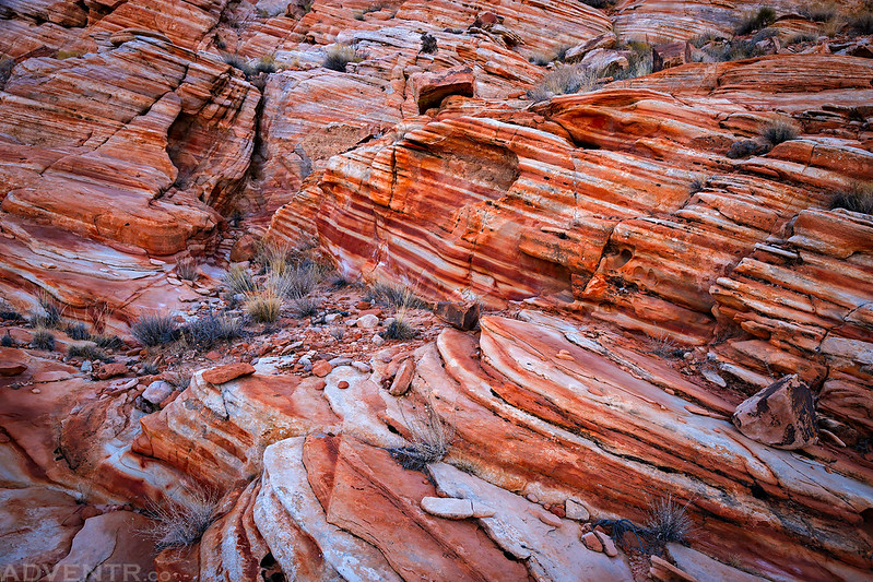
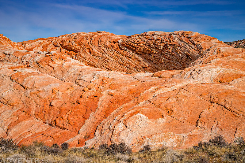
There are a few nice pockets of colorful sandstone along the rough road.
After a quick dinner in Mesquite, we found ourselves driving into Gold Butte National Monument at sunset with a nice view of the Virgin Mountains off to the east. We continued driving in the dark until we found a nice place to camp near Mud Wash.
On Sunday morning we woke up before sunrise again and I wandered around camp taking a few photos of the alpenglow on the sandstone. Then we packed up and spent the rest of the morning searching for a few new rock art sites and revisiting a couple of others.
Morning view from our campsite in Gold Butte National Monument.

Just a small arch near camp.
Warm morning light on Bitter Ridge.

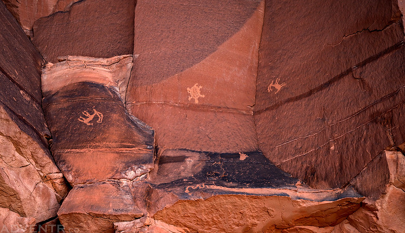
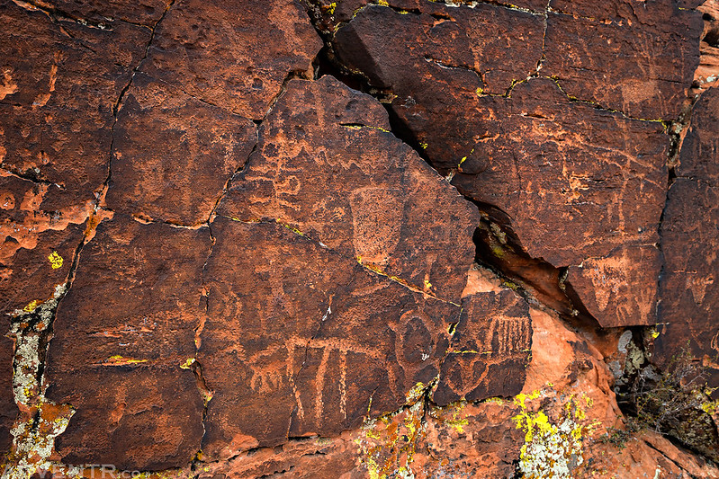
The first panel of petroglyphs we visited this morning.

While not a dense panel of petroglyphs, I liked this one because of the unusual figures found here. While I have seen upside down anthropomorphs before, I can’t recall seeing upside down sheep before? There’s also a turtle figure in the middle with a foot below that and a snake that is hard to see at the very bottom.
We found this boulder at the entrance of a short slot canyon.

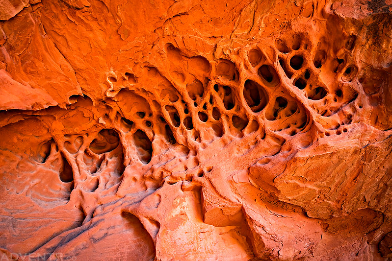
Web of Tafoni
While looking around for other possible petroglyphs in the area I spotted this arch.

Not a bad view…
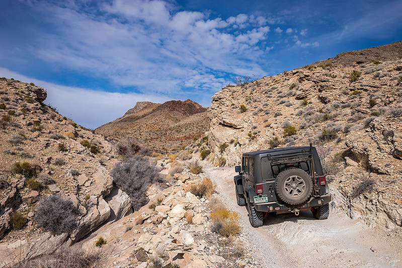
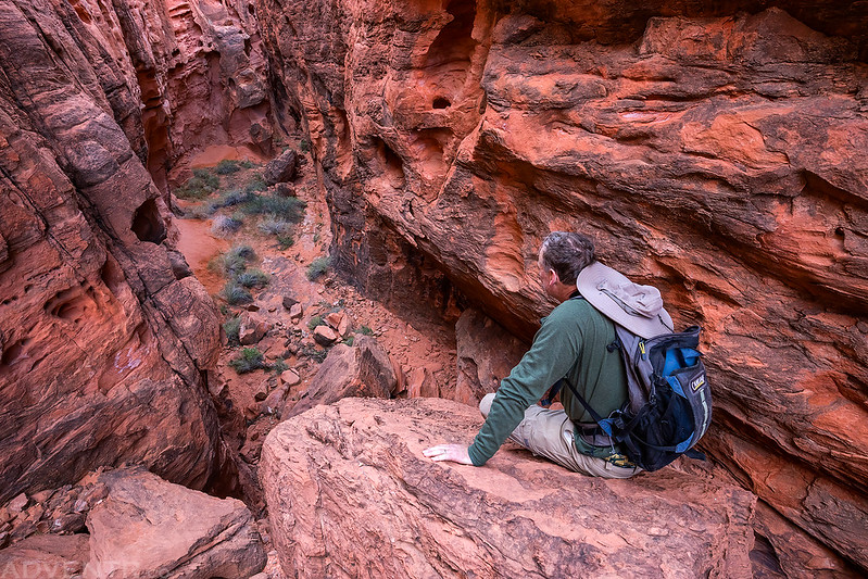
We were trying to find a way down this canyon, but got stopped by a large pour-over and had to find another way around.
The Dark Panel

Kirk’s Grotto

I loved the warm glow behind this large boulder covered in petroglyphs.

Here’s another petroglyph panel I had missed before on the side of a large boulder.

As we were leaving Gold Butte National Monument in the afternoon on our way back to Utah, we made one more quick stop at the CCC Dam near Whitney Pockets. I had seen the sign for it and driven by many times before, but never bothered to stop until now.

After grabbing some dinner in St. George we headed out in the late afternoon to find the Naming Cave. I had hoped to visit this location last year with Diane, but the road was washed out then.
Patina Sheep

The Naming Cave Petroglyphs
By now it was getting late, but I hoped we would have enough time to get over to The Vortex (The Bowl) in the Red Mountain Wilderness before sunset. We quickly drove to the trailhead and started hiking to the top of the ridge. Just as we arrived at The Vortex the sun briefly came out for a few minutes, but then it disappeared for the rest of the evening behind clouds.
The Vortex with the Pine Valley Mountains and Veyo Volcano in the distance.
View from the edge of the Red Mountains.

We waited on the to of the ridge until after sunset to see if the sky would light up with any color, but it was a bust this evening. We hiked down in the dark and then drove back to spend the night at a campsite we had passed earlier in the evening.

Monday morning we slept in a little later and woke up with the sunrise. We packed up and then made our way over to the eastern edge of Snow Canyon State Park. I hoped to hike to a few petroglyph panels in the area before starting the long drive back home.
Since I had never been to or even seen Snow Canyon before, first we stopped at an overlook so I could check it out from above.

Snow Canyon Cliffs

The we started our hike in the park in search of a couple petroglyph panels.

The first petroglyph site was on a prominent wall overlooking the canyons below.
Then we visited the Sinking Ship Panel, named because the rock they are found on supposedly looks like a sinking ship, although I really didn’t see it.

Lines & Tafoni

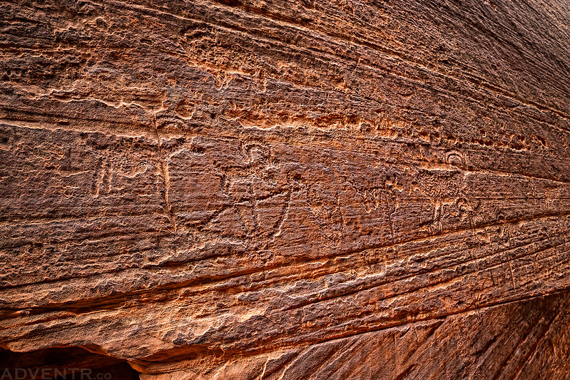
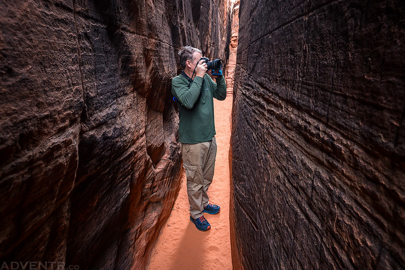
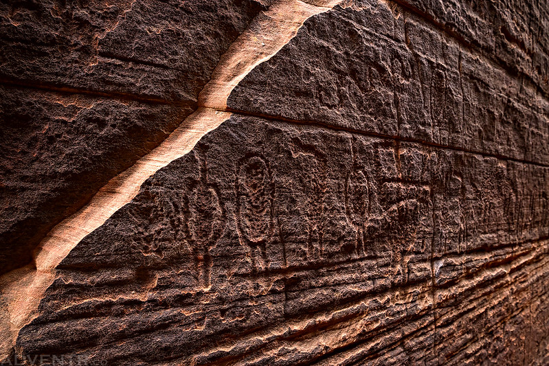
The last petroglyphs we visited today were found in this narrow slot canyon, which is definitely an unusual place to find rock art.

There were a lot of petroglyphs in the slot, but they were all pretty difficult to see.
Jerry taking photos of the petroglyphs.
As we were hiking back to the trailhead the light did come out for a few minutes, so I snapped one last photo of the landscape surrounding us.

After returning to our vehicles at the trailhead it was time to leave the Joshua Trees of the Mojave Desert behind to drive back home across the Colorado Plateau. At least I was able to hike in warmer weather for a couple of days!
That was quite a trip. Amazing ruggedness and unique sites abounding. The colors would have stunned my eyes. The rock art seems extremely old; if only we could know what they were documenting. I especially liked seeing the undulating swirls in the rock and the glyphs in the narrow canyon. If only I could be a fly on the wall as they were being carved! Living in a suburban, busy area, I long for that remote wilderness. Thank you; I always appreciate and admire your work (and play).
Wow, this post has 200+ shares on the Feedly app. Must be the wave-like formation with the tinaja, what a spectacular find.
Really fantastic pics of some spots I have never seen before. What an amazing trip.