Wednesday, October 5, 2016

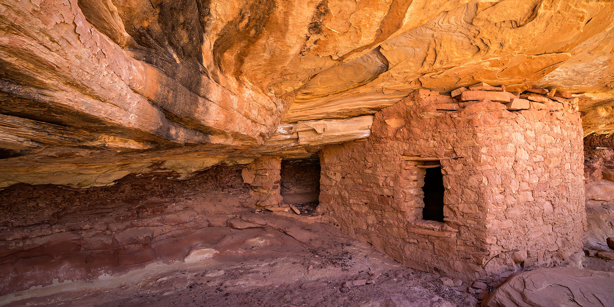
A nice little ruin hidden in Step Canyon.
On Wednesday morning Jared and I woke up with the sun, broke down camp and then hopped into my Jeep so we could drive a little further down the Mormon Trail to begin our hike. Today we would be hiking a loop starting in Step Canyon and following it down to the confluence with Pine Canyon which we then planned to hike up to complete the loop. Hiking down through Step Canyon was pretty easy with only a few obstacles that we had to get around, but as soon as we reached Pine Canyon we found that much of the canyon bottom was either full of water or slick mud and in order to get around those sections we had to deal with bushwhacking through thick vegetation. I’m sure if the canyon were dry it would have been an easy hike, but it was not too much fun today.
I was anticipating this hike being about 8-9 miles in length, but apparently I was way off on my estimate and by the time we completed the loop we ended up hiking about 13 miles and were pretty exhausted. Here are a few photos from the loop.
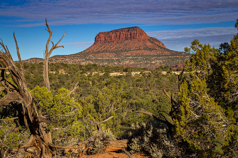
A view over to Moss Back Butte as we hiked across the top of Cedar Mesa.
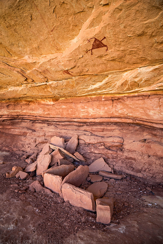
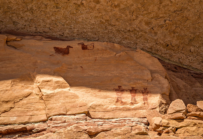
Storage cists with a couple of pictographs above. Jared spotted this pictograph from below as we hiked through the canyon.
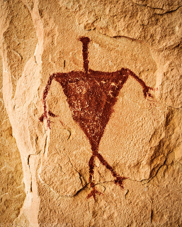
A closer look at the pictograph above the cists.
Part of a cowboy camp we came across.
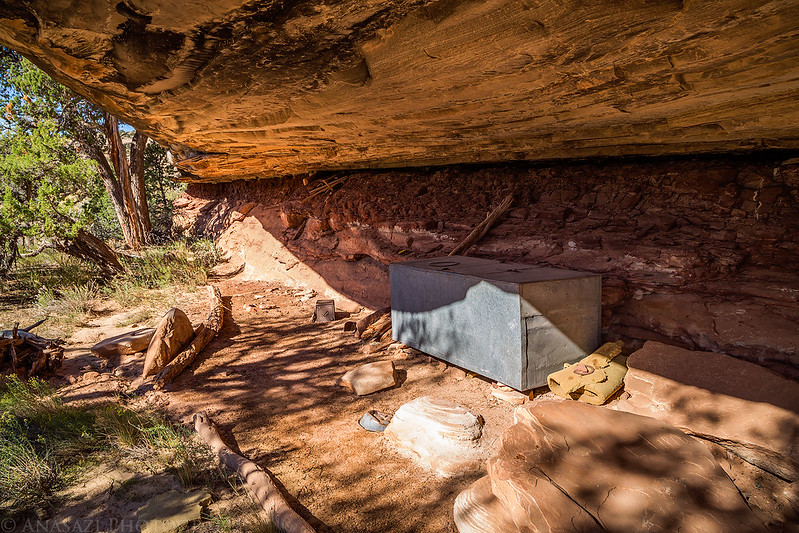
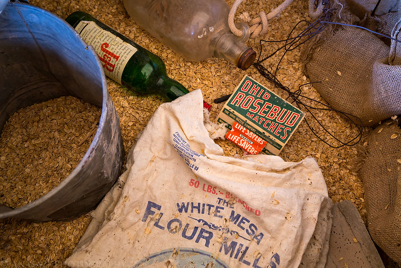
There were plenty of historic relics inside the storage box.
I spotted these colorful pictographs on the ceiling of the alcove.

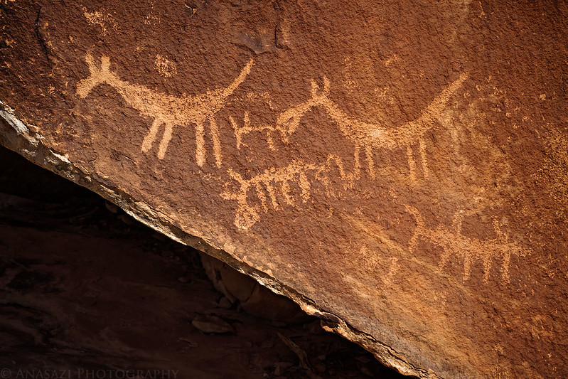
A nice panel of petroglyphs at the bottom of a large boulder.

There were a whole bunch of large corncobs at one of the sites.

There were petroglyphs scattered on many of the boulders in this area.

These petroglyphs are located on the top of a large boulder. Without a polarizing filter I would not have been able to photograph them at all.

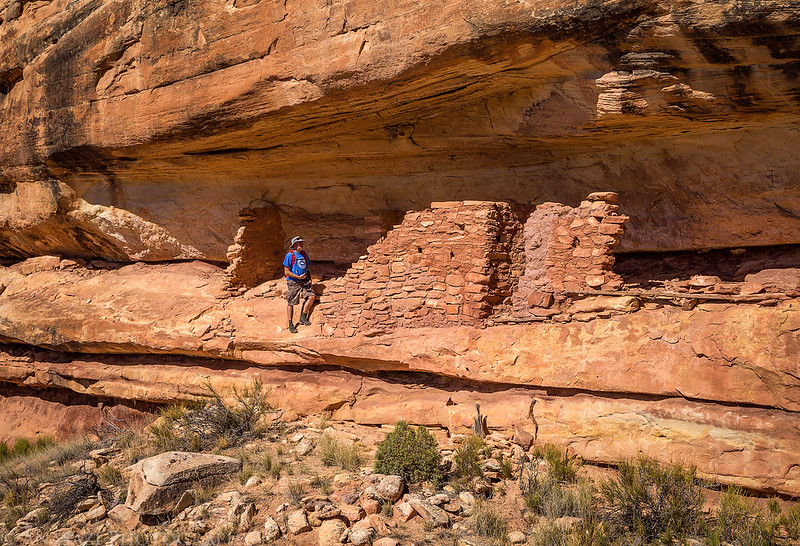
Jared explores some ruins.
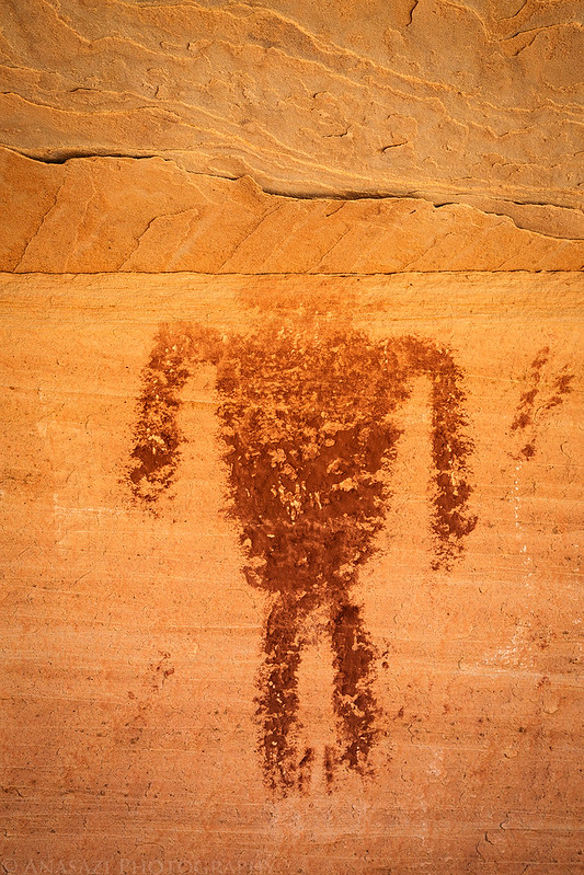
This anthropomorph seems to be missing it’s head…

Looking down into Step Canyon.

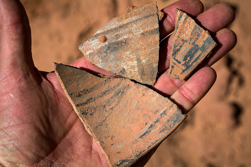
Just a few pottery sherds…
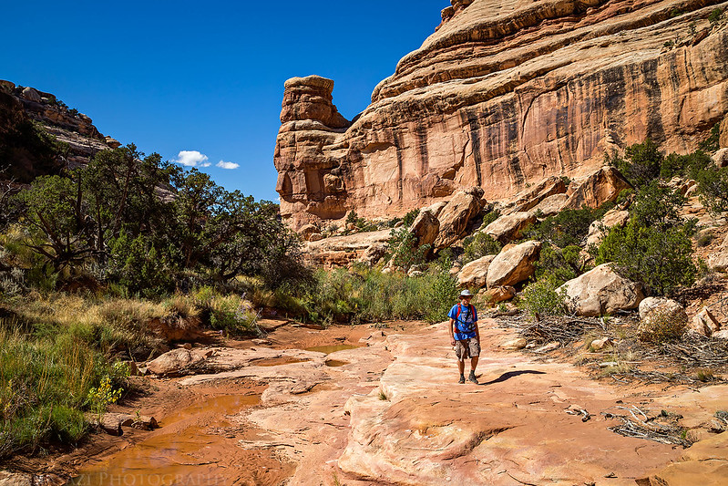
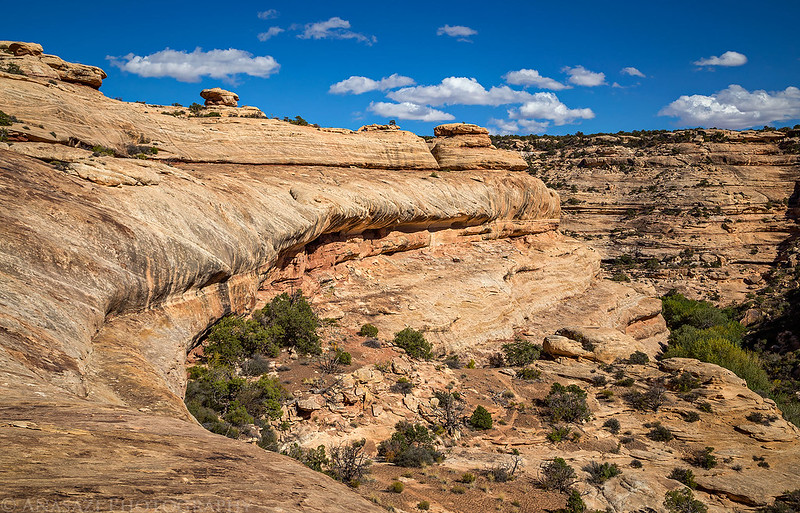
Hiking up Pine Canyon.
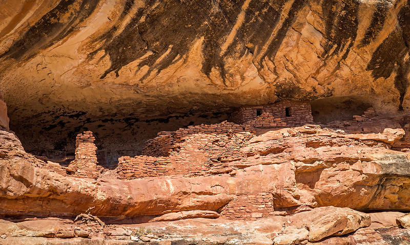
A large complex of ruins we saw but were unable to climb up to.
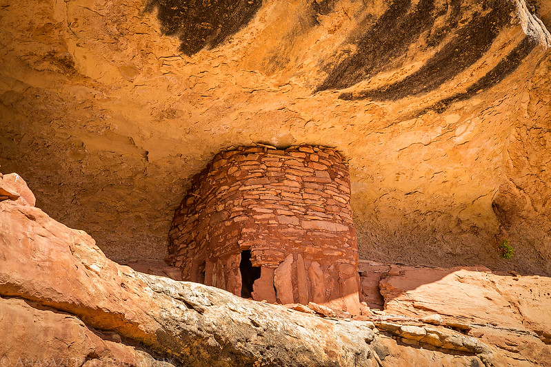
An interesting round structure built with long vertical slabs of rock at the bottom.
Climbing out of Pine Canyon to hike cross-country back to my Jeep. It was trickier than I thought it would be to find a way out of the canyon here, but after a lot of searching we managed to find a way out.
Returning back to my Jeep at the end of the hike with the Bear’s Ears in the background.

We were pretty wiped out and hungry after the hike so we drove straight to Blanding and ended up having burgers at the Patio Drive-In for dinner since they weren’t as busy as some of the other places in town (though we still had to wait in line for a while to place our orders). Our original plan for Thursday was to climb Mount Peale in the La Sal Mountains, but at this point I wasn’t feeling the greatest and suggested we find something easier around Moab to hike instead.
I had planned on camping along the La Sal Pass Road this evening since we were going to climb Mount Peale in the morning, but even though we had changed those plans it still seemed like the most convenient place to camp between Monticello and Moab this evening. We made our way to La Sal and easily found a place to camp low on the road to La Sal Pass and quickly got to sleep.
Wow, those historic artifacts in the cowboy camp look so perfectly arranged and so perfectly nostalgic that they hardly look real! Like a tableau someone would arrange in a museum or something, especially how they are all sort of sticking out of the oats. That’s really cool.
The rest of the hike looks really scenic too. Thanks for sharing. By the way, your sunset pictures from Owl Creek Pass from 1 October were spectacular!
Hey Randy,
Came across this and wanted to let you know that I was able to climb up to those ruins in Pine. There’s a Kiva up top with an intact roof, although very delicate. Some small pictographs too.
I’ve seen photos of the kiva, but unfortunately I’ll most likely never be able to see it in person with my lack of climbing abilities.
I’m wondering if you could tell me if there are any major obstacles that would prevent me from using this route as a multi-day backpack route.
Thanks for sharing your adventure. Last year I hiked from Kane, down Grand, and up and out Bullet. Great 3 day 2 night hike. I plan to continue the adventure and do the lower section this spring (probably March). My present plan is to hike down Step to Pine to Grand and out Collins ( 4 days 3 nights). Any thoughts and insights would be much appreciated.
Owen, I’ve only gone down Step to its confluence with Pine. I’ve read you can go all the way to Grand Gulch, but I can’t confirm that since I haven’t done it, so I’m not sure how easy it is. We did have to find our way around one large pouroff in Step that was a little tricky, but maybe we just didn’t find the best way?
Thank you for the reply. Unless I find a reason not to, I think I’ll try it. Will keep you posted.
Hello all. Replying here because of the comments and questions regarding feasibility of getting down to the Gulch and difficulty of finding the exit route. This thread was helpful when I was researching how to go down Step to the Gulch and then back out Pine, as it provided helpful pictures and clues. We did the trip at the end of April this year. So, quickly: you can get from the confluence of Step and Pine to the Gulch with no obstacles. Step itself has two big pour offs but they are passable without too much trouble. The upstream pouroff you pass to the Right (going down canyon), you should see the path going over the hill as you stand at the pour off. It takes you to a place where you can switchback down narrow ledges to the canyon floor. The lower second pouroff can be passed on both left or right, the right passage you work down the cliff near the pouroff, the left passage, which we took, you follow a path for 100 yards or so and find a dropoff with a short old tree propped up, we lowered our packs and then clambered down the tree, about a 6 foot drop. If heading up canyon this would be on the right, and if you find the tree or can get up that shelf you are good. Not sure how easy climbing around these pouroffs is so I would go down Step and out on Pine. On Pine, the ruin shown in the photo above with the rounded ruin is where the exit route starts. Look up at the ruin, and then up to your left to a small saddle. Author of this thread took a picture of the ruin from that direction. Go up there and you should see a worn pathway into the next rock “bowl” on the down canyon side of the ruin. Contour around to the right, you should see a small pile of rocks to help you get up to the next level. Then keep climbing up to the left to the NEXT rock bowl, where you should find a worn path out, looking up, someone built a couple of crude rock ramps so they could ride dirt bikes down? We tried the exit mentioned by Kelsey around the pouroff farther up Pine, I actually did that 20 years ago, but now, in my 60s with a full backpack, it looked absolutely terrifying. So we backtracked to the nice ruin shown and my buddies eventually found the route out.
Thanks for the info Jay!
Hi, it didn’t seem to post on the thread but I would certainly be OK if you added it. Finding your thread and a couple of the others ( just by Googling Step Canyon) was helpful to our trip. I was confident in reaching the Gulch from the confluence from looking at Google Earth as well. Thanks!