Across the Great Basin and Back | The Loneliest Road (Trip) in America
Wednesday & Thursday, September 2-3, 2020
After hiking to the summit of Wheeler Peak in Great Basin National Park on Wednesday morning, I continued my ‘Loneliest Road Trip in America‘ across the Great Basin as I drove to the west end of Nevada. My next destination would be in the White Mountains located along the eastern edge of California so that I could hike to the summit of White Mountain Peak on Thursday morning, which is the third highest mountain in California at 14,252 feet. Since it doesn’t look like I am going to be climbing any 14ers in Colorado this summer, which will be the first time in over ten years for me, I figured that I could at least hike one new 14er in California this year instead! I haven’t hiked in the mountains of California since I did Mount Whitney in 2014, so I was looking forward to returning!
The peaks of the Sierra Nevada dominated the smoky skyline as I drove into California on another lonely highway over the Lida Summit in the Silver Peak Range.

After leaving Ely and driving west across Nevada on US Route 6, I stopped in Tonopah for gas and then headed south through Goldfield to the Lida Junction where I turned right and followed the road through Lida Canyon to the Fish Lake Valley where I got my first views of the Sierra Nevada and White Mountain Peak on the horizon. From there I followed the winding road up and over Gilbert Pass into the Deep Springs Valley and drove up just past Westgard Pass to the White Mountain Road.
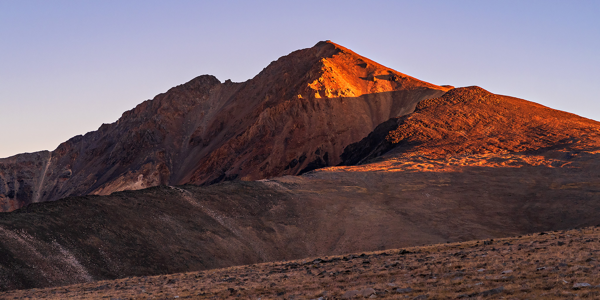
After descending into the Fish Lake Valley I got my first view of White Mountain Peak above.

From the top of Gilbert Pass there was a smoky view into Deep Springs Valley, which separates the White Mountains from the Inyo Mountains and isn’t very far from Eureka Valley located in Death Valley National Park.

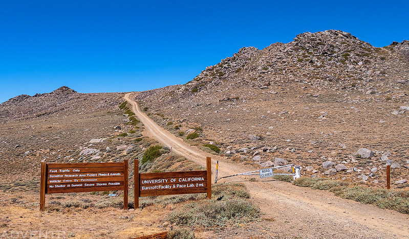
After crossing over Westgard Pass I turned onto the White Mountain Road and would follow it all the way to the locked gate at the end. I stopped at the Sierra View Overlook along the way for a smoky view over the Owens Valley to the Sierra Nevada on the other side.

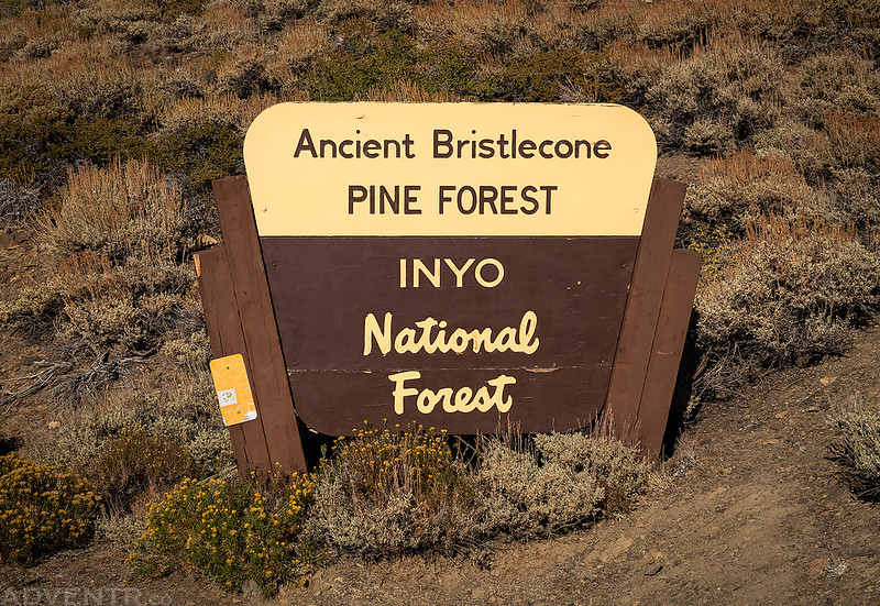
Soon I entered the Ancient Bristlecone Pine Forest, which is home to some of the oldest living organisms on Earth.
Although I was running out of daylight and the road was bumpy and slow going, I had to stop to take a few photos of these ancient trees that were near the road.
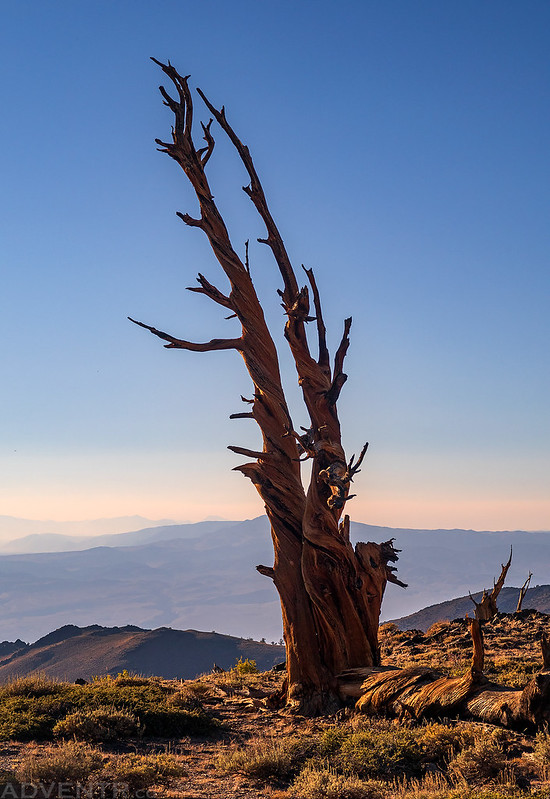
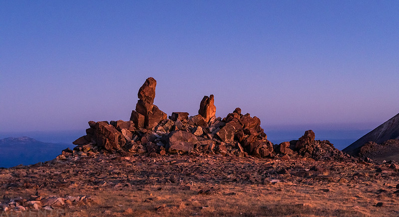
When I reached the edge of the Patriarch Grove I hiked over to a few old Bristlecone Pines on a hillside just before they were swallowed up by the evening shadows.

The Ancients


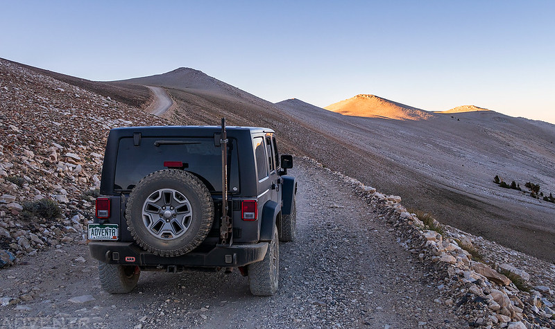
Although the road doesn’t look bad in this photo, believe me, the last few miles were very bumpy and slow going with a lot of fine dust.
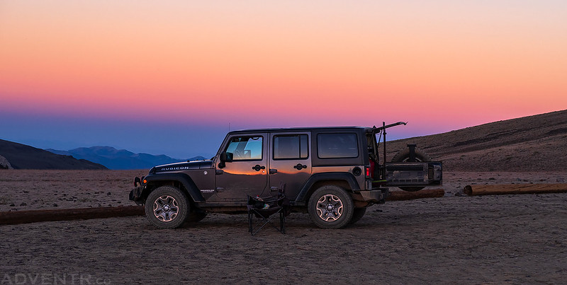
I watched the sunset while I ate my dinner at the trailhead just before the locked gate at the end of the road. There were three other people camped there for the night, but it was a big enough area to spread out in.
A beautiful evening at the White Mountain Peak Trailhead.
When the sun disappeared behind the Sierra Nevada and it started getting dark out, I went to bed early so I could get an alpine start on Thursday morning. Although I had no intentions on making it up to the summit for the sunrise, I at least wanted to get a few miles out of the way before the sun came up. I set my alarm for 4:30am but ended up getting up at 4:00am since I woke up and was feeling wide awake! I guess that’s the nice thing about the time zone change since my body still thinks it’s an hour later than it is. When I had checked the weather forecast the previous evening, they were calling for heavy smoke to move into the area overnight and I was a little worried about that. So I was happy to see that the sky was pretty clear when I looked outside and saw that they were wrong about the the smoke, at least at this elevation.
While I was sitting in my Jeep putting in my contacts, one of the two girls who were camped across the way knocked on the window of my Jeep and needed my help getting into her bear canister. Apparently the pressure from the elevation had changed and no one that was around could get it open. All of their food was in there and they needed to get inside, so she wanted to know if I had a hammer or any tools that we could use to break into it. Lucky for her, I carry a bunch of tools in my Jeep since I never know what I’m going to need to fix when I’m out travelling alone into remote places. Let me tell you, breaking into a bear canister is no easy feat! The little sledge hammer I had did nothing on its own, so we ended up having to cut open the lid using a little saw I use to cut through large tree branches, and then we still needed to use the hammer and a pry bar to finally get the lid off the top. They had their food, but the bear canister was completely destroyed!
Needless to say, breaking into the bear canister delayed my hiking a little bit, so I’m glad I woke up earlier than I had planned. I ended up starting the hike around 4:45am under the light of the full Corn Moon, which was bright enough that I didn’t even need to use my headlamp. It was a great morning for a hike in the mountains!
It was too dark out for me to take photos during the first few miles of the hike, but once it started getting lighter out I got my camera out.
I love watching the Earth’s Shadow move across the sky when I am hiking high in the mountains.

The colors were interesting with all the smoke in the air.

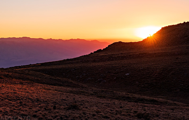
First Light on White Mountain Peak

Mount Tom
White Mountain Peak at Sunrise

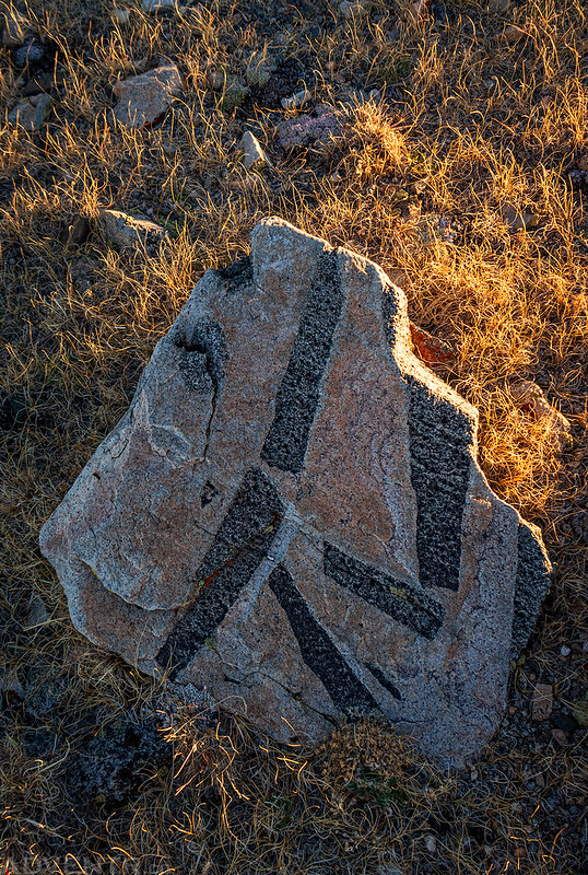
I thought this was an interesting looking rock near the trail.
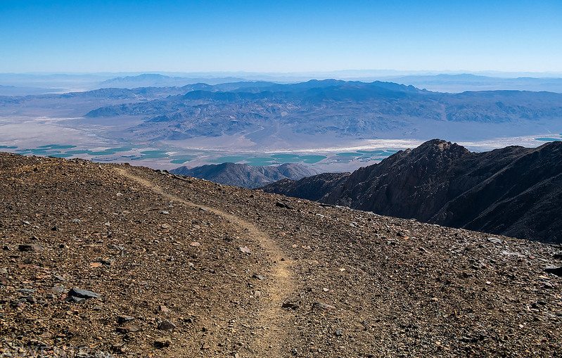
Looking up the switchbacks of the old road that leads to the summit.

A view from the edge looking over Fish Lake Valley.

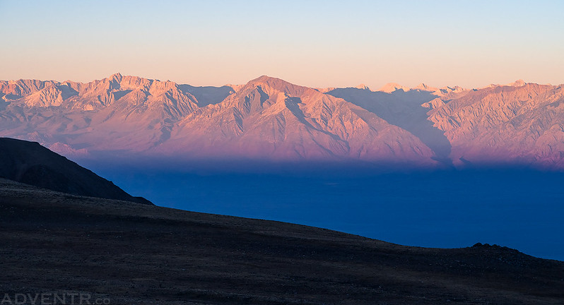
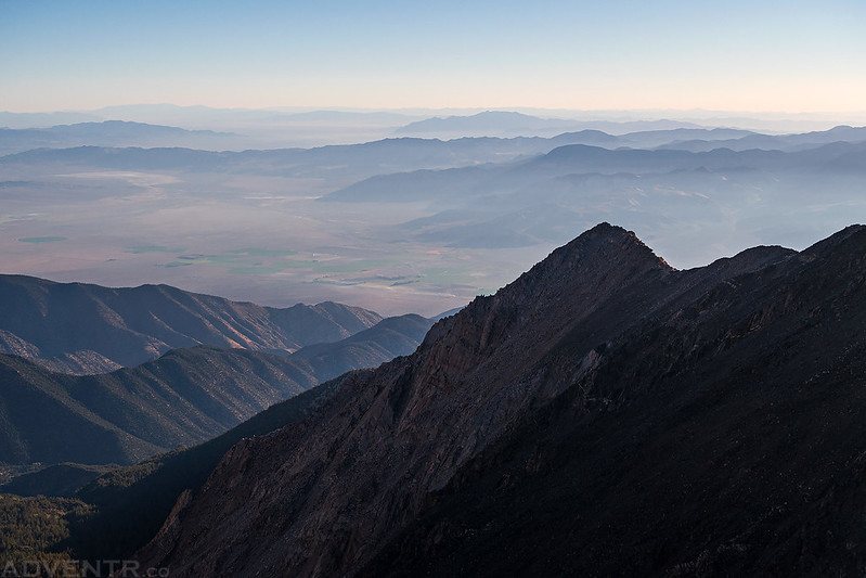
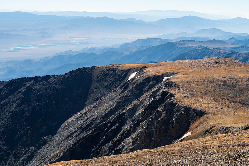
Smoky Great Basin Layers to the East

Soon I was walking over black rocks and then red rocks as I climbed higher.
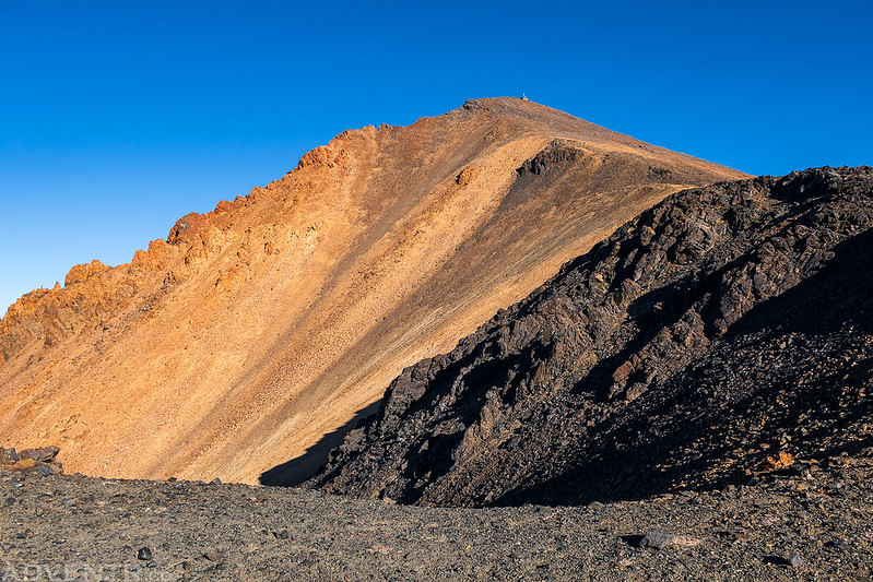
After following the switchbacks of the old rocky road I finally reached the summit!

Experiment In Progress

The White Mountain Summit Laboratory

If summit signs are your thing, there are a couple to choose from…

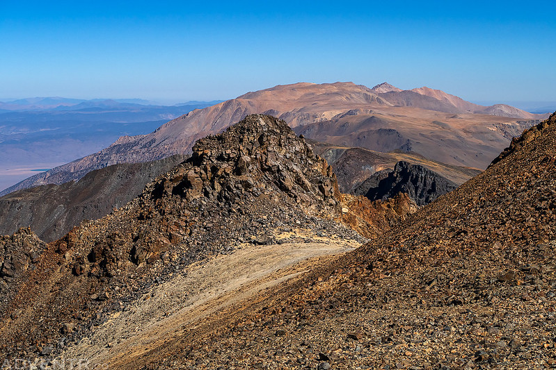
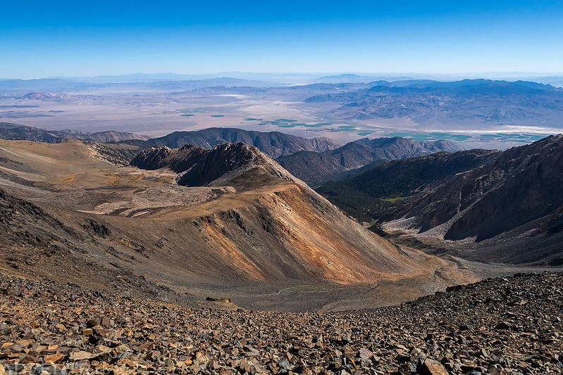
Here’s the view to the northern end of the White Mountains over Headley Peak to Montgomery Peak and Boundary Peak.

Looking to the west over the Volcanic Tableland to the Sierra Nevada.

To the south you could just barely see Telescope Peak on the horizon in Death Valley through the smoke. I’m hoping to climb that one next year sometime.

Although the smoke wasn’t too bad at this elevation, it looked like it was pretty thick down in the Owens Valley.

After having the summit to myself for a while it was time to start hiking back down.
The Edge
The colors of White Mountain Peak from this angle remind me of the three Red Mountains in Colorado.

Following the trail back down.
Another view over Fish Lake Valley from the trail.
Leaving the White Mountain Wilderness.

One last look back to White Mountain Peak as I followed the old road back to the trailhead.

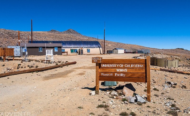
Unfortunately, there is a couple hundred feet of climbing on the way back and my legs were getting tired, so I was moving a little slow. But once I reached the Mount Barcroft Observatory it was all downhill the rest of the way.

Walking back through the White Mountain Research Facility, in the light this time.
I arrived back at the trailhead shortly after noon, where the road ends at the locked gate and the hiking begins. I saw only five other people on the trail all day, which is something that’s hard to do on any Colorado 14er in the summer!
Once back at my Jeep I drove down the bumpy White Mountain Road and then headed into Bishop for some food and gas. I then continued north on US Route 6 to the northern end of the White Mountains where I planned to hike to the summit of Boundary Peak on Friday morning, assuming my legs were up for it! I made a short detour along the way so I could revisit the Chidago Canyon Petroglyphs in the Volcanic Tablelands so I could see some ancient petroglyphs and White Mountain Peak from the west. It was a nice way to top off my visit to White Mountain Peak, even it if was over 100 degrees out down in the valley!
Chidago Canyon Petroglyphs
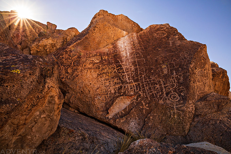

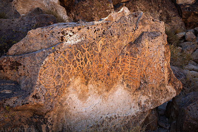
Petroglyphs & White Mountain Peak

Nice trip but I would have had to pass, to much smoke for my lungs. Great photos as always! Thanks for sharing.
Did you have the means to drill a hole in the canister to relieve the pressure and save it too?
Not as much smoke as on this trip: https://adventr.co/2018/06/highland-mary-lakes-verde-lakes/
When we cut through the lid it probably relieved the pressure, but by then I think we had messed up the threads…
Amazing!
I always enjoy your adventures. Thanks for posting.
Thanks Rob!