Friday – Monday, May 10-13, 2019 | Average CFS: 2500
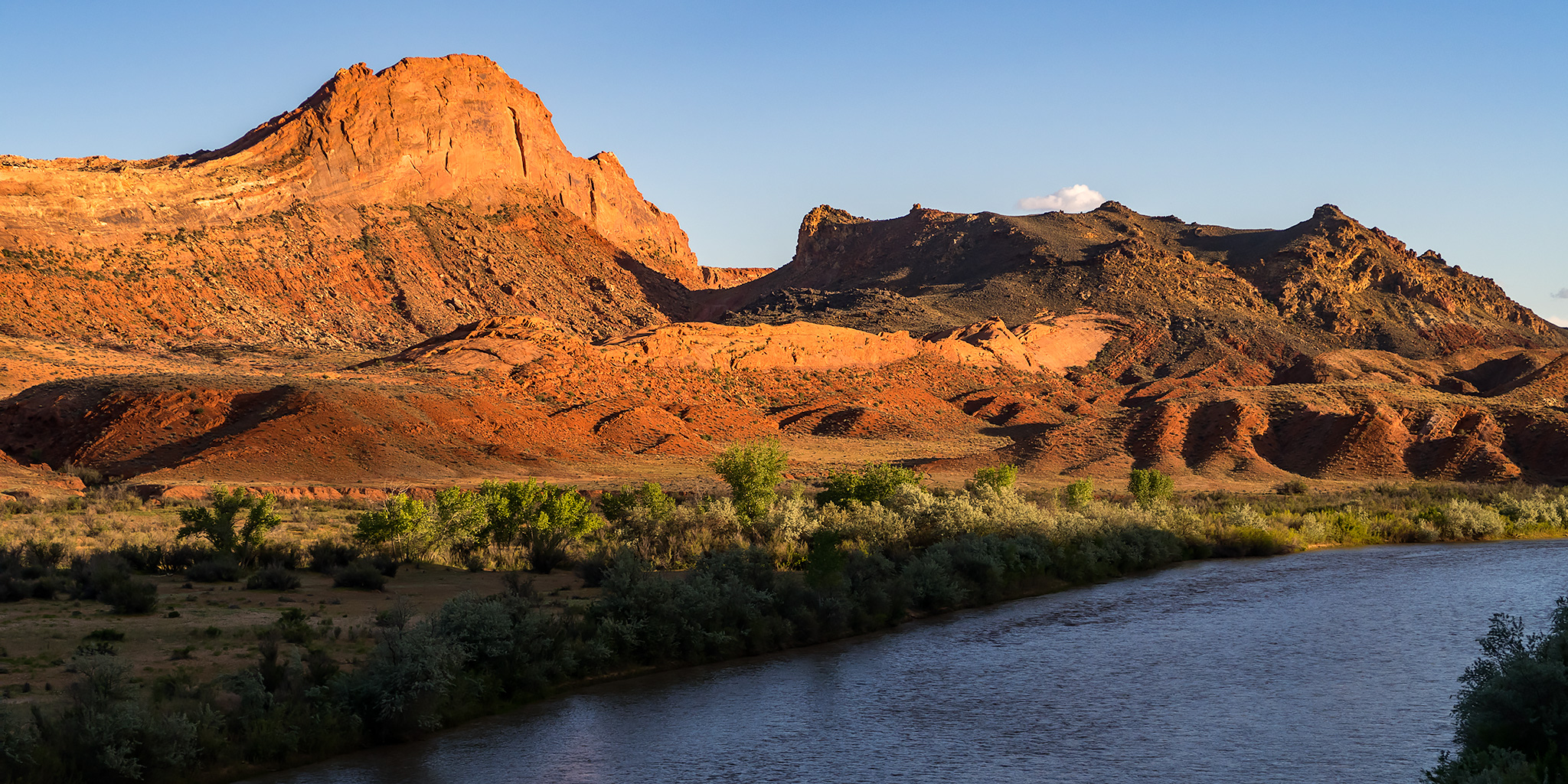
Over the years I have floated the San Juan River between Sand Island and Mexican Hat a couple of times with a small group of friends and we almost always have had a great time on this stretch of the river. I say ‘almost always‘ because the temperature was way too hot out during our last trip in 2017 and the water was moving very fast which turned out to be a bad combination for us. We ended up cutting that trip a day short and heading home early. After taking last year off for a Labyrinth Canyon trip, we decided to get a permit for the San Juan again this year to make up for that last trip. This year I was hoping for much better weather since we were going in May again, but I was still a little worried when we drove down to Bluff on Friday afternoon through rain storms and cold temperatures even though the forecast for the rest of the weekend was looking good. I certainly had my fingers crossed and hoped that the rainbow I saw as we drove over White Mesa was a good sign! And for anyone wondering, River Flowing from the Sunrise is a translation of the Ute name for the San Juan River, and I think it’s a pretty fitting one.
As usual, I left after work on Friday afternoon and this time my friend Chris rode down with me to Sand Island. Like I said above, the temperature out was pretty cool and it had been raining for most of the day around Bluff so we hoped it would stop before we got there so we could get our tents set up without them getting wet. After getting through the busy traffic in Moab, we met the rest of our group at the Sand Island Group Site that I had reserved just before sunset and thankfully the rain had stopped soon before then, although the ground was still pretty wet. After getting my tent up and figuring out our plans with the group for the following morning we all got to bed early so we could get an early start. According to the weather forecast the clouds and storms were supposed to clear up overnight, so imagine our surprise when we woke up in a thick fog on Saturday morning!
We woke up in the fog on Saturday morning at the Sand Island Campground.

We used my Jeep’s battery and a handheld electric pump to fill up the three smaller boats.

Not only was it foggy out this morning, but it was so humid out that just about everything was completely soaked through! My tent has been through heavy rainstorms and been drier afterwards than it was this morning. I basically just had to put the tent away soaking wet since there was no way to dry it and hoped that by the time we got to a campsite later in the day there would be time for it to dry out in the sun. Once we shuttled two vehicles over to Mexican Hat we finished getting our gear together and got on the river just after the fog had finally cleared up. Perfect timing!
After running the shuttle vehicles to Mexican Hat we finally got on the river just after the fog had lifted and the clouds started to clear up a bit.
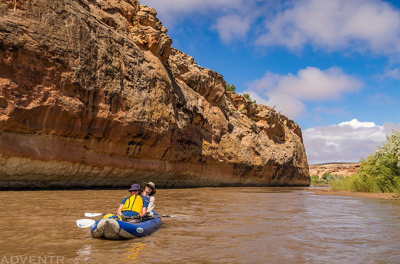
Steve and Pirie

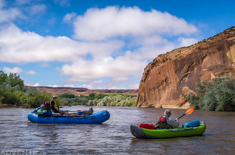
Chris in his brand new inflatable kayak.

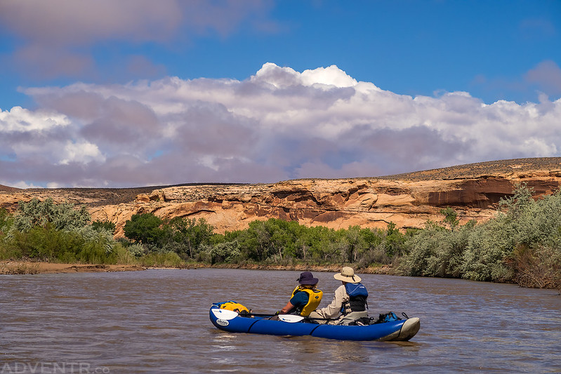
The clouds were very nice this morning.
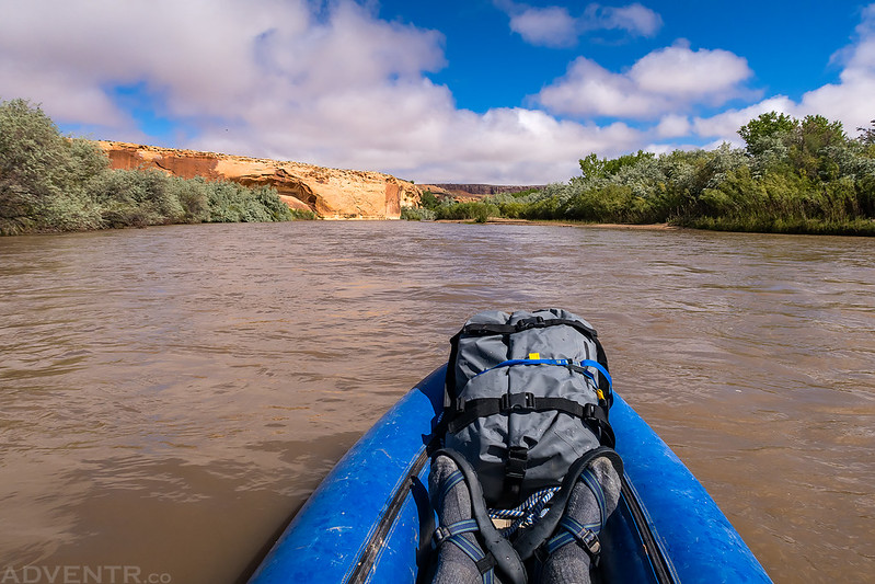
A view from my ducky.
Under an overhang.

Amy and Jackson
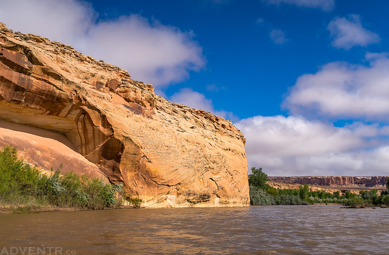
Along The Wall

Down The River
Canyon Curves

This year we decided to skip the petroglyphs near Butler Wash since most of us had been to them many times before, but we did stop to revisit the Desecration Site.


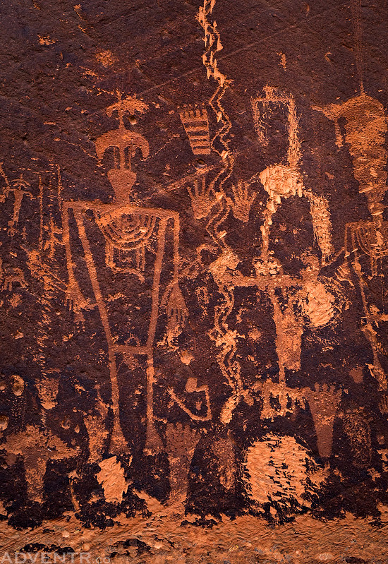


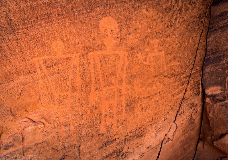
After checking out the interesting petroglyphs at the Desecration Site we continued a short distance down the river so the rest of the group could stop and hike to the River House Ruins (Snake House Ruins). Since I have been there many times before I temporarily split from the rest of the group so I could search for a different petroglyph panel on the other side of the river.
Our group on the other side of the river as I searched for petroglyphs.

I did find the petroglyphs I was looking for!


We had hoped to camp near Chinle Wash so we could do some hiking on the Navajo side of the river, but as usual there were already two groups there figuring out who would be camping there for the night, so we continued down to Big Stick Camp again. It’s a nice site, but it would be nice to camp somewhere different for a change. Before we set up camp I hiked down to the river to see if Lower Chinle Wash Camp was open, and it wasn’t, but when I returned I found that we would be sharing this campsite with another larger group. It wasn’t ideal, but the river today seemed much busier than usual and campsites were getting pretty limited. I quickly layed out my soaking wet tent in the sun and it dried in no time!
I went for an evening hike to this view of the Mule’s Ear and Mule Ear Diatreme before sunset. I had hoped to hike to the summit of the Mule Ear Diatreme this trip if we had camped at one of the Chinle sites, but that will have to wait for another time…

Before going to bed on Saturday night I walked over to the river near the groover and saw some eyes looking back at me. I looked closer since I wasn’t sure what I was looking at and saw that it was a beaver! When I moved it quickly jumped into the river and made a big splash. I went to bed shortly after it got dark out and was glad I had brought my earplugs with since the other group stayed up much later. I slept in until the sun struck my tent in the morning and this time I was able to let it dry out before packing it away.
Big Stick Camp on Sunday morning.

After getting back on the river later in the morning we passed by the mouth of Chinle Wash and noticed that it must have been flash flooding since the water was a much more reddish-brown color than the San Juan water we had been floating on. I had hiked to an overlook of this area the day before and this was not happening then (or else I would have taken a photo from above), so the flood must have started sometime overnight. The two different colors of water took a few miles before they fully mixed into one color, so it was pretty cool floating down the two-toned river!
It was hard to get a good photo of the two colors from river level, but of you look closely you will see I took this photo while floating on the reddish-brown colored water, while the water on the opposite side of the river is more of a greenish-brown color.

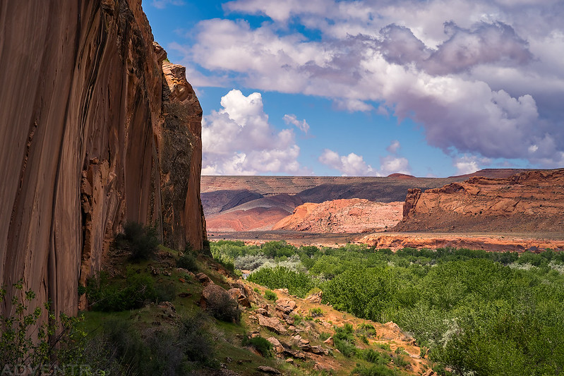
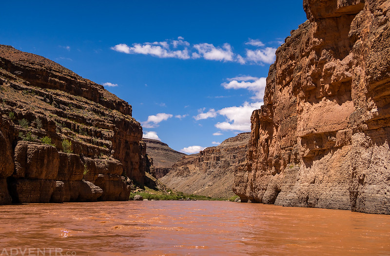
Soon we entered San Juan Canyon.


Floating through The Narrows.
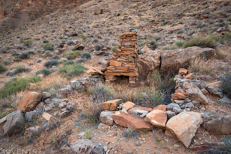
After a short day on the river and a couple of easy rapids we stopped at the Fossil Stop Camp which is a site we have never stayed at before but have wanted to. It’s not a big site, but was plenty big for our little group. Besides all the cool fossils found in the limestone near this camp, there is also an old closed road that was built by the Utah Southern Oil Company in 1928 so they could drill for oil in Soda Basin. They never struck oil there, but I planned to hike there later in the evening to see what remnants were left behind.
Our kitchen at Fossil Stop Camp.

One of the abundant wildflowers we saw throughout this trip.

The remains of a little dugout we found in Soda Basin.
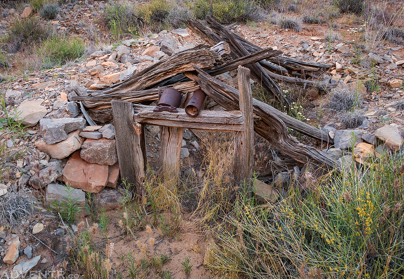
Among the many small remnants left over from the drilling operations I found this drill core.

An old stone chimney in Soda Basin.
Old machinery from the oil drilling days.

River Flowing to the Sunset

A beautiful sunset just above Ledge Rapid as we hiked back to camp along the remains of the old road along the river.

When Chris and I returned to camp just after dark we found that a few of our group had already gone to bed for the night. We stayed up just a little bit longer but soon went to bed as well. I woke up early on Monday morning to take a few photos at sunrise before the rest of our group got up.
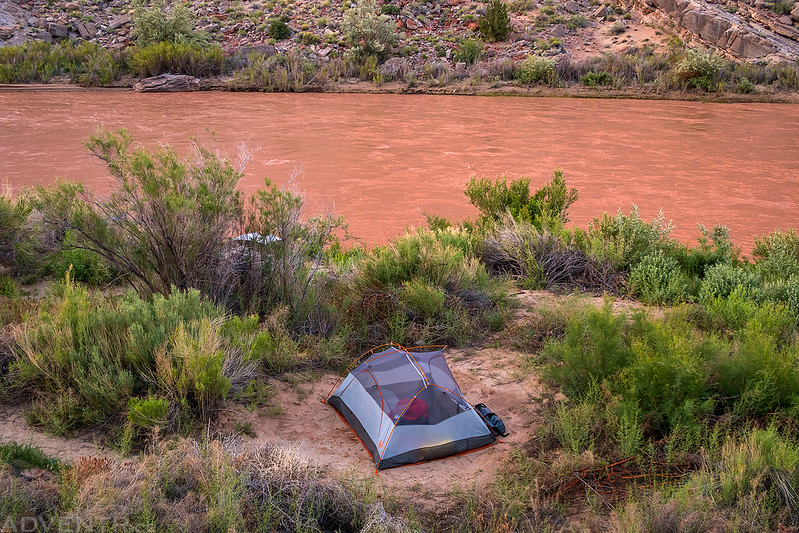
A photo of my tent on Monday morning as I went for a short hike at sunrise.
Golden cliffs reflecting on the river below.

River Flowing from the Sunrise

Two rafts headed back down the river…

My feet disappearing into the sediment-filled river.

Chris the photographer.

Jackson and Ken coming right for me!

A view of Mexican Hat Rock means we are almost to the boat ramp in Mexican Hat. It was another great trip on the San Juan River!

So beautifully captured Randy! Thank you! Your photos of this trip and elsewhere are so much fun to look at. 🙂
Thanks Amy!
I’ve long tried to schedule a trip on the San Juan from Bluff, but haven’t yet done it. Your journal has ratcheted this higher on my to-do list when in Utah again. Thanks.
It’s a great stretch of river!