Friday – Sunday, April 13-15, 2018
After hiking down to Spanish Bottom from The Doll House last weekend, I decided it was time to head back to The Needles for the third time this year so I could hike down Lower Red Lake Canyon from Devils Lane to the opposite side of the Colorado River. I had actually planned on doing this hike at the end of February, but a snowstorm the evening before made me change my mind about driving over Elephant Hill by myself in the morning and I switched up my plans at the last minute.
While I have driven over Elephant Hill many times in the past, this would be the first time I’ve been back since the National Park Service started requiring permits to drive this rugged trail, which is probably part of the reason I hadn’t been back in a while. Thankfully, the permits are still free and don’t require that you to interact with a Ranger if you get them online up to 24 hours in advance, so during the day on Friday I got online and grabbed a permit to drive over Elephant Hill on Saturday so I wouldn’t have to wait for the Visitor Center to open since I wanted to get an early start hiking. With my permit secured and printed out I left after work on Friday and headed down to The Needles with a quick stop in Moab for dinner and fuel. When I was on Canyonlands website earlier in the day securing my permit, I had noticed that there was an alert stating the the access road to the Elephant Hill Trailhead was going to be closed on Thursday and Friday for maintenance. I was concerned that things might still be closed on early Saturday morning if they were running behind, so I decided to check it out before looking for a campsite outside of the park. This little extra drive into the park worked out well since there was an amazing sunset occurring at the same time, so I stopped for plenty of photos along the way. I was also happy to find that the access road was completely open, so I wouldn’t have to change plans again. I left the park and quickly found a campsite along the road to Lockhart Basin within Indian Creek National Monument.
Oh yeah, all of these sunset photos on the first evening were taken with a brand new point and shoot camera that I am trying out, so let me know how you think they turned out in the comments!
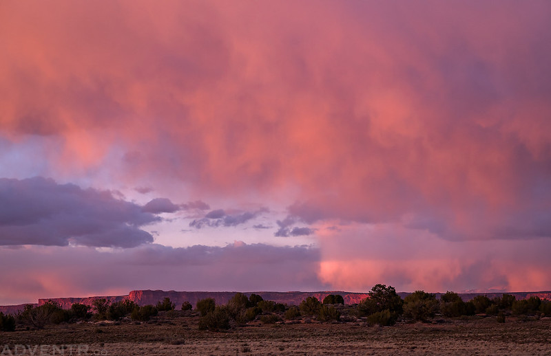
Beautiful warm light with dark clouds above as I drove toward Canyonlands National Park through Indian Creek Canyon.

North Six-Shooter Peak was looking nice as I drove by on the highway.
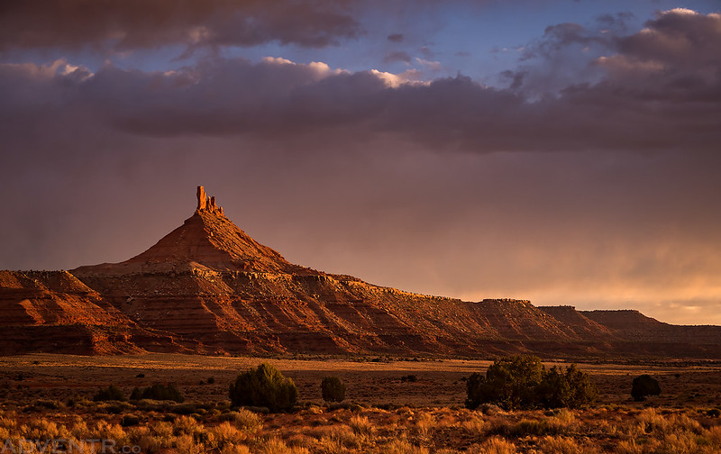
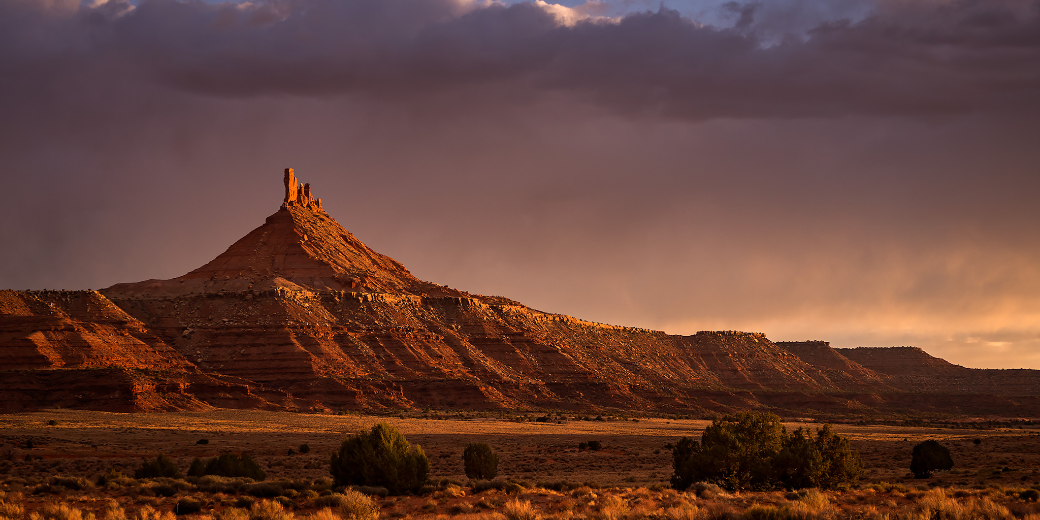
I passed by Squaw Butte on my way to the Elephant Hill Trailhead.

There was an amazing sunset view from Sqauw Flat towards Shay Mountain as I was driving through.
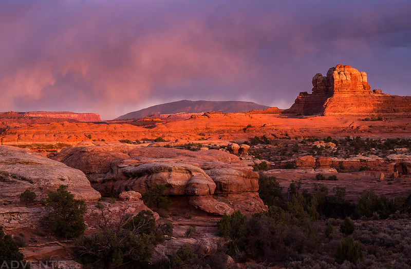
This was one of the best sunsets I have seen in a while!
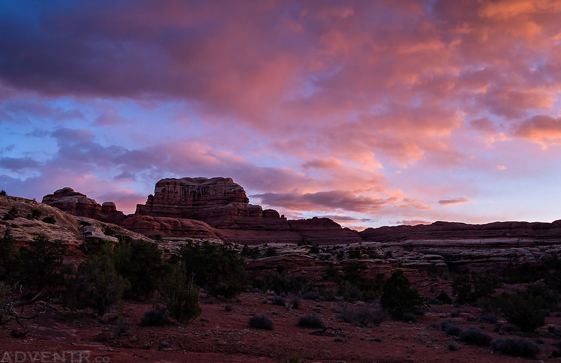
A beautiful magenta sky over the distant Needles.

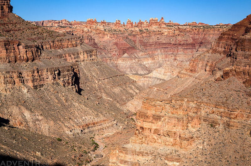
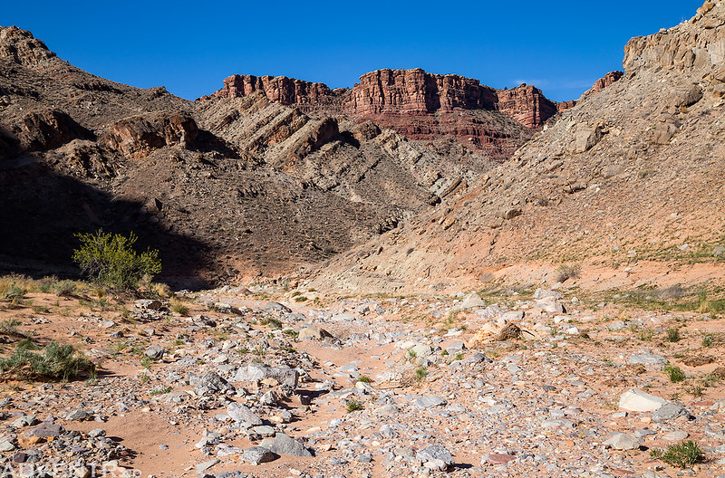
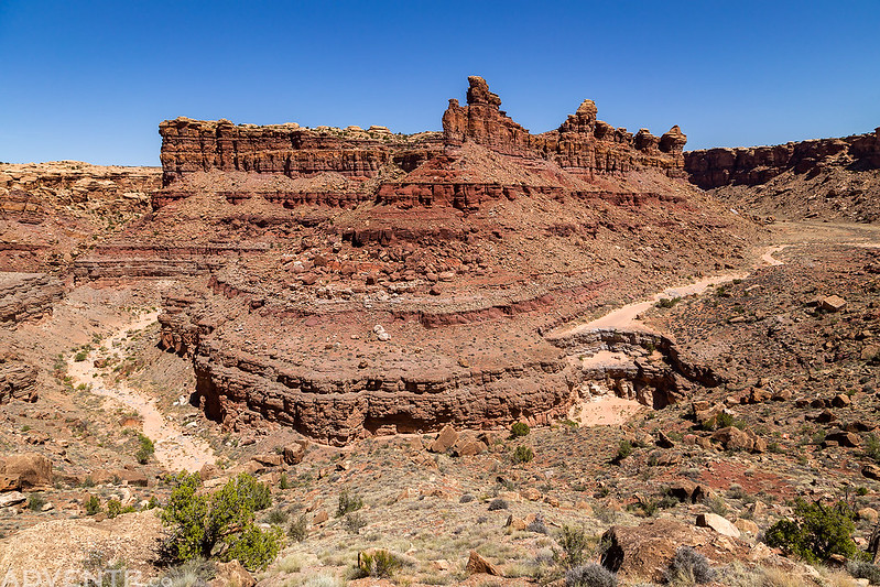
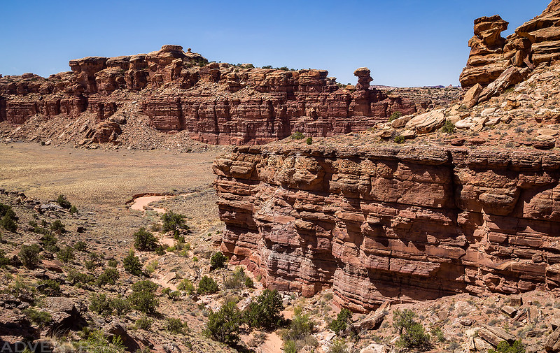
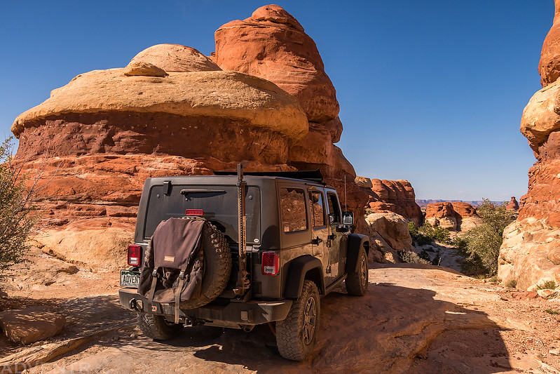
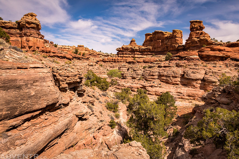
I woke up early on Saturday morning and drove right back into the park and started driving over Elephant Hill shortly before sunrise. The road over Elephant Hill was in surprisingly good condition and it was definitely easier than the last time I was here, but there were a couple rougher sections closer to the Devils Kitchen that hung me up and I actually had to use my lockers for the first time in my new Jeep and bump up some ledges. I made it into Devils Lane in about thirty minutes and parked near the main intersection so I could hike down the Lower Red Lake Canyon Trail into Cataract Canyon while passing through other grabens including Cyclone Canyon and Red Lake Canyon along the way. The trail was in good shape and easy to follow the whole way, even during the steep descent to the bottom. It was definitely easier than the Spanish Bottom Trail on the other side of the river, but also a lot longer. The last two miles of the trail were pretty flat and followed the wash bottom all the way to the Colorado River. Once I reached the river I climbed up to a boulder containing some petroglyphs and another Denis Julien inscription that was very faint and difficult to see.
I only stopped once to take a photo of my Jeep in The Squeeze as I drove the Elephant Hill trail to Devils Lane early in the morning.

Early morning in Devils Lane as I started hiking the trail to Cyclone Canyon and Lower Red Lake Canyon.

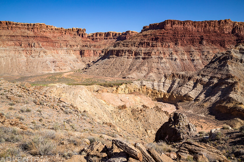
When I reached the biggest descent of the trail into Lower Red Lake Canyon, I could see the canyon below and The Doll House across the river in The Maze.
Hiking through the lower canyon to the river.
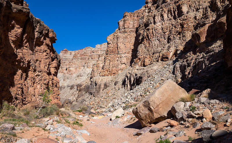
The wash was a bit rocky in places and sandy in others.
Pretty soon I was on a large sandy beach at the mouth of the canyon across the river from Spanish Bottom.
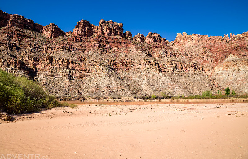
Down By The River

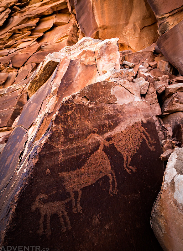
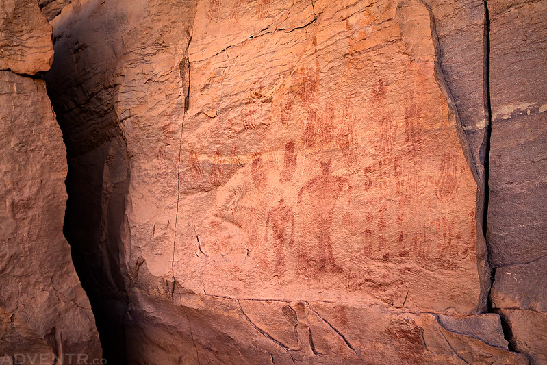
After walking along the shore of the river for a little bit it was time to climb up to search for the petroglyphs and historic inscription I came to find.
I had to climb a lot higher than I thought I would need to, but I eventually found the large boulder I was looking for.
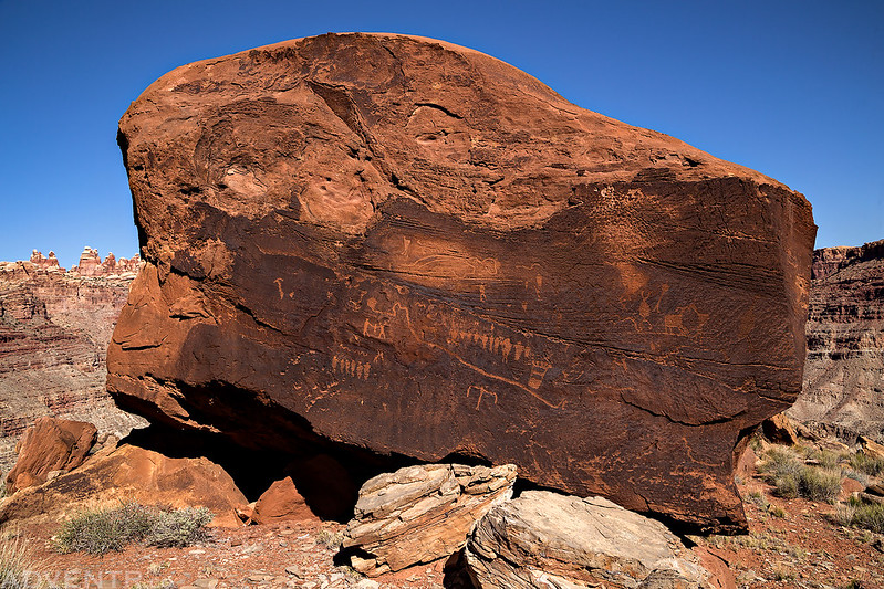
There were some nice interesting petroglyphs found here.
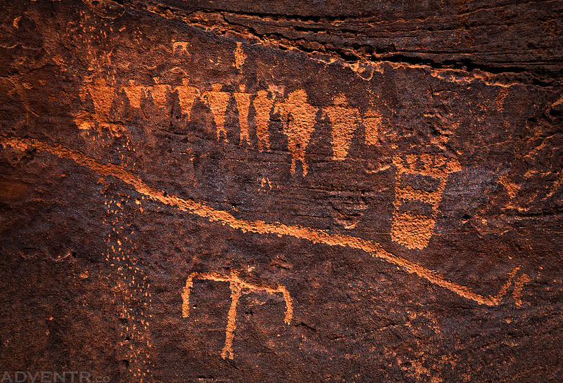
That backpacking figure in the upper left sure reminds me of a pictograph in The Harvest Scene across the river in The Maze.
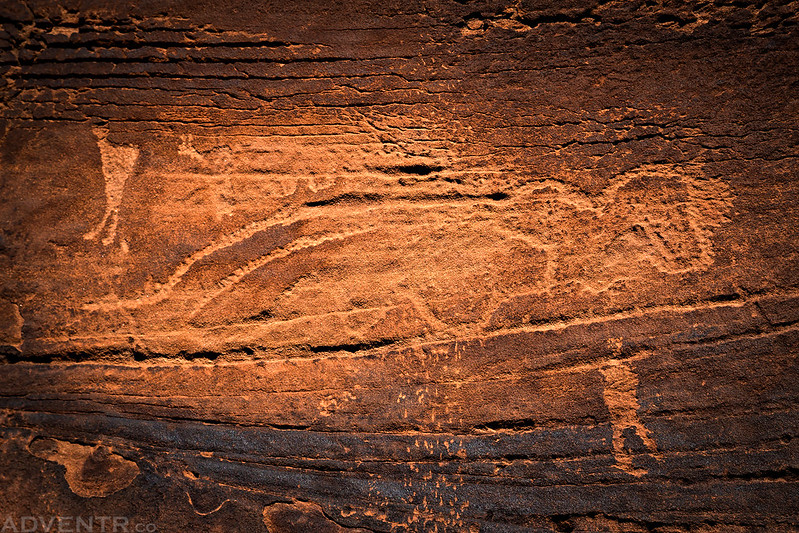
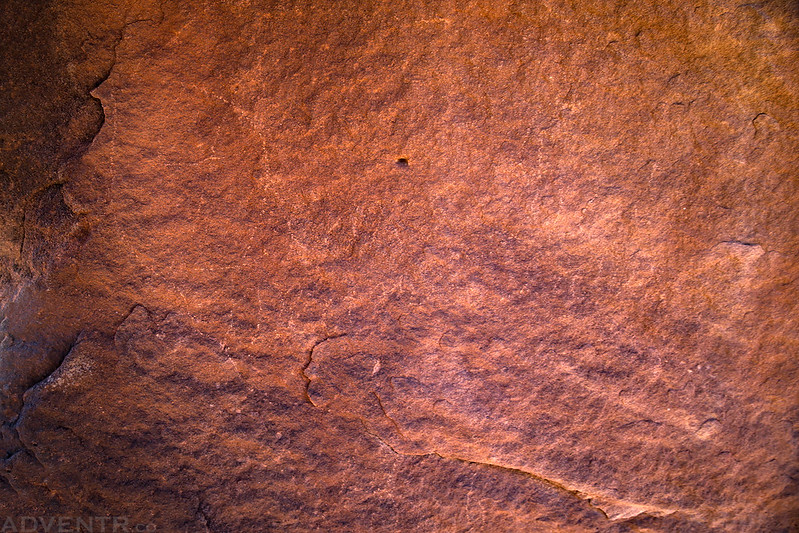
I also found the Denis Julien inscription from 1836 that I was looking for, but it was very faded and hard to see.
There was a nice view down Cataract Canyon to Brown Betty Rapids and the sandy beach I had visited the previous weekend.

Hiking back up Lower Red Lake Canyon was a little slower, but it was much easier for me than hiking back up the Spanish Bottom Trail.
Leaving Cyclone Canyon on my way back to Devils Lane. By the time I had reached my Jeep again I had hiked about 12 miles.
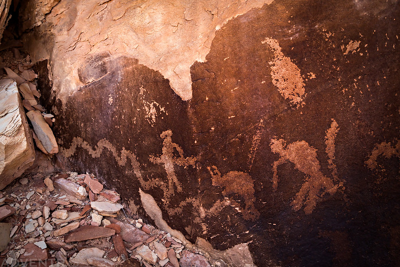
After having a little lunch back at my Jeep I spent the rest of the afternoon revisiting some rock art panels and searching for new one in The Grabens.
A faded Barrier Canyon Style pictograph.

These petroglyphs were new to me and very cool!

Three sheep on a boulder.
Small petroglyphs at the bottom of the same boulder.
A small faded pictograph all by itself.

I revisited the Headdress Site.

The figures that gave this panel its name.
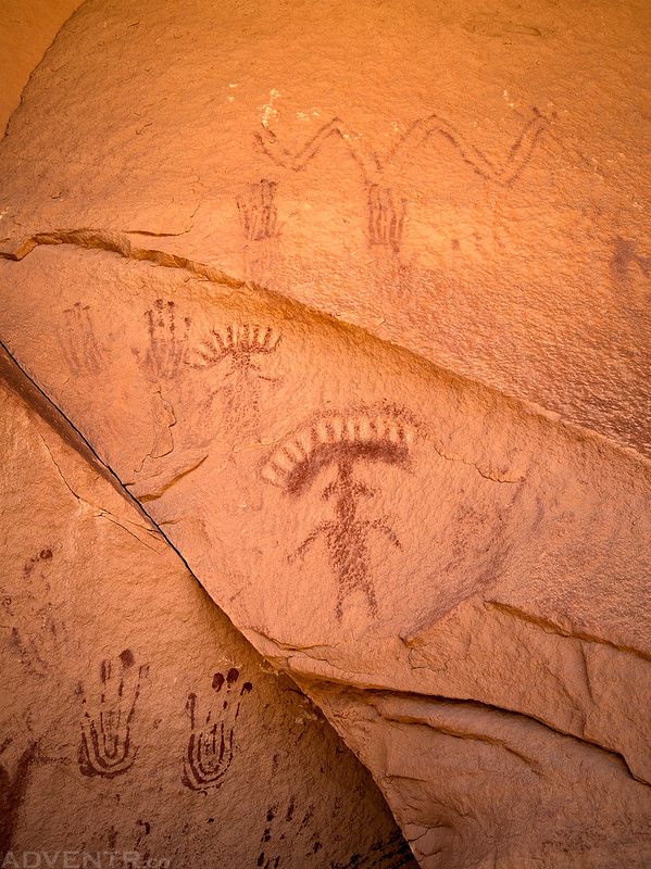
There are a lot of handprints to be found all over the area.
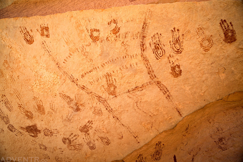
Feet & Hands

More handprints found near SOB Hill.

The Grabens Panel

My Jeep ready to descend the Silver Stairs on my way back to Elephant Hill.

After returning to the main paved road in the park, I found a spot to have dinner and then went for a short evening hike on the Slickrock Trail.

I stopped to take a photo of Wooden Shoe Arch at sunset as I left the park and returned to my campsite along the Lockhart Basin Road.

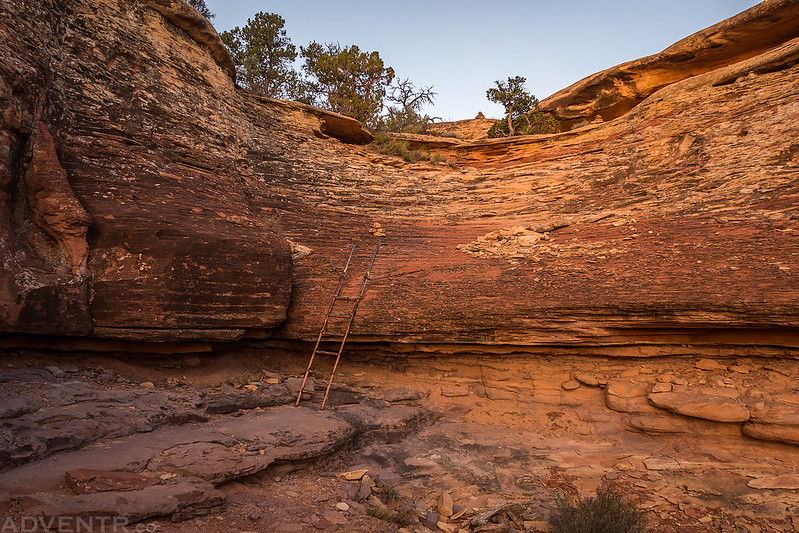
I woke up early again on Sunday morning and drove back into the park to the Big Spring Canyon Overlook at the end of the road and then started hiking the Confluence Overlook Trail shortly before sunrise. While I have been out to The Confluence Overlook a few times in the past, it has always been by taking a short hike from the end of the 4-Wheel Drive road. Since this is one of the very few remaining trails in the park that I had not hiked, I decided to hike the full trail today before heading home so I could cross it off my list. The hike ended up being about 10.5 miles round trip and it took me a little under five hours to complete. There were some pretty nice views along the way and no big climbs or elevation gain, but there was still a lot of smaller ups and downs. The trail even passed near a sandstone high point that I had noticed last week when we were in The Maze, which was a nice unexpected surprise for me.
Early in the hike the trail passed through this little window that offered a nice view of Junction Butte in the early dawn light.

The one and only ladder along the trail.
I watched the sun rise as I hiked the trail. The tops of the La Sal Mountains are visible on the horizon.

Sunrise, Junction Butte and the Island In The Sky.

A nice morning hike across the desert with the top of Elaterite Butte visible in the distance.

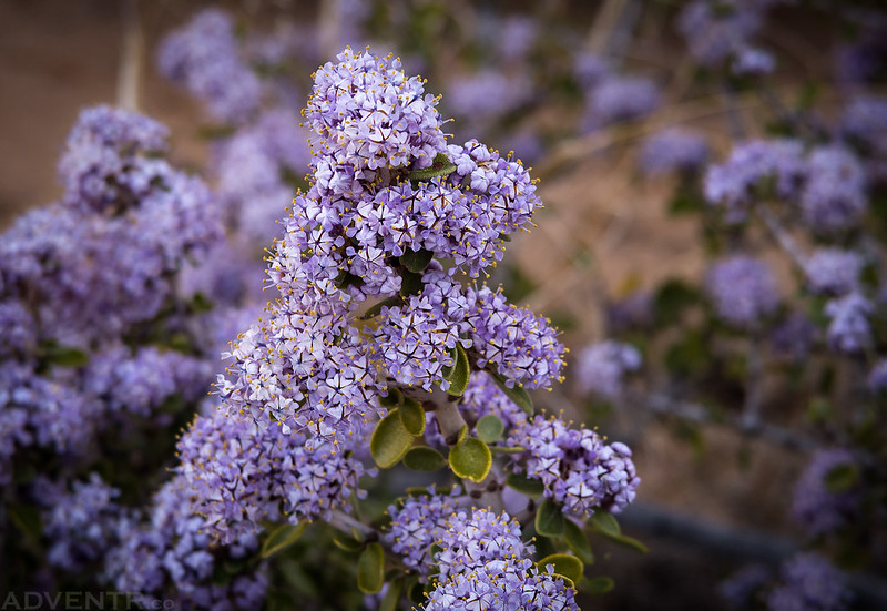
There were plenty of wildflowers out along the trail.


This is the high point I had noticed last weekend when we were camped below Ekker Butte.

Eventually the hiking trail joined the road that I was already very familiar with.

A nice view over the Colorado River to The Maze on the other side.

Since it was early in the morning The Confluence was still partly in the shadows, but it’s still a great view from here.

One last view of Big Spring Canyon as I returned to the trailhead.
After returning to my Jeep it was time to start the drive back home. I stopped at Pasta Jays in Moab for lunch and made it back home in the early afternoon. It was yet another great weekend in Canyonlands National Park and I’m happy that I’ve been able to spend a lot of time exploring this part of the Colorado Plateau this year!
>> Lower Red Lake Canyon & The Confluence Overlook Photo Gallery
Randy,
Great photos as usual.
now you need to doo the third way to the Confluence…from the White Rim to the White Crack and down to the rivers on an old mining road. Nice window arch as a bonus.
One day…
What’s the point and shoot you are testing out? Looks like it works just fine!
I’m trying out the Canon PowerShot G7 X Mark II
Would be interested in longer term comments on the G7X, mostly regarding durability in the outdoors. Mainly I shoot with a weather sealed Pentax DSLR, but also own a Panasonic LX7 “advanced compact” that I have been using a bit more lately in an effort to pare down bulk while hiking, skiing etc. With similar cameras now having 1″ sensors I’m looking to upgrade, but have had issues in the past with S series Canon “lens error”, probably due to dust, grit, moisture from the outdoor environment. Hopefully the G_X series do not suffer from this.
I haven’t had it long enough to post a full review, but I do plan to do that later this year sometime after I really get to try it out. I’ve had a Canon S110 and S90 for a long time and never had any issues with the lens error on those, plus I had plenty of cheaper Canon point and shoots before I really got into photography and also never had issues with those. I guess I’ve had good luck with Canon cameras over the years.
Randy….I enjoy your posts and appreciate you taking the time and effort…..you inform and inspire…a quick question…I drive an F250 with the offroad package…I have been reluctant to tackle Elephant Hill…do you think my truck could make it, or do I need something smaller? Thanks! Tom McC, McQueeney, Texas
I don’t have any experience driving a vehicle that large off-road, but I think that you would definitely want something smaller on Elephant Hill. There are a number of large ledges that the longer wheelbase would get hung up on (my JK Unlimited was getting hung up on some of the ledges and I had to engage my lockers and bump up them, sliding up my gas tank skidplate), plus some very tight switchbacks. Not to mention your F250 might be too wide to fit through The Squeeze.
That said, I’m sure if you really wanted to get your F250 through there, it could probably be done…but I wouldn’t recommend it.