Moab Meanderings | Saturday & Sunday, January 10-11, 2026
This weekend I returned to the sandstone landscape surrounding Moab so I could explore some of the area between the Colorado River and the Gold Bar Rim centered around Culvert Canyon, which is also known as Cameltoe Canyon. I wanted to get in some decent elevation gain during my hike on Saturday since I am hopefully going to be hiking into a very deep canyon again in just a couple of weeks, so I thought it might be interesting to hike from the Colorado River all the way to the top of the Gold Bar Rim by following the Jeep Arch Trail and then some other rugged 4X4 routes found in the vicinity. I left home bright and early on Saturday morning and made my way over to the Culvert Canyon Trailhead to start the hike!
I left the trailhead at dawn and watched the early morning light illuminate the surrounding sandstone as I neared Jeep Arch. After the last couple weekends were full of overcast skies and low clouds, it was nice to see some sunlight for a change!

I initially approached Jeep Arch on the shadowed side, but I liked the way the arch was catching the light on the left side.

I walked through the arch and dropped down the other side for a different view of Gold Bar Arch, which is the name that appears on USGS maps.

I followed the ridge above the arch and then connected up with the Rusty Nail trail.

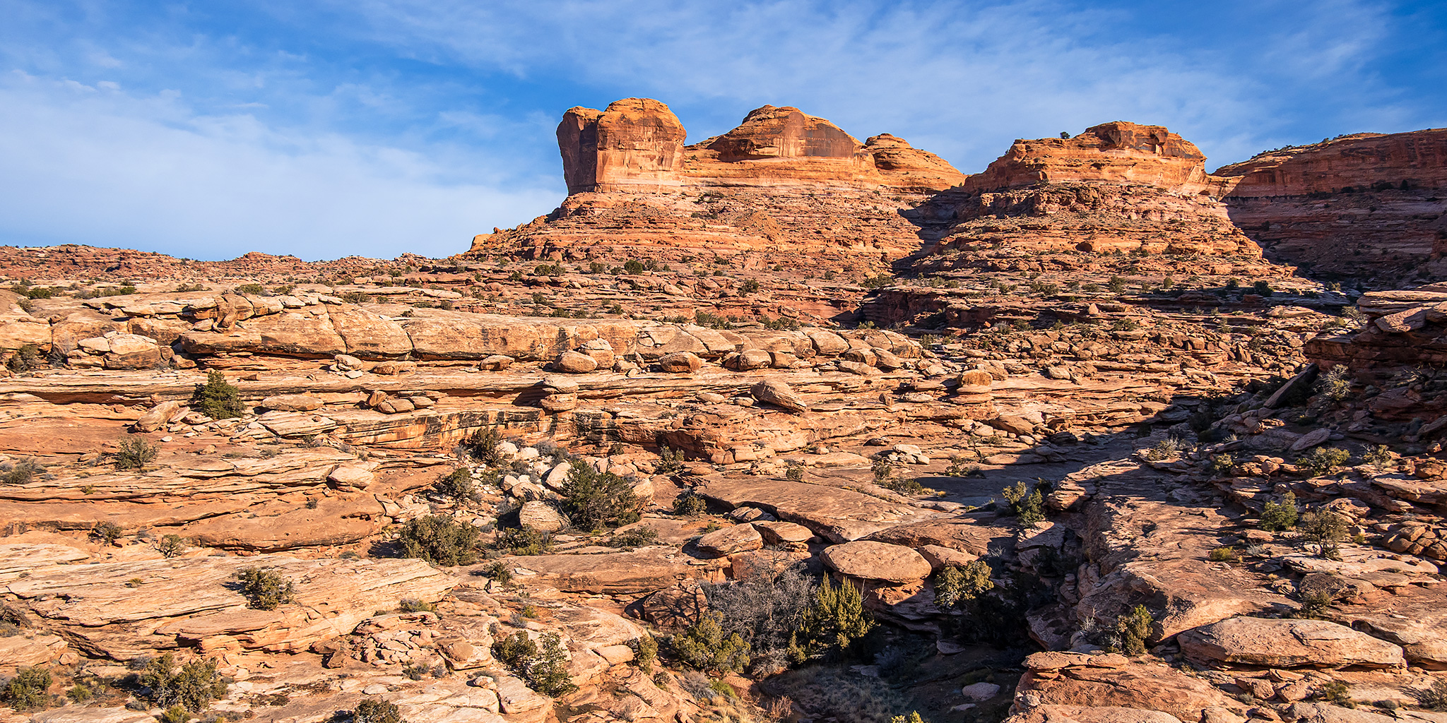
There was a nice view of the upper fingers of Gold Bar Canyon with the Gold Bar Rim above.

While we have had a very mild winter so far, the temperatures finally dropped this past week and there was even some snow in the shaded areas, so this was the first hike this winter where I actually encountered ice in the potholes.

While I roughly followed the 4X4 routes toward the rim, this area is mostly a craggy slickrock wilderness and I wandered around wherever I felt like along the way.

I eventually caught up with the Golden Spike Trail which I followed up to the Gold Bar Rim. The only time I have been on the Golden Spike Trail before was back in 2008 when I drove it in my Jeep XJ.

I followed the Gold Bar Rim Singletrack Trail which closely follows the rim above Moab Canyon and offers distant views into Arches National Park on the other side.

Stopped at an overlook above Moab Canyon with Arths Rim and Sevenmile Rim in the distance.

Poison Spider Arch was more impressive than I was expecting it to be.

Here’s one last look over the Gold Bar Rim before I returned to the Golden Spike Trail and started looping my way back down.

Rusty Nail follows the rim of this shallow canyon.

I hiked through the arch and then followed the trail back down the canyon.

Before returning to my vehicle I hiked up the lower end of Culvert Canyon until I reached a pourover I couldn’t easily get around.

Walking back through the culvert to the trailhead.

After finishing up the long hike I still had a few hours until sunset, but my legs needed some rest, so I just spent the rest of the afternoon revisiting petroglyphs along Potash Road after a quick stop at The Jug Handle.

After having dinner at Pasta Jays, I returned to the Sand Flats Recreation Site to grab my usual campsite and then drove over to watch the sunset from the rim of Rill Creek. The rough and bumpy roads offered a good opportunity to try out the new suspension on my 4Runner that was just installed this past week.


Sand Flats Sunset

Sandstone & Mountains

Mount Tuk at Sunset

After my coldest night camping of the winter so far, I was up early on Sunday morning and returned to Culvert Canyon so I could hike up the opposite side of the canyon from the Jeep Arch Trail.

Once I found a way into the canyon bottom from the ledges, I caught this icy reflection just after sunrise in Cameltoe Canyon.

I bypassed this pourover on the ledge to the right and continued up the canyon until I reached an overlook just before the end of the canyon.

On my way back down I detoured into the pourover alcove I had seen from above.

This is another large pourover I had to bypass in the canyon.

When I reached the mouth of Middle Earth Canyon I followed it up to its end.

Middle Earth Canyon

Looking down the canyon from just below the Middle Earth Waterfall at the canyon’s end.

Headed back down the short side canyon.

Back on the ledges in Cameltoe Canyon.

I passed below Ceiling Arch on my way back to the trailhead.

The light was nice on the shaded walls of the canyon.

Potash Road Petroglyphs // Moab Area Rock Art L
These are a few photos of the petroglyphs I visited along the Potash Road on Saturday afternoon. It’s been many years since I stopped to look at many of these, and it was nice to revisit some old friends!
River Petroglyph Panel

Distant Panel

Besides all the petroglyphs, I was also able to photograph this little ruin.

Three Sheep

Push Me – Pull Me

Big Foot Panel

Bear Panel

Water Bird Panel

Hidden Anthropomorph

Potash Road Petroglyphs


Gorgeous! Thanks for sharing.