Edges of the Labyrinth Canyon Wilderness | Friday – Sunday, November 21-23, 2025
This weekend I didn’t want to stray too far from home but I also wanted to go somewhere where I knew the roads would be OK since we had a week full of wet stormy weather across the Colorado Plateau, so I decided to return to the Labyrinth Canyon Wilderness for the third time this year since there are still a number of hikes I want to do in the area. My main objective was to hike down to Junes Bottom since it’s been on my to-do list for a long time and I have never had the opportunity to stop there while on a river trip through Labyrinth Canyon yet. I left from work on Friday afternoon, got fuel in Green River and then made my way south to the rim above the Trin-Alcove Bend which is where I planned to watch the sunset and then spend the night.
I stopped for a quick photo of the Horse Bench Reservoir since it seems like it’s been a while since I last saw any water in it.

When I reached the end of the road near the Trin-Alcove Bend I walked along the rim until sunset.

The Needles at Sunset

I spent the night near the Trin-Alcove Bend and then was up early on Saturday morning so I could drive around to the other side of Three Canyon and hike down to Junes Bottom. When I left my campsite in the dark I could see bright stars above and it appeared that the sky was clear, but as soon as I reached the other side of the canyon and it started to get a little lighter out, I could see that low clouds had moved into the area which made for an interesting sunrise.
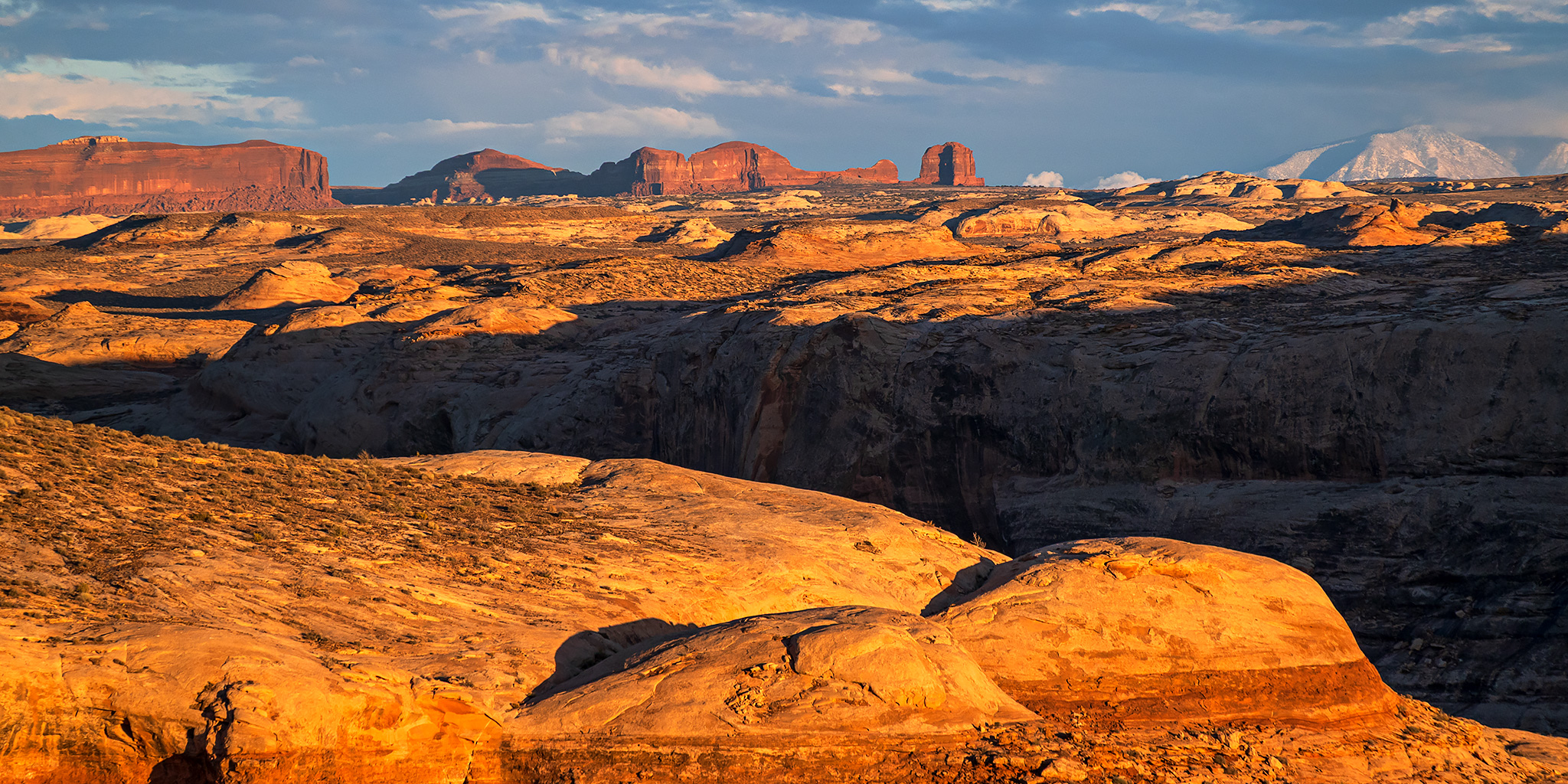
I could see that the San Rafael Reef was lit up in the distance below the clouds.

Low Clouds & Morning Light

Cloud Gap

At first the road out to Junes Bottom was an easy drive, but the further I went the rougher it got. I ended up hitting my skid plates and rear receiver a few times along the way.

Slickrock Morning

When I reached a ledge near the end of the road that I could’ve driven down but wasn’t sure I’d be able to drive back up, I found a place to park and then hiked the rest of the way.

Instead of hiking along the road I walked over to the edge of the canyon above Junes Bottom for a better view.

A view over the Green River from the rim.

I walked along the rim for a bit and then connected back up with the old wagon road which I followed down to the bottom.

I stopped to check out this old stone dugout.

Nearby was a boulder covered with historic ranching relics.

The mouth of Three Canyon was still shrouded with low clouds.

At the other end of Junes Bottom was this large boiler.

This old axle was next to the boiler.

I was considering trying to hike into Three Canyon from here, but shortly after passing by this hidden pool the bushwhacking got too much for me and I decided to skip that idea.

I walked along the Green River on my way back to the wagon road so I could check out possible river campsite options. I didn’t see any that were very good.

Leaving Junes Bottom via the old wagon road.

The clouds were continuing to clear and the sun was coming out more as I left Junes Bottom and Labyrinth Canyon.

Returning to my vehicle.

I stopped for another photo of my 4Runner as I drove across a large expanse of slickrock above the beginning of Labyrinth Canyon.

I also stopped to hike along the rim of the Trin-Alcove Bend while I was on this side of Three Canyon.


After resting and exploring a few new roads between Saucer Basin and The Flat Tops, I returned to the west side of Moonshine Wash so I could hike to Moonshine Spring. I haven’t been back to the Moonshine Wash area in over a decade and was looking forward to the return.

I wandered past this survey marker from 1911.

I made my way out to the point above Moonshine Wash and the West Fork.

I wasn’t able to climb down to them, but I had a good view over these old concrete tanks near Moonshine Spring from the rim.

Crossing the West Fork of Moonshine Wash on my way back to the trailhead.

Moonshine Country

After returning to my vehicle I explored a few more roads on Gruvers Mesa and then returned to the road out to Bull Bottom where I found a campsite for the night. On Sunday morning I drove a short distance over to the Lower Moonshine Trailhead and started hiking up Moonshine Wash at dawn.
It was cloudy and overcast out this morning, so I didn’t bother taking any photos until I started to see some blue sky shortly before reaching my turnaround point in the canyon.

I turned around at the confluence of Moonshine Wash and the West Fork, where I had hiked to the point above the previous afternoon.

Lower Moonshine Wash was a scenic and easy canyon to hike through and I covered 11 miles roundtrip in three hours before heading home.


Great photos as always. Perfect timing for this post, I’ve been planning a trip to the rims above Trin Alcove and Junes Bottom and the information on the road and hike is invaluable. I’ll mostly be flying a drone (the roads are outside the wilderness area), but I will hike down to Junes Bottom following the wagon road. I also plan to fly above Ten Mile bottom, three bends there to shoot. I’ll skip Colonnade this time having shot it twice before.. My map at https://www.google.com/maps/d/u/0/edit?hl=en&mid=16oTYT39s6rfmGclGZzIvg_rq1E8&ll=38.67973020448494%2C-110.38298641224468&z=10 .