Heart of the World | Wednesday, September 10, 2025
I had some time to continue working on my Heart of the World project after work today and decided it was time to cross the Serpents Trail off the list. It’s been a long time since I hiked the Serpents Trail in the Colorado National Monument and I honestly don’t even remember when the last time was, but I would guess it’s been at least eight to ten years now? It’s interesting to think about because there was a time when I hiked this trail pretty regularly to stay in shape, but I guess that’s the main reason why I started this whole project in the first place- so I could return to some of the trails in the Monument that I have not been back to in a long time. Although it was still over 90 degrees out this afternoon when I started hiking up the historic route, there was a strong wind that helped keep it feeling a bit cooler out, plus there were plenty of clouds that helped block the sunlight and made for some nicer photos.
Constructed between 1912 and 1921, Serpents Trail provided the only automobile access to Colorado National Monument until 1937 when the Fruita Canyon portion of Rim Rock Drive opened. Serpents Trail reflects engineering techniques used in the construction of early automobile roads in difficult terrain and was specifically designed to optimize the scenery of the park.
John Otto, the original booster of the park’s scenic wonders and the custodian of Colorado National Monument from 1911 to 1927, designed the original route and was involved in its sporadic construction. The project also provided access to the Glade Park region, and local engineers and citizens contributed to its construction and funding.
Hello, old friend…

A hazy view across the Face of the Monument.


Looking back across No Thoroughfare Canyon.

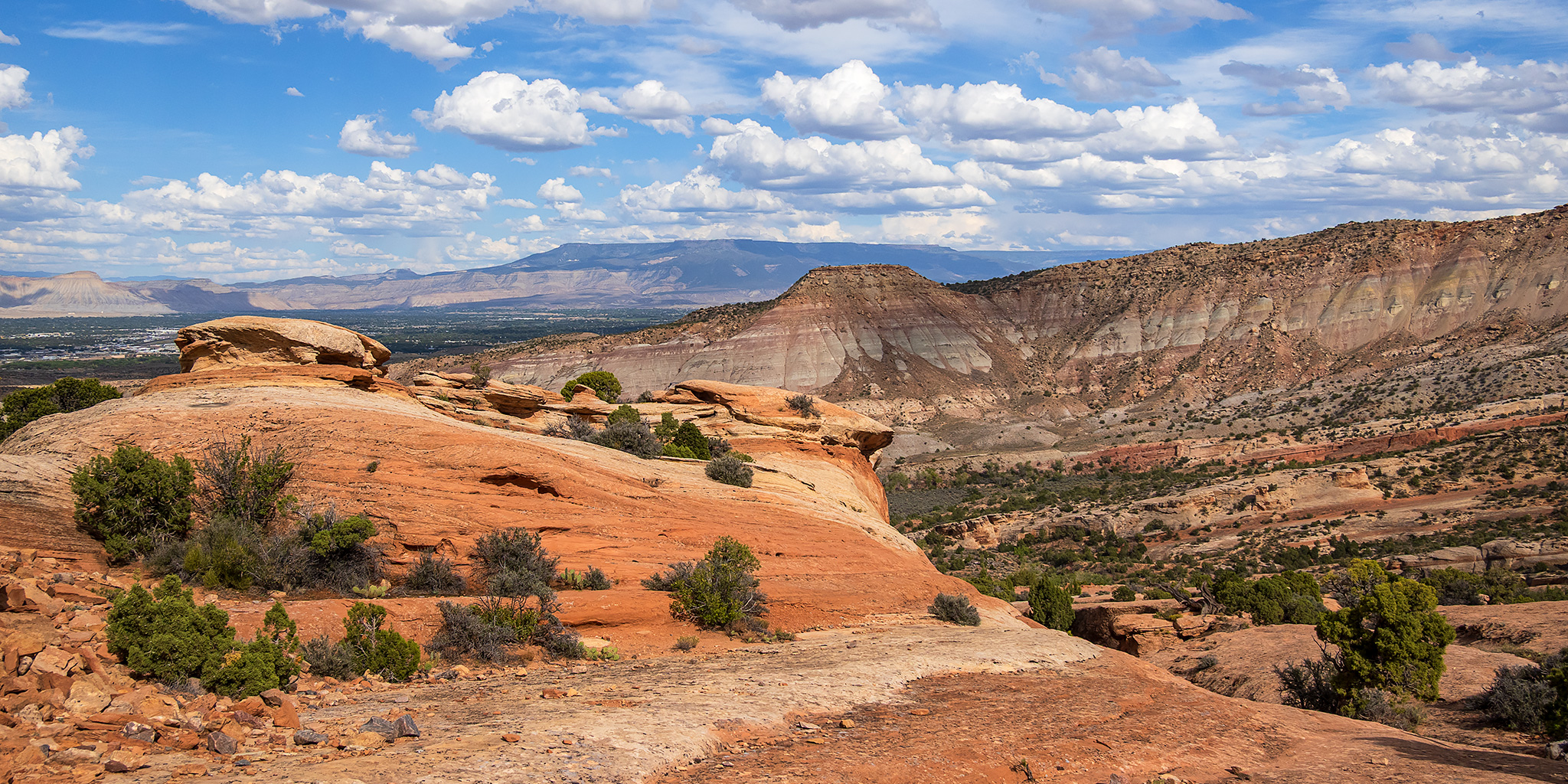
Hiking up the Serpents Trail.


Another view across No Thoroughfare Canyon from higher up.

A lot of work went into the construction of this old road.

A quick stop at the old retaining wall above the switchbacks of Rim Rock Drive.

Serpents Trail View

I hiked past the Serpents Point and planned to visit it on my way back down.

Devil’s Point

I stopped briefly at the top of the trail for this view over Rim Rock Drive and then turned around and started hiking down.

Upper Serpents Trail

I went on a little detour to hike to the top of Serpents Point.

On top of Serpents Point.

Serpents Wash

Then I returned to the trail and continued hiking down.

One last view up to Serpents Point.

Serpents Slickrock View

Here’s one final view across No Thoroughfare Canyon to Eagle’s Wing before I returned to the trailhead and headed home.

Really enjoying all your photo summaries. Fellow 4Runner owner. Thanks!
Thanks Carl!