After Work Adventures | Tuesday & Wednesday, May 14 & 15, 2024
On Tuesday afternoon I left work with the intention of hiking a pair of trails in the Third Flats area to the highpoint of Horse Mesa. Although there were storms in the area, it seemed like they were going to miss the Grand Valley so I didn’t worry too much about them at the time. I drove up Little Park Road into the Bangs Canyon Recreation Area and then followed the Billings Canyon Road to the start of the Saddle Up Trail and started hiking. However, as soon as I made it a short distance up the trail the storm I wasn’t initially worried about moved into the area with strong gusts of wind and rain, so after looking at the weather radar map again I decided it would be best to turn around and come back the following day. Normally, a little rain wouldn’t scare me off from a hike, but I had driven across a lot of clay areas on the road to reach the trailhead and was a little worried about how slick those sections could get if they got wet.
I drove past Haystack 3 Point as I made my way through the Bangs Canyon Trailhead to the Billings Canyon Road.

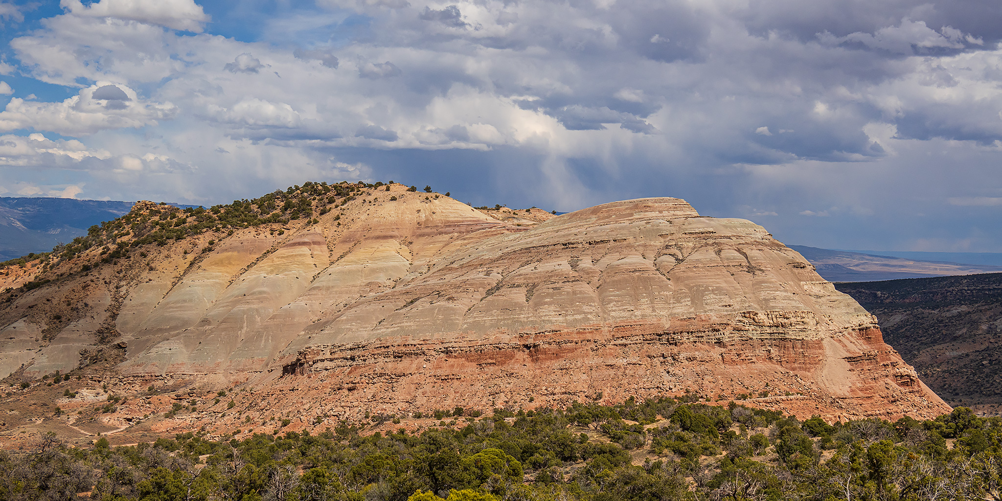
Here’s a view to Horse Mesa, which was my goal for this hike.

Following the Billings Canyon Road to the starting point.

Horse Mesa Highpoint

Dark clouds moving into the area…

Overlooking the claypits to Clarks Bench.

Hiking quickly back down the Saddle Up Trail before it really started to rain. It did start to rain harder as I drove back to the pavement and the clay did start to get a little slick, so I think I made a good call.

After bailing on the hike Tuesday, I returned again on Wednesday after work and started hiking from the same spot with no rain in the forecast.

After hiking up onto Horse Mesa via the Saddle Up Trail, I followed the Pony Tail Trail loop around the perimeter of the mesa.

From the top of the Pony Tail Trail there wasn’t an easy way to reach the highpoint of Horse Mesa, so I would have to find a different route on my way back to the Jeep. There was a nice view over Rough Canyon from up here, though!

Headed down the Pony Tail Trail.


Closing the loop on Pony Tail and returning to Saddle Up.

On the way back to my Jeep I left the trail and followed an easy ridge to the highpoint of Horse Mesa.

Horse Mesa Summit

Horse Mesa Ridge

Here’s one last look back to Horse Mesa after returning to my Jeep and driving back out to Little Park Road.
