Grand Canyon National Park | Tuesday – Saturday, January 16-20, 2024
The canyon fills one with a sense of awe. Under the naked sun, every tremendous detail leaps into glory; yet the change is startling from moment to moment. When clouds sweep the heavens, vast shadows are cast, but so vast is the canyon they seem mere patches of gray and purple and umber. Dawn and evening twilight are brooding mysteries over the abyss. Night shrouds its immensity, but does not hide it. And to none of the sons of men is it given to tell of the wonder and splendor of sunrise and sunset in the Grand Canyon of the Colorado.
Theodore Roosevelt
Rocky Beginnings
The plans for this week-long trip into Northern Arizona and Grand Canyon National Park started to come together almost exactly one year ago when I first learned that reservations for the cabins at Phantom Ranch were going to become available online at midnight on January 17th, 2023. Typically, there is a lottery to stay in these cabins that are located along Bright Angel Creek at the bottom of the Grand Canyon, but Xanterra had stopped the lottery in January 2022 in anticipation of several National Park Service infrastructure projects. However, delays on those projects allowed officials to reopen cabin bookings and I figured this might be my best shot at reserving a cabin without having to deal with the lottery, so I stayed up late to try and get a reservation. Talk about a frustrating experience! Their servers crashed at midnight and didn’t came back up for at least an hour and a half, which was when I gave up trying and went to bed. I ended up waking up around 4:00am and decided to check the website again, which was sort of working by this time, but I could never complete the process of booking a cabin. Originally, I wanted to try to reserve two nights in late November or maybe December and I saw quite a few openings in those months, but I could never get any of the reservations to go completely through while I watched them dwindle away and disappear. Finally, I managed to grab one night on January 18th in 2024 that actually went through, so that was the date we were sticking with and what prompted this entire trip! Throughout the rest of the year I kept an eye on the Phantom Ranch availability calendar to see if I could pick up another night in the canyon since it seemed like a good idea to try to spend more than one night while we were already down there, and I was lucky enough to grab a cancellation for a second night about two months before our trip.
Although I’ve been to the North Rim a couple of times before, I had actually never been to the South Rim of the Grand Canyon before. I’ve never really been tempted to go there because I’ve wanted to avoid the massive crowds that flock there, but also because it’s just shorter for me to get to the Arizona Strip and North Rim from where I live. However, now that we would be hiking down into the the canyon from the South Rim I was finally ready to spend a little time up there, so I booked a cabin along the rim at the Bright Angel Lodge for the two nights prior to our hike.
Above the Rim: South Rim of the Grand Canyon
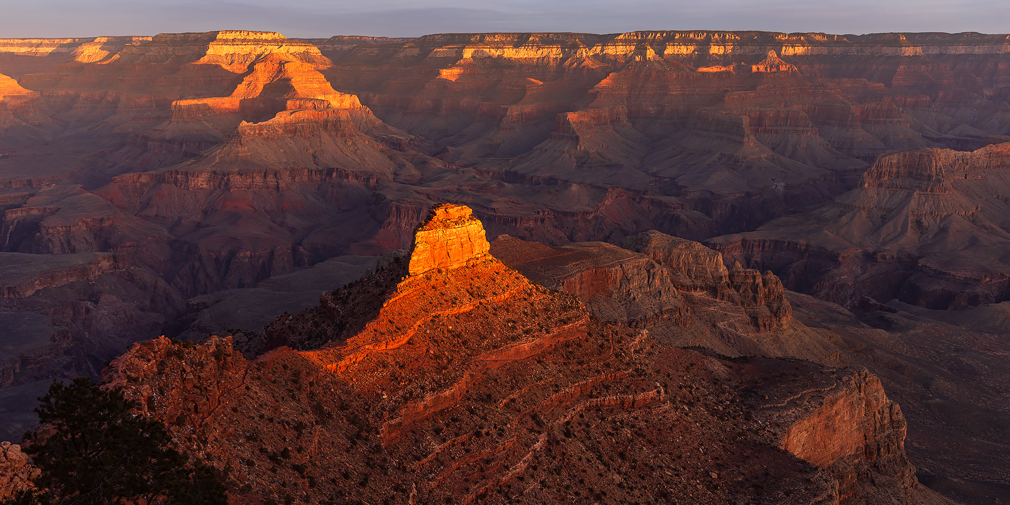
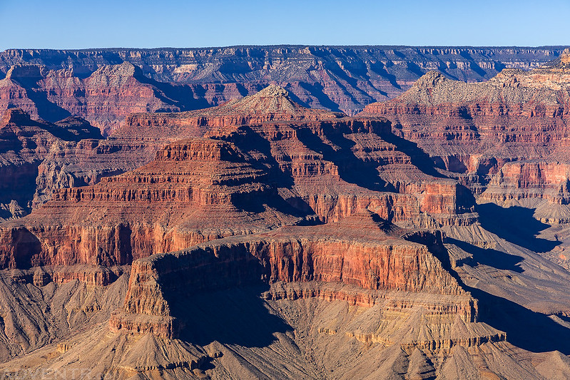
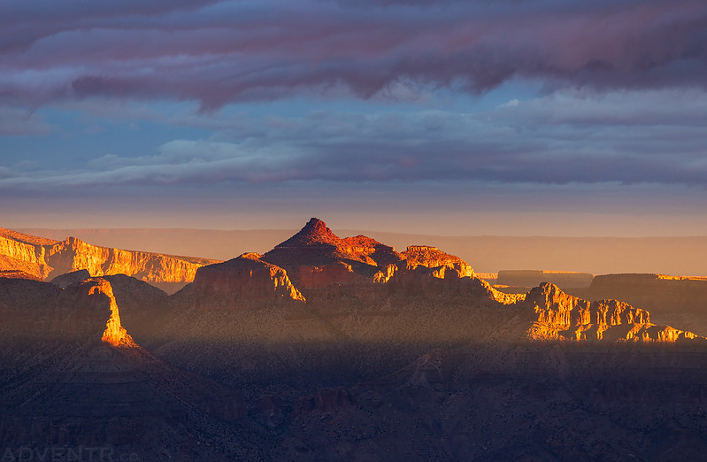
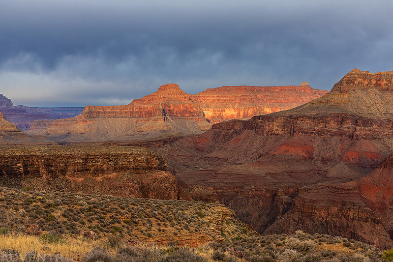
After spending a the first part of the week in Petrified Forest National Park we stayed at a hotel in Flagstaff for one night and then drove over to the South Rim of the Grand Canyon on Tuesday morning by way of Williams and Tusayan. Since this was my very first time to the South Rim we headed straight to Mather Point for my first view of the canyon from this side. Then we spent the rest of the morning and early afternoon visiting all of the overlooks along Desert View Drive as we made our way out to the Desert View Watchtower and then back again.
This was my first view of the Grand Canyon from the South Rim at Mather Point. Unfortunately, the sky was clear and it was a bit hazy out, so I didn’t take many photos from the overlooks today.

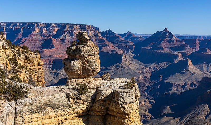
Duck On A Rock
Grand Canyon Layers

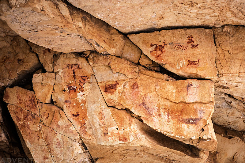
Shortly before reaching the eastern boundary of the Park we stopped to visit the Desert View Watchtower and tour the inside.
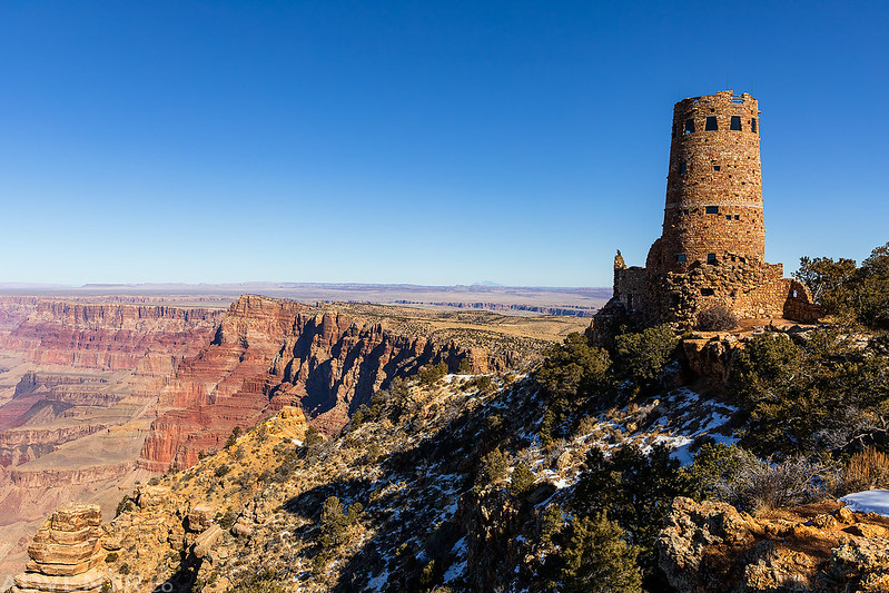
Desert View Watchtower

We had a lot of fun observing all of the reproduced rock art painted inside the watchtower, many of which we have seen the real versions of before.


On our way back to Grand Canyon Village we took a short detour into the new Ancestral Footprints of the Grand Canyon National Monument to visit the Grandview Lookout Tower, which is located on the highest point of the Coconino Plateau. I just can’t pass up the opportunity to visit a new highpoint and Fire Lookout when we are close by!
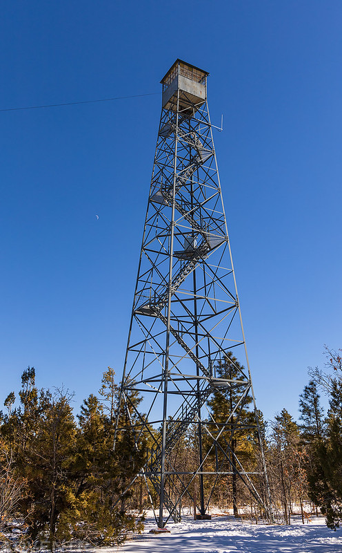
Grandview Lookout Tower

Looking across to Bright Angel Canyon. If you look closely you might be able to spot the South Kaibab Bridge spanning the Colorado River and Phantom Ranch in this photo.

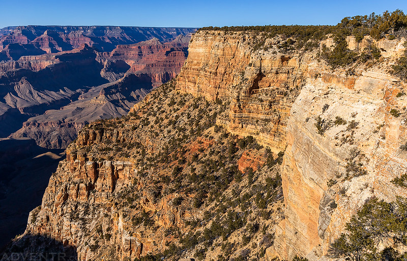
After getting settled in at our cabin we went for a late afternoon drive along the Hermit Road and stopped at most of the overlooks along the way.
Wotans Throne & Vishnu Temple

Great Mohave Wall
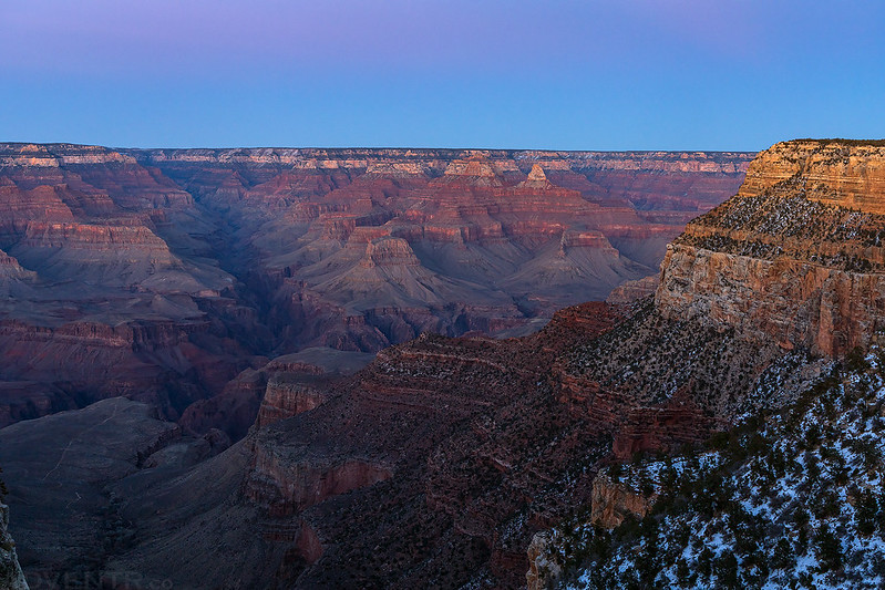
Here’s a view from the South Rim at dusk taken just a few steps off the porch of our cabin.
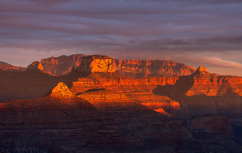
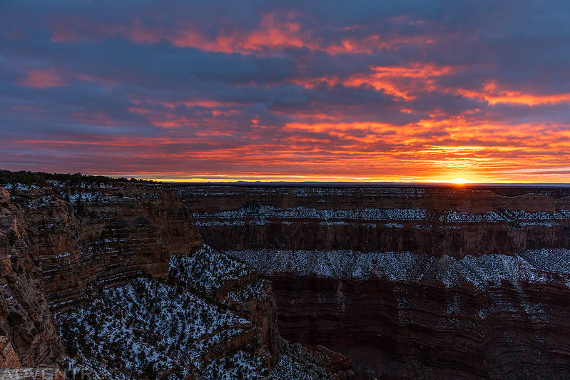
On Wednesday morning I headed over to Lipan Point so I could watch and photograph the sunrise. At first it seemed like there might be too many clouds in the sky, but there was a gap on the horizon that briefly let some light through.


Lipan Point at Sunrise

Saddle Mountain Morning
Jupiter Temple Sunrise

Once the light disappeared, it would remain overcast for the rest of the day.
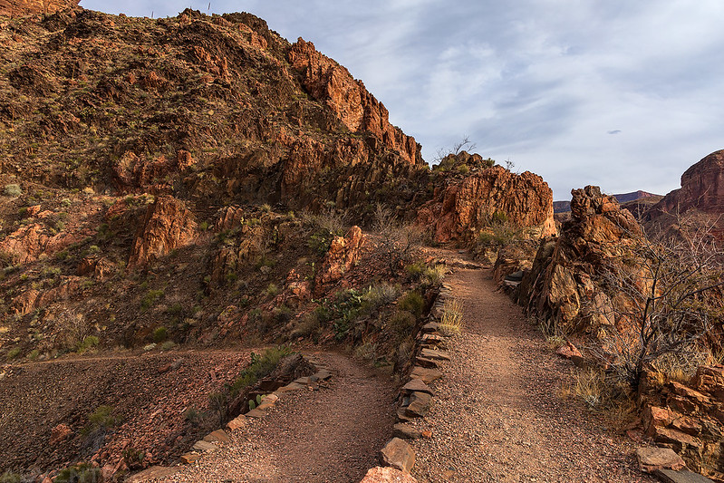
I returned to our cabin and then Diane and I went for a hike along the Rim Trail to Pipe Creek Vista where we hopped on a bus that took us back to the Bright Angel Lodge.

There were low clouds hanging over the canyon during our hike and it appeared to be snowing on the North Rim.


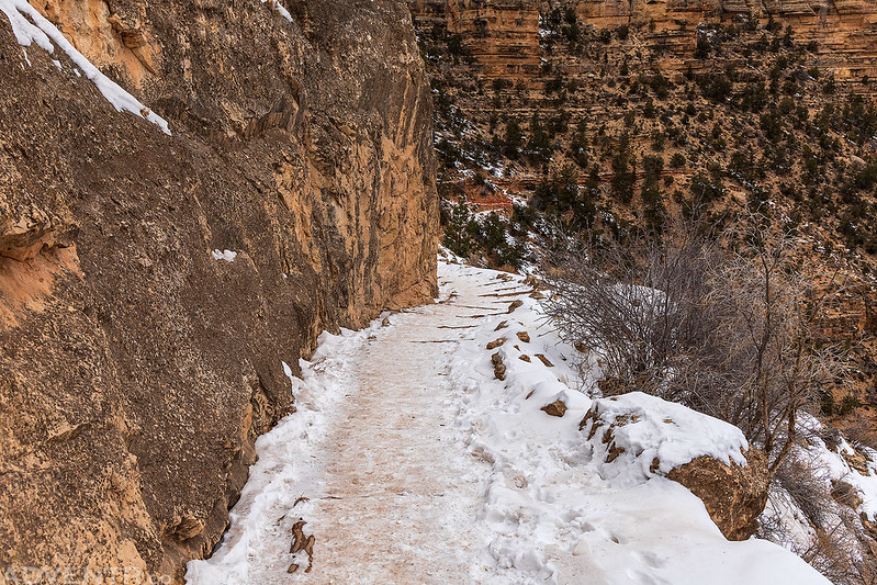
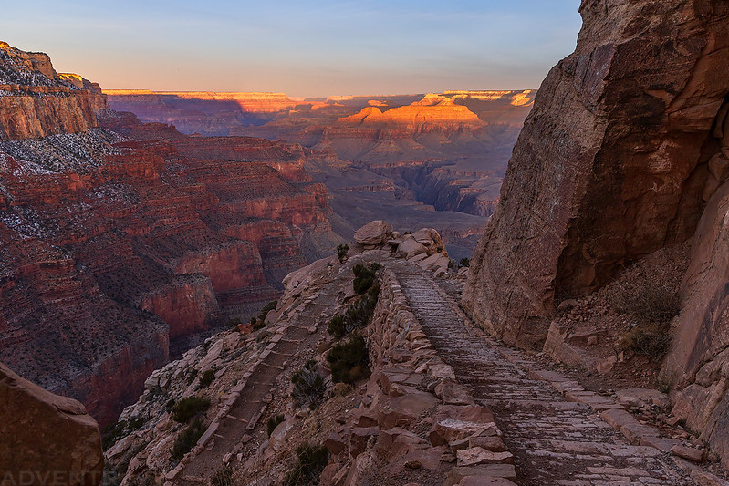
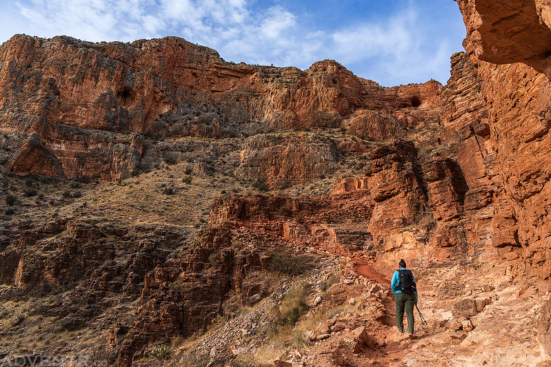
After retuning to the cabin, Diane stayed behind to rest while I went hiking down to the Bright Angel Trail to its current closure.
Warning!

Bright Angel Trail Tunnel

I took a few photos of the distant pictographs seen from the trail with my long lens.


Bright Angel Trail Closure

Hiking back up to the rim.

Later in the afternoon I went for a drive to Hermits Rest and visited the remainder of the overlooks we had skipped the day before.

Looking down over Monument Creek to Granite Rapids.

Although it was overcast for much of the day, there was another brief window of light just before sunset that I watched from Mohave Point.

Light Up the Rim

The setting sun over The Abyss.
The Great Mohave Wall at Dusk

I returned to our cabin after dark with a pizza from the Maswik Pizza Pub for dinner. We spent the rest of the evening getting our backpacks ready for the second leg of our trip and went to bed early so we would we well-rested for our hike to the bottom of the Grand Canyon in the morning!
Below the Rim: South Kaibab Trail to Phantom Ranch
The Colorado is never a clear stream, but for the past three or four days it has been raining much of the time, and the floods poured over the walls have brought down great quantities of mud, making it exceedingly turbid now. The little affluent which we have discovered here is a clear, beautiful creek, or river, as it would be termed in this western country, where streams are not abundant. We have named one stream, away above, in honor of the great chief of the “Bad Angels,” and as this is in beautiful contrast to that, we conclude to name it “Bright Angel.”
Major John Wesley Powell,
August 16, 1869
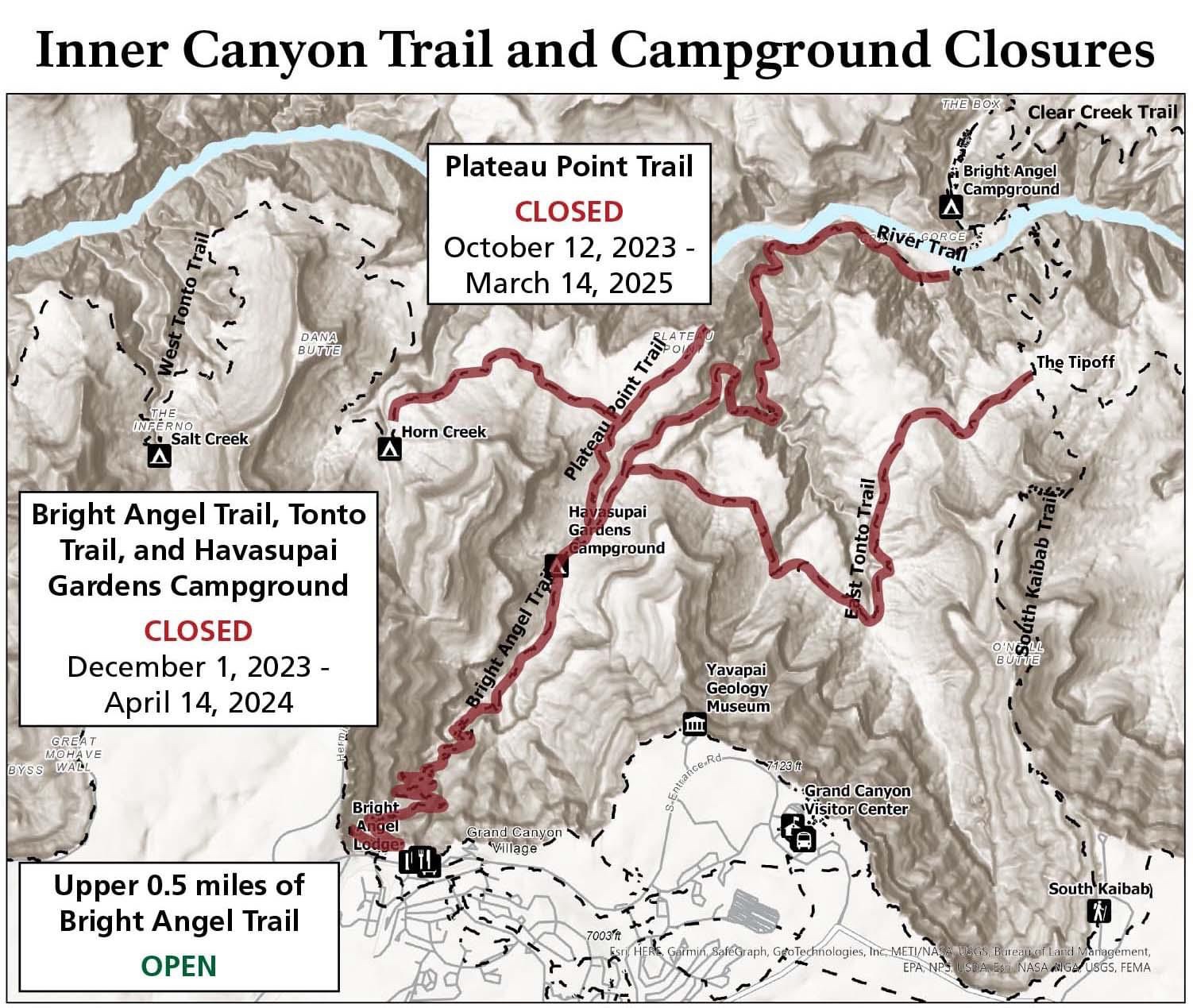
After spending a couple of days up on the South Rim, it was finally time for us to hike into the heart of the Grand Canyon. Although I had originally planned for us to hike down the South Kaibab Trail and then back up the Bright Angel Trail, those plans were dashed in September 2023 when the National Park Service announced that the Bright Angel Trail would be closing from December 1, 2023 until April 14, 2024 for the Transcanyon Waterline construction. It was a bit disappointing to read this news since I was looking forward to hiking a loop of these popular Corridor Trails, but I wasn’t going to give up on visiting Phantom Ranch just because of that. This meant we would be hiking down and then back up the South Kaibab Trail this time, which worried me a little since I was already stressing out about whether or not I was in good enough shape to hike up the ‘easier’ Bright Angel Trail in the first place.
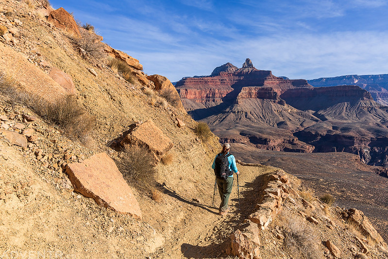
On Thursday morning we made our way over to the South Kaibab Trailhead and started our descent into the Grand Canyon at dawn.

We had brought our microspikes along for the upper portions of the trail, but there was not enough ice or snow for us to need them.

The alpenglow across the canyon was very beautiful this morning.


Diane hikes ahead of me on the trail below Yaki Point.


The first light of the day struck the distant rims and buttes as we neared Ooh Ahh Point.
We arrived at the popular overlook just in time to witness a beautiful Grand Canyon sunrise.

O’Neill Butte

After enjoying the views for a bit, we continued following the South Kaibab Trail down Cedar Ridge.


Light pouring into the canyon over Cremation Creek to Pattie Butte.

This sure wasn’t a bad way to start the day!

After leaving Cedar Ridge we hiked down the sandstone ramp below O’Neill Butte and warmed up in the sunlight.

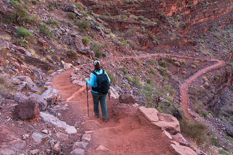
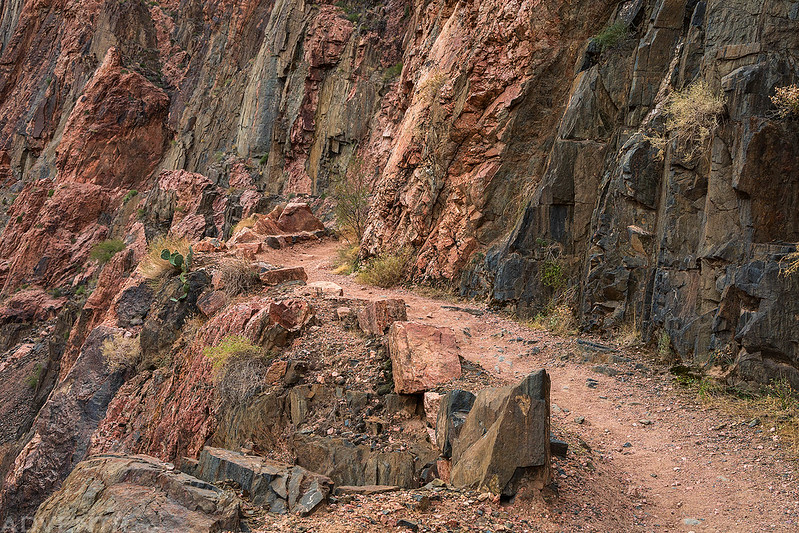
Then it was time to begin our hike down the switchbacks from Skeleton Point.

Skeleton Point Switchbacks


Redwall Skylight Arch

We took a short break at the shelter just above The Tipoff before we began the final descent to the Colorado River.

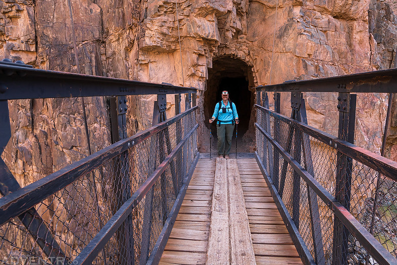
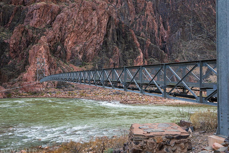
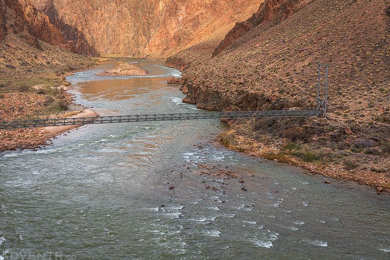
As we neared the bottom of the trail, the South Kaibab Suspension Bridge, also known as the Black Bridge, came into view.

Hiking through a dark tunnel to reach the bridge.

Diane is ready to cross the bridge to the other side of the Colorado River.
By now we were down in the depths of the Granite Gorge.

Looking back at the bridge we just crossed.

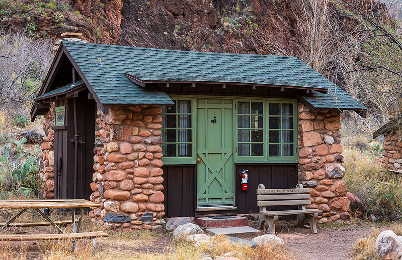
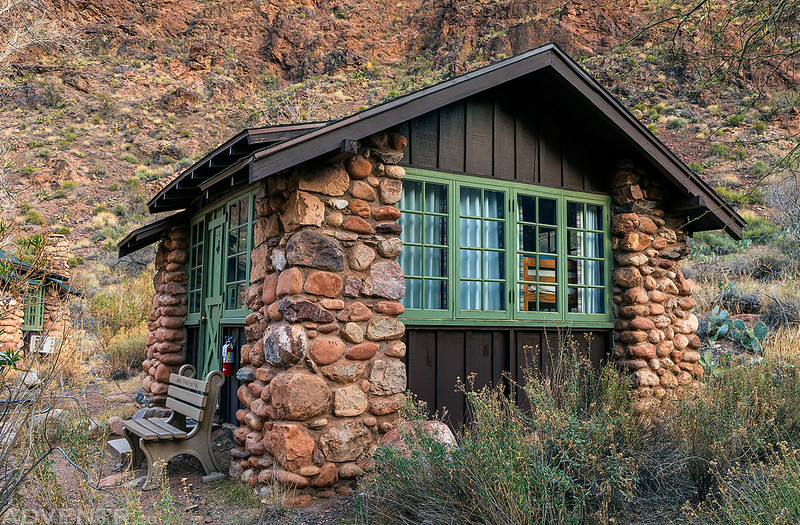
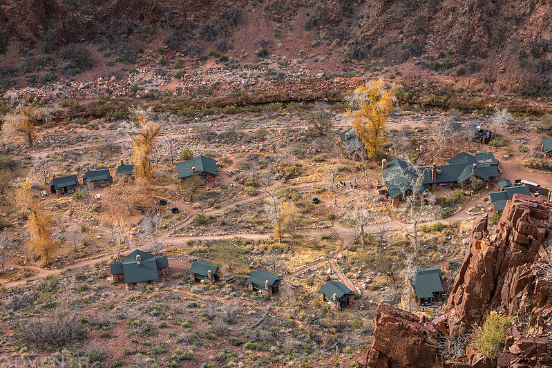
Once we were on the other side of the river, it was a short hike up Bright Angel Creek to Phantom Ranch. We arrived shortly after noon, got settled into our cabin and had some refreshing lemonade and snacks while we relaxed around the cabin for a while. I typically don’t like or drink lemonade, but my friend Jared told me it’s the best he ever had and that I should try it, so I did. He was right, and I drank my fill of lemonade while we were down at Phantom Ranch!
Early in the morning the whole party starts up to explore the Bright Angel River, with the special purpose of seeking timber from which to make oars. A couple of miles above we find a large pine log, which has been floated down from the plateau, probably from an altitude of more than 6,000 feet, but not many miles back. On its way it must have passed over many cataracts and falls, for it bears scars in evidence of the rough usage which it has received. The men roll it on skids, and the work of sawing oars is commenced.
This stream heads away back under a line of abrupt cliffs that terminates the plateau, and tumbles down more than 4,000 feet in the first mile or two of its course; then runs through a deep, narrow canyon until it reaches the river.
Major John Wesley Powell,
August 16, 1869
After relaxing around the cabin for a while, I headed out for an afternoon hike up the North Kaibab Trail into The Box.

Following the trail through The Box.

I went as far as the mouth of Phantom Canyon and then turned around.

Footbridge in The Box

Canyon & Clouds

Leaving The Box on my way back to Phantom Ranch.

Before returning to Phantom Ranch for the remainder of the evening I continued on to check out the Bright Angel Campground and Silver Bridge.
Phantom Ranch Welcomes You

We stayed in Cabin #3 for our two nights in the canyon.
Although I would have loved to have gone on a longer hike up to Ribbon Falls on Friday, I was concerned about hiking out of the canyon on Saturday morning and decided it would probably be best for me to only go on some short hikes today so I wouldn’t wear myself out. So after a big hearty breakfast at the Canteen I went for a loop hike of the River Trail between the two bridges.
I started out by crossing the Silver Bridge.

On the other side of the river I quickly reached the closure of the Bright Angel Trail.

Then I followed the River Trail, which was cut into the cliffs high above the Colorado River, back to the Black Bridge.
Looking downstream over the Silver Bridge from the trail.

River Trail

The Colorado River is a little bit bigger here than it is by our house…
On The Edge

Crossing the Black Bridge again.

Late in the afternoon I return and go up a little gulch just above this creek, about 200 yards from camp, and discover the ruins of two or three old houses, which were originally of stone laid in mortar. Only the foundations are left, but irregular blocks, of which the houses were constructed, lie scattered about. In one room I find an old mealing-stone, deeply worn, as if it had been much used. A great deal of pottery is strewn around, and old trails, which in some places are deeply worn into the rocks, are seen.
Major John Wesley Powell,
August 16, 1869
Back on the other side of the river I stopped to check out the Bright Angel Pueblo.

Then I walked down to Boat Beach. Maybe one day in the next couple of years I will be able to go on a raft trip through the Grand Canyon.

After enjoying a relaxing day with Diane around Phantom Ranch I went for a late afternoon hike up the Clear Creek Trail.
I could see the South Kaibab Trail and River Trails on the other side of the river.

There was a nicely constructed stone bench to sit on and enjoy the views from.

I could look down and see our cabin from the Phantom Ranch Overlook.
The light was getting nice as I hiked back down the trail.


On Saturday morning we left Phantom Ranch after I had another delicious breakfast at the Canteen and we made it to The Tipoff in about two hours.
It had been mostly cloudy for the first part of our hike, but the sun started to peek out from the clouds by the time we reached the Tonto Platform.

Next, it was back up the numerous switchbacks to Skeleton Point.


Looking back to Skeleton Point.

We slowly made our way back up the South Kaibab Trail.

Dappled light across the landscape.

O’Neill Butte

By the time we reached the final switchbacks a storm had moved in an obscured our view of the canyon with snow and rain.

I’m not going to lie, for the past year I have been worried about the hike out of the Grand Canyon since I haven’t done a hike with this much elevation gain in quite a while. Surprisingly, I had absolutely nothing to worry about and found the hike much easier than I was expecting! I was still feeling pretty good by the time we reached the top and could have kept going for a while if I needed to. Our first visit to the bottom of the Grand Canyon was a resounding success and we are already talking about trying to go back in the future, maybe even a Rim-to-Rim hike when the Bright Angel Trail is open again!
>> Above the Rim at the Grand Canyon Photo Gallery
>> Below the Rim at the Grand Canyon Photo Gallery
Thank you for this wonderful report. Your photos are stunning as always!
Thank you Janice!
Your outstanding photos bring back great memories of my rim-to-rim hike many years ago. I was one of two in our group who had not yet hiked the canyon. The others wanted to go down South Kaibab and up the North Kaibab (it’s 5 miles shorter, they said). And so we did, camping at Phantom Ranch and at Cottonwood Campground and a final steak dinner and cabin on the North Rim. Even with conditioning hikes, I learned there are muscles I have that will only ever be used in the Grand Canyon! One of the highlights was ice cold lemonade at a stand run by the daughters of the pipeline caretaker. I thought I was hallucinating! Great post, as always.