Encircling the Wind River Range: Rock Art of the Wind River & Bighorn Basin
Tuesday – Sunday, August 15-20, 2023
After spending the past three days on the Ruby – Horsethief section of the Colorado River it was time for our biennial return to the Wind River Range in Wyoming to begin. Ever since our first trip in 2017 to see the Great American Eclipse, we’ve made it our goal to try and return every other year, which so far we have been able to keep up. Although we have typically gone on a longer backpacking trip during each visit, this year I was more interested in visiting some rock art sites near the Wind River and in the Bighorn Basin that I’ve wanted to see for a long time. So with limited time preventing a longer backpacking trip, we instead looked into going on some shorter day hikes and even branched out into visiting the nearby Absaroka Range for the first time.
Flaming Gorge: Red Canyon Overlook & Ute Mountain Fire Lookout
After getting off the river by noon on Tuesday, Diane and I stopped home just long enough to shower, change clothes, swap gear and vehicles and then we were on the road to Wyoming by 3:00pm. We grabbed a quick dinner as we drove through Vernal and then finished our first day’s drive to our reserved campsite at the Red Canyon Campground in Flaming Gorge National Recreation Area. We planned to stop here for the night so we could split up the drive roughly in half which usually works out great for our drives up to the Wind Rivers. Once we got our tent set up we had enough time to walk the Canyon Rim Trail to the Red Canyon Overlook at sunset.
The view from just behind our campsite wasn’t too bad…
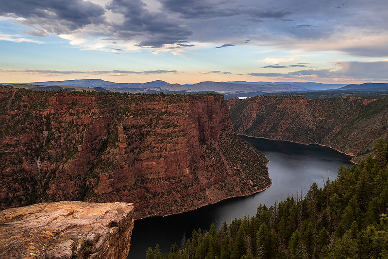
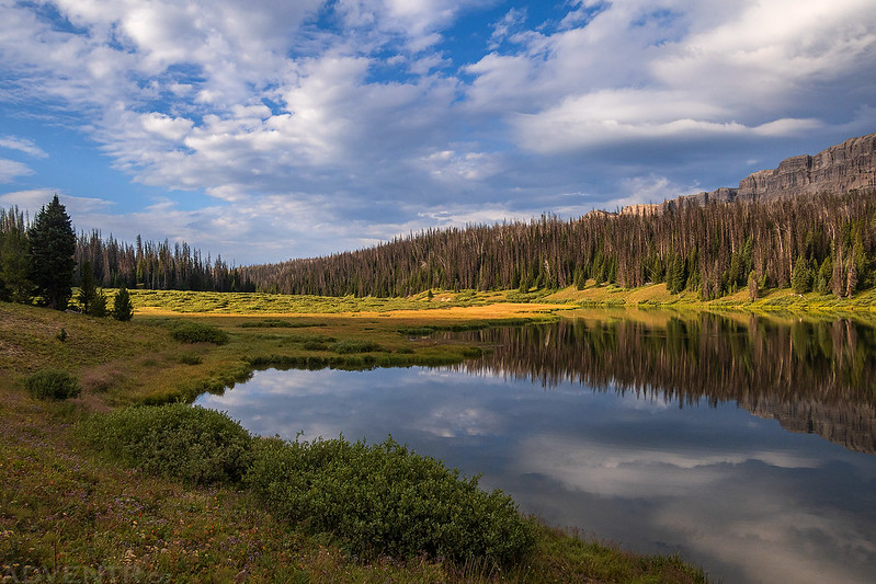
Red Canyon Overlook

Red Canyon & Flaming Gorge Reservoir

There were just too many clouds in the western sky for a good sunset this evening.

We were up early on Wednesday morning and caught the sunrise from the Red Canyon Overlook before continuing on with our drive north.

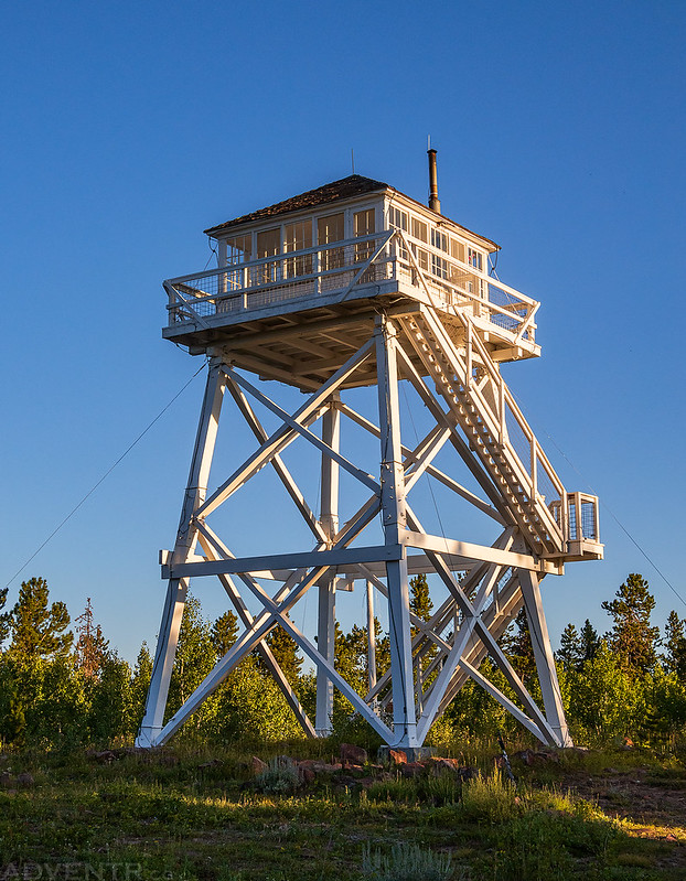
Before leaving Utah we made a short detour so we could visit the Ute Mountain Fire Lookout, which wasn’t far out of the way. This is the first Fire Lookout that I have visited in Utah and it’s also going to be the last since there are no others still left standing.

The Ute Fire Tower was the first lookout tower in Utah to be built with above ground living quarters – today, it is the last such tower still standing in Utah. Completed in 1937 by the Civilian Conservation Corps, the Ute Fire Tower is listed on the National Register of Historic Places and in the National Historic Lookout Register. Over the last 78 years, the Ute Fire Tower has come to symbolize the proud history of wildland firefighting on the Ashley National Forest. Today, the tower serves as an active lookout during the height of the forest’s fire season.
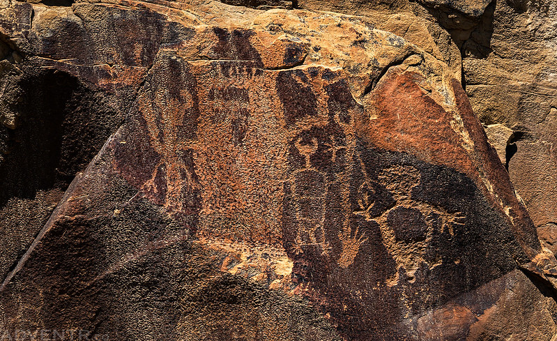
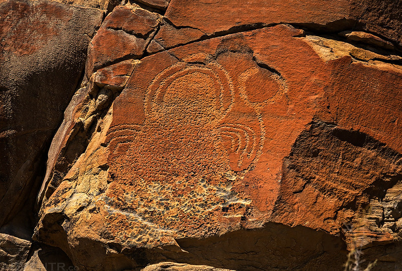
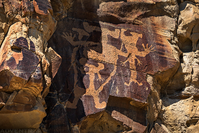
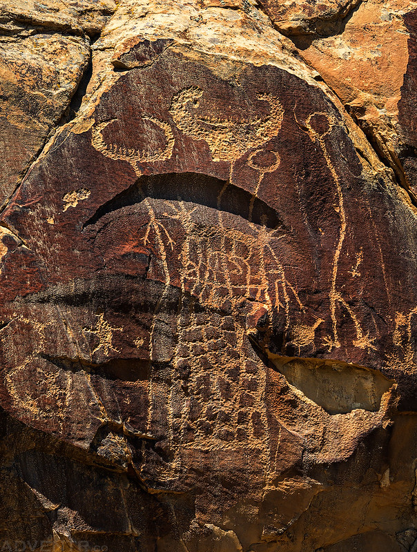
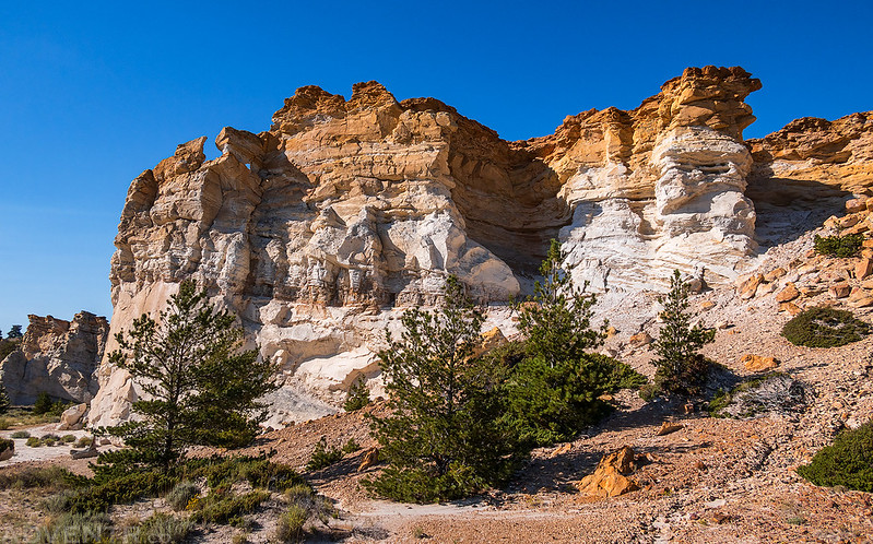
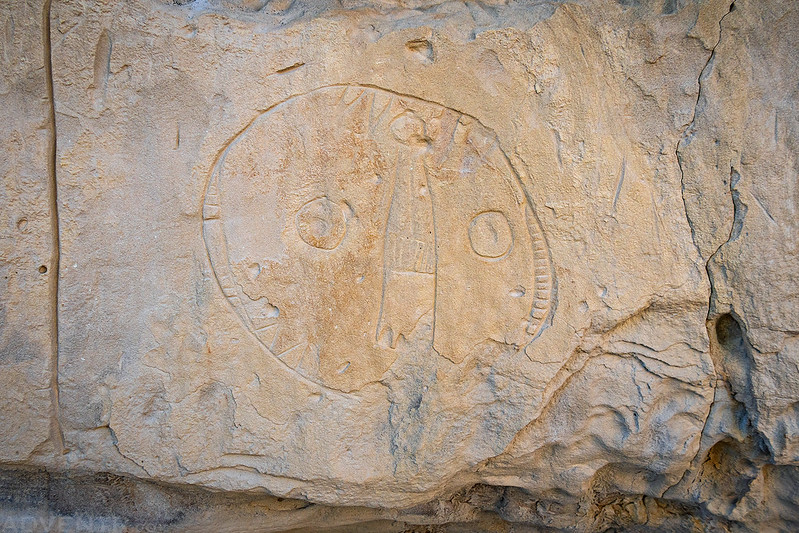
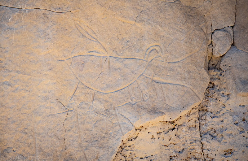
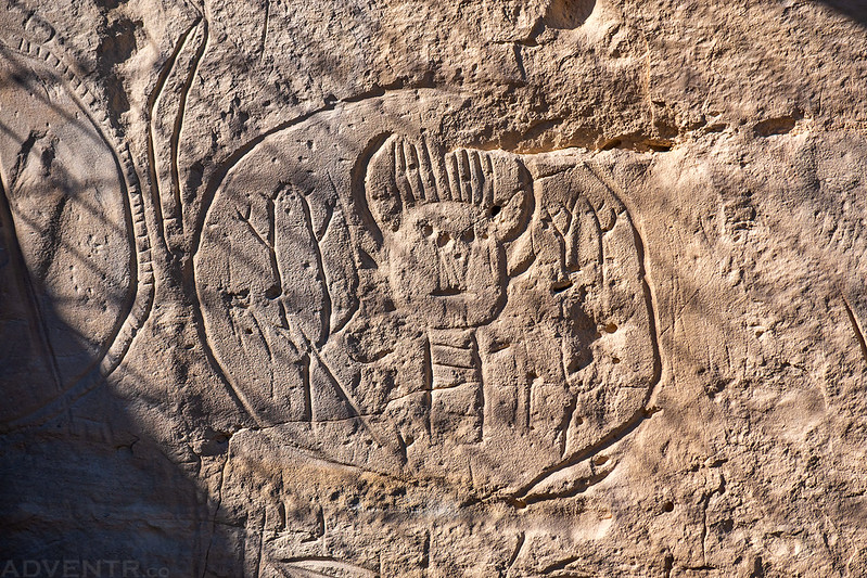
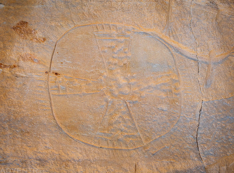
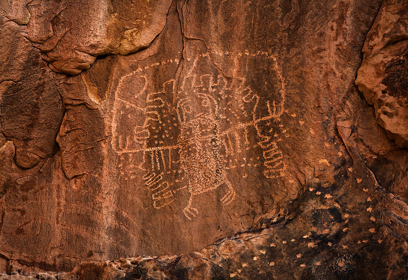
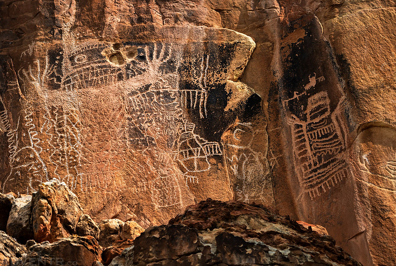
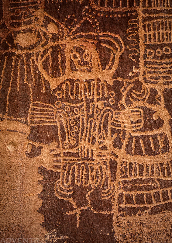
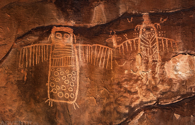
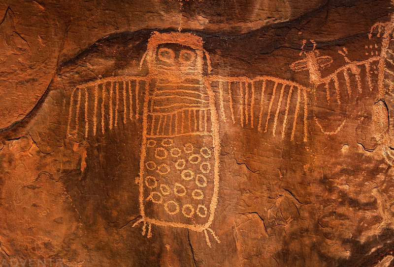
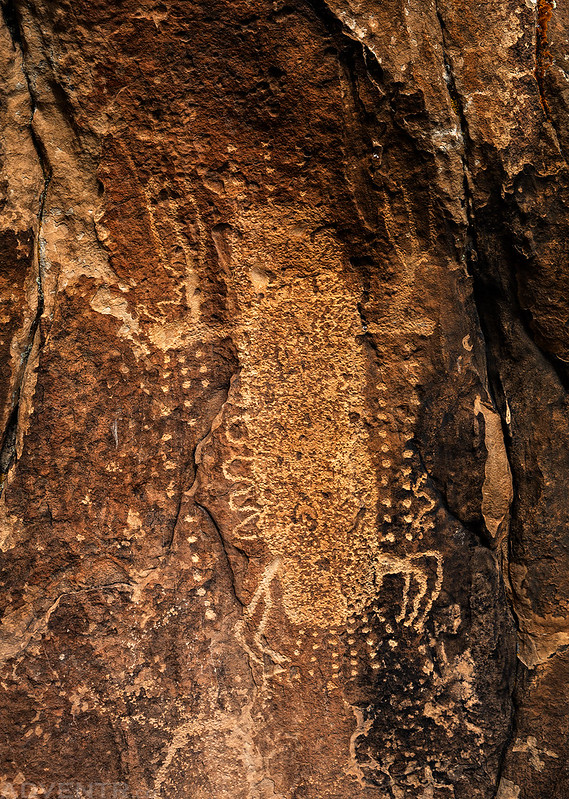
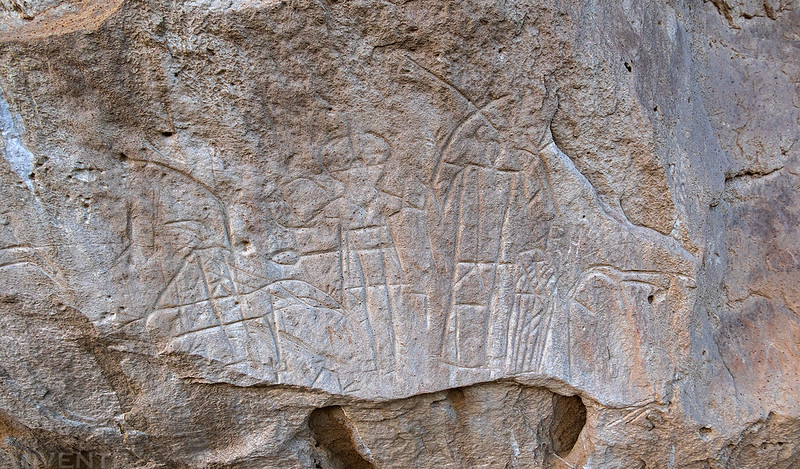
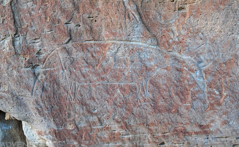
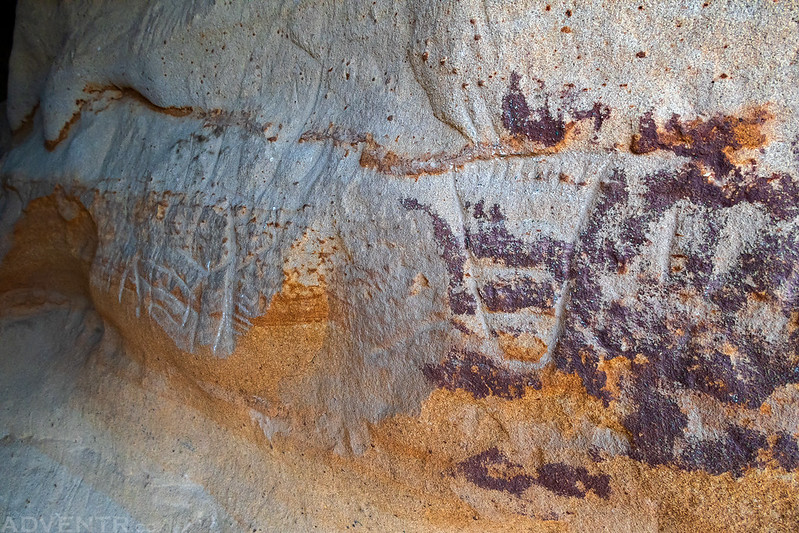
Legend Rock State Petroglyph Site
After a couple more hours of driving, we passed around the eastern end of the Wind River Range and followed the Wind River into the Bighorn Basin where we reached the Legend Rock State Petroglyph Site, our first stop of the day and our introduction to the Dinwoody Tradition Style of petroglyphs that are found in this area. Just like the past couple of days on the river, it was still very warm out as we hiked the short trail along the cliff face and enjoyed seeing the unusual petroglyphs found here. Although the light wasn’t great during our visit, here are some photos of the petroglyphs.


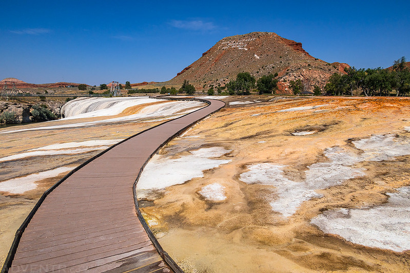
Hot Springs State Park in Thermopolis
After leaving Legend Rock we made a spur-of-the-moment decision to stop at Hot Springs State Park in Thermopolis. Although this wasn’t on our list of planned stops this trip, we thought it might be cool to check it out as we were driving through town, and I’m actually glad that we did. Diane really enjoyed stopping here and I think we might have to come back for a longer visit next time we are in the area.
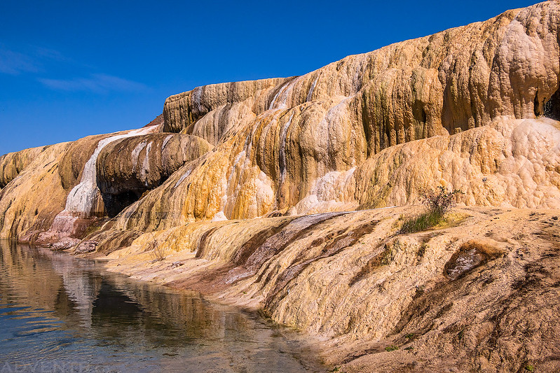
Over colorful terraces along the Big Horn River at Thermopolis flows water from mineral hot springs. More than 8,000 gallons flow over the terrace every 24 hours at a constant temperature of 128 degrees Fahrenheit.
We went for a walk on the boardwalk across the Rainbow Terraces of the mineral hot springs.
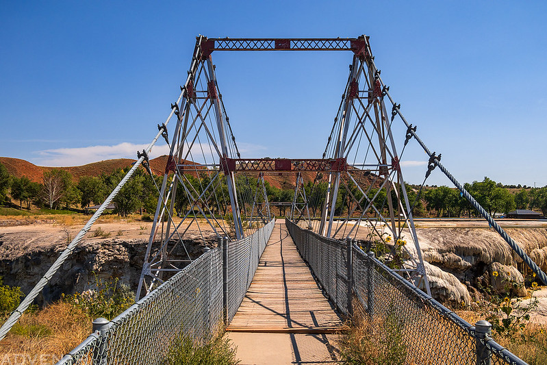
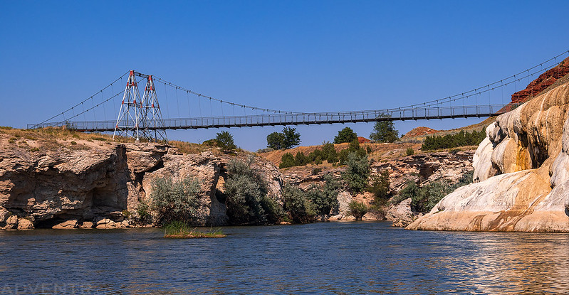
The Swinging Bridge
After walking across the top of the colorful terraces, we headed down to the Bighorn River below and walked through the water for a closer look.
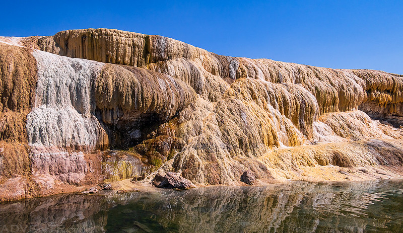
Rainbow Terrace
The Swinging Bridge spanning the Bighorn River.
Teepee Fountain

After our brief visit to the mineral hot springs at Thermopolis we then followed the Bighorn River south to the Wedding of the Waters, where the Wind River suddenly becomes the Bighorn River, and then continued on through Wind River Canyon and Boysen State Park to our final destination of the day.
This river begins in the Absaroka (ab-sore-uh-ka) Mountains located 90 miles to the northwest. It runs southeast, then swings north and flows through two mountain ranges before it joins the Yellowstone River at Bighorn, Montana, 180 miles northeast of here. The waters eventually reach the Gulf of Mexico via the Missouri and Mississippi Rivers.
Early explorers arriving at the river, in what is now the state of Montana, named it the Bighorn for the big horn sheep found along it. Other explorers who found the river south of here, named it the Wind River. In time, people realized there was actually only one river with two well established names. To avoid confusion it was decided that the river upstream from a place 1/2 mile to the south would be called the Wind River and the river downstream the Bighorn.
This canyon, which cuts across and through the Owl Creek Mountains was named the Wind River Canyon. The Canyon which the river cuts through in the Pryor Mountains on the Wyoming – Montana border about 100 miles to the northeast retained the name Bighorn Canyon.
The site where the river changes its name has been known as the Wedding of the Waters, one of the few places where a river changes its name in midstream.
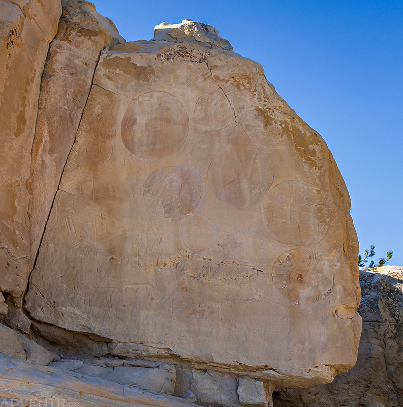
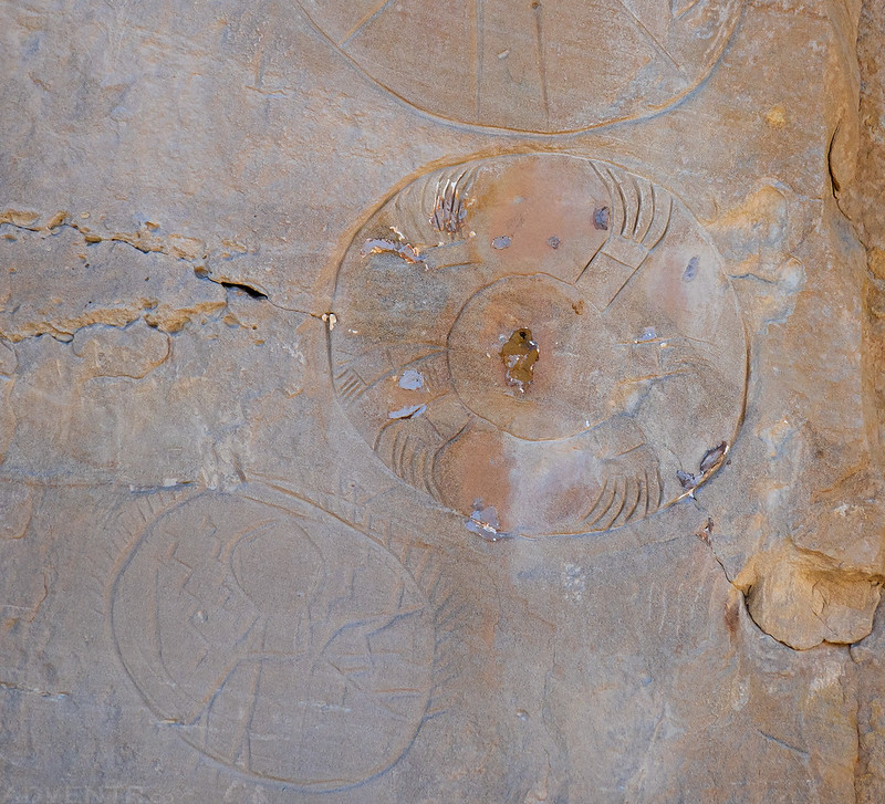
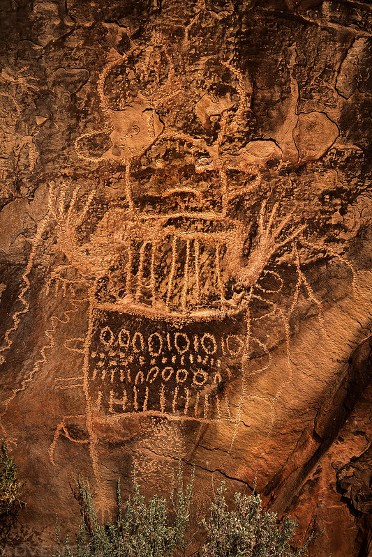
Castle Gardens Petroglyph Site
Our final stop of the day was at the Castle Gardens Petroglyph Site, which is an interesting little area that really makes you feel like you are in the middle of nowhere, until you start seeing all the graffiti everywhere. I’m not sure which was worse, the massive amounts of graffiti or the huge chain-link fences with barbed wire built around the petroglyph sites to protect them?
Castle Gardens

The Gateway

Castle Gardens Hoodoo

Castle Gardens Arch

Exploring Castle Gardens


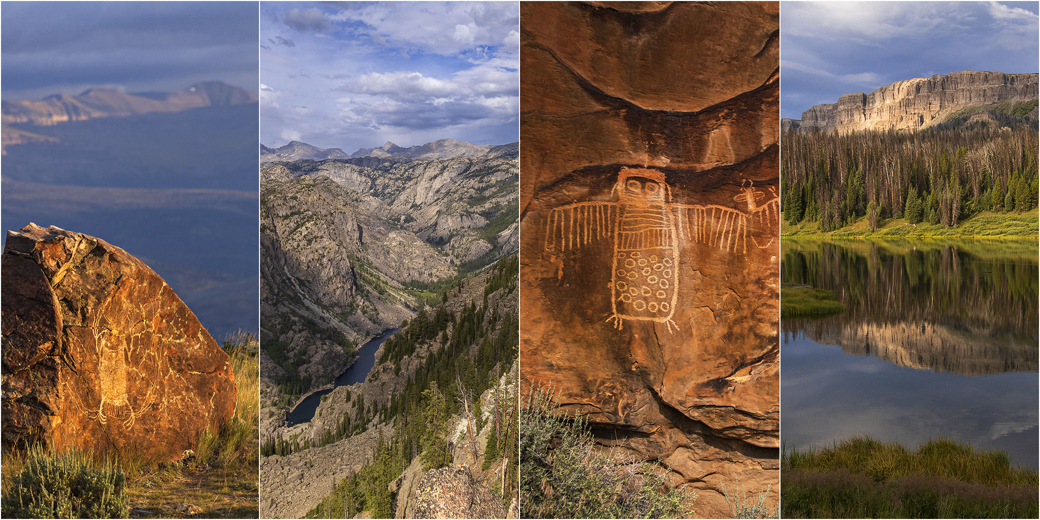
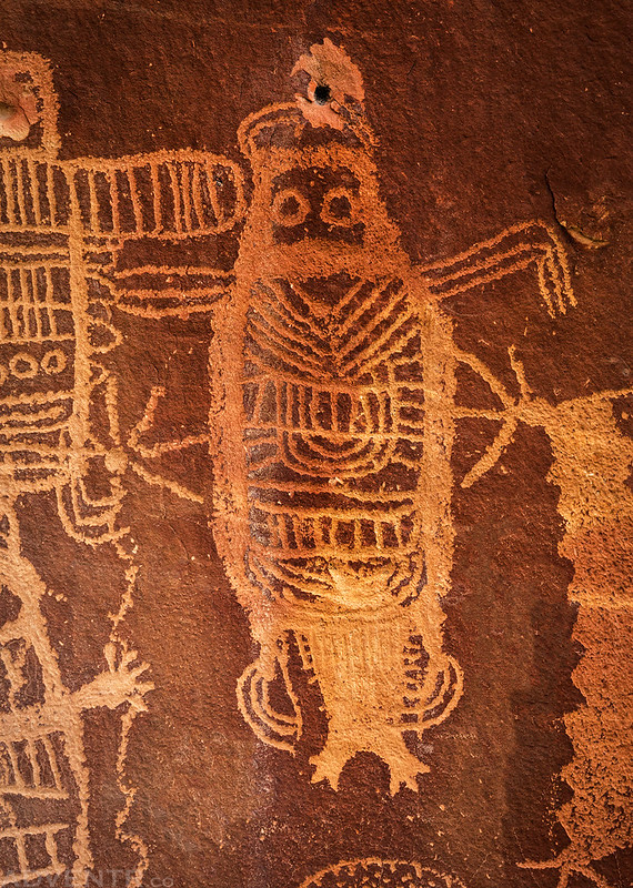
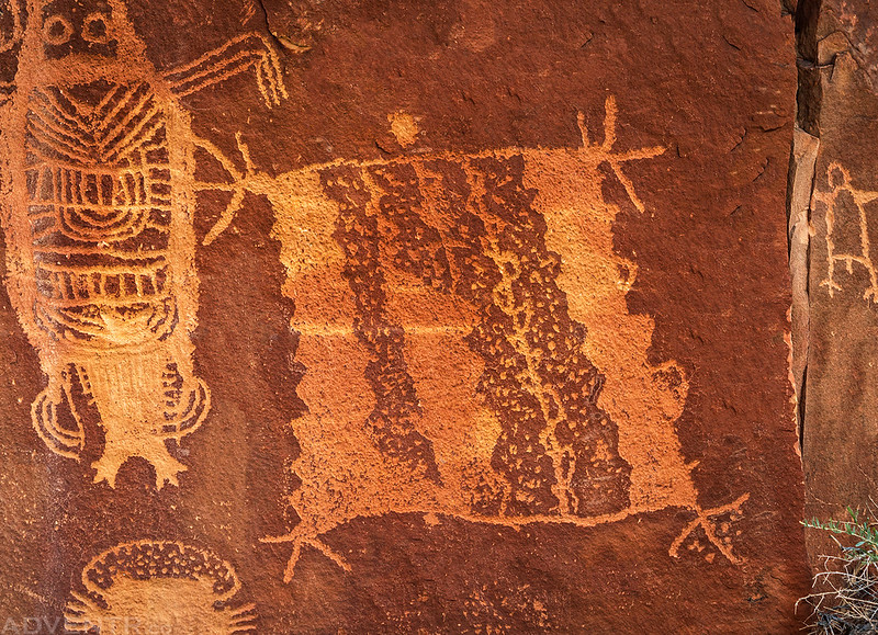
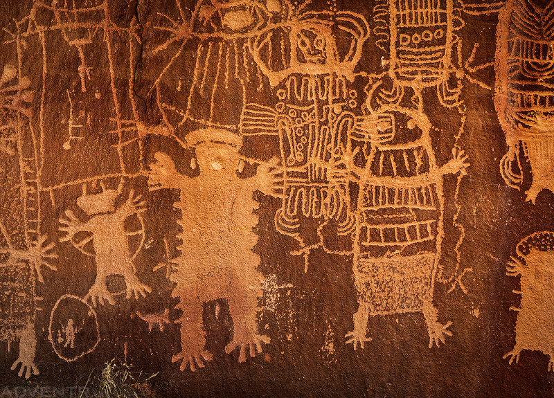
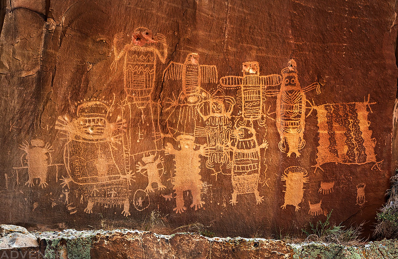
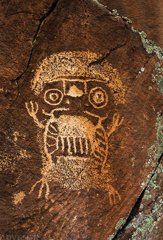
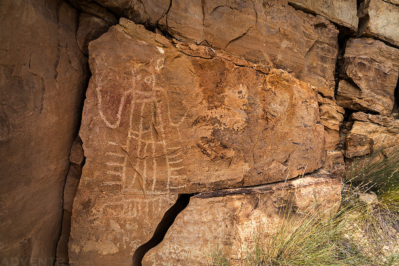
Poha Kahni: Where Spirits Live in the Rocks
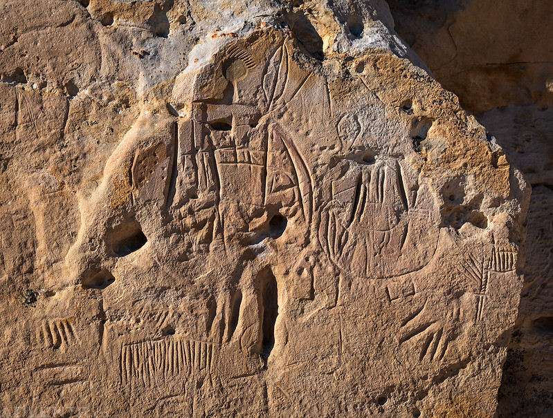
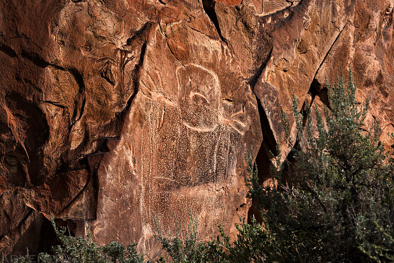
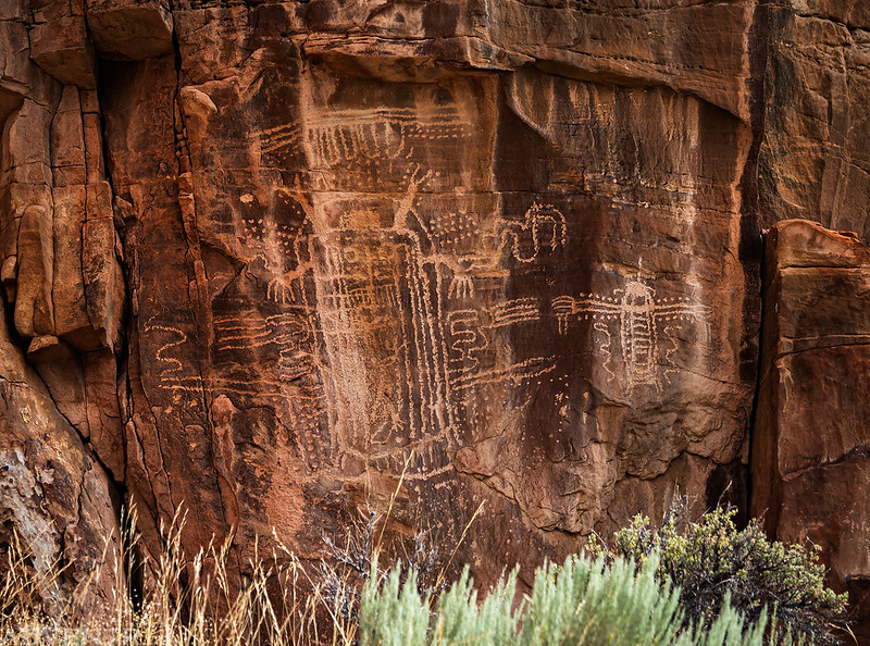
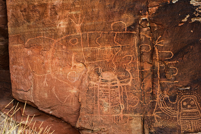
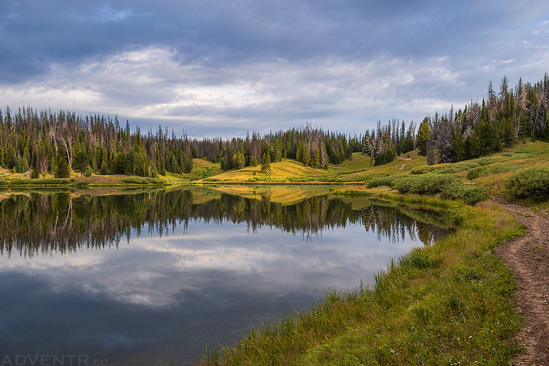
Rock Art of the Wind River
Over the next day-and-a-half we visited and photographed many amazing Dinwoody Style petroglyphs found along the Wind River drainage. The following are a collection of photographs of the unusual and unique rock art we saw on these days.


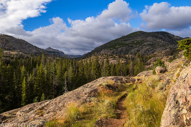
The Wind Rivers: Lake Louise Trail via Torrey Creek
Since we had spent much of our time on this trip looking for rock art, it did not leave us enough time to get in a decent backpacking trip into the Wind Rivers, so we had to find a day hike that would suffice and decided to hike up to Louise Lake from the Glacier Trail since it was not far from Dubois, where we had spent the previous night.
We got an early start on Friday morning and made our way up Torrey Creek to the Glacier Trailhead.

Glacier Trailhead View

Whiskey Mountain Cliffs

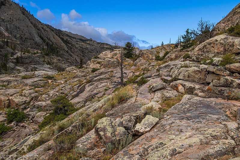
Following the Glacier Trail for a little ways.

Welcome to the Fitzpatrick Wilderness.

Lake Louise Trail View

Lake Louise Trail
Torrey Creek

Hiking up the final climb to Lake Louise.
As soon as we rounded the final corner and got our first glimpse of Lake Louse we were stuck with a strong cold wind that didn’t let up the entire time we were there.
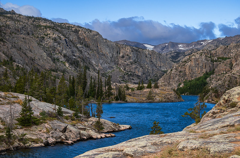
We hiked down to the shore of Lake Louise.
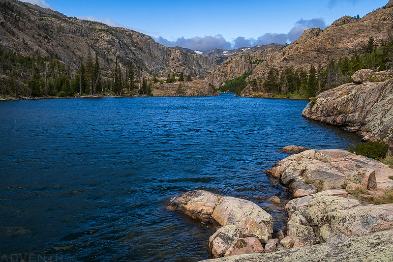
The waters were rough from the strong winds blowing across the surface.
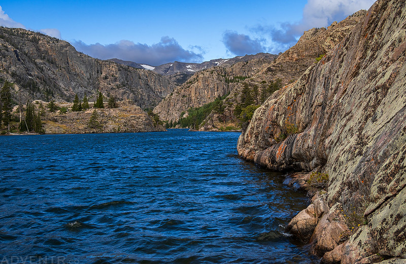
The amazing views were worth putting up with the wind!

Lake Louise

A view of the Torrey Rim as we started our hike back down.

On the way down we took a short side trip to the bridge over Torrey Creek on the Glacier Trail.
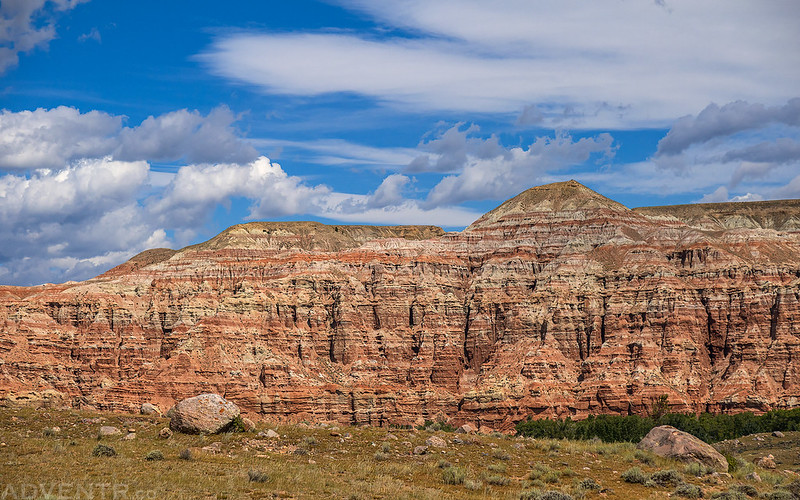
A view of the colorful Dubois Badlands as we made our way back to town for lunch before we headed up into the Absaroka Range.
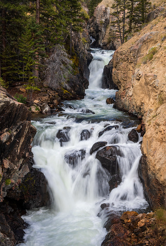
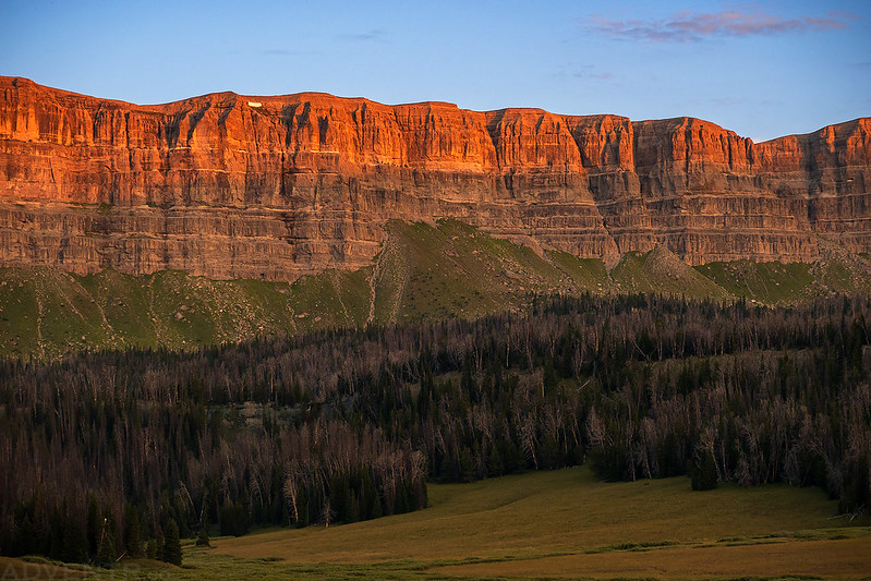
Brooks Lake: An Introduction to the Absaroka Range
After lunch in Dubois we continued up the highway toward Togwotee Pass and the headwaters of the Wind River. Since day hikes into the Wind River Range are hard to come by, we thought it would be a good time for an introduction to the Absaroka Range and found an available campsite at Brooks Lake to spend the night at.
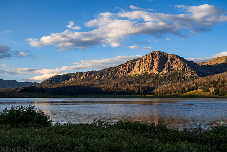
The afternoon light and clouds were looking good when we first arrived at Brooks Lake.

After we got settled into camp we went for a drive up to Togwotee Pass and then went on a short hike to Brooks Lake Creek Falls on our way back.

It was cloudy and raining when we started the hike to the waterfall, but by the time we reached the overlook the rain had stopped and the sun was out again.

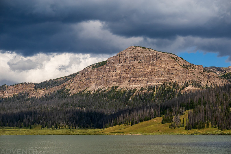
We spent the rest of our evening around our campsite and along the shore of Brooks Lake with the Pinnacle Buttes towering above.

Brooks Lake


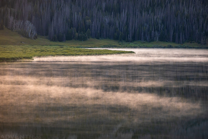
On Saturday morning we woke up early to hike to Upper Brooks Lake located just below Bear Cub Pass on the Continental Divide.
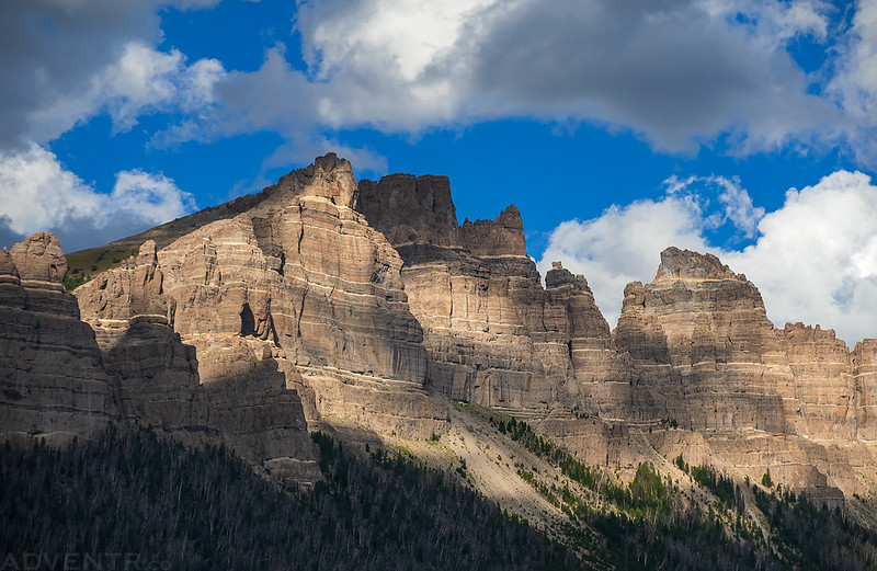
As we hiked up the Yellowstone Trail we watched the warm early morning light illuminate the breccia cliffs that make up the Continental Divide.

Sublette Peak

Steam Fog on Brooks Lake
We arrived at Upper Brooks Lake just in time to catch a good reflection with a little light on the cliffs.
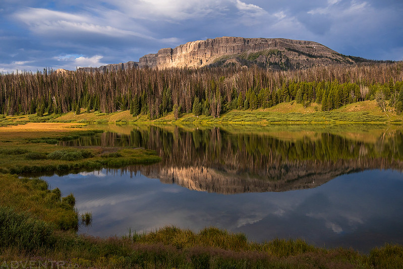
Upper Brooks Lake
I continued following the trail a short distance past the lake to Bear Cub Pass.

Once I reached the pass I walked a little ways into the Teton Wilderness before turning around.

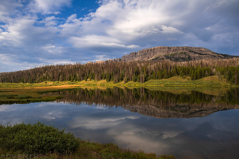
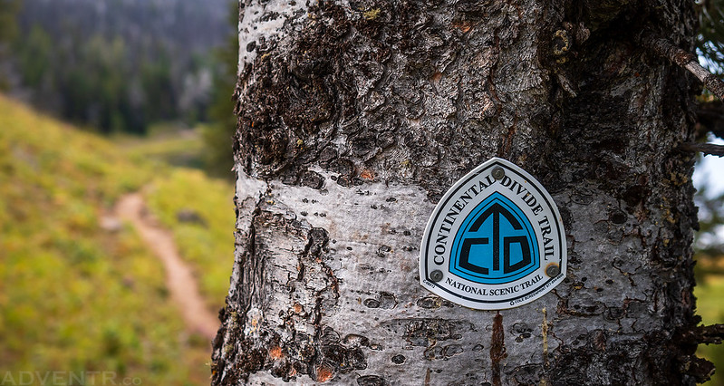
We followed the Continental Divide Trail around the lake and then continued down the other side of the valley back to our campsite.

Brooks Lake Creek Valley

Across the Wind River Range: Union Pass and the Sacred Rim
After returning from our hike to Upper Brooks Lake we packed up camp and started our drive back to the other side of the Wind River Range by way of Union Pass, which would bring us to the Green River and then on to Pinedale.
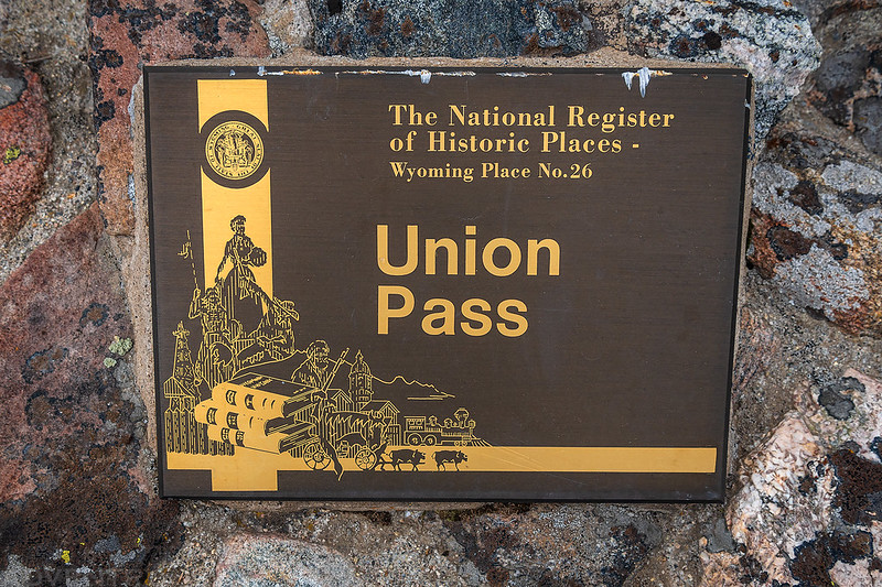
By the time we reached Union Pass the sky was mostly overcast and it was looking pretty dreary out.

Union Pass, so named in 1860 by Captain William F. Raynolds during the Hayden Surveys of Wyoming, provides access across the Continental Divide in the Northern Wind River Mountains. Ancient peoples used this pass for centuries, with use by fur trappers beginning in the early 1800’s. Wilson Price Hunt, an Astorian, crossed Union Pass in 1811, seeking buffalo to feed his party while en route to the mouth of the Columbia River. Jedediah Smith camped with the Mountain Crow during the winter of 1823-24 near Dubois, Wyoming and learned of Union Pass. Because of the deep snows, his attempt to cross failed. The Crow then told him of another pass, later named South Pass, which became the route through the mountains for the Oregon, Mormon and California Trails. Mountain men Jedediah Smith, William Sublette, Robert Campbell, Jim Bridger, and David Jackson also crossed while trapping for beaver. Union Pass is the source of the three major rivers in the American West. To the north, the waters of the Wind River flow to the Gulf of Mexico; the waters of the Green River to the south flow to the Gulf of California and the waters of the Gros Ventre to the northwest flow to the Pacific Ocean via the Snake and Columbia Rivers. Union Pass offers a majestic view of the Rocky Mountains including the Wind River Range, the Absaroka Mountains, the Gros Ventre Mountains, the Teton Range and the Wyoming Range. As those who came before us, abundant wildlife and alpine vegetation can be viewed year round in this beautiful high altitude setting of 9,210 feet.
On the other side of the pass we drove through Fish Creek Park.
Even though the light wasn’t great, we did have a couple nice views of the high peaks of the Wind River Range along the way.

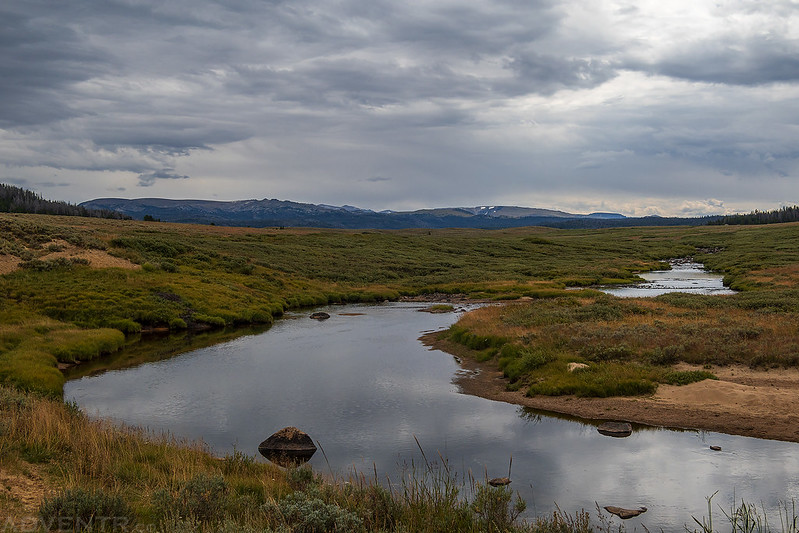
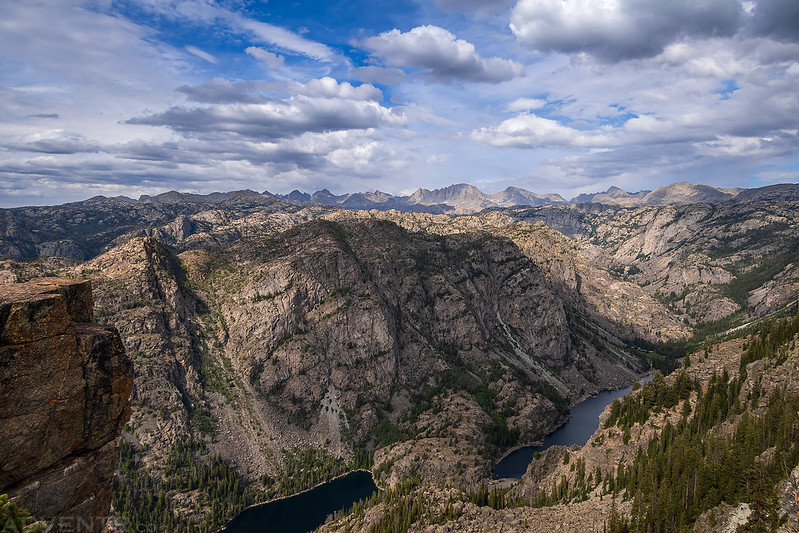
We stopped for lunch in Pinedale and then decided to go on one more short hike before starting our drive home. We followed Skyline Drive up to Elkhart Park so we could hike the Sacred Rim Trail to an overlook high above Long Lake and Fremont Creek.
The entire trail was in the trees with no views, until the very end when the trail comes abruptly to the very edge of the Fremont Creek Gorge.

Although the sky was still overcast when we left the trailhead, by the time we reached the edge of the deep chasm the clouds started clearing a bit and the sun came out. It was perfect timing for this amazing viewpoint!


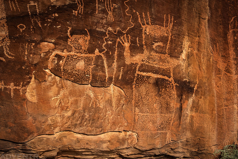
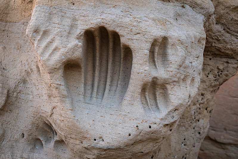
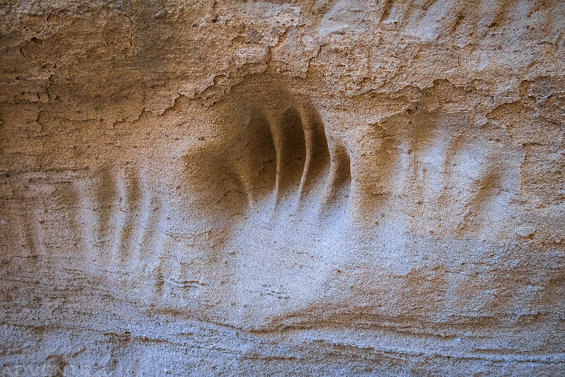
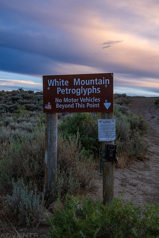
White Mountain Petroglyph Site
After returning to the trailhead from our hike out to the Sacred Rim it was time to start heading home. We planned to spend the night in Rock Springs, but before we arrived there we had just enough time to visit the White Mountain Petroglyph Site as the sun was setting for the day.
Along the way we passed by the Boars Tusk, which is an ancient volcanic plug that juts nearly 400 feet above the flat plains of Wyoming’s Red Desert.

Though they were hard to see and the light was fading fast, I still managed to get some photos of these intriguing petroglyphs at the base of White Mountain.


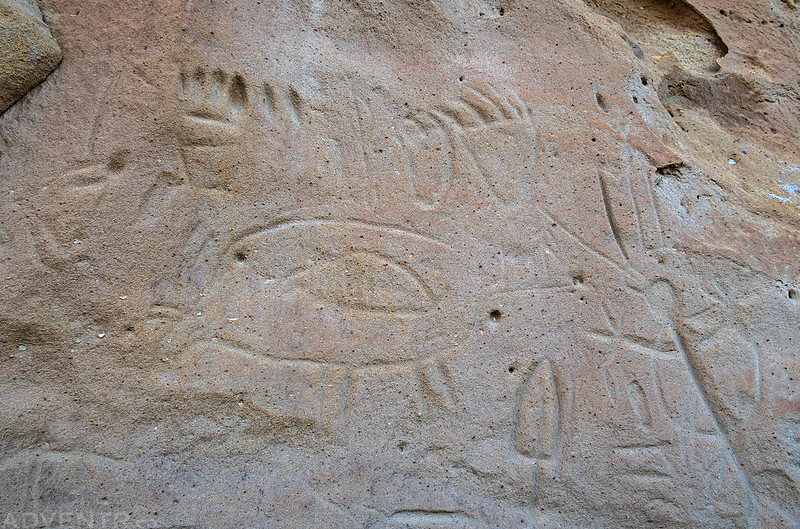


These deep grooved handprints on one large boulder at the site were very interesting and something I have not seen before.
White Rocks after Sunset

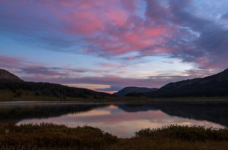
Leaving the White Mountain Petroglyphs Site with a colorful sky after sunset.
What a trip that was! Beautiful photos and interesting and different rock art. Last year we visited Pinedale and did that Sacred Rim hike. Such an incredible view. I really enjoy your blog!
Thanks Randy!