Sunday, May 22, 2022 | Alternate Plans: Back on the Four Corners Circuit
While making our original plans to Bandelier National Monument for this week, before they got cancelled, I had hoped that we would be able to stop by the Ute Mountain Tribal Park again on our way down to New Mexico. But even though we had to change those plans and stick around the Four Corners area, I was still hoping we would be able to go on another tour there. I spent the past two months trying to get ahold of someone at the park to schedule a tour, but was unsuccessful in getting anyone to call or email me back to make the arrangements, so I finally gave up on that idea. Instead, I decided that we were long overdue for another visit to Mesa Verde National Park and thought it would be a good idea to spend a full day on Wetherill Mesa since neither of us had been to that part of the park before. Thankfully, I was able to secure tickets to tours of Mug House and Long House in the weeks leading up to our trip, so we were all set for a great day on Wetherill Mesa!
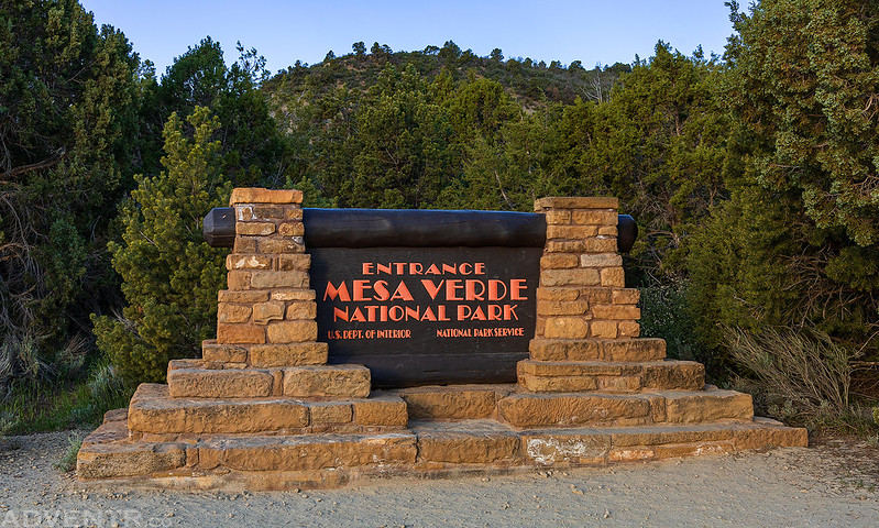
We woke up early on Sunday morning and headed into Mesa Verde National Park shortly after sunrise. Although the road to Wetherill Mesa doesn’t open up until 8:00am, there were a couple stops I wanted to make along the way first.
The morning sun over the La Plata Mountains from the Mancos Valley Overlook.

Our first short hike of the day was to the Park Point Fire Lookout. Diane and I had come to this spot on our last visit to the park, but for some reason I did not take a photo of the Fire Lookout that day, and I wanted to remedy that oversight.
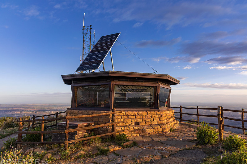
Park Point Benchmark. The highest point in the park at 8,572 feet, although topo maps list it as 8,571 feet.

Morning Layers
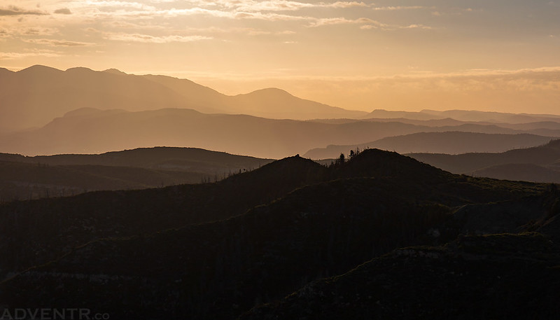
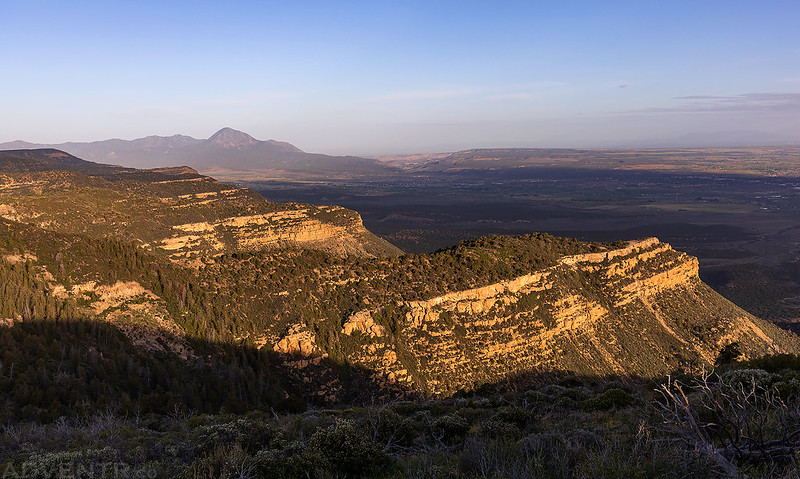
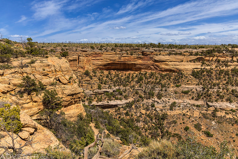
A beautiful morning view from the Park Point Overlook at the edge of Mesa Verde.

Overlooking the North Rim to Sleeping Ute Mountain.
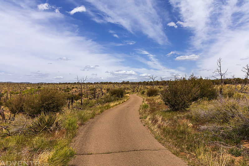
After one more short walk to the Geologic Overlook we made it to Far View Terrace a little early and stayed there until the road to Wetherill Mesa opened up at 8:00am. Once we made it to the parking lot at the end of the Wetherill Mesa Road, it was time to check in for our ranger-guided hike to Mug House at 9:00am. This particular tour is only offered twice a day and is kept small with only 10 people per group, which I think was a nice size.
On our way to Mug House we stopped at Painted Cave and Adobe Cave along the way.
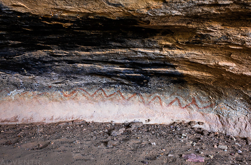
Following the boardwalk between Painted Cave and Adobe Cave.

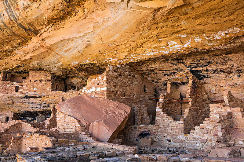
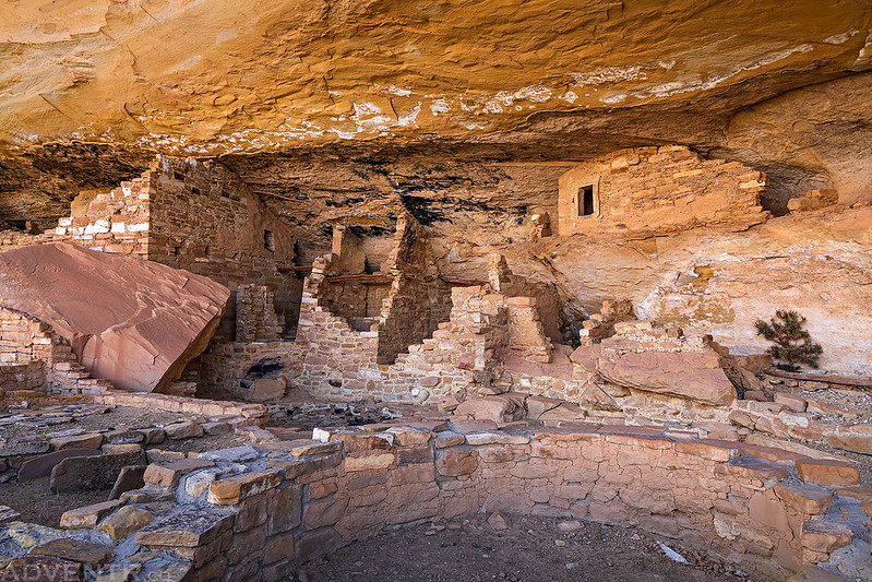
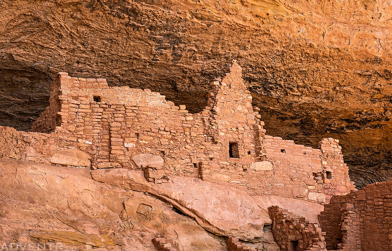
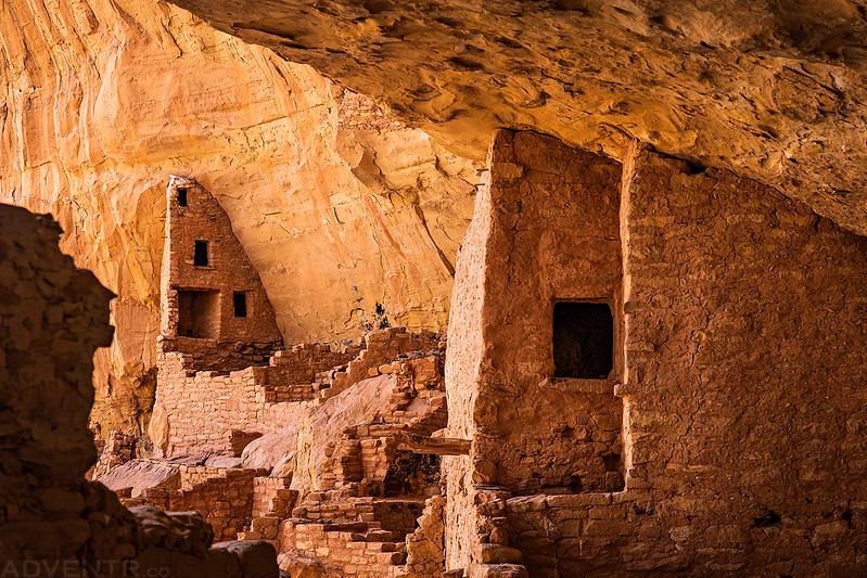
Not much further down the trail we had our first view of Mug House, which was named for three mugs tied together with yucca rope found hanging inside one of the rooms. The light was very nice this morning, so I took a bunch of photos as we explored the site.
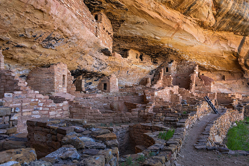

There was still a little plaster in one of the kivas.


After returning from Mug House we went on the self-guided tour of Step House which was a completely different experience. There were a lot more people at this site and the light was terrible. I ended up not taking many photos while we were there.
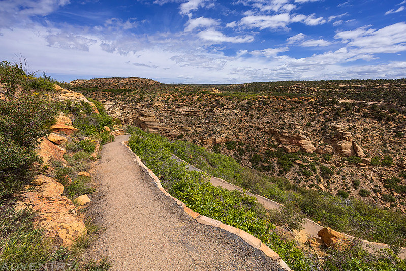
The view over Long Canyon as we started hiking to Step House.

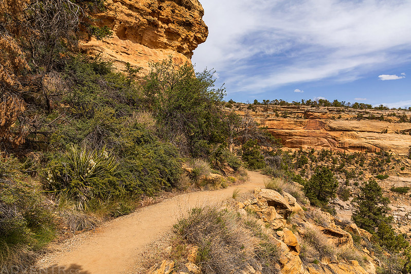
The trail to these ruins is paved and no tour reservations are required, so there were a lot more people here.

Following the paved trail to the alcove containing Step House.

This is a reconstructed pithouse found in the alcove.

There were a couple petroglyphs at this site.

We didn’t stick around very long and then followed the loop trail back to the rim of the canyon.

We returned to the Jeep and ate lunch before setting out to hike the Long House Loop Trail. Our first stop on the loop was at an overlook of Nordenskiold Site #16.

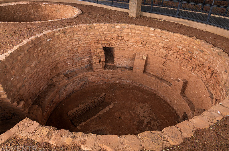
Then we wandered around all the mesa-top sites that make up the Badger House Community. All of these sites have building constructed over them to help protect them from the elements.

At this point Diane found a bench to sit and rest on while I finished the rest of the Long House Loop Trail on my own.

I made sure to stop at the Kodak House Overlook along the way.

Then it was back on the paved Long House Loop again.
I made one last stop at the Long House Overlook before meeting back up with Diane.

Once I joined up with Diane again it was just about time for our ranger-assisted tour of Long House at 3:00pm, so we headed over to the trailhead. The nice thing about the 3:00pm tour is that it’s the last one of the day and there were less people at the site since no other groups showed up after us.
Starting the descent to Long House.
Following the Long House Trail. The large alcove is located just around the corner.
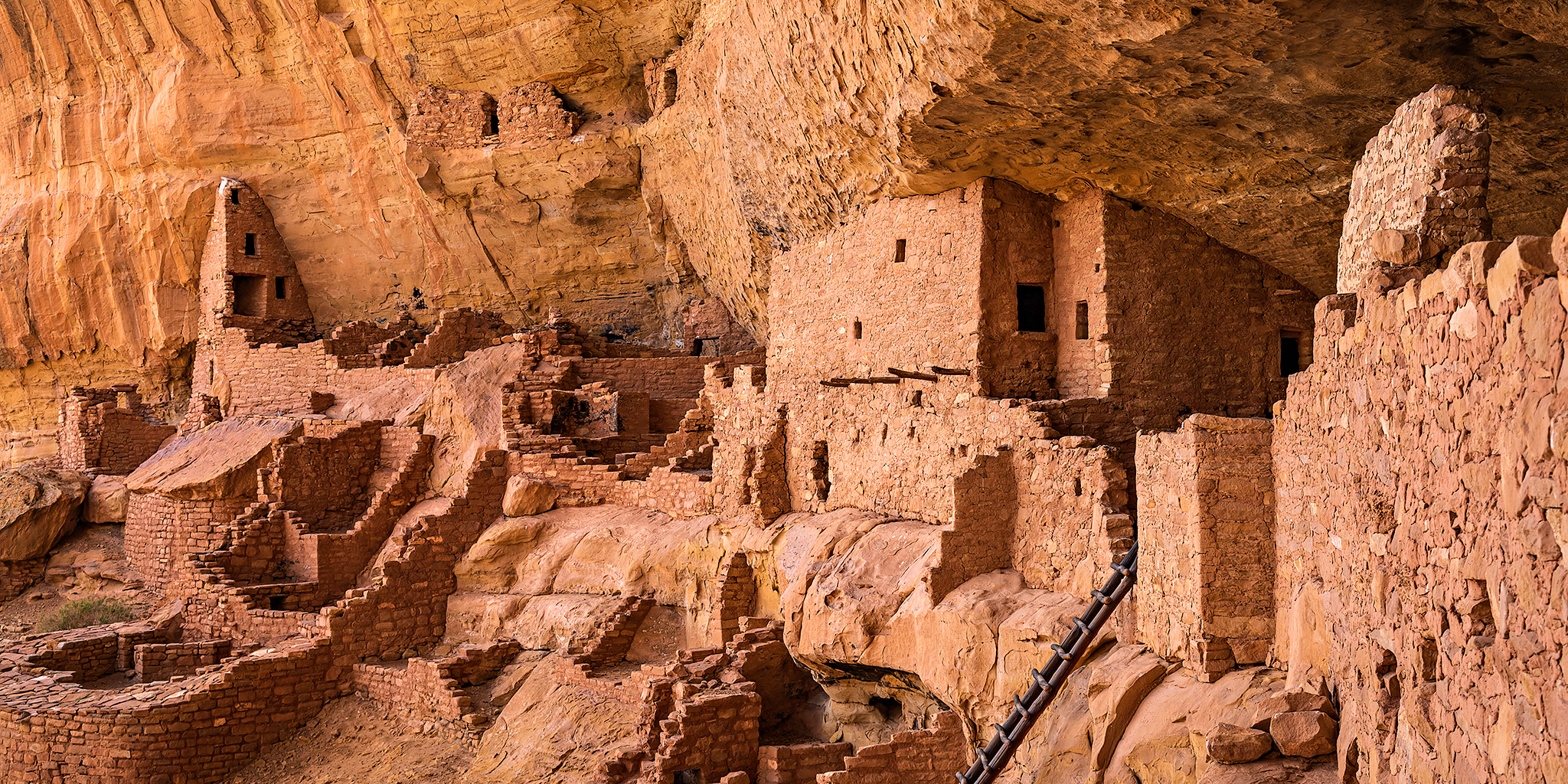
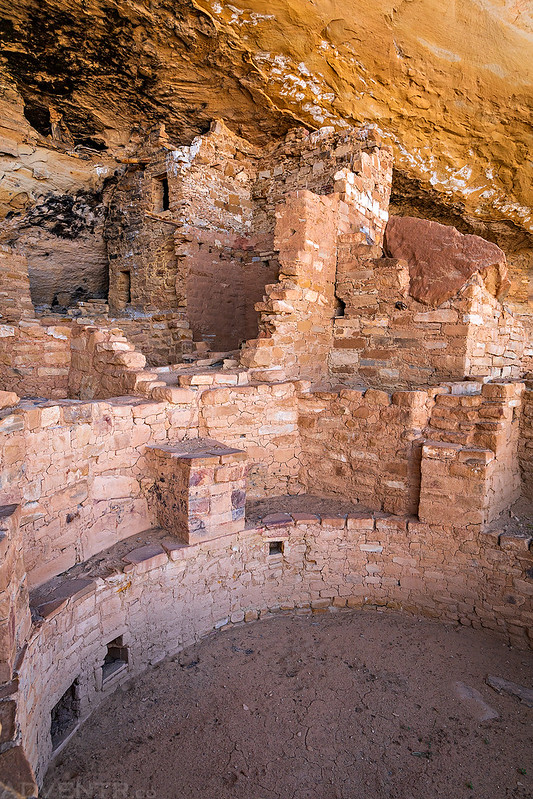
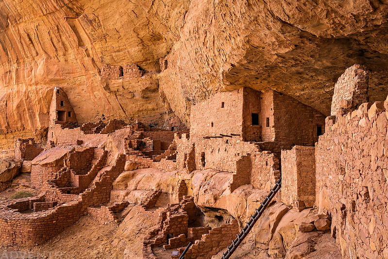
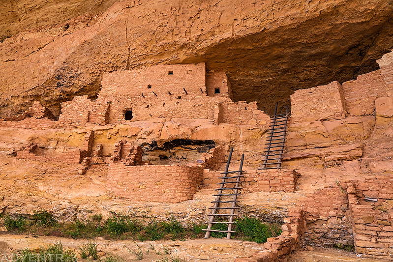
It wasn’t long until we had our first close-up views of Long House, the second-largest cliff dwelling in the park. We spent the next hour wandering around exploring the ruins. There were even a couple tall ladders you could climb up for a closer look at the upper ruins.


When we were done exploring Long House we followed the trail back up to the rim of the canyon and returned to my Jeep in the parking lot. It had been a full day on Wetherill Mesa!

Once we were back to my Jeep it was time to leave the park since we had a couple hour drive ahead of us still. We stopped for a quick dinner in Cortez and then it was off across the Navajo Nation to Chinle so we could be there for our Jeep Tour of Canyon del Muerto on Monday morning!
Thank you Randy! I always look forward to your posts and this one is awesome. I have visited Mesa Verde multiple times over the past several decades and never tire of the scenery and always seem to see new things each and every time even though I have covered some of the same area multiple times.
Your photography is beautiful and I appreciate you naming everything! Where are you able to find the names of everything and do you use multiple sources and how do you remember everything to write your posts?
I hope you write a book someday that contains all of the photographs and postings you have honored us with….please!
Thanks Nancy! I find the names of things mostly from maps and guidebooks. Most of these Trip Reports are from memory, so that’s why I try to post them as quick as possible after the trip before I forget things, but I also sometimes keep notes of things in my phone if I know it’s something I probably won’t remember.
I doubt I will ever write a book. This blog is probably the closest I will ever come to that.
Awesome new Adventr jeep!
Beautiful pics as always! Man, I do need to get back to Mesa Verde. I haven’t been since I was a kid!