Canyons of the Waterpocket Fold | Another Birthday Weekend in Capitol Reef National Park
President’s Day Weekend | Friday – Monday, February 12-15, 2021
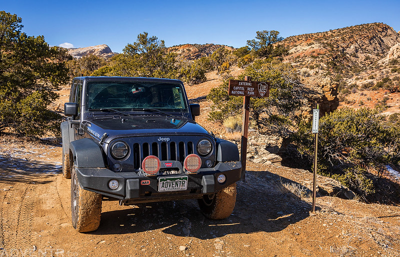
I guess you could say I have a love for exploring the long sandstone monoclines that are found on the Colorado Plateau. I’ve already spent some quality time along Comb Ridge and the San Rafael Reef this year, so I figured it was about time I got back to the Waterpocket Fold in Capitol Reef National Park. Aside from last year, I typically spend the three-day holiday weekend after my birthday in Capitol Reef, so this seemed like the perfect time to get back again this year! I left straight from work on Friday afternoon and headed west into Utah. The sunset was looking like it was going to be good shortly after I passed through Green River, so I turned off onto the Old Highway 24 between the San Rafael River and Green River to take a few photos.
The clouds were looking nice this evening.

Sunset in the badlands near Green River.
Driving along the old highway through Jessies Twist.
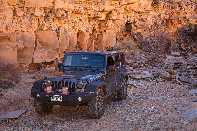
After returning to the main highway I finished the drive to Hanksville and topped off my fuel tank before heading west through the Blue Hills to Capitol Reef. I found a spot to camp off Notom Road near Pleasant Creek just outside of the park and went to bed early.
I woke up early on Saturday morning to drive closer to Torrey so I could get signal on my phone to check the weather. I had originally planned on hiking a few slot canyons this morning, but had been watching the weather forecast closely all week and it looked like I would probably have to change up my plans. The forecast was still calling for rain and snow in the area for most of the day and I knew I didn’t want to be taking my chances in any slot canyons today, so I decided to hike a few of the shorter trails in the Fruita Historic District that I had not been on before.
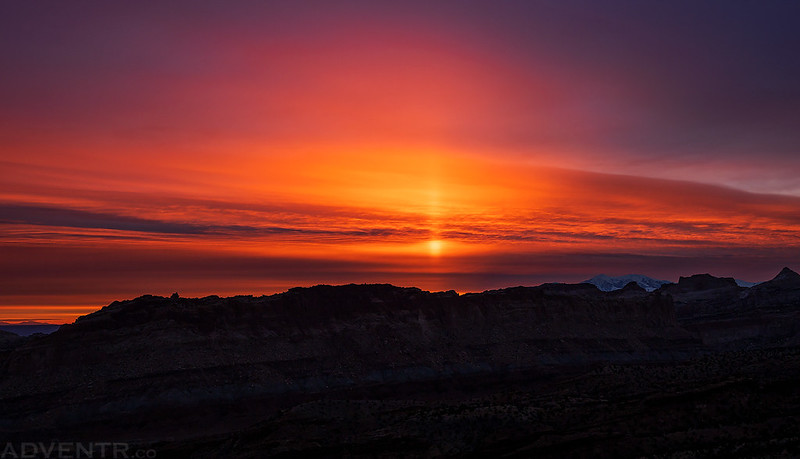
Before heading off to my first hike of the day I stopped by the Goosenecks Overlook since it looked like there might be a nice sunrise this morning. Although the sky was already mostly cloudy, there was a small gap on the horizon that looked like it might let a little light through. While I was waiting at the edge of the canyon the wind picked up and it started to snow lightly for a little bit.
Sunrise was mostly a bust as the gap on the horizon closed up too soon, but there were a few small spots of light on the cliffs above the Goosenecks of Sulphur Creek for a minute or so.
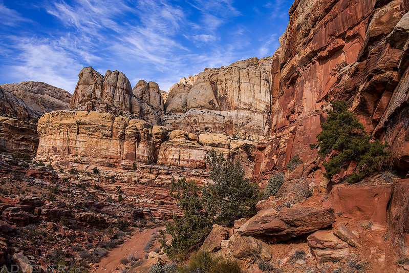
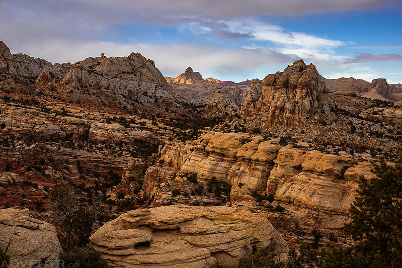
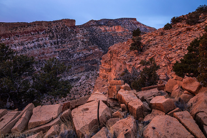
When I finally gave up on the sunrise I headed over the Slick Rock Divide on the Scenic Drive and stopped to hike the Old Wagon Trail. When I started hiking up the trail it was about 42 degrees out with a light breeze.
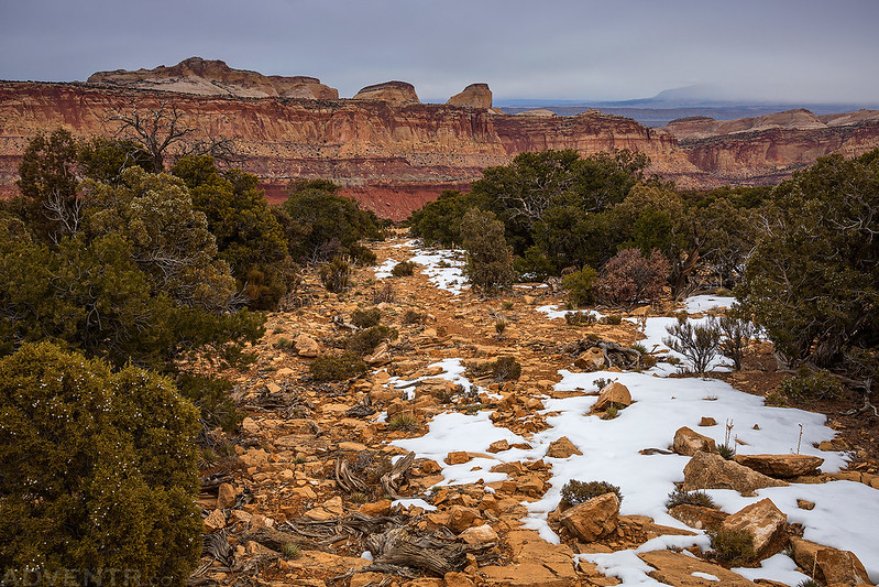
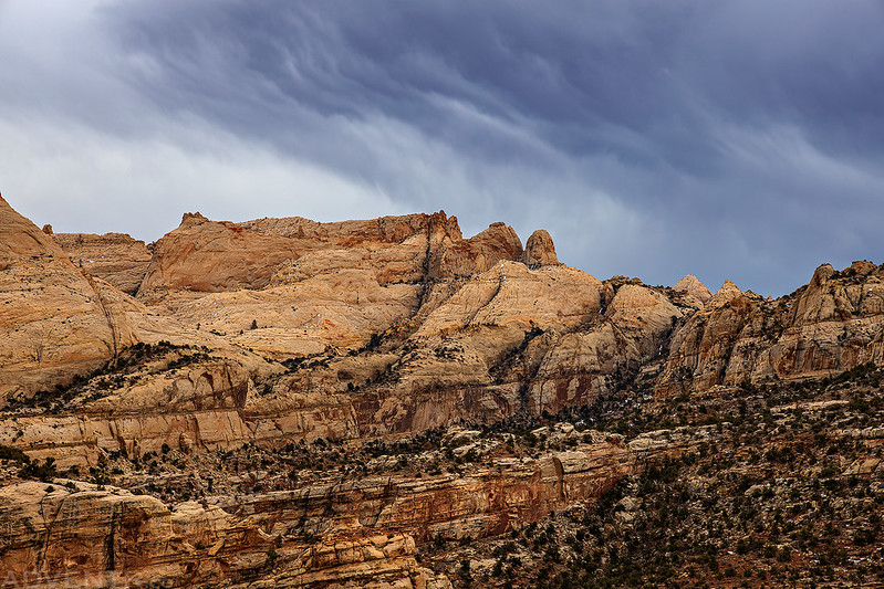
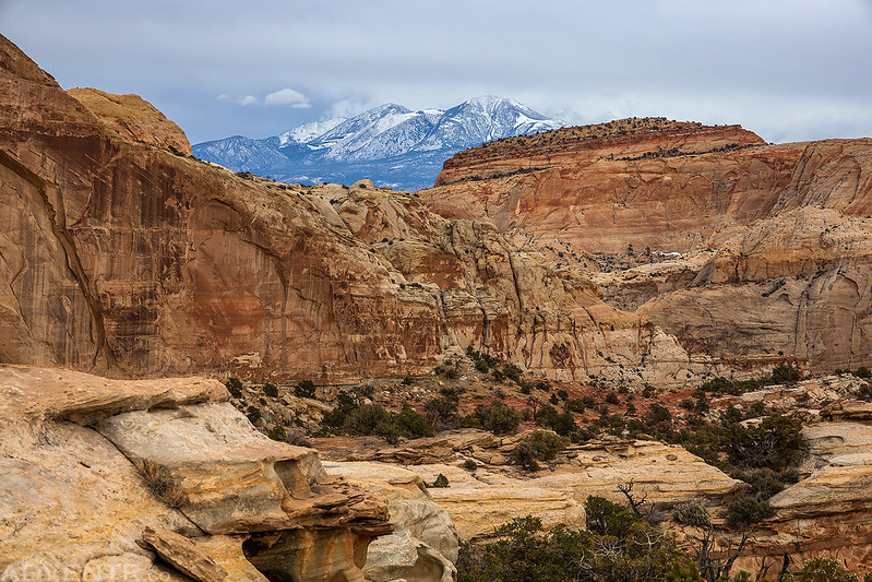
The Old Wagon Trail is a lollipop loop that climbs over 1,000 feet and takes you to the edge of Capitol Wash at the foot of Miners Mountain with views of the Waterpocket Fold, Golden Throne, Ferns Nipple and Henry Mountains to the east.
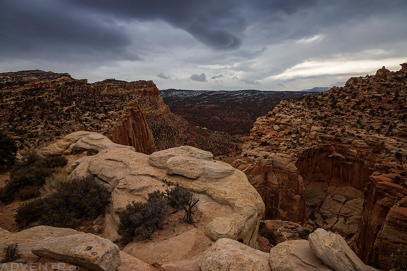
It looked like it was snowing further south along the Waterpocket Fold, but those storms would pretty much stay south of me all day. When I reached the upper end of the loop the wind did pick up quite a bit again, and it was bitterly cold!
A post marking the beginning of the loop portion of the trail.

There was a short spur trail that climbed up to a viewpoint along the way. This spot would probably look nice in the late afternoon on a day that wasn’t overcast…

After returning to the trailhead I drove back to the parking lot next to the Gifford House so I could hike the Fremont River Trail next.

After walking through the Fruita Campground and along the Fremont River for a bit, the trail then climbs a couple hundred feet to an overlook.
Following the Fremont River Trail to the overlook.

A view to the Navajo Knobs from the Fremont River Trail.
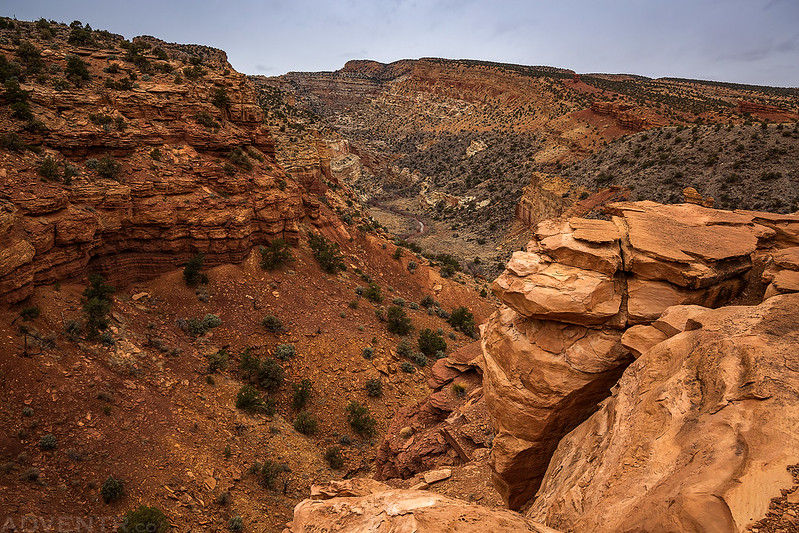
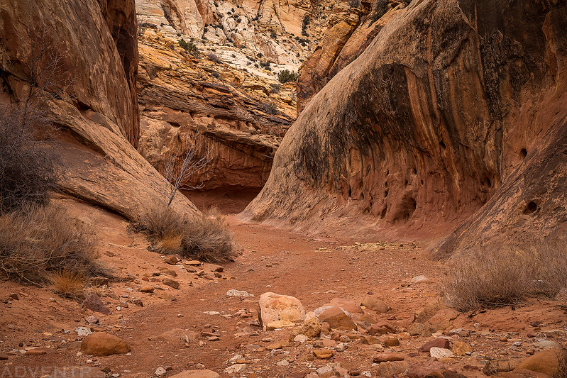
After returning to my Jeep by the Gifford House I decided to head into Torrey for lunch while I figured out what I was going to do for the rest of the day. While eating a burger in my Jeep I decided that I would head back to Capitol Gorge so I could finish hiking all the way through the canyon to the east side of the Waterpocket Fold. The last time I was here with Diane the road was closed so we had only hiked to The Tanks before turning around.
Walking through the narrows of Capitol Gorge I passed a number of people who we headed to The Tanks and back. It kind of made me glad that the road was closed the last time I was here since we saw no one that day! Once I passed The Tanks I saw no one else.

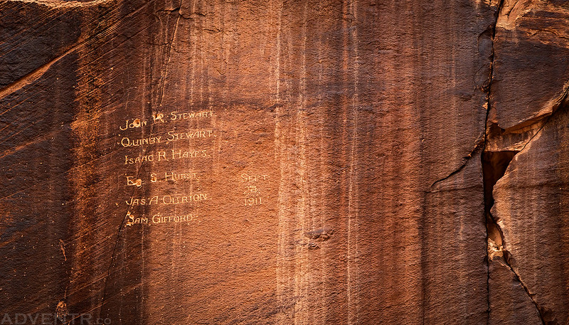
These inscriptions from 1911 are high above the canyon floor and I don’t recall ever seeing them on my previous visits.
Capitol Gorge Curves
I’m having a hard time reading this old inscription, but the dates appear to be from 1888.

After reaching the mouth of the canyon I turned around to hike back up and it started lightly raining for a while.

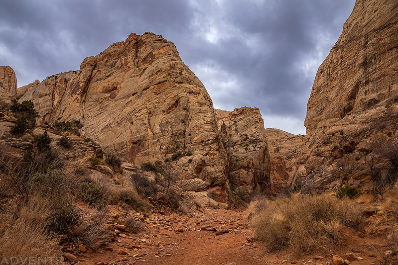
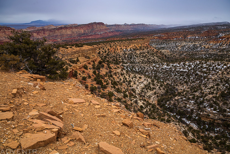
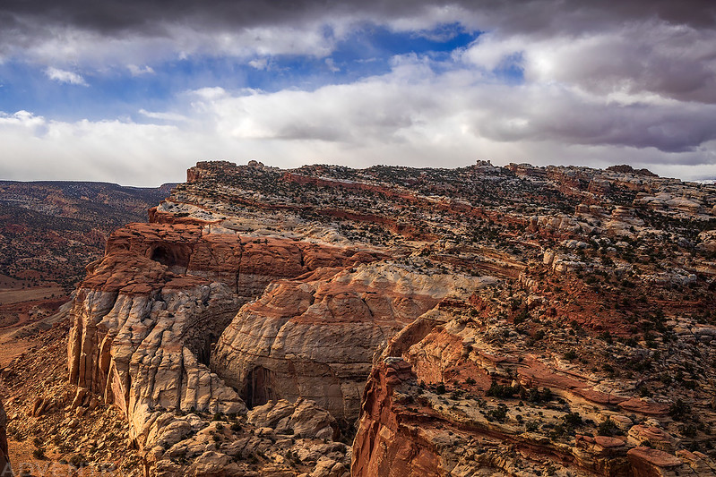
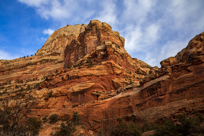
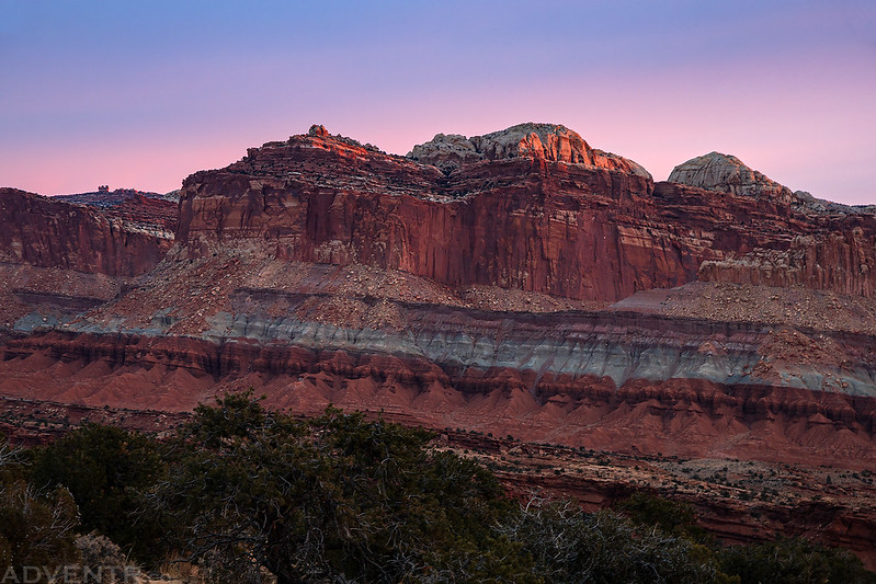
I had planned to hike up the Golden Throne Trail for sunset this weekend, and since I was in the area I decided to do that today. Although it was still pretty overcast out when I started hiking, I hoped that a little light might slip through…
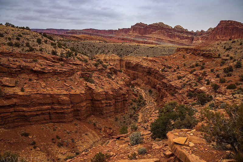
The Golden Throne Trail wound it’s way around a couple of canyons as it climbed up to the top of the Waterpocket Fold.

The scenery was outstanding and it seemed like the sun was trying to come out at times.

Dark clouds over Capitol Gorge and Miners Mountain.
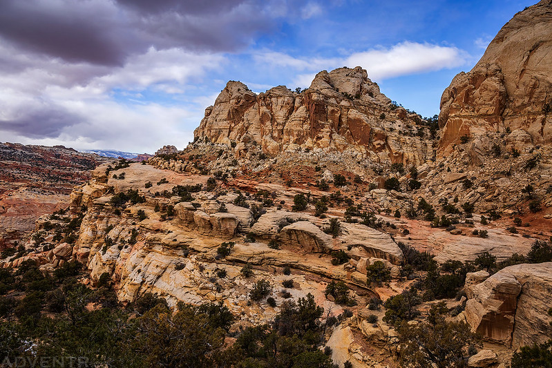
There were more great views as I neared the end of the trail.

Even though there was no nice light this evening, some of the clouds looked interesting.
The Henry Mountains were visible to the east.
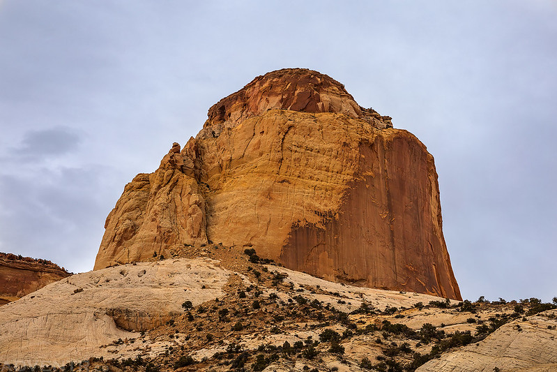
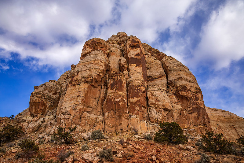
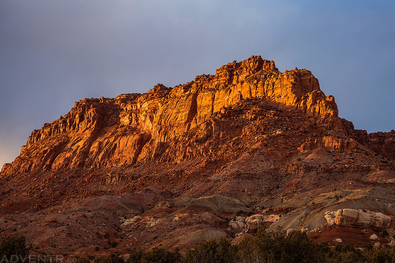
Here’s the Golden Throne on a cloudy evening.
End of Trail

Since I could tell that sunset was going to be a bust, I hiked down a little early and made it back to my Jeep while it was still light out. Then I left the park and returned to the same campsite I had stayed at the night before. I had dinner, read for a bit and went to bed early. It got really windy overnight and the stronger gusts woke me up a few times!
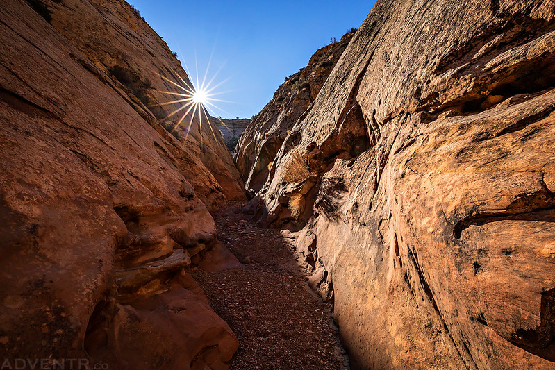
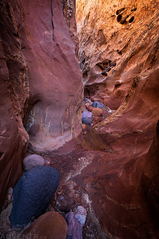
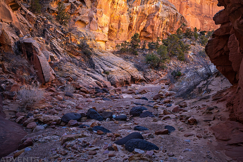
The weather forecast for Sunday was looking good with no rain and partly cloudy skies predicted, so it was time to check out some slot canyons. Since the sky had stayed overcast all day on Saturday I was really hoping for better conditions on Sunday, but things weren’t looking good when I woke up to more clouds and another sunrise that didn’t happen. I drove down Notom Road a few more miles to start my first hike into Sheets Gulch.
I was hiking up the wash in Sheets Gulch when the sun finally started to come out!

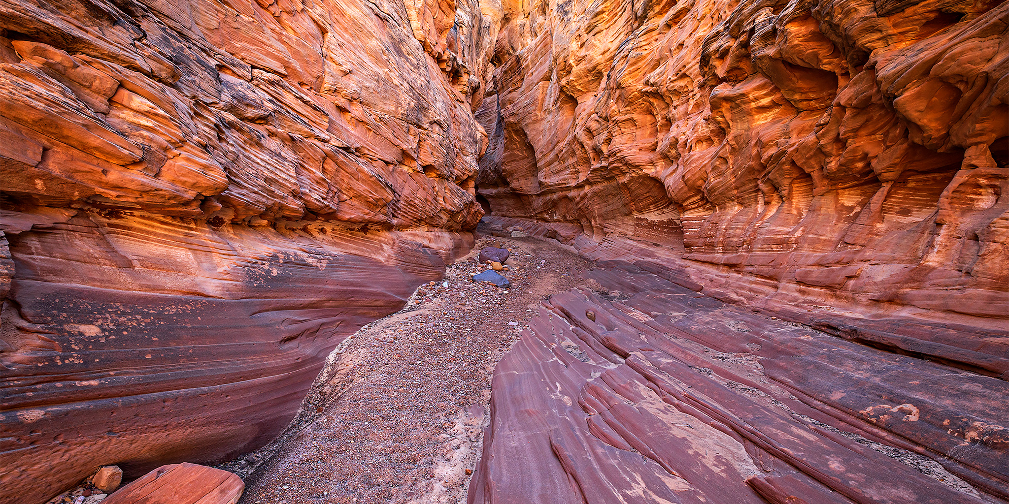
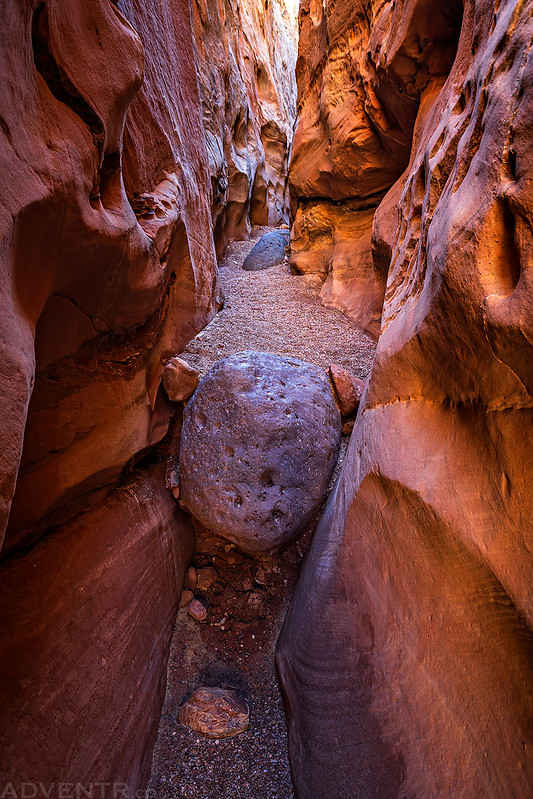
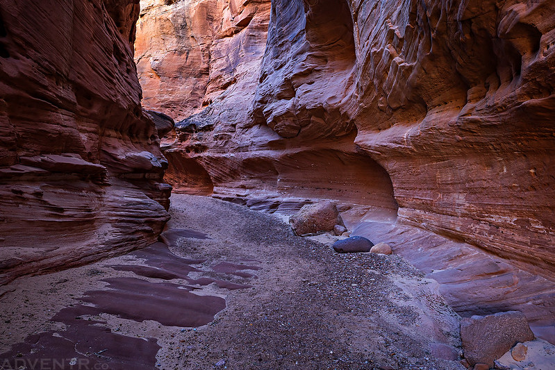
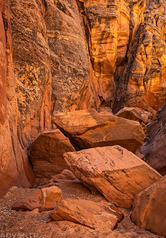
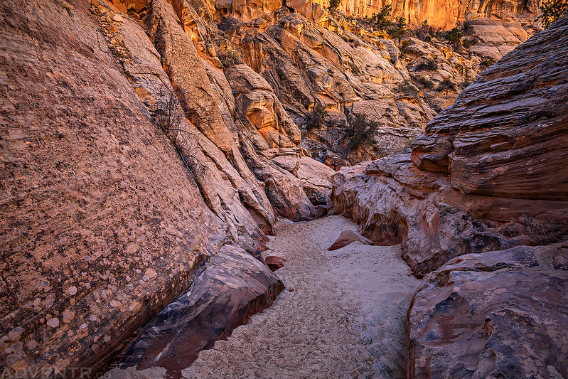
Soon the canyon started to narrow up, and it only would get better from here!
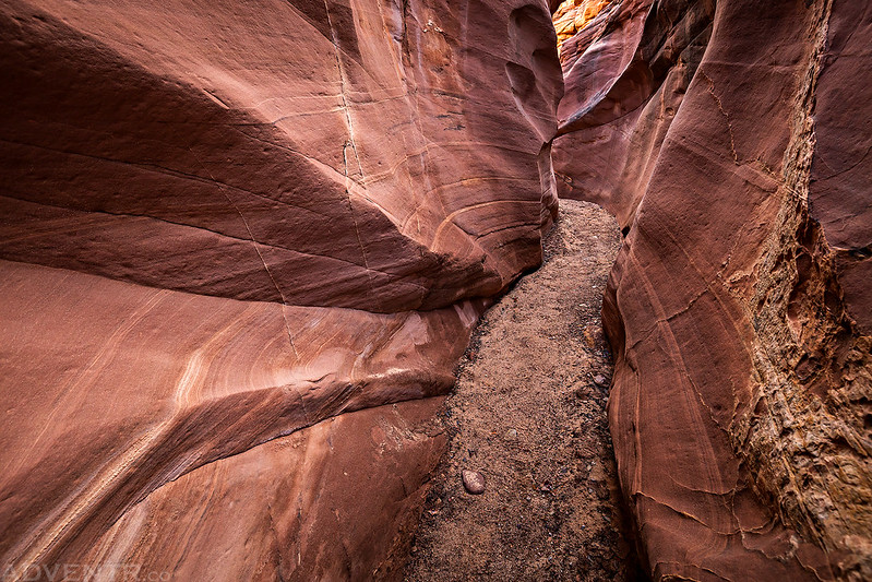
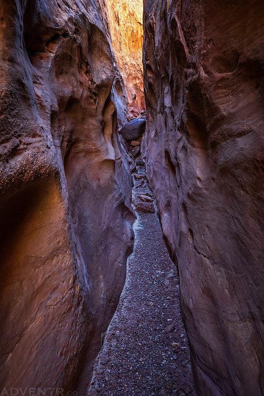
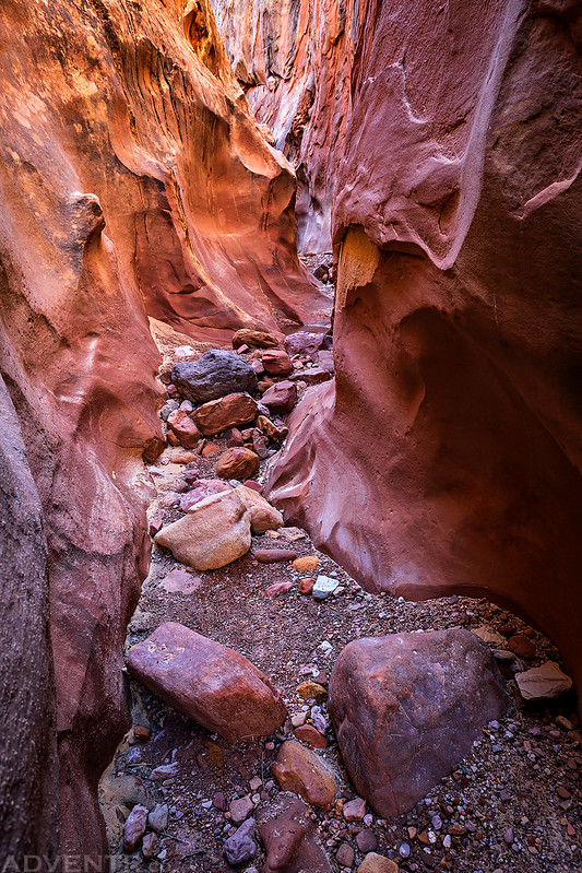
The sculpted narrows and slots were amazingly beautiful and the light seemed to get better the further I hiked into the canyon.


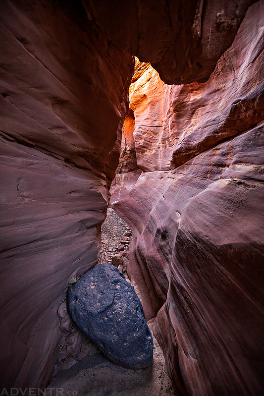
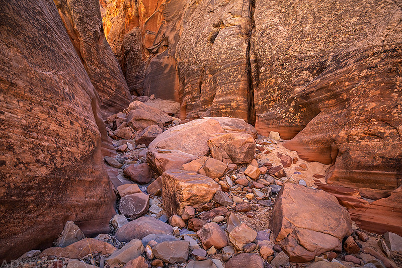
I really enjoyed hiking through this canyon and I was pretty happy that I was able to climb up a few obstacles by myself that would have turned me back just a few years ago.

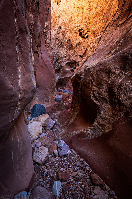
I continued hiking until I reached a pool of water that I couldn’t stem over, and it was too cold out this morning to voluntarily get my feet wet without neoprene socks, which I didn’t bring with.

I turned around and took plenty of photos on my way back through the canyon.


Next I was hoping to hike through Oak Creek Canyon, but on my way to the trailhead I encountered a lot of slippery clay on the road and decided it would probably be best to turn around and come back on a day the road was dry.
Leaving Capitol Reef after being defeated by slippery clay.
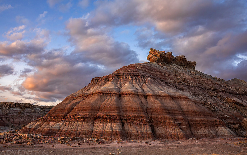
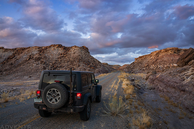
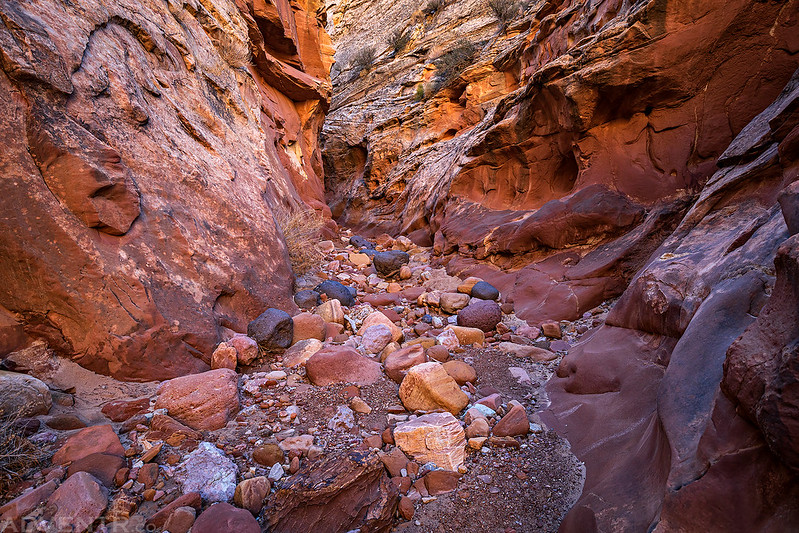
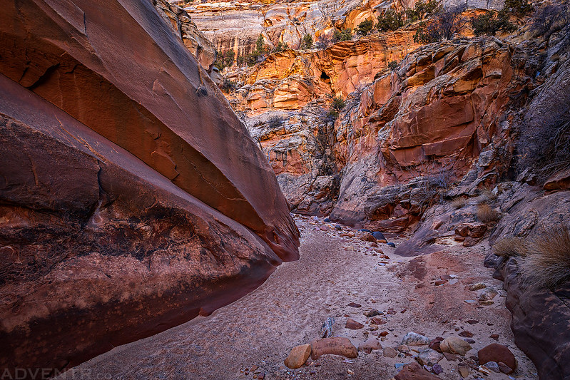
Instead of hiking along Oak Creek, I returned to the Cottonwood Wash Trailhead so I could hike up that canyon. I thought I would have to start hiking from the road, but when I arrived I found that the wash is actually a designated motorized route and I was able to drive further up the canyon than I had anticipated.
I parked at the end of the route in Cottonwood Wash and start hiking from here.
I wasn’t able to hike as far up this canyon as I had in Sheets Gulch because I got stopped by an obstacle much sooner, but the parts of the canyon I did see were very nice and well worth it!


On my way back out of the canyon I spotted this carving high up on the canyon wall.

After returning to my Jeep I drove back along the Fremont River to the Fruita Historic District again so I could try to hike up to Ferns Nipple for sunset.

When I arrived at the trailhead in Grand Wash it was packed with vehicles. It was a much busier place than I was expecting, but I luckily found a parking spot. Unfortunately, as soon as I opened my door I could hear that one of my tires was losing air. I drove backwards a few inches and the sound of air escaping stopped. I looked to see if I could find where the air was coming from and was not happy to discover that it was a puncture in the sidewall. Since air was only escaping when the tire was stopped at a certain spot, I decided that I would go on my hike first and then come back to put on my spare tire.
I started hiking down Grand Wash for a short distance and then began climbing up a rough route opposite of the Cassidy Arch Trail.
The view over Grand Wash was great!

There was one short climbing section that gave me a pause, but I was able to get up it and soon found myself in Bear Canyon.


As I climbed higher the views across Grand Wash to Cassidy Arch and the Frying Pan were pretty outstanding!
Like many of the other trails in the area, this one goes around the heads of a couple canyons along the way.
Looking up at the point above my stopping point for this hike.
At this point my legs were getting tired, I was slowing down and it was getting late. Plus, I still had a tire to change when I got back down to my Jeep, so I decided to end my hike at this viewpoint of Ferns Nipple. I will have to return another time to try to climb to the top.

Waterpocket Fold Country
Following a ledge during my descent into Grand Wash.

Looking up to the mouth of Bear Canyon shortly before I returned to the trailhead.
Instead of changing the tire in a gravel parking lot in the shade I decided to drive back out to the Scenic Drive to find a paved pullout in the sun to work in since the tire had not lost any more air while I was gone. As I drove I could hear spurts of air coming out of the tire every time it rotated to the right spot.
At least I had a great view while putting the spare tire on…

It figures that the first decent sunset of the weeked was happening while I was changing my tire on the side of the road.

It didn’t take me long to change the tire, so I quickly drove over to Panorama Point to catch the last light of the sunset.

Mummy Cliff

Chimney Rock
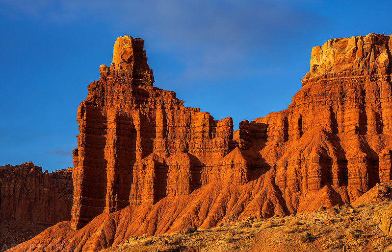
Last light on Meeks Mesa.
When the sun was down I continued on to Torrey to top off my gas tank and then returned to the same campsite near Pleasant Creek for a third night in a row.
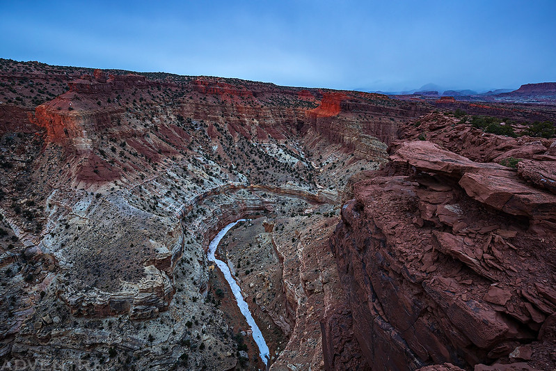
On Monday morning I woke up extra early so I could hike the Fremont River Gorge Trail and catch sunrise from the top. It was 22 degrees out when I got up which was not only the coldest morning of the trip, but the first time it got down below freezing, too. I drove over to the old Blacksmith Shop in Fruita and started hiking up the trail in the dark. After the initial climb to the top of the mesa the trail levelled off for a while but then steeply climbed to the final overlook.
I had high hopes for sunrise this morning when I turned around and saw a sun pillar over the Waterpocket Fold.
As I first reached the edge of the Fremont River Gorge there was a little bit of light on the landscape, but it didn’t last long.
The Navajo Knobs were looking nice lit up for a few minutes, too.
Looking down to the Fremont River after the sun disappeared behind a bank of clouds and would stay hidden for the rest of the morning.

The Fremont River Gorge under another overcast sky.

I stuck around at the overlook hoping the sun would come back out again, but eventually gave up. I hiked back down to the trailhead and started the drive back home. Although I would have preferred a little more sunshine, I still had another great birthday weekend in Capitol Reef National Park!
>> Weekend Wandering Along the Waterpocket Fold Photo Gallery
Hi Randy,
Another great trip report, with the usual stunning photos.
If you get the chance, on another occasion, I’d recommend the hike to the summit of Ferns Nipple in Capitol Reef NP. Kelsey indicates 2 routes to the plateau from Grand Wash, which can be combined into a fun loop.
I admit that I chickened out of an attempt on the summit on my first visit, but made it successfully on my next visit. That sure is some steep slickrock !
Iain D.
Hallo Randy,
congratulation for your Birthday and thank you for your Trip Report.
Michael
Thank you so much for the trip report! I always enjoy your Adventures!!!
Thank you Donnette!