Wilhite Trail & Lathrop Trail
Friday – Sunday, November 22-24, 2019
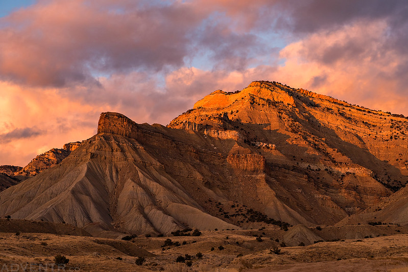
I was originally supposed to go hiking with my friend Alan this weekend, but he had some issues come up on his trip and had to change plans earlier in the week, so I was on my own to find something to do. I figured this would be a good opportunity for me to return to the Island in the Sky District of Canyonlands National Park so I could continue hiking more of the official trails there. I planned to leave right after work on Friday afternoon, but the sky was looking nice when I got out of work so I drove over to the base of the Book Cliffs to watch the sunset before heading out of town. When the sun was down I grabbed a quick dinner in Fruita and then made my way over to Canyonlands and found a spot to camp outside of the Park.
A nice Friday evening drive towards the foot of the Book Cliffs.

As I hoped, the colors of the sunset were very nice this evening.
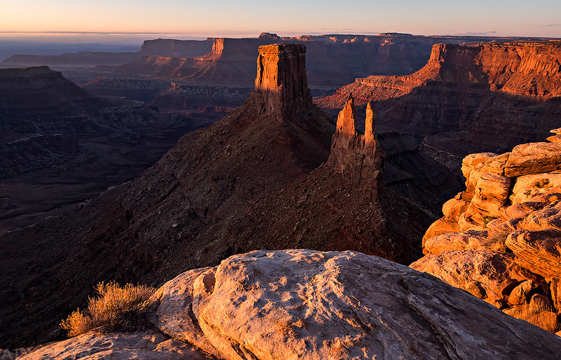
I woke up early on Saturday morning so I could drive out to Marlboro Point to watch the sunrise. I haven’t been back to this spot in about seven years, so it was nice to return and catch the view.
Subtle light at dawn from Marlboro Point.
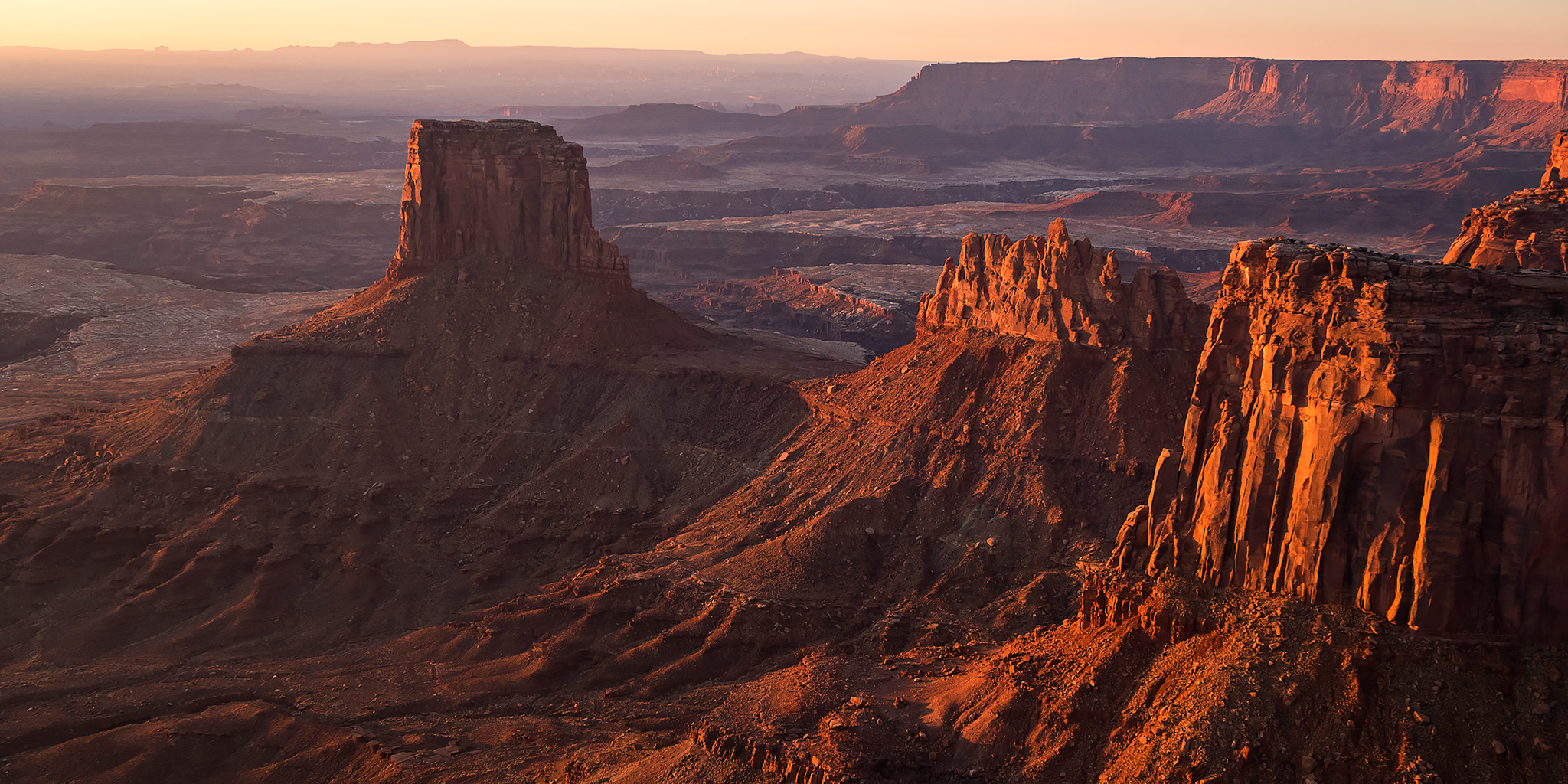
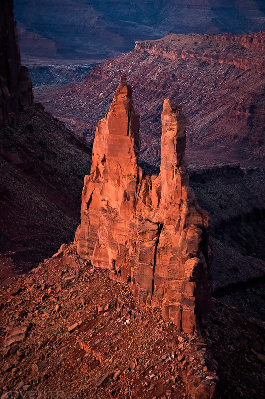
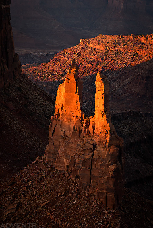
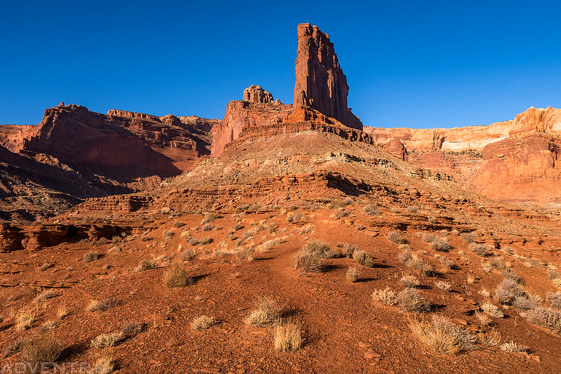
Alpenglow on the Crows Head Spire.
Sunrise from Marlboro Point. A great way to start the day!
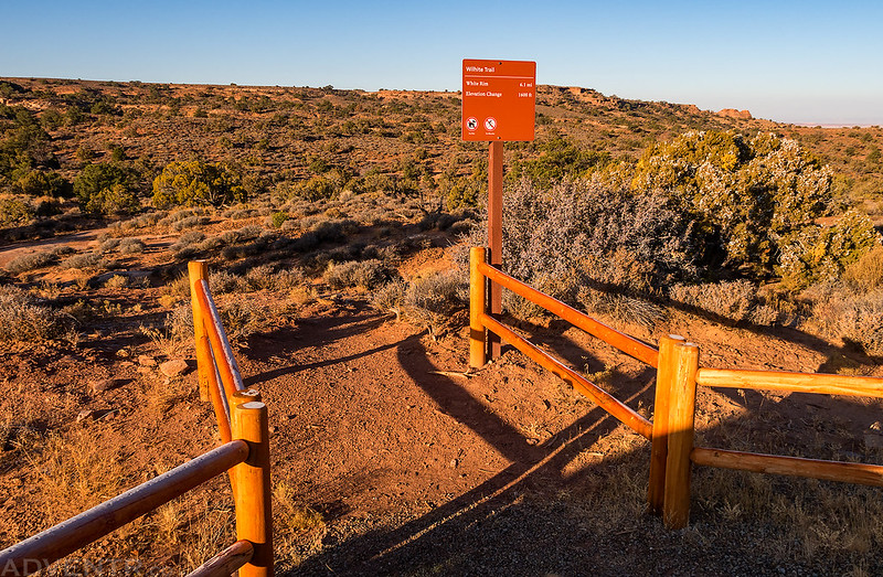
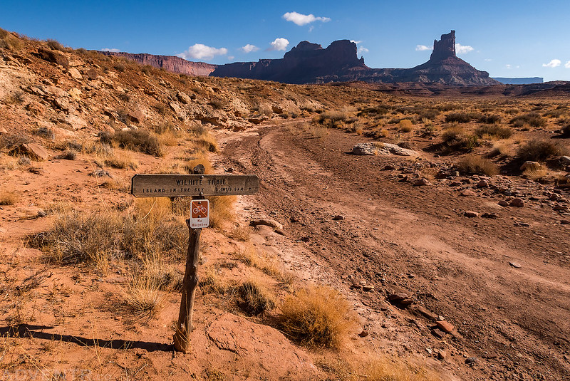
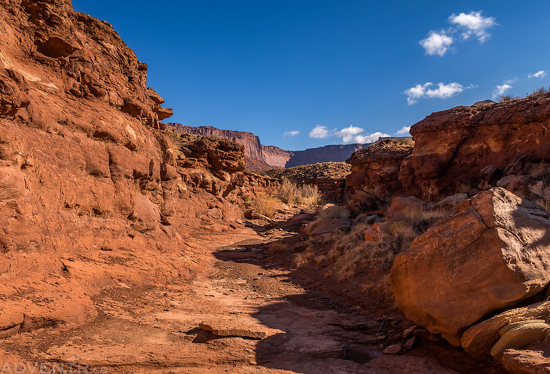
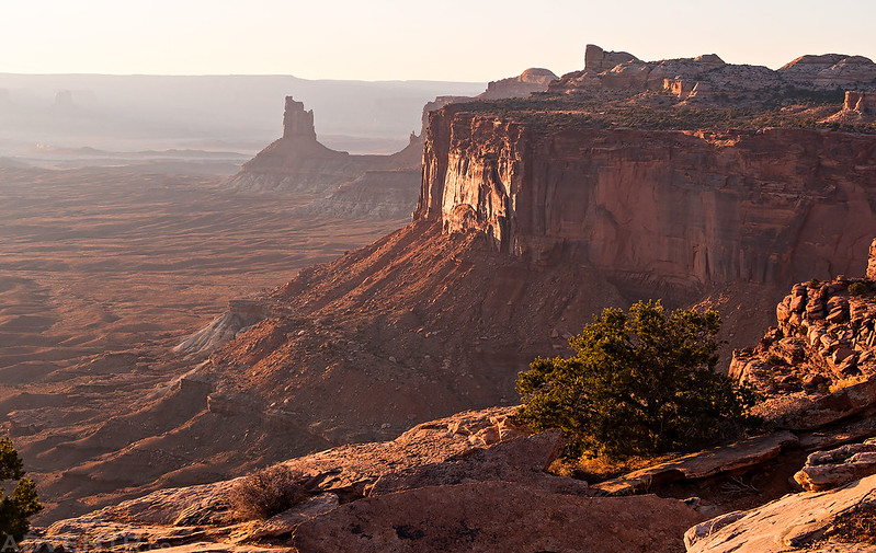
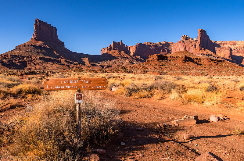
When the sun was up I drove back to the highway and entered the Park so I could hike the Wilhite Trail today. As I started hiking I noticed that mine were the first footprints on the trail since the recent storm had come through the area. It was very humid out which created a lot of haze in the atmosphere as I viewed the familiar distant landmarks from the trail.
Starting my hike on the Wilhite Trail.
As I crested the top of the first ridge along the trail I got my first view of Candlestick Tower below and Cleopatras Chair on the horizon.

Looking down over the Holeman Spring Basin from the edge of the Island in the Sky. After descending the steep switchbacks of the trail, my route would follow that drainage below all the way to the White Rim Road.

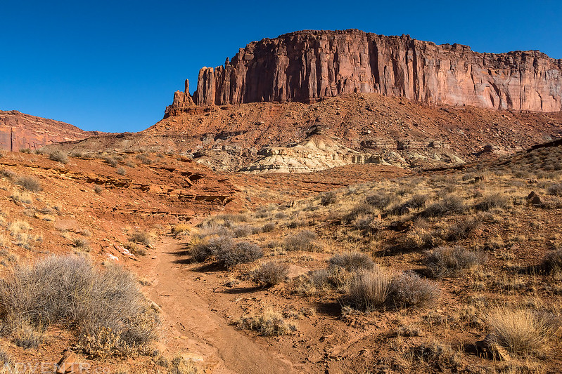
Although the descent was steep, the upper switchbacks of the trail were easy hiking. Near the bottom of the descent the trail got a little rougher with some boulder hopping required.

Once at the bottom of the steep part of the trail the hiking got easier again.

The remainder of the trail mostly followed a shallow wash and canyon the rest of the way. Most of the trail was dry, but the last mile or so of the drainage it followed became muddy. Not slippery muddy, but stick-to-the-bottom-of-your-shoe muddy!

A nice little granary I stopped to visit.

I had started hiking around 8:30am in the morning and reached the White Rim Road just before 11:00am. I sat on a boulder along the road and had some lunch. While I was resting here, two bikepackers rode by on the road, which were the only two people I would see on the trail all day.
I had hoped to climb down into the Holeman Slot on this visit, but like last time I was here, it was full of water and mud, so I walked the rim and enjoyed the views from above. Maybe next year…

Hiking back up the trail through a shallow canyon.
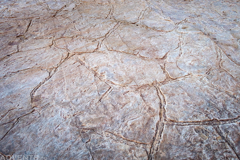
The shapes on the top of this flat boulder reminded me of the playas in Death Valley.
Hiking back up the wash towards the Island in the Sky.
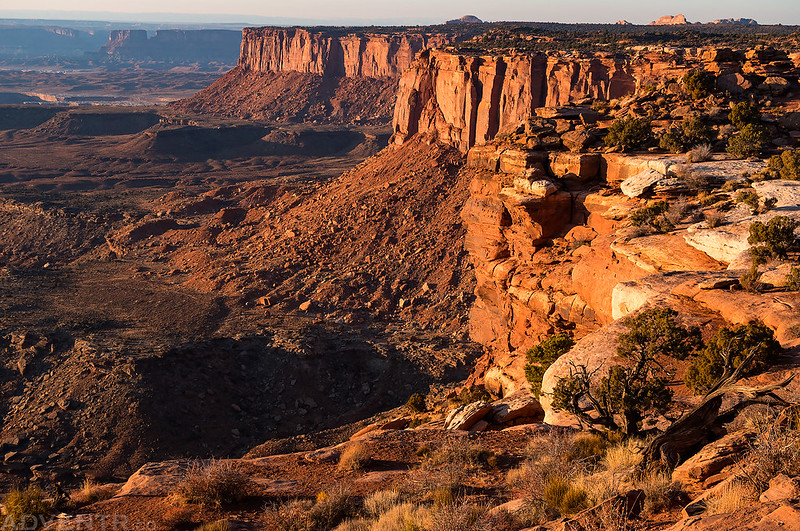
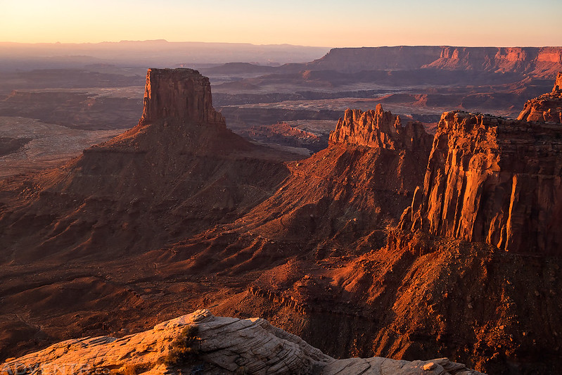
When I returned to my Jeep at the trailhead I decided to visit a few overlooks during the Golden Hour and sunset. My first stop was at Grand View Point.

There’s a nice view of all of Canyonlands from this overlook.

Three fingers of Monument Basin below.

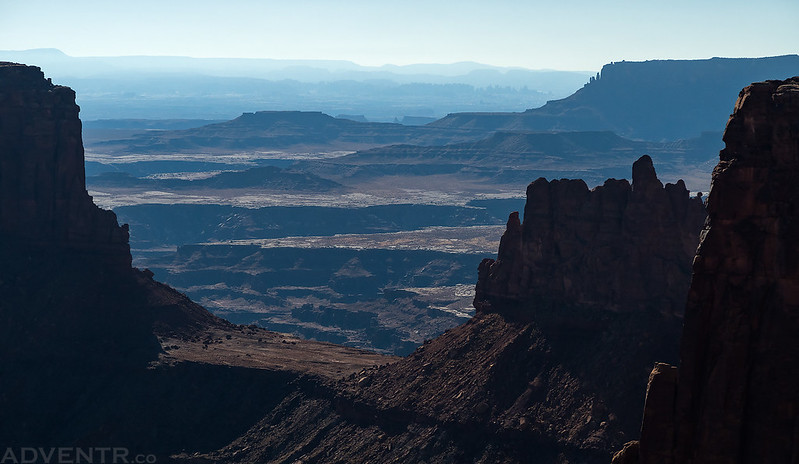
Next I stopped at the nearby Orange Cliffs Overlook. All the humidity and haze in the air this evening made for some interesting distant views.

Edge of the Island
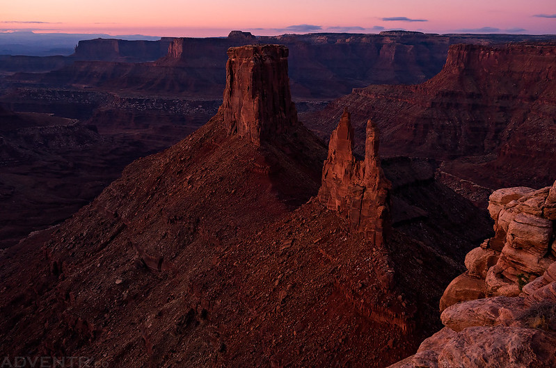
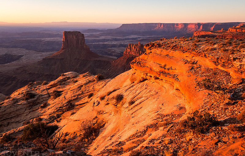
I made a brief stop at the Candlestick Tower Overlook. I figured that since I had seen Candlestick Tower all day from the other side, I might as well stop for a view from this side.
Finally, I watched the sun set from the popular Green River Overlook.

Nice light on the Murphy Hogback.

Washes, light and shadows directly below the overlook.

The sun sets behind the distant Henry Mountains from the Green River Overlook.

I made one last quick stop at The Neck for a view over the South Fork of Shafer Canyon in the fading light of dusk as I left the Park for the night.

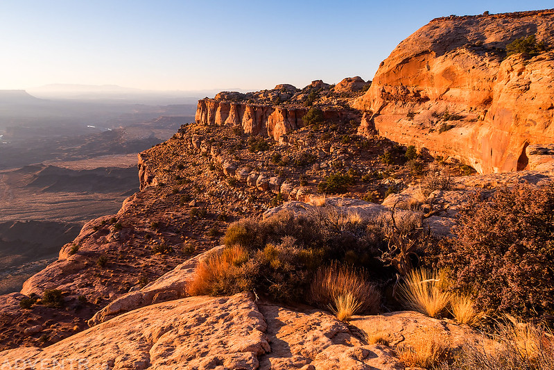
I returned to the same spot I had camped at the previous night, had some dinner and went to bed early. On Sunday morning I woke up to my alarm at 5:00am and drove back into the Park so I could hike the Lathrop Trail. I arrived at the trailhead and started hiking shortly after 6:00am so I could watch the sunrise from the rim before descending the trail to the White Rim. It was a crisp cold morning as I started hiking in the dark with bright stars and a thin crescent moon above. My headlamp made all the frost on the vegetation along the trail sparkle. I’m glad I got the early start and made it to the rim before sunrise since the view from the edge was amazing! I definitely wouldn’t hesitate to hike out to the rim for another sunrise from this area in the future.
As the trail neared the edge of the Island in the Sky, it wandered through sandstone reminiscent of the Coyote Buttes.

Early morning light from Lathrop Point.


There was a great view of Airport Tower from the edge.
Edge of the World
A closer look at Airport Tower with the White Rim below.

The humidity and haze was still around this morning, but it made for some nice photos!

When I was done taking photos from the point I started to descend the trail. The views continued to impress.
More sandstone hiking in warm light.

The trail followed the edge around this point.

Then it descended this steep chute into the upper reaches of Lathrop Canyon.

Looking down the chute at some of the switchbacks of the trail.

After switchbacking through the sandstone ledges, the trail reached a steep rocky area that it follows down the rest of the way.

Lathrop Trail Stripes

Once at the bottom of the chute, the trail follows an old mining road for a while which passes by a couple of old uranium mines. This old motor was right along the road and almost completely buried in a small alcove.

Following the old mining track out of upper Lathrop Canyon.

Soon the trail leaves the old mining road and follows the top of a ridge before descending into a wash that it follows the rest of the way to the White Rim.
The end of the trail at the White Rim Road. I found a boulder here at the edge of the drop-off into Lathrop Canyon to sit on and rest while I had a snack.
Here’s a look at where the Lathrop Trail leaves the old mining road and starts climbing up the chute on my way back.

As I neared the top of the chute a few clouds came floating over the rim, but they didn’t stick around long.

I liked this hazy view of The Needles in the distance. Can you see them?
Micro-Wave. A colorful small alcove that I was just able to get my hand and camera inside for this photo.

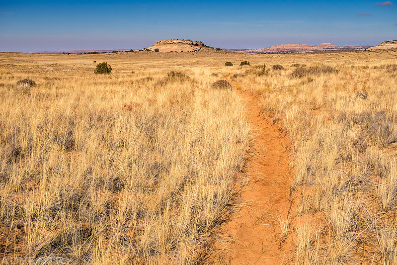
Following the Lathrop Trail across Grays Pasture on the way back to the trailhead.
After returning to my Jeep at the trailhead I headed back home. It was another nice weekend hiking two more trails on the Island in the Sky and I’m looking forward to returning again soon for more!
Now that is REALLY back country. I would have feared being alone. I notice that the granary is in great shape. I guess it is attributed to the remoteness. That’s a good thing. Thanks so much!