Southern Utah Wanderings | Wednesday, October 3, 2018
All the rain we had received the previous day made me a little bit nervous about trying to drive into Beef Basin, which was our original plan for today. I’ve driven that road in the rain before and it was a slippery mess. I didn’t want to have to do that again! So instead of heading into Beef Basin we decided to see if we could get a last-minute campsite in The Needles and drive over Elephant Hill instead. Since the Visitor’s Center didn’t open until 9:00am we slept in later than normal and took our time taking down camp. We arrived at the Visitor’s Center about ten minutes before they opened and there were already a bunch of people waiting to get in. When the doors opened we were the first ones in the Backcounty Office and found that one of the Bobby Jo campsites and the Horsehoof campsite were still open, which is the area we wanted to be in. I had never stayed at any of these sites before, so we decided to give Horsehoof a try for the next two nights. It turned out to be an excellent decision since I think Horsehoof is now one of my favorite campsites in all of Canyonlands National Park! Thankfully we got into the Backcountry Office for our permit when we did, because as we left there was a long line out the door!
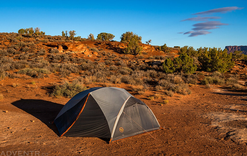
Waking up to a mostly clear sky on Wednesday morning just outside of Canyonlands.
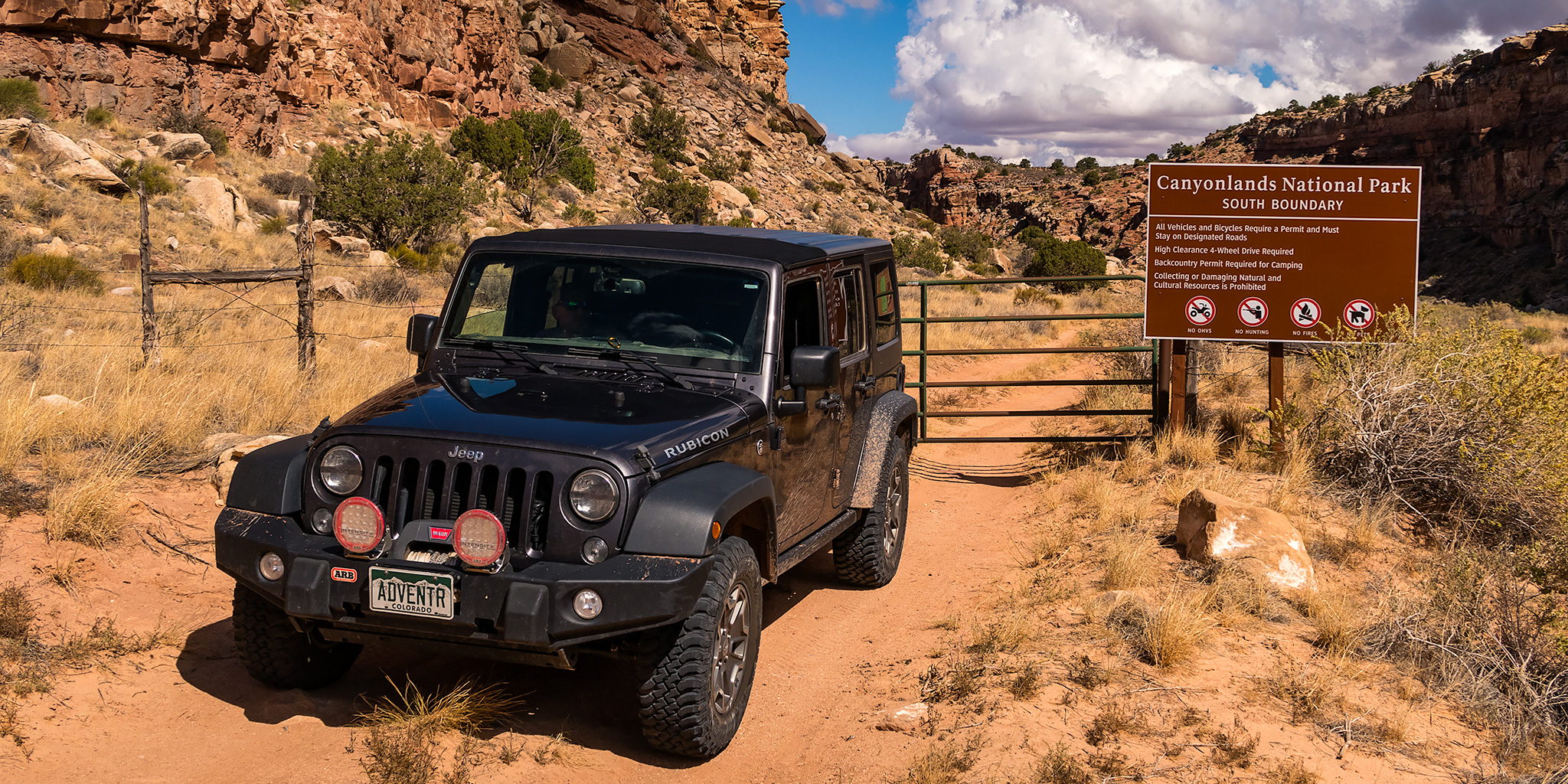
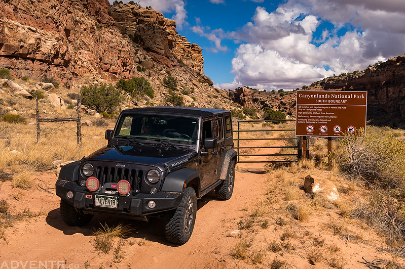
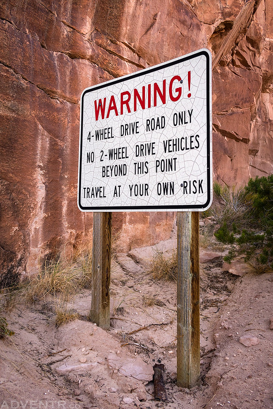
We drove over to the Elephant Hill Trailhead and transferred the rest of Jared’s gear into my Jeep before starting our drive over Elephant Hill. As we were about to begin driving up the trail a Park Ranger that was parked there stopped us and asked to see our permit. Then he told us that we would have to wait thirty minutes to start up the trail because a group of three Jeeps had just gone up. Apparently there is a new rule this year that only groups of three vehicles or smaller can drive over Elephant Hill and they must be spaced out at least thirty minutes apart. This was news to me! The group ahead of us was actually five vehicles and the Ranger made them split up into a group of three and two. We were allowed to drive up with the group of two Jeeps. This new rule really seems like a waste of resources to me to have a Ranger just parked at the trailhead dividing up groups of vehicles and telling them when they can go. After waiting our thirty minutes we drove over Elephant Hill and made our way to the Horsehoof Campsite without any problems. We setup camp and then headed south out of the park to Ruin Park and Beef Basin.
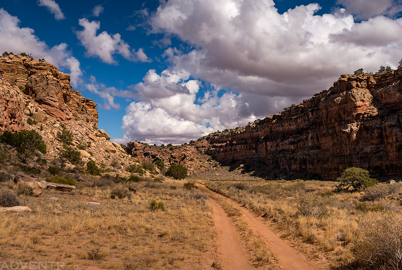
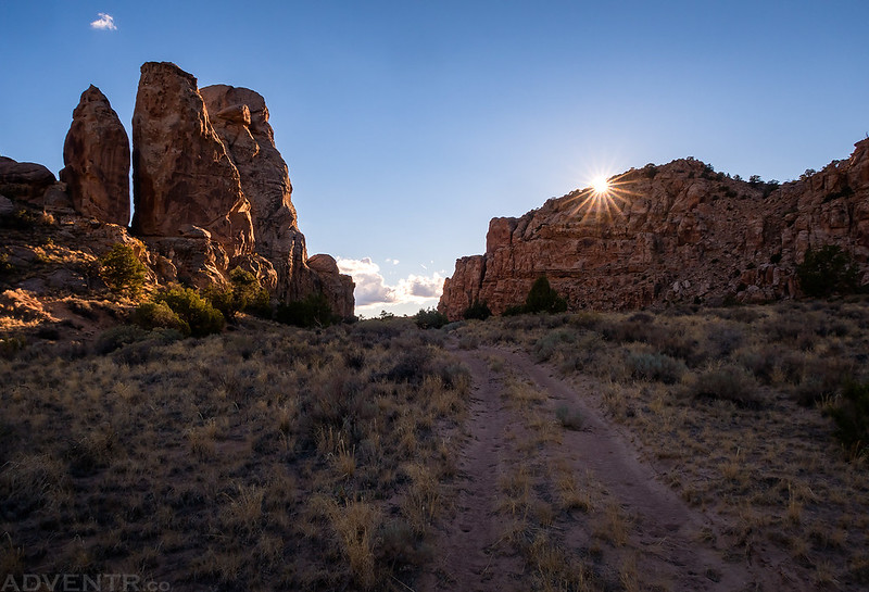
After setting up camp at Horsehoof we continued south out of the park to search for rock art and historic inscriptions.
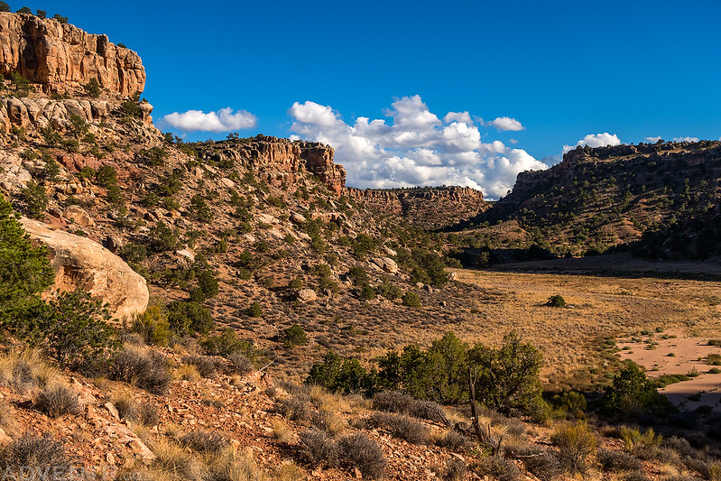
Leaving The Needles via the southern boundary.
The road up to Bobbys Hole was a bit rough with some large loose boulders in the middle of the trail that I had to avoid, but it wasn’t terrible. I only got my Jeep hung up once and had to back up and try again. We tried to drive out to Imperial Valley but the road was washed out too badly and hasn’t seemed to have seen any recent traffic, so we had to turn around. Surprisingly, we actually didn’t see any other recent tire tracks at all on the roads between the Horsehoof Campsite and Beef Basin! Unfortunately, it seemed like we spent too much time driving today and not enough time hiking and exploring. We searched for a number of rock art sites and inscriptions and only found a couple of them.
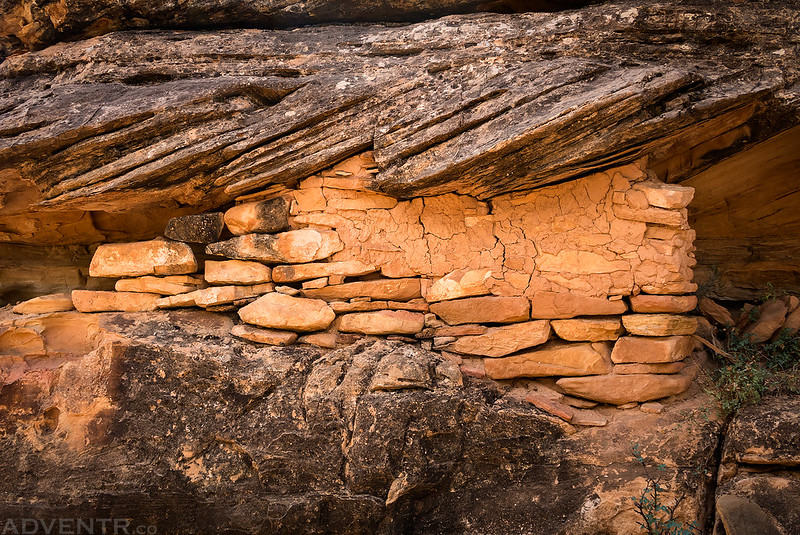
While searching for a possible Barrier Canyon Style rock art panel we found the remains of this granary and plenty of small alcoves with smoke-blackened ceilings in the area.
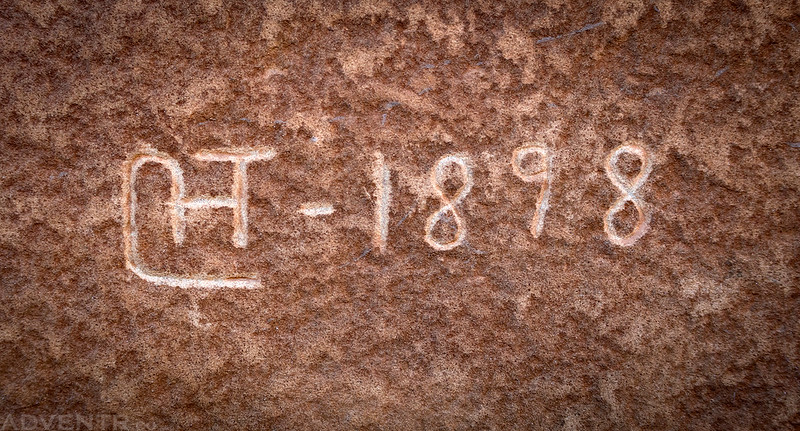
This inscription from 1898 was one of the better ones we found during the entire trip.
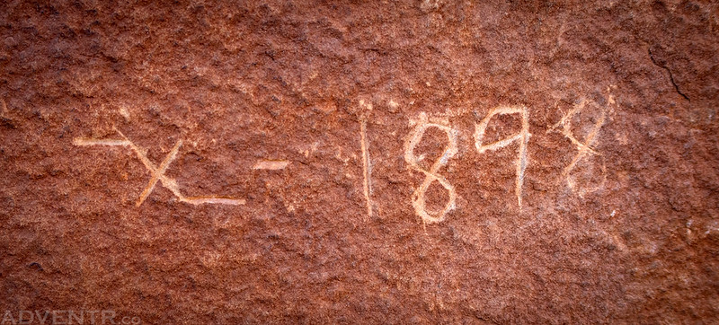
This inscription from the same year was nearby.
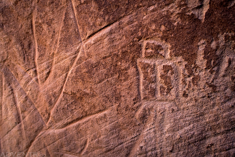
Here’s a very small petroglyph we found near some carved lines in the sandstone. The shape of this one kind of reminds me of the Broken-Hearted Man.
This is always a good sign! We didn’t see anyone else or even any recent tire tracks in this area. It felt much more remote than usual.
Since we couldn’t drive into Imperial Valley, we hiked down Impossible Hill into Cross Canyon to reach it that way.
It was getting late has we hiked on the old road through Imperial Valley.
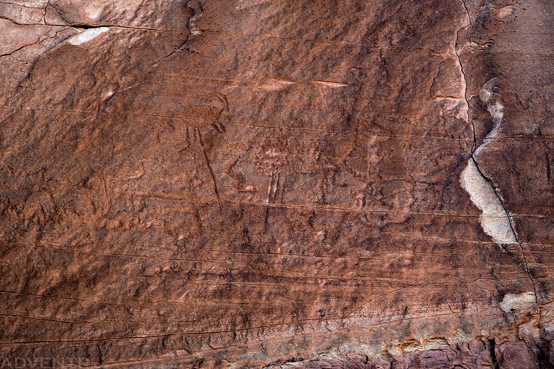
This panel of petroglyphs was very hard to see, but if you look closely you can see what looks like a sheep on a stick.
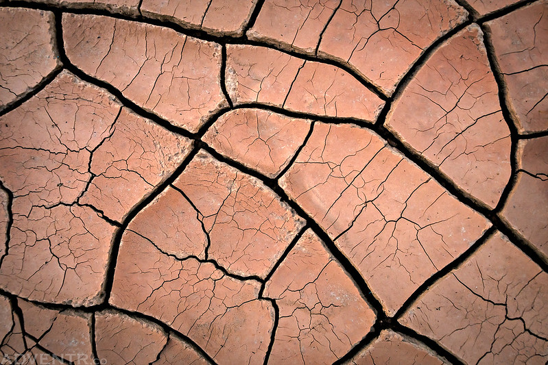
Looking down at the details in the mud cracks beneath my feet.
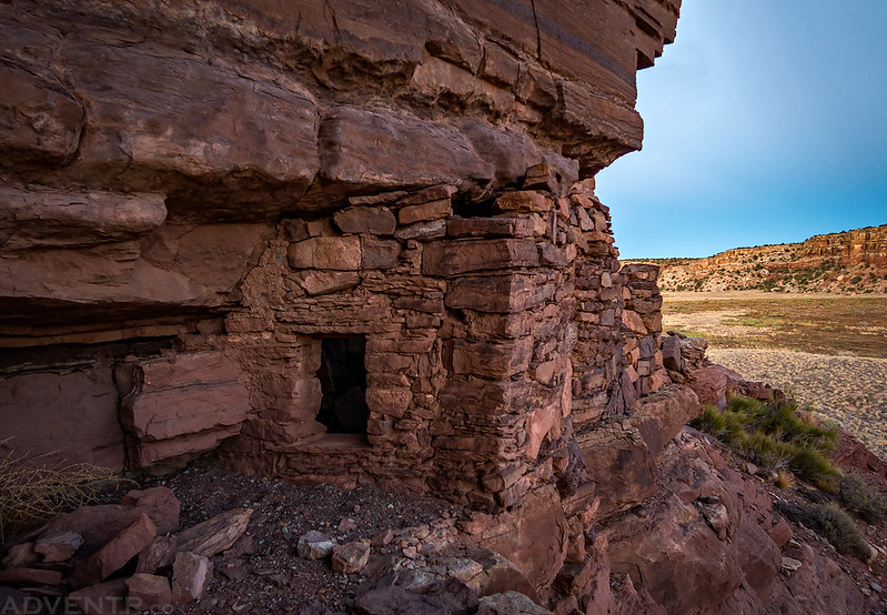
Jared spotted this ruin after the sun had already set, so it was starting to get dark out when I took this photo.
We returned to the Jeep well after dark and then drove back to our campsite for a very late dinner. As we ate dinner and got ready for bed we were able to watch a lot of distant lighting that seemed to surrounded us completely. We were expecting there to be a storm overnight at some point…
Thanks for taking me on another great adventure. Article length was perfect for me. Pictures were great!!!!
The rock granary is unlike anything I’ve seen because of the sturdy blocks.
As always 😉 the sun cooperates with you to give you puffy clouds. I like the
broken heart glyph and did refer to the other one you cited. Lovely
photos, as always.