Friday – Saturday, March 2-3, 2018
This weekend I originally had plans to stay closer to home and do some hiking with Diane in the Colorado National Monument, but near the end of the week she let me know that she had too much work for school to get done and she wouldn’t be able to go hiking this weekend and that I should just make plans on my own. After some thought about where I should go, I made last minute plans to do some hiking in Robbers Roost Canyon near the Dirty Devil River.
I left after work on Friday and made my way west into Utah where I stopped in Green River for dinner and fuel. I continued south towards Hanksville in the dark and then took the familiar left turn onto the road to Hans Flat. It had been pretty windy all day and was supposed to stay that way overnight and through Saturday. This meant there were a few sections of the road that were completely covered with sand dunes, so I had to be careful not to hit them going too fast. After I passed the road to Green River and Horseshoe Canyon I came to Robbers Roost Flat and the road that would take me out to Angel Point, where I planned to spend the night and start hiking from in the morning. I’ve driven by this intersection in the road near Burr Pass countless times in the past on my way to the Maze District of Canyonlands National Park, but I’d never made the right turn before. It was finally time to head in that direction and to start exploring the canyons in this area!
I continued driving out to Angel Point and found a spot to camp near the airstrip. I quickly got to bed but was soon awakened by some very strong winds. I ended up having to move camp a little further from the edge to a spot that was more protected from the high winds. I woke up with the sun on Saturday morning and drove to the very end of Angel Point to begin my hike into Robbers Roost Canyon.
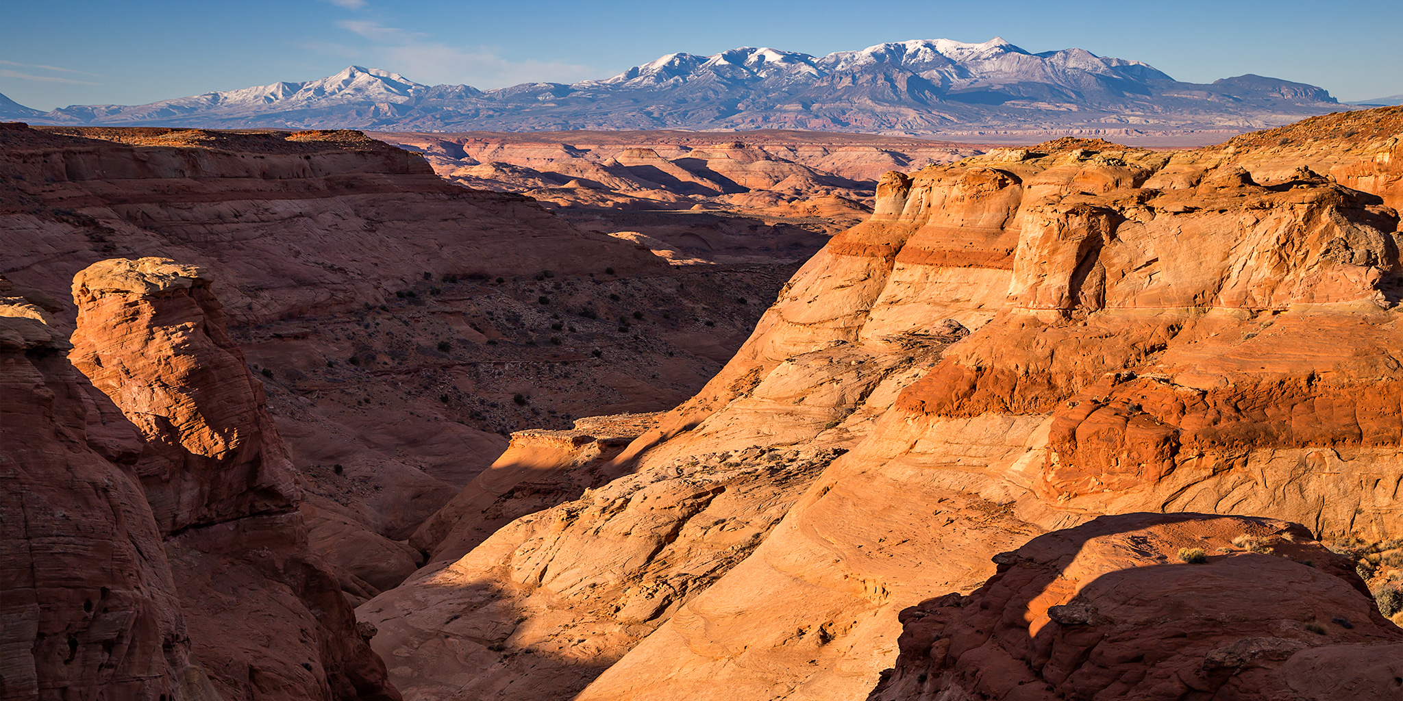
My morning view from Angel Point over to Mount Ellen and the Henry Mountains.
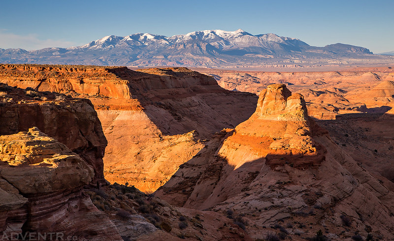
Overlooking No Mans Canyon with the Henry Mountains on the horizon.
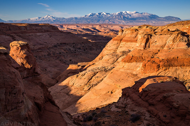
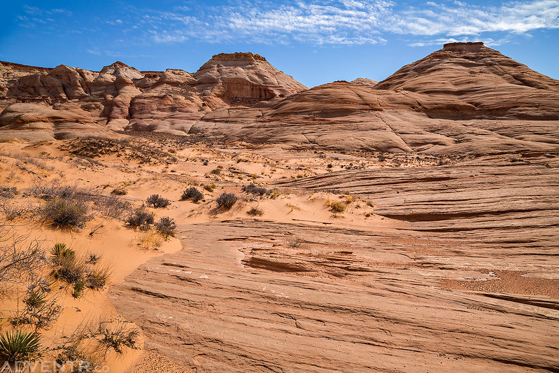
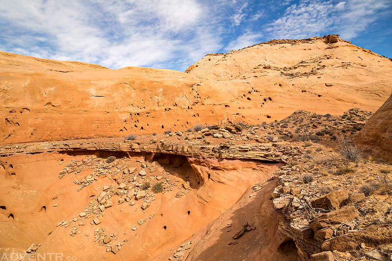
From the Angel Point Trailhead I made my way down the sandstone to a bench above the Dirty Devil River and then descended into the lower part of Robbers Roost Canyon.

Hiking along a narrow ledge in search of rock art.

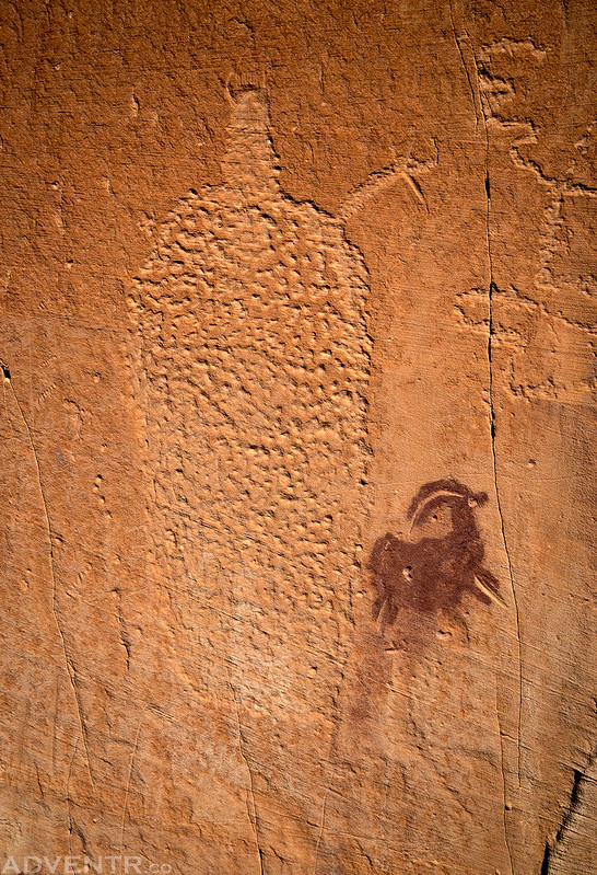
A very cool panel of pictographs and petroglyphs.

A closer look at my favorite part.

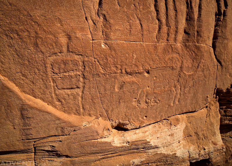
A small Barrier Canyon Style petroglyph next to a canine with a curved tail.
A nice petroglyph of a bighorn sheep among some faded Barrier Canyon Style pictographs.

A Fremont anthropomorphic figure next to a snake or zigzag line.

A couple of the figures found here only seemed to have one raised left arm.

These leaping red sheep pictographs were also common.

A lone petroglyph on a large boulder.

A small and fragile arch protruding from a colorful wall.
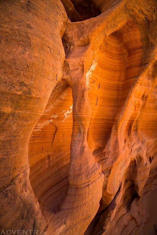
While not as colorful as other parts of the Colorado Plateau, the sandstone here had some nice striations.

Hiking back up to Angel Point on sandstone and through sand. It was still very windy out today, especially the higher I climbed, so this sand was blowing around all over the place.
A colorful bowl of sandstone as I climbed back up to Angel Point.
I thought this layer of limestone within the sandstone was pretty interesting as I climbed out of this little canyon.
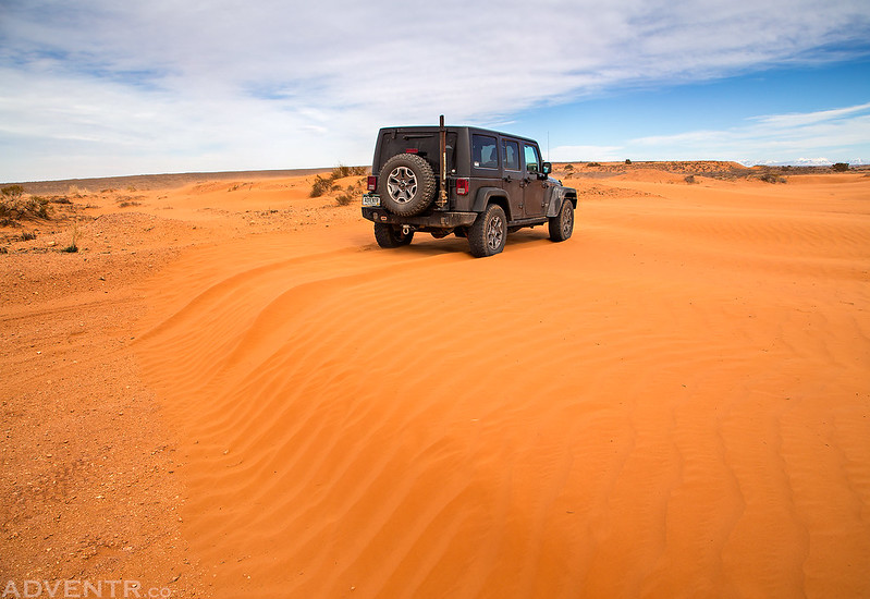
After returning to my Jeep I decided to drive over to visit what’s left of the cabin in the upper South Fork of Robbers Roost Canyon near Silvertip Spring that Butch Cassidy and The Wild Bunch are rumored to have used as a hideout. On the way there I encountered a lot of sand that had blown across the road like in the photo below. There is a road underneath all of that sand!
After visiting the stone chimney, which was all that was left of the cabin, I headed back out over the sandy road to Green River for some dinner and then headed back home. It had been a nice little trip down to Robbers Roost!
Beautiful images in challenging conditions! Driving on a road which disappeared under sand is “yikes!” Sand in your gear and everywhere is “ugh!”. I love your posts that highlight the rock art too which is educational for me as I am not near that area. Always a nice nature break from you! Thanks!
Thanks Michele. Good thing I have plenty of experience driving on sand dunes!
Great pics. I wonder if someone had tried to cut out the canine with curved tail?
Also, do you sleep in the Jeep or have a tent that attaches?
It does look like someone may have started to cut out that petroglyph.
In the colder winter months when I am by myself, I usually sleep in the back of my Jeep because it’s quick, easy and warmer. The rest of the year I’m usually in a tent.