Saturday & Sunday, August 22-23, 2015
Over the years I have spent a lot of time in and around the Uncompahgre Wilderness of the San Juan Mountains, and every time I do I usually see the massive Uncompahgre Peak looming above all the other mountains along with it’s shorter but more rugged neighbor, Wetterhorn Peak. I have wanted to climb Wetterhorn Peak for a long time, but the class 3 route to it’s summit combined with exposure had stopped me from trying until I gained more experience. For years I have looked at photos and videos of the final climb to the summit and thought that there was no way I’d be able to do that, so I kept putting it off. After a few years of hiking easier fourteeners, it was finally time for me to attempt my first class 3 route and I knew it would have to be on Wetterhorn.
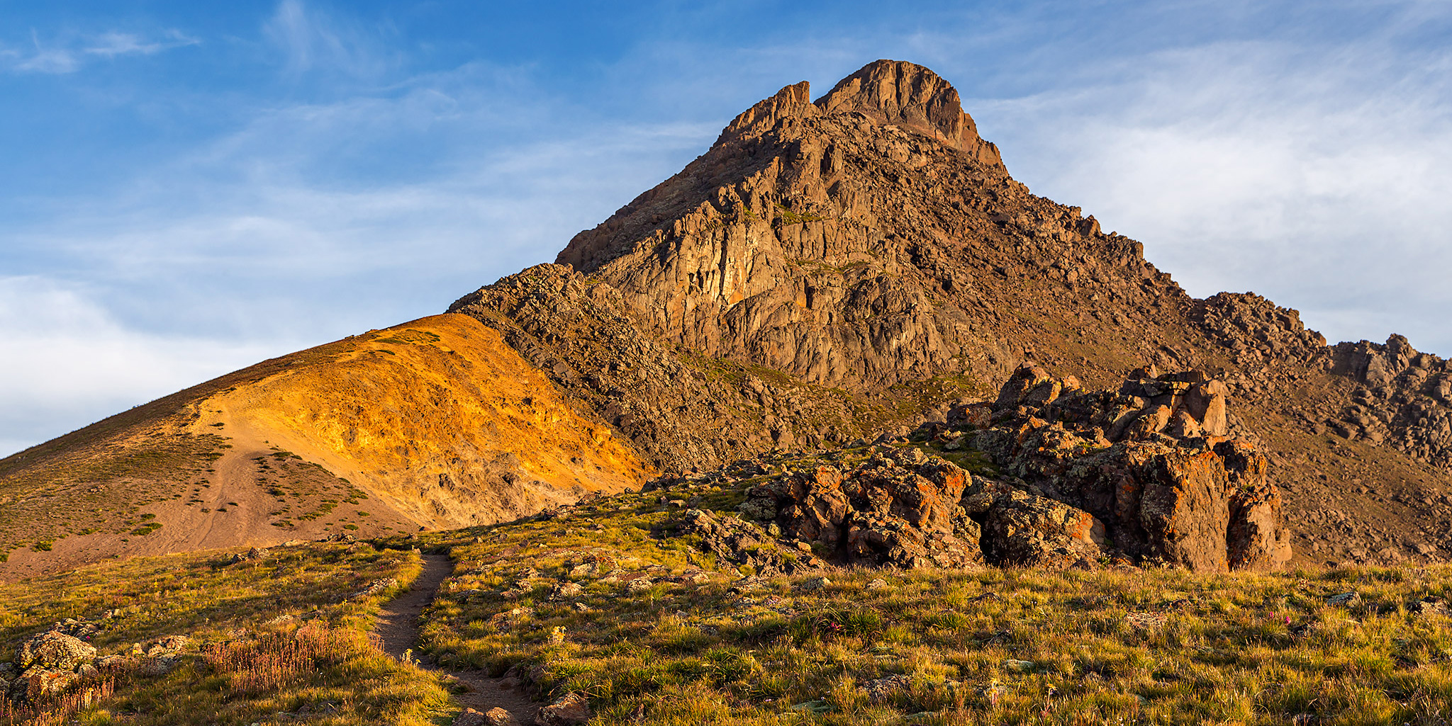
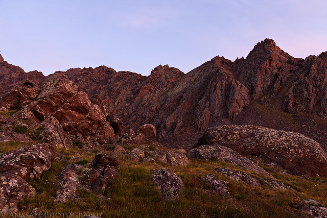
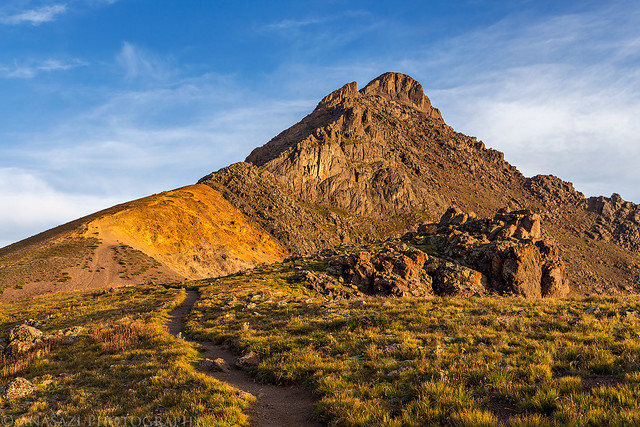
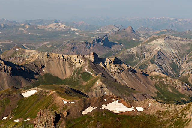
An impressive view of Wetterhorn Peak last summer on a backpacking trip into Wetterhorn Basin.
For the past week, the sky in western Colorado has been full of smoke from wildfires along the west coast, so please forgive me if my photos aren’t up to my usually high standards. I always do my best with the conditions I am given, but some conditions are more difficult than others.
Since Diane is a better climber than I am and is also better with exposure, she came along to help me if I needed it. This would only be her second fourteener attempt after climbing Handies Peak last summer and it would be my twentieth. We left home on Saturday morning and drove through Ouray to Red Mountain Pass where we took the dirt road through US Basin to the top of Browns Gulch so we could hike to the summit of Ohio Peak to help get a little acclimated for Wetterhorn the following morning.
Diane starting the hike across the alpine tundra of upper Browns Gulch on our way to Ohio Peak.
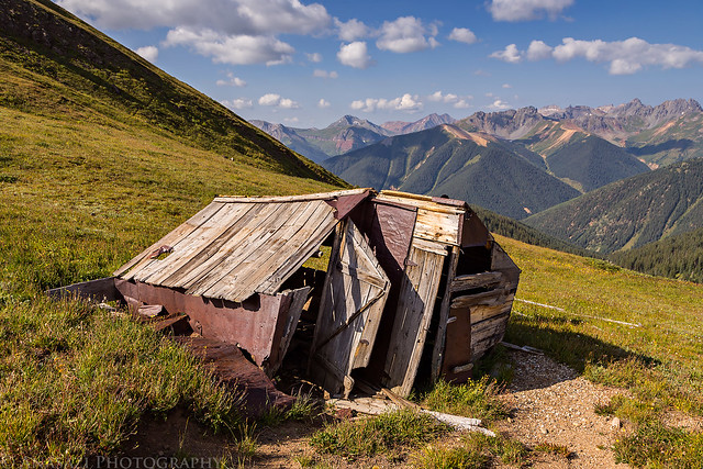
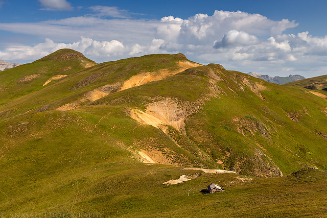
An old shack we passed at the saddle on the ridge below Ohio Peak.
Looking down on the shack as we climbed towards the peak.
The final rocky stretch to the summit. You can see Silverton off to the left at the end of Cement Creek (which has been in the news quite a bit lately).
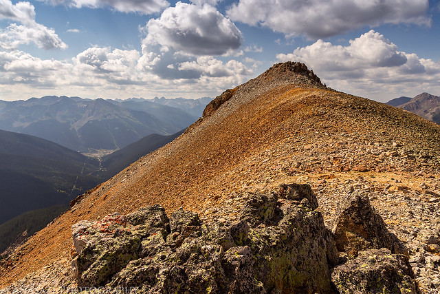
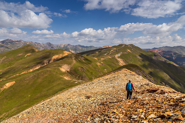
On the summit of Ohio Peak (12,673).
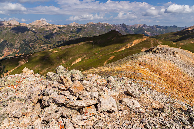
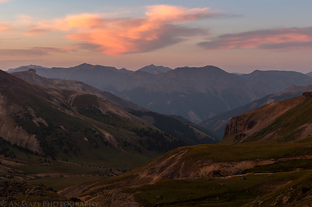
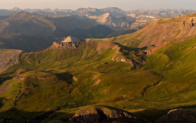
Looking across the ridge to Anvil Mountain (12,537) and Sultan Mountain (13,368) on the left. I had thought about hiking over to Anvil Mountain today but decided to save it for another trip since we started late and still had to get over near Matterhorn Creek to setup camp.
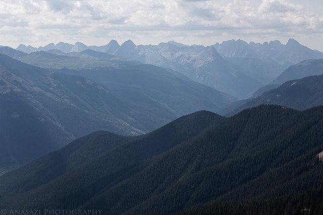
The smokey and hazy view to the Grenadier Range and the Needle Mountains in the Weminuche Wilderness.
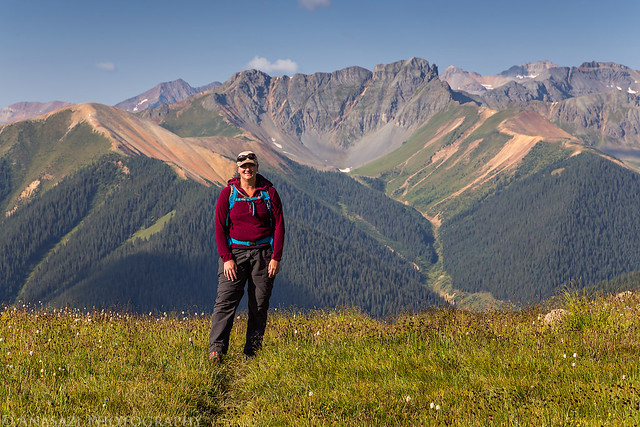
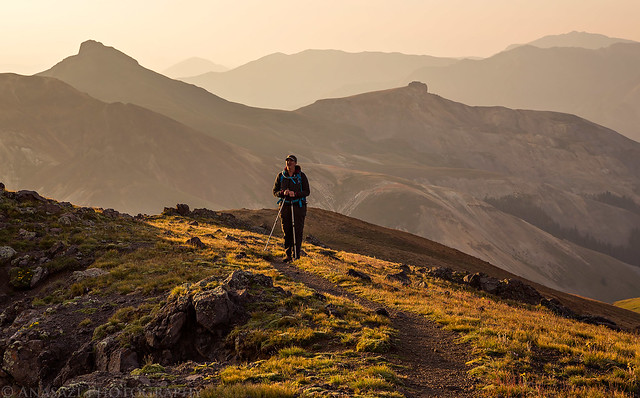
Diane hikes down ahead of me with views of McMillan Peak (12,804) and Red Mountain #3 (12,890) in front of us. We had a nice weekend hiking to the summit of those peaks last month.
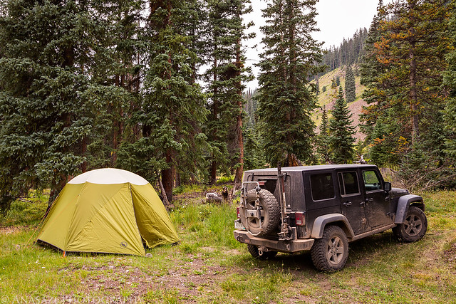
After returning to my Jeep we finished the drive down Browns Gulch and into Silverton. We stopped for lunch at the Kendall Mountain Cafe and then continued up along the Animas River through Animas Forks and up to Engineer Pass. We drove over the pass and turned left at Capitol City to follow the North Fork of Henson Creek to the Matterhorn Creek Trailhead. We found a nice campsite about a mile and a half past the trailhead and setup camp for the night. Since we were planning on an alpine start Sunday morning, we went to bed early.
The nice campsite we found along the North Fork of Henson Creek.
My alarm woke us up at 3:30am on Sunday morning and we made it over to the trailhead shortly before 4:00am. We started hiking up the trail in the dark with help from our headlamps. The stars above were bright and clear and the temperature was very comfortable with no wind. It was a great morning for a hike! Shortly before reaching the large boulder-field area it got light enough that we no longer needed our headlamps and we were able to watch the sun rise from near the base of Wetterhorn.
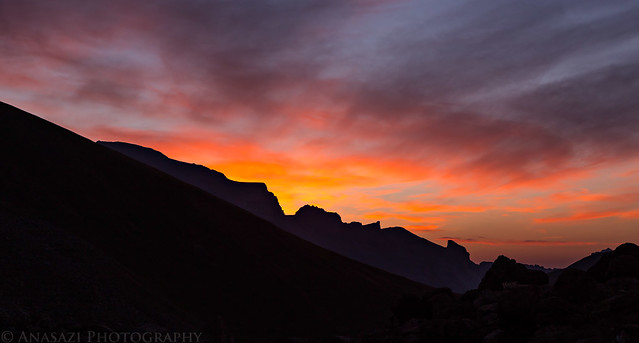
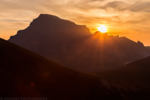
The sun started to light up the clouds above Uncompahgre Peak shortly before sunrise.
I love hiking through the mountains when the rock around me is illumined by the alpenglow.
An early morning view down Matterhorn Creek with the tops of Redcloud Peak and Sunshine Peak visible in the middle.
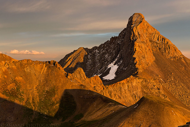
The sun finally came up to the right of Uncompahgre Peak (14,309), the highest peak in the San Juan Mountains.
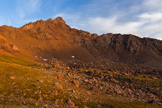
Sunrise on Wetterhorn Peak (14,015) before we climbed up to the saddle.
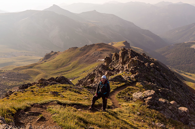
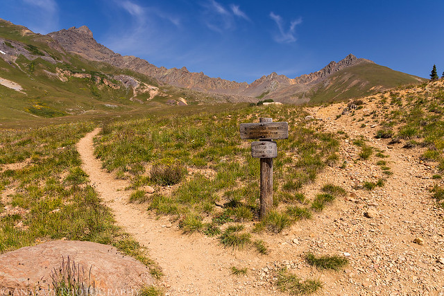
View up the trail on the saddle. Once we reached the rock past the yellow dirt section the fun would really begin.
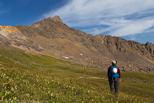
Diane stops for a view of the peak on the saddle with Broken Hill (13,256) in the haze behind her.
Smoke-filled skies above the upper reaches of Matterhorn Creek and Mary Alice Creek.
Diane follows me up the ridge.
Minor scrambling is involved.
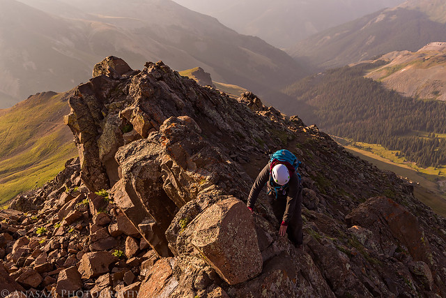
A short break in the rock along the ridge.
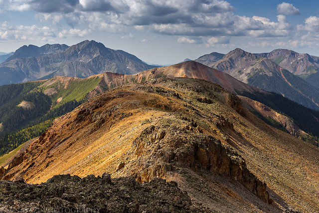
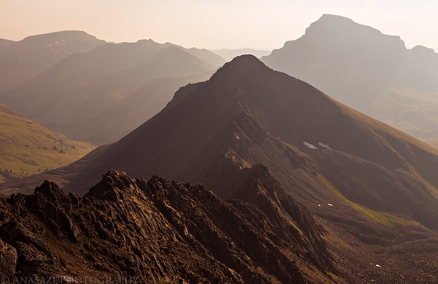
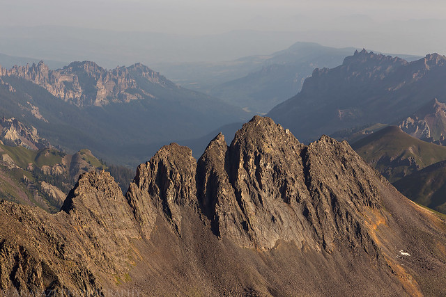
Looking down the ridge to Matterhorn Peak (13,590).
Unfortunately, about 200 feet from the summit Diane started to get some symptoms of altitude sickness and decided to sit down and rest while I finished the climb to the top by myself. It was a hard decision for her to make and she was disappointed that she wouldn’t make it to the top this time, but it was the right decision to make.
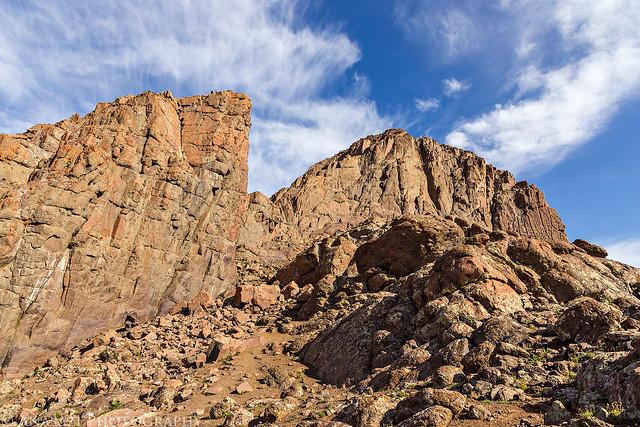
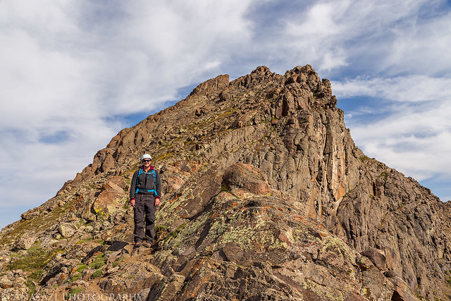
The Prow on the left and the summit on the right. I had to climb up through a notch between the two.
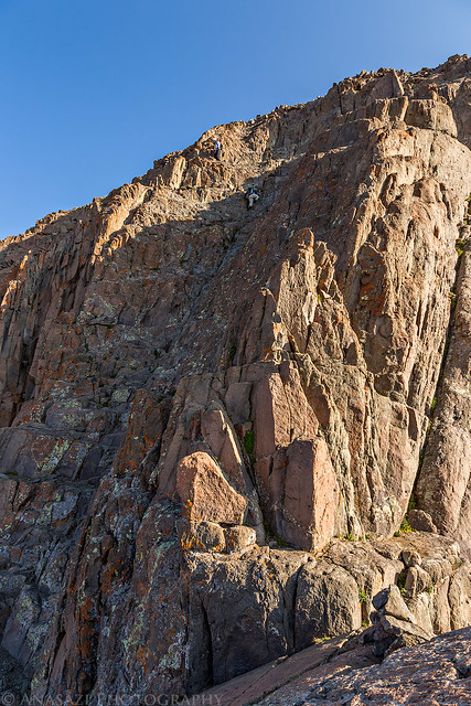
Once I was through the notch I finally had my first view of the final climb to the summit. I was hoping that it would look easier and less intimidating in person than in the photos I had seen, but it didn’t. The first thought that ran through my head was that there was no way in hell I’d be able to climb that up to the summit and I’d have to turn around here! I sat down and watched two people ahead of me finish their climb to the top while I considered my options. I wished that Diane had been able to get this far with me because I knew she would have no problem climbing this section and encouraging me to the top.
Here is a view of the final climb to the summit with two climbers nearing the top for scale. The person standing up is on a narrow ledge between the two sections of the climb.
After taking a few minutes to catch my breath and compose myself, I figured that I had already come this far and I should at least try to start the climb to see how it felt. If I didn’t like it, I could turn around and head back down. I’m glad I tried it, because once I started I realized that it was a lot easier than it looked from below and the exposure didn’t really bother me like I thought it would. I just concentrated on what my hands and feet we doing and before I knew it I was standing on the summit of Wetterhorn Peak. I had made it! Of course, I still had to worry about getting back down…
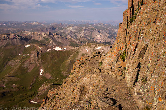
Following the narrow ledge to the final pitch.
Smokey view over Heisshorn (13,411) and down the Middle Fork of the Cimarron River.
A nice look over the ridge to Coxcomb Peak (13,656) and Redcliff (13,642). I spent a nice evening photographing the sunset from Unnamed 13206 on that ridge last year.
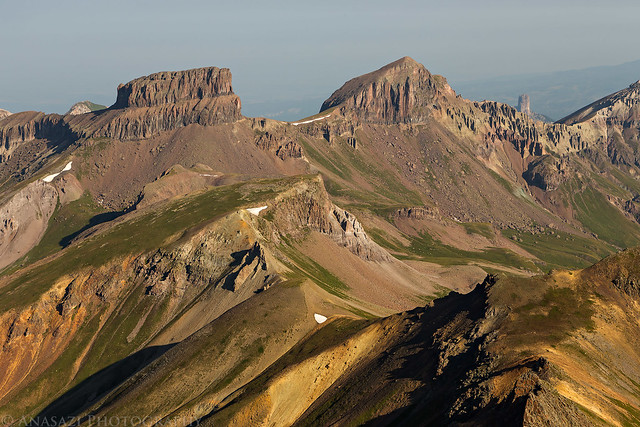
Nice views of the peaks within the Uncompahgre Wilderness to the west including Wildhorse Peak and the Dragon’s Back.
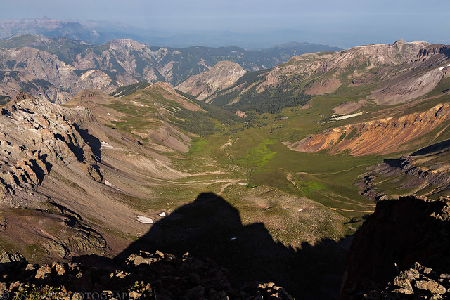
Wetterhorn’s shadow in Wetterhorn Basin.
I really didn’t have anything to worry about coming back down off the summit since it was just as easy for me to climb down as it had been going up. I would have no problem climbing this section again in the future and actually found it fun. I returned to check on Diane and we started our descent off the mountain.
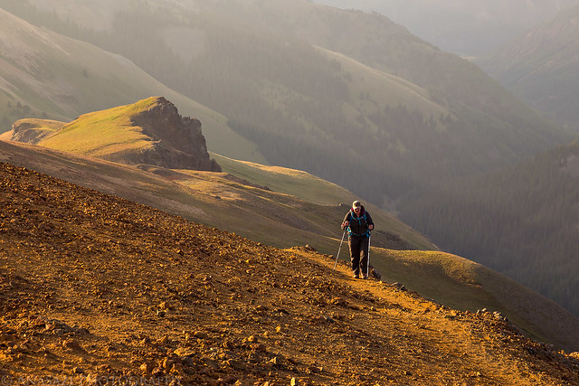
Diane started feeling much better as soon as we started to descend.
One last look at Wetterhorn before we finished hiking back to the trailhead.
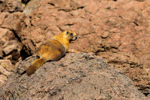
We passed plenty of marmots in the boulders, but this one posed on a rock for me and was a lighter color than the rest.
Back to the intersection with the Ridge Stock Driveway, this time in the light. I had originally wanted to climb Matterhorn Peak today, but we changed those plans when Diane started to not feel well. I’ll have to return another time to climb that one, preferably on a day without all the smoke in the air! Plus, I’m sure that Diane would like to return and take another shot at Wetterhorn.
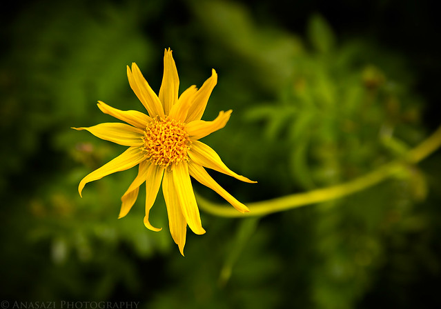
This lone flower caught my eye along the trail shortly before reaching the trailhead.
Back to my Jeep at the Matterhorn Creek Trailhead. We had some lunch and then drove back to camp so we could take down our tent and head home. It was a great weekend and I’m looking forward to trying some other class 3 routes in the future!

I absolutely love your site! It is a terrific tool for preparing for our adventures having just moved here from flat Florida in March. I’m loving the endless possibilities here but find myself needing to have more detail on what to expect – especially on the 4WD roads… Also, the quality of your photos is stunning. Keep up the great work. I know I’ll keep following!
Thank you Kevin!
Flippin’ amazing.
Thanks Richard!