The Orange Cliffs Unit | Memorial Day Weekend
Friday – Monday, May 22-25, 2015
Since we had a great trip to The Maze District of Canyonlands National Park during last year’s Memorial Day Weekend, we decided to go back again this year and spend a few nights at a few different campsites so we could explore new areas. Even though we didn’t technically spend much time in the actual Maze District since all of the campsites we stayed at were in the surrounding Orange Cliffs Unit of Glen Canyon National Recreation Area, we did hike down into Ernies Country for a little while.
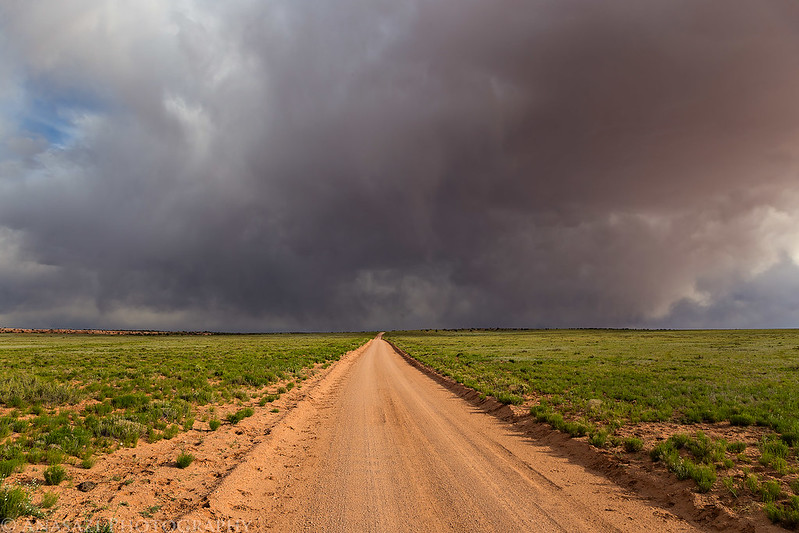
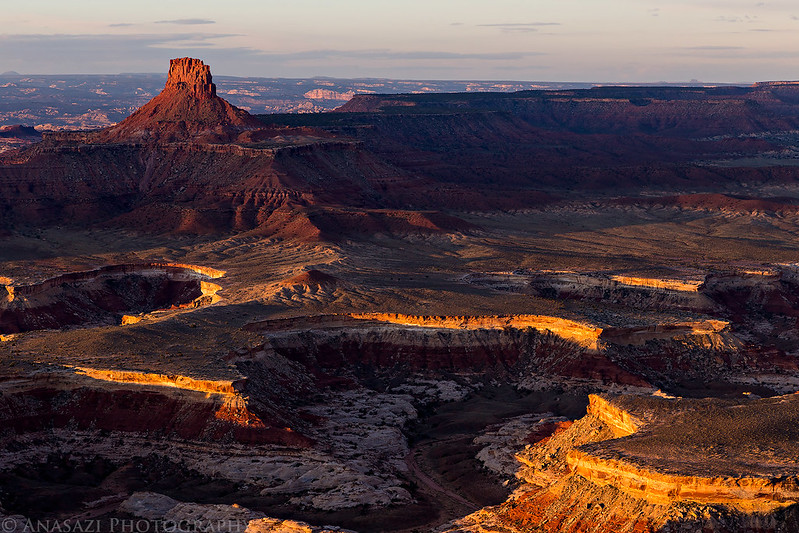
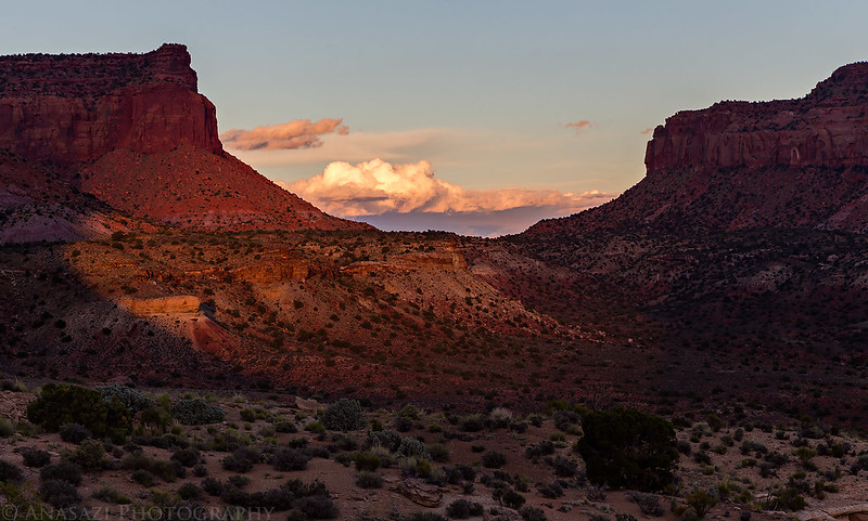
The Colorado Plateau had been receiving a lot of rain and storms the past few weeks and the forecast for this weekend was no different. The month of May has been very wet and it’s pretty obvious based on how green the desert is right now. We left home after I got out of work on Friday evening and drove west on I-70 into Utah. We topped off the fuel tank in Green River and had a quick dinner before continuing the drive out past the Hans Flat Ranger Station onto North Point and to our first campsite on the edge of the Orange Cliffs at Panorama Point. We arrived about an hour before sunset, but it didn’t really matter since the clouds were pretty thick to the west and we never saw the sun after arriving. We had seen the last spotlight from the sun on the canyons below as we were driving to the end of North Point. As we setup our tent for the night there was a little lightning in the distance over the Abajo Mountains and over the Book Cliffs to the north. Luckily, none of it ever got close to us and we never had any rain either, though we could see it raining around us. There was a great view over the Canyonlands from up here, so it’s too bad that the sunset was a bust. Unfortunately, after the sun went down, the wind picked up and would keep up all night. The constant gusts of wind against the tent made a lot of noise causing neither of us to sleep very well this night.
Interesting clouds off this the distance towards Horseshoe Canyon.

Driving into the storm…

A very green desert along the road to Hans Flat.
The last light we would see on the canyons below for the evening.

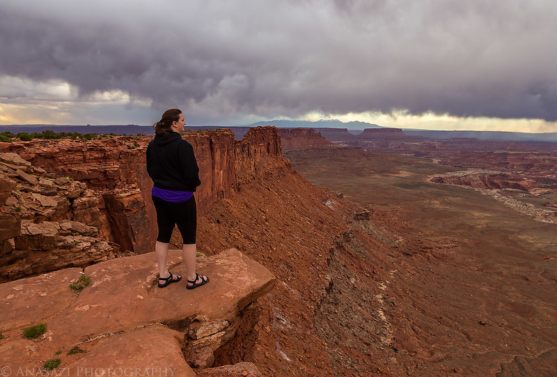
Diane takes in the view from Panorama Point.
The La Sals over the gap between Grand View Point and Junction Butte in the Island in the Sky.

Distant sun rays shortly before sunset.

I woke up early on Saturday so I could photograph the sunrise. The clouds from the previous evening had cleared out and there weren’t many left when the sun came up. Of course, they would start building up again about an hour after sunrise, which seemed to be a common theme this weekend. After taking a few photos, I went back into the tent and fell asleep again for a while longer.
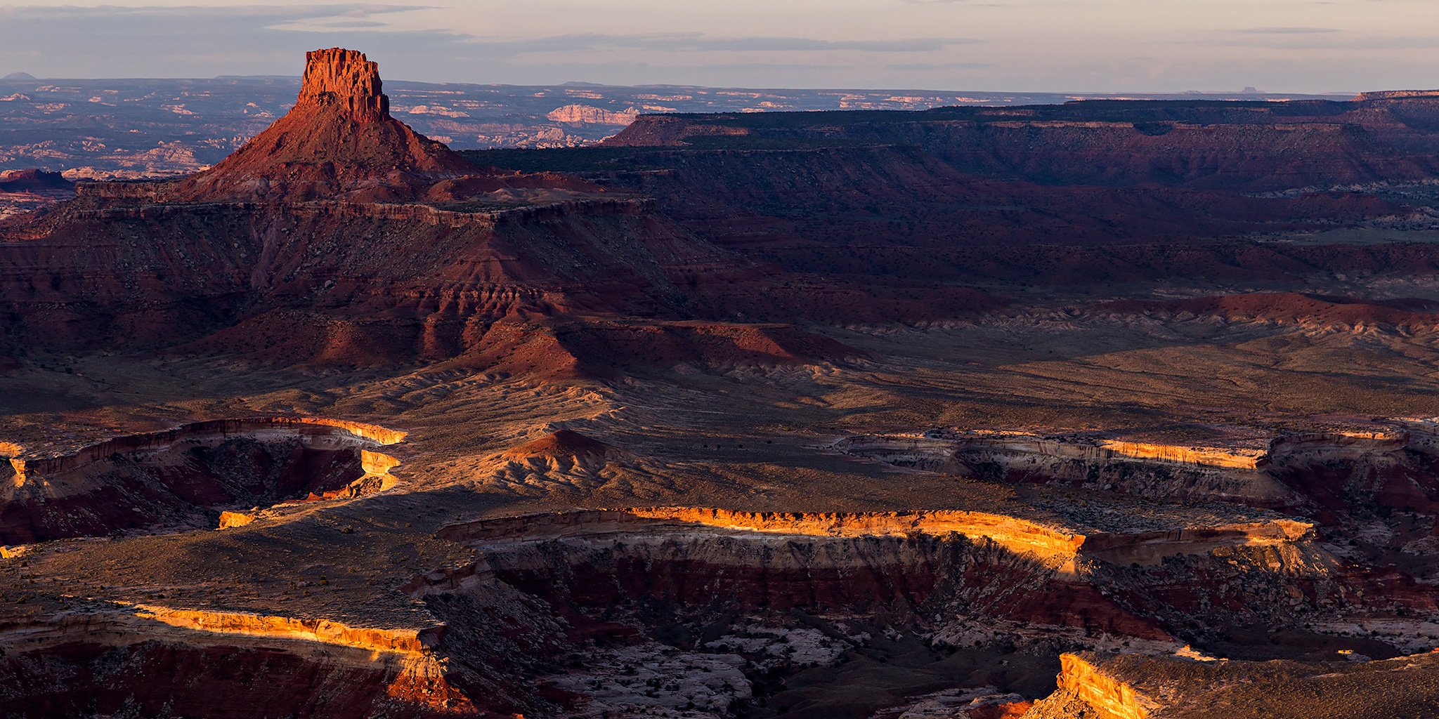
Horse Canyon and Elaterite Butte glow in the soft dawn light. The Land of Standing Rocks is visible to the left of the butte.

First light on the Orange Cliffs.
Warm morning sunlight strikes the rim of Horse Canyon below.

Horse Canyon and Elaterite Butte in early morning light.
An abstract view looking straight down on small drainages from Panorama Point.

Sunrise from Panorama Point.

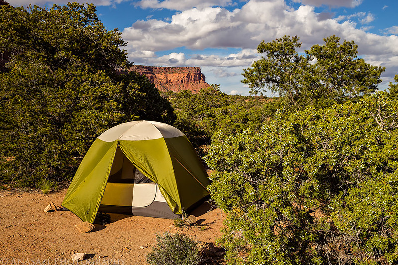
Our tent on the edge of the Orange Cliffs.

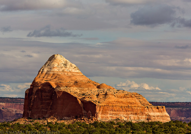
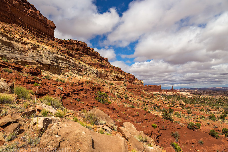
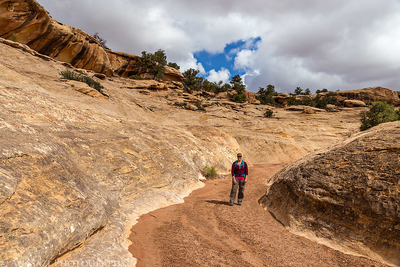
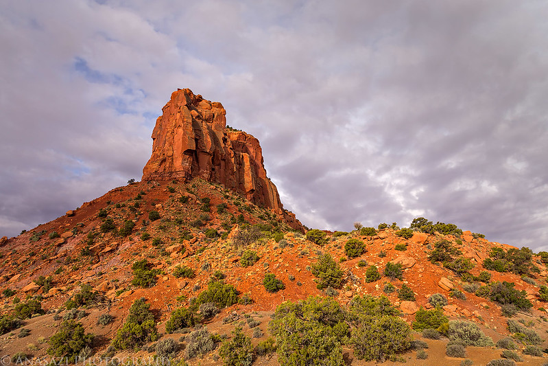
When I woke up for the second time, we packed up camp and made our way off of North Point to the Flint Trail. We made a couple quick stops at the French Cabin and French Spring since I had never stopped at either of those locations before and then made one last detour to The Neck on The Big Ridge to check out the campsite before we descended to the bottom of the Flint Trail. As we started driving down the Flint Trail light rain started to fall. We made it to our second campsite at the Golden Stairs and managed to get our tent setup just before it started to rain harder. We had lunch while it was raining and then started hiking down the Golden Stairs trail when the rain had lightened up again. Crossing the China Neck offered nice views all around from this narrow sandstone ridge. The trail was steep and washed out in a few places, and we reached the road below after hiking about 2 miles. We followed the road past Mother and Child Rock and then followed another trail down into Range Canyon for a little exploring. We visited a nice Barrier Canyon Style pictograph panel in the area. While we were checking out this panel, the clouds finally started to clear and we had some sunlight for our hike back to the top. Hiking back to the top was a little slower since we had to climb back up about 1,000 feet. The hike turned out to be about 10 miles round trip.
We passed by Cleopatras Chair as we drove off of North Point.
Diane hikes down the Golden Stairs trail in the rain.

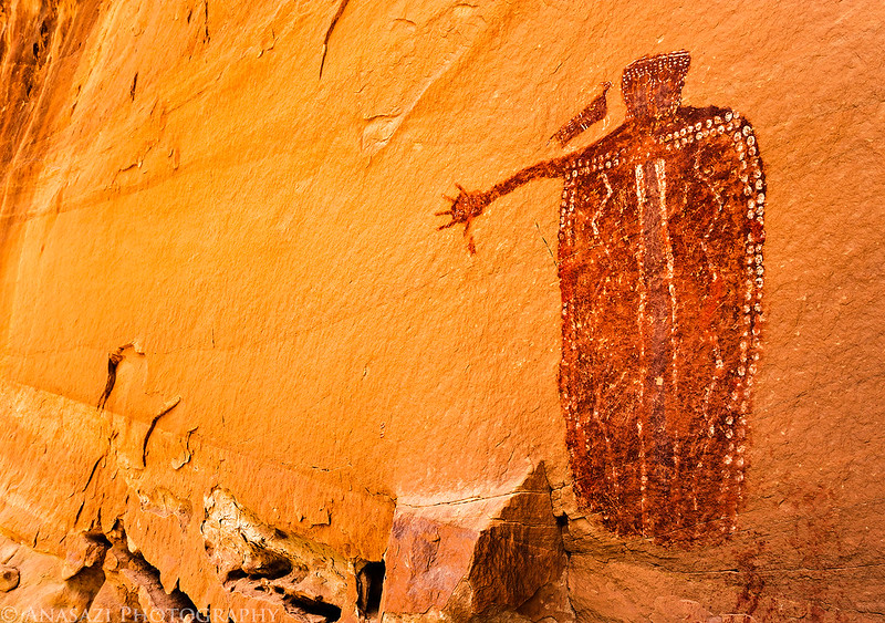
A nice panel of red Barrier Canyon Style pictographs.

Diane hikes up Range Canyon as the sun comes back out.

Climbing out of Range Canyon on this little fin.

Mother and Child Rock

Following the road back to the Golden Stairs trail.

Starting the climb back up to camp.
Sunlight and shadows across Ernies Country.

Back across the China Neck.

After returning to camp we had dinner and relaxed for the rest of the evening. Before sunset more dark clouds had moved in and it would start raining again after dark. It seemed to rain steadily for much of the night but quit a few hours before sunrise.
Our tent at the Golden Stairs campsite as another storm moves in.

On Sunday morning we slept in a little later before packing up camp to go on a couple of short hikes. I was really looking forward to revisiting The Perfect Panel and searching for another small pictograph panel in the area.
Leaving the Golden Stairs on our way to Waterhole Flat.

Spotlight on The Block

Diane hiking in a canyon.
An ancient cist.

The beautiful Barrier Canyon Style pictographs known as The Perfect Panel.


Diane stands in front to add a little scale.

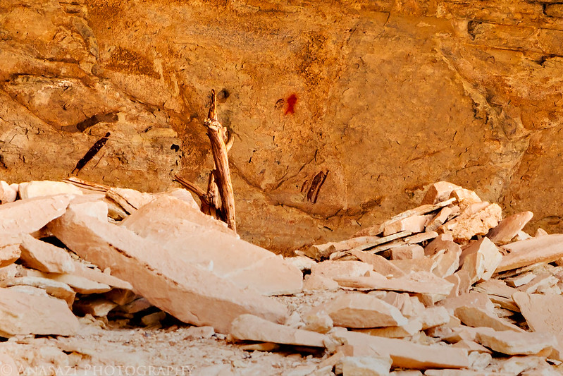
I tried to visit the small pictographs in this alcove, but was unable to climb up closer, so this is a heavily cropped photo. I really would have loved to get a better view of these.
When we were done hiking for the morning, we drove over to Waterhole Flat and visited the old Chaffin Camp before climbing up to Sunset Pass, our last campsite of the trip. It was a very nice site right in the pass at the base of Gunsight Butte. Since I’ve been on a lot of trips to southern Utah these past few weeks, we decided to spend the rest of the day just relaxing around camp and reading. It was nice to take it easy for a change.
Waterhole Flat Intersection

Driving to Sunset Pass and Gunsight Butte.

Our tent at the Sunset Pass camp.
About two hours before sunset we left for an evening drive into Hatch Canyon, since I had never been down this road before, and made it back just before the sun was down for the day. The sky was almost cloudless when we went to bed and we finally got to see a few stars, but about an hour after dark we heard thunder and then it started to rain pretty heavily and did so for a while. It sounded like the hardest rain we had experienced on the trip so far, but we were dry in our tent.
An evening view down Hatch Canyon towards the Henry Mountains.

Fiddler Butte stands out well in the foreground.

Re-entering the Orange Cliffs Unit.


Evening view in Hatch Canyon.
Sunset Pass lived up to it’s name this evening as the last light of the day spotlights the pass.
When I had originally setup this trip, my plan was to exit via Hatch Canyon and Poison Springs Canyon today. However, with all the rain we’ve had recently I cancelled that idea earlier in the trip since I was concerned about crossing the Dirty Devil River and didn’t want to have to backtrack if it wasn’t passable. I’ll have to save that for another time. With all the rain we had overnight, I was also a little concerned about the clay road heading over to the base of the Flint Trail, since that stuff can get really slippery when it’s wet. I was tempted to drive out to Hite, but noticed that as we drove down from Sunset Pass, the road was pretty dry, so we gave it a try. I guess our camp must have been near the edge of the storm, because the road turned out to be very dry and it didn’t appear there was much rain the further north we drove.
Morning view down Hatch Canyon.

The view of Gunsight Butte above our camp.
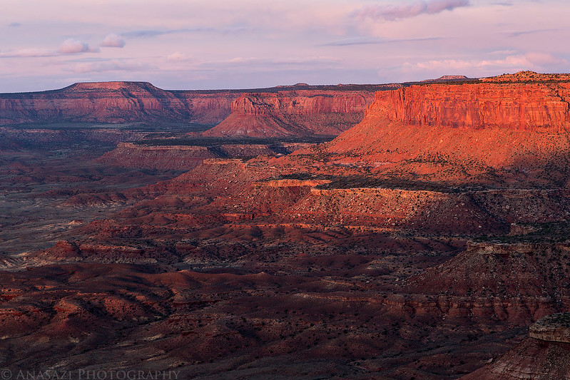
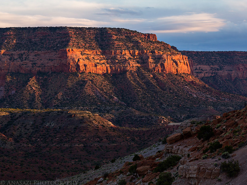
Morning light on The Block as we left Sunset Pass and started the drive back home.

The rest of the drive home was pretty uneventful. We took the Green River Road out this time and then stopped in Green River for a little lunch before finishing the drive home. We didn’t even run into any more rain today, though it did look like the Book Cliffs were getting hit with some storms. We’ve had a lot of fun spending the last two Memorial Day weekends around The Maze and look forward to spending some more time here in the future.
Phenomenal as usual, love to follow your journeys. Keep it up!
Did you carry extra gas and if so how much and did you use it?
I was probably carrying 10 extra gallons of fuel, but only used 5. That’s typical of most of my trips into the Maze.