Curecanti National Recreation Area | Saturday & Sunday, June 24-25, 2023
After hiking through the Dark Canyon of Anthracite Creek on Saturday morning I returned to Hotchkiss and grabbed a burger from 133 BRGR for an early lunch and then continued following the West Elk Loop Scenic Byway into the Curecanti National Recreation Area so that I could finish what I started last month and complete hiking all of the official trails within the park. I planned to start with the Neversink Trail, which is located just a few miles outside of Gunnison at the very eastern edge of the Recreation Area, and then I would work my way back west toward home. Since none of the three trails I had left to hike were very long, I also explored a couple of the backroads along the way that headed up toward the edge of the West Elk Wilderness in the Gunnison National Forest.
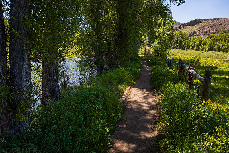
Neversink Trail
The Neversink Trail is a short and easy walk along the Gunnison River under the shade of large cottonwood trees.
The trail crossed this bridge to an island in the river that was currently flooded by the high spring runoff.

Gunnison River Channel

After my short walk along the Neversink Trail I sat in the shade and read a couple chapters of a book for a little bit before starting my drive back east to the Dillon Pinnacles Trail.
Red Creek Road
On my way to the trailhead I made a detour up the Red Creek Road and drove up the flank of the West Elks until I reached a snow drift across the road near 11,000 feet that stopped my progess.

As I drove down the road along East Red Creek there was a very hazy view of San Luis Peak and Stewart Peak in the La Garita Mountains.

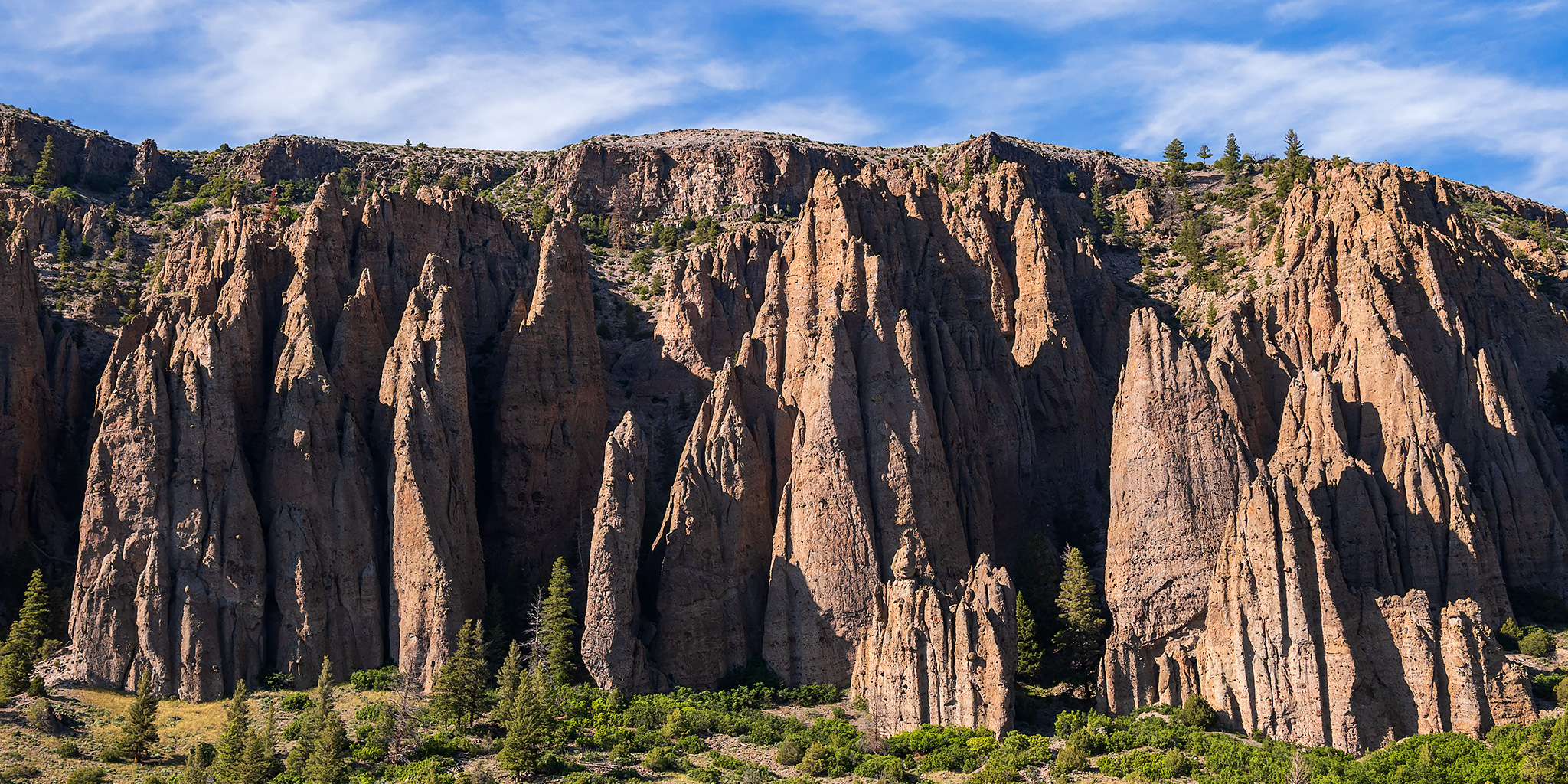
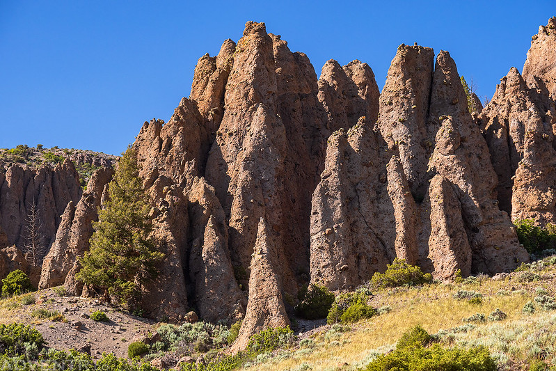
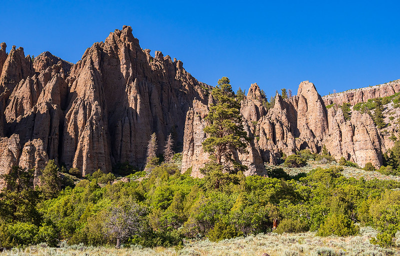
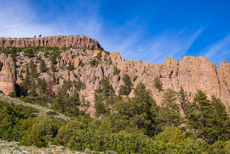
Dillon Pinnacles Trail
Later in the afternoon I went for a hike along Blue Mesa Reservoir to the Dillon Pinnacles. I have seen these geologic formations numerous times as I flew by on the highway, so I was looking forward to getting a closer look today.

The Dillon Pinnacles
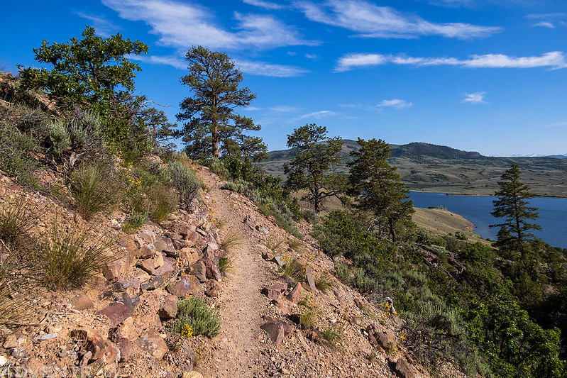
Looking down at the Blue Mesa shoreline from the end of the trail.

Although it was still pretty hazy out this afternoon, a few nice clouds did move in above the pinnacles while I was near the end of the trail.


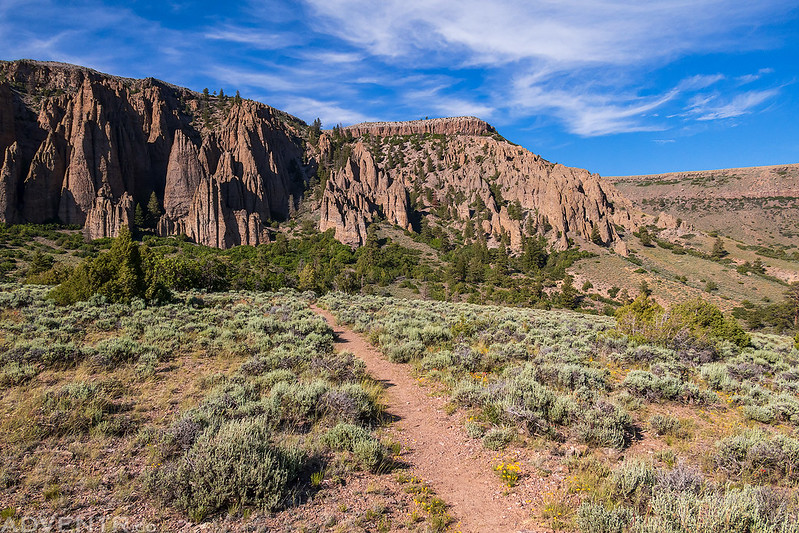

Following the Dillon Pinnacles Trail back to the trailhead.
Pioneer Lookout Point
After leaving the Dillon Pinnacles I only had one trail left to hike, but I was going to save that one for Sunday morning, so I drove back over to Pioneer Point to eat dinner and take in the views before returning to a campsite I had scouted out earlier in the day.
The Curecanti Needle
Curecanti Creek Canyon

An evening view from the Pioneer Point Overlook.

Shortly before sunset I left Pioneer Point and headed over to a campsite just outside the Curecanti National Recreation Area along Mesa Creek. I read a little more and then went to bed early again.
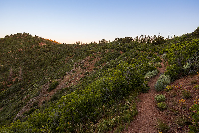
Crystal Creek Trail
I was up early on Sunday morning, watched the sunrise from Morrow Point and then headed over to the Crystal Creek Trailhead so I could hike my final trail in Curecanti National Recreation Area!
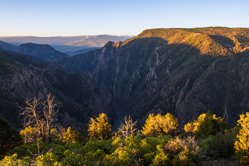
I followed the Crystal Creek Trail to its highpoint at the Spring Benchmark and then to the edge of the Black Canyon of the Gunnison.
It was nice seeing the high peaks of the Uncompahgre Wilderness over the depths of the Black Canyon from the trail.
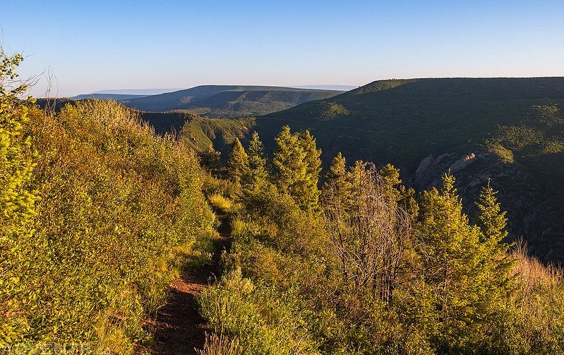
Looking the other direction were views of Pine Ridge, Green Mountain and even the Grand Mesa.
Crystal Creek and the West Elks

It was really hard to get a good view of Crystal Creek through the morning light and haze…
Richardson’s Geranium

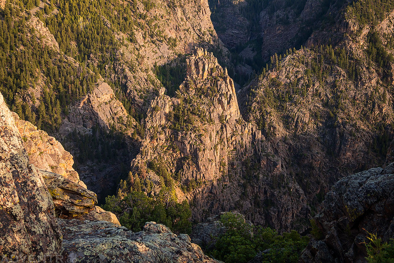
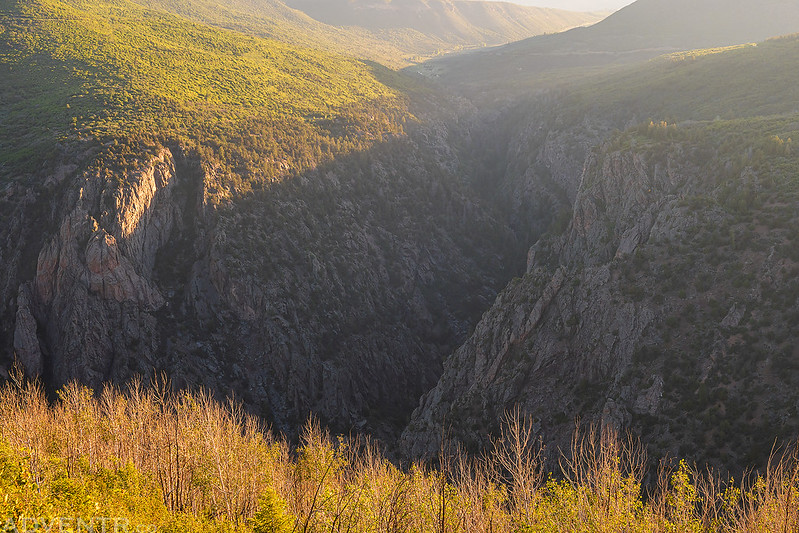
Looking down into the depths of the Black Canyon from near the end of the trail.

The Crystal Reservoir

Needle Rock Road
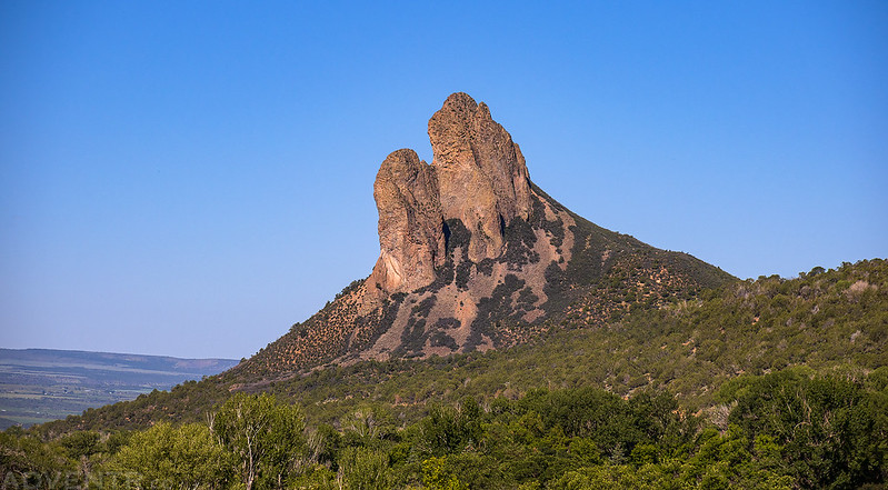
It was still pretty early when I finished the hike, so I drove up the Crystal Creek Road onto Black Mesa until I was stopped by more snow across the road. Then I went for one more final drive along the Smith Fork up the Needle Rock Road until I was surrounded by peaks of the West Elks including Little Sand Mountain, Smith Fork Mountain and Tater Heap.
I stopped underneath Needle Rock for a view as it’s been over a decade since I last stopped by.

Here’s a hazy view of the Chain Mountains from near my turnaround point.

One final view of Needle Rock as I made my way back down to Delta for lunch, and then headed home.