Flat Top Mountain, Blair Mountain and the Roan Plateau
Friday – Sunday, June 24-26, 2022
This weekend I planned to spend my time hiking and driving to a couple highpoints of the high mesas and plateaus of Western Colorado, starting with a hike I’ve been looking forward to for a while into the Flat Tops Wilderness on Saturday morning. I left after work on Friday afternoon, grabbed a quick dinner in Glenwood Springs and then followed the Colorado River to Dotsero and McCoy and then took Highway 131 north to Yampa. There were storms in the area this afternoon and I was a little worried that Glenwood Canyon might get closed by Flash Flood Warnings, which has been common lately, but thankfully that did not happen. Once I reached Yampa I started following the Bear River on my way to the Stillwater Reservoir, and turned off to take a side road up to Gardner Park to find a spot to camp for the night. I watched the sunset from the edge of the Gardner Park Reservoir and then went to bed early so I could get an early start on Saturday.
An evening at the Gardner Park Reservoir.
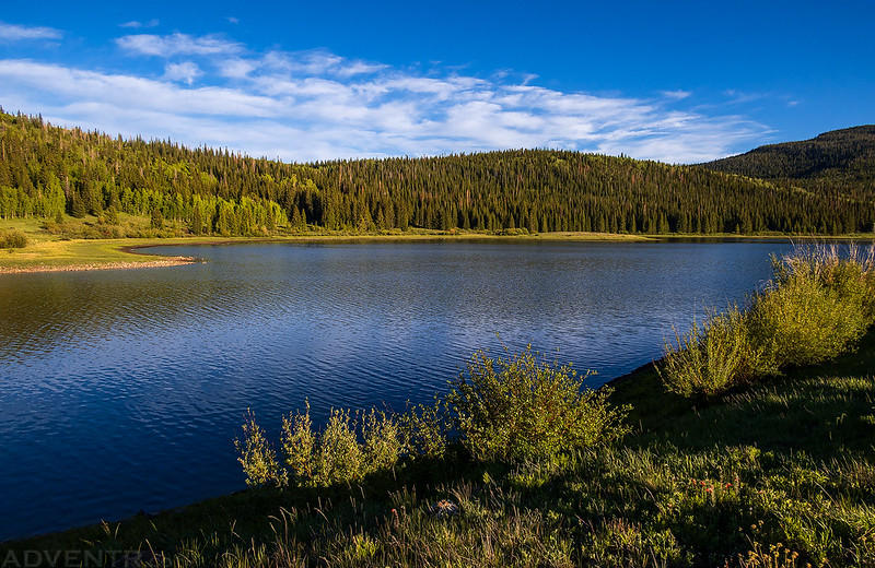
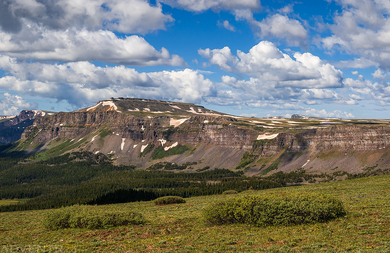
From the shore along the reservoir I could just barely see the summit of Flat Top Mountain sticking up above the hills, which would be my destination the following morning.
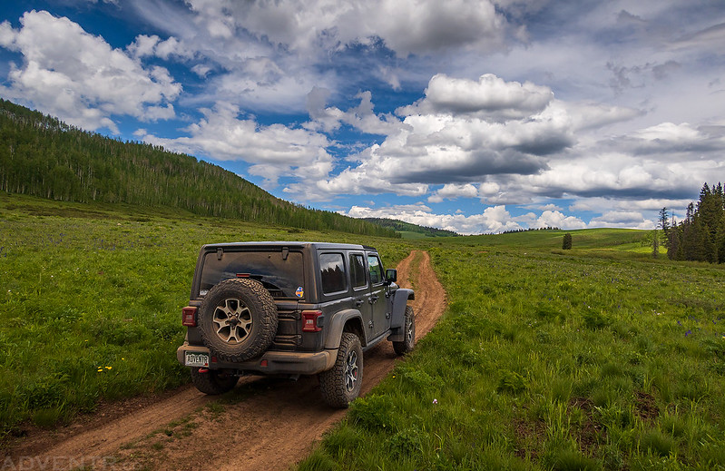
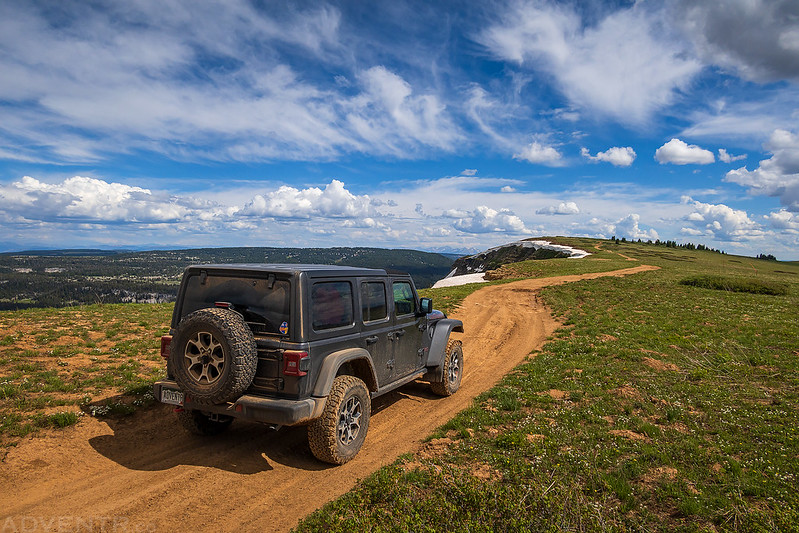
Just a photo of my Jeep at camp this evening.

Flat Top Mountain: Highpoint of The Flat Tops
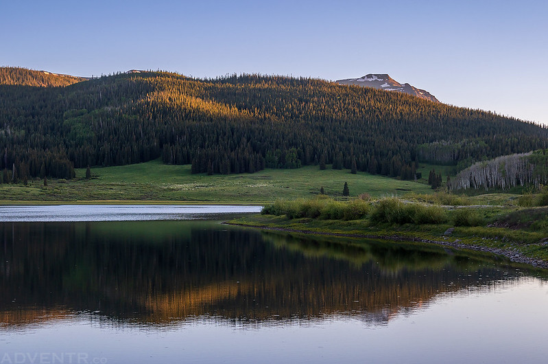
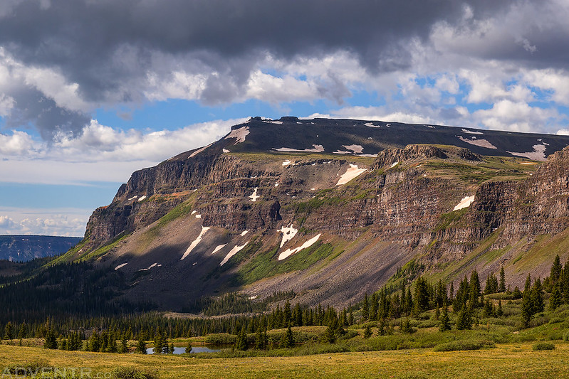
I woke up early on Saturday morning and watched the sunrise as I drove past the Yamcolo Reservoir and the Bear Lake Reservoir on my way to the trailhead just below the Stillwater Reservoir. Today I was looking forward to returning to the Flat Tops Wilderness and planned to hike to the summit of Flat Top Mountain which is the highest point in the Flat Tops at 12,354 feet.
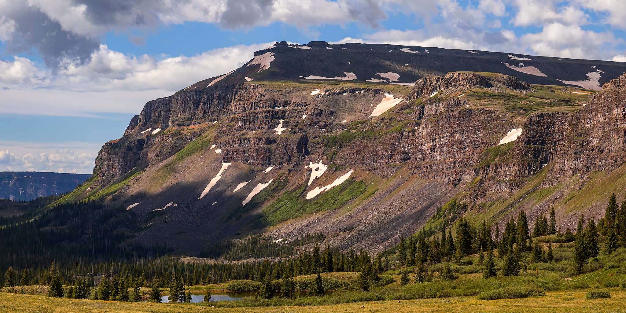
Sunrise & Flat Top Mountain
Flat Top Mountain viewed from the north.

Shortly after leaving the trailhead and Stillwater Reservoir, I passed a couple of small tarns as I made my way up the North Derby Trail.
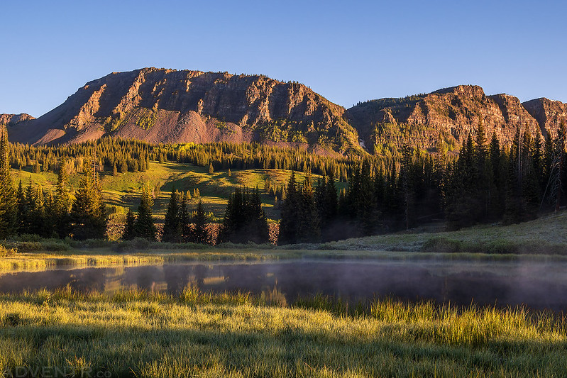
There was some steam fog rising up off the water this morning.

Just a little further up the trail I entered the Flat Tops Wilderness.

After hiking through the trees with limited views for a little bit, I entered another clearing and passed this tarn.

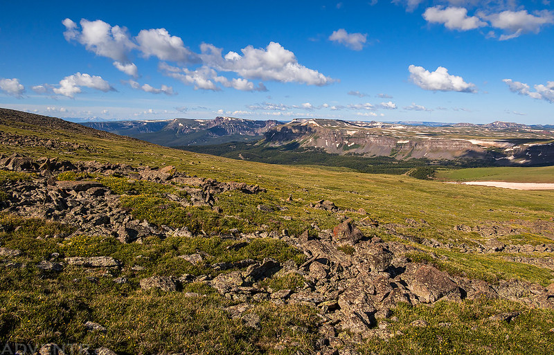
It was a beautiful morning for a hike across the vast expanses of the Flat Tops once I was up on the plateau above treeline.
After a long and steady climb, I reached the summit of Flat Top Mountain.

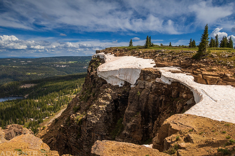
The top of Flat Top Mountain was very flat and rocky.

A distant view of the Lost Lakes Peaks, which I hiked early last summer.
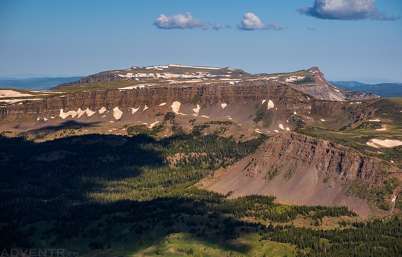
As I hiked back down to the pass I had great expansive views of the peaks of the Flat Tops Wilderness.
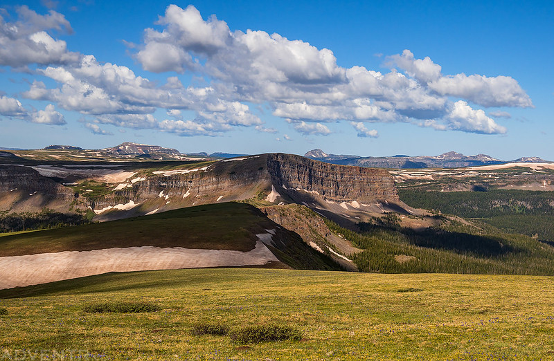
The clouds were starting to look nice late this morning, too.
Walking along the edge…

Mandall Lakes Basin

Derby Peak
Once I was back at the pass I headed down through the trees and back to the trailhead. There were quite a few mosquitoes around during the hike back down, so I kept moving and didn’t stop much.
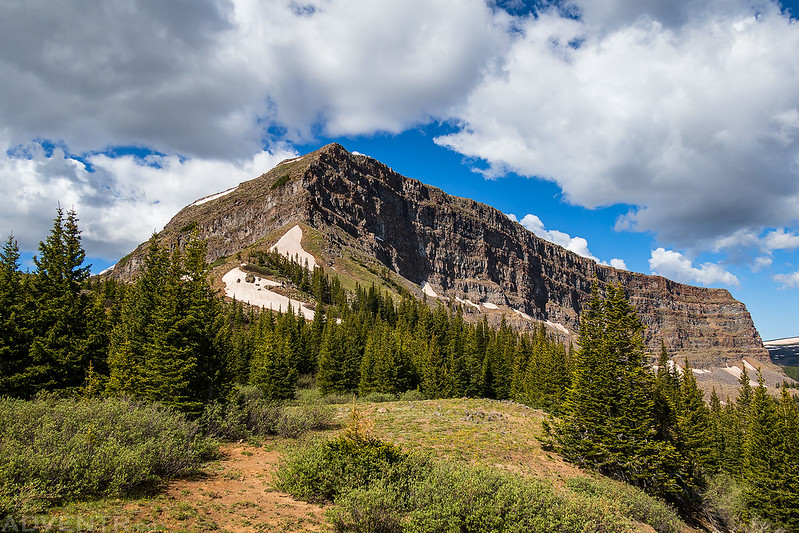
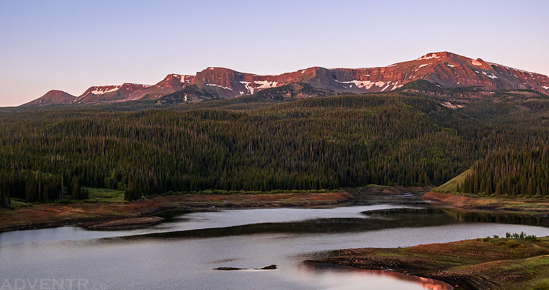
Here’s a parting shot of Flat Top Mountain as I left the area and started my loop around the north side of the Flat Tops via Dunckley Pass and Ripple Creek Pass. It was starting to get even more cloudy by this time.

I was hoping to get gas in Yampa before starting my drive along the Flat Tops Scenic Byway, but the only gas station in town was out of fuel when I arrived. I thought I would probably have enough to complete the loop so I decided to take my chances as I made my way over to Buford.
Blair Mountain: Highpoint of the White River Plateau
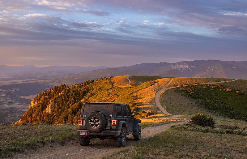
After following the North Fork of the White River from Ripple Creek Pass to Buford, I took a left onto the New Castle – Buford Road so I could visit the top of Blair Mountain, which is the highpoint of the White River Plateau at 11,460 feet. I was able to drive pretty close to the highpoint by following some bumpy Jeep roads.
The landscape was very green as I drove across the White River Plateau this afternoon.

Corral Creek Road
Looking down on Blair Lake from the edge of Blair Mountain.
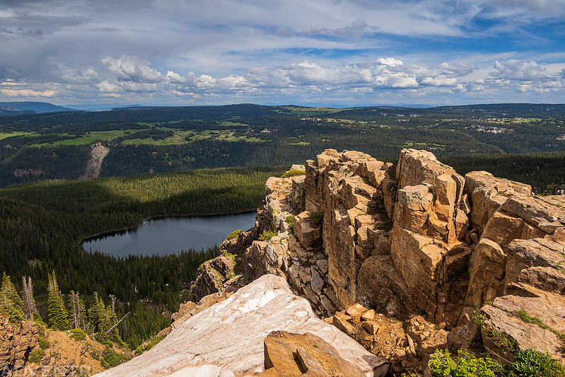
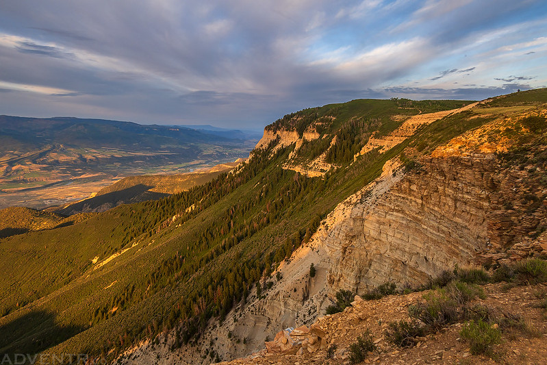
The views from the edge of Blair Mountain were outstanding!

Following the Blair Mountain Road along the edge of the plateau.
Looking down over the Elk Lakes.

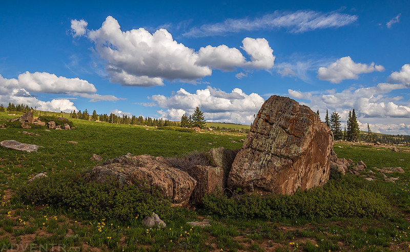
Boulders & Clouds
I was originally planning to spend the night in this area, but by now I was getting low on gas and was a little worried that I wouldn’t have enough to make it back to New Castle, so I thought it would be best to head down now and hopefully not run out of gas along the way. That way I wouldn’t have to stress about it all night. Thankfully, I just barely made it to a gas station in New Castle! With a full tank of gas I headed west on I-70, grabbed a late dinner in Rifle and then drove up onto the Roan Plateau to find a place to camp for the night.
Highpoint of the Roan Plateau & Gardner Benchmark
After my dinner in Rifle, I followed the Grand Hogback to Piceance Creek and then drove the road up Cow Creek to the top of the Roan Plateau. I ended up driving to the eastern edge of the plateau and spent the night at the highpoint looking down over the lights of Rifle far below.
The sun went down as I was driving across the top of the Roan Plateau, and I didn’t end up stopping to camp until it was dark out.

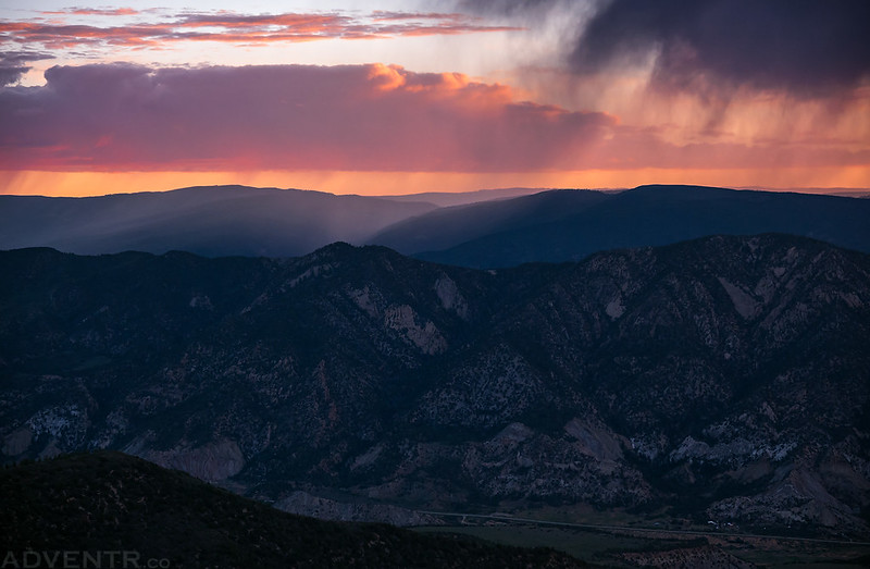
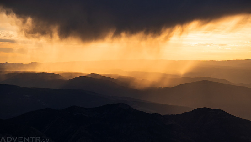
I woke up before sunrise on Sunday morning and was treated to a colorful sky with some rain to the east. There were also a few lightning bolts, although they were far enough away that I never heard any thunder.

Road on top of the Roan Cliffs.


Since I had spent the night at the highpoint of the Roan Plateau (9,300), I didn’t have to do any hiking to reach it this morning.

I did take a drive and short walk over to the Gardner Benchmark (9,286), though.
The Edge of the Roan Plateau
Rays of sunlight filtering through the Grand Hogback.

Morning Rain
After thoroughly enjoying the views from the edge of the plateau this morning, I started my drive down the JQS Road and then headed home early. It was a very nice weekend in the high mesas and plateaus of Western Colorado!


>> High Mesas and Plateaus of Western Colorado Photo Gallery