The Four Sacred Mountains of the Navajo | La Cieneguilla Petroglyphs
Thursday & Friday, September 2-3, 2021
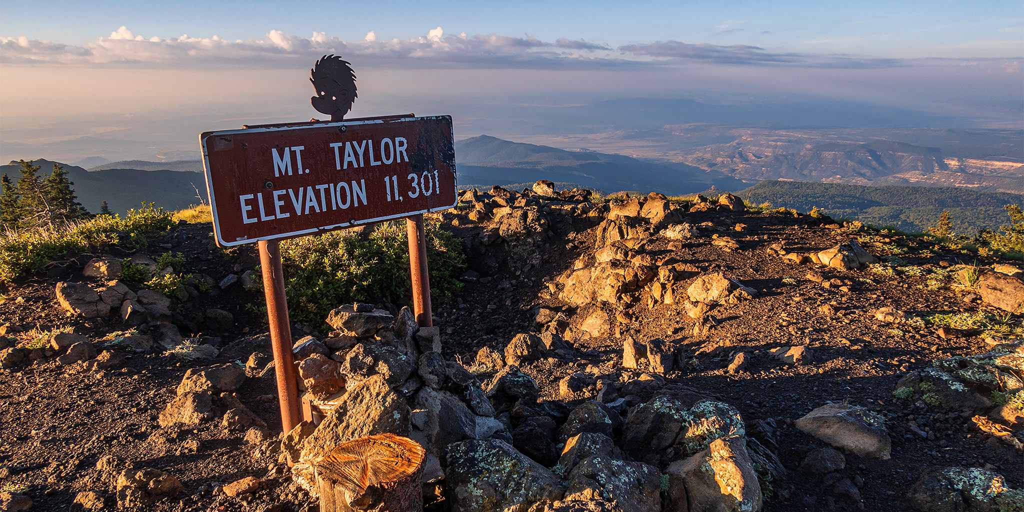
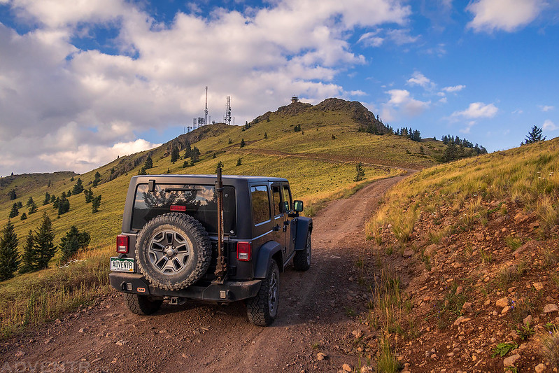
After climbing Humphreys Peak on Thursday morning and then leaving Arizona, I made my way into New Mexico so I could climb the highest peak in the state to complete the Four Corners state high points. But Wheeler Peak would have to wait one more day so I could take a short detour near Grants to hike to the summit of Mount Taylor, which is the Sacred Mountain of the South to the Navajo people (Diné). I’ve actually wanted to hike Mount Taylor ever since I first laid eyes on it last year during our visit to El Malpais National Monument, and this seemed like the perfect opportunity to do so since it was right along the way. It sure feels like I’ve been spending a lot of time in this area lately, but I’m not complaining since I’m really enjoying it! Once I made it to Grants, I stopped for a quick dinner and gas in town and then drove up onto San Mateo Mountain so I could visit the La Mosca Lookout and find a place to camp for the night.
The Holy People put four sacred mountains in four different directions, Mt. Blanca to the east, Mt. Taylor to the south, San Francisco Peak to the west and Mt Hesperus to the north near Durango, Colorado, thus creating Navajoland. The four directions are represented by four colors: White Shell represents the east, Turquoise the south, Yellow Abalone the west, and Jet Black the north.
From: DiscoverNavajo.com
Welcome to Cibola National Forest

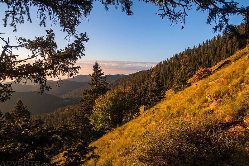
The light was looking nice on East Grants Ridge as I followed Lobo Canyon Road.

I drove up the road in La Mosca Canyon all the way to the towers on top of La Mosca Lookout.
La Mosca Canyon Sunrays

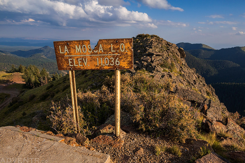
The current La Mosca Lookout Tower was built in the 1960’s to replace an older lookout that was originally built in the late 1930’s.

La Mosca Lookout
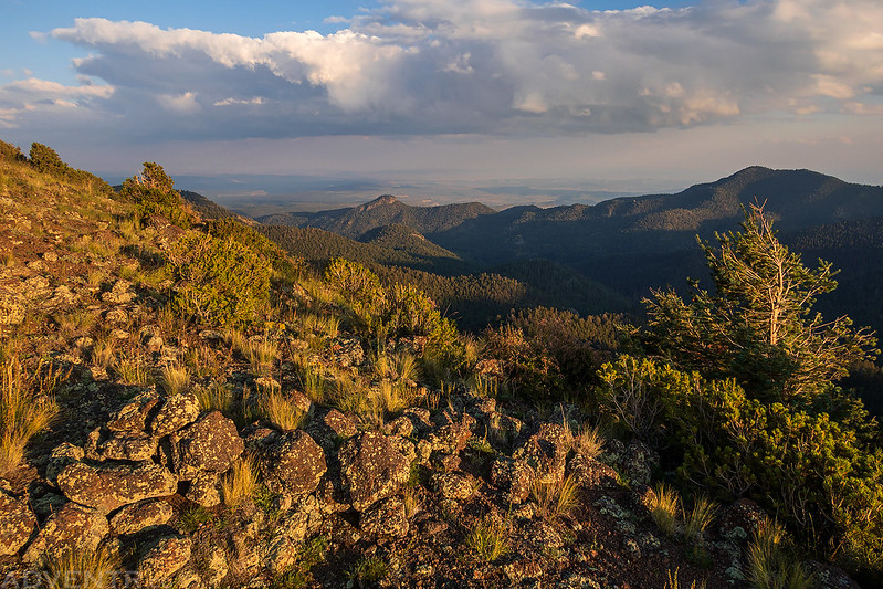
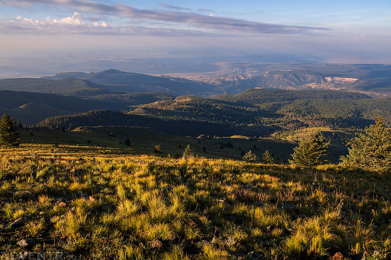
A nice view over Water Canyon from the summit of La Mosca Lookout.

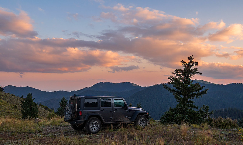
After visiting the lookout I found a campsite nearby and went for an evening walk along the ridge to watch the sunset. There were nice clouds in the sky this evening and the smoke wasn’t too bad.


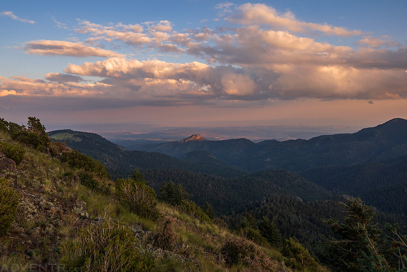
I stayed on the ridge until just after sunset when it started to get cold out since I hadn’t brought a jacket with me, and then I headed back down to camp to get to bed early.
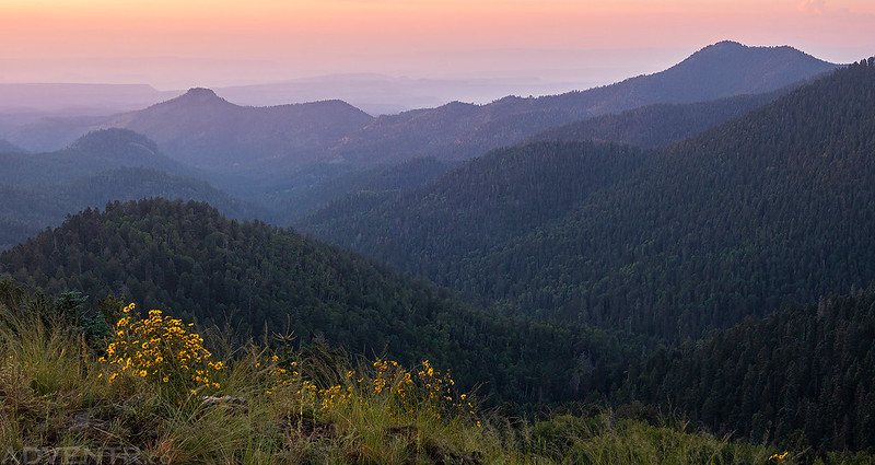
I slept very well overnight and was up shortly before sunrise. The hike to the summit of Mount Taylor is pretty short, so I didn’t need to get up very early since I was camped only about a mile away from the trailhead.
I watched the color in the sky change beyond Mount Taylor as I drove to the Gooseberry Trailhead.

The smoke in the air turned a shade of magenta over Water Canyon.

It was uncomfortably humid out this morning as I started hiking, but the light was nice.
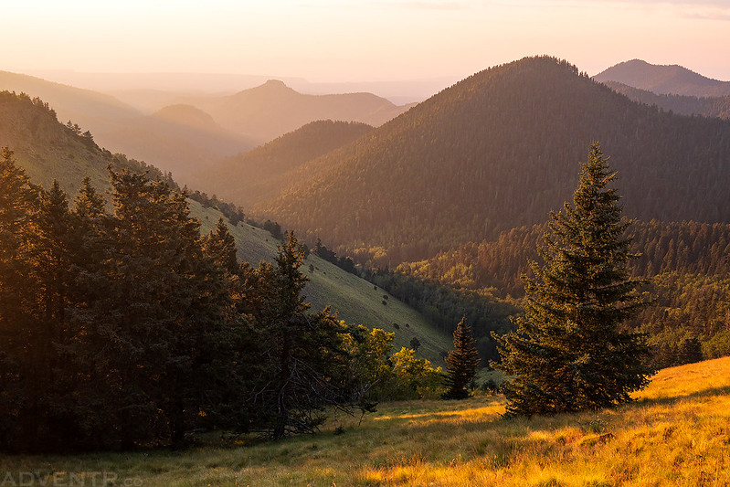

The last couple of switchbacks just before the summit are in the trees, but the sun kept peeking through.

It only took me about 35 minutes to reach the summit of Mount Taylor.

The smoke-filled canyon below…

Looking down the south ridge from the summit.

Off in the distance through the smoke and haze is El Malpais National Monument.
After enjoying the view from the summit for a while, it was a quick hike back down to my Jeep.

I drove back down from San Mateo Mountain into Grants and grabbed a quick breakfast in town before heading off to Taos and the southern end of the Sangre de Cristo Mountains so I could climb Wheeler Peak, the highest peak in New Mexico.
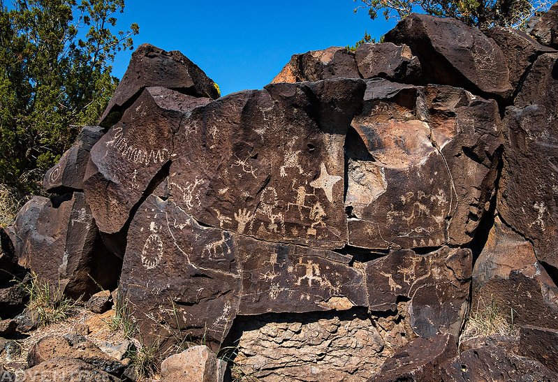
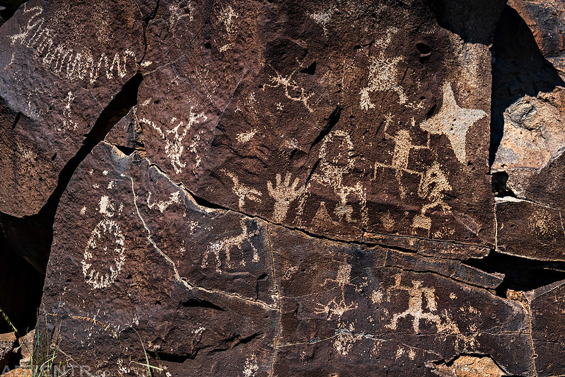
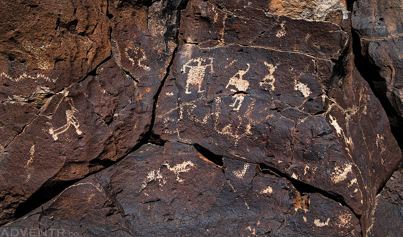
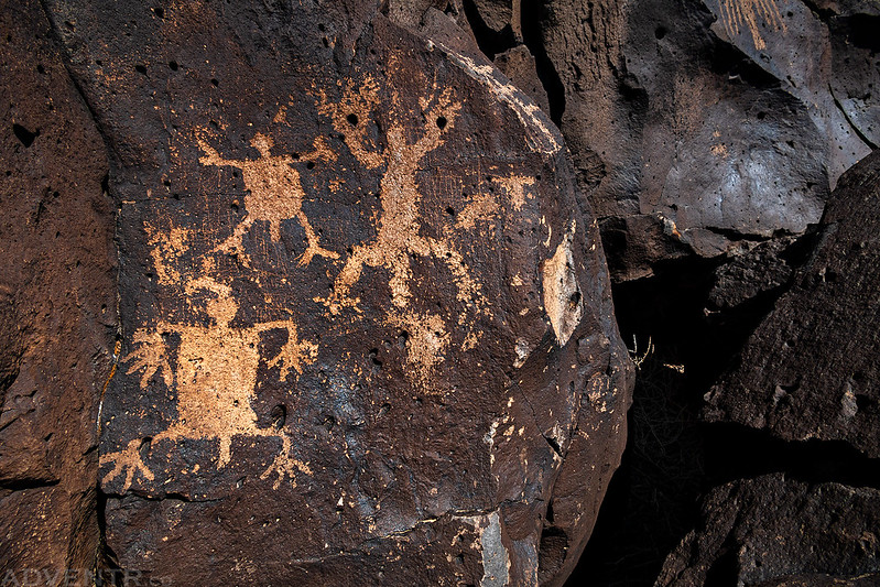
Caja del Rio Plateau: La Cieneguilla Petroglyphs
After driving past Albuquerque and across a number of different Indian Reservations, I took a detour just short of Santa Fe so I could bypass the town and stretch my legs for a little bit while searching for the La Cieneguilla Petroglyphs. Even though it was only in the mid-80’s when I went on this short hike, it was still very humid and uncomfortable out. While I didn’t have time to thoroughly explore the edge of the Caja del Rio Plateau, it was a nice introduction to the area and I found a couple nice panels while I was there. Next time I am in the area I will have to return and take my time. Here are a couple of photos I took while I was there.


Beautiful!