Tomsich Butte to Poor Canyon, Road Hollow to Fix-It Pass & Slipper Arch
Friday & Saturday, May 1-2, 2020
I was originally supposed to be in the San Rafael Swell this weekend for an event that was cancelled due to the current COVID-19 pandemic, but since most of Utah, including Emery County, was open to camping again I decided to still head into the Swell so I could spend Saturday hiking and exploring more of the Muddy Creek Wilderness. I’ve gone on a couple of great trips along the Muddy Creek over the past few years and have been looking forward to getting back there again. This time I planned to hike into the Upper Gorge of Muddy Creek from Tomsich Butte and then continue into Poor Canyon as far as I could go. I was hoping that Poor Canyon would share some of the same amazing features that the forks of Chimney Canyon do, and I wasn’t disappointed!
It looked like there was rain in the distance as I drove down from The Big Ridge into Hondu Country.
I left right after work on Friday afternoon and headed west to the San Rafael Swell, driving through some pretty strong winds that are common this time of the year on the Colorado Plateau. As soon as I got off the interstate at the Temple Mountain Road exit I noticed that there were a lot of campsites located along the roads in this area, but thankfully they seemed to thin out the further away I got. I drove over The Big Ridge and then descended into Hondu Country near Tomsich Butte where I found a campsite for the night across from The Hondu. It was actually very close to the spot I camped last year with my friend Chris the night before we floated through the Chute of Muddy Creek. There were a number of groups already camped in the area since it’s usually a pretty popular place, but everyone was pretty well spread out and kept their distance from each other. The evening light and clouds were looking nice when I arrived, so I went for an evening hike along Muddy Creek to take a few photos before sunset.
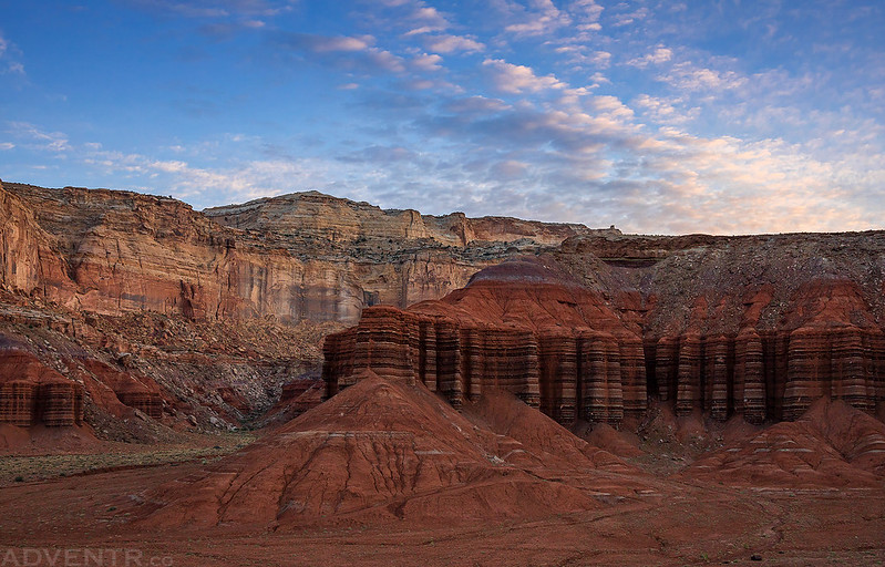
I liked the different layers of light and stone in this shot of Tomsich Butte from camp.

An evening stroll along Muddy Creek.

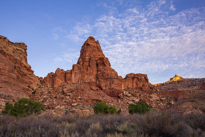
I climbed up to the top of this little mesa for a higher vantage point of the surrounding area.

There was a nice view over Muddy Creek from the other end of the mesa.

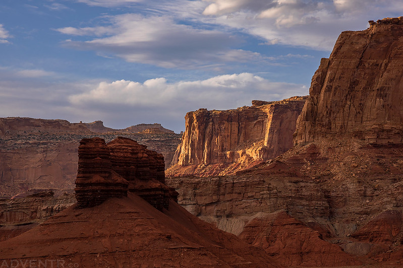
Swell Layers
I returned back to camp shortly before sunset to get ready for an early start on Saturday morning.
Here’s one last view of The Hondu before it got dark out and I tried to get to sleep.

Upper Muddy Creek Gorge & Poor Canyon
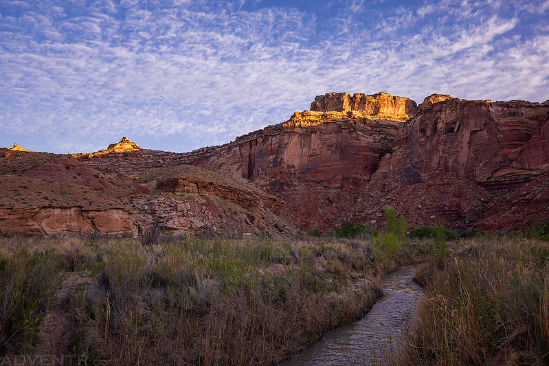
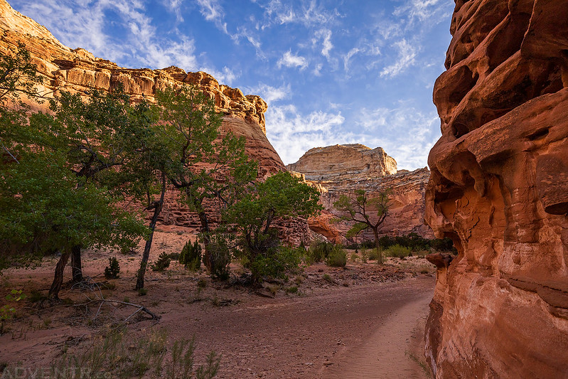
I didn’t sleep very well overnight. The temperature out was pretty warm for much of the night and there were quite a few strong gusts of wind that kept me up. It kind of reminded me of last year when we camped here and the wind had picked up during the middle of the night and didn’t let up until morning. I got up early on Saturday morning so I could get started hiking before sunrise and beat the heat later in the day. I drove a short distance over to the trailhead and started hiking up Muddy Creek towards Poor Canyon about a half hour before sunrise. The first part of the hike follows an old mining road, so I made good time.
Sunrise was looking promising as I was hiking along the old mining track, so I climbed up to the top of a small ridge to watch it. Of course, by the time I reached the top many of the clouds had quickly disappeared.

There were a few clouds left in the sky looking the opposite direction, though.
I waited around on the ridge for a little while, but the sunrise turned out to be a bust, so I continued hiking deeper into the gorge.
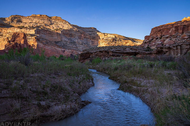
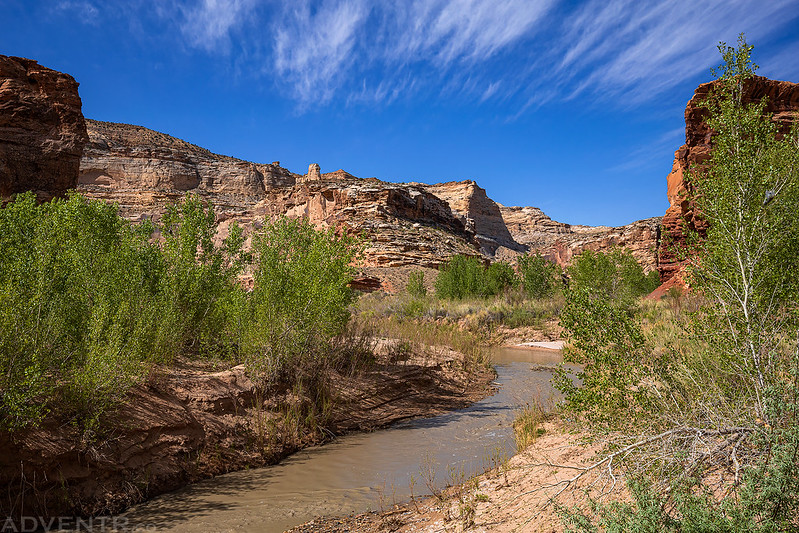
The sun finally made an appearance as I followed faint animal trails along the bank of Muddy Creek.
Morning along Muddy Creek

I found this old inscription along the creek. C. Ivie 94

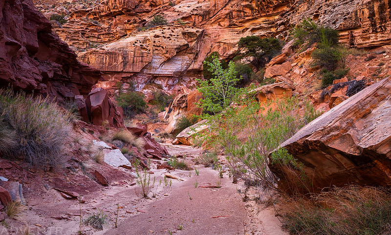
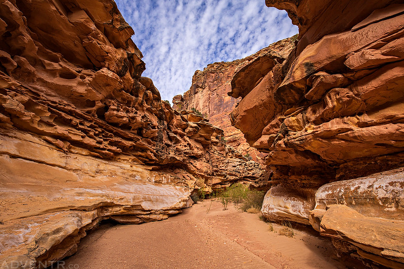
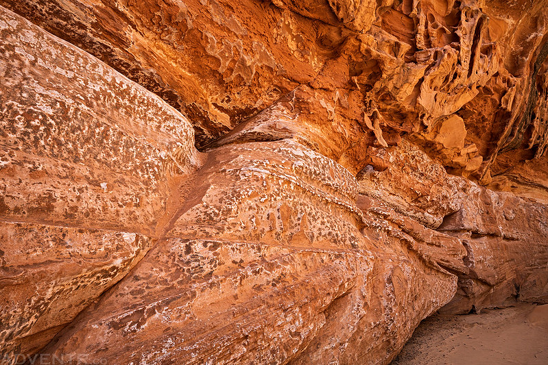
Soon I found myself at the mouth of Poor Canyon and left Muddy Creek to start hiking up this large tributary. This big wall of tafoni caught my attention.

Initially, I wasn’t that impressed with Poor Canyon as I first started hiking up it, but after a few short bends I turned a corner and came across this scene. I just stopped in my tracks and said WOW! This is what I came looking for! I was pretty much in awe for the remainder of the hike in the canyon.
There was a lot of tafoni and salt stained walls in this part of the canyon which reminded me of Chimney Canyon, just as I had hoped.

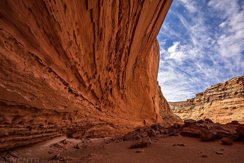
Poor Canyon is rich in beauty.

There was even a short section of short narrows to hike through.

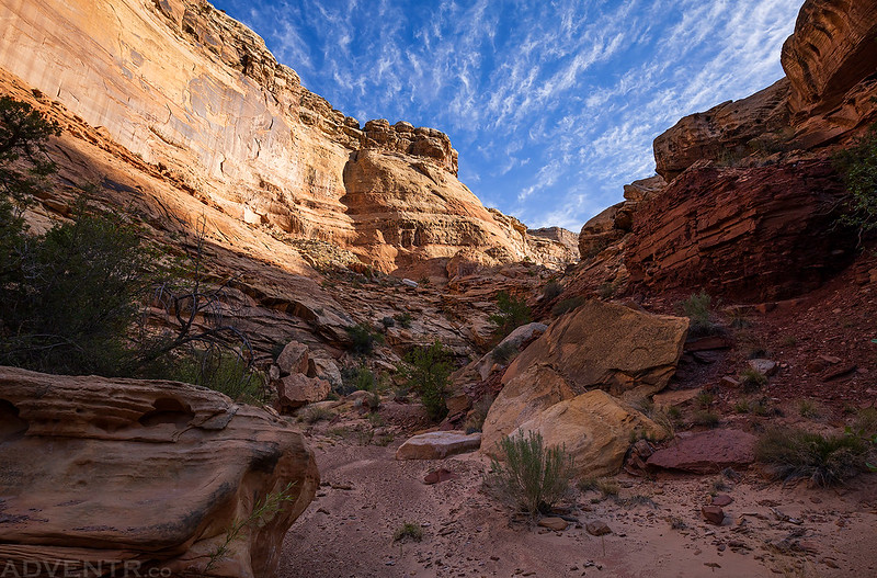
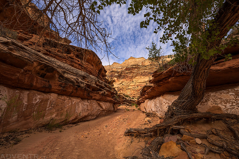
After hiking through the narrows the canyon opened up and really reminded me of Chimney Canyon.

Of course, once the canyon opened up the wash became much more sandy which wasn’t as fun to hike through, but the scenery made up for it.

I climbed up to the saddle of a bend in the canyon for this view of upper Poor Canyon. This seemed like a good place to turn around since it looked like I wouldn’t be able to go much further anyway.

Hiking back down Poor Canyon. It was starting to get a bit warmer out by this time.
Through the narrows on the way back.
I loved the clouds over this canyon wall covered in tafoni.

Although I saw plenty of smaller holes among the tafoni in the canyon walls, this was probably the only one I saw that was large enough to be classified as an actual arch, if you can spot it in this photo…
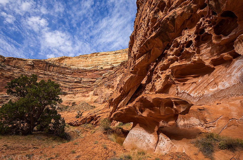
Before leaving Poor Canyon, I climbed up to a large alcove in the lower portion of the canyon that I had skipped on my way in.

I stopped for a break in the shade of the alcove before heading back out into the heat.

This is a view of the canyon from inside the alcove.

Canyon Corner
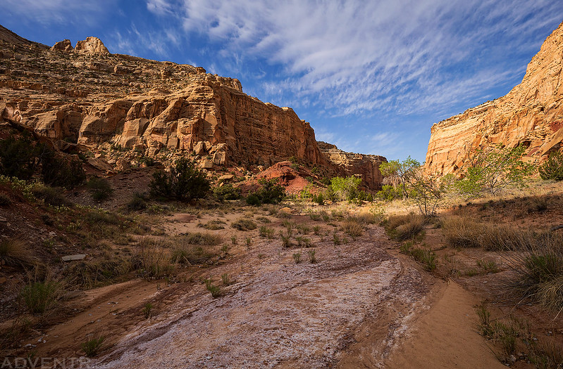
Leaving Poor Canyon and returning to the Muddy Creek Gorge.

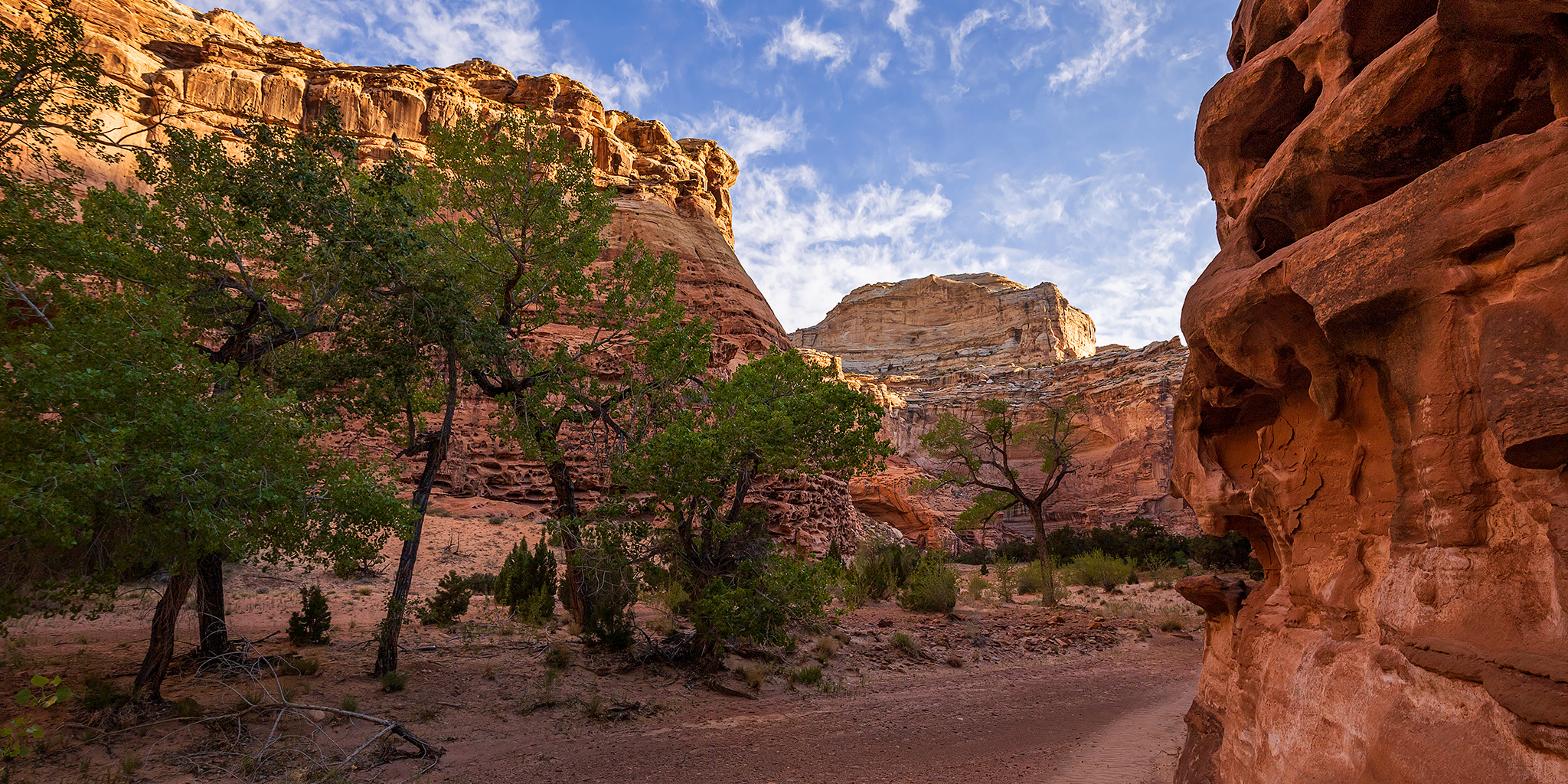
Hiking through the Upper Muddy Creek Gorge on my way back to Tomsich Butte.
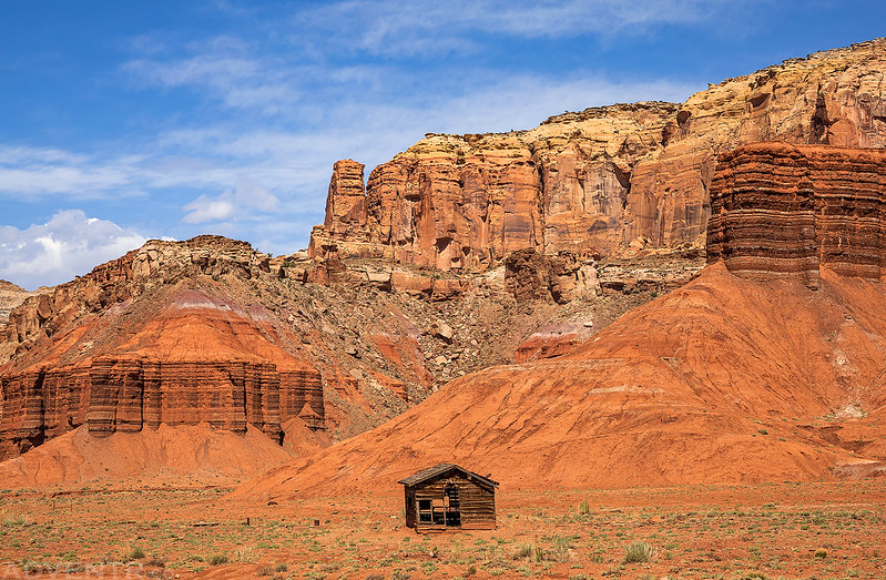
A beautiful setting for this little old cabin.
Road Hollow to Fix-It Pass & Slipper Arch
I returned to my Jeep by 11:30am and still had plenty of daylight left to explore more of the San Rafael Swell. Since it was pretty warm out by now I didn’t really feel like going on a hike, so I thought I’d do a little exploring with my Jeep for a change. These days it’s not that often that I head out just to drive trails in my Jeep anymore, so I thought that might be fun for a change of pace. Although I’ve driven many of the 4×4 roads in the Swell before, Fix-It Pass is one of them that had eluded me. Plus, I’d still never made it over to Slipper Arch in the North Fork of Coal Wash before, so I though that would make a good destination this afternoon. Instead of returning north the way I had come, I took the scenic route through Reds Canyon on the way back to I-70. Once I reached the Temple Mountain Road exit again, I crossed under the Interstate and followed Road Hollow to Oil Well Flat and then to Fix-It Pass.
Following the road through Road Hollow. Apparently, this was one of the first roads that crossed the San Rafael Swell from east to west.

Passing below Round Knoll (6,254).

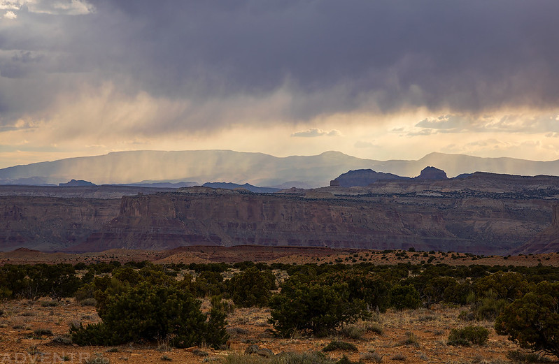
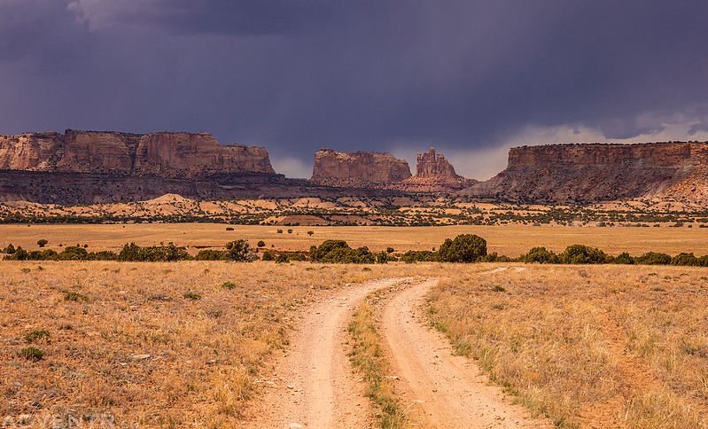
Driving into an oncoming storm.
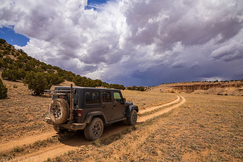
Dark storm clouds over Oil Well Flat.
Devils Monument & Joe and His Dog came into view as I entered the upper reaches of Saddle Horse Canyon.

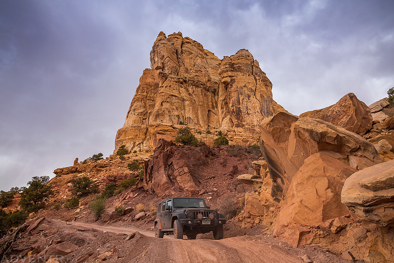
My Jeep at the top of Fix-It Pass.

Coming down from Fix-It Pass. I believe this used to be the toughest section of the road in the past, but it was apparently repaired and improved last year sometime. When I got out of my Jeep to scout the road and take this photo, thunder erupted from the sky and echoed off the canyon walls. I quickly got back in my Jeep and finished the drive down from the pass before the storm was on top of me.
It started to rain pretty hard when I first arrived at Slipper Arch, so I waited out the storm and was finally able to get a shot of this massive arch when the rain stopped.

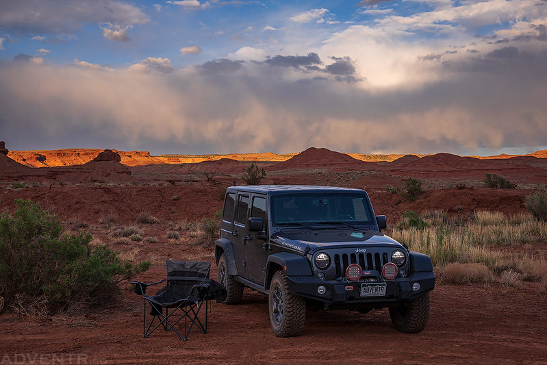
Leaving the North Fork of Coal Wash on my way back home. It had been a nice day in the Swell!
