Black Bear Pass to Columbine Lake
Saturday, August 17, 2019
This weekend I decided to skip the peak bagging for a minute and just wanted to go on a nice hike in the high country through the upper basins of Mineral Creek near Silverton. I have wanted to hike to the turquoise blue waters of Columbine Lake for a long time but I didn’t really want to follow the steep trail that everyone else does, so I decided that I would drive up to Black Bear Pass and then hike over to the lake by passing through a couple different high alpine basins and maybe stop at a couple of passes along the way. Now after hiking this route I’ve got to say that it was pretty amazing! One of the nice things about this hike is that it was all above treeline and pretty much stayed between about 12,600 feet and 13,000 feet. There were a lot of ups and downs along the way, but it didn’t feel like I was climbing a steep mountain and the route offered spectacular views in all directions right from the beginning. This Grand Basin Traverse takes you through Mineral Basin, Porphyry Basin, Silver Cloud Basin and Mill Creek Basin on your way to Columbine Lake. Along the way you have the option of climbing up to two different passes for views into Mud Lake Basin and Bridal Veil Basin, plus you will also pass by Porphyry Lake, Bullion King Lake and a number of other small tarns along the way. This is definitely the way to hike to Columbine Lake!
Since there were no storms in the forecast for the entire weekend and I wasn’t worried about getting a later start, I slept in on Saturday morning before leaving home and heading down to Red Mountain Pass and then Black Bear Pass. When I left home, the Grand Valley was full of smoke and it was pretty hazy out. At first I thought it might be from the wildfire that broke out near the Palisade Peach Festival on Friday, but as I drove further south there was smoke all the way to Red Mountain Pass, so I knew it had to be coming from somewhere else. Thankfully, shorty after I started hiking the smoke did clear out and it turned out to be a beautiful day in the mountains! Although there were no storms in the forecast, strong winds were predicted. While it was a bit breezy out at times during my hike, the only times I ever experienced any stronger winds were when I was at the two passes.
When I first started hiking across Mineral Basin there was still a lot of smoke in the air and I was worried it was going to be like this all day, but thankfully the smoke cleared out by the time I made it into Porphyry Basin.
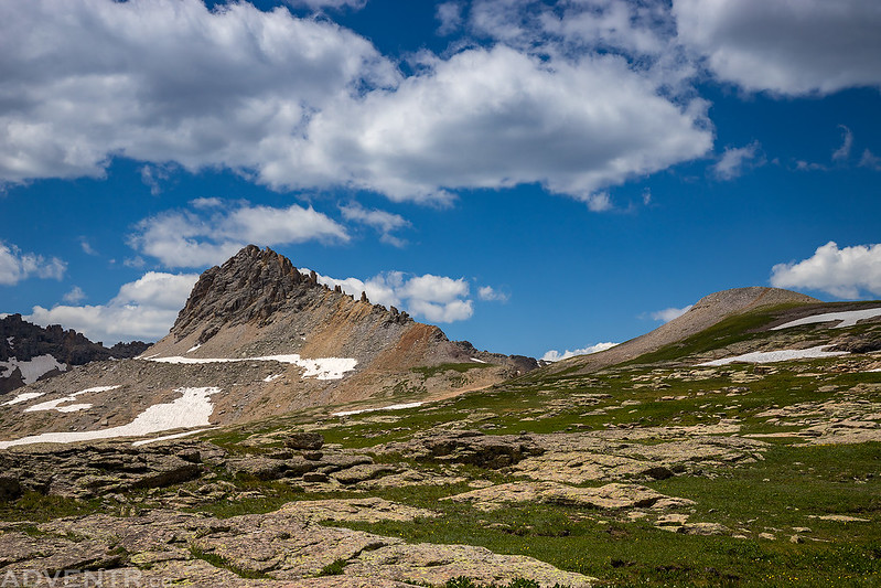
Looking back to Black Bear Pass and Trico Peak (13,321) as I climbed up to the first ridge. If you look closely you can see my Jeep down below the pass.
A view from the top of the first ridge as I made my way into Porphyry Basin.

Before heading across Porphyry Basin I climbed up to the pass pictured here for a view into Mud Lake Basin on the other side.

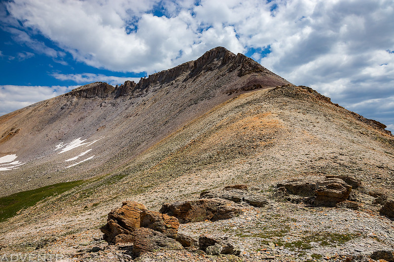
The Three Needles (13,481) towered above the pass.

Looking up from the saddle to the summit of T10 (13,477).
Mud Lake Basin below and the Sneffels Range on the horizon.
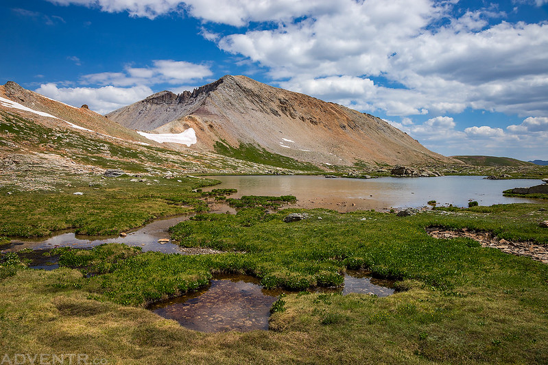
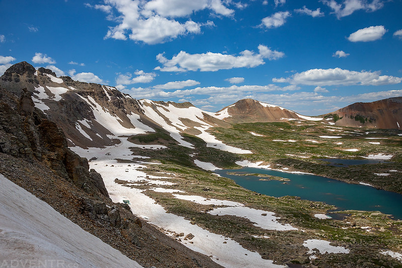
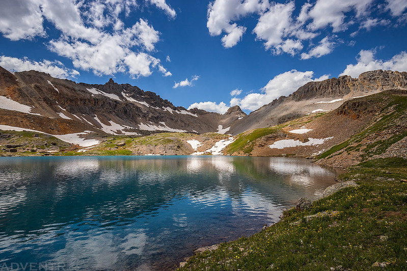
My next destination was hiking past Porphyry Lake on my way to the other side of the basin.

Looking back over Porphyry Lake & T10.
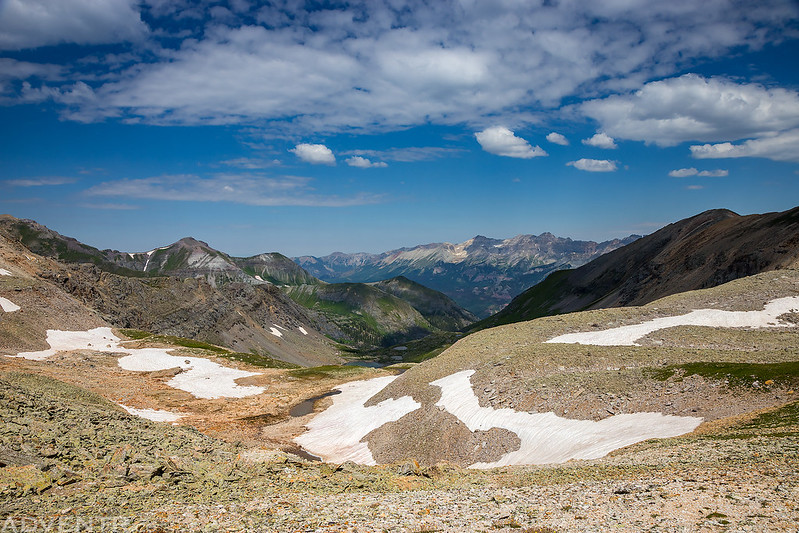
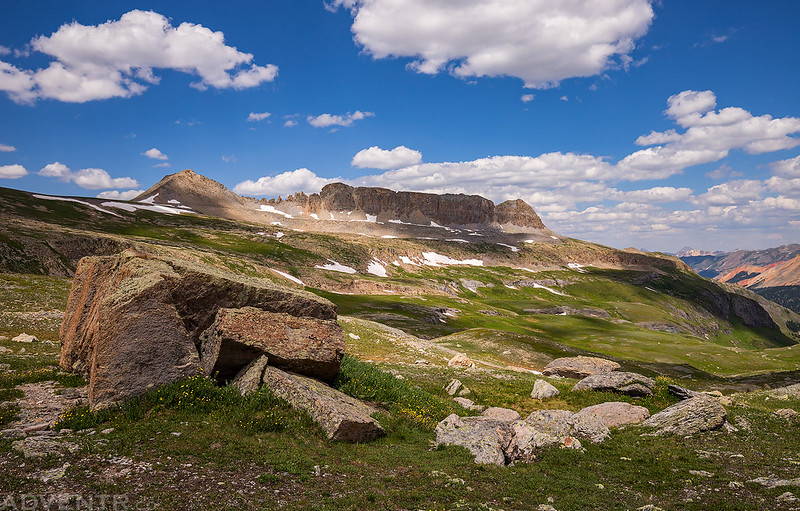
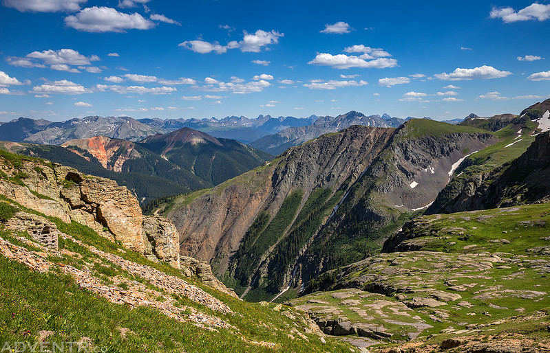
A grand view back across Porphyry Basin as I climbed up the ridge on the other side.
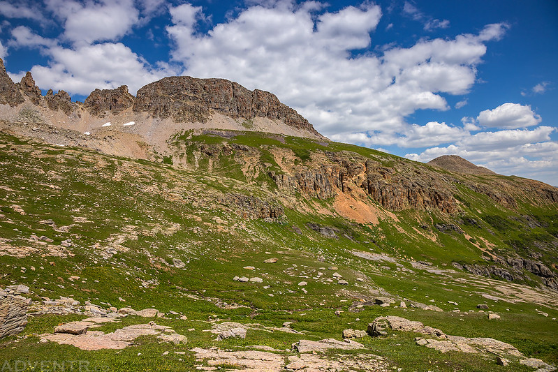
A view across Silver Cloud Basin, the next basin I needed to get across.
Wildflowers & Needles
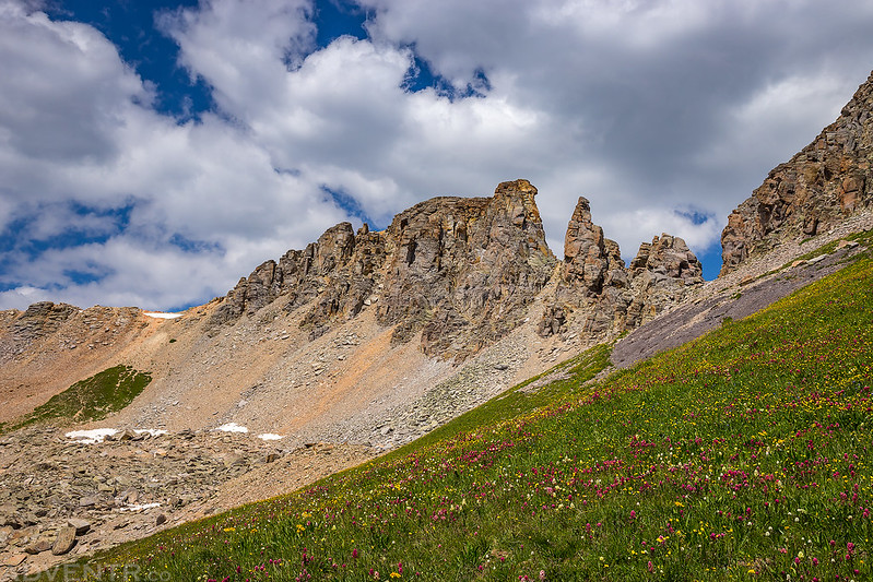
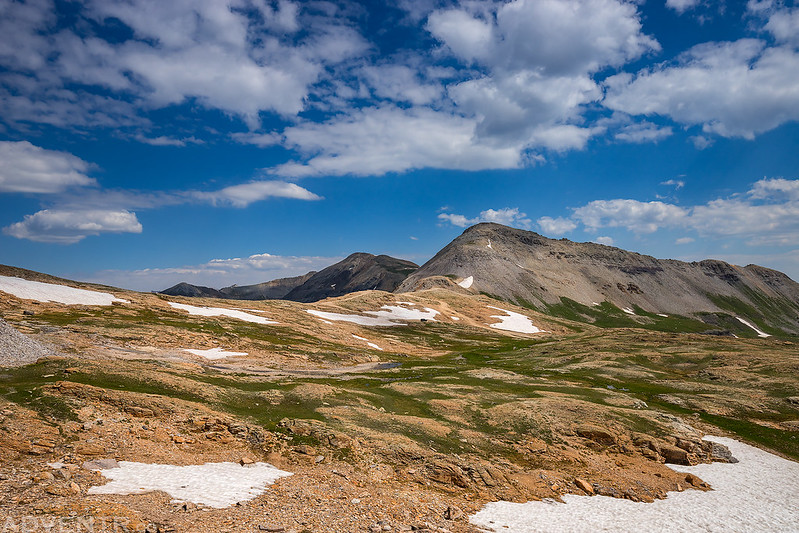
This was a very cool area with amazing views!

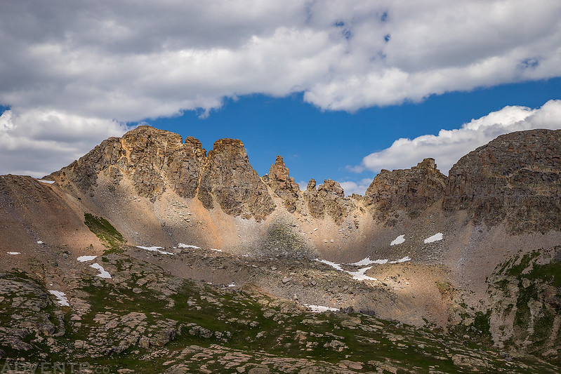
Looking back after descending into the basin.
I liked the spotlight on these rock towers below the clouds.
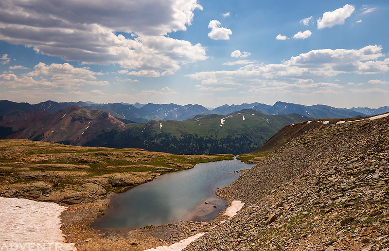
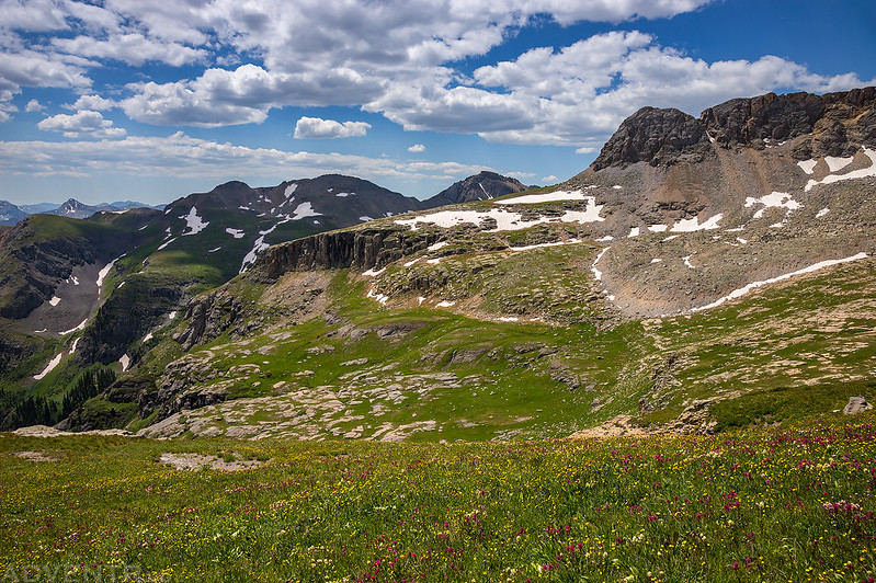
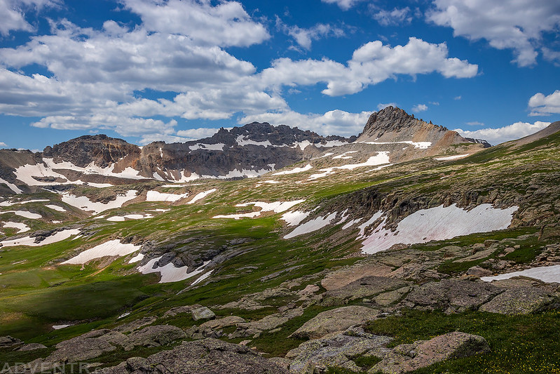
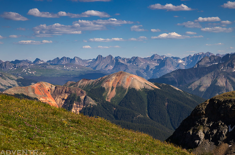
After hiking around the next promontory I had a great view into Mill Creek Basin.
Before heading over to Columbine Lake I hiked up to Columbine Pass, which is the low point to the right of the descending jagged ridge.
From Columbine Pass I had a nice view over Lewis Lake to Oscars Peak (13,432).
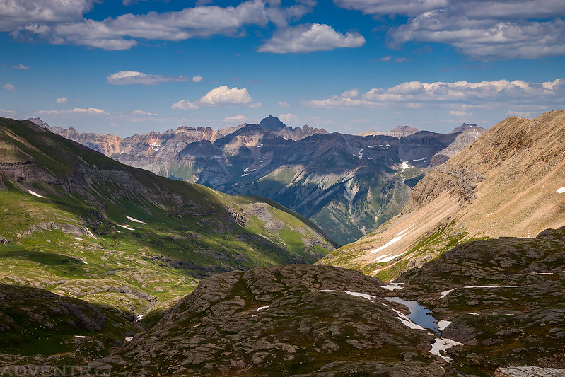
An amazing view down Bridal Veil Basin with Bridal Peak (13,510) on the right.

Looking over to Mount Sneffels (14,150) in the shadows on the horizon. I really need to climb that one again with Diane sometime…
Next I started my descent from the pass to Columbine Lake.
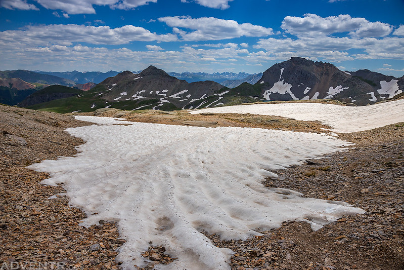
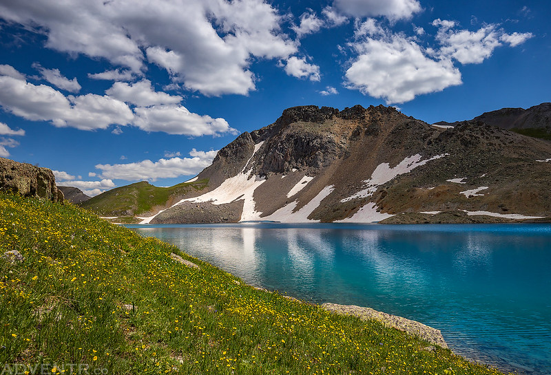
A glimpse of Columbine Lake in the distance.

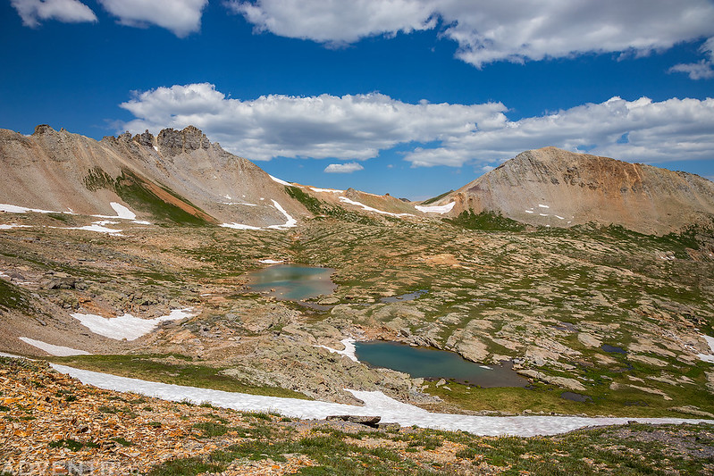
I passed a couple small tarns on my way to the lake.

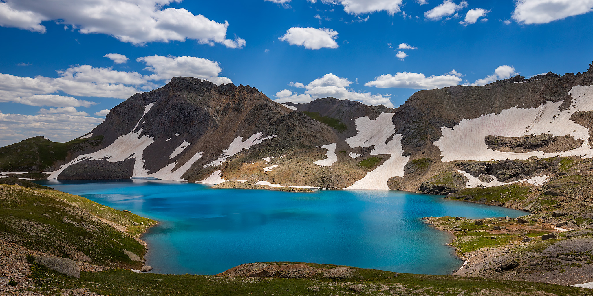
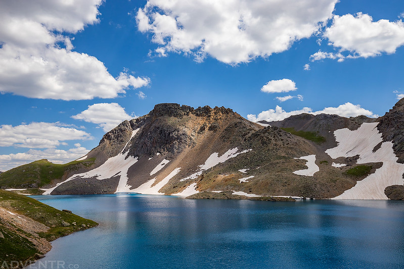
This was my first view of Columbine Lake as I arrived at a nice overlook. What a beautiful sight!

I hiked down to the shore for a closer look at the turquoise blue waters.
After spending some time at the lake it was time to hike back across Mill Creek Basin. This time I skipped Columbine Pass and took a shortcut across the basin.
Just another high alpine tarn along the way.

Silver Cloud Basin was such a cool area!

I took a short side trip to an overlook of Bullion King Lake when I was back in Porphyry Basin.

I almost stepped on this ptarmigan. They really blend in well among the rocks…

One last view over Anvil Mountain (12,537) to The Grenadiers before I returned to Mineral Basin and my Jeep.
I had originally planned on sticking around Silverton for another day and then hiking some more on Sunday morning, but after having dinner at Handlebars I decided to head home so I could rest on Sunday instead since I have a couple of busy weekends coming up and won’t have another free day for over a month.
>> Grand Basin Traverse Photo Gallery
Cool! Did you follow a trail or did you have to do your own route finding?
I came across an occasional section of trail and a cairn here and there, but most of it required route-finding.
I’m definitely going to have to try that route. The main trail is a “puffer” and not nearly as scenic as this route you came up with. Thanks for sharing Randy!
It was a great route! If you have two vehicles you could complete the hike by returning down the standard Columbine Lake Trail which would probably be a little easier than the way I did it.
Beautiful hike!.. Just curious, would it be possible to drive up the Jeep road up to Porphyry Basin (#822) and start the hike from there to Columbine Basin?
Again, thanks for sharing!
Yes it would be possible. I considered starting there but wanted a little bit longer of a hike and decided to start at Black Bear Pass instead.
How long is this route?
I believe it was over 8 miles each way.