La Sal Mountains Peak Bagging | Pilot Mountain, Green Mountain & Mineral Mountain
Friday – Saturday, July 5-6, 2019
After spending the last month on the river it was finally time for me to start getting back into the mountains again! Like last year around this same time, I decided that this would be a good weekend to continue my peak-bagging pursuit in the La Sal Mountains near Moab. Since I’d already climbed the San Juan County High Point a couple years ago, I thought it was about time that I finally got to the summit of the Grand County High Point. Originally, Diane was supposed to come with me on this trip and we were going to spend the full weekend in the area, but at the last minute she decided to take a shift at work on Saturday, so I ended up going by myself. I’m not going to lie, I was very worried about this hike. Since I’ve been on the river every weekend for the last month I felt that I was quite a bit out of shape since I haven’t been hiking much lately. It feels like I haven’t put on my hiking boots in forever; not to mention that I haven’t been up in the high country since late September of last year! I was really concerned that I wasn’t going to make it to the summit this time, but still, I knew that I needed to try…
I left after work on Friday, grabbed a quick dinner and then made my way through Castle Valley to the La Sal Mountain Loop Road on my way to Miners Basin. It’s been over ten years since the last time I was up in Miners Basin and for some reason I recalled the road being very steep and narrow. Was my memory wrong! The road was actually much easier than I remembered and not even very steep. There were plenty of places to pass other vehicles, although I never came across any this time. The only problems I ran into this time were a couple of trees that had come down into the road, and I was able to squeeze around or drive over all of them. I was expecting there to be at least a couple other people up in the basin during the holiday weekend, and was surprised to find myself up there all alone. I would actually not see another person until I was back on the La Sal Loop Road on Saturday afternoon.
This was the largest tree that had fallen down across the road, but someone had already stacked a few rocks on the right side, so I was able to easily drive over it.

All alone at the Miners Basin Trailhead.

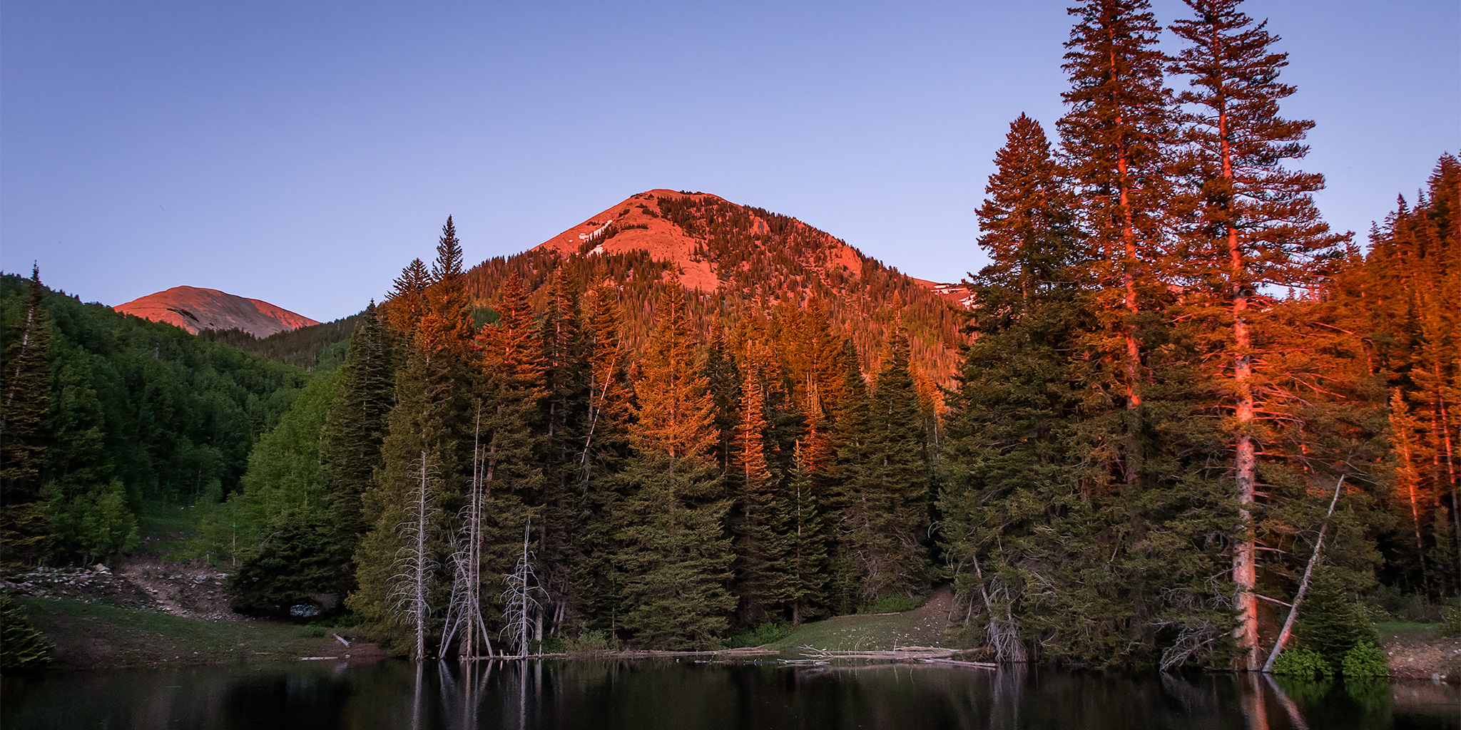
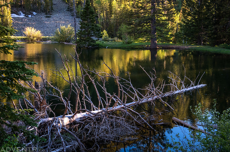
Since I had Miners Basin all to myself this evening, I walked around the small tarn at sunset and took a few photos.

Dead In the Water
Mineral Mountain reflection shortly before sunset.
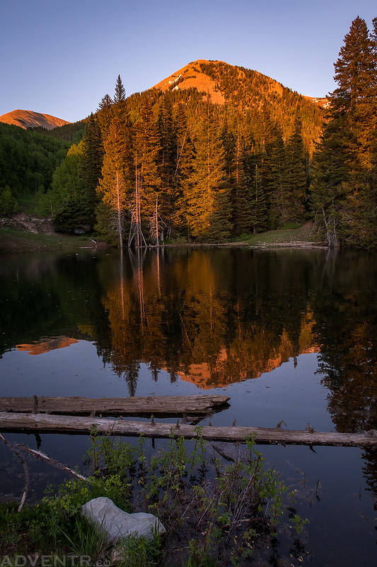
Right before the sun completely disappeared, it dropped down into some smoke or haze on the horizon and the light turned a very bright red color.

Once the sun was down I read for a little bit and then went to bed early. I wasn’t very concerned about thunderstorms on Saturday afternoon, so I wasn’t planning on an alpine start this time and planned to wake up at sunrise.
I slept well all night and the sunrise seemed to arrive sooner than I had hoped. When I got up it was a nice cool 41 degrees outside with a perfectly clear sky above. I had a quick snack for breakfast and then started my hike on the trail that heads over to Warner Lake.
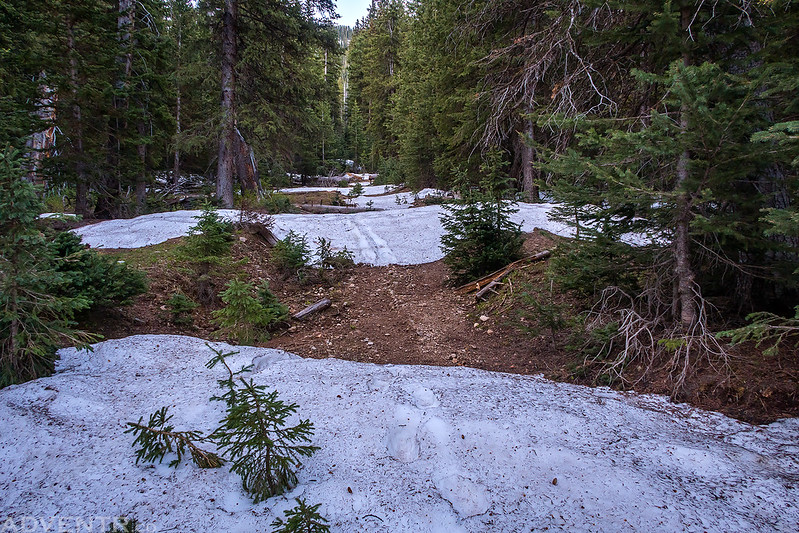
There was still a lot of snow across the trail in the trees that I needed to cross. There were a bunch of avalanche debris in places, too.
I didn’t stay on the trail to Warner Lake for very long and instead I found myself climbing up the basin on an old mining road that has been closed for a while. I watched the sunlight strike the unnamed peak on the other side of the basin as I climbed higher toward the ridge above.

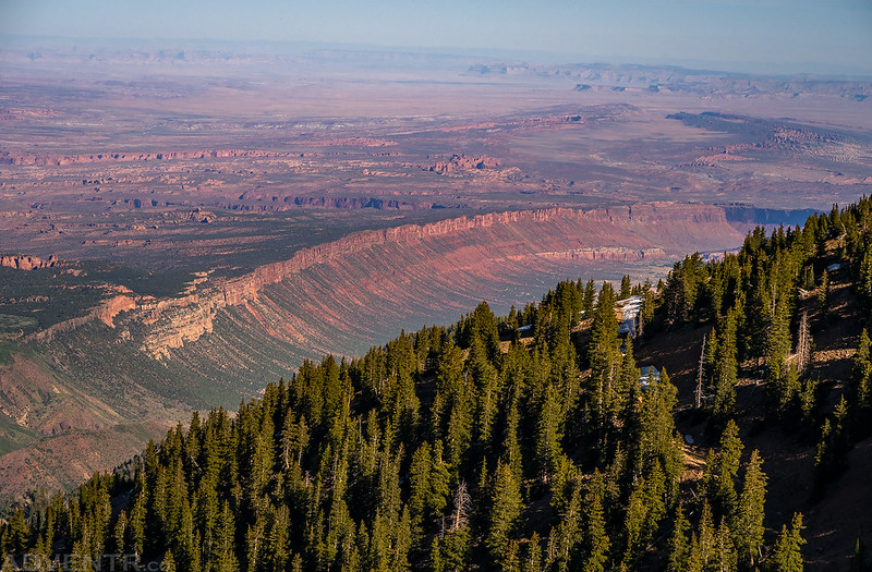
Looking back at Gold Knob (10,961) with the canyon country and Henry Mountains in the background. I swear, just about every time I climb in the La Sal Mountains it seems there is smoke or haze all around…

As I climbed higher I got this hazy view of Porcupine Rim and Elephant Butte below.
When I reached the saddle I turned right and headed for the summit of Pilot Mountain first since it was a short detour and I wasn’t planning on coming back this way. I was walking next to a large snow drift when all of a sudden about a dozen mountain goats got up off the snow and disappeared down the other side. I didn’t even see them lying on the snow until they moved! Of course, I was too slow with the camera and didn’t even get off one shot before they were gone.
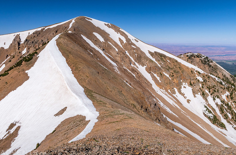
From the summit of Pilot Mountain (12,220) I had a good view over to Mount Peale (12,721), Mount Mellenthin (12,645) and Mount Tukuhnikivatz (12,482).
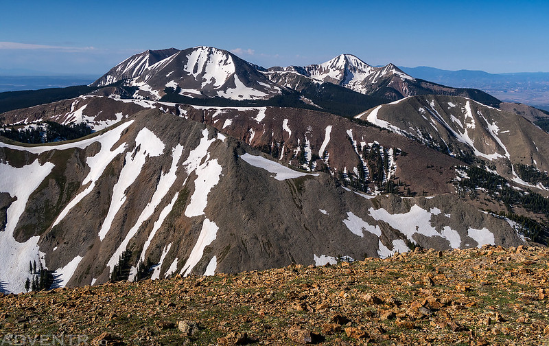
Here’s a closer look at Mount Peale and Mount Mellenthin.

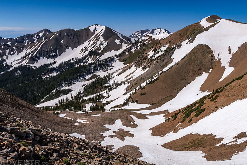
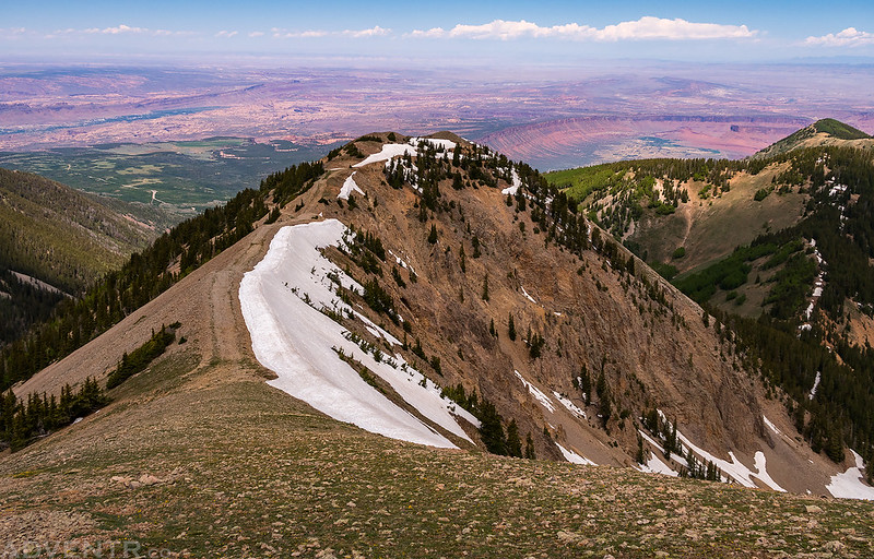
Following the ridge from Pilot Mountain toward Mount Waas.

Before starting the climb up Mount Waas, I had to get up and over Green Mountain first.
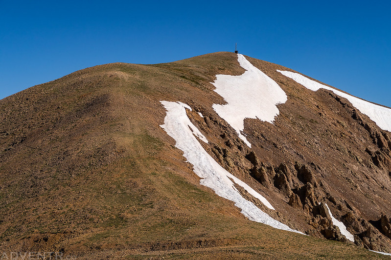
A view of the old antenna and building on the summit of Green Mountain (12,163).

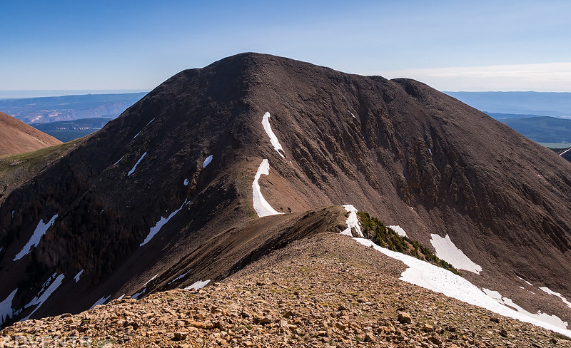
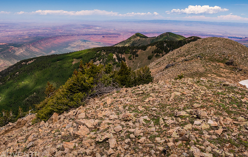
Now all I had left to do was follow this ridge to the summit of Mount Waas.
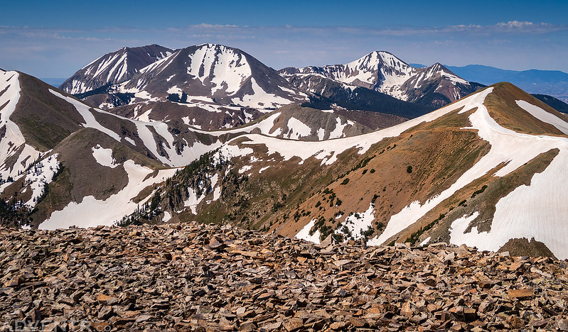
To my left were nice views of Castle Mountain (12,044) and La Sal Peak (12,001).

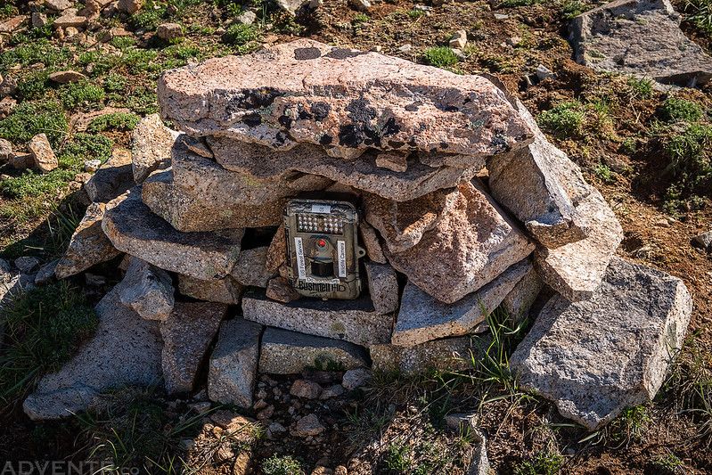
When I reached the low point of the saddle I found these stacked rocks with a Forest Service Wildlife Camera in place. I wonder if they are monitoring the mountain goats up here?
The view across Beaver Basin to Manns Peak (12,272) and Mount Tomasaki (12,239) was pretty nice, too. For the past couple of years I had actually planned to hike to Mount Waas from Beaver Basin, but I figured there was probably still too much snow this year for me to try it now, which is why I started from Miners Basin instead.
While I had been feeling pretty good while hiking to Pilot Mountain and Green Mountain, I definitely slowed down on the steep climb to the summit of Mount Waas, but I did make it!

A closer look at the benchmark on the summit. It seems there are a couple different dates stamped on it?

A grand view from the summit of Mount Waas (12,331), the highest point in Grand County, Utah!
After enjoying the view on the summit for a little while, it was time to follow the ridge back over to the top of Green Mountain again.
Unlike my slow climb up the ridge, it only took me about 15 minutes to reach the low point of the saddle again, and I was surprised to see there were clouds building over Mount Waas already. It had been perfectly clear when I was just up there. That was quick!

From the summit of Green Mountain I started hiking down the ridge on the west side so I could visit the summit of Mineral Mountain on my way back to the trailhead.
View from the summit of Mineral Mountain (11,608).
There was a good view of Horse Mountain (11,130) from up here.

I was planning on taking another old mining road that came near the top of Mineral Mountain back down to the trailhead, but it looked like it was covered with a lot of snow still, so I decided instead to hike down to the saddle below and catch the Bachelor Basin Trail at the pass. It turned out to be much steeper and looser than I was expecting and probably wasn’t the best idea. There also ended up being a few patches of snow that I needed to cross, so it was a good thing I had my microspikes with me, even though I had not needed them up until this point. I took my time and carefully made it down to the pass where I found another old mining road that I followed down through the Miners Basin Site and back to my Jeep at the trailhead. I hopped in my Jeep and drove back down to the La Sal Loop Road and then headed home for the weekend. Overall, the loop I hiked ended up being just over eight miles long with about 3,900 feet of elevation gain. My first peak-bagging trip of the summer was a success!
One last view of Castle Valley and Round Mountain (6,185) from the Miners Basin Road during my drive back down to the pavement.

Great pictures! I’m planning something similar but am not sure if there’s a trail cutting thru the woods between Mineral Mountain and Gold Knob. Do you have a GPX file of your hike?