Wednesday – Saturday, April 24-27, 2019
Earlier this year two of my favorite bands, Architects and While She Sleeps, announced a tour that started in late April and went through May. These two bands don’t tour in the US very much so I knew that I really needed to go to this one! I’m just glad the tour dates closest to home didn’t coincide with a weekend that I had already made plans for! We were unable to go to the Denver date, which was the closest one to us, so we decided to go to the Phoenix date instead and would plan a short easy trip around it. I had never been anywhere between Flagstaff and Phoenix before, so I thought it would be a good idea to play tourist for a change and visit all of the popular National Monuments as an introduction to the area. I also figured that since we were going to be seeing the Architects in concert on Saturday night, that it would be nice to visit the ruins left behind by the ancient architects of Arizona on our way there!
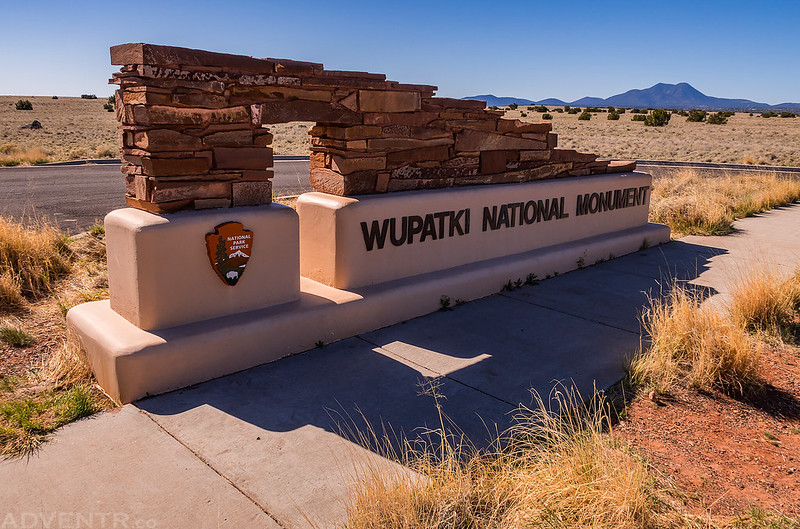
After spending Wednesday night at the Sand Island Campground along the San Juan River in Utah, we drove a couple more hours to Wupatki National Monument, our first stop of the day on Thursday.
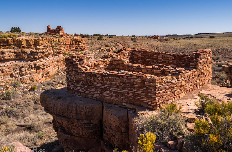
Shortly after entering the park we went on a short hike to the Box Canyon Pueblo. Look closely and you can see three different ruins in this photo.
We had a pretty good view of Humphreys Peak (12,633) and the rest of the San Francisco Peaks from here.
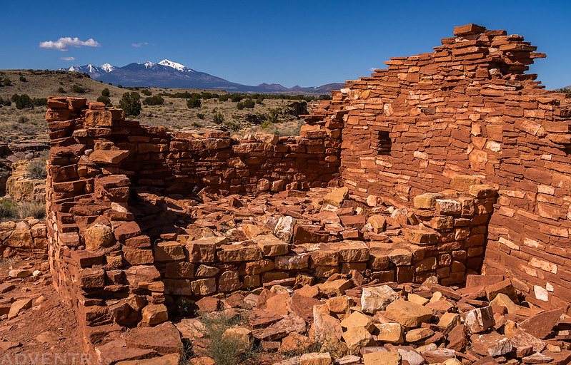
Then we hiked to the end of the trail to visit the Lomaki Pueblo.

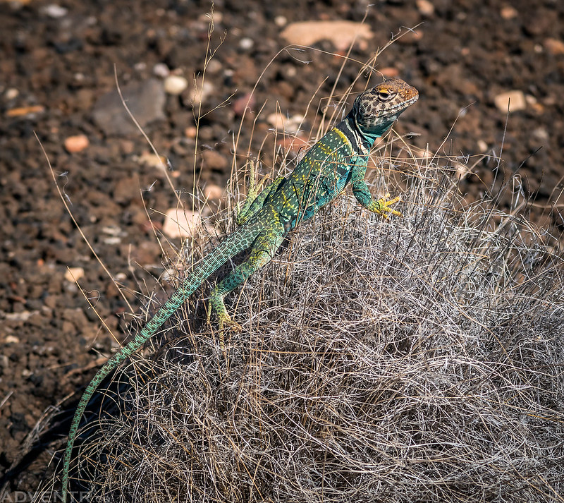
On our way back to the trailhead this collared lizard hopped into this bush to have its photo taken. I obliged.
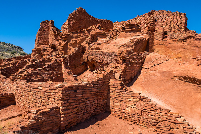
Next we continued driving to the Visitor Center and then hiked around the larger Wupatki Pueblo.

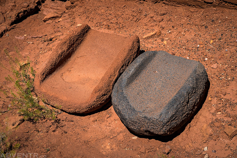
It seemed like were a lot of very large metates all over the place.
Another look at the Wupatki Pueblo from the other side.
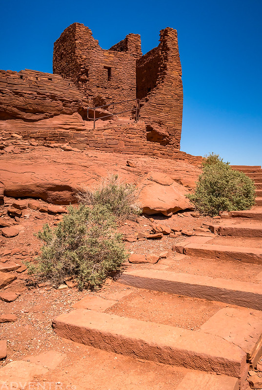
Then we headed over to the Wukoki Pueblo. This was a very cool ruin, it’s just too bad they added stairs and a metal railing to the structure.
View from inside the Wukoki Pueblo

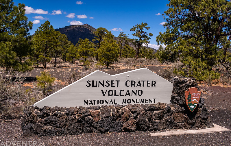
We continued the drive along the Sunset Crater Loop Road until we reached Sunset Crater Volcano National Monument.
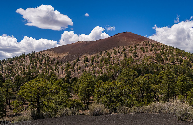
Here’s a view of the Sunset Crater (8,039) from the Cinder Hills Overlook.
We went on a short hike on the Lava Flow Trail to see part of the Bonito Lava Flow.

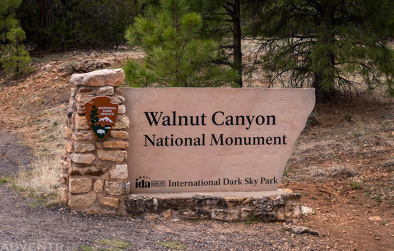
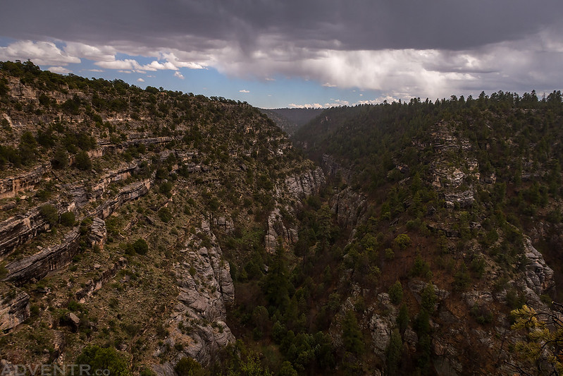
After returning to the main highway, we drove through Flagstaff and then over to Walnut Canyon National Monument.
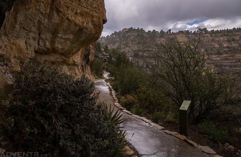
Descending the stairs from the Visitor Center into Walnut Canyon on the Island Trail.

There were a lot of ruins along the trail, but most of them weren’t in good condition. These were some of the better ones.

While we were on the a trail a thunderstorm moved into the area with heavy rain, so we took shelter in one of the many alcoves along the trail to wait it out.
A view over Walnut Canyon as the rain moved off to the east while we hiked back up to the trailhead.
Before retiring to our hotel room in Flagstaff for the evening, we made one last stop to hike around the Elden Pueblo which is basically right along the highway in town. There was a light rain during this short hike.

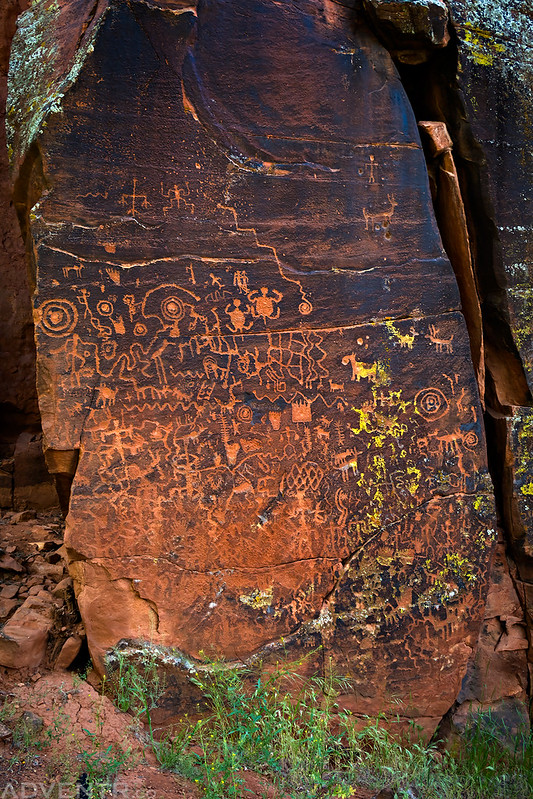
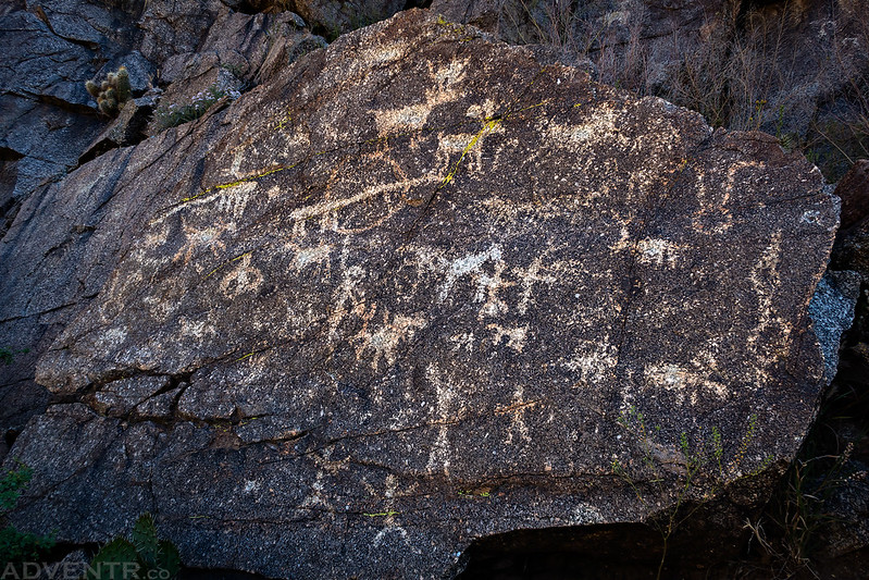
On Friday morning we left Flagstaff and headed further south into the Verde Valley for the day. Our first stop was at the V Bar V Heritage Site in the Coconino National Forest.

There is a very nice panel of petroglyphs found at this site along Wet Beaver Creek.


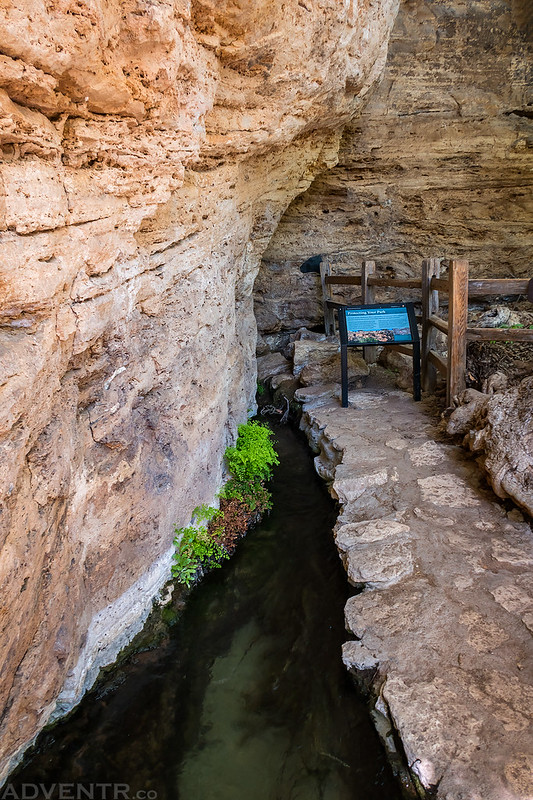
After checking out the petroglyphs at the old V Bar V Ranch, it was a short drive to Montezuma Well National Monument. Montezuma Well is a natural limestone sinkhole through which 1.5 million gallons of 74 degree water emerge each day from an underground spring. If you look on the far side of the well you can see a few ruins underneath the rim, too.

A short trail that went down near the water passed by this little ruin in a cave.

Above and to the left of the ruin is this old inscription that says: “Photos of this by Rothrock, Phoenix, 1878” I’m not sure why I didn’t think of using this method of advertising sooner for my photos!

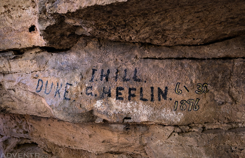
An inscription from Duke Heflin from 1896, also near the ruin.
As we hiked around the Montezuma Well Loop trail we took the short detour that brought us to the outlet of the well. All the water in the well finds it’s way into Wet Beaver Creek through this ditch.
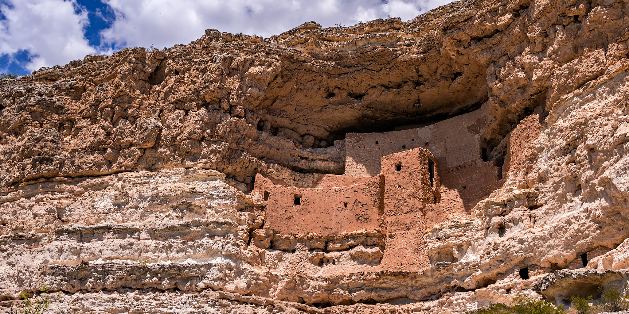
Next up we headed over to check out Montezuma Castle National Monument.

Although you haven’t been allowed to enter these ruins in a long time, they are still worth the visit to see from below. Such an amazing location!
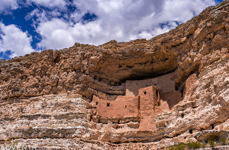
Just a closer look at the Montezuma Castle Ruins.

Here’s a closeup photo of the bark of an Arizona Sycamore tree. This was our first time seeing these trees and they were pretty cool.

While we were at Montezuma Castle we found out about another pueblo protected in a National Monument that wasn’t too far away that I had not heard about before. Since we still had plenty of time we decided to head over to Tuzigoot National Monument so we could check it out before heading back to our hotel room in Camp Verde for the evening.

Our first view of the Tuzigoot Pueblo as we drove into the Monument.

There were nice clouds above this large pueblo as we walked the trail that looped around it.

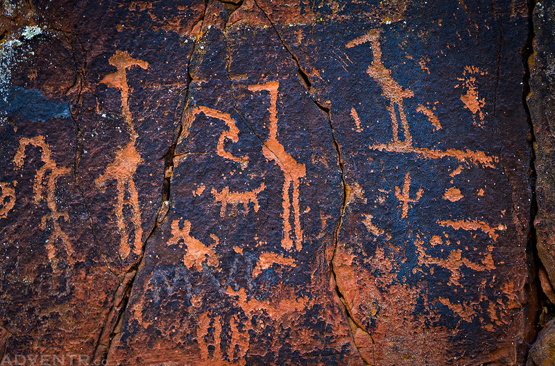
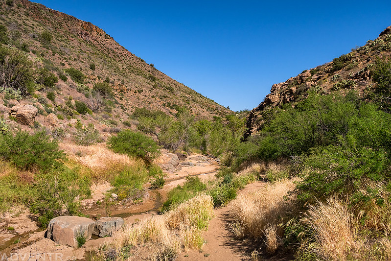
On Saturday morning we had to get to Phoenix with enough time to rest up before the concert in the evening, but we stopped to go on one more short hike on the Badger Springs Trail in Agua Fria National Monument.

There were a few purple claret cups along the beginning of the trail.

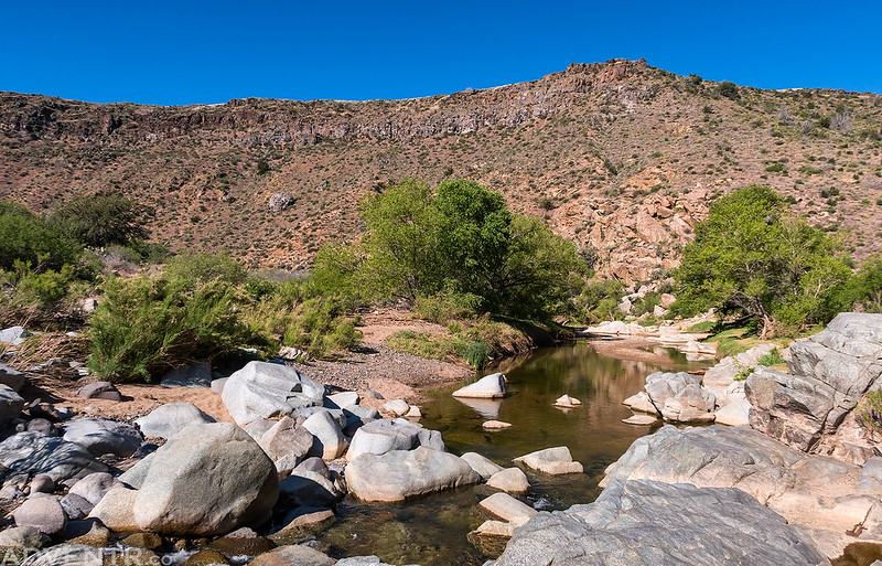
We visited the petroglyphs found near the confluence of Badger Springs Wash and the Agua Fria River.


The Agua Fria River below Black Mesa.
Hiking back to the trailhead along Badger Springs Wash. From the trailhead it was an easy drive to Phoenix and then we had an awesome time seeing the Architects later in the evening!
Wow Randy! You pack A LOT in! Love you telling the story and taking me along the journey. Thanks.