The Grand Gorge of Muddy Creek & Skyline Rim
Friday – Sunday, May 11-13, 2018
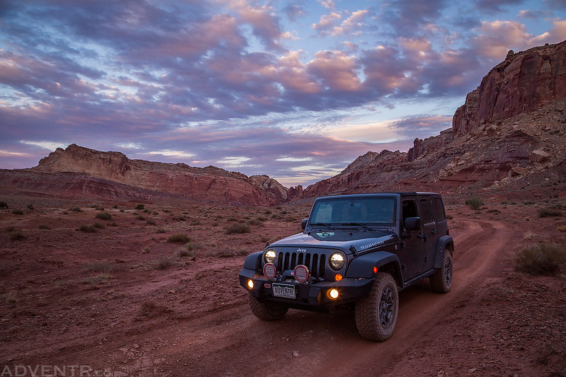
This weekend I left after work on Friday and headed down into Muddy Creek Country at the southern end of the San Rafael Swell. I have wanted to hike into the Grand Gorge of Muddy Creek for many years now and decided it was finally time to go do it! As I was driving west into Utah there was a pretty strong headwind which killed my fuel mileage, but since the weather forecast was predicting strong winds all weekend, I was expecting it. I just hoped that the wind gusts wouldn’t interfere with my plans too much. It’s just the typical spring weather on the Colorado Plateau! I made a quick stop in Green River to fill up my tank and then continued up onto the Swell where I planned to spend the night near the old Hidden Splendor Mine.
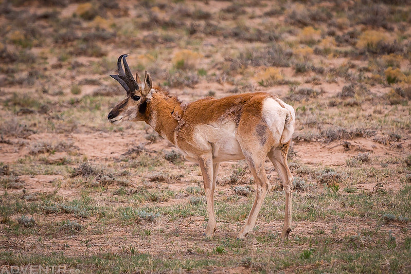
Shortly after leaving I-70 on the Temple Mountain Road, I spotted this pronghorn on Paige Flat and stopped for a quick photo.
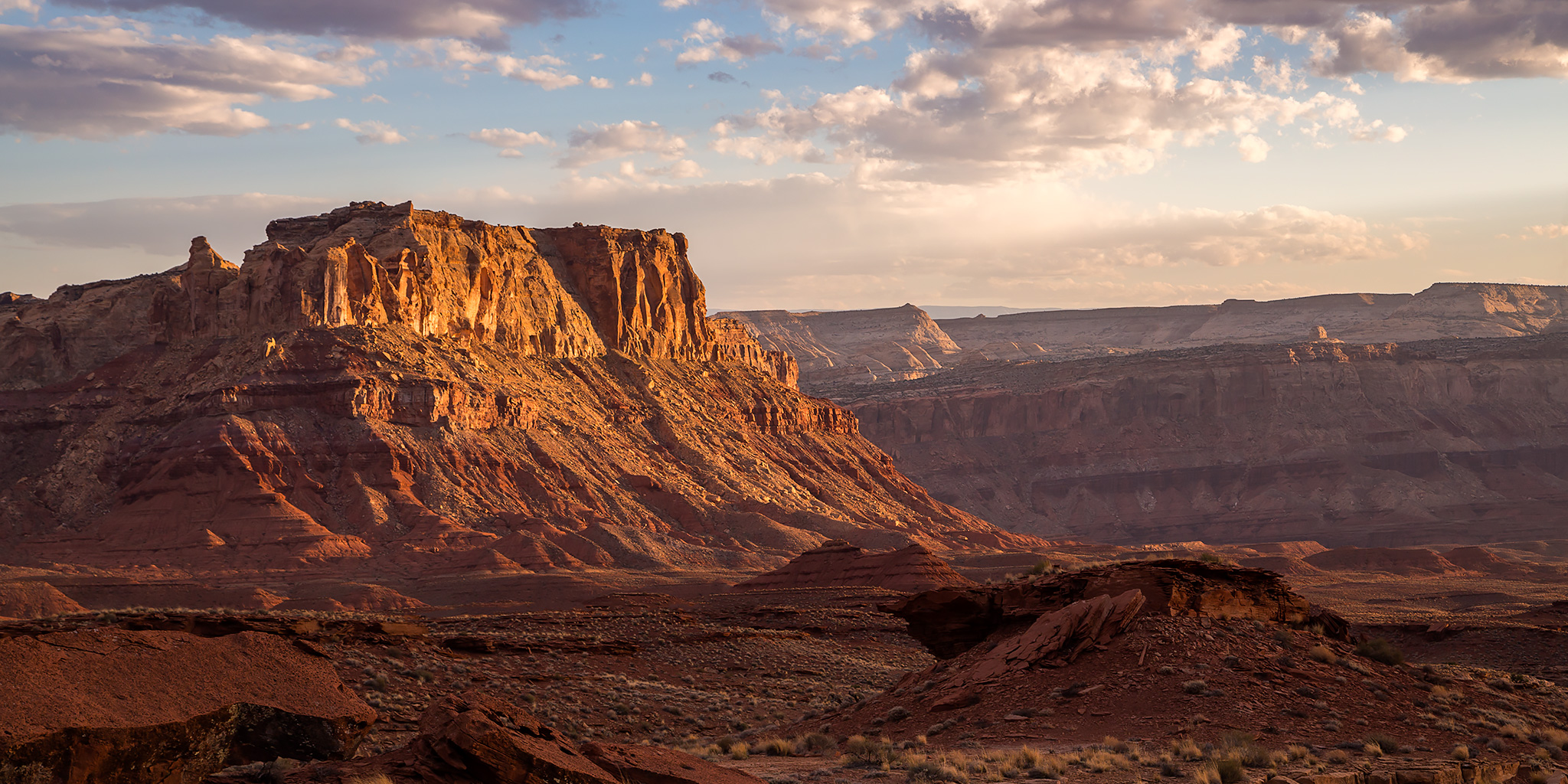
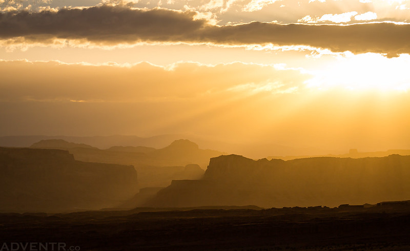
As the road I was following dropped off The Big Ridge into Keesle Country, I was treated to an amazing sunset view! It had been overcast for much of the day so I was happy to have some of the clouds clear out in time for sunset!
The Road to Hidden Splendor
Beautiful light on Sy Butte before sunset.

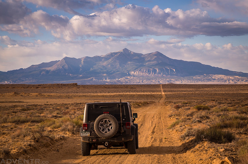
A pretty nice view over the San Rafael Reef to the Henry Mountains.
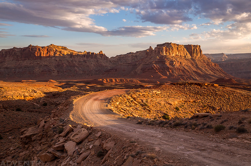
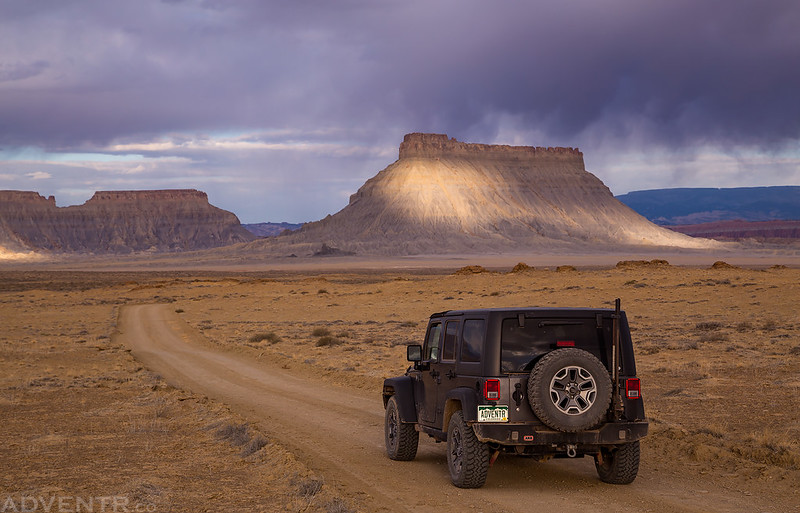
Continuing on to Hidden Splendor.

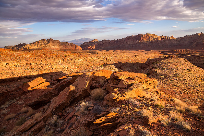
All the dust in the air from the strong winds helped to create a colorful sunset this evening.
I love the layers of Chimney Canyon visible in this scene.

I went on a short detour to the Quandary Trailhead as the clouds turned magenta.
I arrived at the end of the road along the banks of Muddy Creek as the dim light of dusk was fading into darkness. I was actually expecting to find other people camped here since it’s a pretty popular place, but no one was around and I ended up having the place to myself all night. It had been a long day and I was tired, so I tried to get to sleep right away. Unfortunately, it stayed windy outside for a while and it took me longer to fall asleep than I would have liked.
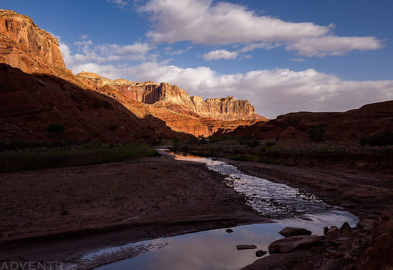
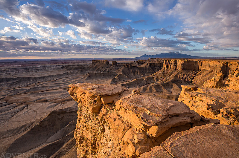
The wind did eventually die down sometime overnight and when I woke up in the morning it was nice and calm out. After having a little breakfast I started my hike downstream into the Grand Gorge, where the Muddy Creek carves its way through the San Rafael Reef. I spent the next few hours hiking through the river to the other side of the Reef and then returning the same way. Muddy Creek wasn’t living up to its name today and was flowing pretty clear and much lower than it usually does at this time of the year, which isn’t surprising because of the winter we’ve had. For most of the hike I found it easier to hike in the creek in order to avoid slippery mud and quicksand along the banks. After hiking partway into the gorge the sky started filling up with clouds and the strong wind gusts returned. At times the wind was blowing so hard that the water in the creek appeared to be moving upstream! But at least the wind kept the no-see-ums and other bugs away today.
The Muddy Creek in the shadows as I started my hike near Hidden Splendor in the morning.
A green pool I passed by early in the hike.
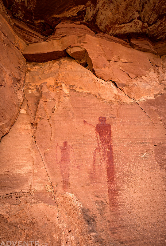
I stopped to visit this pair of Barrier Canyon Style pictographs that I was looking for.

Here’s a closer look at the pictographs. They appear to be holding a few snakes up.
The clouds that moved in above the canyon created some nice light throughout the rest of my hike.
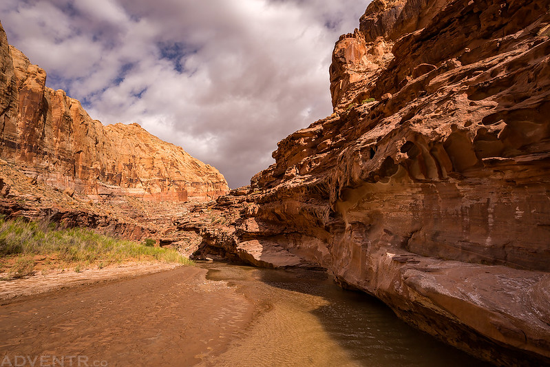
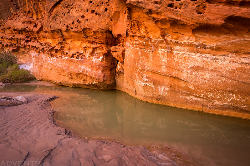
Underneath a large alcove that the creek flows through.
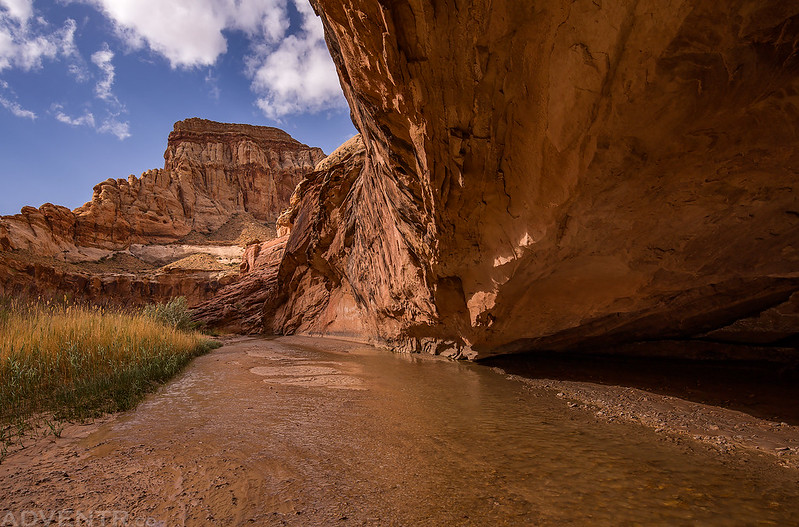
Nice light in the canyon as I approached the gooseneck.
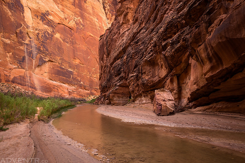
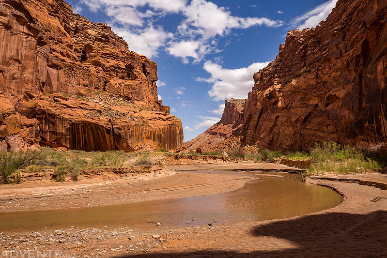
The final stretch of the canyon where Muddy Creek leaves the San Rafael Reef.

After exiting the gorge on the south side, I searched around a little and did find a few small and faded Fremont pictographs.

Hiking back into the gooseneck on my way back to the trailhead.

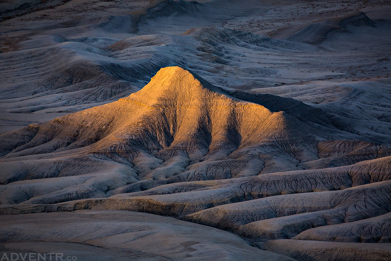
Spotlight & Shadows along The Muddy

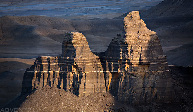
Triangle Rock

The Grand Gorge of Muddy Creek
On my way back out I stopped to check out these old bunkhouses right along the creek near the Hidden Splendor Mine.

After leaving the bunkhouses the last part of the hike was out of the water on an old road and through a windy sandstorm. The strong winds did dry off my socks and pants very quickly, though! I saw no one else during the entire hike which was nice. I returned to my Jeep and had some lunch before leaving the area and driving over to Temple Mountain and past Goblin Valley State Park to the Wild Horse Mesa Road. I hadn’t driven this road in almost ten years and was looking forward to it since I really didn’t remember much about it. When I drove past the trailhead for Little Wild Horse Canyon I was surprised to see just how many vehicles were parked there. I knew it was a popular place, but when did they add that second huge parking lot? I was very glad that I had no plans to stop anywhere near there today!
I passed near Family Butte on my way over to Temple Mountain.

A view of the other side of the San Rafael Reef from the Wild Horse Mesa Road.

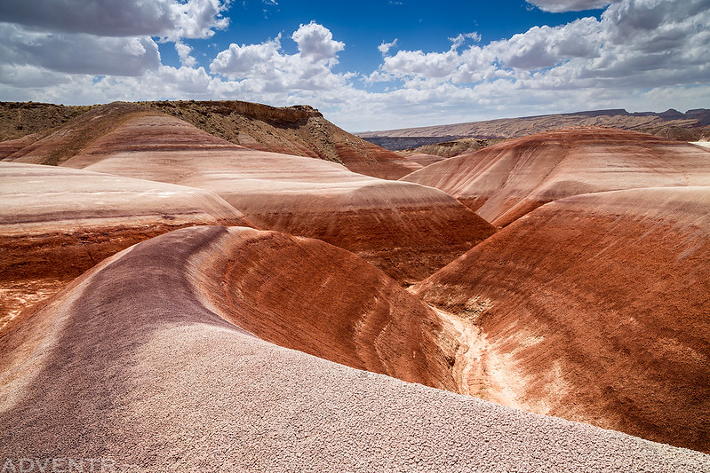
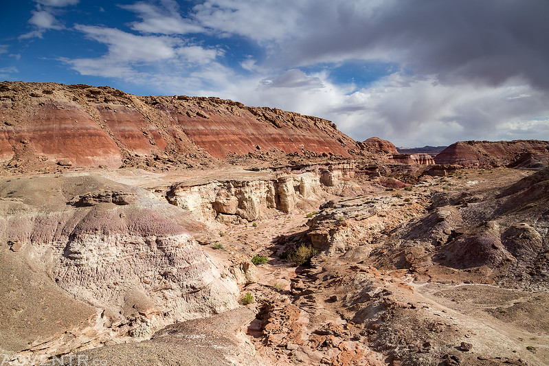
The road passes through some very colorful bentonite clay hills.
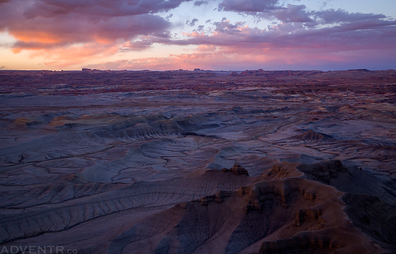
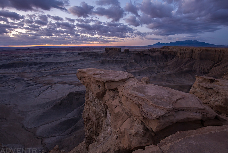
I followed the road to its crossing of Muddy Creek, this time crossing it in my Jeep, and then continued through the badlands past Factory Butte until I reached Highway 24. Next I headed into Hanksville for fuel and dinner before returning to Skyline Rim at the edge of the Factory Bench. I spent the rest of the late afternoon here waiting to photograph at sunset. It was very windy at times up here! I was expecting other people to show up closer to sunset since it’s another popular location, but again I ended up having the place to myself all evening. The sunset was pretty spectacular, too! Here are a bunch of photos I took this evening.
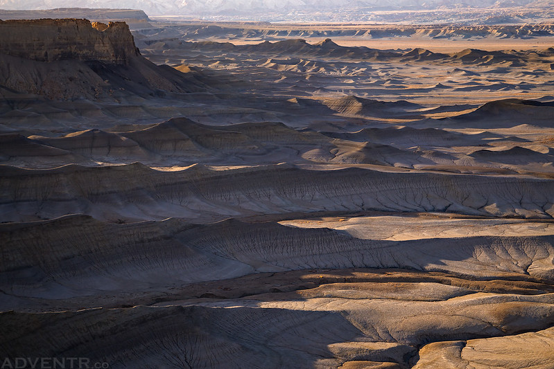
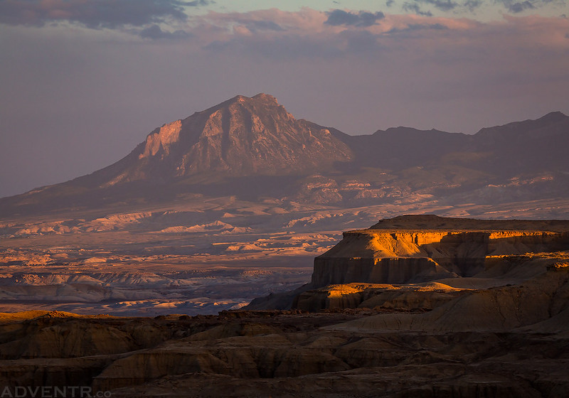
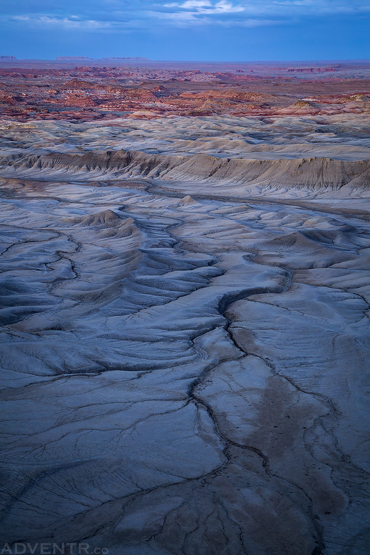
The badlands below the Skyline Rim Overlook.
You can see Temple Mountain on the horizon.

Gold & Blue

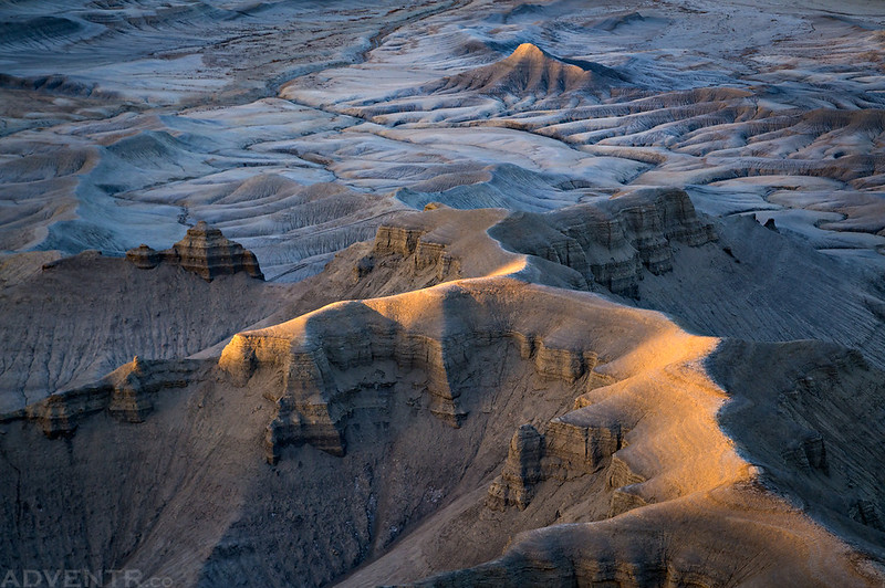
Topography
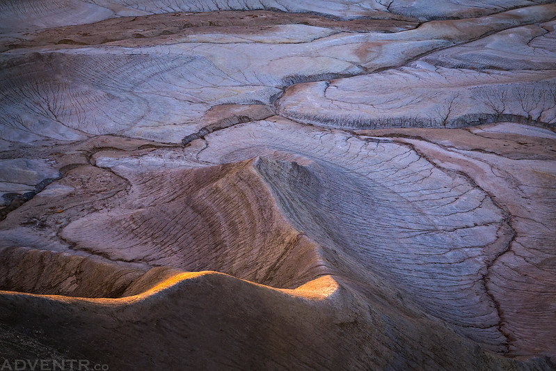
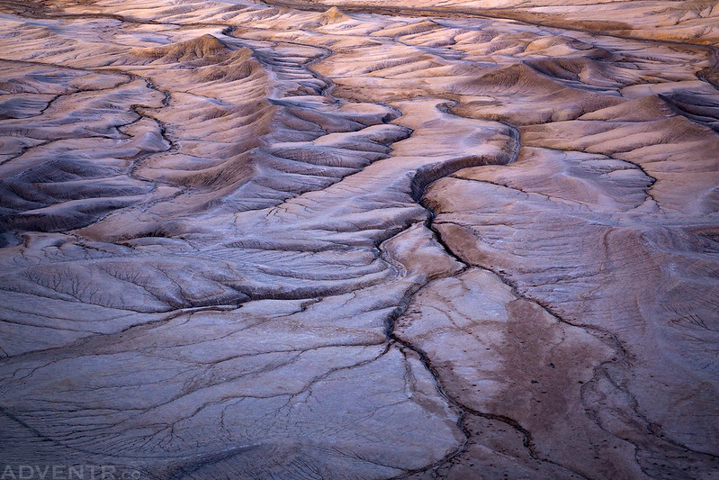
Erosion
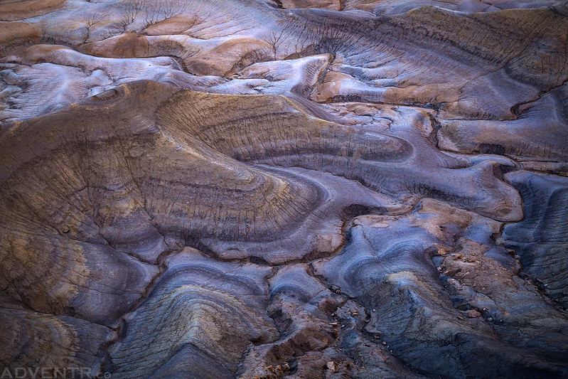
Veins of The Earth

I loved the last remaining light on this small peak below.
A distant view of Bull Mountain.
These colors didn’t last long…
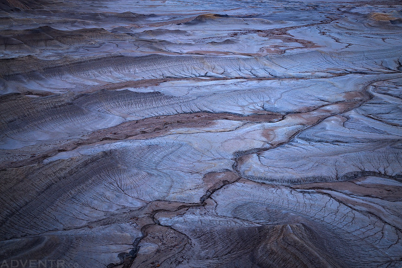
I just loved the textures and colors below the rim.
My last shot in the very low light of dusk.
When the light was completely gone I headed back to my Jeep so I could get to bed. Thankfully, the strong winds calmed down shortly after sunset and I was able to sleep a little better this night. I woke up early on Sunday morning so I could catch the sunrise from the rim before moving on.
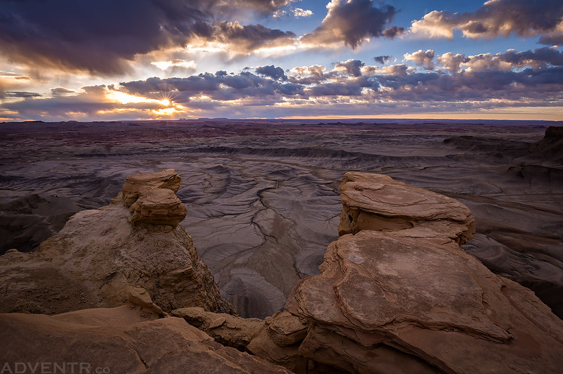
There were some great clouds in the sky at dawn, and I was really hoping the sun would make an appearance, but unfortunately there were just too many of them on the eastern horizon.
More nice clouds looking the other direction toward the San Rafael Reef.

The first time the sun did briefly peek out from behind the clouds I was able to catch a little sunstar.
Sunrays over The Flat Tops in the distance.

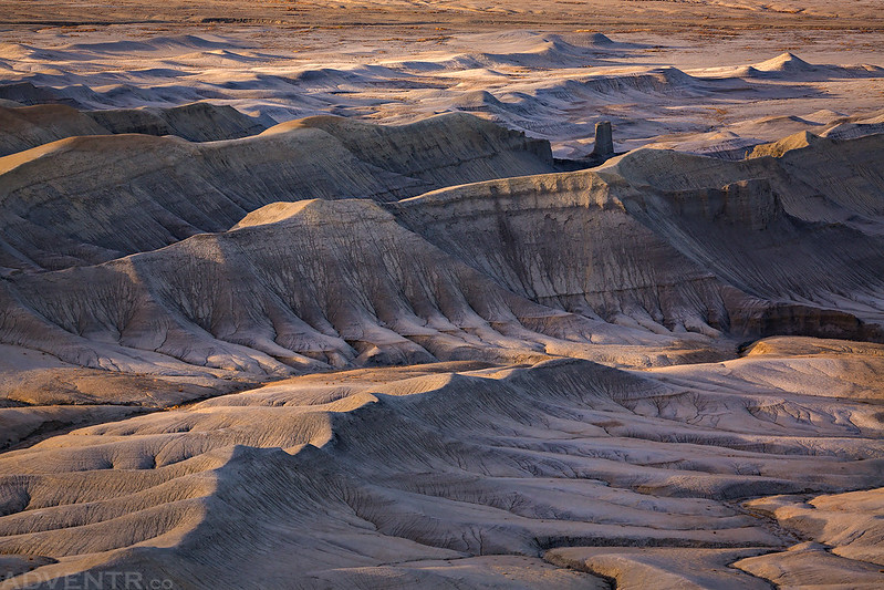
Finally, there was light on Skyline Rim!
One last parting shot of the textures below.

When the sun was up and I was done taking photos it was time to leave. I didn’t have any other specific plans for the rest of the day, but it was too early to head home already, so I decided to go for a drive on the backroads through the badlands that were visible below Skyline Rim since I had been staring at them for a few hours by now.
Spotlight on Factory Butte as I was driving back to the highway.
The long road toward the Henry Mountains.
Driving through the moonscape below Skyline Rim.

On one of the dead-end roads I followed, I came across a nice area of red clay hills to explore.

Eventually I found myself at a fence and a trailhead for the Hanksville – Burpee Dinosaur Quarry. I’d never even heard of it before, so I went for a short hike in the area. I think I will have to come back another time for some more exploring!
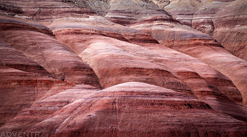
Soft light on red clay hills.
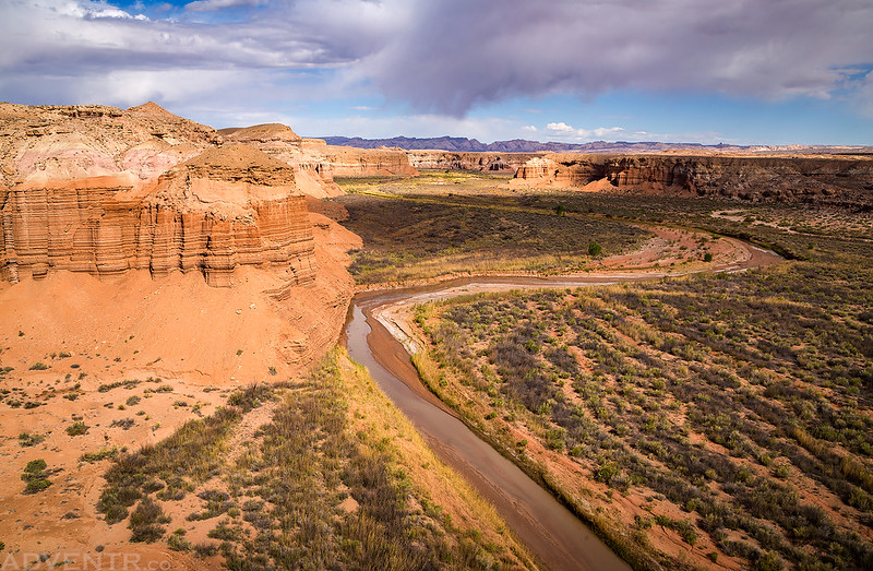
After following a few more dead-end roads, I eventually found myself at the edge of a canyon overlooking Muddy Creek. As I hiked out to the edge I thought to myself that this location is a fitting spot to end my trip into Muddy Creek Country and I would head back home after returning to my Jeep. It had been a very nice weekend!
Interesting canyon walls as I hiked to the edge.

A view from the Muddy Creek Overlook to end my trip.
Nicely done.
Thank you!
Wow, some beautiful displays of light and shadow as well as textures! What interesting areas!
Thanks.
Thanks Dianne! I had a lot of fun taking these photos 🙂
Wow, fantastic journal and photos.
Thanks Bob!
You always blow me away with your beautiful photos and always inspire me to explore more. I look forward to reading your adventures.
Thank you Debra!