Wednesday – Sunday, April 30 – May 4, 2014
Salt Creek Canyon. This is a place I have wanted to visit for quite a long time. It’s actually one of the main reasons I decided to get started backpacking a few years ago. I was very excited to finally experience this amazing canyon, and it certainly didn’t disappoint!
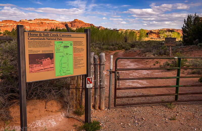
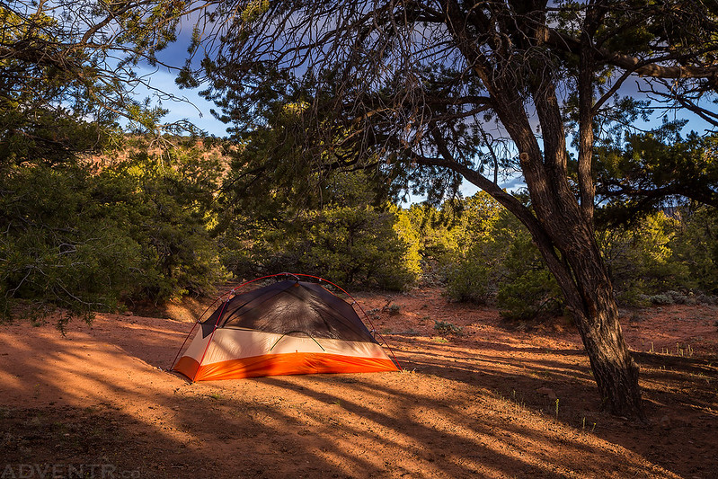
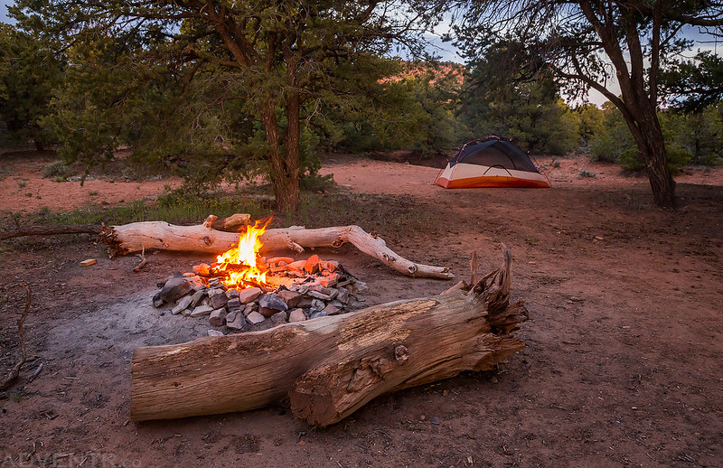
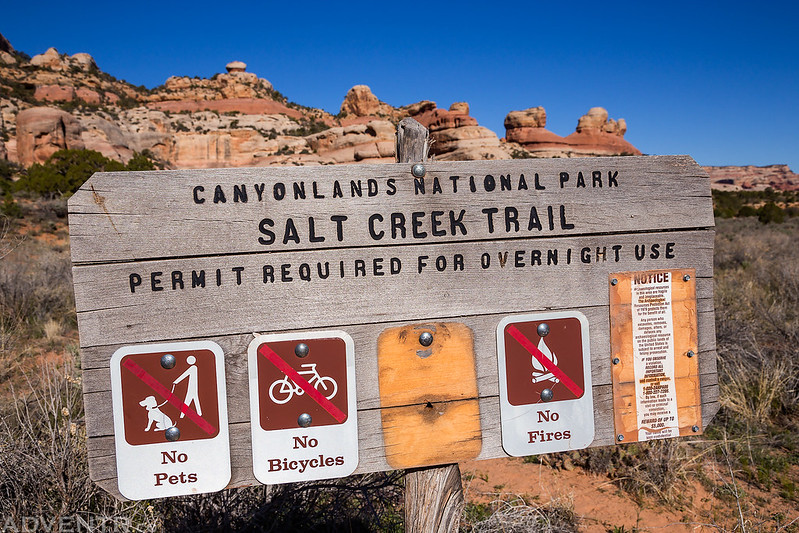
I had taken Wednesday off from work so I could spend some time with Diane before leaving and so that I could double-check to make sure I had everything I needed for the trip packed into my backpack and Jeep. In the early afternoon Dave and Jared texted me to let me know they were driving through Price. This was my cue to leave my house so I could meet them in Moab. I arrived about 10 minutes after they did at Pasta Jays, and we had a nice big dinner before driving down to The Needles District of Canyonlands National Park to start our trip. First we dropped off Dave’s Jeep at the locked gate on the road into Salt Creek Canyon. We were hoping we would be able to leave a Jeep at Peekaboo so we could bypass the sand slog at the end of our hike, but as we figured, the road was still closed as it has been for a while now. They loaded their gear into my Jeep and we drove up to the trailhead near Cathedral Butte. We setup camp under the butte and across the road from the trailhead so we could get an early start the following morning. There was a beautiful sunset with plenty of nice clouds this evening. We took a few photos around the area and then warmed up around the fire before getting to bed early.
At the locked gate on the Salt Creek Road. Our journey would end here in four days.
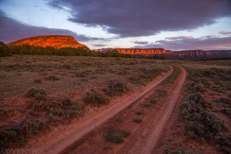
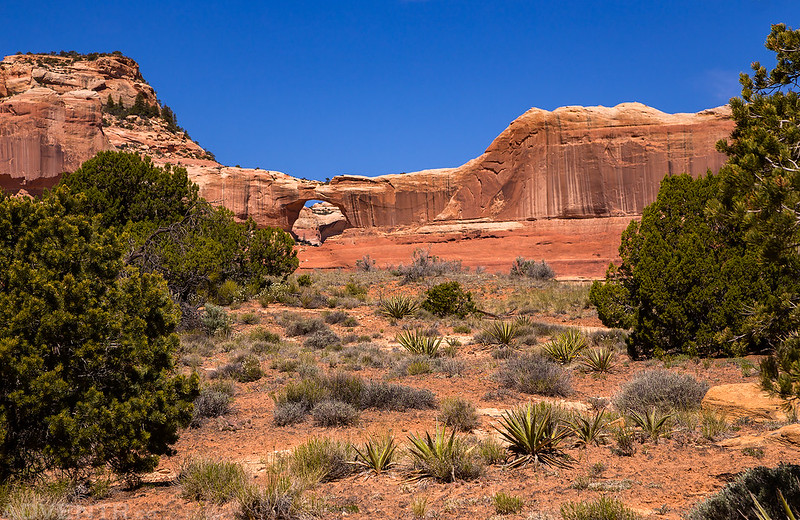
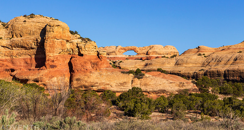
Nice clouds above the cliffs of Indian Creek Canyon as we turn onto the Cottonwood Canyon Road to reach the trailhead near Cathedral Butte.

My first campsite of the trip near the upper trailhead.
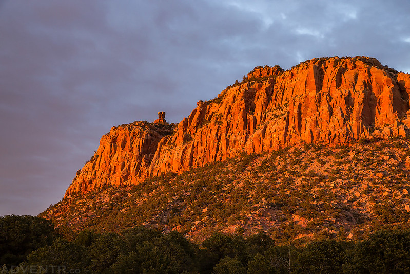
Great golden light on Cathedral Butte this evening shortly before sunset.

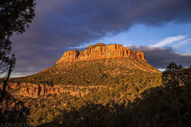
The golden light then turned to a beautiful red.

There was a faint sun pillar to the west after the sun dropped below the horizon.

Warming up near the fire this cold evening.
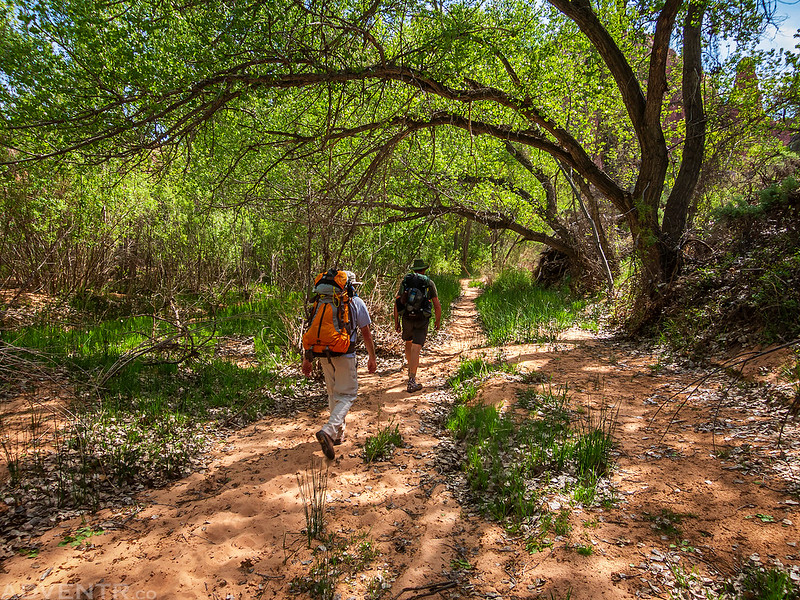
It was pretty cold and windy during the night. I think my Jeep said it was in the lower 20’s when we woke up. The temperature really pushed the limits of my 25 degree sleeping bag and my feet were pretty cold in the morning. They would not warm back up until we had hiked a few miles. We left shortly after sunrise and began our descent into the East Fork of Salt Creek on our way to SC1, our first reserved campsite of the trip.
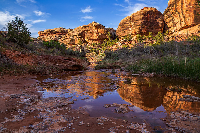
First light of the day over Salt Creek Canyon and Canyonlands before we start our descent into the East Fork.

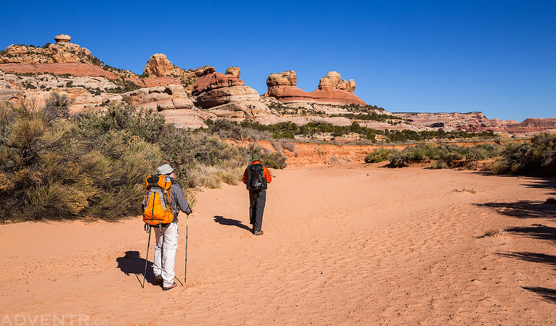
Hiking in the wash of the East Fork shortly before reaching the park boundary.
Entering the park. I wonder what previous regulation was removed from the sign?
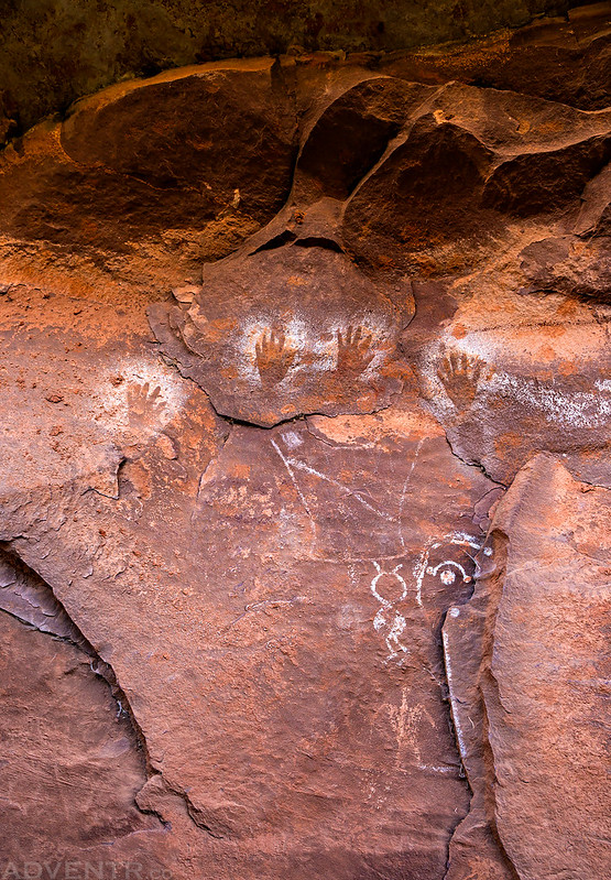
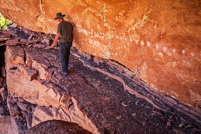
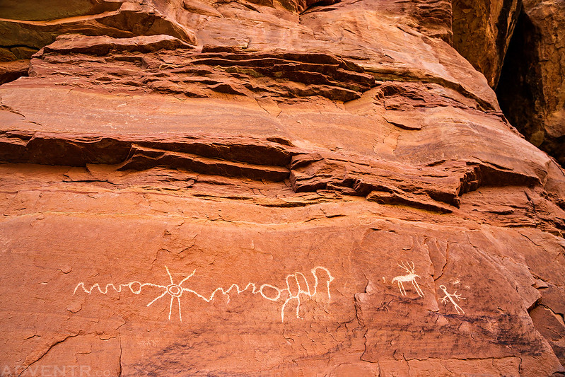
After crossing the marshy area we reached the first small panel of pictographs right next to the trail.
We had to bushwhack through some thick vegetation to reach this nice panel across the creek from Kirk’s Cabin.
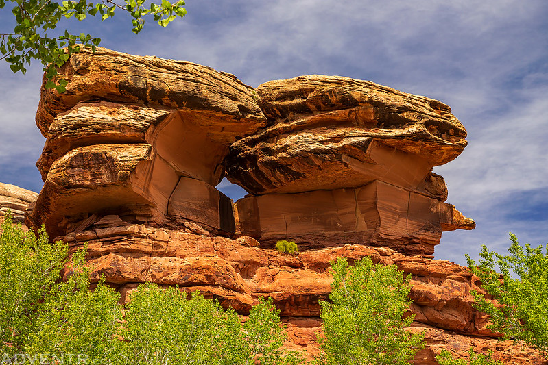
We also had a nice view of Kirk Arch nearby.
Inside Kirk’s Cabin.

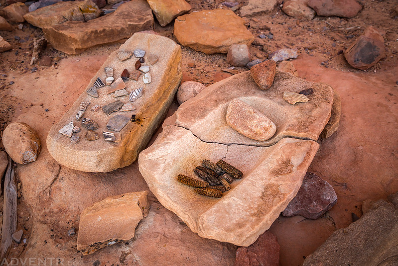
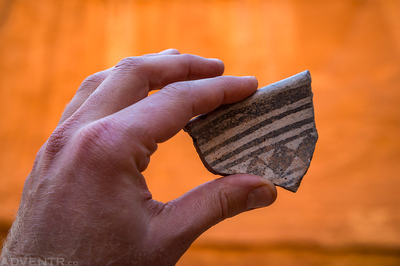
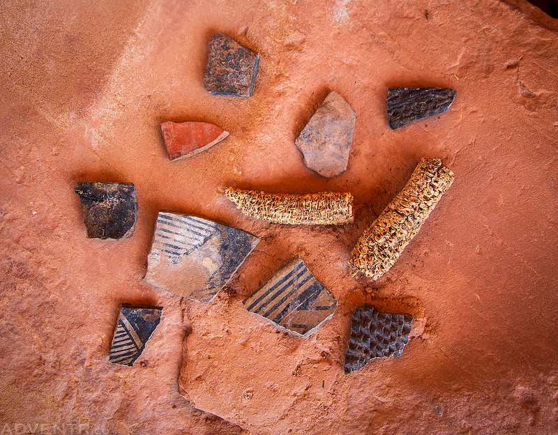
A large piece of corrugated pottery that I found near some small ruins.

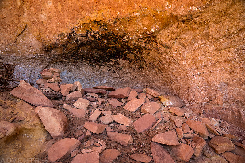
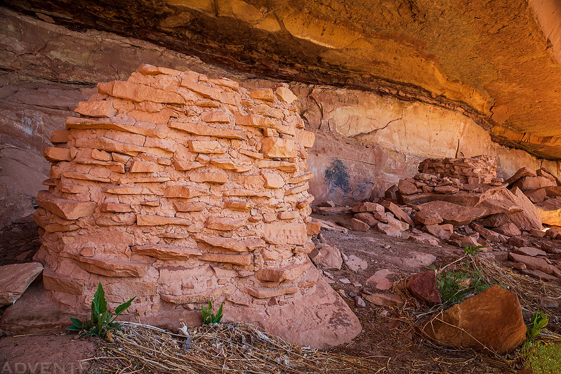
A smoke-stained ceiling above this small alcove with broken-down walls.
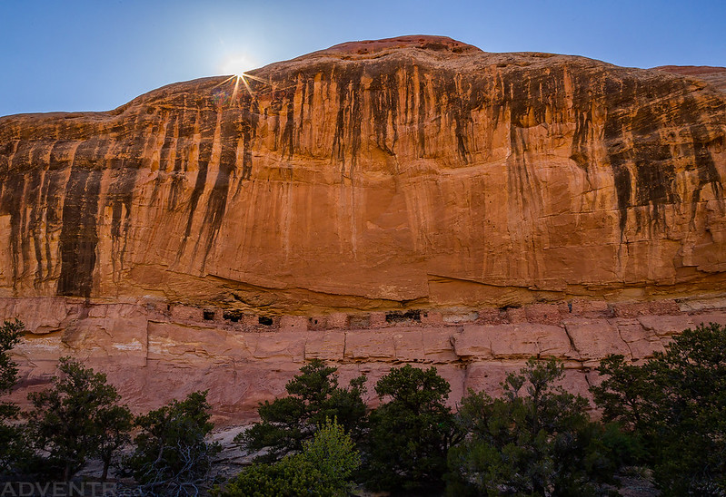
Before heading back to camp for the night I wanted to visit Big Ruins while they were in the shade.

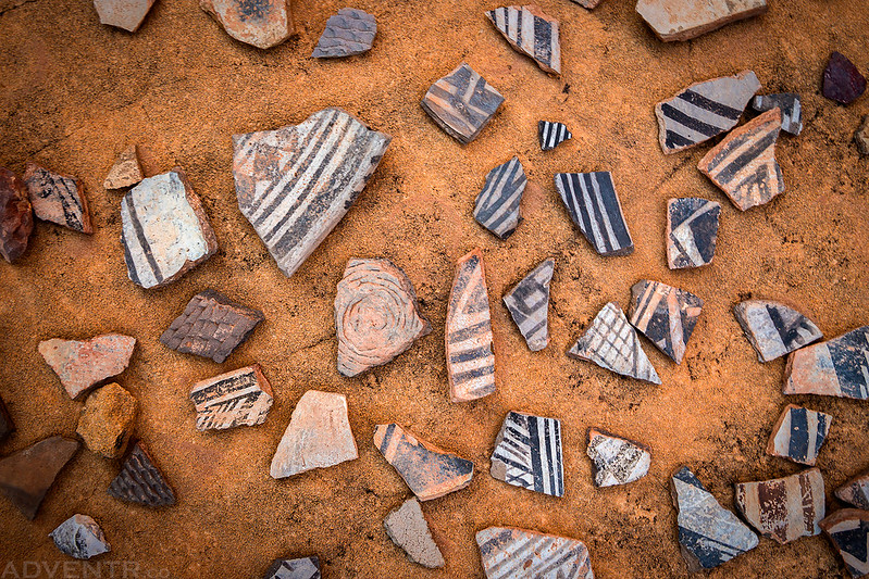
I’ve seen a lot of pot sherds over the years, but this was probably the largest concentration of large pieces that I have seen.
Kirk’s Cabin in the late evening light.

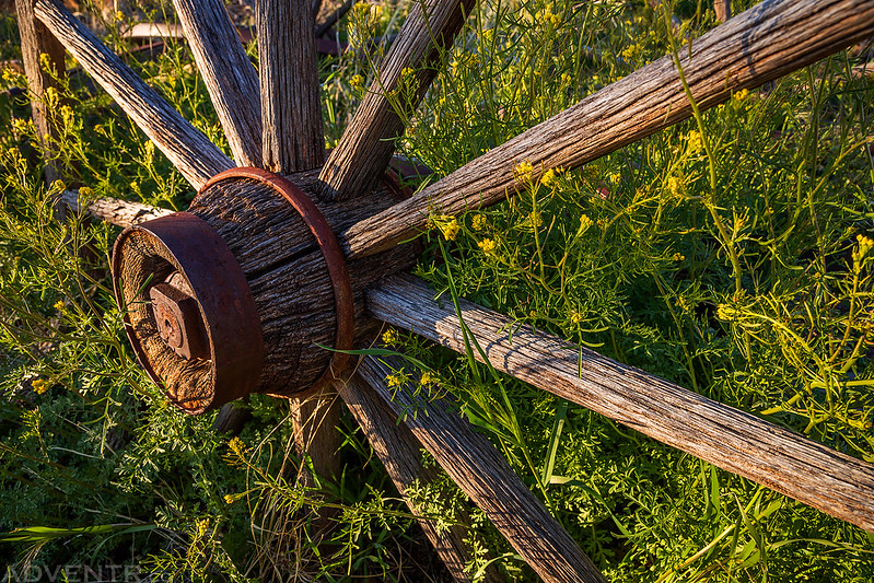
Wheel of a wagon next to the cabin.
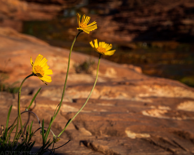
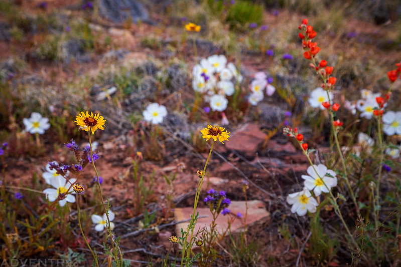
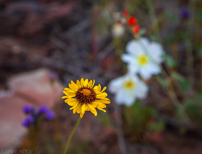
Wildflowers were abundant during our entire hike through the canyon.
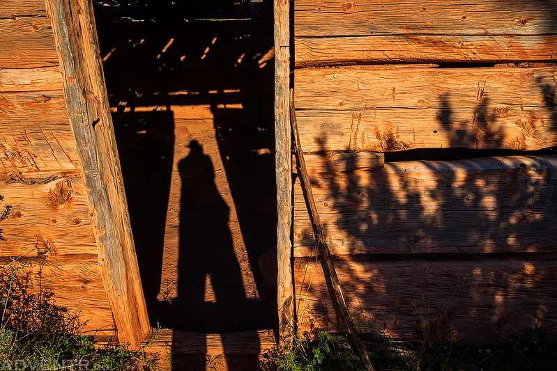
My shadow in the doorway of Kirk’s Cabin.
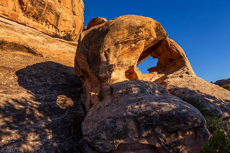
A small arch with a shadow near our campsite.
Stains on the sandstone.

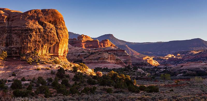
A view up canyon shortly before sunset.

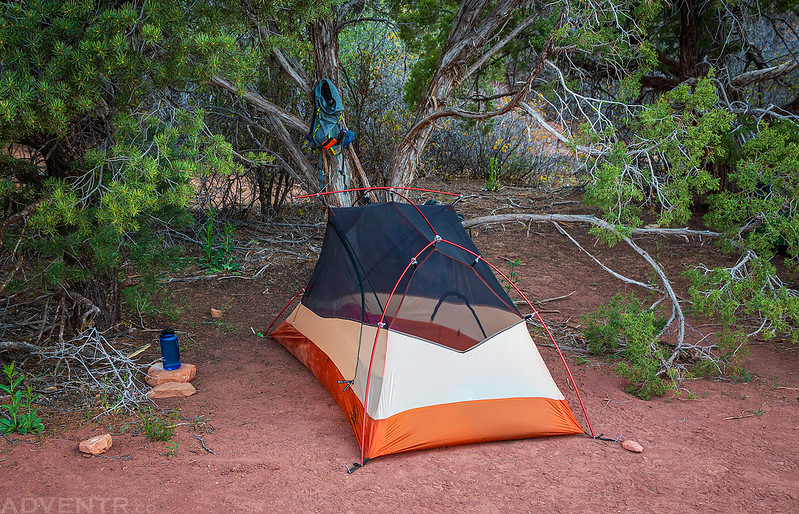
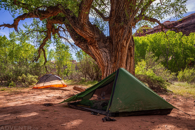
My tent at SC1.
The temperature was a bit warmer this night, though still a bit cooler than I would have preferred. Each night would warm up more than the previous on this trip. We were up early again and left camp shortly after sunrise on our way to SC3. It’s really nice backpacking with friends who also like to get up early and get moving shortly after sunrise. I was really looking forward to this day since I have always wanted to see the All American Man and Four Faces pictographs. Both of these panels had been very high on my list of rock art sites to visit and we would be passing by both of them today.
A natural arch visible from the trail.
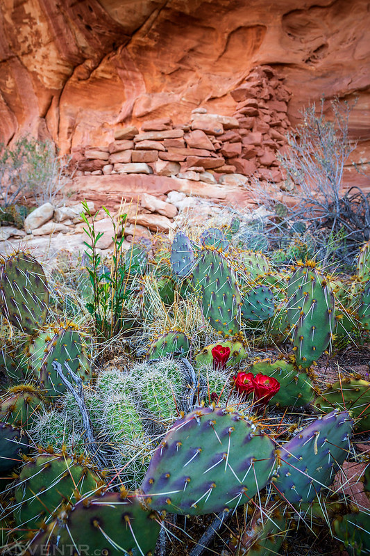
A large path of cactus’s guard the remaining walls of this small ruin.
We made sure to visit Wedding Ring Arch.

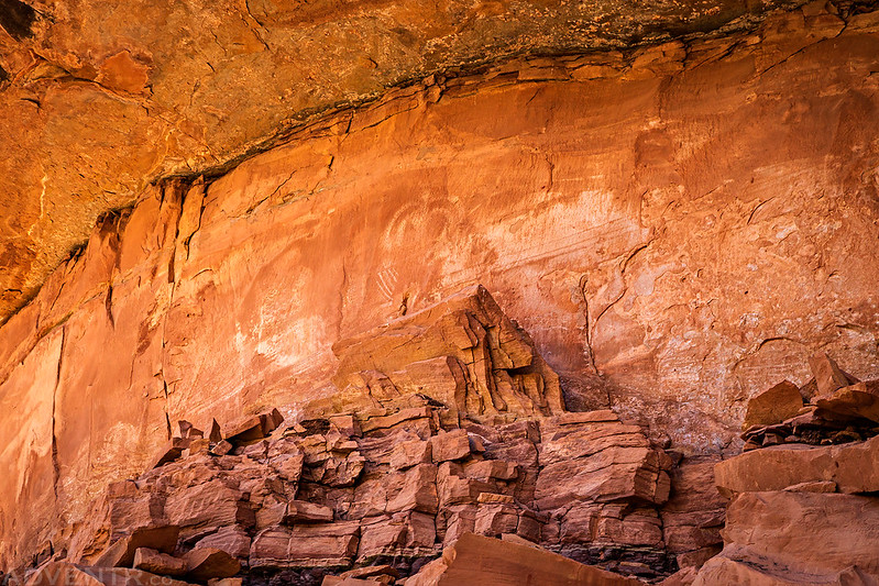
A very interesting Barrier Canyon Style pictograph site that I was hoping to find on this trip.


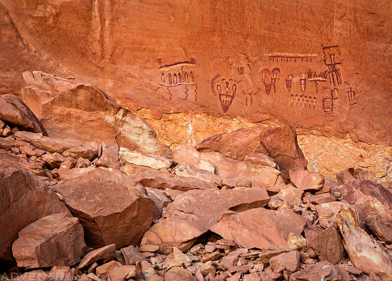
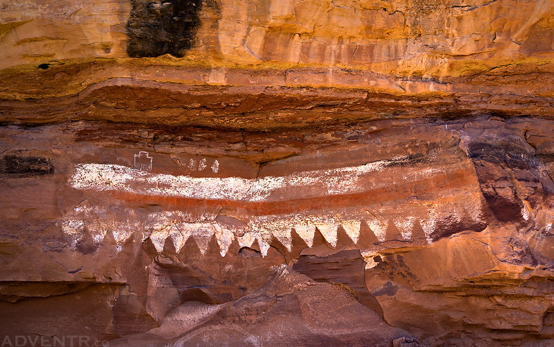
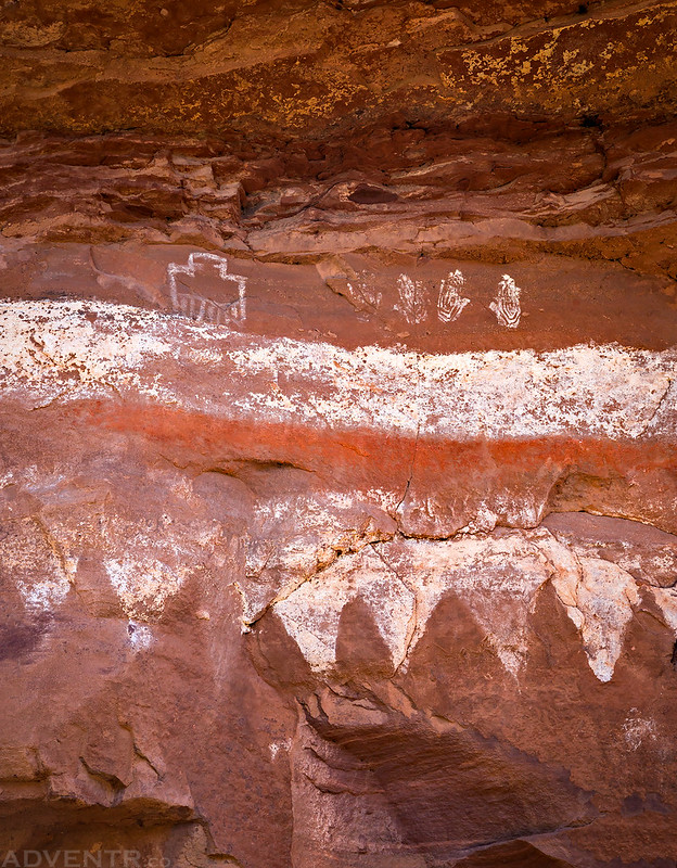
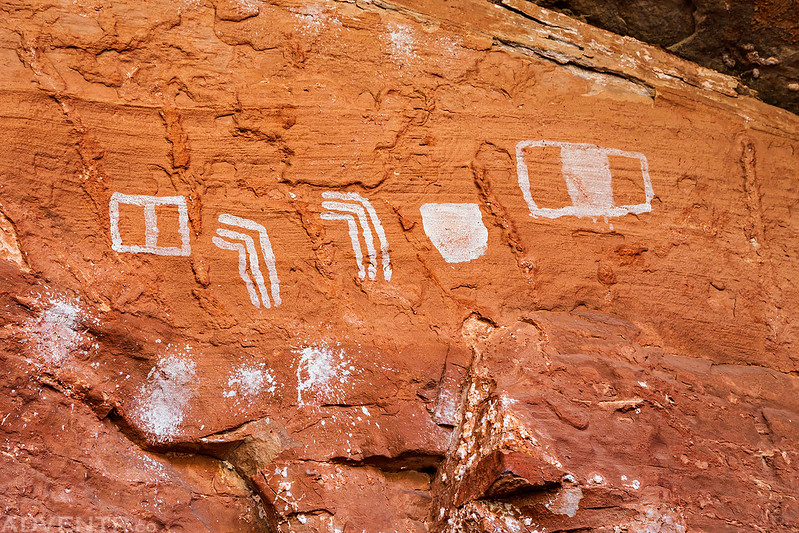
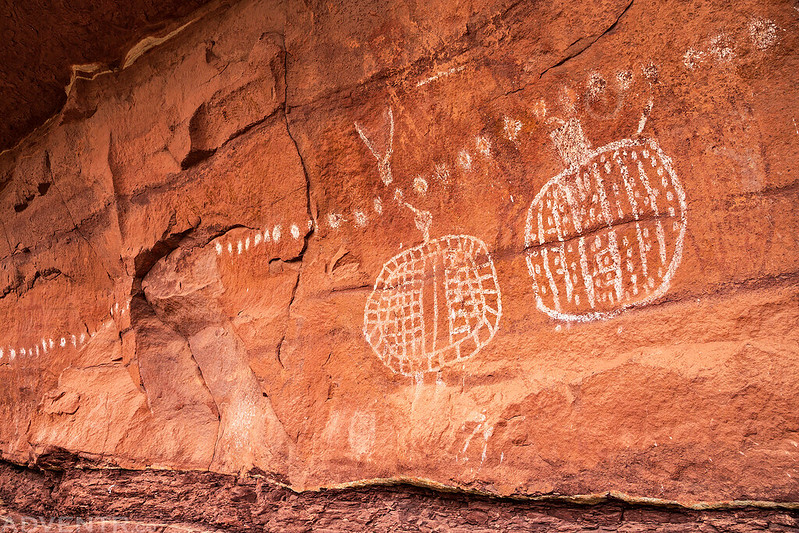
Reverse handprints and white dots are abundant in this section of Canyonlands.

Pot sherds and corn cobs.
Some of the ruins in this alcove are built on large boulders.

It was cool to finally be able to visit Squash Patch Ruin. The squash plants are still reseeding and growing after all these years.

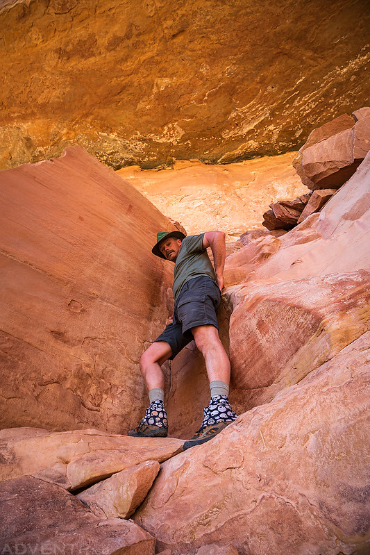
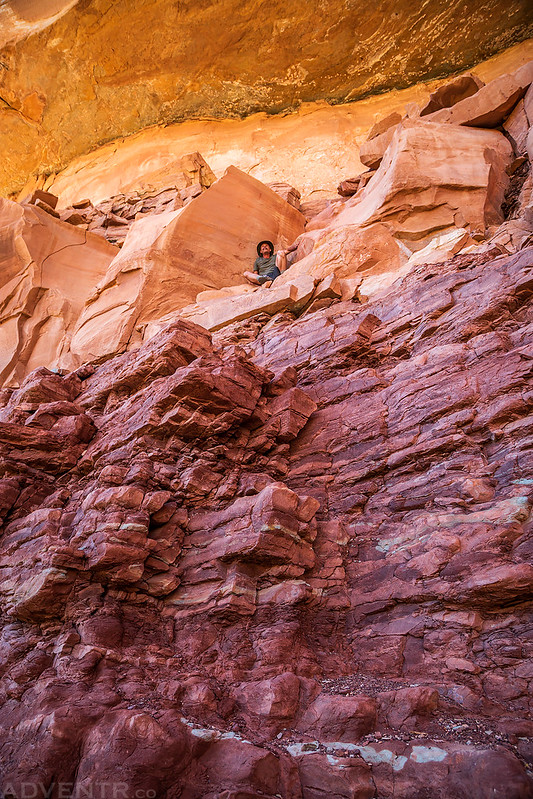
I stopped to explore a few joints along the trail.

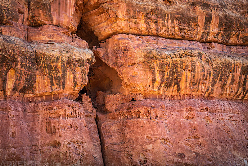
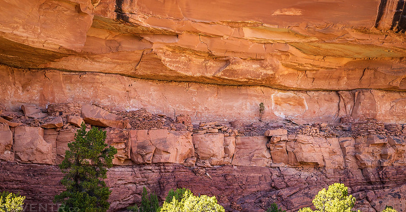
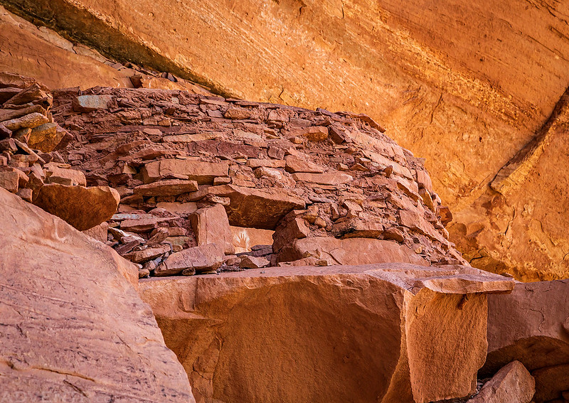
Ruins located high in an alcove above a tall crack in the sandstone.
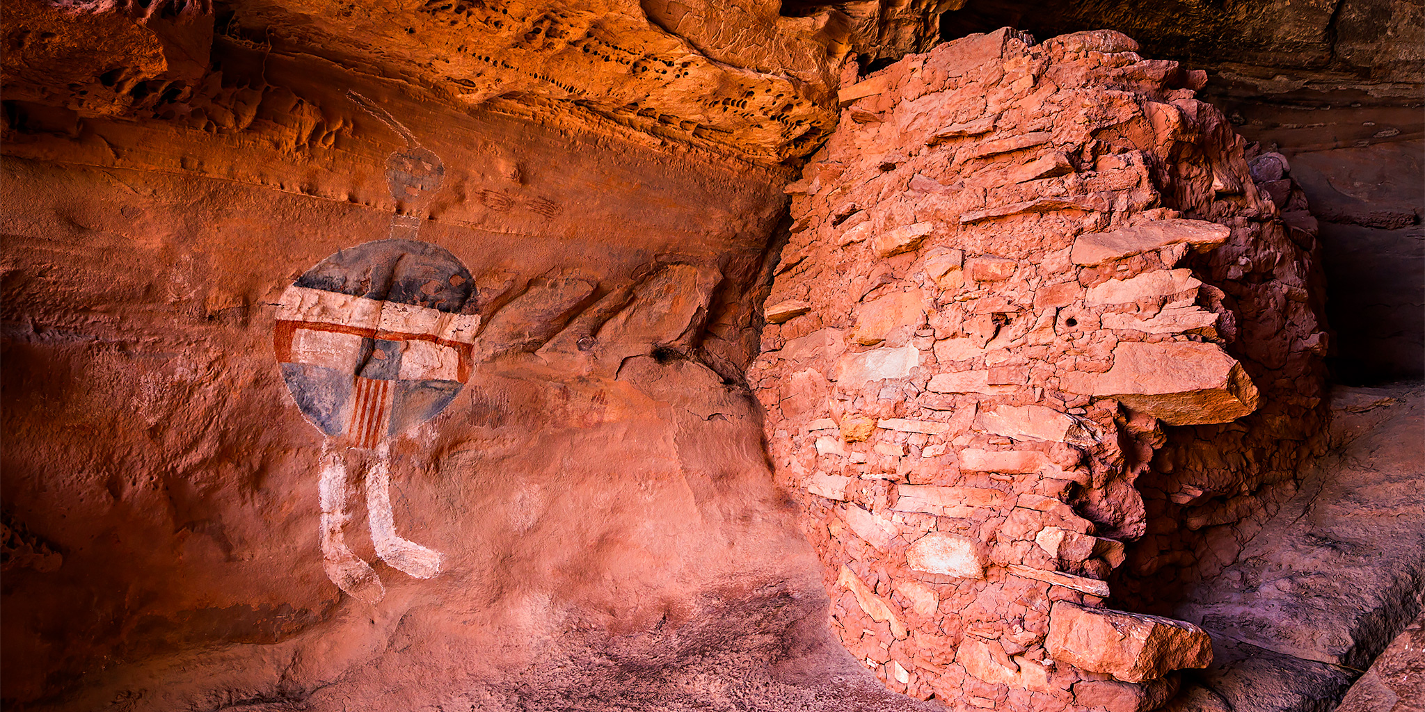
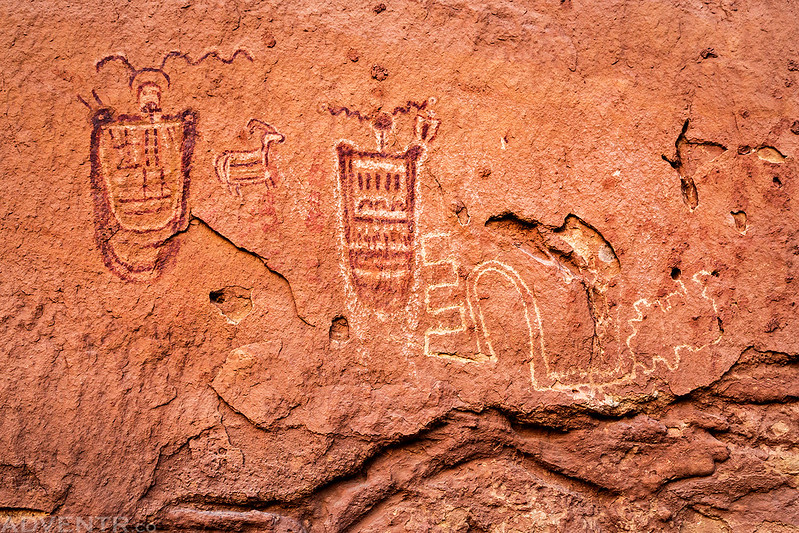
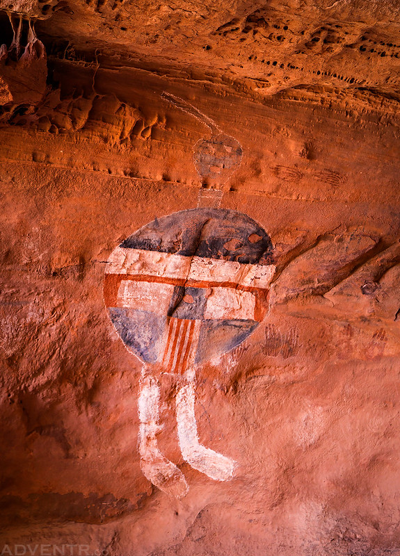
I was happy to finally visit the spectacular All American Man pictograph.
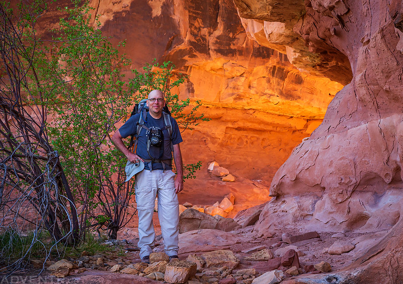
Jared stops to pose in front of some nice reflect light.
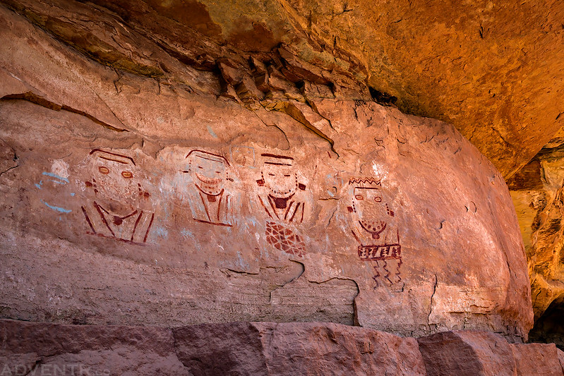
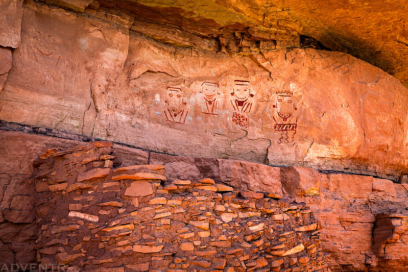
The Four Faces were just as nice as I had hoped.
View over the ruin in front.


Besides white dots and reverse handprints, connected triangles were also a common theme along the way.

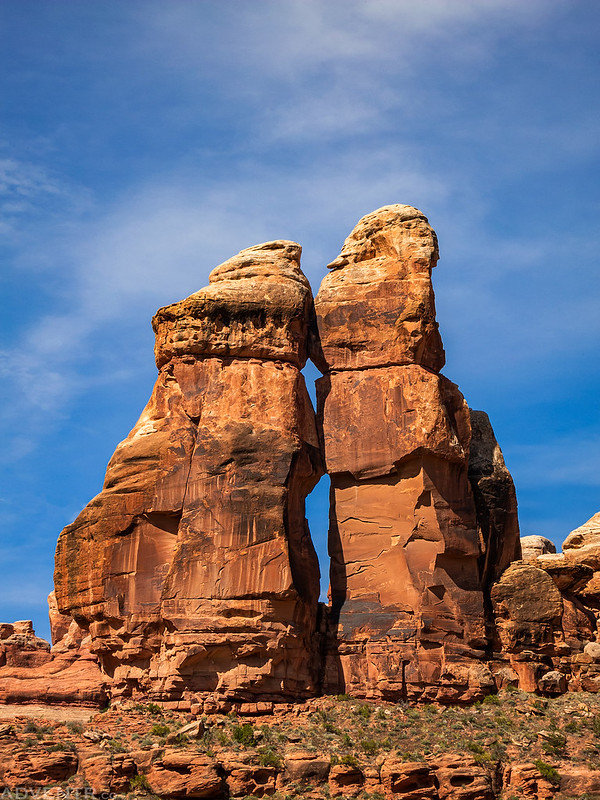
We climbed up for a closer look at the Two Faces.


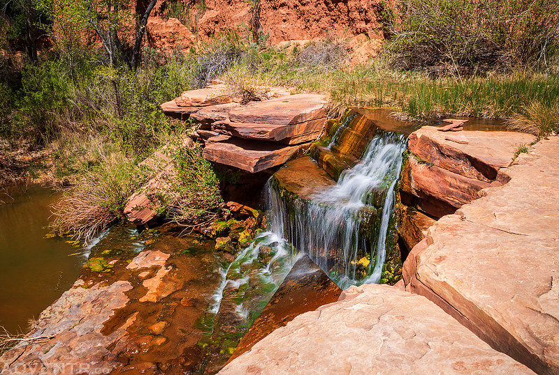
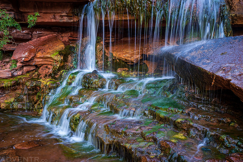
Eventually we reached the Upper Jump of Salt Creek, which would be the furthest we would go today.
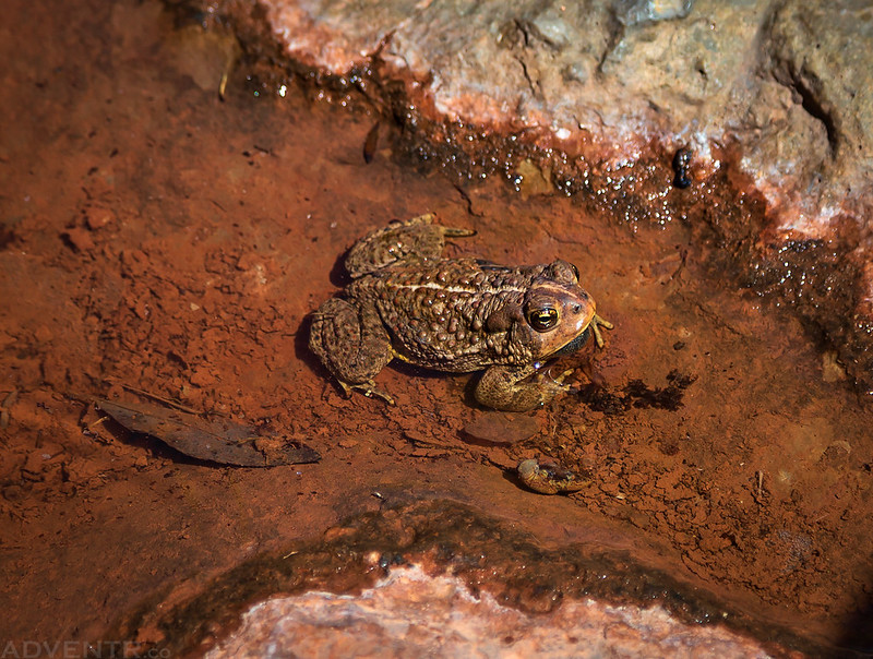
There was a toad hanging out in the water below the waterfall.
We visited a small side canyon to search for more ruins and rock art.


Interesting how they constructed a floor across the gap in the ledge here.

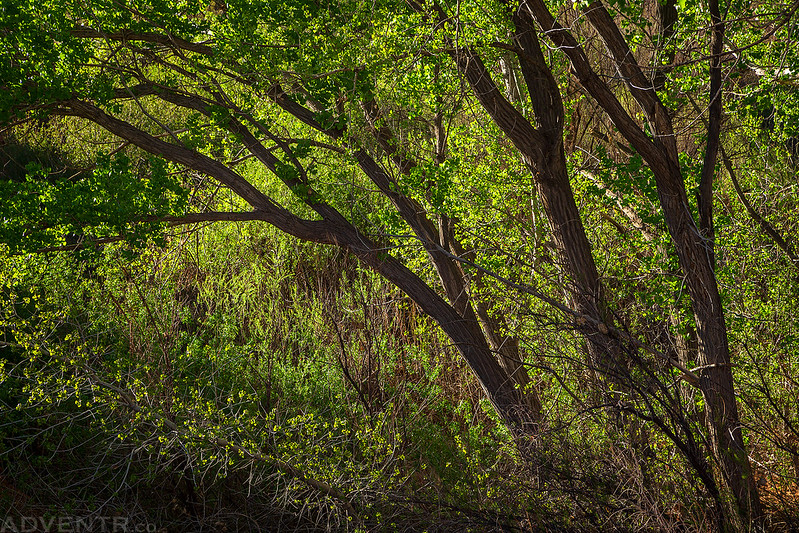
Back-lit cottonwood trees.
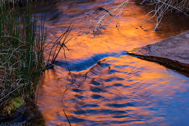
Reflections in Salt Creek.
I visited the Upper Jump in the evening before sunset to take a few photos of the waterfall.

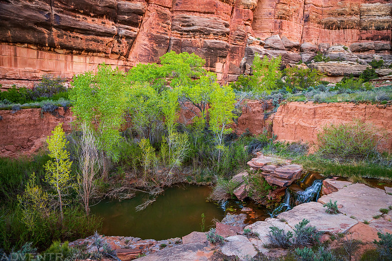
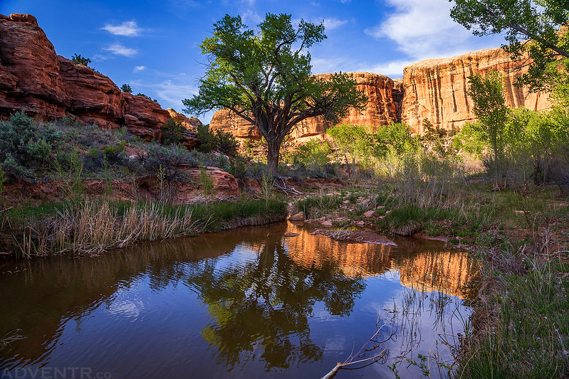
A beautiful desert oasis.

My tent at SC3.

Light on the sandstone formations above camp as the day comes to an end.

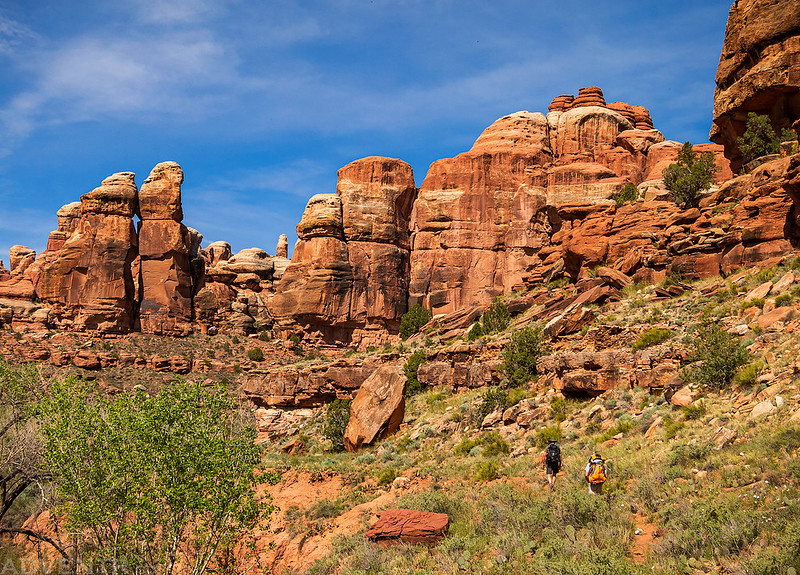
On Saturday we left camp early and made our way to the Angel Arch Camp located just past the mouth of Angel Arch Canyon under a few large cottonwood trees. It was very warm in the sun under the mostly cloudless sky which definitely started to drain my energy. We would take a few breaks in the shade throughout the day to cool off and relax.
Hiking on the bench below Upper Jump after leaving SC3.
A few petroglyphs high above the trail that Dave and I climbed up to.
Dave stops to search the canyon walls for ruins.

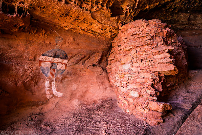
A faded pictograph panel found in a larger complex of ruins we visited.

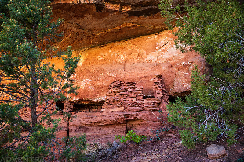
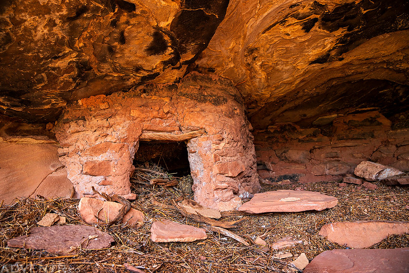
This granary was hidden high up in a cave.

A closer look with some intense reflected light.

Below the ruins the bench was covered with many different kinds and colors of wildflowers. The best wildflower display we would see the whole trip!
While photographing the flowers I came across this well-hidden granary in an unusual location. Had I not been checking out the flowers I’m sure we would have missed it.
Faint petroglyphs above.

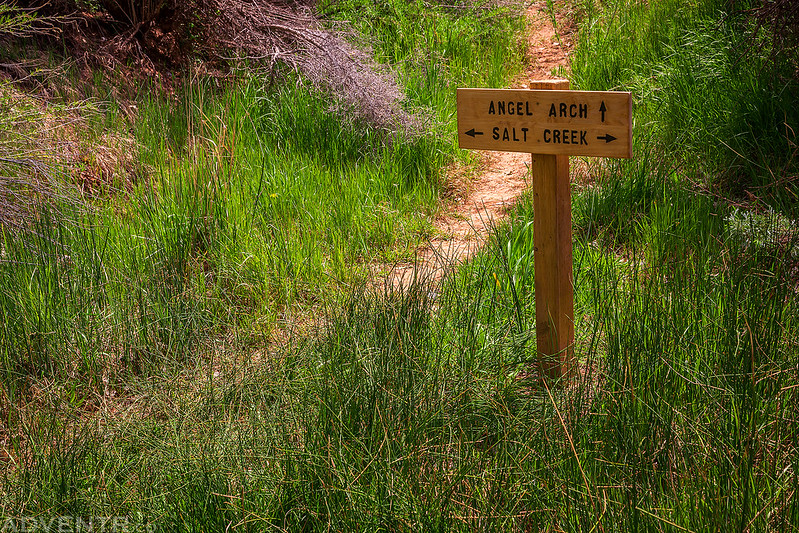
We eventually reached the intersection with the Angel Arch Trail.
While setting up camp, we noticed pictographs on these rocks above.
When Dave and I climbed up there for a closer look, I wasn’t convinced they were authentic. They looked more modern to me.

We then found our way over to the Bighorn Ruins, which is another large complex of ruins on a high ledge.
That’s where I saw a few similar pictographs to the ones we had just visited above our campsite. This made me think that maybe they are authentic?
We found something at these ruins that I have not seen before, a constructed staircase. Very unusual!

At first we thought these ruins were also inaccessible like the Big Ruins, however I managed to find a route up. Unfortunately, it was pretty sketchy and I was only able to make it half-way up. Dave did manage to climb up to the top, though.
While Dave was visiting the ruins above, I noticed the reverse handprint visible through the window of this structure.
Here’s a view of the route to the ruins. Dave had a little trouble getting back down and this was taken when he was relieved to make it past the most difficult part.
Back at Angel Arch Camp.
Shortly before sunset I headed out with my camera near camp to photograph reflections.

On Saturday we had been going back and forth on whether or not we wanted to hike to Angel Arch for sunrise the following morning since we would have a long hike back to the Jeep afterwards. In the end we decided it would be stupid not to take the three mile round trip hike to the arch since we were so close. I am glad we made that decision since the clouds in the sky and light on the arch just after sunrise was pretty nice.
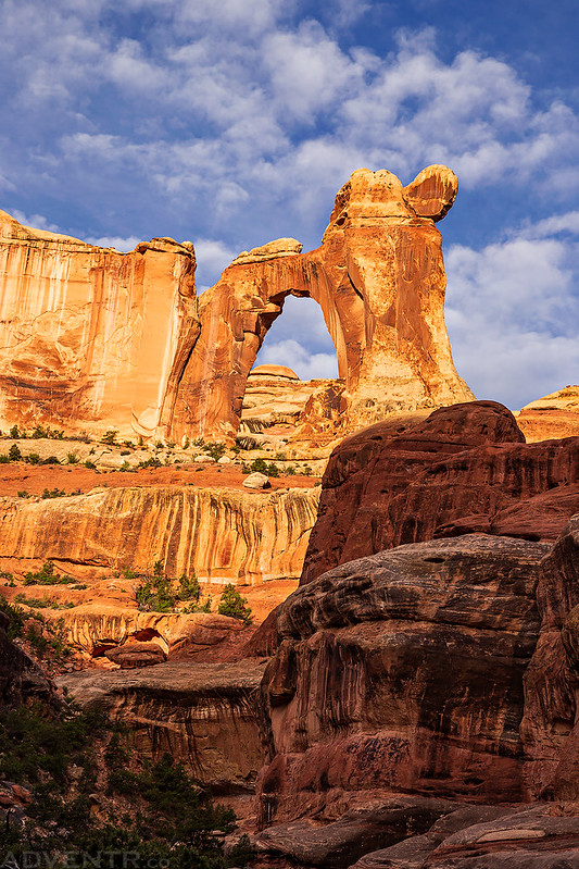
Sunlight just touching the top of Angel Arch when I arrived.

Molar Rock and Angel Arch in early morning light. What a beautiful scene and great way to start the day!


After returning to camp and packing up, we started the long hot hike out. Not only would this be the longest day of hiking with our packs on, it was also the warmest. The only saving grace was the overcast sky which stuck around until we reached Peekaboo Spring. Then it was a hot sand slog under the sun.
Hiking under the overcast sky.


We made sure to visit the Flying Carpet pictograph panel on the way.


…and of course we stopped to rest and check out the rock art at Peekaboo.
After Peekaboo I didn’t take any more photos, I just powered through to reach the Jeep near Cave Spring since I have hiked and driven this section plenty of times in the past. We had to drive back up and get my Jeep from the upper trailhead and then we drove to Moab to finish off the trip with a burger and a Coke from the Blue Pig. Then it was an hour and a half of driving and I was back home again. This was definitely a trip I will not forget!
Fantastic pictures. The best one I have evers seen from the all american pictorgaph.
Thx for showing.
Thank you very much, Michael!
Outstanding. Great trip report
Fantastic adventures, I had no idea the shield pictograph “all American man” was so large! Looks quite big next to the ruin wall, have only seen close ups before.
Great reading as always, transports me away.
Thanks RJ!
Great report, I enjoyed a lot! I have recently visited the Canyonlands and I loved it. I definitelly want to go back one day. But all the country out there is amazing. You are lucky, gyus, to live closer to this hiking paradise…
Great photos! How was the drive out to Cathedral trailhead zone (how was the Beef Basin Rd.?)
Thanks. The road out to the Cathedral TH is usually pretty easy. The only time I had an issue was when it was raining and very slippery out.
I’ve been reading your blog for a few years and always love the photos and trip reports. It’s fun because we have done a lot of trips to SE Utah over the years and it’s cool to see another person do them. I was wondering how you know the names of the panels and the ruins. We just wander about without any knowledge of the areas besides our own and I would never know the name of any ruins. Thanks Jordan
From many different sources. The well-known ones are labelled on USGS maps, then there are guidebooks and archaeological papers. Sometimes I have heard names from friends and sometimes I just call them whatever I feel like.