Memorial Day Weekend | Friday – Monday, May 23-26, 2014
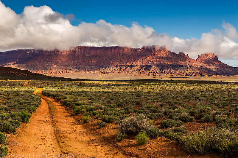
It’s been over three years since I have been to the Maze District of Canyonlands National Park and I have been wanting to get back. Earlier this year I decided to try out Canyonlands’ new online permit system and got a permit for a few campsites in The Maze over Memorial Day weekend. The last time I was in The Maze we camped in the Land of Standing Rocks, but this time I wanted to make sure we spent a night at the Maze Overlook. I also wanted to check out the Millard Campsite along the Green River since it seems like a pretty remote area of the park and I haven’t heard about too many people driving out to it.
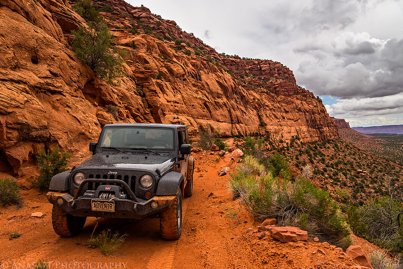
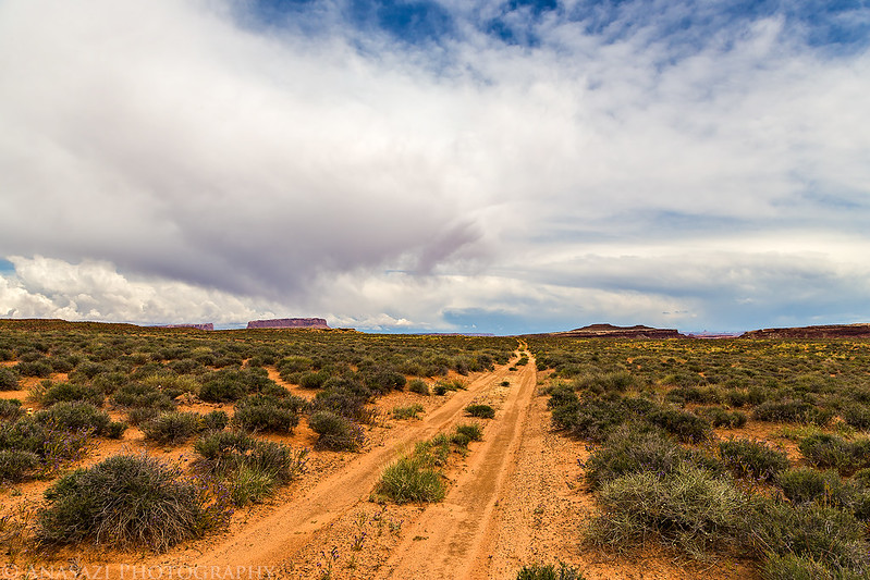
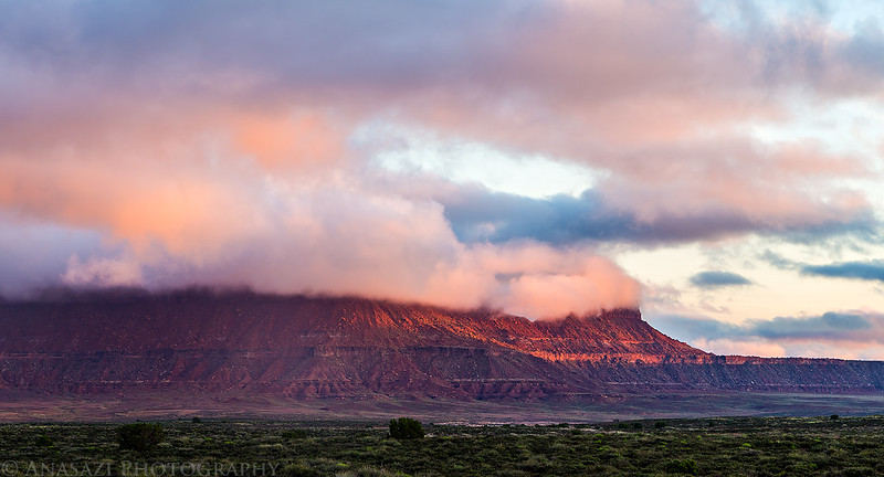
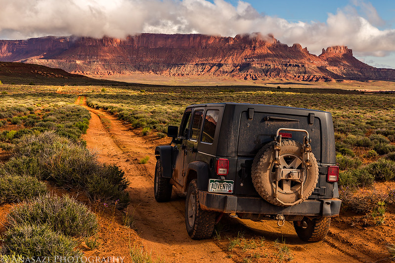
After work on Friday, I picked up Diane and we headed west into Utah. I topped off my fuel tank in Green River and we grabbed a bite to eat for dinner before heading south on Highway 24 through a very heavy storm that dumped a lot of rain in the area and caused some flash flooding. It left wet road conditions behind and even some deep water holes in the roads. These conditions slowed us down a little, but didn’t stop us. We would find minor washed out sections of the roads and trails we drove for the rest of the weekend, but luckily none were completely washed out. We made the long, wet and bumpy ride out to the High Spur campsite atop the Orange Cliffs overlooking Millard Canyon and setup camp in the twilight. It had stopped raining by the time we were setting up camp, so at least we didn’t have to deal with getting wet. We wanted to try and watch the Camelopardalids meteor shower this evening, but the clouds that still filled the sky prevented that. As we went to sleep we could see flashes of lightning off in the distance, but they were far enough away that we didn’t even hear any thunder. I had a hard time falling asleep this evening and ended up not getting much sleep at all.
Ready to start our adventure on this stormy evening as we turn off Highway 24 onto the Hans Flat Road.
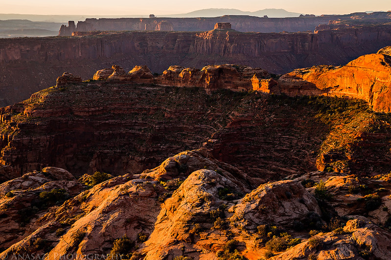
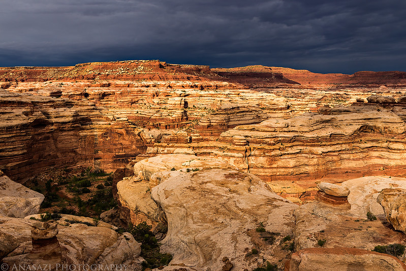
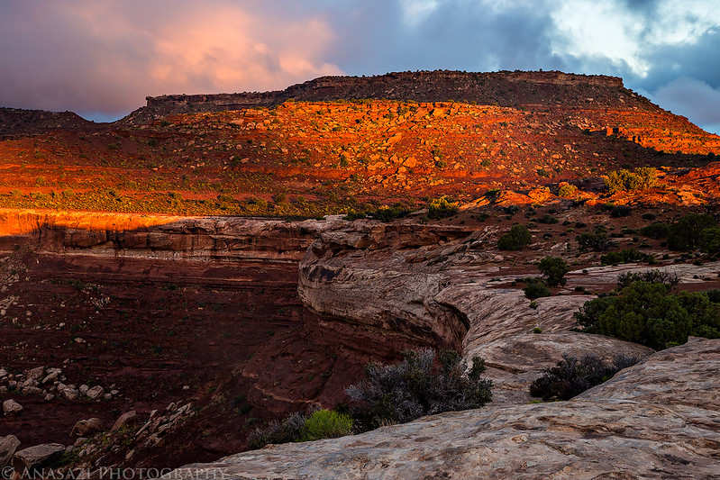
I don’t recall it raining overnight, but the tent was soaked in the morning, so maybe I slept through it? Even without much sleep I woke up before sunrise and hiked over to the rim of Millard Canyon to shoot a few sunrise photos. The clouds had cleared out and the sky was mostly clear by now.
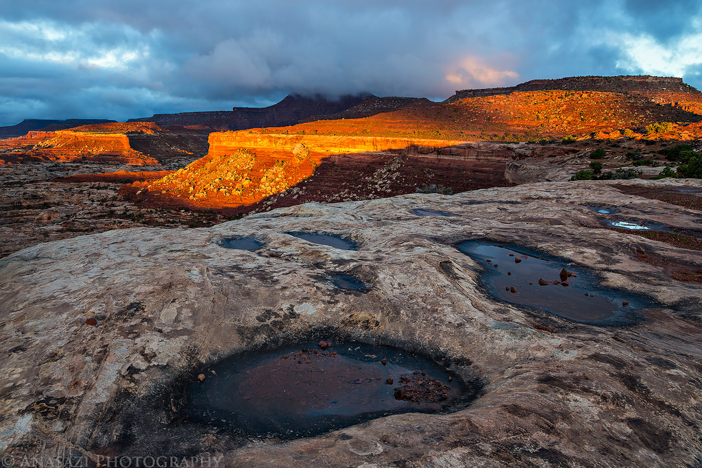
Looking down from the rim as the sunlight strikes the edge of the sandstone below.

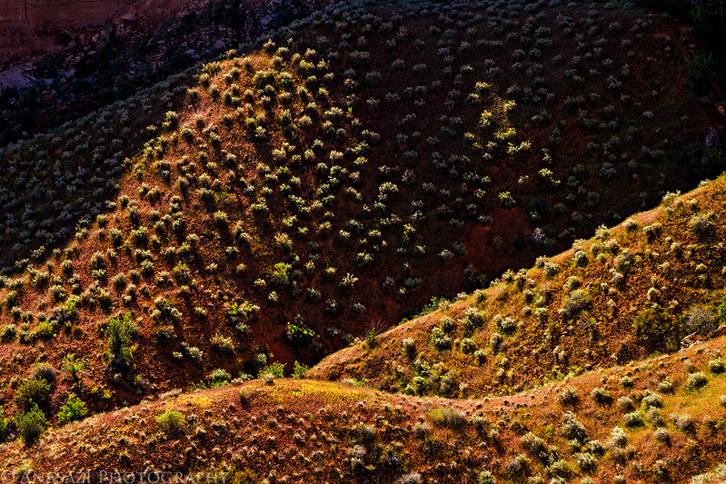
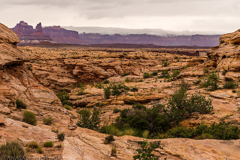
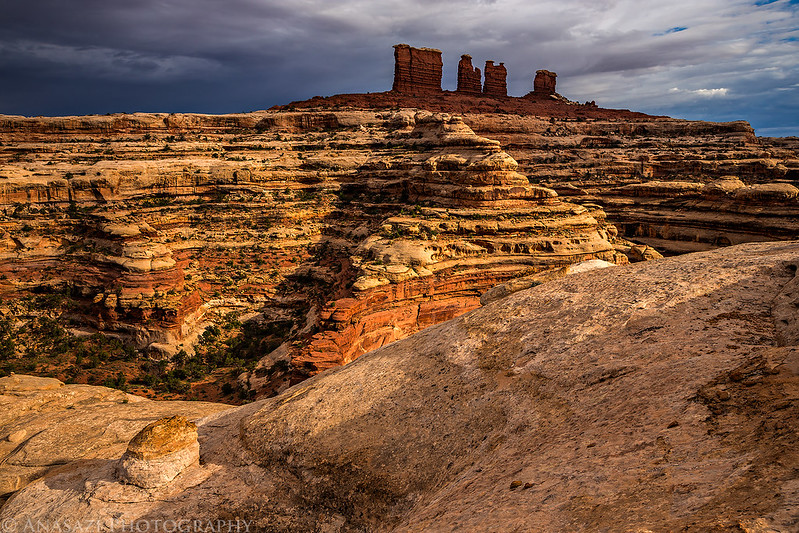
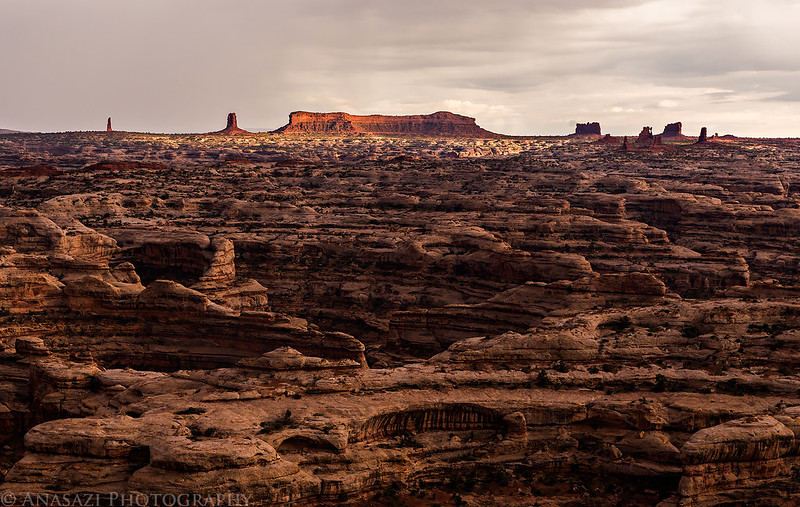
Cool rock formations near the High Spur campsite.
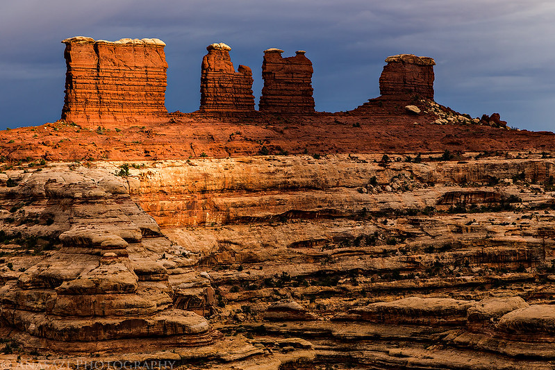
The Buttes of the Cross are on the other side of Millard Canyon. We will be getting a better view of those later in the day.
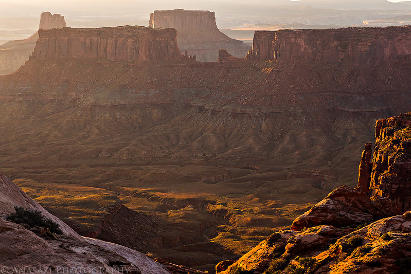
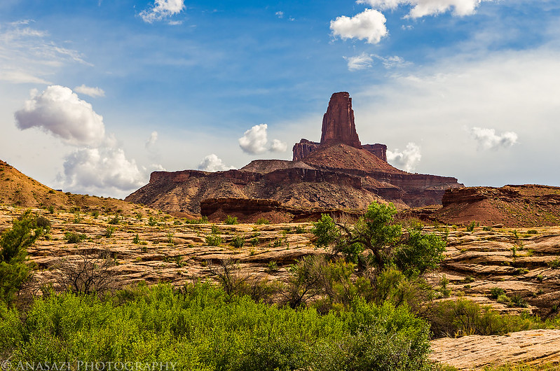
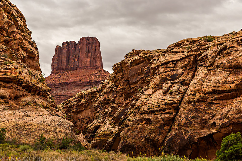
Cleopatra’s Chair is the prominent sandstone formation in the middle at the top of this photo.


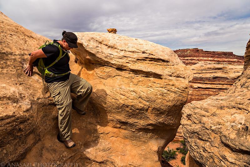
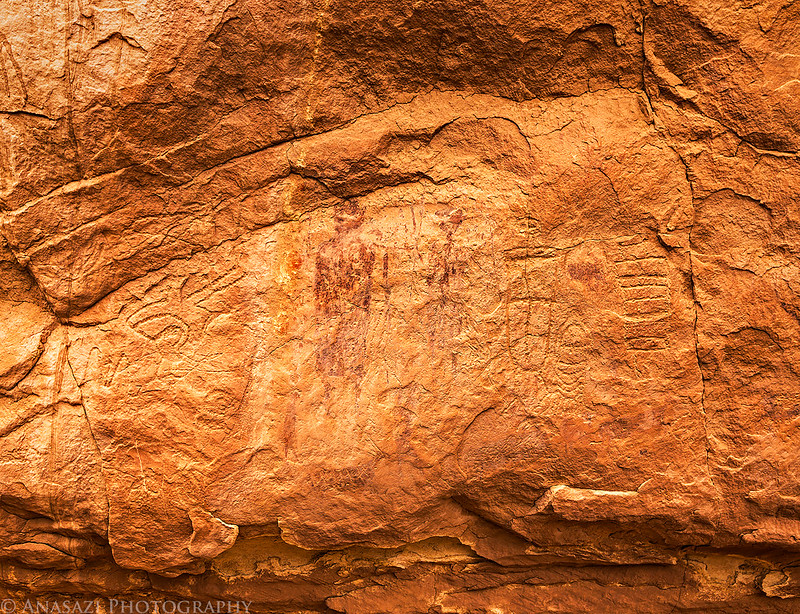
After we broke down camp and loaded it into the Jeep, we drove a little further on The Spur to the beginning of the Deadmans Trail. The road appeared recently washed out in a few places, but it wasn’t anything my Jeep couldn’t handle. I’ve hiked to the Great Gallery in Horseshoe Canyon from the typical trailhead a few times before but have always wanted to hike down to it from the Deadmans Trail. When I first planned this trip I was hoping to hike down in the dark and photograph the Great Gallery while it was still in the shade, but thanks to a lack of sleep and catching the sunrise at camp I will have to try that another time in the future. Some of the pictographs were still in the shade when we arrived, but not all of them. We were the first and only people at the panel this morning which was nice and relaxing. After sitting and studying the panel for a while we started the climb back out of the canyon to the Jeep so we could continue on our journey.
Leaving High Spur camp.
Ready to start our hike down the Deadmans Trail.

A nice view down into Horseshoe Canyon.
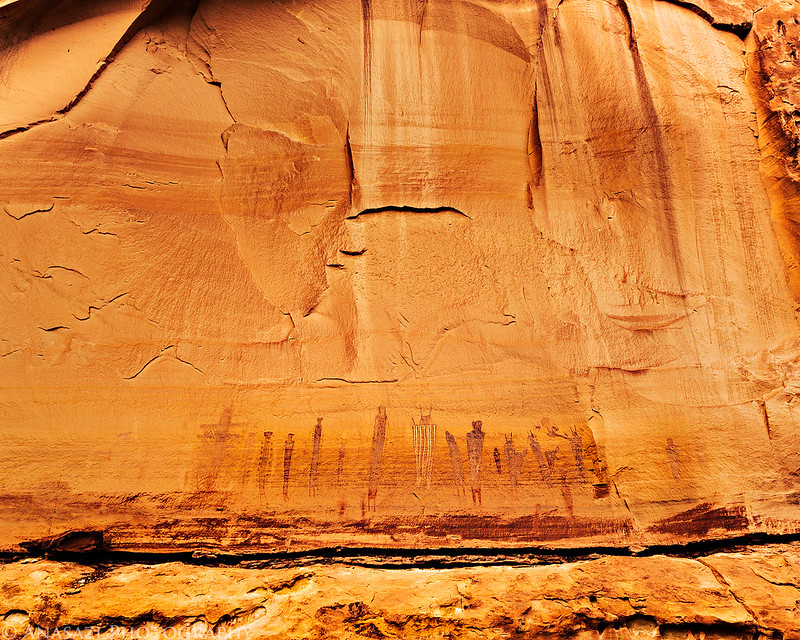
Ghosts of the Great Gallery.
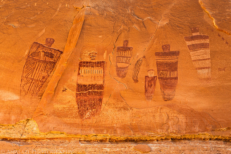
Amazing detailed pictographs.

The Holy Ghost Panel.
A steep climb back up the Deadmans Trail.

Sandstone formations inside a shallow alcove along the trail.
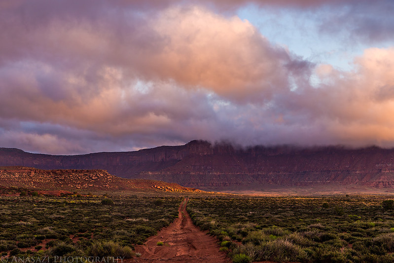
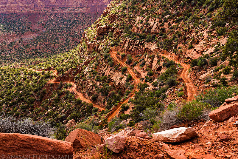
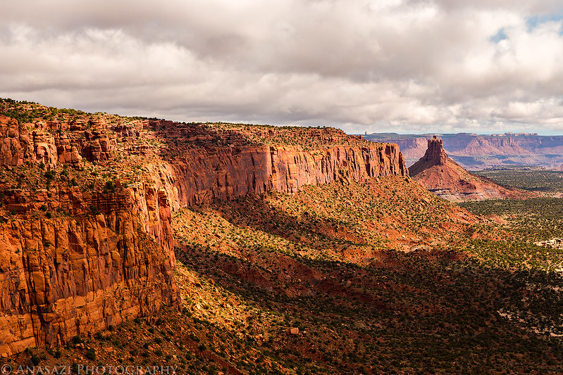
After our morning hike we drove back to the Hans Flat Ranger station so we could get updated weather conditions before heading down into The Maze. As we drove towards the ranger station, we noticed the clouds were starting to build and it looked like more rain might be in store for the afternoon. It seemed like a monsoon pattern which is quite a bit early in the year to be happening. The park ranger confirmed our suspicions with a 40 percent chance or rain forecasted for the rest of the day. He also told us that not many people drive out to the Millard Campsite and that we would be the first ones out that way in a while, so he had no idea the conditions of the road and we would have to find out for ourselves how it was. We left the ranger station and made our way to the Flint Trail switchbacks so that we could get down them before any more rain moved into the area. They were in good shape on our drive down and had not beef affected by the previous night’s storm. We stopped for lunch at the Golden Stairs and then continued past the Maze Overlook turnoff on our way to the mouth of Millard Canyon.
Driving down the Flint Trail.

Main intersection near the bottom.
A small hoodoo near the intersection.

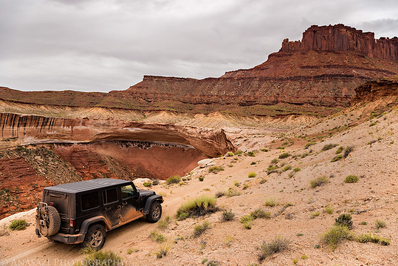
Two-track driving along the base of the Orange Cliffs on this overcast afternoon.

Following the road across the Millard Benches.
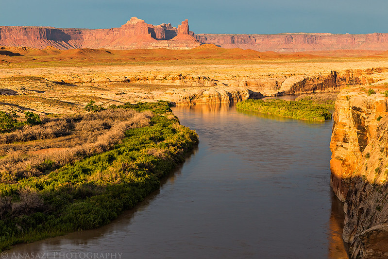
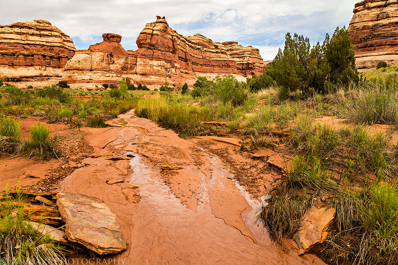
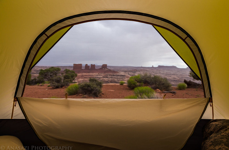
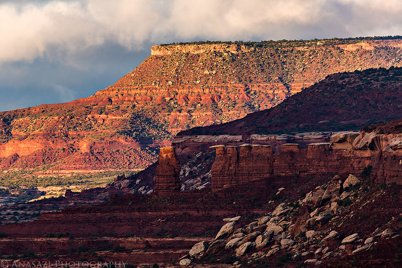
We passed Horse Canyon, Ekker Butte, Deadhorse Canyon and the Buttes of the Cross on our way to the Millard Camp. The road was a little bumpy but it wasn’t difficult. It was a little too bumpy to drive as fast as I would have liked, though. This section of the road kind of reminded me of The White Rim trail on the other side of the river, except less traveled. We had a little on and off rain during the drive, but there wasn’t enough precipitation to even get the ground wet. There was just enough to keep the dust down, which is always nice. When we reached the campsite along the Green River, we setup our tent under a large cottonwood tree. It was a very nice site that offered great views and plenty of solitude. I would happily camp here again. While we were setting up camp, the clouds finally started to clear and the sun broke free of the overcast sky we had been driving under all day. We spent the evening exploring the area and taking photos until the sun set. Unfortunately, by the time it started to get dark out there were too many clouds to watch the meteor shower again.
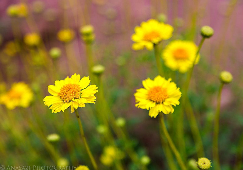
There was a lot of Prince’s Plume around and plenty of other desert wildflowers.

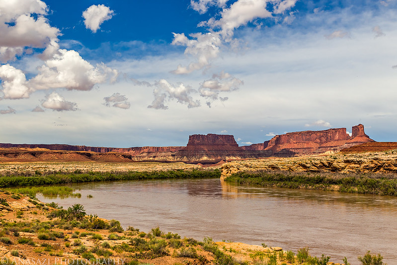
A bend in the Green River near the mouth of Millard Canyon as the sky finally starts to clear a little.
A view of the Buttes of the Cross from near our campsite. This is the only area where these buttes look like a fallen cross.
Off to the south we see a butte in the form of a fallen cross. It is several miles away, but it presents no inconspicuous figure on the landscape and must be many hundreds of feet high, probably more than 2,000. We note its position on our map and name it “The Butte of the Cross.”
Major John Wesley Powell,
July 17, 1869
Looking down on our camp along the Green River. You can see Junction Butte in the background.


Following the bench behind camp above the river.

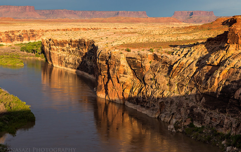
A nice reflection of the cliffs on the river at the beginning of Stillwater Canyon.
Looking across the Green River towards Candlestick Tower.

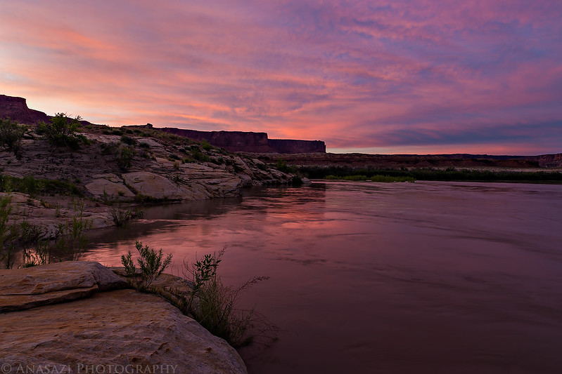
Steer Mesa is reflected on the river shortly before sunset.

There was nice color in the sky after the sun went down.

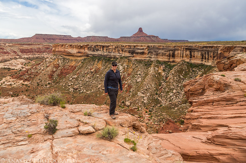
The sky was pretty overcast when we woke up on Sunday morning so there wasn’t a good sunrise to photograph. We packed up camp and started our drive back out, but first we stopped near the Anderson slot canyon below the Buttes of the Cross and hiked down into Anderson Bottom on an old stock trail to search for some petroglyphs and a granary. We managed to find the small granary on The Frog in the middle of the rincon but it wasn’t very impressive. There was no opening and it just looked like a stack of rocks. We had a tougher time finding the petroglyph panel and were just about ready to give up and start our hike back to the Jeep when I managed to spot it. On our way back, we hiked past the stock trail and went further up the canyon to check out the slot. I’m glad we didn’t try to come down through the slot since it was full of water from the recent rain and we would not have been prepared for it. We hiked back up to the Jeep and then drove to the Maze Overlook. We stopped for lunch along the rim of Horse Canyon with a nice view of the Land of Standing Rocks in the distance. When we reached Camp 2 at the Maze Overlook we setup our tent at a nice site near the edge with a great view of the Chocolate Drops. Diane had some schoolwork to get done, so she spent some time working on that while I hiked along the edge towards Elaterite Butte.
Though the sky was overcast this morning, there was an interesting shape to the clouds above.

Here’s a side view of the Buttes of the Cross from where we started hiking to Anderson Bottom.

And just here we climb out once more, to take another bearing on The Butte of the Cross. Reaching an eminence from which we can overlook the landscape, we are surprised to find that our butte, with its wonderful form, is indeed two buttes, one so standing in front of the other that from our last point of view it gave the appearance of a cross.
Major John Wesley Powell,
July 17, 1869
The nice petroglyph panel we found.

There were plenty of wildflowers down in this old meander of the river.

Hiking up Anderson Canyon to reach the slot.
A pool of water at the end of the slot canyon.

Hiking back to the stock trail.

When we reached the rim of the canyon, we looked across to the Island in the Sky and noticed these low clouds that seemed to be pouring over the edge. I have not seen anything like it before.
There were other low clouds hanging onto the buttes and cliffs as we drove back towards the Maze Overlook.

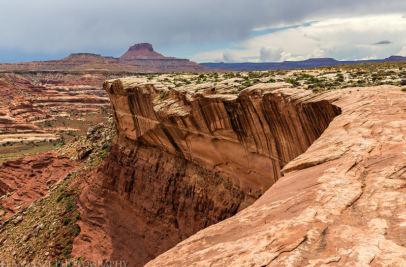
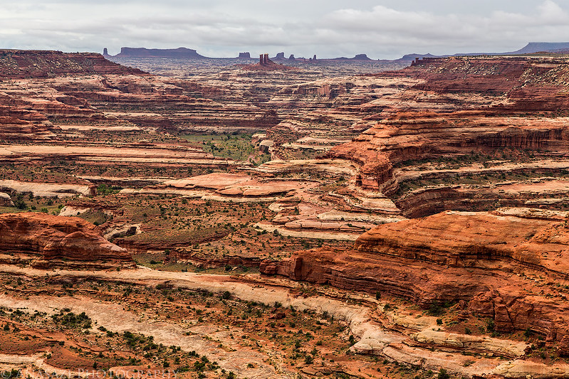
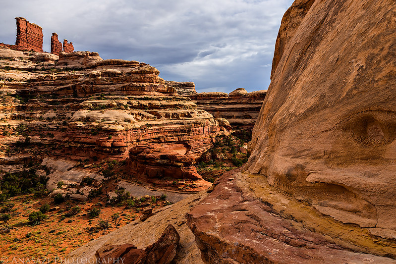
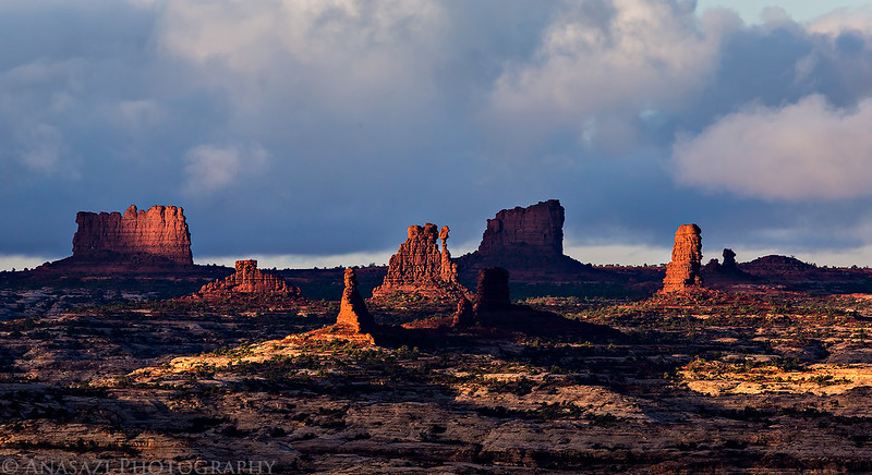
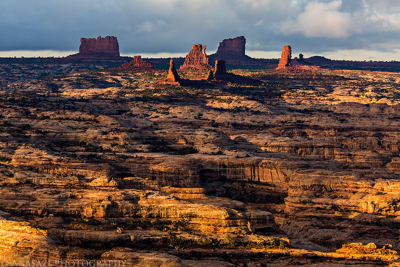
A view of the Land of Standing Rocks and the Maze Overlook from our lunch stop.
Entering The Maze again.
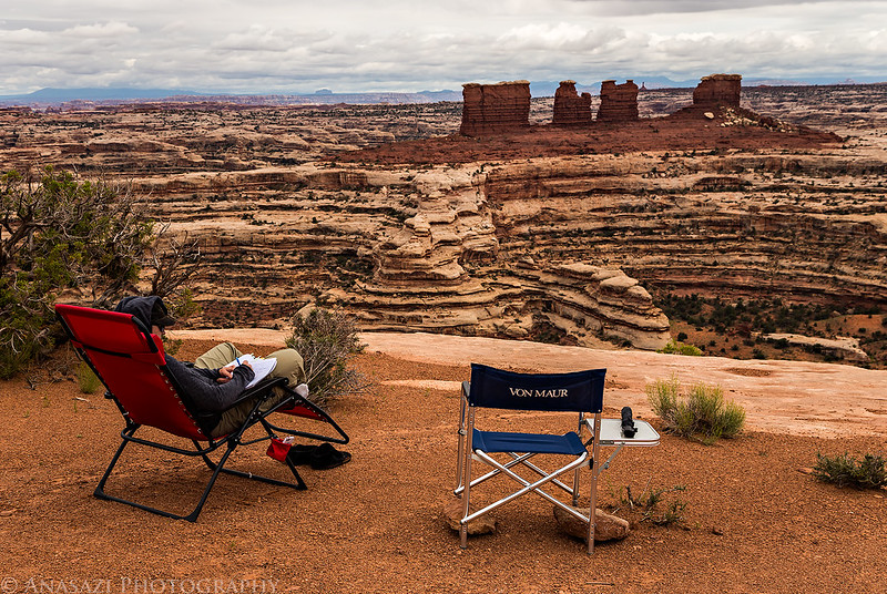
Diane gets some homework done from our campsite. Can you think of a better place to get schoolwork done?
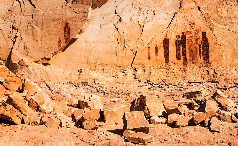
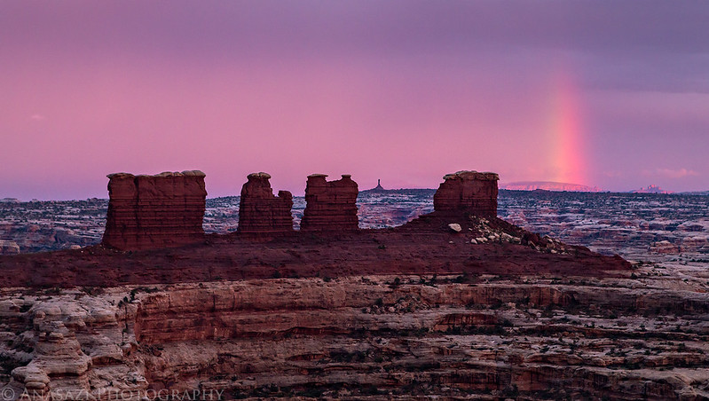
We were originally planning on hiking down the Maze Overlook trail to the Harvest Scene in the morning before leaving, but when I told Diane that the panel would be in direct sunlight and hard to see if it wasn’t cloudy, she suggested we hike down and see it that evening. We had enough time before sunset, so we grabbed our packs and left for the nearby trail. Most of the trail down was pretty easy, except for the one large ledge we had to descend. I was worried about being able to get back up it, but it turned out that going back up was much easier than down. It was nothing to worry about. The moki steps were easy, too. While we were hiking in the canyon the overcast skies finally started to break up and we got some spotlighting in the canyons. On the way to the Harvest Scene we stopped at another panel I had searched for a few years ago and not found. I have no idea how I missed it back then? It was so easy to spot on this time! We visited the Harvest Scene and took some photos while it was in the shade and then we started our hike back up to camp. We made good time on the hike and still had plenty of time to eat dinner before sunset. While we were cooking dinner it started to rain and we ended up eating in the tent. It would rain on and off the rest of the night, but our tent kept us nice and dry and still allowed us a beautiful view towards the Chocolate Drops. At sunset, there was a small enough hole in the clouds to the west which created a rainbow behind the Chocolate Drops and added a little color to the sky. What a way to end the day!
View from the trail as we descend into The Maze.

Coming down the moki steps.

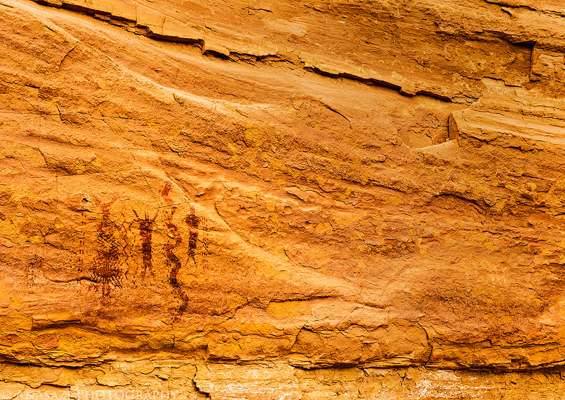
Faint Barrier Canyon Style pictographs and petroglyphs that I was unable to find the last time I was here. I have no clue how I missed them, they were fairly obvious this time! Maybe I’ve got better at locating them over the past few years?
Hiking through the beautiful canyon on our way to the Harvest Scene.

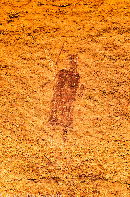
The Harvest Scene pictographs are so much easier to see when they are not in direct light.

This was Diane’s favorite pictograph in the area. It’s small, but very detailed.
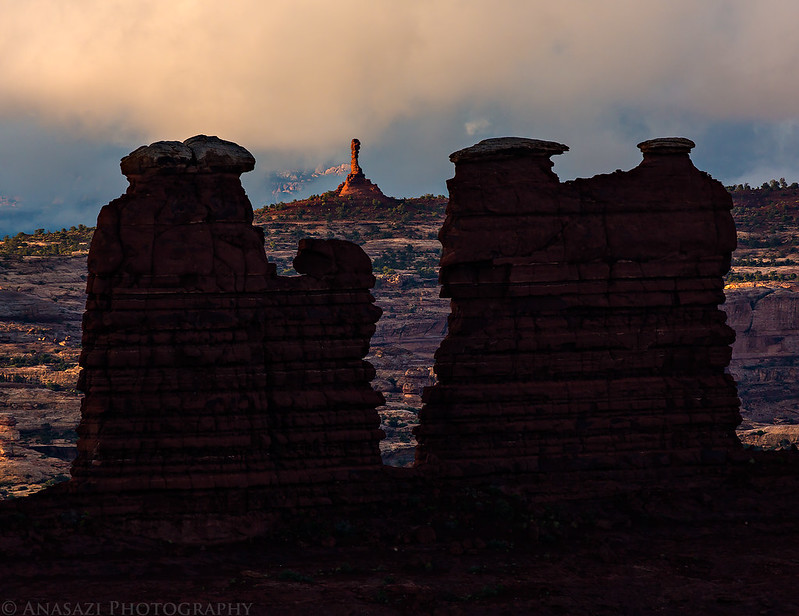
Spotlight on the Chocolate Drops.
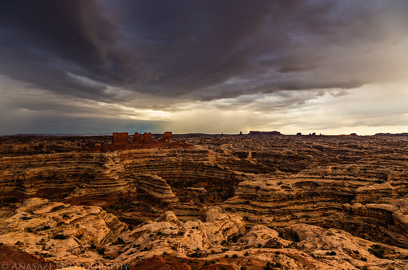
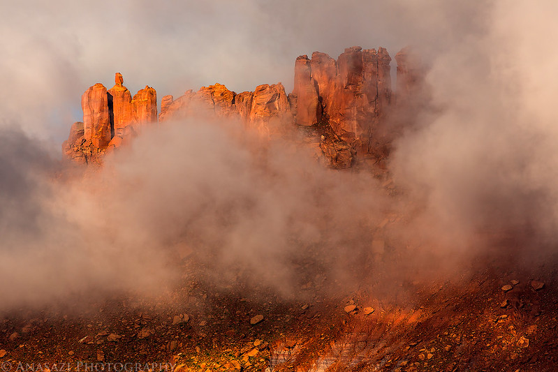
Dark clouds over The Maze.
Waiting out the rain in our tent with an amazing view.
Light on Lizard Rock after the rain.
Storm clouds over The Maze.
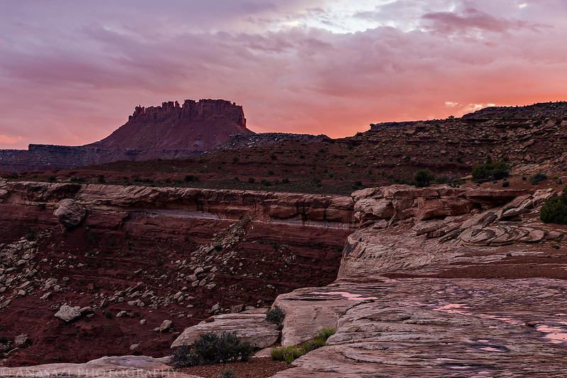
Elaterite Butte through the rain.

The beginning of a beautiful sunset.
I was hoping to catch a rainbow near the Chocolate Drops, and it actually happened!
Beautiful color in the sky over the orange Cliffs after the sun dropped below the horizon. A great way to end the day!

It rained for most of the night and when I looked out of the tent shortly before sunrise I was disappointed to see a lot of clouds still in the sky. However, looking towards the east it looked like there might be a small hole to let some sunlight through. I got up, grabbed my camera, and took my chances. I’m glad that I did, because it turned out to be the best sunrise of the trip. It was an amazing morning! I’ll let the photos do the talking…


Since we had hiked down into The Maze the evening before we took things slow this morning as we packed up camp and got ready for the drive back home. The sky and light was still pretty nice as we drove back to Hans Flat. The roads had quickly dried out from the rain and the Flint Trail was still in good shape. I had been a little worried about not having enough gas to get back to Green River, even with an extra 5 gallons I brought with, but once we got past the Ranger Station my Jeep’s MPG vastly improved and I had nothing to worry about. I probably could have got away without the extra gas, but it really would have been cutting things too close for me. We fueled back up in Green River and grabbed some burgers from Ray’s Tavern to end the trip. It was a great long weekend in the Maze District of Canyonlands!


A view of the Flint Trail switchbacks below.
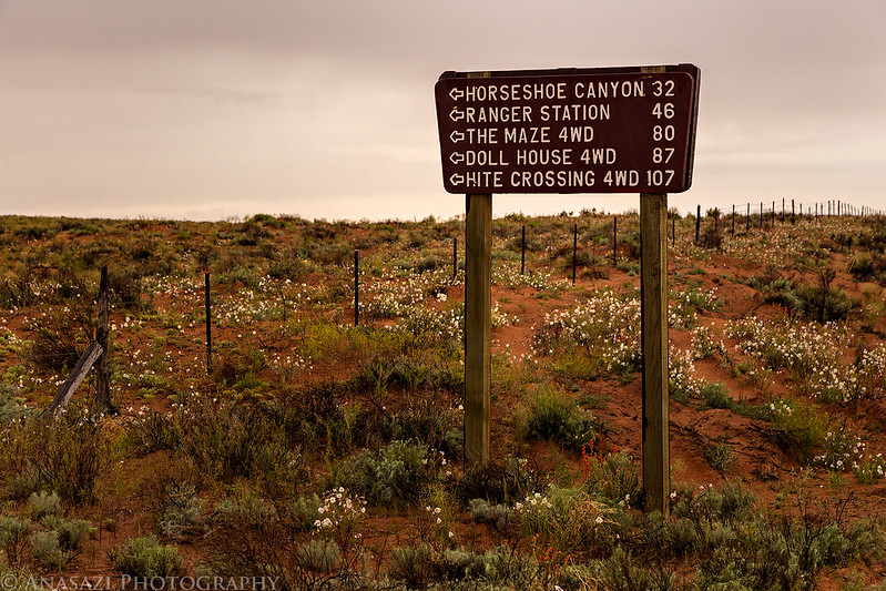
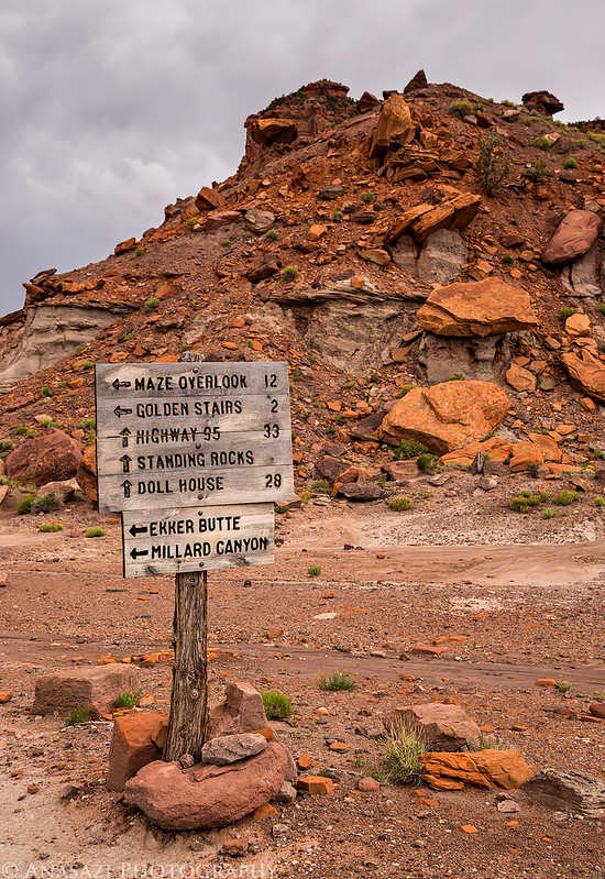
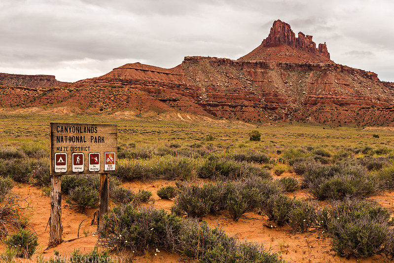
One of my favorite signs!

Fantastic . We have been in the Southwest for three Weeks. And we Are nie back in Germany. It is nearly impossible for us to make such fantastic Tours like yours. Because most of the rental Cars dös Not 4wd und hc. Thx for showing your pix.
Michael
Sounds like a great trip! In fact, I may just use this as a template for an Autumn journey up this way. Thanks for the inspiration!
Marvelous photography and commentary. I hope to go there in April 2015, and your post has been very helpful and your photography inspirational!! Well done on all fronts!!
Thanks Terry! Have a great trip next year!
Glad I found this before our trip this April. Probably the best pics and commentary I have read. Great job. One question. Our first night is at High Spur. Can you tell me your route to High Spur from Green River?
We took the Hans Flat Road (near the turnoff to Goblin Valley) from Highway 24 to the Hans Flat Ranger Station and then headed north to High Spur.