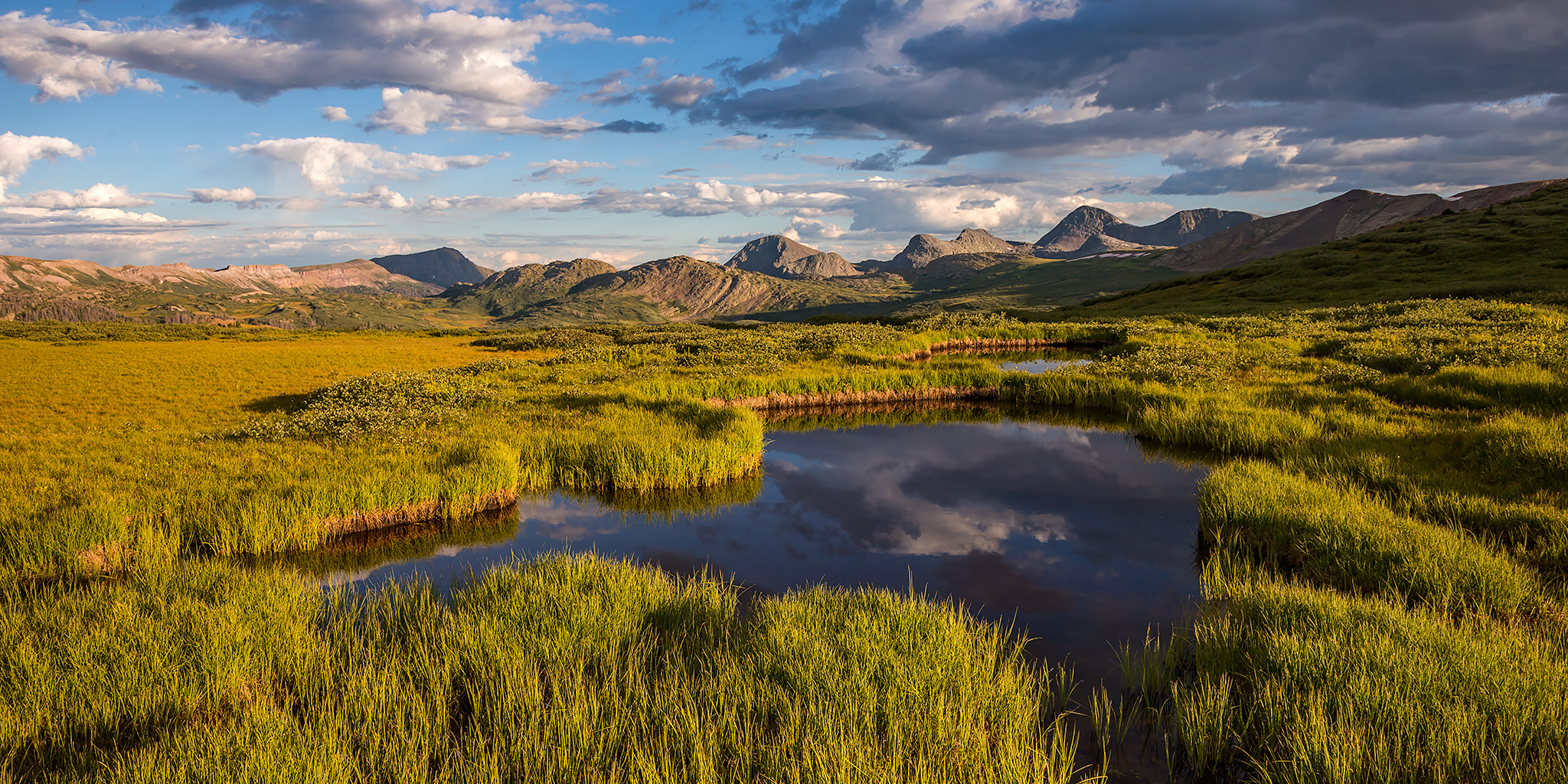
Press "Enter" to skip to content

Tag: wildlife

The Wind Rivers: Cirque of the Towers

Wednesday – Saturday, August 21-24, 2019

After our first backpacking trip into the Wind River Range for The Great American Eclipse two years ago it was time that we finally headed back for a another one. Since we had some pretty good conditions on that last trip (weather and mosquitoes) we planned to go at the same time of the year. Of course, since we had already visited Titcomb Basin and Island Lake on that previous trip, this time I really wanted to check out the Cirque of the Towers. I had originally planned this trip to be a four day loop that would take us past Big Sandy Lake into the Cirque of the Towers and then over Texas Pass to Shadow Lake, but things didn’t quite go as planned and we ended up not completing the loop. It was still an amazing trip and we both really enjoyed our time spent in the Cirque of the Towers!

2 Comments

Grand Basin Traverse: The Basins of Mineral Creek

Black Bear Pass to Columbine Lake
Saturday, August 17, 2019

This weekend I decided to skip the peak bagging for a minute and just wanted to go on a nice hike in the high country through the upper basins of Mineral Creek near Silverton. I have wanted to hike to the turquoise blue waters of Columbine Lake for a long time but I didn’t really want to follow the steep trail that everyone else does, so I decided that I would drive up to Black Bear Pass and then hike over to the lake by passing through a couple different high alpine basins and maybe stop at a couple of passes along the way. Now after hiking this route I’ve got to say that it was pretty amazing! One of the nice things about this hike is that it was all above treeline and pretty much stayed between about 12,600 feet and 13,000 feet. There were a lot of ups and downs along the way, but it didn’t feel like I was climbing a steep mountain and the route offered spectacular views in all directions right from the beginning. This Grand Basin Traverse takes you through Mineral Basin, Porphyry Basin, Silver Cloud Basin and Mill Creek Basin on your way to Columbine Lake. Along the way you have the option of climbing up to two different passes for views into Mud Lake Basin and Bridal Veil Basin, plus you will also pass by Porphyry Lake, Bullion King Lake and a number of other small tarns along the way. This is definitely the way to hike to Columbine Lake!

8 Comments

Mount Columbia via Frenchman Creek

Saturday & Sunday, August 10-11, 2019

I had such a nice time in the Sawatch Range a couple of weeks ago when I climbed Mount Yale that I decided to return again this weekend with Diane so we could go on an overnight backpacking trip along Frenchman Creek and climb Mount Columbia (14,073) on Sunday morning. Since we didn’t have a long hike ahead of us, we slept in later on Saturday morning before heading out on our way to the Arkansas River Valley. We stopped at K’s in Buena Vista for lunch and then from there it was a quick drive over to the Frenchman Creek Trailhead at the boundary of the Collegiate Peaks Wilderness. When we arrived I was pretty surprised to find that there were no other vehicles parked there, plus we would not seen anyone else on the trail all weekend. It was a little bit strange, even for a non-standard route on a 14er, especially on a weekend on this side of the mountains, but I’m not complaining!

1 Comment

The Highest Point in Grand County: Mount Waas

La Sal Mountains Peak Bagging | Pilot Mountain, Green Mountain & Mineral Mountain
Friday – Saturday, July 5-6, 2019

After spending the last month on the river it was finally time for me to start getting back into the mountains again! Like last year around this same time, I decided that this would be a good weekend to continue my peak-bagging pursuit in the La Sal Mountains near Moab. Since I’d already climbed the San Juan County High Point a couple years ago, I thought it was about time that I finally got to the summit of the Grand County High Point. Originally, Diane was supposed to come with me on this trip and we were going to spend the full weekend in the area, but at the last minute she decided to take a shift at work on Saturday, so I ended up going by myself. I’m not going to lie, I was very worried about this hike. Since I’ve been on the river every weekend for the last month I felt that I was quite a bit out of shape since I haven’t been hiking much lately. It feels like I haven’t put on my hiking boots in forever; not to mention that I haven’t been up in the high country since late September of last year! I was really concerned that I wasn’t going to make it to the summit this time, but still, I knew that I needed to try…

1 Comment

North Fork of the Gunnison River

Paonia River Park to the Gunnison Forks Recreation Site
Independence Day | Thursday, July 4, 2019

This year for the Fourth of July I was looking to go on one last river trip before I started heading into the mountains for the summer season. Since I only had one day off from work for the holiday I wanted to go somewhere close to home and on a river that was still not running too high, which was hard to find this year! On Wednesday afternoon Jackson, Chris and I decided that we would give the North Fork of the Gunnison River a try from the Paonia River Park to its confluence with the Gunnison River. The North Fork of the Gunnison is formed just below the Paonia Reservoir by the confluence of of Muddy Creek (not that Muddy Creek) and Anthracite Creek, which originates in The Raggeds of the West Elk Mountains. Since we have already floated most of the Gunnison River from Pleasure Park to Whitewater, we thought it would be nice to work our way further up the North Fork and finally check it out.

2 Comments