Press "Enter" to skip to content

Tag: moose

A Smoky Drive Through Grand Teton National Park

Saturday, August 23, 2025

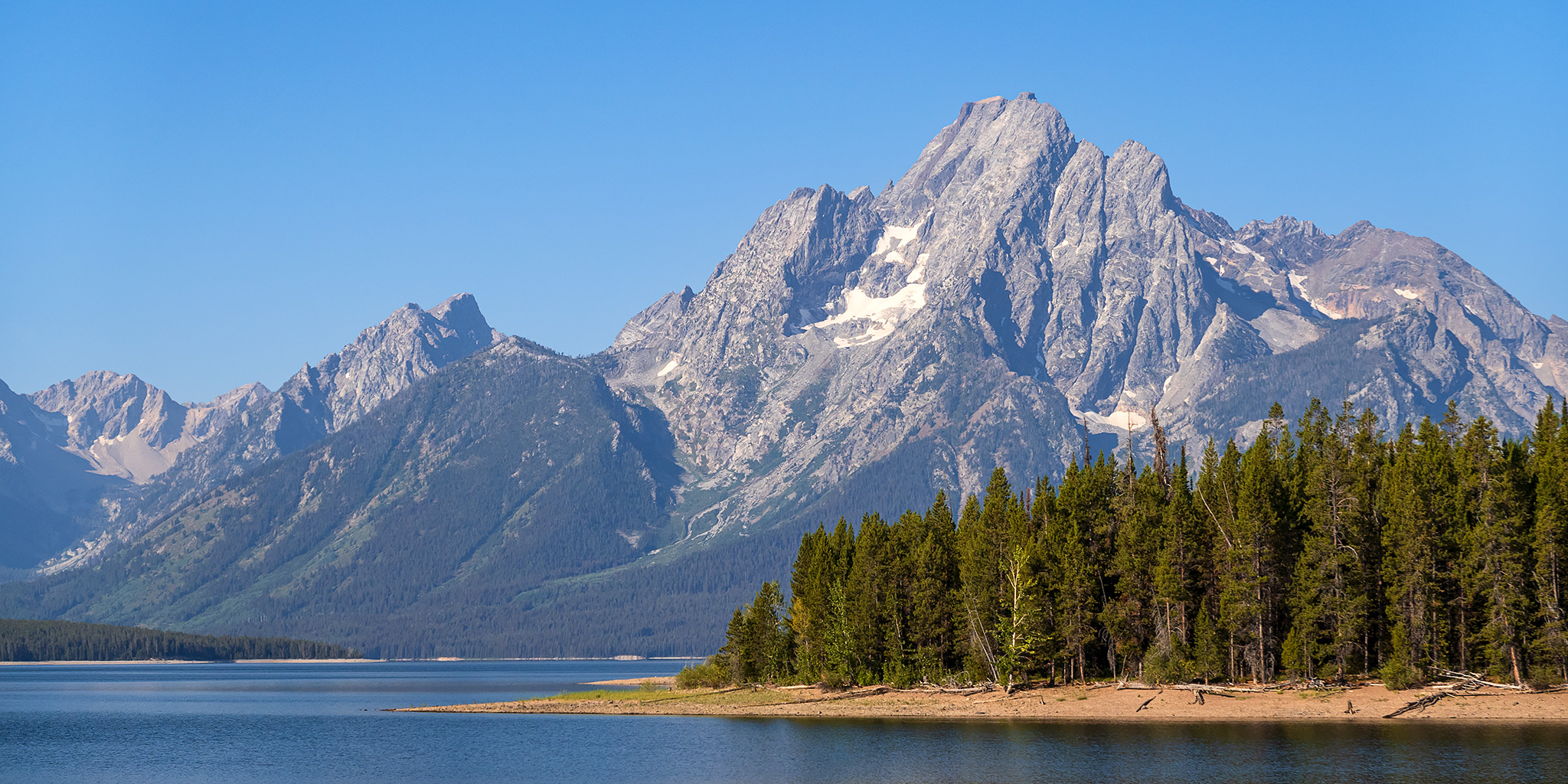
After leaving Yellowstone National Park through it’s South Entrance on Saturday morning it was time to start our drive back home, but since we would be driving through Grand Teton National Park for the first time we decided to spend a few hours in the park stopping at overlooks and viewpoints along the way and even going on a couple of short hikes. Unfortunately, there was still a lot of smoke in the air from wildfires and the hazy light during our late morning and early afternoon visit was pretty terrible, so these are just some snapshots I took during our brief visit to the park. Maybe it’s because we drove through on a Saturday, but I was a bit shocked at how busy this park was! I was expecting Yellowstone to be packed with people, and aside from the popular geyser basins it wasn’t as bad as I envisioned, but Grand Teton was what I was expecting Yellowstone to be like with vehicles lining both side of the roads and overfilled parking lots and trailheads.

1 Comment

Colorado Trail: Carson Saddle & the Continental Divide

Friday – Sunday, September 6-8, 2024

With the mountain season coming to an end in just a few short weeks and a busy schedule for me later this month, I wanted to make sure that I got out for some more hiking above treeline in the high country this weekend before it was too late. I thought a good way to do that would be by hiking part of the Colorado Trail along the Continental Divide in the San Juan Mountains starting from the Carson Saddle above Wager Gulch, so that’s where I headed when I left work on Friday afternoon. I didn’t want to deal with the Middle Bridge over Blue Mesa on US 50, so instead I opted to go over Red Mountain Pass into Silverton and then took the Alpine Loop over Cinnamon Pass to the Lake Fork of the Gunnison River.

Leave a Comment

East Brush Creek: Ironedge Trail & Mystic Island Lake

Holy Cross Wilderness | Friday & Saturday, August 16-17, 2024

Aside from my weekend visit to the Red Table Mountain late last summer, I haven’t spent much time exploring the area at the very northern end of the Sawatch Range, so I decided to stick around after the GIS Colorado Summer Meetup to hike a couple of trails on the west side of the Holy Cross Wilderness, hoping they would be a little less popular than those found on the east side. After the GIS presentations at Sylvan Lake were completed early on Friday afternoon, I drove over Hardscrabble Mountain into Eagle for fuel and snacks and then headed up East Brush Creek and the Hat Creek Road to the Peter Estin Hut, which is one of the popular 10th Mountain Division Huts. From the parking area near the hut I hiked over to the Ironedge Trail and followed it to the ridgeline that makes up the boundary of the Holy Cross Wilderness and then continued up to the Charles Benchmark.

Leave a Comment

Red Castle Lakes via the East Fork of Smiths Fork

High Uintas Wilderness | Thursday – Sunday, August 1-4, 2024

After Diane and I backpacked into Henrys Fork and then hiked to the summit of Kings Peak in the Uinta Mountains back in 2018, we had talked about returning to the High Uintas Wilderness every other year for a new backpacking trip. Unfortunately, we did not keep up with that idea and have not returned since that trip, but this year I was determined to finally get back and planned for us to spend a couple nights near the Red Castle in the East Fork of Smiths Fork, which is a location I have wanted to visit for quite a long time. Although I would have preferred to do this trip much later in August, Diane was pretty busy at that time and the only weekend that work for both of us was the first weekend in August, so that’s when we would have to go. We left from home after Diane got out of work on Thursday evening and drove up to the Red Canyon Campground within the Flaming Gorge National Recreation Area and arrived shortly after dark. We quickly got our tent set up and were in our sleeping bags by 10:00pm.

Leave a Comment

Medicine Bow Peak in the Snowy Range

Wednesday, August 31, 2022

After spending my first night at the Spruce Mountain Fire Lookout Tower I got up extra early on Wednesday morning so I could drive to the nearby Snowy Range and hike to the summit of Medicine Bow Peak, which at 12,013 feet is the highest peak in this small but spectacular subrange of the Medicine Bow Mountains. After leaving the Fire Tower, I dropped down into the Centennial Valley and then followed the Snowy Range Highway, which is also known as the Great Skyroad, up to the Lewis Lake Trailhead near Libby Flats. As I passed through the small town of Albany, I swear I saw a Ringtail Cat cross the road in front of my Jeep, but it was too dark out for me to be 100% certain. I arrived at Lewis Lake just in time to catch the pre-dawn alpenglow and then a beautiful sunrise, but as I was making my way to the shore of the lake I had to give wide berth to a couple of moose that were grazing right near the trailhead.

1 Comment