Press "Enter" to skip to content

Tag: lime creek

Comb Ridge and the Borderlands of the Bears Ears

Borderlands of the Bears Ears Country IV | Saturday – Monday, January 17-19, 2026

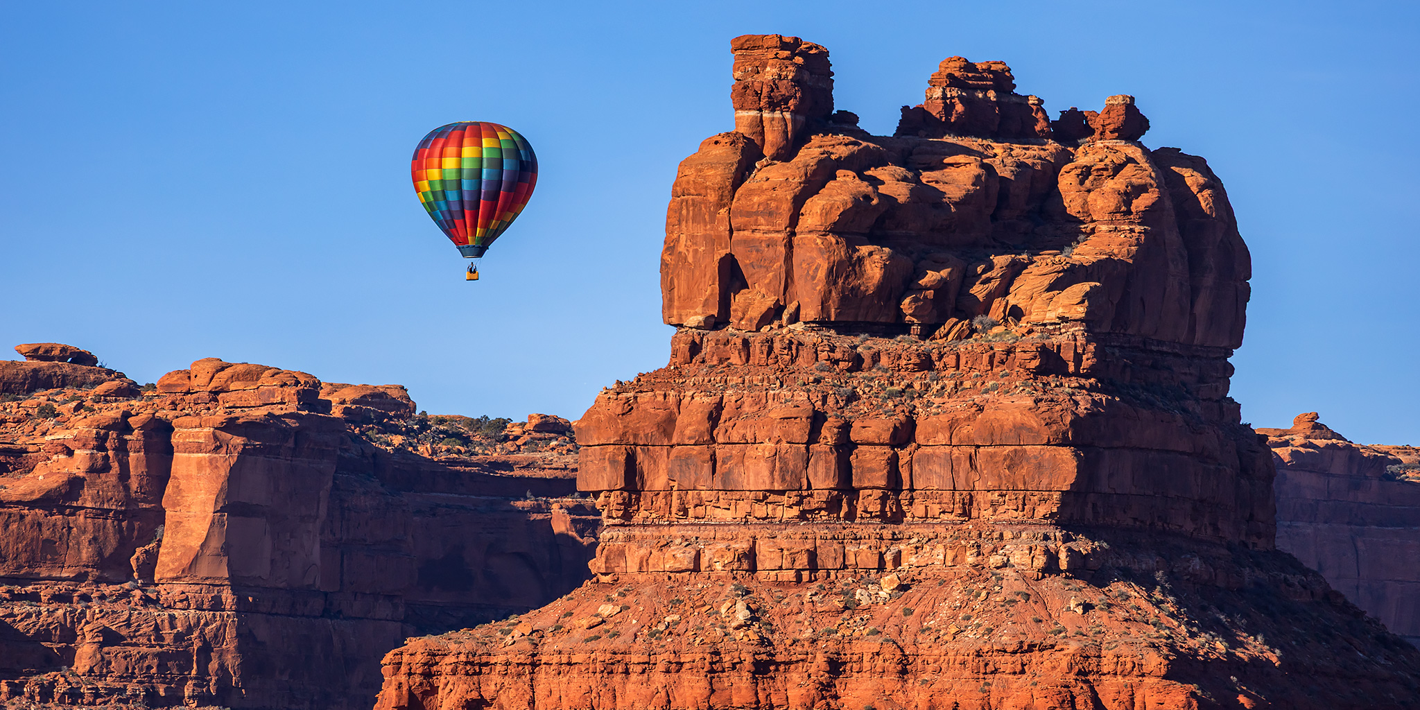
While I was originally hoping to take Diane out to the Pahranagat Valley over this extended holiday weekend, we found ourselves needing to stay closer to home for the time being, but I still wanted to go somewhere where Diane would be able to join me. She has recently started Radiation Therapy and is still not allowed to do much hiking, but after a little bit of thought I figured we could return to Comb Ridge and the surrounding country to go on some shorter and easier hikes in the area. This would also give us the opportunity to return to the Bluff International Balloon Festival since we haven’t been back to the event since 2014, which was shortly after we first started dating and I believe it was also our very first weekend trip away together! These are some photos of what we saw this weekend.

6 Comments

San Juan River: Sand Island to Mexican Hat

Thursday – Sunday, September 18-21, 2025 | High CFS: 622 – Low CFS: 524

Although I certainly enjoy the early season spring-runoff river trips of summer, I think my favorite time to get out onto a desert river is during low-water at the end of the season in September. I guess I just enjoy the cooler temperatures, relaxing pace, minimal bugs and sandy campsites that are common at this time of the year. So when I realized earlier in the year that I had not been back on the San Juan River since 2019, I knew I wanted to get back on it during September since all of our previous trips have been in May and June. Jackson was also interested in a late season trip and managed to get us a permit for three days on the stretch from Sand Island to Mexican Hat. We were all set to finally float the San Juan River in September and I was looking forward to my final river trip of 2025!

Leave a Comment

Red Table Mountain: Crooked Creek to Mount Thomas

Around the Red Table: Crooked Creek Pass & Cottonwood Pass
Friday – Sunday, September 15-17, 2023

This weekend I headed out to the very northern end of the Sawatch Range so I could drive around and explore Red Table Mountain, which is located just west of the Holy Cross Wilderness between Gypsum, Eagle and Thomasville. I left from work on Friday afternoon, stopped in Rifle for gas and a bite to eat, and then continued on through the Roaring Fork Valley to Basalt where I turned off and followed the Fryingpan River to Lime Creek. Although I had driven through a couple heavy rain storms along the way, I found the beginning of the Crooked Creek Pass Road to be in good condition when wet, but that quickly changed as I drove higher and found some very slick conditions. After sliding off the road into the ditch twice, and thankfully not off the other side of the road, I found a small level spot to pull over and spend the night at. I had had enough of the slick and slippery road and felt it was too sketchy to continue driving up to the pass or turning around and heading down, so I was hoping that the road would dry out a bit overnight.

1 Comment

Coal Bank Pass: Spud Lake Trail & Pass Trail

Wednesday & Thursday, July 26-27, 2023

While spending the latter part of this week attending the annual GIS Colorado Summer Meetup at the Chris Park Campground near Durango, I was able to get out on a couple of short hikes near Coal Bank Pass since I was in the area. On Wednesday afternoon I left work, grabbed a quick dinner in Delta and then headed down through the San Juan Mountains to the campground via the San Juan Skyway. After crossing over Red Mountain Pass and getting stopped by construction for a little while, I continued over Molas Pass and Coal Bank Pass and then turned off onto the old Lime Creek Road so I could go on a short hike to Potato Lake via the Spud Lake Trail.

Leave a Comment

Cedar Mesa Chronicles: Chapter 3

Thursday – Sunday, March 25-28, 2021

This weekend Jerry and I were planning to go on a three-day backpacking trip in Capitol Reef National Park, but as the weekend got closer the weather forecast was not looking good. The forecast was calling for much cooler temperatures with rain and snow which would not have been good for the narrow water-filled canyon we wanted to hike, so it looked like we would be changing our plans. Instead, we decided to head further south to Comb Ridge and Cedar Mesa since we knew we would be able to work around the weather there no matter what it did. I left after work on Friday afternoon and headed south to meet up with Jerry. After getting stuck in traffic for a while just before entering Moab, I drove through some pretty strong winds with snow from about Monticello to Blanding. I met Jerry at the Butler Wash Ruins just after sunset and we decided to camp along Comb Wash, just in case there was a lot of precipitation overnight and the roads got muddy. As predicted, there was more rain and snow overnight so on Friday we stuck to the lower elevations and did a little hiking on Comb Ridge. Later in the day things had started to dry out so we headed up onto Cedar Mesa for the rest of the weekend. Here are some photos from our weekend spent below the Bears Ears.

7 Comments