Press "Enter" to skip to content

Category: Jeeping

Rock Art Along the Old Trappers’ Trail

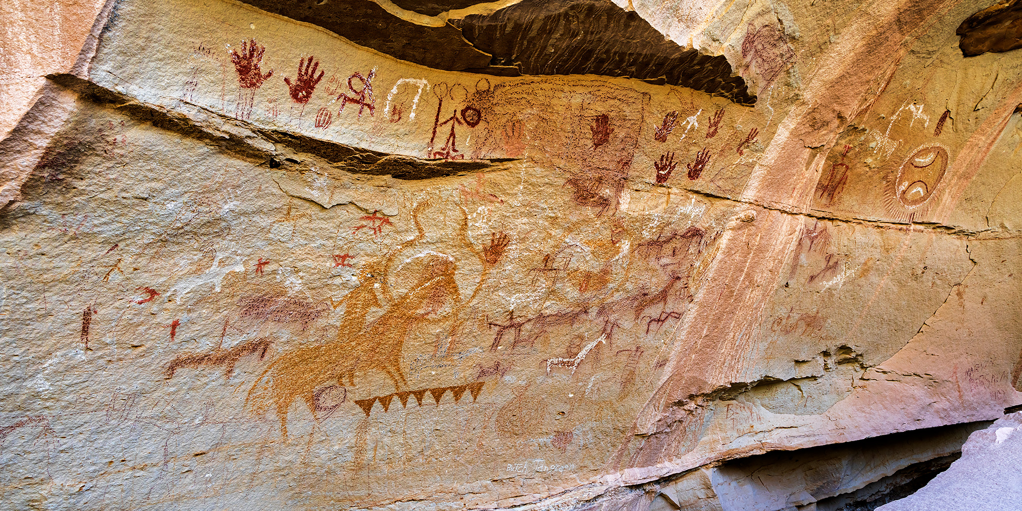
Book Cliffs Rock Art VIII | Friday, August 30, 2024

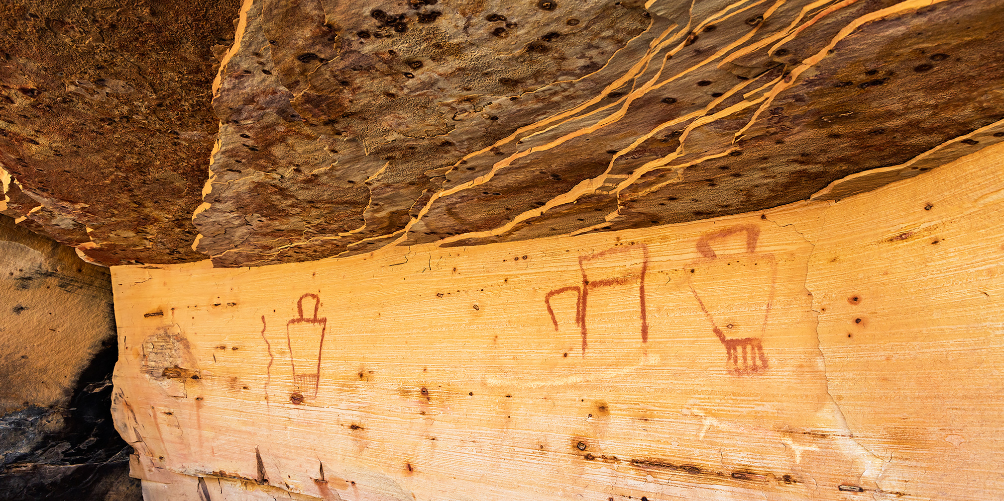
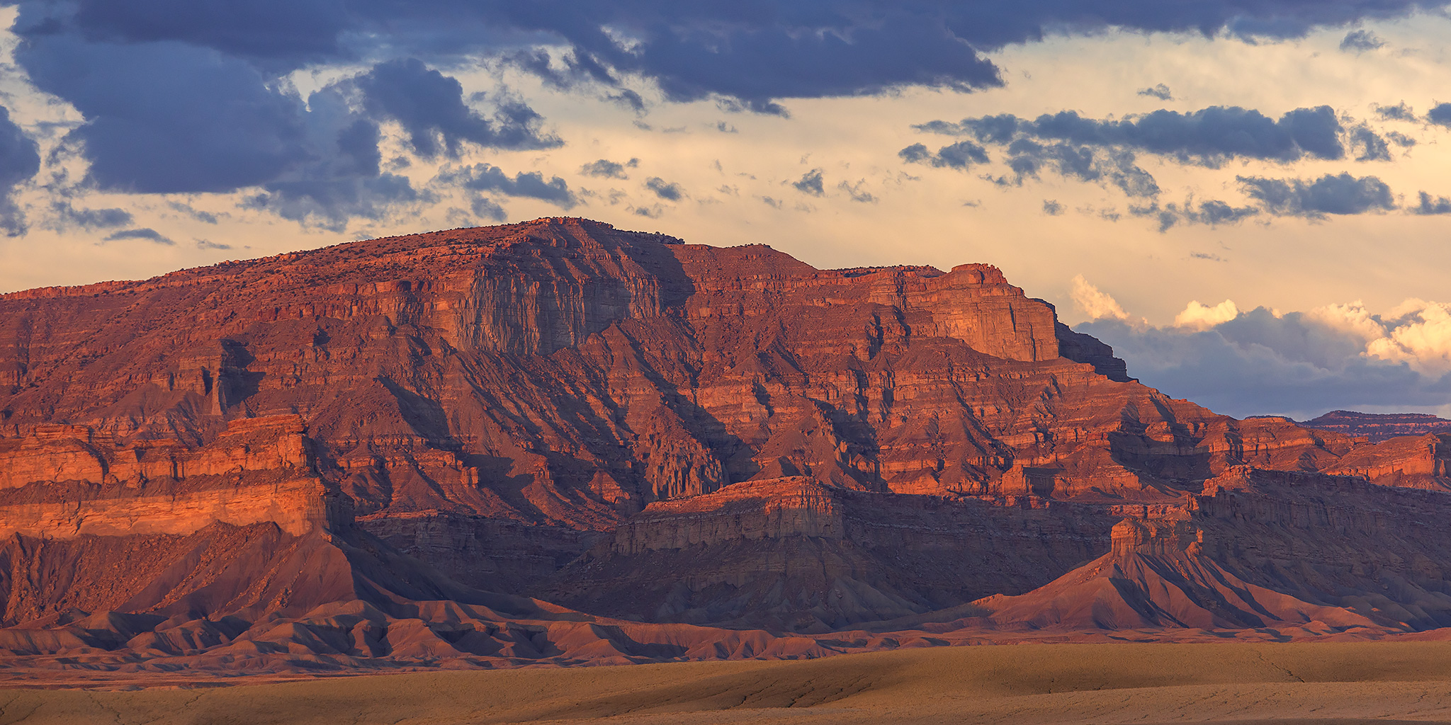
After spending most of Monday hiking with a friend in the San Rafael Swell, we met up again on Friday morning in the Book Cliffs so we could spend a few hours visiting rock art sites along the Old Trappers’ Trail, which was a historic route in eastern Utah that travelled through the Book Cliffs to the Uinta Basin. While much of this rock art is located on private property and some of it is visible from the public road, my friend had secured us permission from the ranch to access their property so we could get a closer look at these images. After viewing and photographing the rock art in this area for most of the monrning, I returned to the Interstate and continued west to Green River where I grabbed lunch at Ray’s and then headed out to spend the rest of the weekend exploring the High Plateaus of Utah. Here are some photos from my morning along the Old Trappers’ Trail.

Leave a Comment

Rock Art of the San Rafael Swell XVIII

Monday, August 26, 2024

After my plans were washed out in the Book Cliffs on Sunday, I met up again with my friend in the San Rafael Swell on Monday morning so we could spend most of the day visiting and searching for some rock art sites. The storms that had been prevalent the previous week had all cleared up overnight and the weather forecast was looking very dry for the foreseeable future so we didn’t have to worry about any of that today, although it was now a bit hazy or smoky out. Many of the roads we drove throughout the day were in rough shape from all the recent rain, but thankfully they were all dry and we had no troubles getting around in my Jeep. Even though we didn’t find everything we were looking for today, we still had a nice time sauntering around the Swell and now I’m really looking forward to getting back out into the desert more often starting in just a few more weeks!

1 Comment

Rock Art of the Book Cliffs VII

Sunday, August 25, 2024

After spending Saturday morning on the Colorado River in Glenwood Canyon, I left home early on Sunday so I could meet up with a friend in Green River later in the afternoon. Since I had plenty of time before we were supposed to meet I thought it would be a good idea to spend the morning searching for new rock art sites in the Book Cliffs as I slowly made my way to Green River. Unfortunately, the weather would not cooperate with those plans today thanks to the stormy weather we’ve been experiencing lately and just as soon as I neared the edge of the Book Cliffs it started to rain pretty hard which made the roads I wanted to drive slick and muddy, so I had to turn around and find some better roads. I did my best to get around in the wet conditions, but I ended up spending most of the day just revisiting sites I haven’t been to in a while. I guess I’ll have to come back to search out the new sites when it’s a bit drier out.

2 Comments

East Brush Creek: Ironedge Trail & Mystic Island Lake

Holy Cross Wilderness | Friday & Saturday, August 16-17, 2024

Aside from my weekend visit to the Red Table Mountain late last summer, I haven’t spent much time exploring the area at the very northern end of the Sawatch Range, so I decided to stick around after the GIS Colorado Summer Meetup to hike a couple of trails on the west side of the Holy Cross Wilderness, hoping they would be a little less popular than those found on the east side. After the GIS presentations at Sylvan Lake were completed early on Friday afternoon, I drove over Hardscrabble Mountain into Eagle for fuel and snacks and then headed up East Brush Creek and the Hat Creek Road to the Peter Estin Hut, which is one of the popular 10th Mountain Division Huts. From the parking area near the hut I hiked over to the Ironedge Trail and followed it to the ridgeline that makes up the boundary of the Holy Cross Wilderness and then continued up to the Charles Benchmark.

Leave a Comment

Sylvan Lake: Hardscrabble Mountain to Fulford Cave

Wednesday – Friday, August 14-16, 2024

This week I left after work on Wednesday afternoon and headed east on I-70 towards Eagle so I could spend Thursday and Friday attending the annual GIS Colorado Summer Meetup, which was being held at the Sylvan Lake State Park campground this year. I exited from the interstate at Gypsum and followed the road along Gypsum Creek around Hardscrabble Mountain below the edge of the Red Table Mountain as I hoped to take the backroads to Sylvan Lake, but when I was only a few miles away I ran into wet roads that were slick with mud and had to turn back and go around the long way through Eagle. I haven’t had good luck with the slick muddy roads in this area in the past, so I didn’t want to take any chances! Here are some photos from a few days spent at the Elk Run Campground next to Sylvan Lake.

Leave a Comment