Friday – Sunday, September 6-8, 2024
With the mountain season coming to an end in just a few short weeks and a busy schedule for me later this month, I wanted to make sure that I got out for some more hiking above treeline in the high country this weekend before it was too late. I thought a good way to do that would be by hiking part of the Colorado Trail along the Continental Divide in the San Juan Mountains starting from the Carson Saddle above Wager Gulch, so that’s where I headed when I left work on Friday afternoon. I didn’t want to deal with the Middle Bridge over Blue Mesa on US 50, so instead I opted to go over Red Mountain Pass into Silverton and then took the Alpine Loop over Cinnamon Pass to the Lake Fork of the Gunnison River.
As soon as I left Silverton the sky opened up and I was bombarded with rain and graupel for a couple of minutes, so I pulled over under a tree and took this short video clip.
When the precipitation had just about stopped, a little light snuck through a hole in the clouds and lit up the mountains behind me.

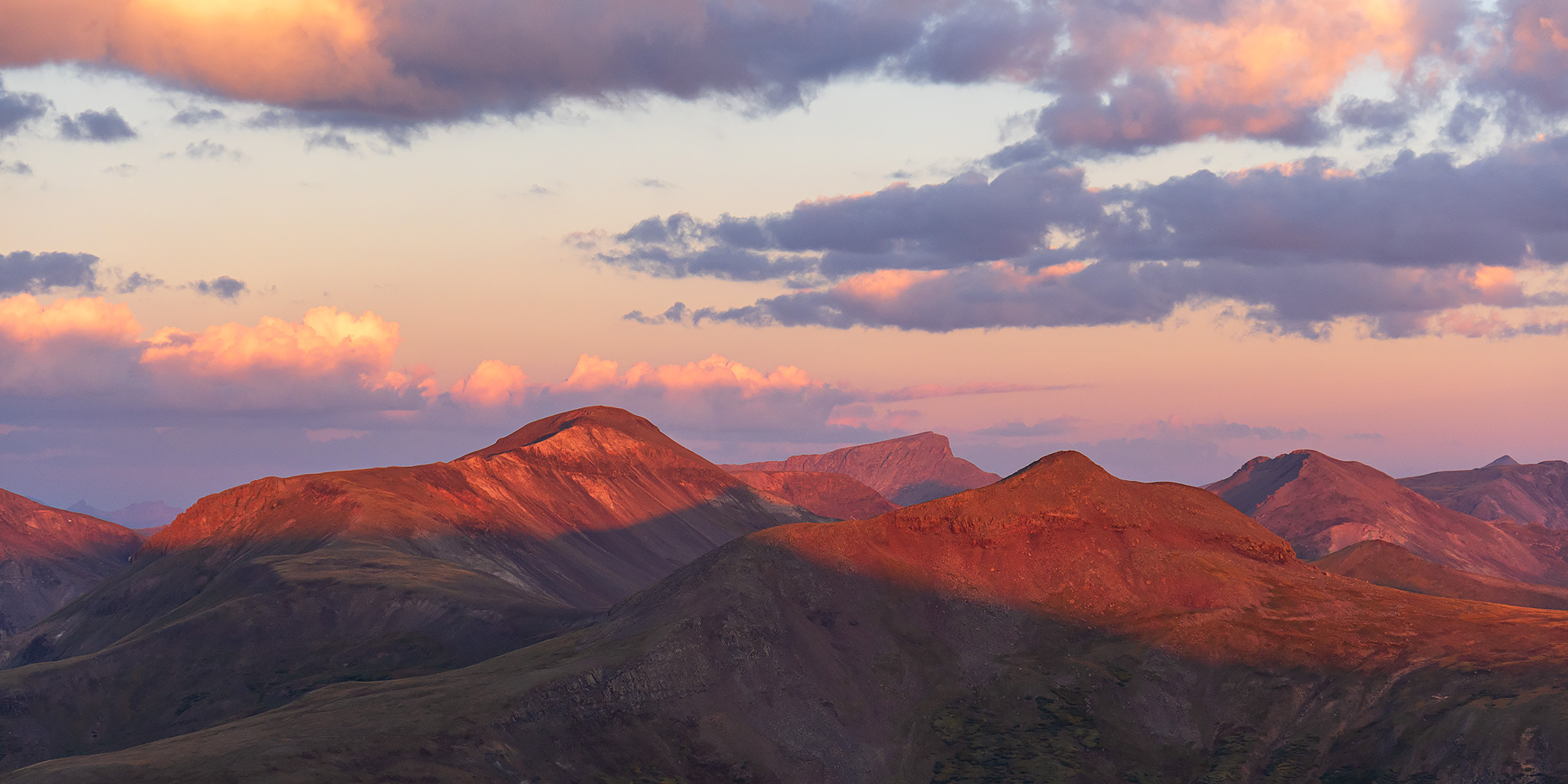
The road up to Cinnamon Pass was a bit rougher than the last time I drove it, but that seems to be common for all the roads around these parts.

While I was up at Cinnamon Pass some more light broke free of the clouds and began to illuminate Whitecross Mountain.

There was nice light in this unnamed basin just below Cinnamon Pass as I started down the other side.

A view from the road towards the Lake Fork of the Gunnison River and Burrows Park.

There was a nice view of Handies Peak along the way, too.

Driving through Burrows Park with Sundog and Redcloud Peak towering above.

I saw a number of these juvenile Red-Tailed Hawks along the road this evening, but this one didn’t seem to be bothered by my presence as I drove by.

After racing the last faint light of the day up Wager Gulch I made it to the ghost town of Carson and found a place to camp down the road a short distance. Unfortunately, there are now No Trespassing signs posted all over Carson, probably because it sold for just under $1 million last year.

I watched the color disappear from the clouds and then went to bed after dark.

On Saturday morning I was up about an hour before sunrise and drove up to the Carson Saddle to watch the sunrise and then start hiking west on the Colorado Trail / Continental Divide Trail through Lost Trail Creek. The sky was clear and there appeared to be smoke in the air from wildfires, so conditions weren’t the greatest for photos.
Overlooking the Lost Trail Creek drainage.


PT 13581 catching the morning light.

It was a beautiful morning for a hike on the Colorado Trail.


I followed the Colorado Trail to the pass between Lost Trail Creek and Pole Creek.

These tall rocky spires were just above the trail.

There was even a small arch next to the trail, and I was able to catch a sunburst!

Overlooking Pole Creek as I left the trail at the pass and headed to the summit of Tundra Top.

From the ridge I had a great view over Cataract Lake.

Although it was a bit smoky and hazy out, I enjoyed the view down Cataract Gulch to the peaks of the Uncompahgre Wilderness on the horizon.

There was a great view of Half Peak on the other side of Cataract Gulch.

I continued up the ridge to the top of Tundra Top.

The summit of Tundra Top (13,453) was a large flat expanse of alpine tundra, so it’s an apt name.

I walked over to the northern edge of the summit for a view across to Cataract Peak.

After returning to my Jeep the same way I had come, I went for a little drive on the roads up at the Carson Saddle and had a great view of Redcloud Peak and Sunshine Peak across the valley.

I was scouting a starting point for my planned Sunday morning hike when I came across this cool Continental Divide Trail post.

Bent Peak & Carson Peak

As I drove back down into Wager Gulch I passed this moose near the road that didn’t seem to care that I was there.

When I reached the Alpine Loop at the bottom of Wager Gulch I headed into Lake City for an early dinner and then followed the Silver Thread Scenic Byway over Spring Creek Pass into the watershed of the Rio Grande where I spent the rest of the afternoon exploring some of the roads in the area while there were on and off rain and thunderstorms.
Later in the evening I returned to the same campsite in Wager Gulch just in time to catch the sunset. It had been mostly cloudy all evening, but a little light managed to sneak through at the tail end of sunset.

Wager Gulch Sunset


I was up early again on Sunday morning and drove back up to the Carson Saddle in the dark. I returned to the Colorado Trail and this time headed east to the summit of the Coney Benchmark as I watched the sunrise.
It was a beautiful morning along the Continental Divide.

I hadn’t been hiking for very long when the sun came over the Continental Divide.

There was a hazy but colorful view over to Bristol Head on the Rio Grande side of the divide.


Just another lovely morning in the San Juan Mountains.

I noticed there was one mountain off in the distance that was covered with snow or ice. I guess it must have been from a pretty localized storm the previous evening.

Handies Peak at Sunrise

I continued up the ridge toward the Coney Benchmark.

Coney Benchmark Summit (13,339)

Coney, 1964

From the northeastern edge of the Coney Benchmark summit I had an outstanding view over the Continental Divide with the Colorado Trail visible below. I love hiking above treeline at this time of the year when the alpine tundra is changing colors.

I followed a faint trail down the ridge and joined back up with the Colorado Trail as I made my way to the next highpoint along the divide.

Rio Grande Layers

I followed the trail around the top of the Kitty Creek basin.

Continental Divide Trail

It wasn’t long until I reached the summit of PT 13260.

After leaving the summit of PT 13260 I followed the southeast ridge back down to the Colorado Trail and then looped back to my Jeep.

There was a hazy view of Lake San Cristobal as I followed the ridge back down to the trail.

On my way back I did get to hike over the highest point along the entire Colorado Trail.

From the highpoint of the trail it was just a short walk back down to my Jeep.
