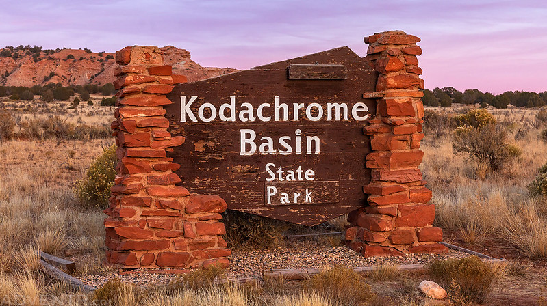
Veterans Day Weekend at Kodachrome Basin State Park
Thursday – Sunday, November 9-12, 2023
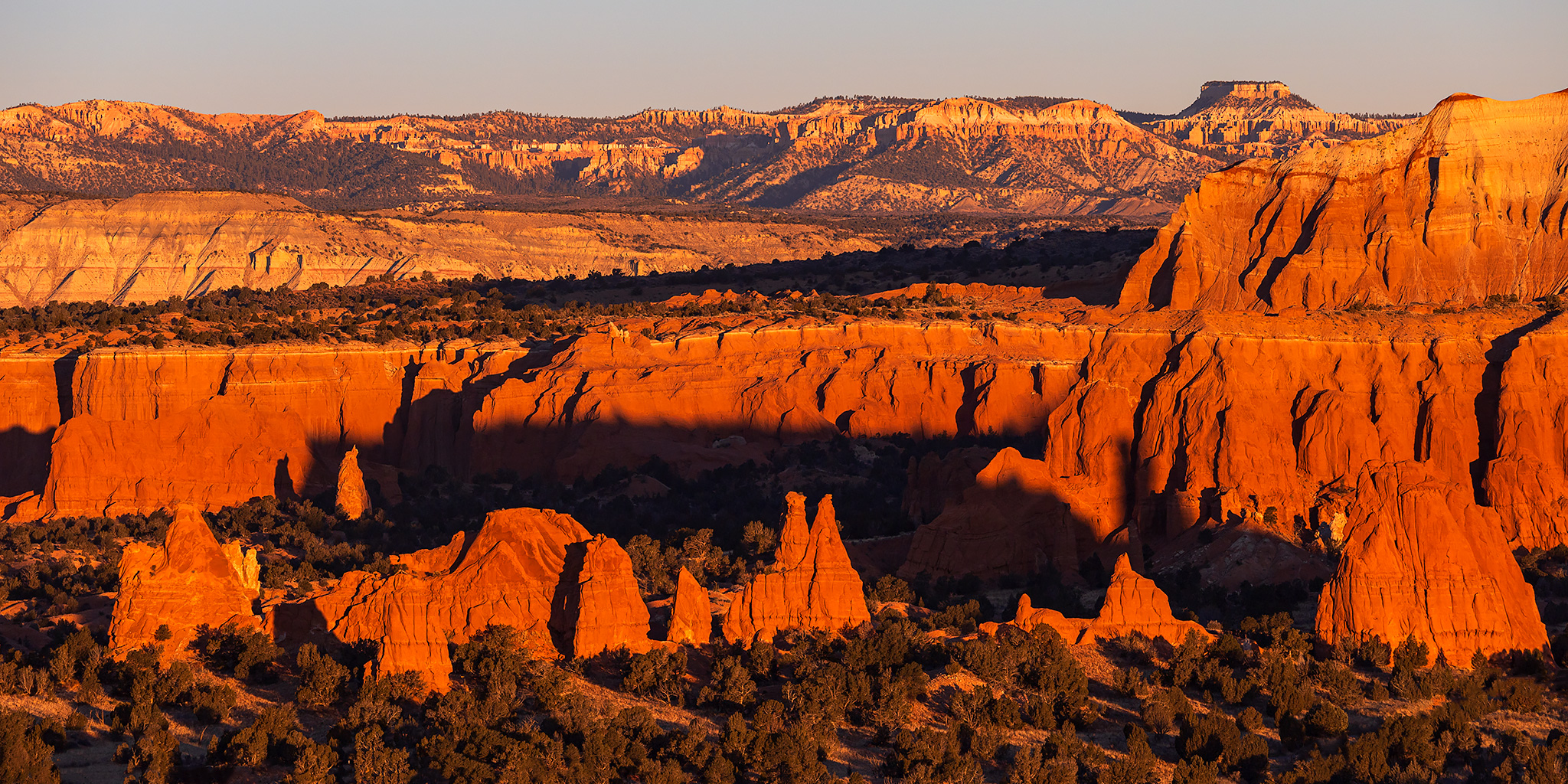
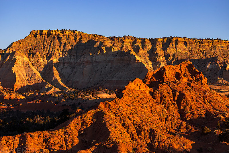
It was a beautiful and fantastic country. A mile to the left near the base of the cliff I could see red pinnacles thrust up from the valley floor. The few natives who had been here called this area ‘Thorny Pasture,’ but we renamed it ‘Kodachrome Flat’ because of the astonishing variety of contrasting colors in the formations. Huge rocks, towers, pinnacles, fins and fans surrounded us. Everywhere the results of erosion could be seen in all stages.
– Jack Breed, Motoring into Escalante Land, September 1949
Kodachrome Basin State Park is a relatively small park located in Southern Utah that is nestled into the rugged canyon country between the White Cliffs and the Pink Cliffs of the Grand Staircase and is best known for the sixty-seven towering sand pipes that dominate the desert landscape. These sedimentary pipes are believed to be found nowhere else on earth and while there are several theories that have been proposed to try to explain their formation, geologists are still unsure of the exact origin of these unusual sand spires. Over the years I have driven right past the entrance to Kodachrome Basin on numerous occasions as I have driven down the Cottonwood Road while exploring the Grand – Staircase Escalate National Monument, which practically surrounds this small reserve, and in all that time I have never stopped to check it out. This holiday weekend I finally planned to change all that by spending some quality time hiking and exploring the interesting landscape of Kodachrome Flat.
Although I had booked a bunkhouse at the park for two nights many months ago hoping that Diane would be able to join me on this trip, she unfortunately ended up having to work all weekend so I would be on my own again this time. As usual, I left from work on Thursday afternoon, drove across the San Rafael Swell and then weaved my way through the High Plateaus of Utah until I reached Tropic later in the evening. I topped off my gas tank and then followed the Paria River to Skutumpah Road and found a campsite for the first night. I got right into my sleeping bag and fell asleep pretty quickly.
On Friday morning I was up before sunrise, finished the short drive into the park and then started hiking the Panorama Loop Trail at dawn.

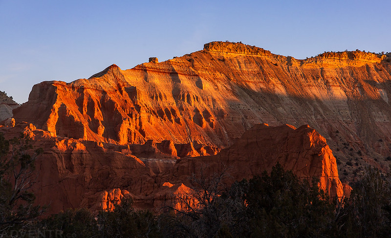
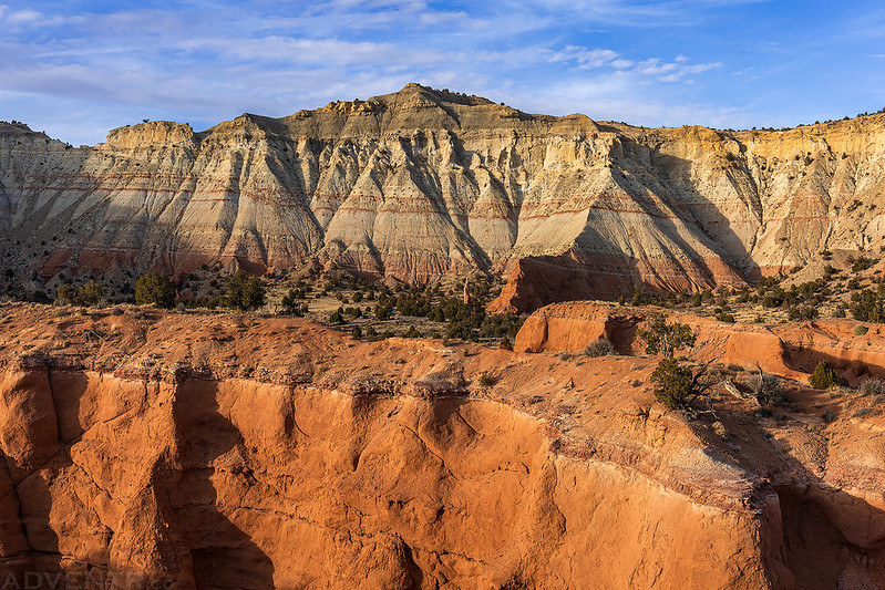
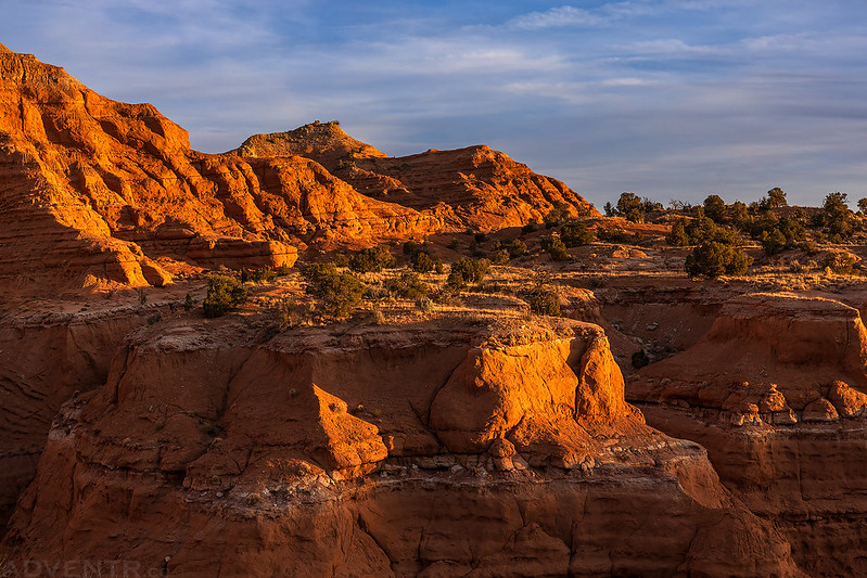
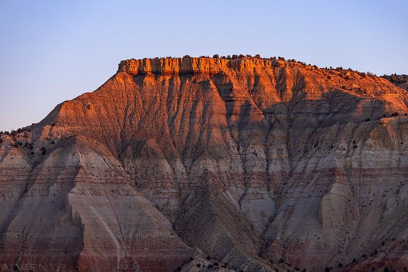
I caught the sunrise on the surrounding hills as I made my way to the top of Panorama Point.
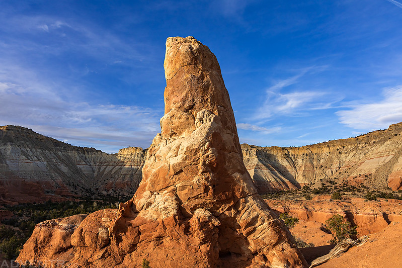
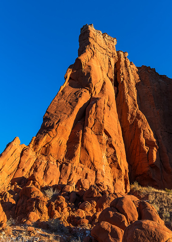
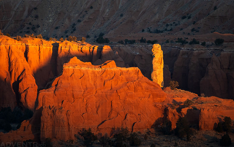
I passed by this nice sandstone chimney near the trail just as the first warm light of the day struck it.
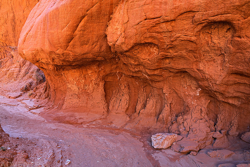
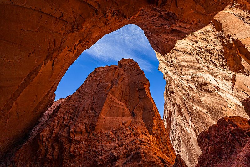
After taking in the views from Panorama Point, I continued on to the Cool Cave Loop and entered the Cool Cave.
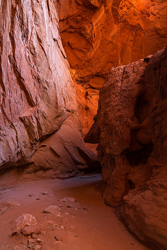
The light was pretty nice inside the Cool Cave at this time.
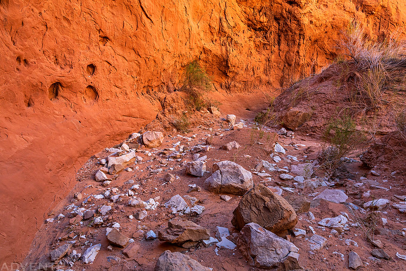
After returning to the Panorama Trail I explored the short loop through the Secret Passage.

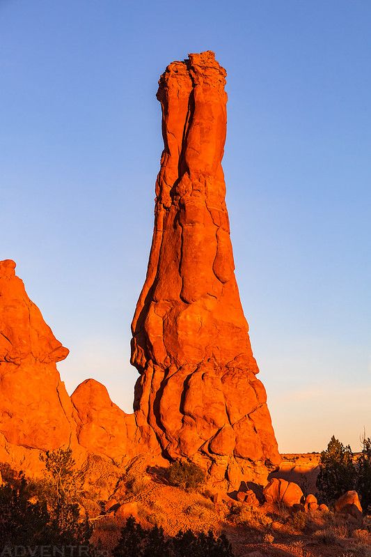
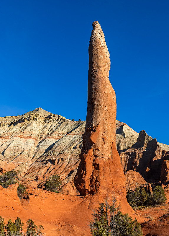
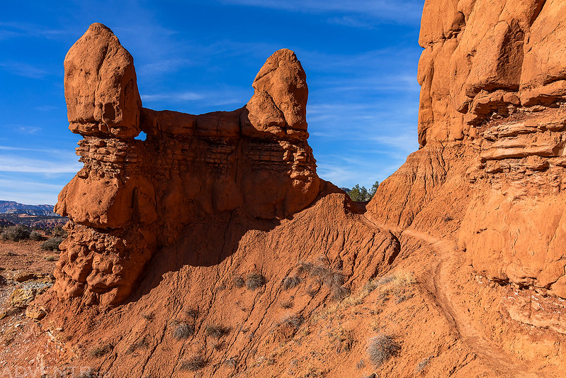
Then after passing by the Hat Shop I stopped to admire the Ballerina Spire.
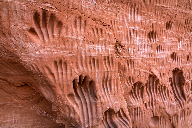
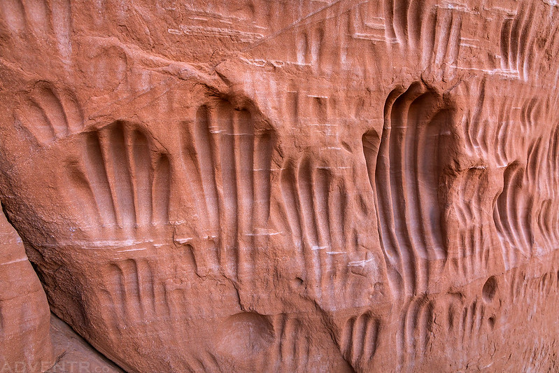
My final stop along the Panorama Loop this morning was at Indian Cave. Now, I’m not sure if these hand-grooves in the sandstone are actually authentic or just created by visitors to the park over the years (my gut says it’s the latter, especially since it appears the park has removed this location from recent maps), but if they are authentic this would be the second time this year I have seen something like this.
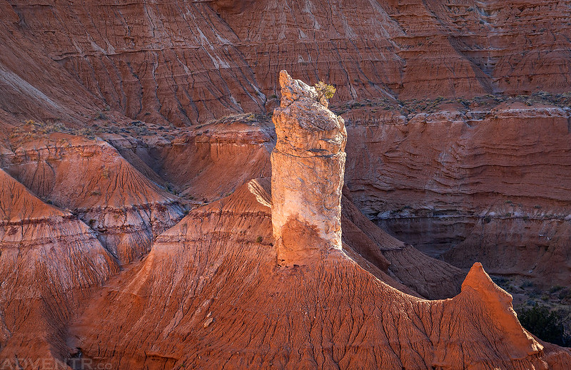
After finishing up the Panorama Loop quicker than I had anticipated and then going for a short walk on the Nature Trail, I followed the Angel’s Palace Loop to an overlook of this sand spire.
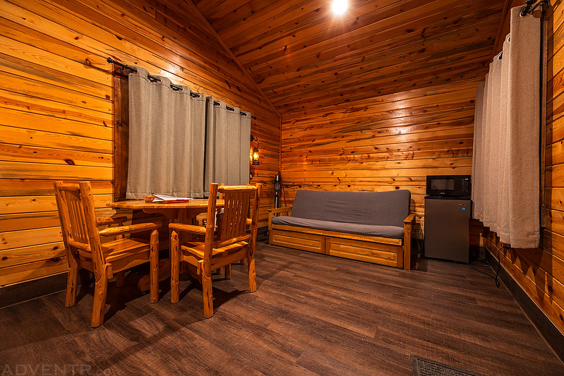
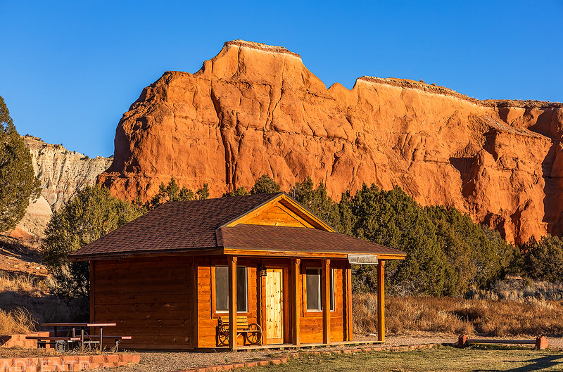
Next up, I got settled into the Paria Bunkhouse, my home for the next two nights, and then hiked the Grand Parade Trail which passed pretty much right next to it.
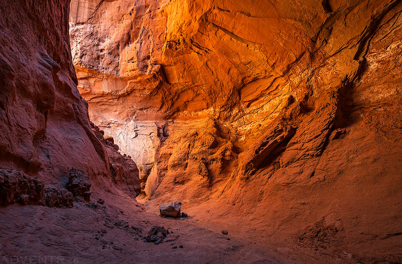
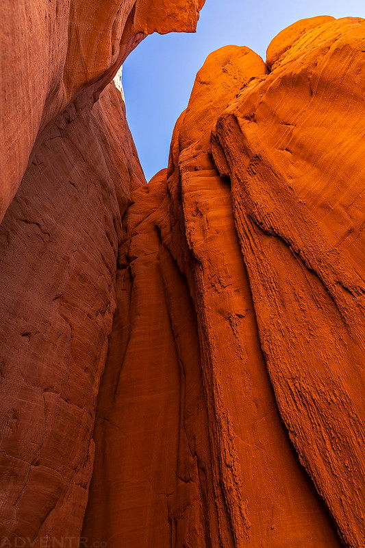
Looking straight up in this short but tall little slot in the canyon wall reminded me of similar features at Cathedral Gorge State Park in Nevada.
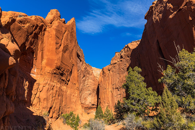
Two spurs left the main loop trail and headed up short box canyons where the light was much nicer.
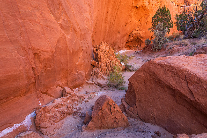

At the end of the first box canyon.
Before the trail looped around back past my bunkhouse, it passed right next to this sand pipe.
Later in the afternoon I returned again to the Angel’s Palace Trail for the second time today to watch the sunset.
Angel’s Palace Thumb
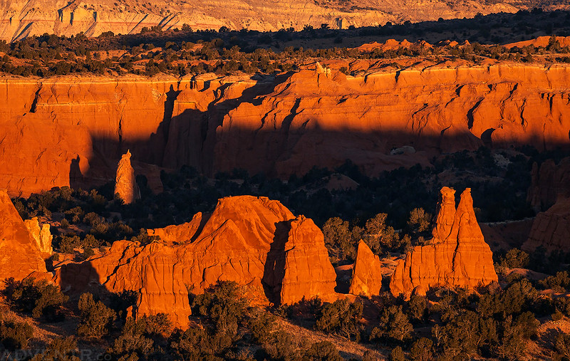
Although the light and sky wasn’t the best for photos most of the time, a little light did get through shortly before sunset and lit up the landscape nicely.
Angel’s Palace Sunset
Once the sun was down I returned to the Paria Bunkhouse for the rest of the night.
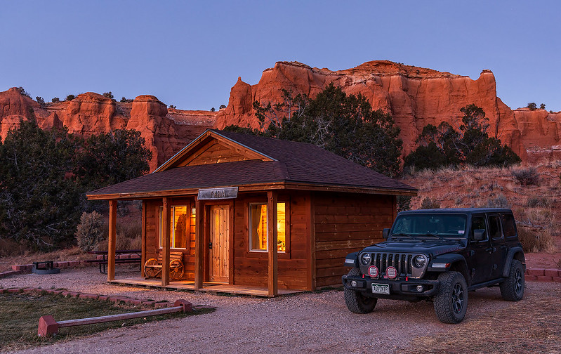
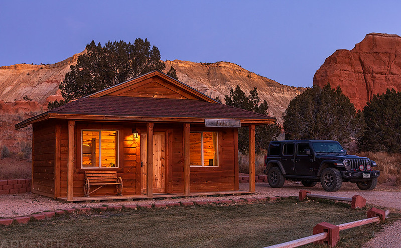
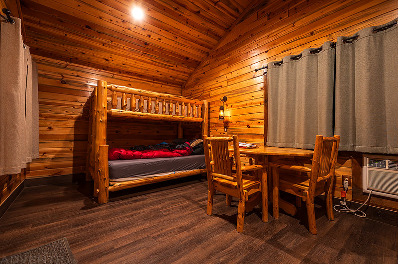
It was a pretty nice place to spend two nights inside the park.
On Saturday morning I was up early again and back on the Panorama Trail before sunrise. While I was hiking that loop the previous morning I had come across a junction with a trail called the Shepherd’s Loop that had not been on any of the maps I used to plan the trip, so I came back this morning to hike that loop. Combined with the Panorama Loop and Cool Cave Loop, it would make a 9+ mile loop into more remote backcountry that would have much more elevation gain and loss along the way than all the other easier trails in the park.
Fred Flintstone Spire
Another morning view from along the Panorama Trail.
I passed by this unnamed spire as I made a short detour over to the Mammoth Spire Overlook that I had also bypassed the previous day.
Hiking around the point on the Cool Cave Trail.
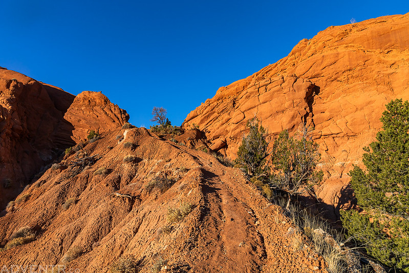
After some initial ups and downs, the Shepherd’s Loop Trail climbed steeply up the ridge to this pass.
An interesting hoodoo found along the Shepherd’s Loop Trail.

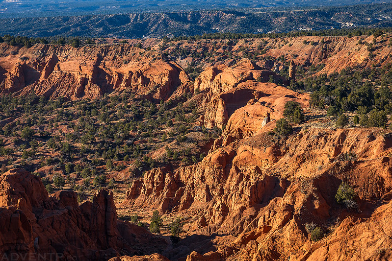
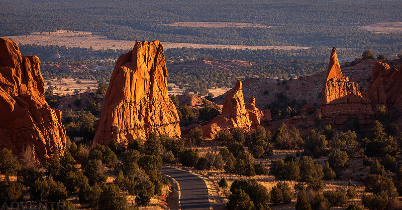
After following the rim of the mesa for a while with views of Powell Point and the Pink Cliffs, the route would drop down a steep and loose trail to connect back up with the Cool Cave Loop. There’s also an option of rappelling into the Cool Cave, if that’s something you are interested in.
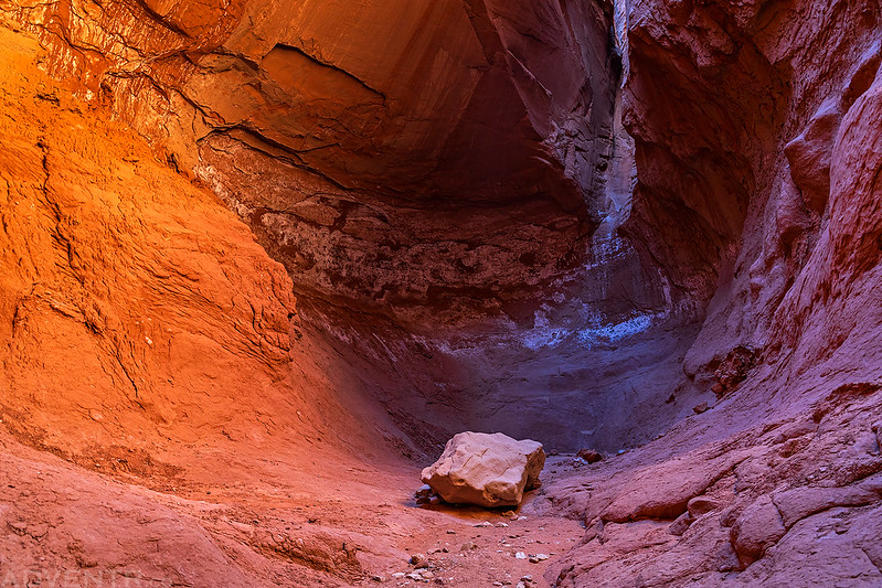
Since I was passing right by, I stopped to visit the Cool Cave again.
Cool Cave Alcove

Looking up in the Cool Cave.
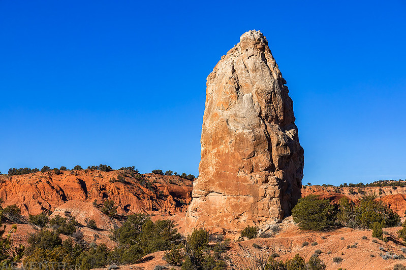
On the way back to the trailhead I passed by the Mammoth Spire.
Mammoth Spire
Since I was planning to hike all the trails in the park during this visit, I had hoped to hike to the top of the Eagle’s View Trail which I think would have offered a very nice view over the entire park, but unfortunately I had learned the previous day that the trail was closed, and it appears that it’s been indefinitely closed since at least 2010.
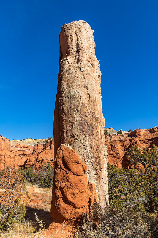
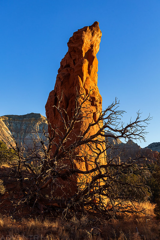
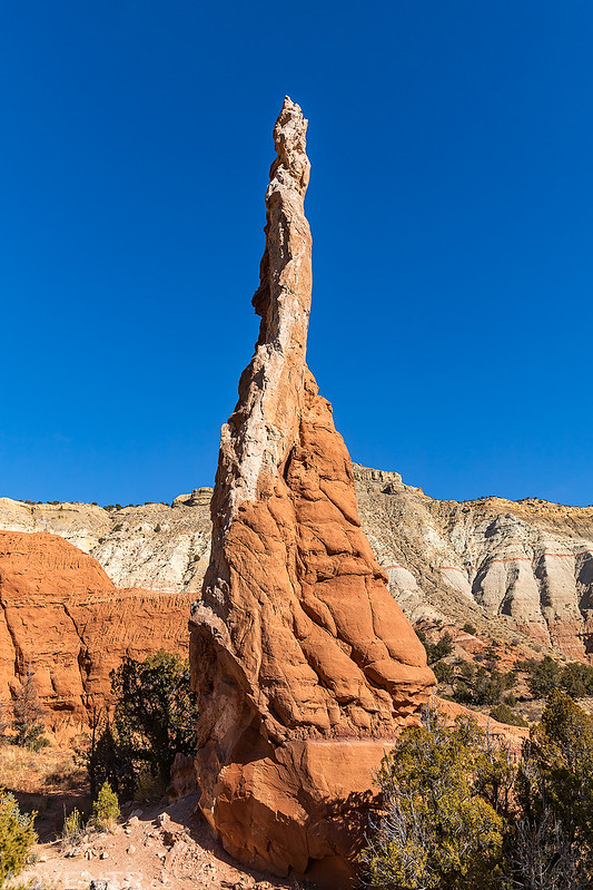
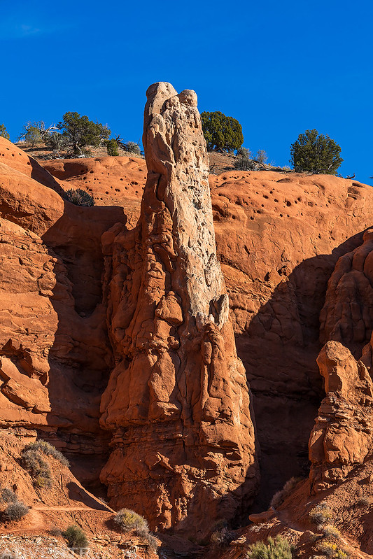
This slender spire is located near the trailhead for the Eagle’s View Trail.
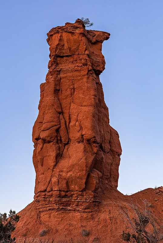
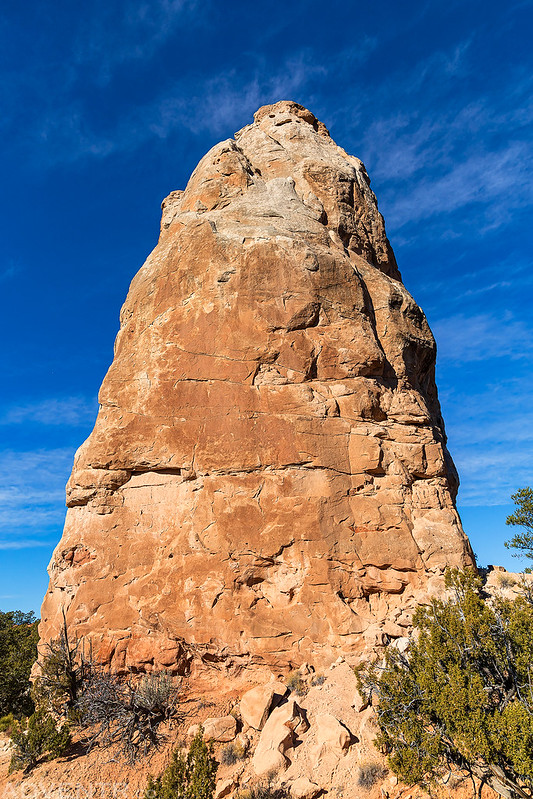
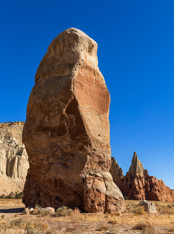
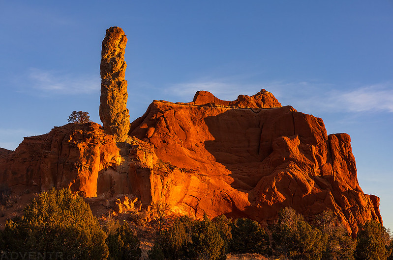
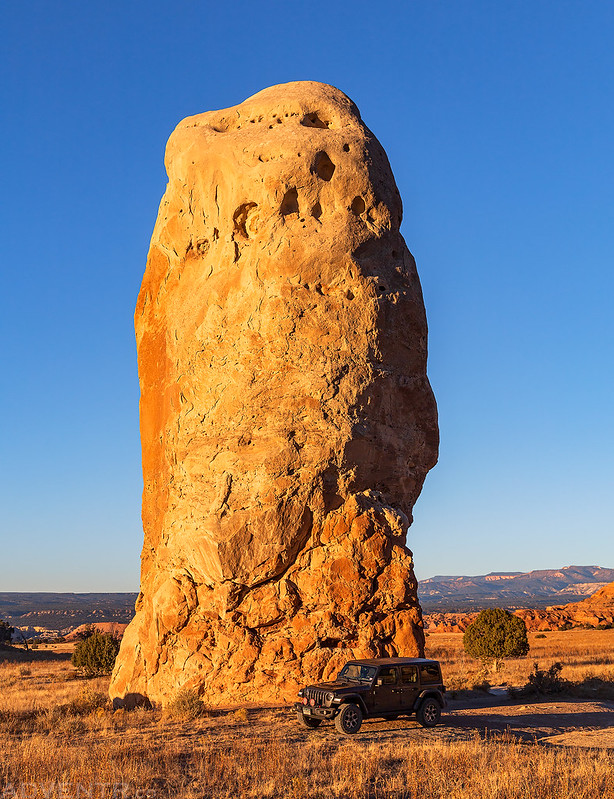
Before heading over to my final trail in the park, I drove over to check out Chimney Rock. Fun fact: The park was initially named Chimney Rock State Park in 1962 when it was first opened, but then the Kodak Corporation gave permission to use the name of its popular brand of film, and the park was officially renamed Kodachrome Basin State Park.
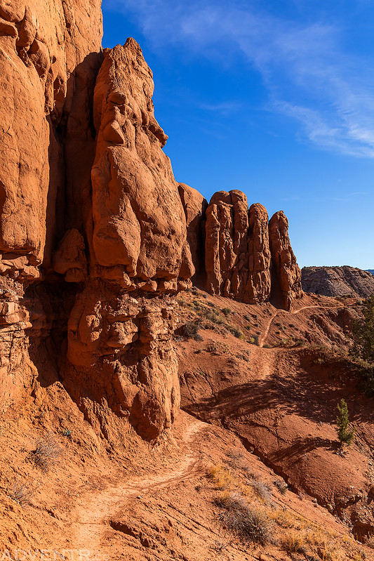
After a short visit with Chimney Rock I headed over to the Sentinel Trail and hiked to the Sentinel Spire. This trail used to be known as the Shakespeare Arch Trail, but that arch collapsed in 2019, so I’m a few years too late to see it.
Sentinel Loop Trail
I took the Slickrock Cutoff that offered a short little scramble to the top of the mesa.
Shortly before sunset I returned to the top of the Angel’s Palace Trail to take in the views again.
Sand Pipe at Sunset
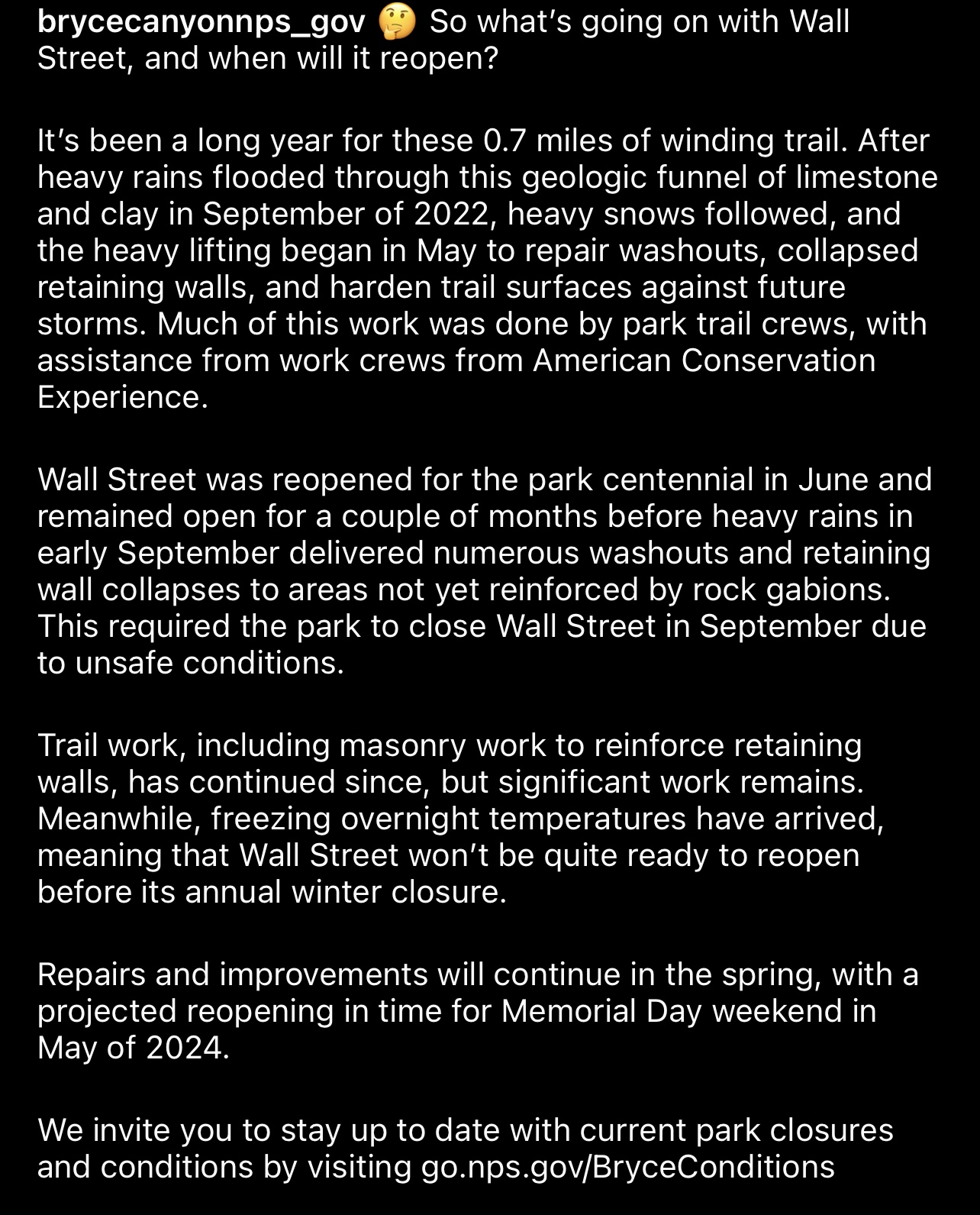
When I first started planning this trip earlier this year, I had originally thought that on Sunday morning I could return to Bryce Canyon National Park to hike the Wall Street trail before heading home. Last year when I visited Bryce Canyon in December it had already been closed for the winter, so I was unable to hike it then. Well, as luck would have it, it was also closed now, and has been for much of the year, so that was not going to happen today.
Since I wouldn’t be hiking Wall Street this morning, I instead returned to the Slickrock Cutoff of the Sentinel Trail since I had noticed it would make for a good sunrise view the previous afternoon.
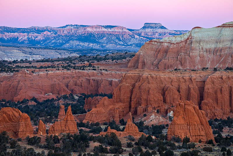
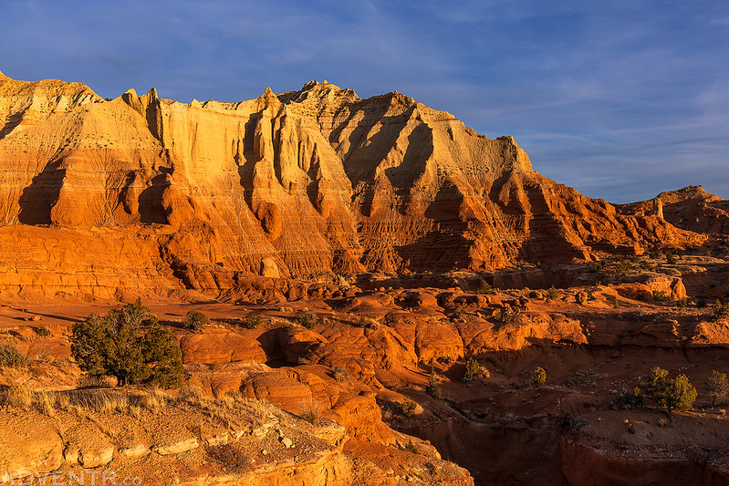
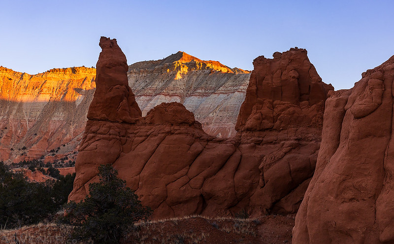
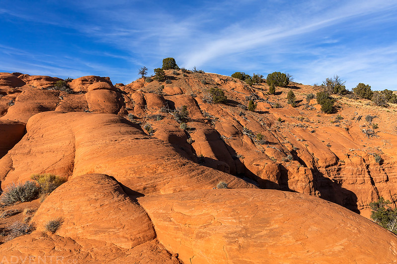
Watching the first light of the day on the cliffs.
Sand Pipe at Sunrise
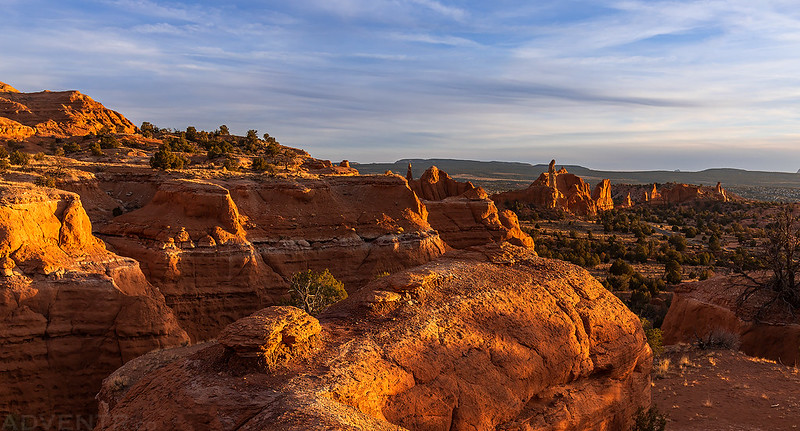
It turned out to be a pretty great place to watch the sunrise over Kodachrome Basin.
Kodachrome Basin Sunrise

When the sun was up I returned to the trailhead.
I made one last drive over to Chimney Rock to see it in the morning light towering over my Jeep.
Then I returned to the Paria Bunkhouse, packed up my gear and started the drive back home.
I had a pretty amazing extended weekend hiking and exploring Kodachrome Basin State Park, and I can now say that I know the park pretty well and have hiked every trail, some of them two and three times!
Really appreciated this write-up – it inspired me to book a bunkhouse for Thanksgiving for our family and we had a great time exploring the park for the first time from this snug home base. Thank you!
Thanks for sharing Rachel! I’m glad you guys had a great time at this nice little park!