Southern Utah Wanderings | Friday – Monday, September 29 – October 2, 2023
The time had finally come to get back out into the desert on the Colorado Plateau and I was definitely ready to begin my annual trip into Southern Utah with my friend Jared. This year we decided to start out hiking and exploring a couple of canyons that cut deep into the Dark Canyon Plateau and Elk Ridge so we could continue what we had originally began during our 2021 trip around the Abajo Mountains before we were chased out of the higher country by wet and stormy weather at the time. As usual, I left from work on Friday afternoon, grabbed a quick dinner in Fruita and then drove straight through to Monticello, where I topped off my gas tank so it would last me the next couple of days in the backcountry. It had been a very windy drive, which would be just a taste of what was in store for us over the next couple of days. From Monticello I followed the Harts Draw Loop Road into Indian Creek and then headed up onto the Salt Creek Plateau where I stopped at our usual campsite in the area and waited for Jared to arrive later in the evening.
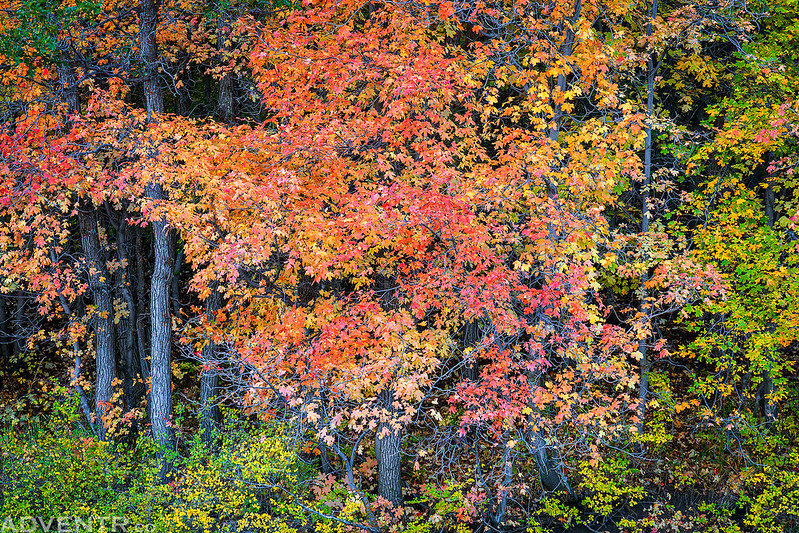
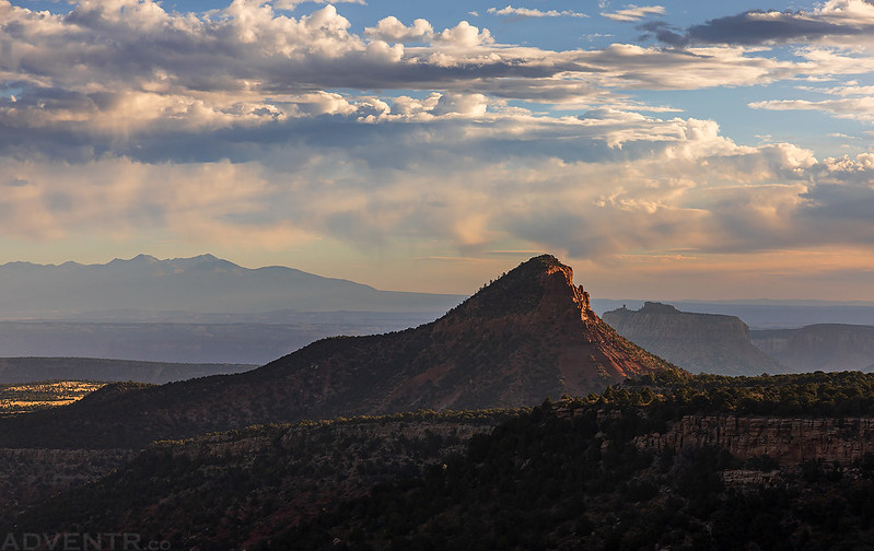
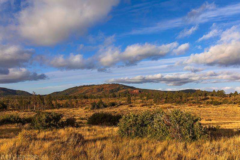
The fall colors were looking pretty nice as I drove along the Harts Draw Loop Road around the flank of the Abajo Mountains.
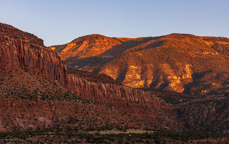
I watched the sunset as I drove high above North Cottonwood Creek and below Bridger Jack Mesa.
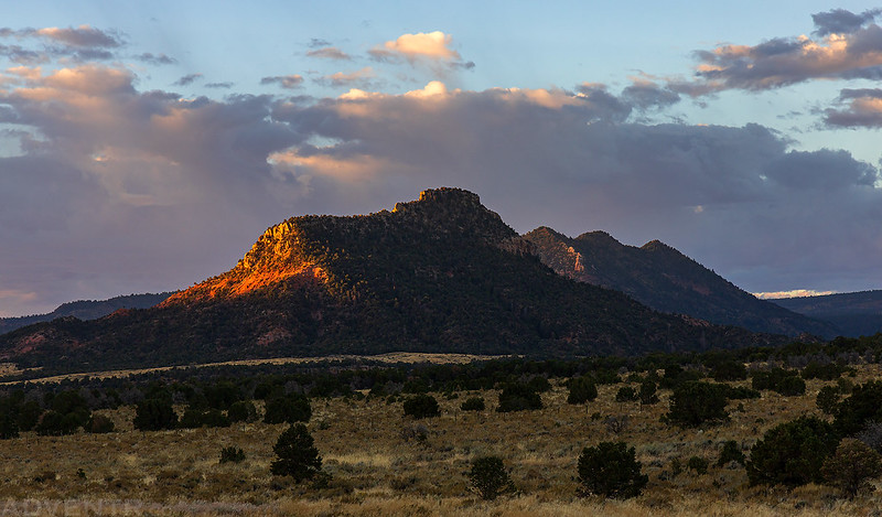
On Saturday morning Jared and I were up early to watch the sunrise from camp and then finish our drive out onto the Dark Canyon Plateau.
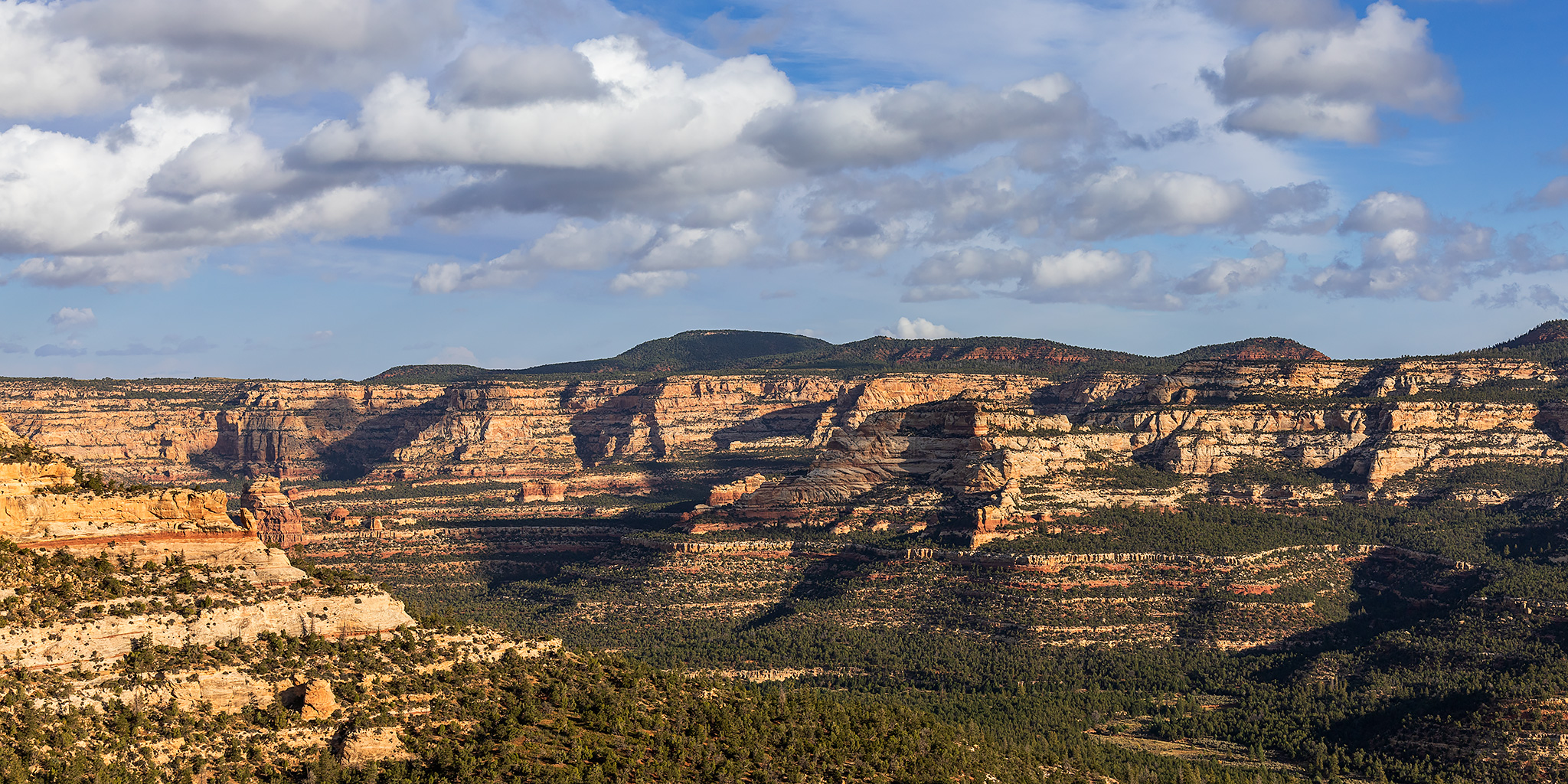
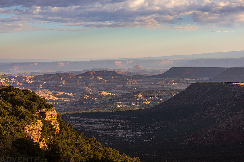
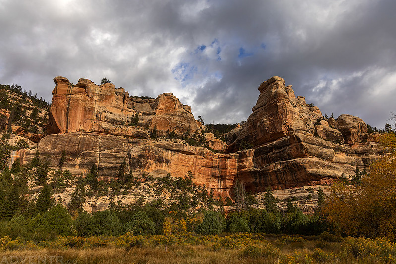
We passed by Boundary Butte…
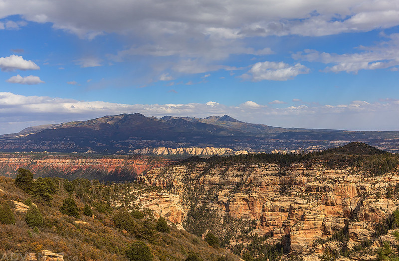
…and then had a nice view over Salt Creek Canyon country.
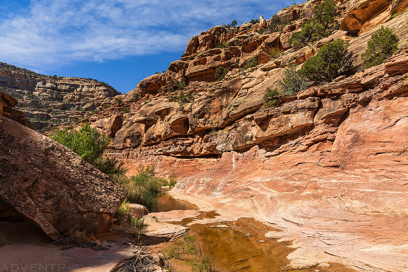
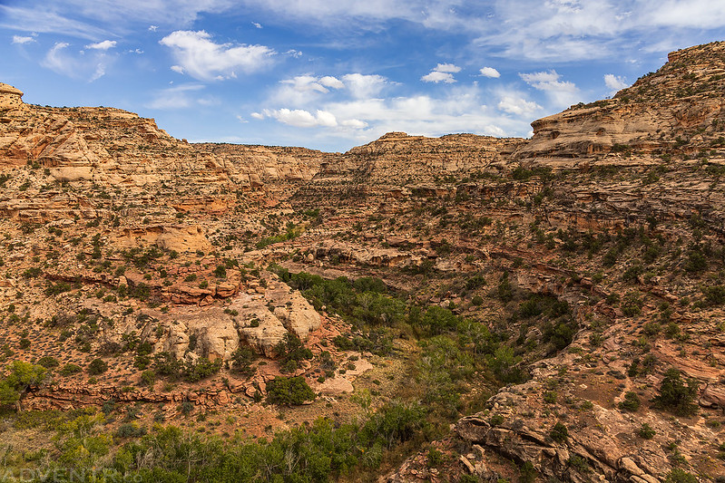
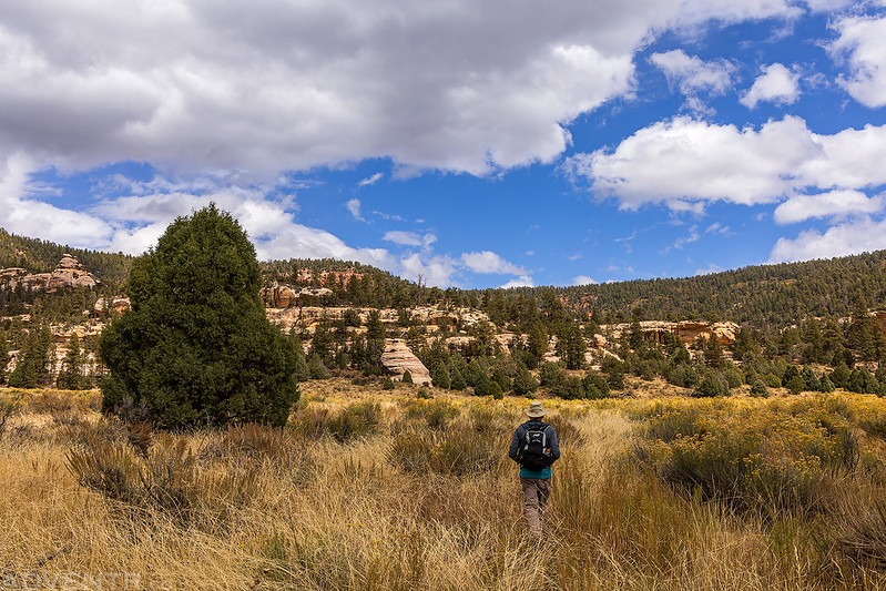
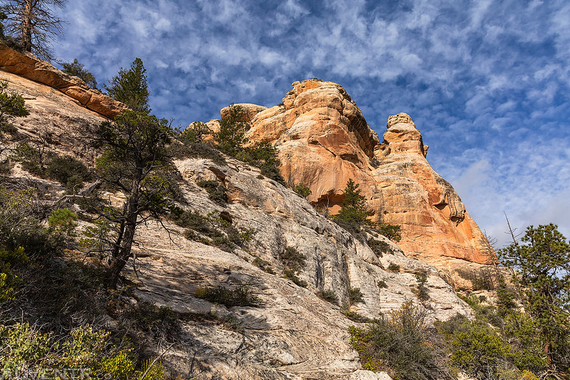
After reaching our planned trailhead, we set out cross-country toward the edge of Bowdie Canyon where we had great views over Cataract Canyon to the Orange Cliffs.

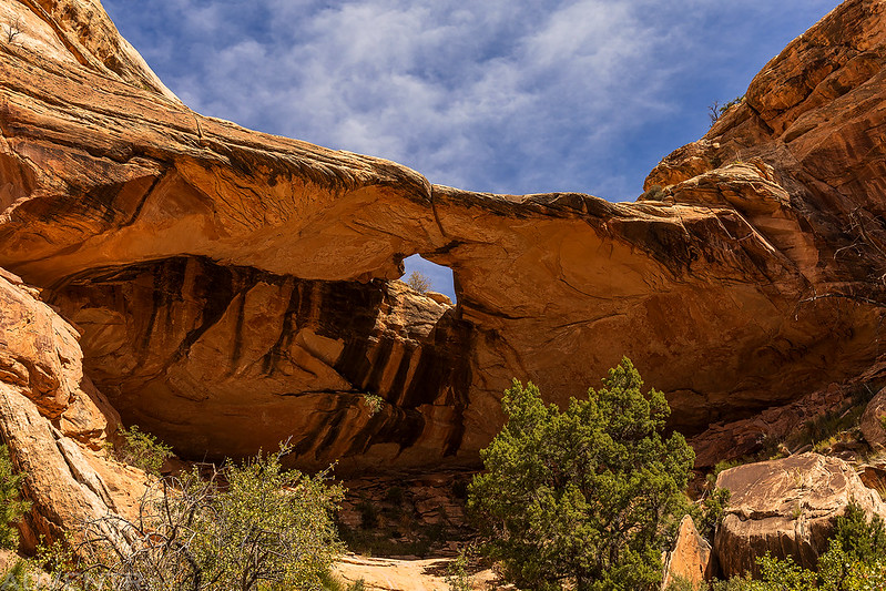
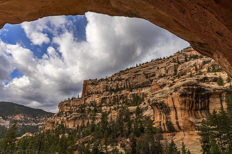
As we searched for a route into the canyon we passed by this small arch.

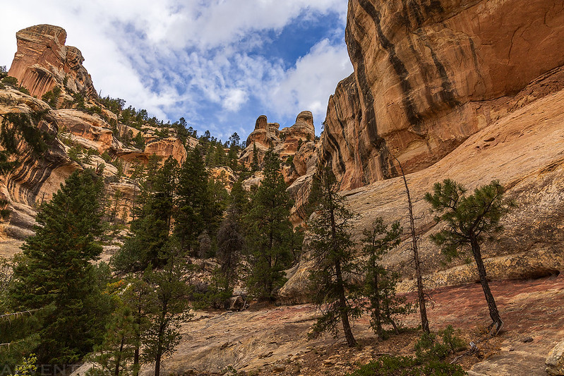
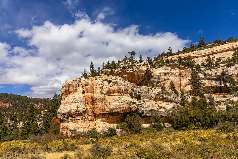
Bowdie Canyon

It was a little convoluted finding our way into the canyon, but after some trial and error we were eventually walking along the bottom.
It was a nice canyon to explore, but because of the long drive and route-finding issues, we didn’t have as much time to spend in the canyon as we would have liked.


Bowdie Bridge
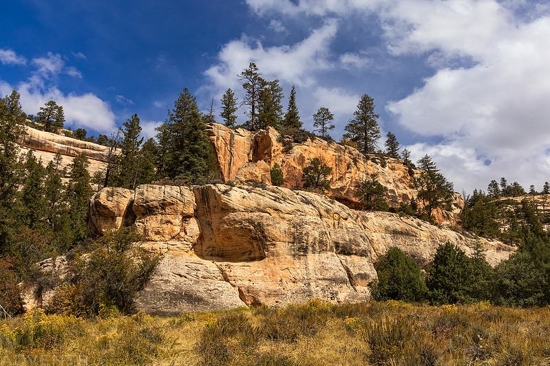
Looking down the canyon beyond a large pourover.

Here’s one last look into Bowdie Canyon as we climbed back out of the canyon and made our way cross-country to the Jeeps.
We arrived back to our vehicles late in the afternoon and then headed back up onto North Elk Ridge so we could find a campsite near the trailhead for our next hike into upper Dark Canyon. We arrived at camp after dark, ate a late dinner and then went to bed early.
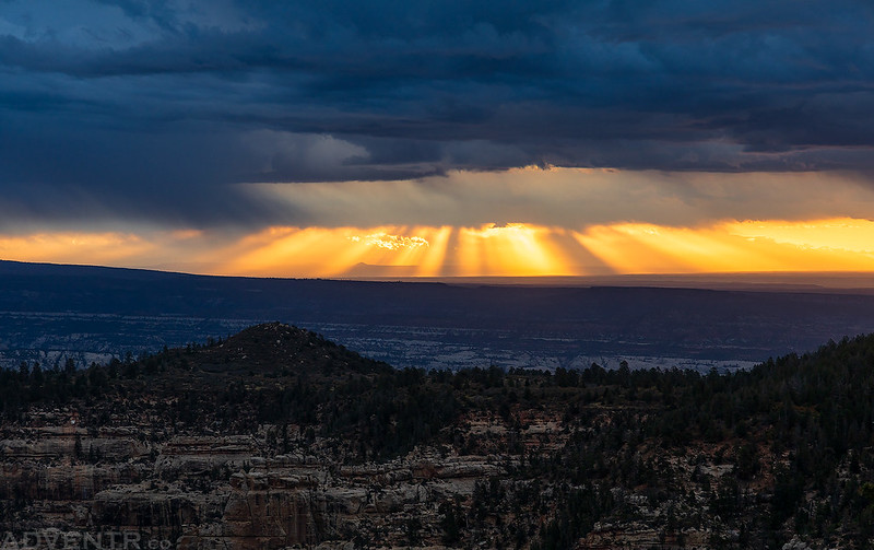
On Sunday morning we were up before sunrise and drove down to The Notch, where we left my Jeep, and then we took Jared’s back up to the Horse Pasture Canyon Trailhead and started hiking down the trail into the Dark Canyon Wilderness.
Although it was pretty cloudy out this morning, there were some nice sun rays above the horizon to the east while we were up near The Notch.
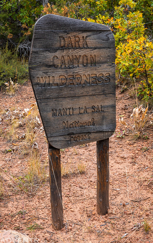
Welcome to the Dark Canyon Wilderness.
The first part of the Horse Pasture Canyon Trail was in the trees with limited views until we started the final descent to the canyon floor.
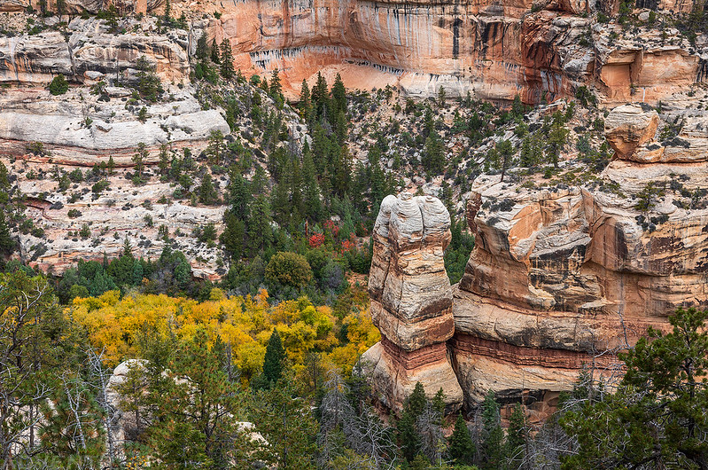
While we were hiking through the tall grass along the trail-less floor of Horse Pasture Canyon the sun did start to come out from behind the clouds a little.

We explored an alcove or two on our way to Dark Canyon.
Jared walks along the ledge into a large alcove.

The Alcove View
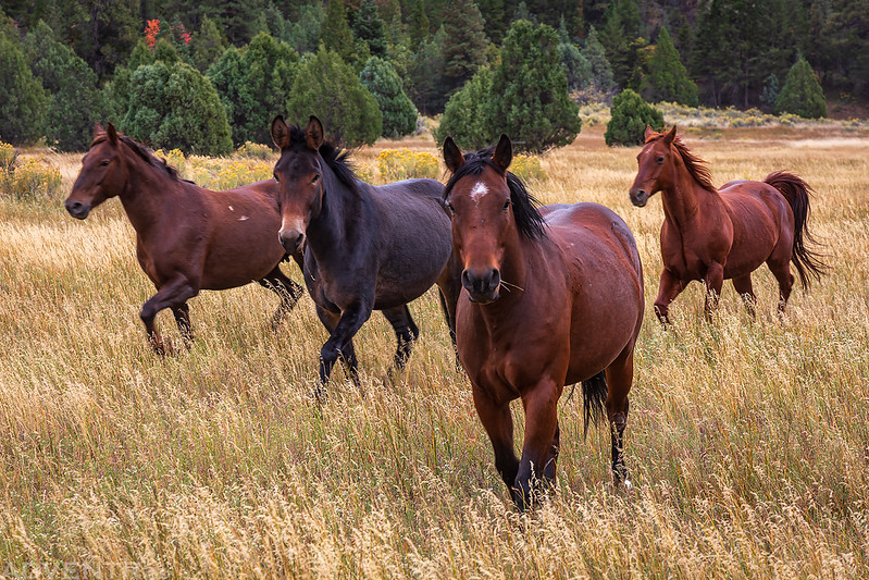
As we neared Dark Canyon we saw a group of six wild horses in the distance. As soon as they noticed us they started running our way.
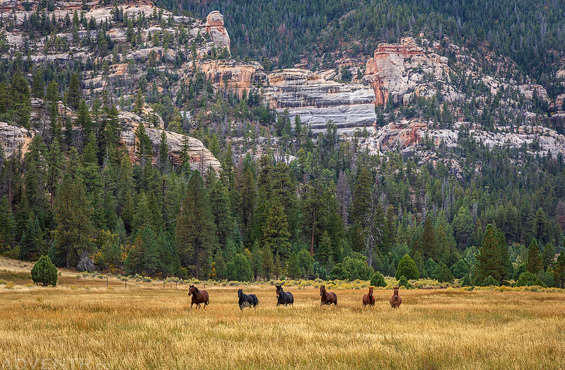
They came right up to us and had no fear. I’m not sure how wild they really were?
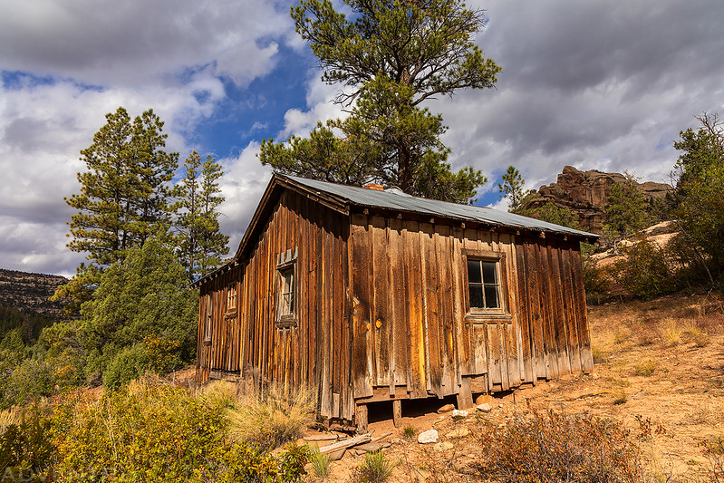
Shortly before reaching Dark Canyon we passed by this small cabin.
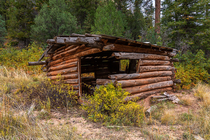
Just beyond the cabin were the remains of the old Scorup Cow Camp.
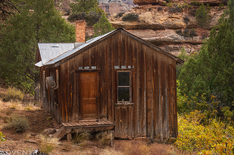
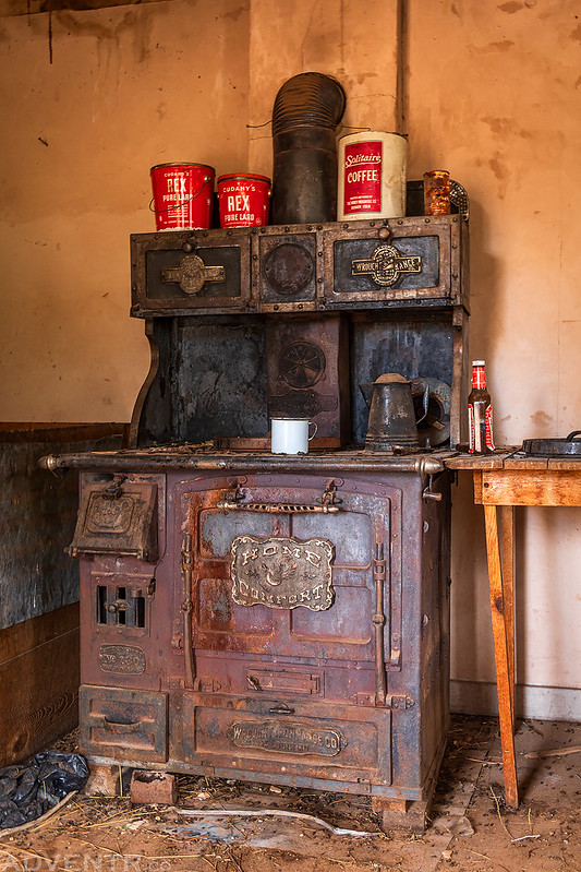
And around the corner was the historic Scorup Cabin. We headed inside for a closer look.
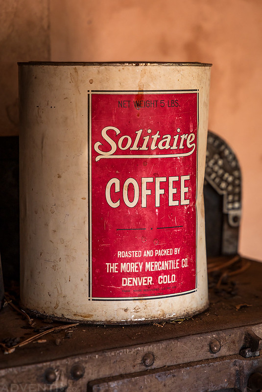
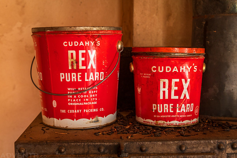
Scorup Cabin Kitchen

Home Comfort
Solitaire Coffee
Rex Pure Lard
Scorup Cabin Bedroom
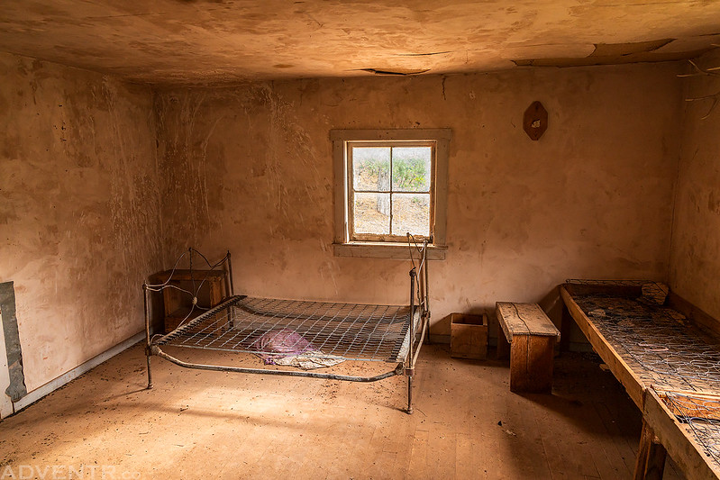
Bedroom Stove

Outside views of the Scorup Cabin.


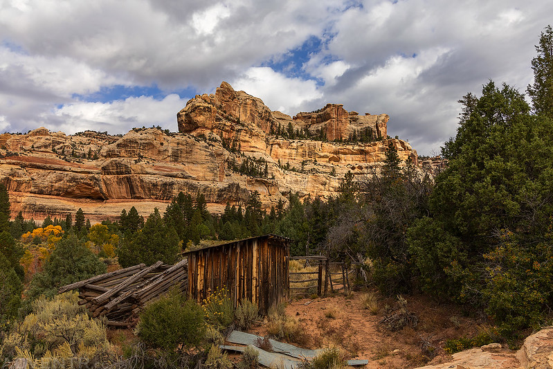
There was a nice view down Dark Canyon from the cabin.

From the Scorup Cabin we headed into upper Dark Canyon on The Notch Trail and had to cross a number of these large arroyo cuts along the way.
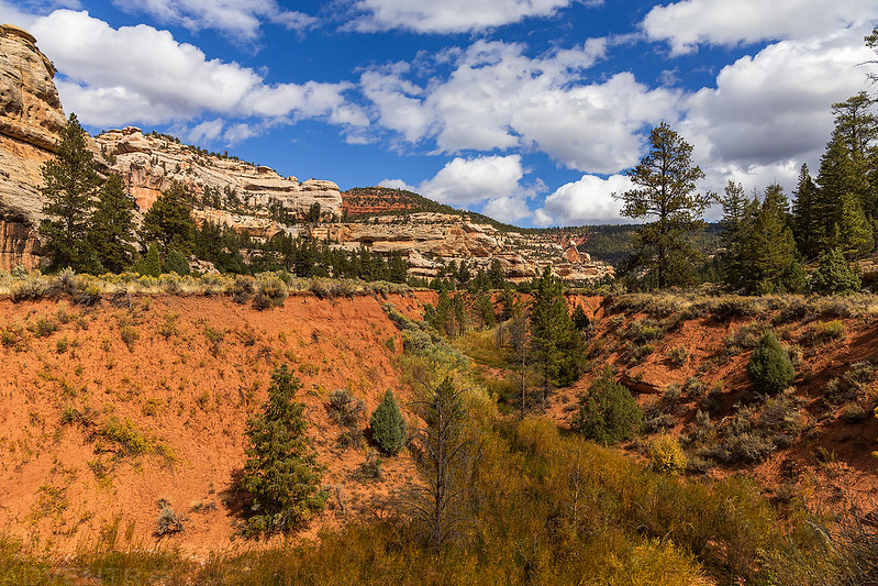
Upper Dark Canyon

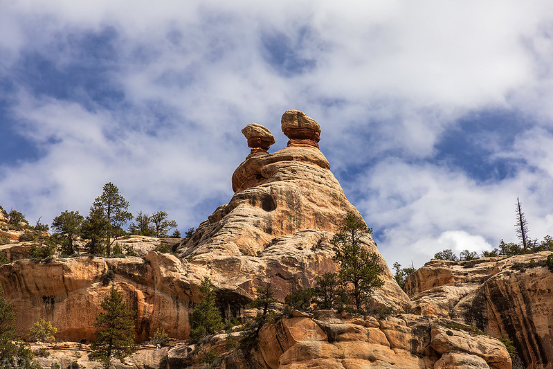
The sandstone and clouds were looking nice this afternoon, even though it was still very windy and had been all day.
Here’s Jared walking along the typical trail found in upper Dark Canyon- there really isn’t much of one. There was quite a bit of bushwhacking along the way…
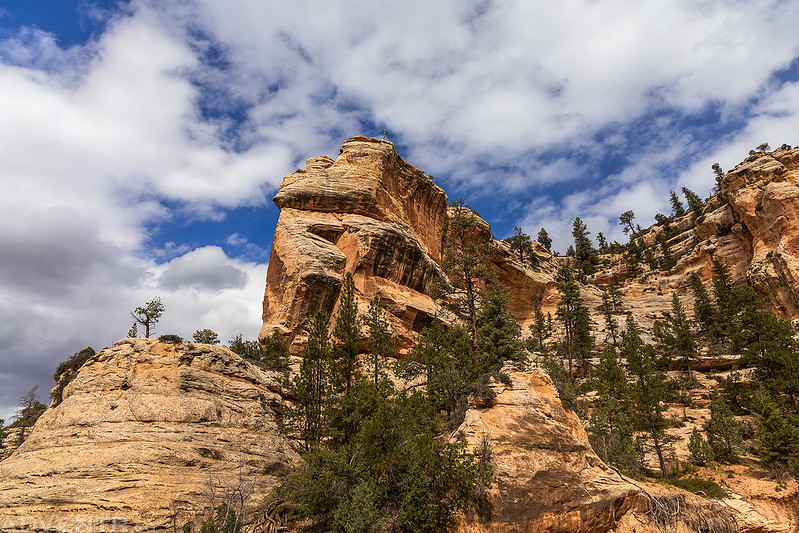
Upper Dark Canyon Views
Here’s another view toward the Abajo Mountains after reaching my Jeep at The Notch and then starting back to pick up Jared’s Jeep.
We passed by this overlook of Cherry Canyon as we made our way down onto Dry Mesa in search of a campsite for the night.

Looking north to North Long Point on the other side of Dark Canyon shortly before sunset.

After a stormy night filled with wind, rain, hail, thunder and lightning (some strikes were pretty close), we woke up to a nicer morning Monday, although it was still very windy out. By this time we were getting a little tired of the constant wind…
We spent the morning hiking along the rim of Dark Canyon.


Here’s one final overlook of Dark Canyon before we returned to our Jeeps and then headed into town for fuel and supplies.

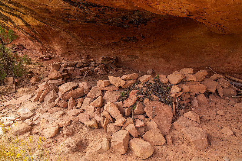
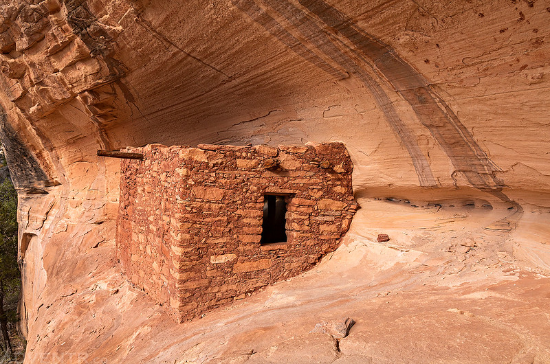
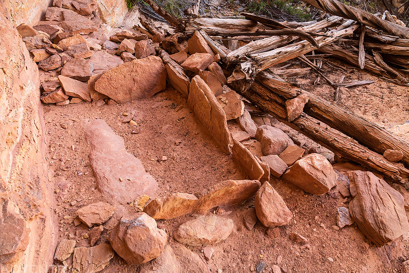
Ruins of the Dark Canyon Plateau
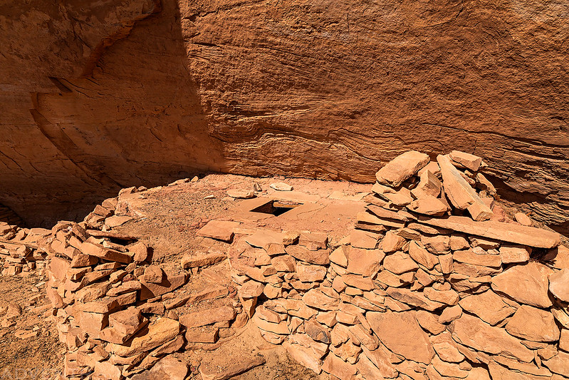
Below are photos of some of the ruins that we came across while exploring the Dark Canyon Plateau the past couple of days.
Room With A View
The remains of a wall in a shallow cave.

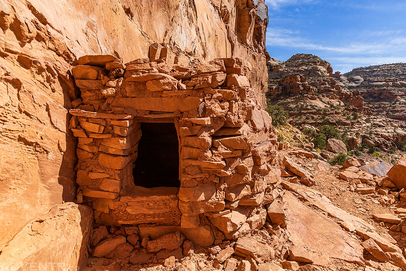
Little Doorway

This kiva was a bit interesting to me since it appears to have a curved stairway to the top. I cannot recall ever seeing that before?
Rough Ruins
Two Ruins

Square Ruin
Interior of the Square Ruin

Rectangle Ruin

Ruins on a high ledge that looked pretty inaccessible.

Three Kivas


Alcove Granary

Very interesting ruins, and I’m fascinated that so much of the “accessories” are still in the cow camp cabin. I always enjoy your posts, and your photos are consistently great.
Thank you Randy! The cabin was pretty cool to explore.
For myself your captions would be better UNDER the photos as that’s what I’m used to after about 65 years of reading. Mostly westerns. Started out with Zane Grey, younger son’s name is Zane Grey, and then moved on to Louis L’Amour. L’Amour is well known for writing about places he had actually been to. If he writes about a canyon, mountain, river, whatever, it most likely is there. While most places could just be seen and used from maps his fine detail of trails, caves, divas, etc. is such that you could use his books as a map. Well, allowing for we stupid humans destroying the wilderness. He even wrote about the valley that I am from, the Sequatchie Valley, in SE Tennessee. In the book “Jubal Sackett” there is even a map of my valley tho crude and spelled one letter different it is there. You can come visit it just like described in the book. Picture Cade’s Cove in the Smokey Mountains but with shorter mountains. Ours are actually plateaus that top out at around 2500 feet but ya make do with what you have. The area Jubal first glimpsed while on his quest for his father to find land to move the family to, Grassy Cove, is 90% unchanged from the 1700’s. L’Amour, thru his character Jubal’s eyes stated the Valley was “The most beautiful place he had ever seen”. The valley is nearly 40 miles from it’s beginning and petters out in north Alabama. The Sequatchie River emanates from a cave in the cove and flows all the way down the valley to enter the Tennessee River just below Nickajack Dam. Named for Nickajack Cave. The came where Johnny Cash had his religious experience. It’s a huge cave inconveniently flooded by TVA when they flooded the area to make the lake. Yeah, that tucked but TVA does whatever TVA wants. A government unto itself similar to railroads…..
Anyway, come visit my valley where you can still do some exploring despite California sending it’s invaders with money enough to purchase overpriced “lots” in bluff developments. Now they’re trying to get elected in local elections so they can recreate what they were escaping when they moved here. Sigh.
Sorry about my too long comment. PTSD and me.
Keep up the good work.
rick in Tennessee.
Nov 22, 2025.
My wife of 53 year’s birthday. I even remembered to get her a card.
Beautiful!
Thank you Sue!
Great photos! I was in Peavine canyon on sept. 26th and the road to the cabin was washed out. The road in is not for the faint of heart. Thanks for sharing, I enjoy reading about your trips.
I think that road has been washed out for as long as I can remember (at least from the junction in Dark Canyon). Did you hike to the cabin from the washout?